
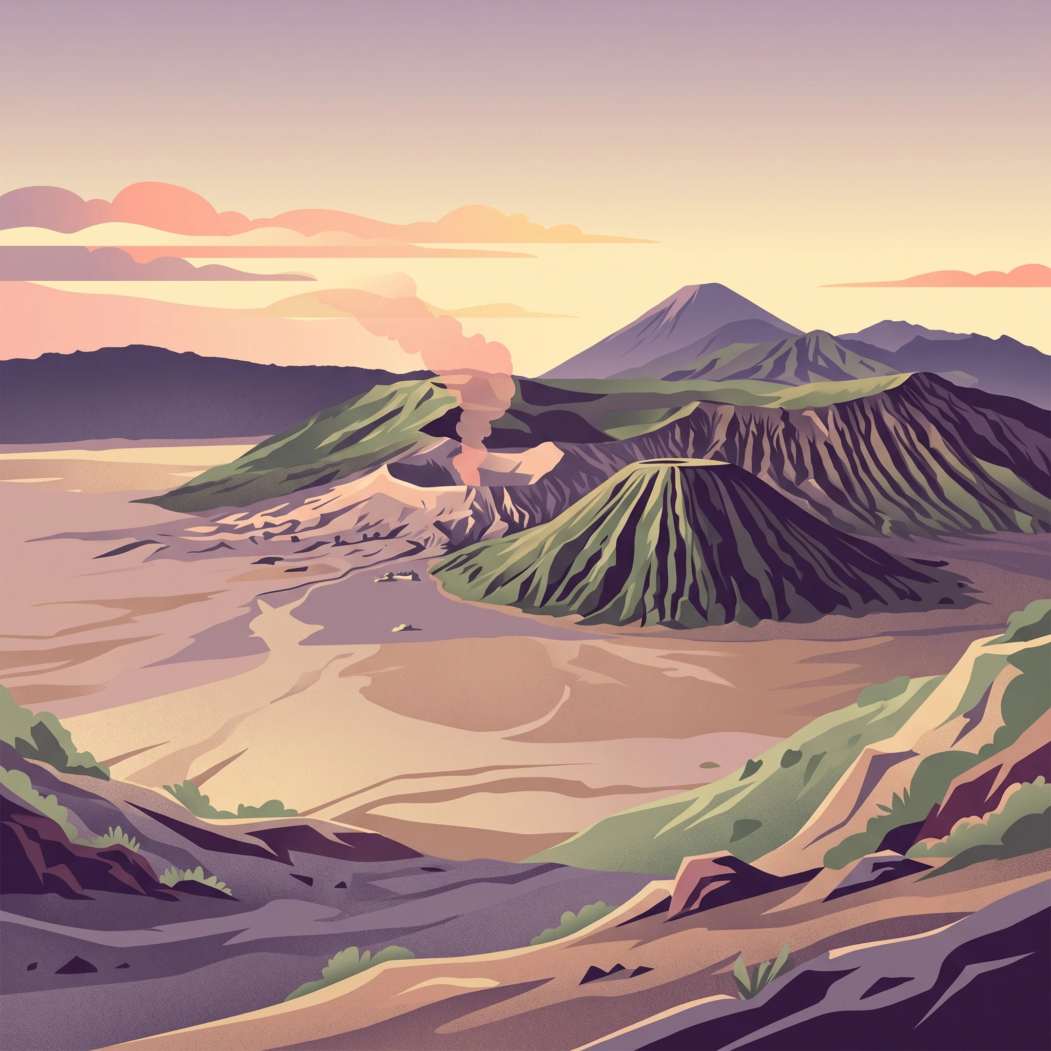
When to Visit
When Is the Best Time to Visit Bromo Tengger Semeru National Park
Determining the best time to visit Bromo Tengger Semeru National Park centers on the trade-off between the clear, dry conditions of the winter months and the increased visitor density that accompanies predictable weather. The most reliable windows for accessing the park, particularly for those seeking unobstructed sunrise views over the Tengger Caldera, generally occur during the dry season spanning June through September. During this period, lower precipitation levels and reduced cloud cover maximize the likelihood of capturing the iconic silhouette of Mount Semeru against the morning sky, yet this consistency attracts higher visitor numbers compared to the wetter transitions of the shoulder season.
Balancing Weather Reliability and Visitor Volume
While the period from June to September offers the most stable conditions, travelers should recognize that these months also coincide with peak demand. The park experiences its lowest monthly precipitation during this phase, creating a drier environment that makes navigating the sandy, volcanic terrain of the Tengger Sand Sea significantly easier. However, the popularity of the park during this time means that popular viewpoints such as Mount Penanjakan can become crowded, requiring earlier starts and more advanced logistical planning to secure prime observation spots. Those who prefer a quieter experience may find the transitional months of April or October to be a viable compromise, as these windows often offer a mix of manageable weather with fewer crowds, though the probability of overcast skies and intermittent rain increases noticeably.
Understanding the Impact of Elevation and Climate
Climate patterns within the park are heavily influenced by its elevation, which creates a sharp contrast to the warmer coastal temperatures found elsewhere in East Java. Even during the peak dry season, the high-altitude environment of the caldera remains cool during the day and can drop to near-freezing temperatures overnight. The interaction between these cold nighttime temperatures and the high humidity levels typical of the region means that gear choices are as critical as calendar selection. Visitors must prepare for sudden atmospheric shifts, as the high-altitude landscape is prone to mist and rapidly changing visibility regardless of the season. Planning a visit involves accepting that the park is an active, evolving geological site where weather can fluctuate within a single day. Consequently, the timing of your trip should reflect your tolerance for variable visibility and your capacity to handle the temperature extremes characteristic of this high-altitude volcanic massif.
Seasonal Planning
Best Months to Visit Bromo Tengger Semeru National Park at a Glance
The Peak Viewing Window: June through September
For travelers prioritizing consistent, clear-sky views of the Tengger Caldera, the months of June, July, August, and September form the most reliable visiting window. During this period, precipitation drops to its lowest annual levels, often resulting in less than one millimeter of rainfall per day. This dryness is critical for photographers and sightseers who want to view the iconic panorama from Mount Penanjakan without the heavy obstruction of thick, low-lying cloud cover. While this season offers the highest probability of sun-drenched sunrises, travelers should anticipate cooler temperatures, particularly at night, and an increase in wind speeds that can make exposed high-altitude ridges feel significantly colder than lowland measurements suggest.
The Transitional Months: April, May, and October
If you prefer to avoid the highest visitor numbers, the shoulder months of April, May, and October provide a middle ground. These periods act as transitions between the wet and dry seasons. You may encounter a higher frequency of rainfall compared to the peak dry months, but these windows often feature periods of clearing weather that offer excellent visibility without the intense humidity of the peak rainy season. Temperatures remain moderate, and visitor density is generally more manageable, making these months a tactical choice for those who value a balance between landscape clarity and a quieter park environment.
Challenges of the Wet Season: November through March
Visiting between November and March requires a flexible itinerary and a tolerance for frequent, heavy precipitation. This period sees the highest humidity and rainfall averages of the year. While the landscapes can appear lush, the persistent cloud cover often hides the volcanic peaks, significantly reducing the chances of catching the classic sunrise view over the caldera. Furthermore, this period presents increased risks related to ground stability, as heavy rainfall can lead to localized flooding and trail issues. Travelers choosing these months should be prepared for restricted access to certain viewpoints and a heightened need for waterproof gear and durable, high-traction footwear.
Summary of Seasonal Trade-offs
- June to September: Best for maximum sunrise visibility and stable, dry ground conditions, though periods are often the busiest and subject to strong winds.
- April, May, and October: Provides a compromise with moderate crowds and generally acceptable weather, though brief rain showers are more likely than in the heart of the dry season.
- November to March: Offers a quieter experience with fewer crowds, but carries the highest probability of heavy rain, thick cloud cover, and potential trail disruptions.
Annual Climate Overview
Monthly Weather and Climate Trends in Bromo Tengger Semeru National Park
Understanding the climate patterns of Bromo Tengger Semeru National Park requires distinguishing between typical regional averages and the specific, high-altitude conditions encountered within the caldera and summit areas. While regional climate data provides a foundational baseline for temperature and rainfall, the park's topography, which includes the expansive Tengger Sand Sea and peaks exceeding 3,000 meters, creates microclimates that often diverge significantly from these generalized statistics. Travelers should view these long-term normals as a guide for seasonal planning rather than a precise forecast for any single day of their trip.
Patterns in Rainfall and Atmospheric Humidity
Rainfall in the park follows a distinct seasonal cycle, with the period from June through September marked by significantly reduced precipitation. July and August typically represent the driest months, with daily averages dropping to nearly negligible levels. During this window, lower relative humidity levels generally coincide with clearer skies, making it the most reliable time for observing the sunrise from Mount Penanjakan without the interference of heavy cloud cover.
Conversely, the wet season usually intensifies from November through March. January and February often experience the highest precipitation volumes, which can saturate the volcanic terrain. While these months are often categorized by lower visitor numbers, the increased rainfall can lead to reduced visibility and challenging ground conditions. It is important to note that these regional trends are averages, and localized showers can occur throughout the year, especially in high-altitude environments where mountain ranges often trap moisture.
Temperature Variations and High-Altitude Exposure
Temperature ranges in the park are heavily dictated by altitude. While average daily means in the wider region often sit in the mid-twenties Celsius, the temperature within the park boundaries, particularly on the caldera rim and near the crater of Mount Bromo, feels considerably colder. The shift from night to day is a defining aspect of the park experience, as nighttime temperatures often plummet due to the lack of heat-retaining structures in the vast sand sea and the cooling effect of high elevations.
Daytime temperature maximums tend to be more stable, yet they never reach the sweltering heat found in the lowlands surrounding the park. The period from August through October historically shows a trend toward higher maximums, but the rapid drop in temperature after sunset remains a constant factor. Travelers should interpret the difference between daily minimums and maximums as a requirement for layered clothing rather than a guide to summer-like conditions, as the park's climate remains consistently temperate to cool by international standards.
Wind and Daylight Trends
Wind patterns follow a predictable progression that influences how the park is experienced. Mean wind speeds typically increase during the dry months, peaking between August and September. While these winds can help disperse morning mist and improve visibility, they also contribute to the "outright cold" sensation described by many visitors at high-altitude viewpoints.
Daylight duration remains relatively consistent throughout the year due to the park's proximity to the equator, varying by only about an hour between the shortest days in June and the longest days in December. Consequently, sunrise and sunset times do not fluctuate as drastically as they do in higher latitudes, allowing for a somewhat standardized daily schedule for sunrise excursions. Nevertheless, even with over 11 hours of daylight in mid-winter, the potential for persistent cloud cover in the wetter months can significantly reduce the amount of direct sun reaching the caldera floor, reinforcing the importance of planning around the dry season for those prioritizing clear, panoramic views.
Seasonal climate
Understanding Seasonal Weather Patterns at Bromo Tengger Semeru
The Dry Season: Stable Skies and High Visibility
From June through September, the park enters its most stable weather phase. This period is defined by significantly lower precipitation, with monthly rainfall dropping to its lowest points in August and September. These months are the most reliable for travelers seeking the iconic sunrise views from Mount Penanjakan. The lack of cloud cover during this phase allows for the clearest silhouettes of Mount Semeru and the volcanic expanse of the Tengger Sand Sea. While the lower humidity levels and reduced rainfall make for more comfortable trail conditions, travelers should be prepared for the highest wind speeds of the year during this time. The dry air, while visually rewarding, also amplifies the nighttime temperature drop, making it the most critical time to pack thermal layers for pre-dawn starts.
The Wet Phase: Moisture and Atmospheric Change
Running from November through March, the wet season introduces a marked change in the park's environment. Increased precipitation, reaching its highest averages in January and February, defines this period. Unlike the dry months, this phase is characterized by higher humidity and frequent cloud cover, which can obstruct the panoramic views that draw visitors to the caldera. It is during this time that the park becomes more susceptible to environmental shifts, including saturated trails and higher chances of localized erosion. While these months offer a quieter experience with fewer crowds, the trade-off is a higher probability of interrupted sunrise viewings and less consistent access to remote areas of the caldera.
Transitional Windows: The Shoulder Seasons
April and October serve as essential transition months between the wet and dry phases. These windows do not adhere to a rigid seasonal label, as they fluctuate depending on the year's specific weather patterns. April marks the tail end of the wetter period, often showing a decline in daily rainfall, while October represents the beginning of the transition toward the end-of-year rains. Visitors traveling in these months may experience a mix of conditions, often enjoying clear, crisp mornings followed by increasing afternoon cloudiness. These periods are marked by more moderate wind speeds compared to the peak of the dry season. Rather than expecting fully dry or fully wet conditions, travelers should approach these months with flexibility, recognizing that the environmental stability is less predictable than during the core peak or trough months of the climate cycle.
Seasonal Experiences
Experiencing the Tengger Caldera and Mount Bromo Landscapes Throughout the Year
Navigating Volcanic Terrains by Season
The experience of the Tengger Caldera is deeply influenced by the moisture and temperature shifts between the dry and wet phases. During the drier months from June through September, the solidified volcanic ash and sand within the Sea of Sand remain firm and relatively dry. This stability makes traversing the caldera floor on foot or horseback more predictable. In contrast, the increased precipitation of the November through March period can turn these sandy expanses into soft, muddy, or churned surfaces, which may alter the ease of access for those hiking from Cemoro Lawang or relying on local transport across the caldera.
Sunrise Vistas and Atmospheric Conditions
The famed sunrise views from Mount Penanjakan, King Kong Hill, and the Seruni viewpoints are inextricably linked to the annual precipitation cycle. The clear, stable air common in the peak dry months provides the most frequent opportunities for the classic silhouette of Mount Semeru to emerge against the morning sky. During the wetter months, cloud cover and mist often obscure these distant peaks, frequently settling directly into the caldera basin. While this can create a dramatic, moody atmosphere, visitors seeking the high-contrast, wide-angle views common in guidebooks will find these conditions less supportive of such sightings. The transition months of April and October often present a variable mix of clarity and sudden cloud accumulation, requiring travelers to be flexible with their viewing expectations.
Accessing Crater Rims and Backcountry Trails
High-altitude activities, such as standing at the edge of the active Bromo crater or attempting the multi-day trek to the summit of Mount Semeru, require constant monitoring of local conditions. The cooling temperatures at these elevations,which can drop to near zero at night,are a year-round reality, yet the physical conditions of the trails vary by season. During the height of the wet season, the risk of landslides and the prevalence of heavy fog can render higher trails and steeper crater approaches significantly more hazardous. While the crater rim itself remains a primary destination, the quality of the experience,ranging from crisp, wind-exposed ridge walks to slippery, low-visibility ascents,fluctuates based on the timing of your visit. Always consult the official park offices at Ranupani or Cemoro Lawang for current trail status, as volcanic activity levels and local weather can mandate closures regardless of the seasonal calendar.
Visitor Priorities
Choosing the Best Time to Visit Bromo Tengger Semeru Based on Personal Priorities
Prioritizing Clear Views and Hiking Stability
For hikers focused on the iconic sunrise vistas from Mount Penanjakan or trekking across the Tengger Sand Sea, the period from June through September remains the most reliable. These months align with the peak dry season, characterized by minimal rainfall and significantly lower relative humidity, often dropping below 70 percent in September. The primary benefit of this window is the consistency of visibility. During the height of the dry season, the absence of thick cloud cover allows for the clearest panoramic views of the caldera and the imposing silhouette of Mount Semeru. The trade-off for these stable conditions is higher wind speeds, which can reach averages of 4 m/s in the latter part of the season. Hikers should be prepared for cold gusts at the crater rim, regardless of the sunnier daytime skies.
Seeking Milder Temperatures and Lower Wind
Travelers who prefer to avoid the wind chill associated with the peak dry season might consider the late shoulder months, particularly April and May. During these months, the wind intensity is generally lower than the mid-year peak, averaging between 2.1 m/s and 2.7 m/s. While there is a slight increase in precipitation compared to the absolute dry months of August and September, temperatures remain cool and comfortable for extended trekking. April offers a balance where the landscape retains some lushness from the preceding rainy months without the persistent mud that hampers trail access during the wet season. The primary compromise for this preference is the higher probability of localized afternoon showers, meaning early morning starts remain essential for success.
Navigating the Wet Season for Trail Solitude
While the wetter months from November to March bring higher precipitation and greater humidity, they offer a different experience for those prioritizing solitude on the trails. Rainfall data indicates that December and January experience significant moisture, often exceeding 7 to 10 mm per day. The resulting environment is characterized by increased cloud cover, which often obscures sunrise views and makes navigation on steep volcanic slopes more challenging due to loose, wet sediment. Hikers choosing this window must accept that visibility is never guaranteed and that certain trails may be susceptible to landslips or flooding. This period is less suited for those seeking classic photography but may appeal to visitors comfortable with rapid, localized weather shifts who prefer to avoid the peak visitor density of the dry season.
Aligning Daylight and Thermal Comfort
Daylight hours fluctuate slightly throughout the year, with the longest days occurring around December, providing up to 12.46 hours of light. However, this peak in daylight corresponds with the wettest months, creating a direct conflict between the desire for more time on the trail and the reality of afternoon storms. Conversely, the months of June and July offer the shortest days, roughly 11.5 hours, but provide the most reliable weather for time-sensitive activities. For travelers whose priority is maximizing movement on the caldera floor, the trade-off is clear: sacrifice an hour of potential daylight in exchange for the high probability of clear, dry walking conditions found in the heart of the dry season.
Logistics and Access
Seasonal Access and Operational Planning for Bromo Tengger Semeru
Navigating Routes to the Caldera
Access to Bromo Tengger Semeru National Park relies on three established entry points, each with distinct logistical implications for your travel planning. The Probolinggo to Ngadisari route through Cemoro Lawang remains the most frequented path. It offers the most straightforward logistics for independent travelers, though the reliance on shared public minibuses, often locally referred to as bison, can be unpredictable regarding departure times. Because these vehicles typically require a full load of passengers to depart, travelers should account for potential wait times or be prepared to negotiate a higher fare to secure an earlier departure.
Alternative entry routes offer different experiences but require more self-sufficiency. The Pasuruan to Tosari route provides a slightly different geographical approach, often preferred by those arriving from the direction of Surabaya. Travelers choosing the Malang to Tumpang route face a more challenging, off-the-beaten-path experience. This route often necessitates the hire of 4WD vehicles or specialized transport, as standard infrastructure is sparse compared to the main northern access points. Always verify current road conditions and the availability of local transport services with regional authorities or your accommodation provider before finalizing your route, especially during the wetter months when road quality can fluctuate.
Administrative Requirements and Official Verification
Entry to the national park is governed by regulations that are subject to change. While historical patterns indicate that major park highlights remain accessible throughout the year, specific trail statuses, permit requirements, and entry fees are managed by park authorities and can be updated without prior notice. Travelers should treat all information regarding current opening times, visitor center operations, or mandatory registration processes as temporary. Always consult the official website of Taman Nasional Bromo Tengger Semeru or contact local park offices directly for the most current administrative directives before you arrive.
Planning for Local Holiday Peaks
Your chosen travel dates will significantly influence your experience, particularly concerning visitor density. While the climate patterns favor dry-season exploration, the park experiences surges in domestic tourism during local public holidays and school vacation periods. These times often result in increased demand for transport, accommodation, and access to popular sunrise viewpoints. If your priority is a quieter visit, cross-reference your travel windows with Indonesian public holiday calendars. Planning a visit during the middle of the work week rather than weekends can also assist in managing crowd levels, even within the peak dry season.
Safety and Preparation
Seasonal Weather Hazards and Packing for Bromo Tengger Semeru
Managing High Altitude Temperature Fluctuations
Preparation for the park requires a clear understanding of the difference between regional Javanese climate and the specialized conditions of the high caldera. While daytime temperatures in the surrounding lowlands remain consistently warm, the park’s elevation, averaging around 2,100 meters, creates a sharp contrast. Visitors should anticipate nighttime temperatures that can drop significantly, often nearing freezing during the dry season months of June through September. Because the park’s lodging can vary in insulation quality, it is practical to pack versatile, layered clothing. Relying on local rental options for heavier gear is common, but bringing reliable base layers ensures personal comfort regardless of the season. Always check the latest weather forecasts immediately before your trip, as these averages provide only a baseline for potential conditions rather than a guarantee.
Terrain Stability and Trail Safety
Navigation through the volcanic landscape involves specific terrain challenges that shift with the seasons. During the wetter months, typically from November through March, increased rainfall can heighten the risk of slippery paths, mud, and restricted visibility. The terrain consists of loose volcanic soil and steep, exposed ridges, particularly along the rim of the active crater where paths can be narrow and unprotected. Regardless of the time of year, always maintain a steady pace and avoid wandering outside marked paths. If planning a trek toward higher elevations like Mount Semeru, consult current official status reports, as volcanic activity and weather-induced trail closures are common. Safety protocols, including adherence to exclusion zones set by authorities, are non-negotiable. These zones may be adjusted at short notice based on real-time monitoring of volcanic seismic activity.
Exposure, Sunlight, and Wind Considerations
Even when the air feels refreshingly cool during the day, the high altitude significantly increases the intensity of UV radiation. Protecting your skin with appropriate coverage is essential, as the high-altitude sun can be deceptive in its intensity, even on overcast days. Furthermore, the dry season brings an increase in wind speed, which can make summit viewpoints and open caldera crossings feel much colder than the ambient temperature suggests. Packing a windproof outer shell is recommended for sunrise viewing at Mount Penanjakan or for excursions across the Tengger Sand Sea. Because weather patterns in high volcanic regions can change rapidly, keeping a compact, accessible daypack with essential layers allows you to adjust quickly to shifting wind or precipitation levels. Always prioritize checking local alerts from the national park management or geological centers for the most current safety and access information regarding volcanic activity levels and trail conditions before departing.
Final Planning
How to Select Your Ideal Time to Visit Bromo Tengger Semeru
Balancing Climate Stability with Personal Objectives
Selecting the right time for your visit requires a clear assessment of your primary goals versus the realities of East Java's volcanic climate. If your foremost priority is maximizing the probability of clear, panoramic sunrise views over the Tengger Caldera, the dry season between June and September is your most reliable window. During these months, the atmospheric stability significantly reduces cloud cover, providing the crisp visibility necessary for the park's iconic photography. However, this period coincides with peak visitor density, meaning you must be prepared to navigate larger crowds at popular viewpoints like Mount Penanjakan and share the trails with more fellow travelers.
Navigating the Shoulder Seasons and Wet Months
For those who prioritize solitude and a more tranquil experience, the shoulder months of April and October offer a strategic compromise. While these periods introduce a higher likelihood of rainfall compared to the mid-year dry stretch, they generally see reduced foot traffic. The weather remains manageable for most activities, though you should build extra flexibility into your schedule to account for potential afternoon showers or lingering mist. Conversely, visiting during the wet season from November through March is best suited for those willing to accept significant trade-offs. While the park is at its quietest and the landscape displays a lush vibrancy, you must contend with frequent precipitation, higher humidity, and a much greater risk of trail closures due to mud or landslips. Choosing this timeframe demands a higher tolerance for logistical uncertainty and the willingness to prioritize indoor or lower-elevation experiences if visibility becomes too obscured for crater-rim treks.
Finalizing Your Decision
Ultimately, there is no single month that satisfies every requirement, as the park's high-altitude environment creates conditions that change rapidly. Your decision should center on whether you value environmental certainty or a more private, off-peak atmosphere. Once you have identified the seasonal window that aligns with your priorities, remember that climate normals serve only as a baseline for expectations rather than a guarantee of conditions. Before finalizing your travel dates or setting off for the caldera, verify all current access requirements, volcanic activity alerts, and weather forecasts through official park channels to ensure your visit remains both safe and enjoyable.