

Mori Atlas logo
National parkBromo Tengger Semeru National Park

Atlas exploration of volcanic terrain and mapped protected boundaries in Indonesia

Bromo Tengger Semeru National Park: East Java's Premier Protected National Park

(Taman Nasional Bromo Tengger Semeru)

Bromo Tengger Semeru National Park stands as a significant protected national park within the province of East Java, Indonesia. This page serves as a focused entry point for understanding the park's distinct identity as a protected landscape, detailing its mapped boundaries and geographical placement. Users can explore the unique atlas context it offers within the broader Indonesian archipelago, focusing on its terrain and regional significance.

volcanic landscapesand sea ecosystemnational parkJava mountainsactive volcanocrater lake

Bromo Tengger Semeru National Park

National park

Park overview

Structured park overview, official facts, and landscape profile for Bromo Tengger Semeru National Park

Bromo Tengger Semeru National Park park facts, protected area profile, and essential visitor context
Review the core facts for Bromo Tengger Semeru National Park, including designation, size, terrain, visitor scale, habitats, and operating context in one park-focused overview.

About Bromo Tengger Semeru National Park

Bromo Tengger Semeru National Park represents a remarkable convergence of volcanic geology, ecological zonation, and human cultural heritage in eastern Java. The park's core feature is the Tengger Caldera, a massive volcanic crater formed approximately 45,000 years ago in an eruption comparable to the historic Krakatau event. Within this ancient caldera, a complex of five volcanoes has developed, including the perpetually active Mount Bromo, the dormant Mount Batok covered in casuarina forest, Mount Kursi, Mount Watangan, and Mount Widodaren with its sacred cave. The Tengger Sand Sea (Laut Pasir Tengger) covers the caldera floor, creating an almost surreal landscape of shifting volcanic sand dunes amid steaming vents and sulfurous crater lakes. To the south, the Semeru volcanic group contains Java's highest mountain, an active stratovolcano that regularly produces pyroclastic flows and volcanic material that nourishes the fertile lower slopes. The park's boundaries encompass not only these dramatic volcanic features but also substantial montane and sub-montane forest areas, alpine meadows, and a chain of scenic crater lakes including Ranu Kumbolo, Ranu Pani, and Ranu Regulo. The park's management balances active volcanic monitoring with conservation of unique ecosystems and sustainable tourism that supports local Tenggerese communities.

Quick facts and research context for Bromo Tengger Semeru National Park

Located in East Java, Indonesia, the park covers 50,276 hectares spanning administrative boundaries of Malang, Lumajang, Pasuruan, and Probolinggo regencies. The Tengger massif is a nested volcanic complex with five cones rising from an ancient caldera, while the Semeru Group to the south contains Java's tallest mountain. The area experiences a subtropical highland climate with cold temperatures, frost common in winter months from May to September. The park supports three distinct ecological zones: sub-montane tropical rainforest, montane forest with pioneer species and edelweiss, and subalpine vegetation at higher elevations. The Tengger Sand Sea has been protected since 1919, making it one of Indonesia's earliest conservation designations.

Park context

Deeper park guide and search-rich context for Bromo Tengger Semeru National Park

Bromo Tengger Semeru National Park history, landscape, wildlife, and travel context
Explore Bromo Tengger Semeru National Park through its history, landscape character, ecosystems, wildlife, conservation priorities, cultural context, and seasonal travel timing in a structured park guide built for atlas discovery and search intent.

Why Bromo Tengger Semeru National Park stands out

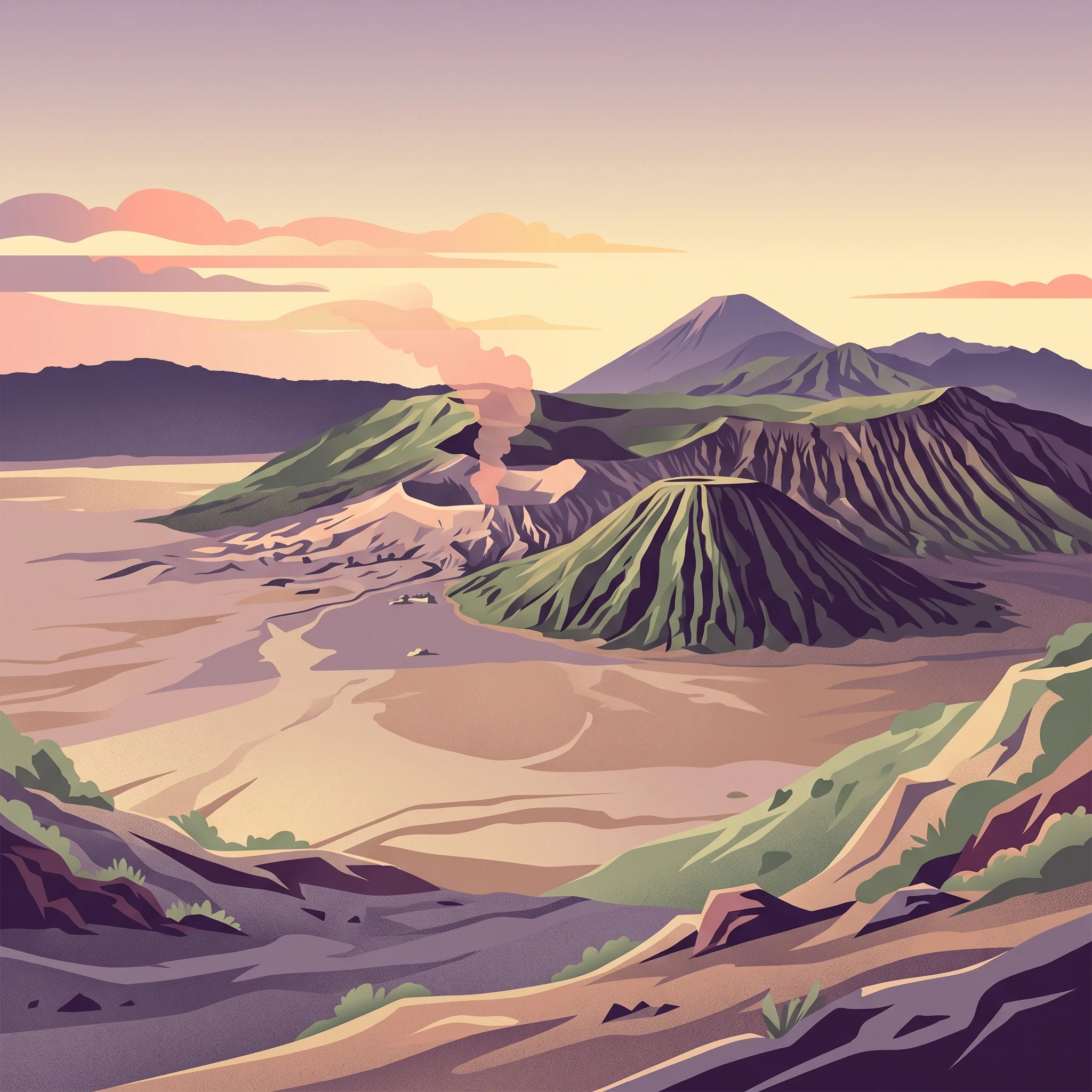
The park is renowned for its extraordinary volcanic landscape, featuring the iconic Tengger Sand Sea that stretches across the caldera floor in a striking contrast to the surrounding volcanic peaks. Mount Bromo, one of Indonesia's most active and accessible volcanoes, periodically erupts with dramatic steam and ash emissions visible from the crater rim. The sunrise views from Mount Penanjakan, overlooking the entire Tengger volcanic complex with Mount Semeru imposing in the background, have become one of Indonesia's most photographed scenes. The park is also distinguished as the only conservation area in Indonesia possessing a true sand sea ecosystem, a geological feature created by centuries of volcanic ash and sediment accumulation.

Bromo Tengger Semeru National Park history and protected-area timeline

The protection of this volcanic landscape began early in Indonesia's colonial history, with the Tengger Sand Sea designated for conservation in 1919, making it one of the earliest protected areas in the archipelago. Prior to national park status, the broader Tengger region functioned as a nature reserve, tourism forest, and combined protection and production forest managed by Perum Perhutani. The international recognition of the area's outstanding universal value came at the World National Parks Congress held in Denpasar, Bali, on October 14, 1982, when Bromo Tengger Semeru was confirmed as a national park. The formal governmental designation followed on November 12, 1992, when the Indonesian government officially declared the area a national park under Ministerial Decree SK No. 278/Kpts-VI/97 with a total area of 50,276 hectares. This designation consolidated several previously separate conservation areas, including the Tengger Sand Sea Nature Reserve, Ranu Kumbolo Nature Reserve, and Ranu Pani-Ranu Regulo Reserve, along with tourism parks and production forests. The park's establishment reflected both the area's exceptional natural values and the preservation of traditional Tenggerese culture and indigenous resource management practices.

Bromo Tengger Semeru National Park landscape and geographic character

The physical landscape of Bromo Tengger Semeru National Park is defined by its dramatic volcanic topography and the nested calderas that shape the terrain. The main Tengger Caldera spans roughly 8 kilometers across and is surrounded by steep crater walls rising 200 to 600 meters above the caldera floor. Within this ancient crater lies the Tengger Sand Sea, a 5,250-hectare expanse of volcanic sand and sediment that represents Indonesia's only true sand sea, creating an environment more reminiscent of desert landscapes than typical tropical rainforest. The five volcanic cones rising from the caldera floor each possess distinct characters: Mount Bromo (2,329 m) with its perpetually smoking crater, the forested Mount Batok (2,470 m), and the three active cones of Kursi, Watangan, and Widodaren. Surrounding the caldera proper are additional peaks including Mount Pananjakan (2,770 m), the most popular sunrise viewpoint, and the outer ring of mountains such as Mount Jantur, Mount Ider-ider, and Mount Mungal. The southern Semeru Group contains the highest peak in Java, Mount Semeru (3,676 m), a complex stratovolcano surrounded by a radial drainage pattern of over fifty rivers that have carved deep valleys through the volcanic terrain. Scattered throughout the park are four significant crater lakes, with Ranu Tompe being particularly isolated and scenic.

Bromo Tengger Semeru National Park ecosystems, habitats, and plant life

The ecological character of Bromo Tengger Semeru spans three distinct zonal systems determined by elevation and temperature gradients. The sub-montane zone from 750 to 1,500 meters supports tropical rainforest characterized by families including Fagaceae, Moraceae, Anacardiaceae, Sterculiaceae, and Rubiaceae, with remarkable biodiversity including approximately 225 orchid species. The montane zone from 1,500 to 2,440 meters features reduced plant diversity dominated by pioneer species, with distinctive vegetation including casuarina (cemara), mountain Vaccinium, Albizia lopantha, and the iconic Javanese edelweiss (senduro). The subalpine zone above 2,400 meters supports limited vegetation of Vaccinium varingifolium and Casuarina junghuhniana, while above 3,100 meters on Mount Semeru's summit, no plant life survives in the loose volcanic sandstone. The Tengger Sand Sea represents a unique ecological phenomenon, a desert-like ecosystem in Indonesia maintained by ongoing volcanic activity and the dynamic deposition of ash and sand.

Bromo Tengger Semeru National Park wildlife and species highlights

The wildlife community of Bromo Tengger Semeru, while not exceptionally diverse in species numbers, includes several notable and threatened species. The park protects approximately 137 bird species, 22 mammal species, and 4 reptile species. Notable bird species include the green peafowl, a striking species inhabiting the forest edges, and the besra, a bird of prey found in the montane zones. Among mammals, the Javan rusa represents an important population of this endemic deer species, while the Sumatran dhole (wild dog) and crab-eating macaque are regularly observed. The park also provides habitat for the marbled cat and the Javan leopard, both threatened felines whose presence in the park contributes to its conservation significance. The crater lakes of Ranu Pani, Ranu Regulo, and Ranu Kumbolo support waterbird populations including various duck species and herons.

Bromo Tengger Semeru National Park conservation status and protection priorities

Bromo Tengger Semeru holds significant conservation importance both within Indonesia and globally as a representative of tropical volcanic mountain ecosystems. The park's designation as IUCN Category II reflects its primary purpose of protecting scenic natural landscapes while allowing sustainable tourism and research activities. The Tengger Sand Sea, protected since 1919, represents one of Indonesia's earliest conservation commitments and remains the only sand sea ecosystem in the country, making it a globally unique feature. The park protects important watersheds for the densely populated lowlands of East Java, with over fifty rivers originating in the massif and providing irrigation for agricultural lands. The protection of Javanese edelweiss and approximately 200 endemic orchid species reflects the park's role in preserving Java's unique montane flora. Conservation challenges include managing the tension between active volcanic processes and visitor safety, addressing the 2023 wildfire that affected the Tengger crater area, and balancing tourism development with ecological integrity.

Bromo Tengger Semeru National Park cultural meaning and human context

The Bromo Tengger Semeru landscape is inseparable from the Tenggerese people, an indigenous Hindu community of approximately 600,000 people who have inhabited the Tengger mountains for centuries. Descendants of the Majapahit empire, the Tenggerese were driven into the hills following the 19th-century arrival of Muslim Madurese to the lowlands. Their traditional religion, a remnant from the Majapahit era, closely resembles Balinese Hinduism but incorporates stronger animist elements. About thirty villages within and around the park are occupied by Tenggerese communities, with Ngadas and Ranu Pani located within the park boundaries. The Tenggerese maintain a sophisticated system of traditional resource management and agricultural practices adapted to the volcanic terrain, cultivating terraced rice fields and garden plots. Sacred sites within the park include the Widodaren cave near Mount Batok, used for traditional ceremonies. The annual Yadnya Kasada ceremony, in which Tenggerese worshippers offer sacrifices to the gods of Mount Bromo, represents a living cultural tradition that intertwines with the park's landscape.

Top sights and standout views in Bromo Tengger Semeru National Park

The sunrise panorama from Mount Penanjakan, overlooking the Tengger Caldera with Mount Bromo steaming in the foreground and Mount Semeru's silhouette against the pink morning sky, represents one of Indonesia's most iconic natural vistas. The Tengger Sand Sea offers an otherworldly experience, a vast volcanic sand desert surrounded by crater walls and volcanic peaks, with visitors crossing the sand on foot or horseback to reach the Bromo crater. Mount Bromo's accessible crater allows close observation of ongoing volcanic activity, with visitors often witnessing steam explosions and sulfur emissions from the active vent. The challenge of climbing Mount Semeru attracts experienced trekkers to Java's highest summit, while the park's crater lakes such as Ranu Kumbolo provide scenic backcountry camping. The Tenggerese cultural dimension adds depth to visits, with opportunities to observe traditional village life and participate in or witness local ceremonies.

Best time to visit Bromo Tengger Semeru National Park

The optimal visiting season for Bromo Tengger Semeru runs from May through September, corresponding to the dry winter period when clear skies prevail and sunrise views over the caldera are most reliable. June, July, and August typically offer the best visibility and most dramatic sunrises, though these months also bring cold nighttime temperatures that can drop below freezing, particularly at higher elevations. The wet season from October through April brings heavier rainfall that can obscure caldera views and make some trails slippery and challenging. The period around June to August coincides with the peak tourism season, so visitors seeking solitude should be prepared for larger crowds at popular sunrise viewpoints. For wildlife viewing, the dry season concentrates animals around water sources, while the green season offers lusher vegetation but more difficult conditions. Trekkers attempting Mount Semeru should note that the climbing season follows similar seasonal patterns, with the most favorable conditions during the dry months.
Park location guide

Geography guide, regional context, and park location map for Bromo Tengger Semeru National Park

Bromo Tengger Semeru National Park park geography, regions, and map view in Indonesia
Understand where Bromo Tengger Semeru National Park sits in Indonesia through a broader geographic reading of the surrounding landscape, nearby location context, and its mapped position within the national park landscape.

How Bromo Tengger Semeru National Park fits into Indonesia

Indonesia is a vast archipelagic nation in Southeast Asia and Oceania, spanning over 17,000 islands between the Indian and Pacific Oceans. As the world's fourth-most populous country with 288 million people, it features extraordinary cultural and biological diversity, withJavanese and Sundanese being the largest ethnic groups. The country gained independence from the Netherlands in 1945 and operates as a unitary presidential republic.

Wider geography shaping Bromo Tengger Semeru National Park in Indonesia

Indonesia is situated in Southeast Asia and Oceania, spanning the equatorial region between the Indian Ocean to the west and the Pacific Ocean to the east. The archipelago includes major islands such as Sumatra, Java, Sulawesi, and parts of Borneo and New Guinea. It borders Papua New Guinea, Timor-Leste, and Malaysia by land, with extensive maritime boundaries throughout the region.

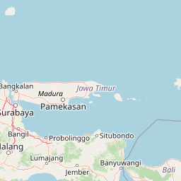
Map view of Bromo Tengger Semeru National Park

Use this park location map to pinpoint Bromo Tengger Semeru National Park in Indonesia, understand its exact geographic position, and read its mapped placement within the surrounding landscape more clearly.

Pigeon | © OpenStreetMap contributors

Location context for Bromo Tengger Semeru National Park

East Java
Park atlas

Compare additional national parks and protected landscapes across East Java, tracing their geographic spread and unique volcanic features.

Nearby National Parks and Protected Areas Around Bromo Tengger Semeru National Park
After exploring Bromo Tengger Semeru National Park, discover other national parks and protected areas in East Java and the wider Indonesian archipelago. Compare diverse ecosystems, unique geological formations, and the broader regional spread of conservation landscapes.
National parkEast Java

Meru Betiri National Park: Mapped Protected Landscape in East Java

Discover the terrain and geography of this national park.

Meru Betiri National Park in East Java, Indonesia, offers a rich tapestry of mapped landscapes, from its distinctive sandy beaches and mangrove ecosystems along the southern coast to its interior volcanic highlands and tropical rainforests. This protected area is crucial for understanding the regional geography and the distribution of conservation lands across Java. Explore its topographic diversity and unique ecological settings that define this significant national park.

Area
580 km²
Established
1982
IUCN
II
Visitors
2.5K annual
National parkEast Java

Alas Purwo National Park: A Protected Landscape within East Java's Geography

Mapped natural terrain and national park status in East Java.

Delve into the atlas-specific details of Alas Purwo National Park, a key protected area located in the East Java region of Indonesia. This page focuses on its identity as a national park, highlighting its geographic significance and the value of its mapped landscape for structured discovery. Understand the context of this protected land within the broader geography of East Java, contributing to a comprehensive overview of Indonesia's conservation territories.

Area
434.2 km²
Established
1992
IUCN
II
Visitors
14.7K annual
National parkCentral Kalimantan

Sabangau National Park: Central Kalimantan's Mapped Protected Landscape

Discover protected area boundaries and regional geography.

Sabangau National Park stands as a notable protected area within the expansive Central Kalimantan region of Indonesia. This national park offers a focused point for exploring specific mapped boundaries and understanding its unique position within the broader geographic tapestry of Borneo. Users can investigate the park's landscape context and its identity as a distinct protected territory, contributing to a structured understanding of Indonesia's natural areas.

Area
5,687 km²
Established
2004
IUCN
II
Relief
Lowland
National parkEast Nusa Tenggara

Komodo National Park: National Park Protected Landscape Atlas Entry

Mapped boundaries and regional geography for this Indonesian protected area.

Delve into the atlas representation of Komodo National Park, an essential protected landscape within the East Nusa Tenggara region of Indonesia. This entry highlights the park's mapped boundaries and its distinctive geographic setting. Understand the park's role as a national park and its contribution to the structured exploration of protected areas and natural landscapes across the Lesser Sunda Islands.

Area
1,733 km²
Established
1980
IUCN
II
Visitors
45K annual
National parkEast Nusa Tenggara

Manupeu Tanah Daru National Park: National Park Protected Landscape and East Nusa Tenggara Geography

Discover its mapped boundaries and regional atlas context.

Delve into the protected landscape of Manupeu Tanah Daru National Park, a significant national park situated within East Nusa Tenggara. This dedicated page provides detailed geographic context, focusing on the park's mapped boundaries and its contribution to the regional natural landscape. Understand its identity as a protected area and explore its place within the broader atlas of global conservation lands, fostering a deeper appreciation for its distinct geographic characteristics.

Area
879.84 km²
Established
1998
IUCN
II
Relief
Lowland
National parkCentral Kalimantan

Bukit Baka Bukit Raya National Park: Central Kalimantan's Protected Montane Rainforest Landscape

Explore the geographic core of Borneo's Schwaner mountain range.

Bukit Baka Bukit Raya National Park is a critical national park situated in Central Kalimantan, Indonesia, recognized for its extensive montane tropical rainforests and rugged topography. The park's landscape is dominated by the Schwaner mountain range, featuring prominent peaks like Bukit Raya, and functions as a vital watershed and biodiversity corridor. This protected area offers a rich subject for understanding regional geography, mapped landscapes, and the significance of Borneo's natural heritage within an atlas context.

Area
1,810 km²
Established
1992
IUCN
II
Relief
Mountain
National parkSumba

Laiwangi Wanggameti National Park: Protected Landscape and Geographic Atlas

Explore the mapped boundaries and regional context of this national park.

Laiwangi Wanggameti National Park serves as a vital protected area within Indonesia's Sumba region. This entry facilitates a deep dive into the park's specific geography, offering insights into its mapped protected boundaries and its contribution to the regional landscape. Users can engage with structured data to understand the park's unique natural identity and its place within a broader atlas of protected lands, focusing on geographic context and landscape characteristics.

Area
470.14 km²
Established
1998
IUCN
II
Scope
Terrestrial
National parkSouth Sulawesi

Bantimurung-Bulusaraung National Park: National Park Protected Landscape Identity and Geographic Setting

Mapped boundaries and regional atlas context for this South Sulawesi park.

Bantimurung-Bulusaraung National Park is an important protected area in South Sulawesi, Indonesia, designated as a national park. This entry provides a focused look at its geographic scope, mapped outlines, and the characteristics that define it as a protected landscape. Understanding this park's specific terrain and regional setting is key to appreciating its role within the broader atlas of natural areas and conservation efforts.

Area
437 km²
Established
2004
IUCN
II
Visitors
600K annual

Common questions about visiting, size, designation, and location context for Bromo Tengger Semeru National Park

Bromo Tengger Semeru National Park FAQs for park facts, access, geography, and protected area context
Find quick answers about Bromo Tengger Semeru National Park, including protected-area facts, park geography, trail and visitor context, and how the park fits into its surrounding country and regional landscape.
MoriAtlas Explorer

Continue Your Protected Areas Search Across the Global Atlas

Deepen your exploration by continuing the structured search for national parks and protected areas worldwide. Utilize the comprehensive filtering capabilities to compare different conservation landscapes and refine your understanding of global park geography. Discover more about the distribution and characteristics of protected natural areas.

Global natural geography