
Mori Atlas logo
Protected landscapePřírodní park Buděticko

Mapping the geomorphological transition between the Šumava foothills and the Blatenská pahorkatina uplands

Přírodní park Buděticko: A Protected Landscape within the Foothills of Southwestern Bohemia

Přírodní park Buděticko represents a distinct protected landscape situated at the confluence of the Šumava foothills and the rolling Blatenská pahorkatina uplands. This area within the Klatovy District is defined by its unique geological intersection of gneisses and limestone-influenced soils, supporting a rich assembly of meadow flora and orchids. Our mapped atlas view traces the riparian influence of the Otava River and the interconnected cultural landscape where traditional villages and medieval landmarks like Rabí Castle define the regional terrain.

nature parklimestone floraorchidsgentiansŠumava foothillsBohemian uplands
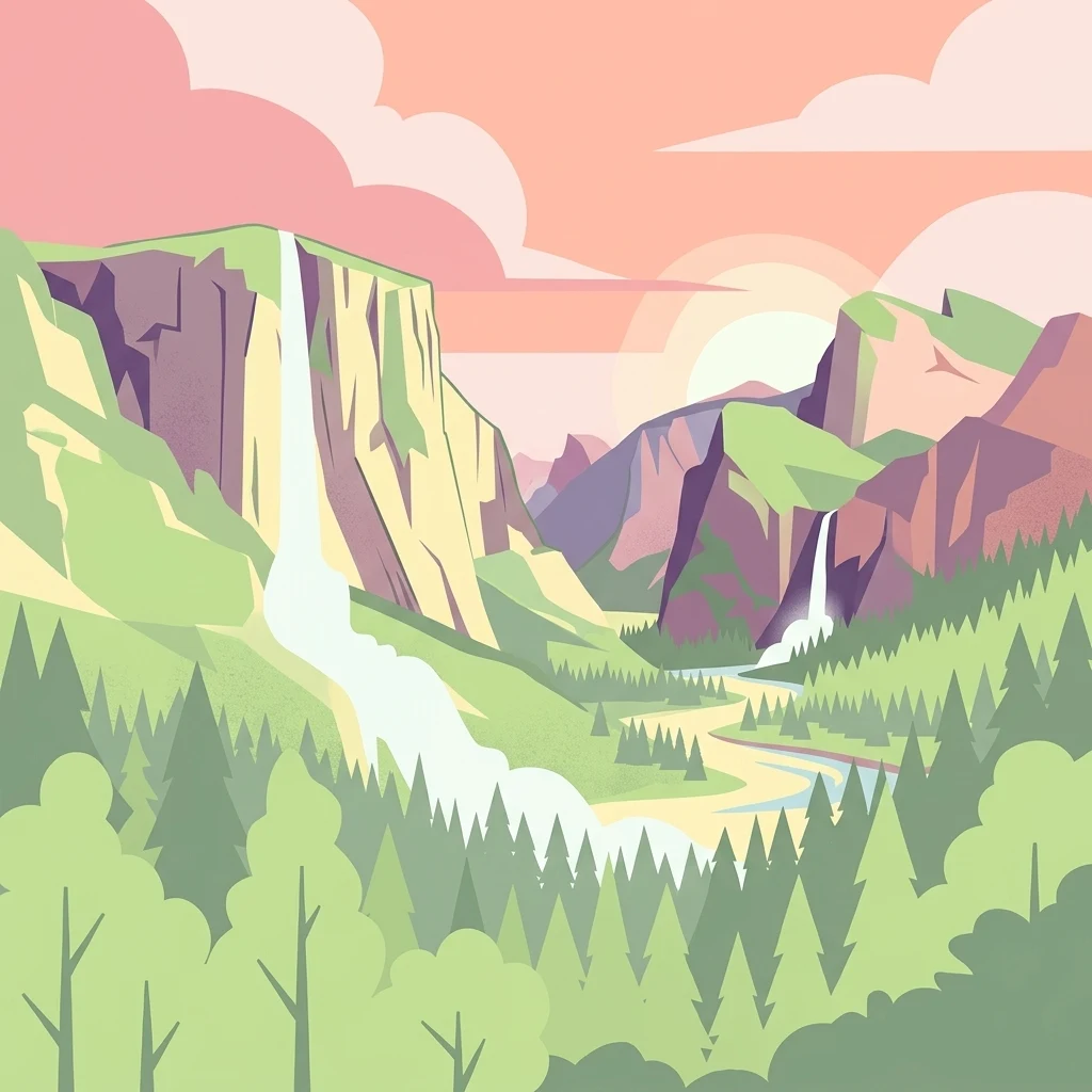
A stylized digital illustration showing a valley surrounded by steep cliffs and pine forests with two waterfalls flowing into a winding river under a setting sun.

Přírodní park Buděticko

Protected landscape

Park overview

Structured park overview, official facts, and landscape profile for Přírodní park Buděticko

Přírodní park Buděticko park facts, protected area profile, and essential visitor context

Review the core facts for Přírodní park Buděticko, including designation, size, terrain, visitor scale, habitats, and operating context in one park-focused overview.

About Přírodní park Buděticko

Přírodní park Buděticko is one of the lesser-known but ecologically distinctive nature parks of southwestern Bohemia. Established in 1994 and administered through the framework of Czech nature park protections, it covers roughly 44 square kilometers spanning the Šumavské podhůří foothills and the gently rolling Blatenská pahorkatina upland. The result is a mosaic of wooded slopes, meadow valleys, and small agricultural settlements that together create the kind of varied microhabitat mosaic that Bohemian nature parks are often celebrated for.

The park lies in the Klatovy District, between the larger town of Sušice and a chain of smaller villages including Hrádek, Zbynice, Čejkovy, Vlkonice, and Rabí. The localization shapes the park's character, anchoring it in a region where medieval landmarks and traditional Bohemian rural landscape patterns coexist with natural values. Rabí Castle, the largest castle ruin in Bohemia, sits within the protected area, illustrating how the park bridges ecological and cultural heritage.

Geologically, the underlying rocks include gneisses and quartz diorites, but phytogeographically the whole area falls within the Sušicko-horažďovické limestone district. This special combination of geology and biogeography is central to the park's identity, supporting diverse orchid populations, fringed gentians, and a range of other protected species. The Otava River runs along part of the park's edge, and the Černíčský potok forms its northern boundary, ensuring that aquatic and riparian habitats are part of the protected mosaic.

Two small nature reserves lie fully inside the park: Zbynické rybníky, focused on its ponds, and Čepičná. These reserves complement the broader park protection regime. Together with the surrounding landscape, they make Buděticko a representative example of how regional nature parks in the Czech Republic integrate local biodiversity, traditional land use, and cultural monuments into a single protected framework.

Quick facts and research context for Přírodní park Buděticko

Přírodní park Buděticko was established in 1994 by the Klatovy Municipal Office and covers approximately 44 square kilometers in the Klatovy District of southwestern Bohemia. The protected area lies between Sušice and several smaller settlements, including Hrádek, Zbynice, Čejkovy, Vlkonice, and Rabí.

Geologically, much of the park sits on gneiss and quartz diorite substrates, while phytogeographically it falls within the Sušicko-horažďovické limestone district. Two geomorphological units meet here: the Šumava foothills and the Blatenská pahorkatina. The Otava River partly defines the park's edge, and the northern boundary follows the Černíčský potok stream. Two small nature reserves, Zbynické rybníky and Čepičná, fall within the park.

Protection and recognition

Examining terrestrial protection scope and international recognition records

Přírodní park Buděticko Protection Status and Recognition Data

Přírodní park Buděticko maintains a documented terrestrial protection scope within regional conservation frameworks. Official records compile available designation history and management parameters for structured analysis.

Protection details

Protection scope
Terrestrial
Transboundary protection
No
Park context

Deeper park guide and search-rich context for Přírodní park Buděticko

Přírodní park Buděticko history, landscape, wildlife, and travel context

Explore Přírodní park Buděticko through its history, landscape character, ecosystems, wildlife, conservation priorities, cultural context, and seasonal travel timing in a structured park guide built for atlas discovery and search intent.

Why Přírodní park Buděticko stands out

Buděticko is best known for its rich orchid flora and other protected plant species thriving on its limestone-influenced soils within the Šumava foothills. The park is distinguished by autumn meadows that turn blue with flowering fringed gentians, a striking seasonal phenomenon that signals the area's ecological character. It is also recognized for its assemblage of warmth-loving fauna, including rare invertebrates such as the blue-winged grasshopper and the oil beetle, as well as for the presence of the Eurasian otter in the Otava River along the park's boundary.
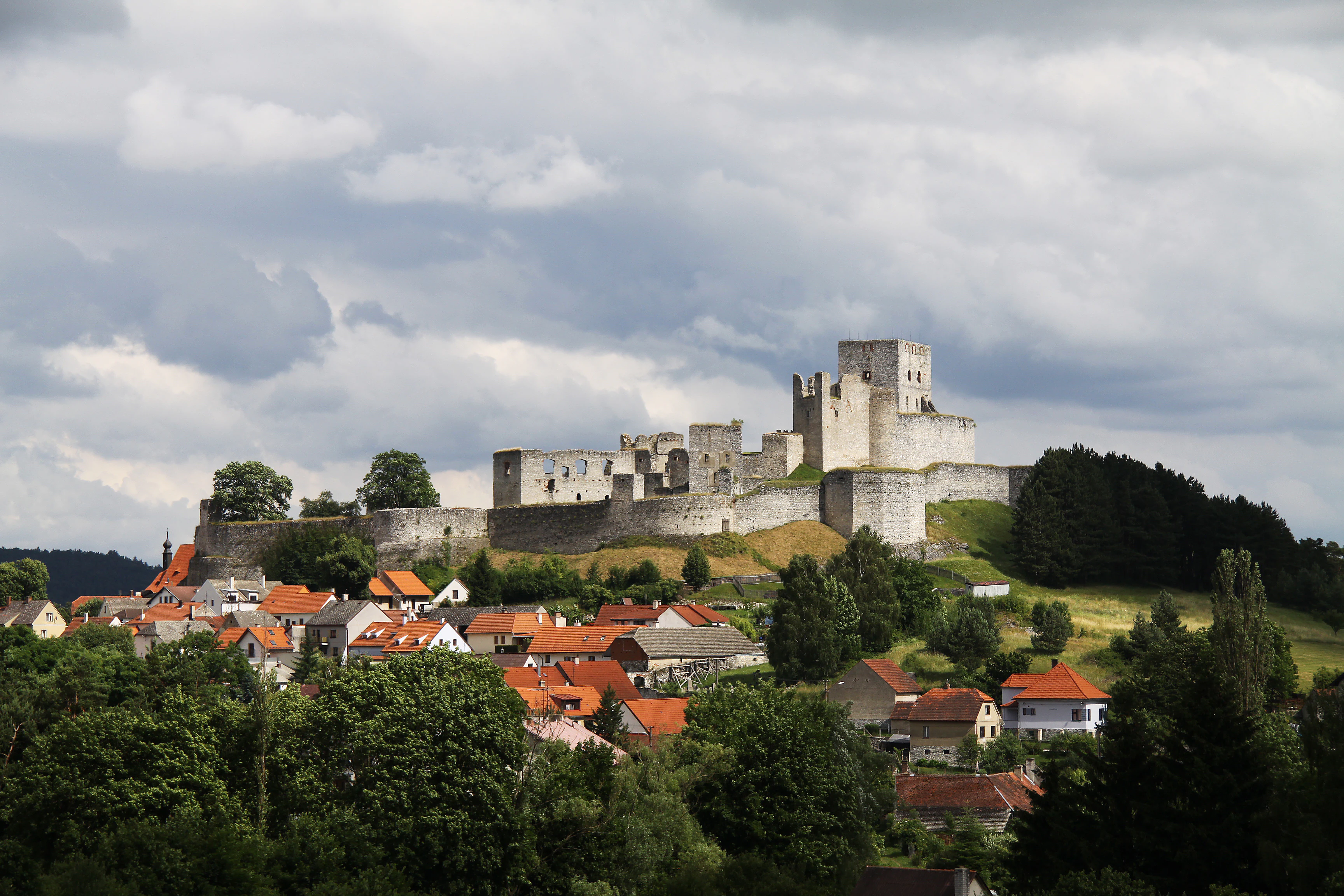
A wide shot showing the extensive stone ruins of Rabi Castle situated on a hilltop above a village with red-roofed houses under a cloudy sky.
The medieval ruins of Rabi Castle overlooking the village of Rabí, located within the Buděticko Nature Park.

Přírodní park Buděticko history and protected-area timeline

Přírodní park Buděticko was formally designated in 1994, with the declaration issued by the then Klatovy Municipal Office. The park was created during a period when Czech regional administrations were actively establishing nature parks as a form of landscape protection that balanced ecological goals with the preservation of traditional Bohemian countryside.

The park encompasses a landscape whose human history stretches back much further than its formal protection. Settlements such as Budětice, Vlkonice, Zbynice, and Rabí have long historical roots, and Rabí Castle, situated inside the park, marks the area as a place of medieval significance. The 1994 designation thus did not invent a new landscape but rather formalized protection for a region whose natural and cultural layers had been evolving together for centuries. Since its establishment, the park has operated within the Czech nature park system as a regional landscape protection area, with the small reserves of Zbynické rybníky and Čepičná providing additional local protection layers inside its boundaries.

Přírodní park Buděticko landscape and geographic character

The landscape of Buděticko is shaped by its position at the meeting point of two Bohemian geomorphological units. The Šumavské podhůří, or Šumava foothills, brings gently rising terrain and wooded slopes descending toward the larger regional valleys. To the north and east, the terrain transitions into the Blatenská pahorkatina, a rolling upland characterized by softer hills and broader meadows. Together they create a varied topography of ridges, valleys, and basin lowlands.

Geologically, much of the park is underlain by gneisses and quartz diorites, giving the slopes and valleys a characteristic Bohemian foothill substrate. Despite this rocky base, the area's phytogeographical placement within the Sušicko-horažďovické limestone district creates conditions favorable to lime-loving plants, which in turn support the park's rich floristic profile. Water shapes the park's boundaries: the Otava River traces part of the western edge, while the Černíčský potok defines the northern boundary, adding riparian corridors to the wider landscape mosaic.

Human settlement is woven into the visual character of the park. Small villages such as Hrádek, Zbynice, Čejkovy, Vlkonice, and Budětice, together with the historic site of Rabí Castle, break up the natural scenery and emphasize how the protected landscape is also a lived-in cultural region. The combination of forested slopes, open meadows, scattered ponds, and clustered villages gives Buděticko a distinctly Bohemian foothill character.

Přírodní park Buděticko ecosystems, habitats, and plant life

Ecologically, Buděticko is defined by a striking overlap of geological and phytogeographical conditions. Although much of the park sits on gneiss and quartz diorite substrates, the entire area is classified phytogeographically as part of the Sušicko-horažďovické limestone district. This overlapping character creates conditions where lime-influenced plant communities thrive on substrates that would elsewhere support different vegetation types.

The park is particularly notable for its orchid-rich flora. Species found here include white and red helleborines, the dark-red helleborine, creeping lady's tresses, the green-winged orchid, bird's-nest orchid, and common twayblade. The Bohemian subspecies of the dune gentian, hairy oxytropis, martagon lily, and common moonwort also occur. In autumn, the meadows and field margins turn blue with flowering fringed gentians, a defining seasonal feature of the park's natural character.

Habitats within the park range from wooded slopes and rocky outcrops to open meadows, ponds, and stream corridors. Two small nature reserves lie within the boundaries, Zbynické rybníky, focused on its pond system, and Čepičná, providing additional localized protection. The Otava River and the Černíčský potok add riparian and aquatic habitat value, supporting both freshwater invertebrates and the wider wetland ecosystems that complement the terrestrial flora.

Přírodní park Buděticko wildlife and species highlights

The wildlife profile of Buděticko is especially notable for its assemblage of warmth-loving invertebrates, a feature tied to the park's limestone phytogeography and its drier meadow habitats. Among the recorded species are the blue-winged grasshopper, a characteristic insect of open, warm grasslands, as well as the oil beetle and the hairy rove beetle, all species associated with traditional, extensively managed European countryside.

Aquatic and riparian wildlife is supported by the park's hydrological features. The pond mussel has been recorded inside the park, and the Eurasian otter inhabits the Otava River as it flows along the park's edge, an important indicator of healthy river conditions. Historically, the freshwater pearl mussel also occurred in this stretch of the Otava, reflecting the river's broader ecological significance for sensitive mollusk species.

The presence of these species, together with the rich flora and varied habitats, gives Buděticko an ecological character that bridges specialized limestone-flora communities, warm-loving insect fauna, and freshwater river ecosystems.

Přírodní park Buděticko conservation status and protection priorities

Buděticko plays a meaningful role within the Czech system of regional landscape protection. Designated as a nature park in 1994, it operates under the broader legal framework that aims to preserve regionally important landscapes while allowing traditional land uses to continue. The park protects a mosaic of habitats, from orchid-rich meadows and fringed gentian grasslands to pond systems, river corridors, and foothill forest, that together represent a distinctive transitional zone between the Šumava highlands and the interior Bohemian uplands.

The conservation value of the park is reinforced by the presence of multiple protected plant species, including orchids and the Bohemian subspecies of the dune gentian, and by the protection of warmth-loving insect fauna. Two small nature reserves within the park, Zbynické rybníky and Čepičná, add a layer of stricter protection for specific sites, ensuring that key habitats receive focused management.

The Otava River corridor is also a conservation asset. Its role in supporting the Eurasian otter, and historically the freshwater pearl mussel, links Buděticko to broader efforts to maintain healthy river ecosystems in southwestern Bohemia. Together, these features make the park a regionally important refuge for biodiversity within a heavily settled and historically used landscape.

Přírodní park Buděticko cultural meaning and human context

Buděticko is more than a natural area; it is also a landscape strongly marked by human history. Several traditional Bohemian villages, including Budětice, Vlkonice, Zbynice, Čejkovy, and Hrádek, lie within or adjacent to the park, creating a protected area that simultaneously sustains a living rural community.

Most strikingly, the park contains Rabí Castle, the largest castle ruin in the Czech lands and a landmark of medieval Bohemian history. The castle's presence within the nature park illustrates the Czech tradition of integrating cultural monuments and natural heritage within a single protected framework. The result is a region where medieval stone architecture, historic villages, and contemporary farming coexist with orchid meadows, gentian-rich grasslands, and riverine habitats.

Top sights and standout views in Přírodní park Buděticko

Přírodní park Buděticko's strongest points of distinction include its position at the transition between the Šumava foothills and the Blatenská pahorkatina, its unusual overlap of gneiss and diorite geology with limestone phytogeography, and the resulting richness of its orchid flora. The autumn blooming of fringed gentians across the park's meadows is a signature seasonal feature, while the Otava River corridor adds important freshwater and riparian value, including the presence of the Eurasian otter.

Equally notable is the park's integration of natural and cultural heritage, with small protected reserves such as Zbynické rybníky and Čepičná nested within a landscape that also contains the historic Rabí Castle and a chain of traditional Bohemian villages.

Best time to visit Přírodní park Buděticko

The character of Buděticko shifts with the seasons in ways that reflect both its flora and its traditional landscape use. Spring and early summer are the most rewarding period for visitors interested in the park's orchids, when white and red helleborines, green-winged orchids, bird's-nest orchids, and common twayblades come into flower across the meadows and woodland margins.

Late summer and autumn bring a different highlight: the meadows and field margins turn blue with flowering fringed gentians, one of the park's signature visual experiences. The surrounding villages and castle ruins are most comfortably explored in mild weather from late spring through early autumn, when the combination of open landscapes and traditional Bohemian village architecture is at its most accessible.

Monthly climate preview

Long-term representative monthly temperature and precipitation data patterns

Přírodní park Buděticko Climate Normals and Annual Temperature Rhythm

Přírodní park Buděticko exhibits a recorded annual temperature rhythm ranging from sub-zero winter minimums to peak summer maximums alongside measured precipitation levels. Examining the full monthly climatology profile provides detailed insight into long-term averages across the representative coordinate.
Annual mean8 °C
-3 °C19 °C
Jan-3°
Feb-2°
Mar
Apr
May12°
Jun16°
Jul19°
Aug18°
Sep13°
Oct
Nov
Dec-2°
Warmest month
July

18.5 °C

Coolest month
January

-2.8 °C

Wettest month
June

2.9 mm/day

Driest month
February

1.4 mm/day

Park location guide

Geography guide, regional context, and park location map for Přírodní park Buděticko

Přírodní park Buděticko park geography, regions, and map view in Czechia

Understand where Přírodní park Buděticko sits in Czechia through a broader geographic reading of the surrounding landscape, nearby location context, and its mapped position within the national park landscape.

How Přírodní park Buděticko fits into Czechia

Czech Republic is a landlocked Central European country with a population of approximately 10.9 million people. The nation was established as an independent state on January 1, 1993, following the dissolution of Czechoslovakia. Its capital and largest city is Prague, with other major urban centers including Brno, Ostrava, Plzeň, and Liberec.

Wider geography shaping Přírodní park Buděticko in Czechia

The Czech Republic is a landlocked country in Central Europe. It is bordered by Germany to the west, Austria to the south, Poland to the northeast, and Slovakia to the southeast. The landscape is predominantly hilly, with the territory covering 78,871 square kilometers.

Map view of Přírodní park Buděticko

Use this park location map to pinpoint Přírodní park Buděticko in Czechia, understand its exact geographic position, and read its mapped placement within the surrounding landscape more clearly.

Pigeon | © OpenStreetMap contributors

Location context for Přírodní park Buděticko

Klatovy District

Visual reference for limestone terrain, meadow habitats, and regional protected area character.

Přírodní park Buděticko Photos and Landscape Scenery

Visual documentation of Přírodní park Buděticko reveals the varied topography of the Šumava foothills and transitional Bohemian uplands. Examining protected area imagery provides clearer insight into local limestone geology, river corridors, and traditional regional habitats.

A wide shot showing the extensive stone ruins of Rabi Castle situated on a hilltop above a village with red-roofed houses under a cloudy sky.

Park atlas

Compare adjacent Bohemian foothill landscapes and regional nature reserves

Other Parks Near Přírodní Park Buděticko And Surrounding Protected Areas

Browse nearby protected landscapes and related regional reserves connected to the Šumava foothills. Comparing adjacent terrain reveals broader ecological patterns across the surrounding Bohemian uplands.
A horizontal watercolor illustration depicting soft, rolling hills in shades of green, yellow, and light pink with small clusters of trees.
Nature reservePlzeňský kraj
About 9.4 km away#1 closest

East

Prácheň Nature Reserve: Protected Broadleaf Woodlands and Historic Castle Remains

An atlas view of Bohemian forest geography and heritage landscapes

Prácheň Nature Reserve protects a compact block of warm-loving deciduous woodland set atop a hilltop in the Plzeňský kraj region. The area integrates significant natural habitats with cultural heritage, encompassing an early medieval hillfort and castle ruins. This unique blend of forest ecology and Bohemian historical geography offers a distinct perspective on protected areas within the southwestern Czech landscape.

Area
0.283 km²
Established
1953
IUCN
IV
Relief
Upland
Natural monumentPlzeňský kraj
About 16 km away#2 closest

North

Velký kámen Natural Monument: Protected Siliceous Outcrops and Regional Geography

Geological landscape within the Plánický hřeben area of Plzeňský kraj.

Velký kámen serves as a notable protected landmark featuring an elongated siliceous rock formation and remnants of natural beech forest. Its location on the V Kopaninách hillside makes it a key feature of the broader regional geography, while its status as both a natural monument and an Eneolithic archaeological site provides a layered perspective on the Bohemian landscape.

Area
0.012 km²
IUCN
IV
Relief
Upland
Scope
Terrestrial
Watercolor illustration of a river flowing through a forested landscape with rolling hills in the background
National parkSouth Bohemian Region
About 16 km away#3 closest

South

Šumava National Park: Czech Republic's Premier Forested National Park and Protected Landscape

Explore the unique glacial lakes, peat bogs, and regional geography.

Šumava National Park, situated in the South Bohemian Region of the Czech Republic, is the nation's largest protected area and a vital component of Central Europe's forest ecosystems. This entry details its expansive terrain, highlighting the significant peat bog complexes and ancient glacial lakes that define its unique landscape. Discover the park's geographic context, mapped boundaries, and its importance as a protected natural asset within the broader regional atlas.

Area
680.64 km²
Established
1991
IUCN
II
Visitors
2M annual
Watercolor painting of a grassy meadow bordered by a forest line with soft green and muted earth tones.
Nature reserveJihočeský kraj
About 21 km away#4 closest

South

Rašeliniště u Martinala: A Protected Nature Reserve in the Jihočeský kraj Foothills

Mapping transitional bog ecosystems and submontane habitats

Located in the Šumava foothills, Rašeliniště u Martinala is a protected nature reserve defined by its dual-parcel structure of peat-forming wetlands and juniper-rich dry grasslands. This site acts as a key ecological node, supporting a high density of protected species within the Jáchymovský potok drainage basin and representing a refined example of south Bohemian submontane landscape character.

Area
0.095 km²
Established
2011
IUCN
IV
Relief
Upland
A watercolor painting showing a panoramic view of soft rolling green hills, a small stream, and wildflowers in the foreground.
Natural monumentJihočeský kraj
About 23 km away#5 closest

Northeast

Smyslov Natural Monument: Mapping Protected Habitats in the South Bohemian Region

Traditional pastoral landscapes and botanical meadow mosaics

Smyslov stands as a significant natural monument in the Jihočeský kraj, illustrating the traditional ecological structure of the Blatná area. The site is defined by its tight combination of dry, rocky slopes featuring juniper, and shallow depressions hosting moisture-loving vegetation. Explore this distinct protected area to understand its role in conserving rare meadow flora and traditional South Bohemian terrain.

Area
0.078 km²
Established
1990
IUCN
IV
Relief
Lowland
A horizontal watercolor painting depicting a soft, atmospheric landscape with a foreground of purple and pink wetland grasses, a midground of scattered green coniferous trees, and hazy, distant mountain silhouettes in the background.
Nature reservePlzeňský kraj
About 23 km away#6 closest

Southwest

Prameniště Nature Reserve: Protected Wetland and Mountain Spring Systems in Plzeňský kraj

Mapping the hydrological headwaters of the Šumava Mountains

Prameniště Nature Reserve represents a critical cluster of protected mountain springs and peat bogs across the Pancířský hřbet ridge. By focusing on the source areas for the Křemelná and Řezná rivers, this reserve maintains essential hydrological integrity within the wider Plzeňský kraj landscape. Its mosaic of sub-alpine peatlands and montane spruce forests provides an important study of high-altitude wetland geography in the central European mountains.

Area
3.536 km²
Established
1994
IUCN
IV
Relief
Mountain
A watercolor painting of soft green rolling hills and small clusters of pine trees against a light sunset sky.
Natural monumentJihočeský kraj
About 24 km away#7 closest

East

Ryšovy Natural Monument and Botanical Protected Area in Jihočeský kraj

Exploring limestone woodland terrain and rare floral habitats

Ryšovy is a notable natural monument in the Czech Republic, defined by its characteristic limestone bedrock and the resulting diverse herb layer. This protected area creates a significant botanical stronghold within the wider landscape of the Jihočeský kraj, featuring a mosaic of woodland patches and sun-exposed clearings that support protected orchids and other rare thermophilous plant species.

Area
0.35 km²
Established
1990
IUCN
IV
Relief
Upland
Watercolor painting showing mountains, forests, and valleys in a landscape.
National parkGermany
About 27 km away#8 closest

South

Bavarian Forest National Park: Protected Landscape and Regional Geography Atlas

Explore mapped terrain and protected park boundaries in Germany.

Dive into the specifics of Bavarian Forest National Park, a key protected area noted for its distinct landscape and geographic importance. This MoriAtlas entry details the park's mapped boundaries and its setting within the surrounding regional geography, offering a clear atlas-style view of its natural terrain. Understand its identity as a national park and discover its place in Germany's protected lands.

Area
242.45 km²
Established
1970
IUCN
II
Visitors
1.3M annual

Common questions about visiting, size, designation, and location context for Přírodní park Buděticko

Přírodní park Buděticko FAQs for park facts, access, geography, and protected area context

Find quick answers about Přírodní park Buděticko, including protected-area facts, park geography, trail and visitor context, and how the park fits into its surrounding country and regional landscape.
MoriAtlas Explorer

Continue Your Protected Areas Search Across the Global Atlas

Deepen your exploration by continuing the structured search for national parks and protected areas worldwide. Utilize the comprehensive filtering capabilities to compare different conservation landscapes and refine your understanding of global park geography. Discover more about the distribution and characteristics of protected natural areas.

Global natural geography