Mori Atlas logo
National parkBavarian Forest National Park

Discover the mapped terrain and park boundaries of this national park in Germany.

Bavarian Forest National Park: Protected Landscape Identity and Geographic Context

(Nationalpark Bayerischer Wald)

Bavarian Forest National Park stands as a significant protected landscape within Germany, offering a unique focus for atlas-based geographic exploration. As a national park, its mapped boundaries define an area of natural terrain crucial for understanding regional landscape context. This page provides detailed geographic information, allowing for structured discovery of the park's setting and its place within the broader landscape, accessible through MoriAtlas's map-centric discovery tools.

national parkold-growth forestmountain forestCentral Europeprotected areawilderness conservation
Illustration showing a mountain peak with waterfall, lake, and forest landscape

Bavarian Forest National Park

National park

Park overview

Structured park overview, official facts, and landscape profile for Bavarian Forest National Park

Bavarian Forest National Park park facts, protected area profile, and essential visitor context
Review the core facts for Bavarian Forest National Park, including designation, size, terrain, visitor scale, habitats, and operating context in one park-focused overview.

About Bavarian Forest National Park

Bavarian Forest National Park occupies the interior mountains of the Bavarian Forest along Germany's border with the Czech Republic in the counties of Regen and Freyung-Grafenau. The landscape is characterized by granite bedrock and a succession of forest types that change with elevation, from valley spruce forests through mixed mountain forests to pure spruce forests at the highest elevations. The park's conservation approach distinguishes it from most European forests: in the nature zone covering over 75 percent of the area, no human intervention occurs, not even after storms or pest outbreaks. This philosophy has created vast areas of dead wood and allowed natural forest regeneration, transforming former plantation spruce forests into developing wilderness. The park maintains visitor facilities including the Hans-Eisenmann-Haus information center near Neuschönau, the Haus zur Wildnis at Falkenstein, animal enclosures showcasing species like lynx, wolves, wisent and elk, and an extensive network of hiking trails and educational paths including the popular Baumwipfelpfad treetop walkway.

Quick facts and research context for Bavarian Forest National Park

Bavarian Forest National Park covers roughly 24,250 hectares along the German-Czech border in the eastern Bavarian Forest mountains. Established in 1970 as Germany's first national park, it forms the heart of Central Europe's largest continuous forest ecosystem together with Šumava. The park contains three distinct elevational forest zones: high-elevation spruce forests, mixed mountain forests of beech, fir and spruce, and valley spruce woods. It also protects rare raised bogs and former high meadows called Schachten. The park receives approximately 1.3 million visitors annually and serves as an important economic driver for the region.

Park context

Deeper park guide and search-rich context for Bavarian Forest National Park

Bavarian Forest National Park history, landscape, wildlife, and travel context
Explore Bavarian Forest National Park through its history, landscape character, ecosystems, wildlife, conservation priorities, cultural context, and seasonal travel timing in a structured park guide built for atlas discovery and search intent.

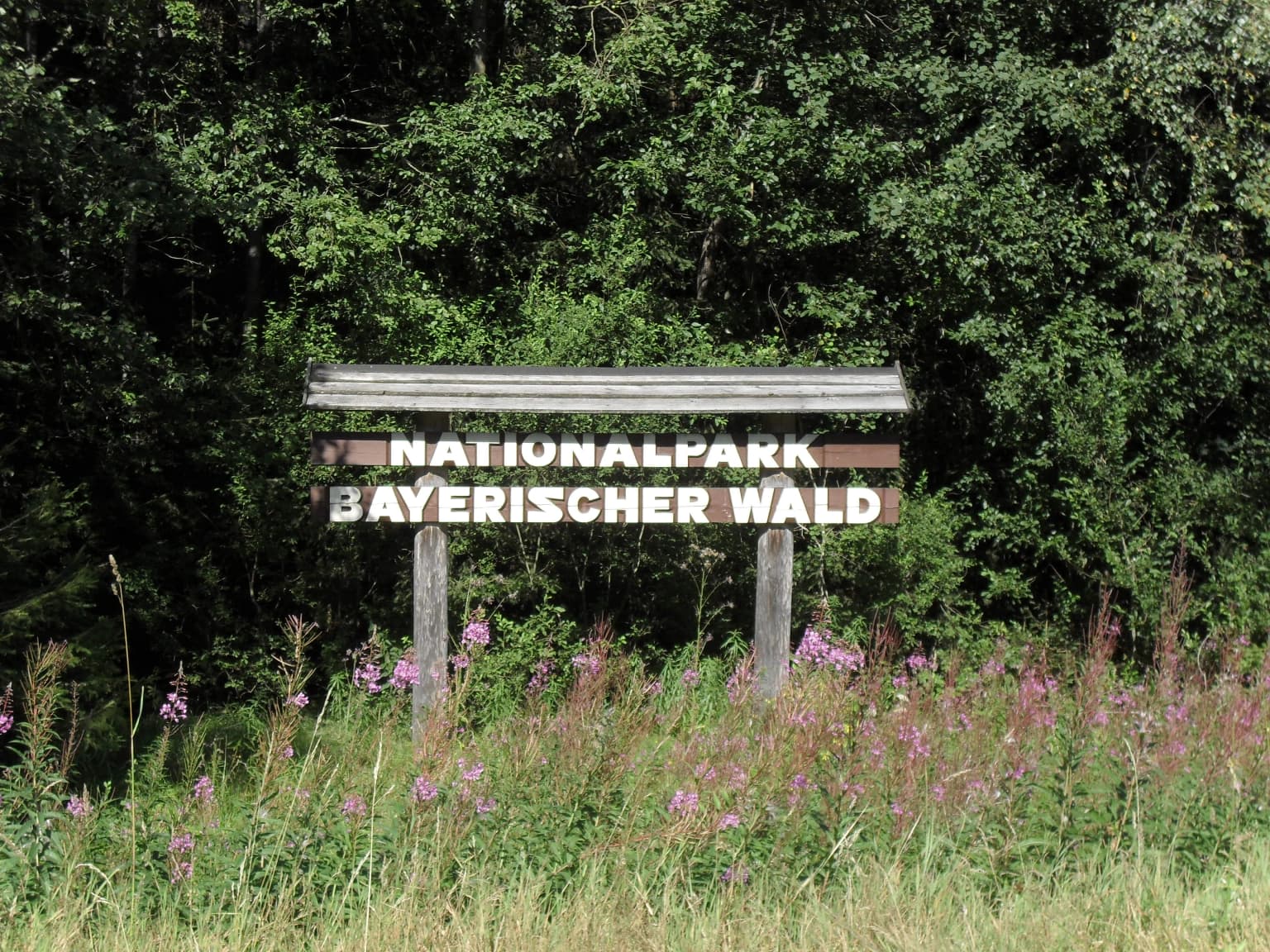
Why Bavarian Forest National Park stands out

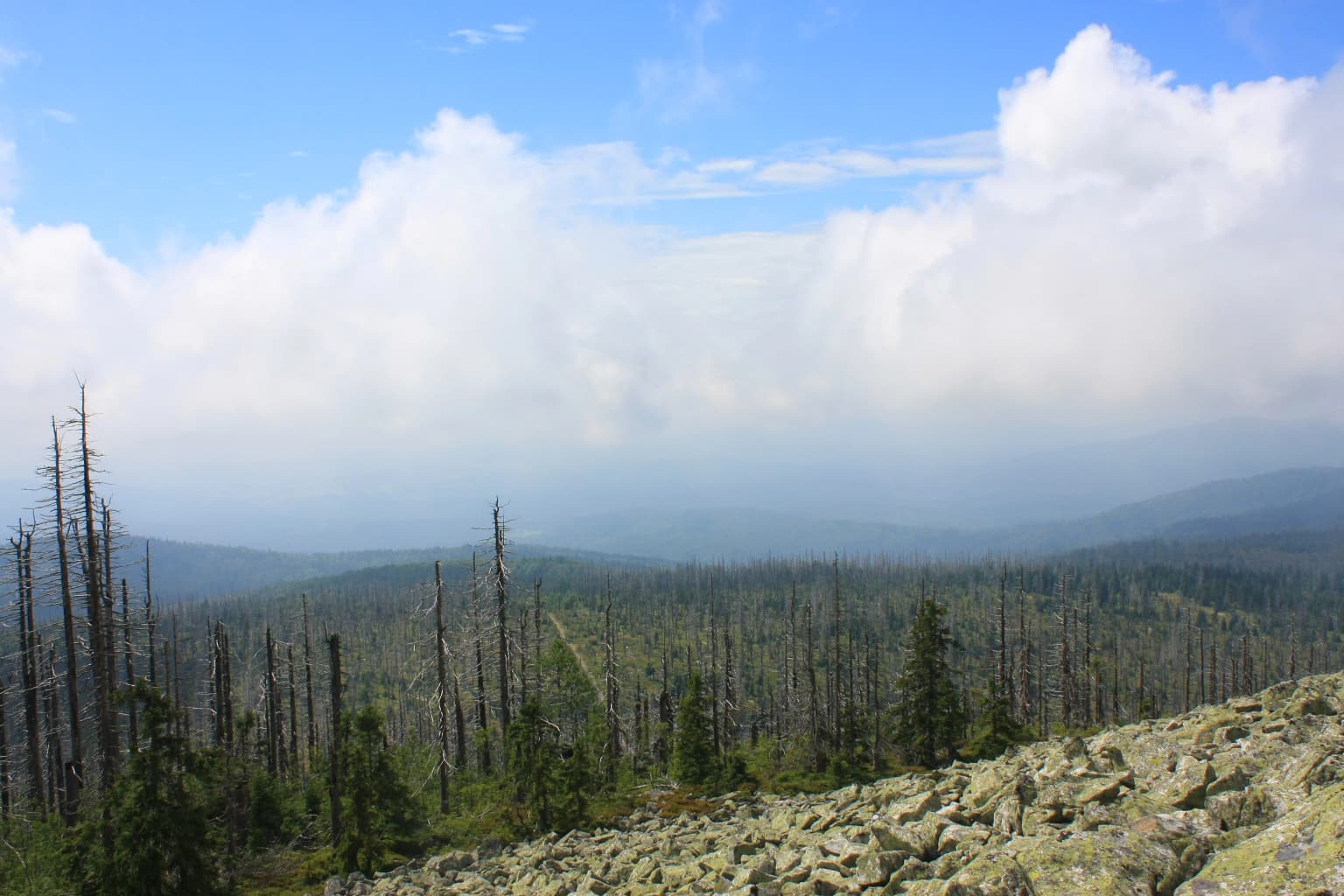
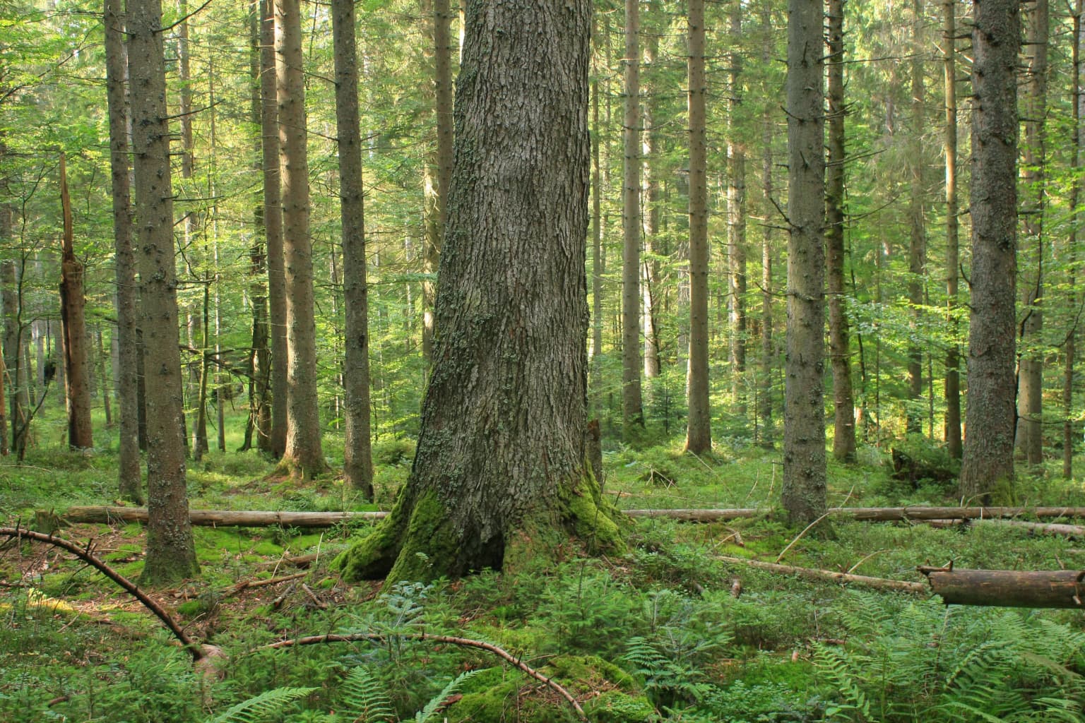
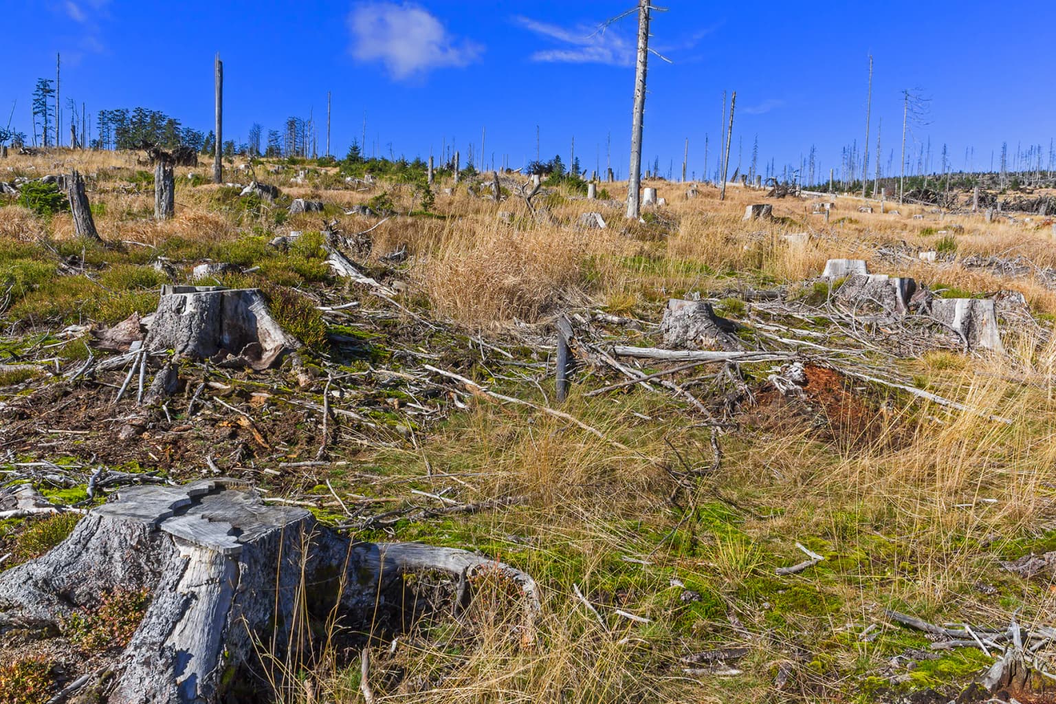
Bavarian Forest National Park is best known as Germany's pioneering national park and its bold approach to wilderness conservation that lets nature take its course without human intervention. The park gained international attention during the 1990s when extensive bark beetle infestations killed large areas of high-elevation spruce forest, sparking intense public debate about conservation philosophy. It is also famous for successful species reintroductions, particularly the Eurasian lynx, and more recently for establishing a wolf population with the first wild-born cubs in Bavaria in over 150 years. The park protects significant old-growth forest remnants including the Urwaldgebiet Mittelsteighütte and Hans-Watzlik-Hain with centuries-old trees.

Wooden sign displaying 'NATIONALPARK BAYERISCHER WALD' text with purple wildflowers in the foreground and dense forest in the background
Entrance sign for Bavarian Forest National Park surrounded by wildflowers and forest

Bavarian Forest National Park history and protected-area timeline

The movement to protect the Bavarian Forest began in the early 20th century as the last old-growth forests disappeared to industrial forestry. Early protected areas included Höllbachgspreng (1914), Urwaldgebiet Mittelsteighütte (1939), and Hans-Watzlik-Hain (1950). After World War II, plans for a national park were delayed until the 1960s when conservationists including Bernhard Grzimek and Hubert Weinzierl renewed efforts. The Bavarian Parliament unanimously approved the park in 1969, and it officially opened on October 7, 1970, covering 13,229 hectares in the Rachel-Lusen area. Initially, reduced forestry continued, but in 1983 the decision was made to end all timber extraction in inner reservations, aiming to create a wilderness for future generations. In 1997, the park expanded by 10,950 hectares to include the Falkenstein area. The park celebrated its 50th anniversary in 2020, and in 2022 achieved the IUCN goal of having 75 percent of its area free from human intervention, four years ahead of the 2027 target.

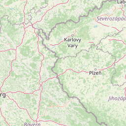
Bavarian Forest National Park landscape and geographic character

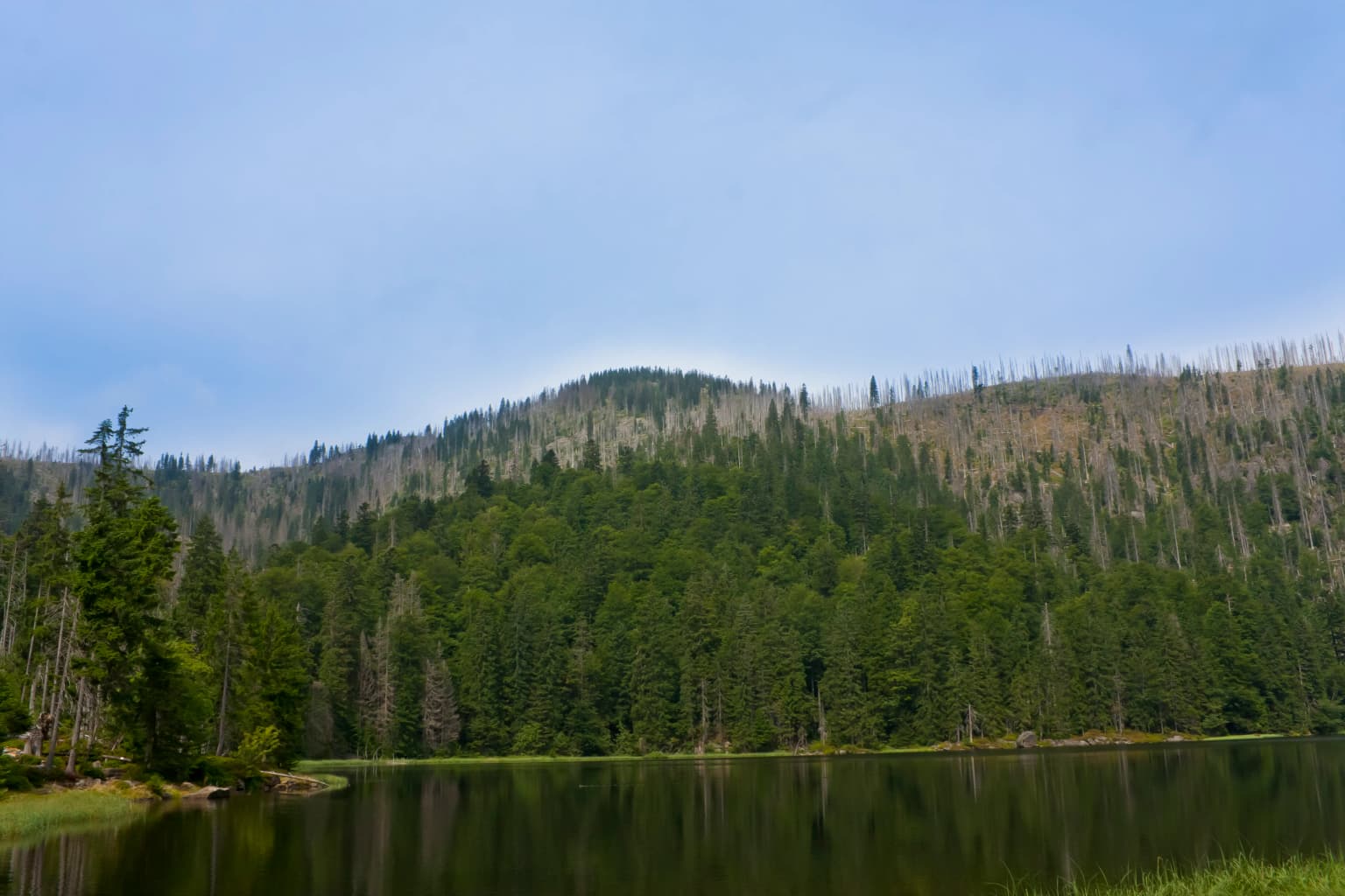
The park spans the main ridge of the Bavarian Forest from Großer Falkenstein in the northwest through Großer Rachel to Lusen in the southeast. The terrain consists of rounded mountain peaks and ridges underlain by ancient granitic and gneissic bedrock of the Bohemian Massif, with soils dominated by acidic brown earths, podzols and peat soils in the bogs. Rock outcrops and block fields characterize higher elevations. The landscape includes ecologically significant raised bogs such as Großer Filz and Latschenfilz with their bog lakes including Latschensee. Former high-altitude pastures called Schachten dot the landscape, and steep-walled valleys like the Höllbachgspreng contain remnants of original ravine forests. The numerous enclaves of municipal land scattered throughout the park create a complex boundary with adjacent communities.

Landscape view from a mountain summit showing forested valleys, distant mountains, and rocky terrain in the foreground under a partly cloudy sky
View from Lusen summit onto forested mountains and valleys in Bavarian Forest National Park

Bavarian Forest National Park ecosystems, habitats, and plant life

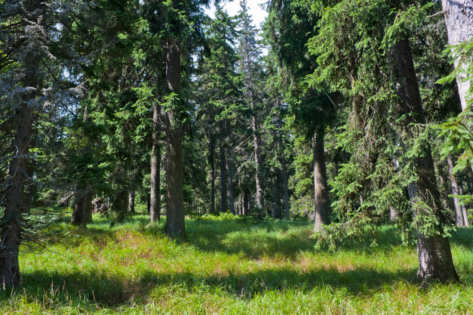
The park protects a representative cross-section of Central European mountain forest ecosystems. At the highest elevations above 1,050 meters, Norway spruce dominates nearly pure stands, while the montane zone between 700 and 1,150 meters features mixed forests of European beech, European silver fir and spruce in roughly equal proportions. Valley forests at 600-800 meters are dominated by spruce with birch, rowan and alder. The park contains rare raised bogs fed only by rainwater, supporting specialized vegetation including sphagnum mosses, heathers, cranberry and cloudberry. Deep ravine forests host diverse deciduous species including sycamore maple, mountain elm, ash, linden and yew. The tree species composition has been heavily influenced by past forestry, with spruce far exceeding its natural proportion while silver fir, the dominant species in natural montane forests, has been nearly eliminated and is now only about 5 percent of the forest but regenerating in gaps.

A calm lake surrounded by dense forest with a mountain ridge under a partly cloudy sky
Scenic view of Rachelsee lake with Rachel mountain in the background within Bavarian Forest National Park

Bavarian Forest National Park wildlife and species highlights

The park supports populations of rare mammals that have been reintroduced or recolonized naturally. Eurasian lynx were reintroduced in the 1970s and established a population of roughly 70-100 animals before declining due to illegal persecution. Wolves arrived naturally beginning in 2015-2016, with the first wild-born cubs documented in 2017, establishing a transboundary population with Šumava. Other notable mammals include wildcat, Eurasian beaver, otter, and several rare bat species. The park is particularly important for capercaillie, a species whose population declined dramatically after World War II but has recovered to over 600 individuals through intensive conservation efforts including winter feeding stations. Hazel grouse, peregrine falcon, black stork and pygmy owl represent other rare bird species. Over 1,800 beetle species have been documented, including 14 ancient woodland indicator species such as the longhorn beetle Tragosoma depsarium.

A forest scene with tall evergreen trees and grassy ground, sunlight filtering through the canopy
Spruce forest in Bavarian Forest National Park with tall evergreen trees and grassy undergrowth

Bavarian Forest National Park conservation status and protection priorities

Bavarian Forest National Park exemplifies the non-intervention or process protection approach to conservation that allows natural disturbances like windthrows and bark beetle outbreaks to shape forest development without human interference. This controversial approach generated significant public debate, particularly during the extensive spruce dieback of the 1990s, but has produced large areas of dead wood and natural forest regeneration that support biodiversity. The park achieved IUCN Category II protection in 2024 and has been certified as a Transboundary Peace Park with Šumava since 2009. The zoning system divides the park into nature zone (where no management occurs), management zone (where bark beetle control protects adjacent forests), and recreation zone (concentrating visitor facilities). The park maintains an extensive environmental education program including two national park centers, animal enclosures, youth facilities and numerous interpretative trails.

Bavarian Forest National Park cultural meaning and human context

The Bavarian Forest region, historically known as the Herkynian Forest, was largely uninhabited forest wilderness through medieval times. Settlement began with monastic clearances from the Danube valley, creating forest clearings for villages along trade routes to Bohemia. The glass-making industry from the 13th century established many present-day communities including Riedlhütte and Neuschönau. Local inhabitants, called Waidler, traditionally viewed the forest as a source of livelihood but also as dangerous wilderness to be controlled. The establishment of the national park represented a cultural shift, with traditional perspectives viewing wild forest as threatening contrasting with modern conservation values embracing wilderness. The park's history includes ongoing tensions between local communities dependent on forest resources and conservation philosophy.

Tall spruce trees with moss-covered trunks, ferns on the forest floor, and fallen logs
Common spruce forest in Bavarian Forest National Park

Top sights and standout views in Bavarian Forest National Park

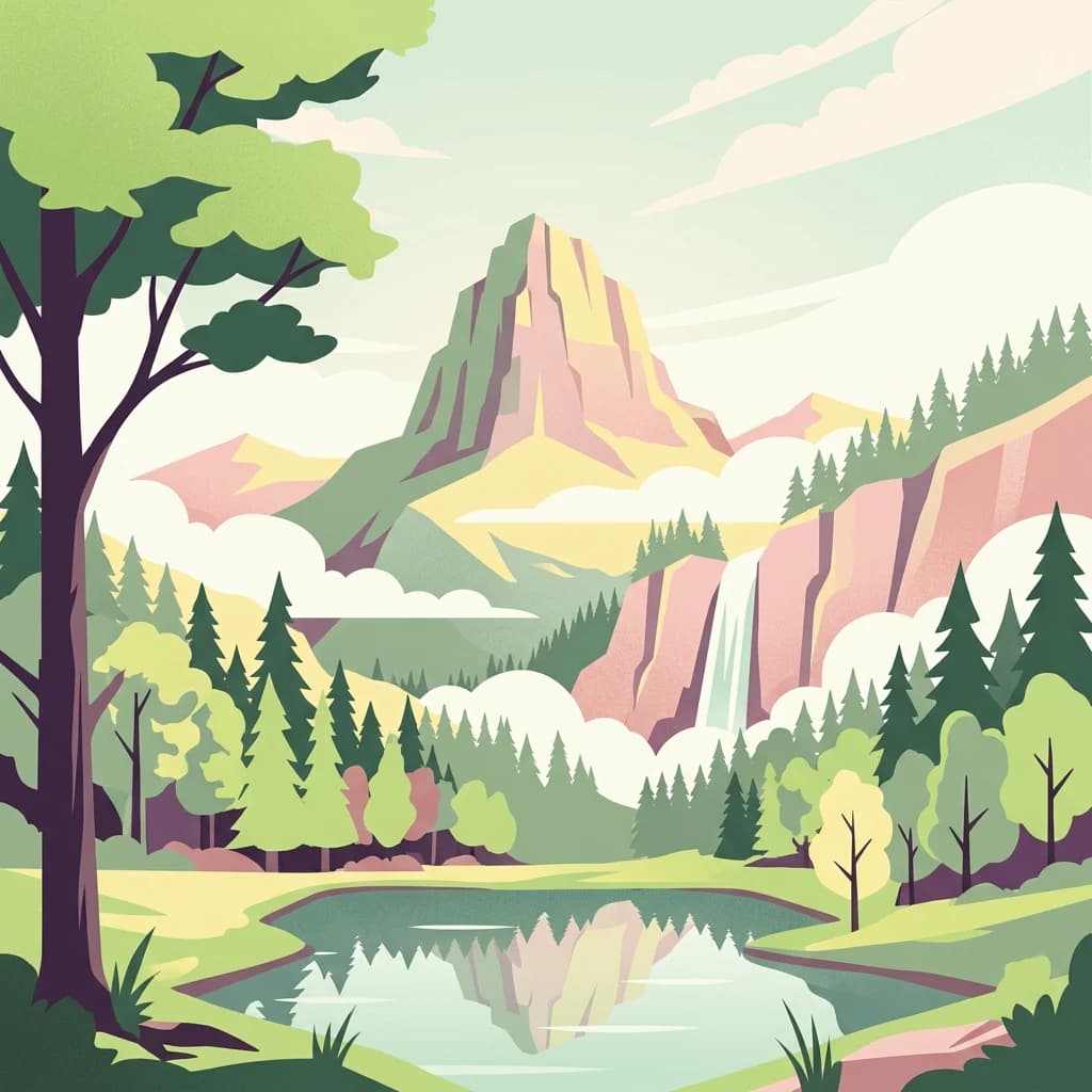
The park offers diverse attractions including the Großer Rachel, the highest peak at 1,453 meters with its glacial lake Rachelsee and ice age interpretive trail. The Lusen mountain features a distinctive silicate block scree field and natural forest regeneration following 1990s bark beetle dieback. The Urwaldgebiet Mittelsteighütte preserves 38 hectares of old-growth forest with massive spruce, fir and beech specimens. The Hans-Watzlik-Hain contains the Waldhaustanne, one of the largest trees in the region with a 6.4-meter trunk circumference and estimated 600-year age. The raised bog areas of Schachten and Filze provide unique wetland habitats, while the Baumwipfelpfad treetop walkway offers elevated forest views. Wildlife viewing opportunities include the animal enclosures at both visitor centers showcasing lynx, wolves, wisent and other species.

Tree stumps and dry grass in an open clearing under a clear blue sky
Large forest clearing with tree stumps and dry grass in Bavarian Forest National Park

Best time to visit Bavarian Forest National Park

The park can be visited year-round, with each season offering distinct experiences. Summer provides the most accessible hiking conditions and full operation of visitor facilities, with July and August seeing the warmest temperatures but also heaviest visitor traffic. Autumn offers colorful forest scenery and fewer crowds, though facilities begin seasonal closures in October. Winter transforms the landscape into a snowy wilderness with excellent cross-country skiing on marked trails, though many higher-elevation trails close and some roads restrict car access. Spring brings fresh vegetation and awakening wildlife, though trail conditions may be muddy and some facilities remain closed. The shoulder seasons of May-June and September-October often provide optimal conditions for hiking with moderate temperatures, lower visitor numbers and full facility access.

Park location guide

Geography guide, regional context, and park location map for Bavarian Forest National Park

Bavarian Forest National Park park geography, regions, and map view in Germany
Understand where Bavarian Forest National Park sits in Germany through a broader geographic reading of the surrounding landscape, nearby location context, and its mapped position within the national park landscape.

How Bavarian Forest National Park fits into Germany

Germany is a federal republic in Western and Central Europe with a population of over 83 million across sixteen constituent states. It is Europe's largest economy by nominal GDP and a major global exporter and importer. The capital is Berlin, and the country borders Denmark, Poland, Czech Republic, Austria, Switzerland, France, Luxembourg, Belgium, and the Netherlands.

Wider geography shaping Bavarian Forest National Park in Germany

Germany is located in Western and Central Europe, spanning 357,022 km². It borders Denmark to the north, Poland and the Czech Republic to the east, Austria and Switzerland to the south, and France, Luxembourg, Belgium, and the Netherlands to the west. The country has coastlines on the Baltic Sea and North Sea to the north, with the Alps located in the southern region.

Map view of Bavarian Forest National Park

Use this park location map to pinpoint Bavarian Forest National Park in Germany, understand its exact geographic position, and read its mapped placement within the surrounding landscape more clearly.

Pigeon | © OpenStreetMap contributors

Location context for Bavarian Forest National Park

BavariaFreyung-GrafenauRegen

Understand the diverse terrain, old-growth forests, and conservation landscape character of this significant Central European protected area.

Bavarian Forest National Park Photos: Explore Landscapes, Scenery, and Protected Habitats
Explore comprehensive imagery of Bavarian Forest National Park, revealing its unique mountainous terrain, expansive spruce forests, and ecologically vital raised bogs. These visuals offer a deep understanding of the park's protected landscapes and wilderness conservation philosophy, illustrating its distinctive natural features and habitats.

Wooden sign displaying 'NATIONALPARK BAYERISCHER WALD' text with purple wildflowers in the foreground and dense forest in the background

Rocky terrain with pine trees in the foreground and a distant valley with mountains under a partly cloudy blue sky.

Landscape view from a mountain summit showing forested valleys, distant mountains, and rocky terrain in the foreground under a partly cloudy sky

A calm lake surrounded by dense forest with a mountain ridge under a partly cloudy sky

A forest scene with tall evergreen trees and grassy ground, sunlight filtering through the canopy

Small waterfall on Kleine Ohe stream surrounded by green forest vegetation

Tall spruce trees with moss-covered trunks, ferns on the forest floor, and fallen logs

Tree stumps and dry grass in an open clearing under a clear blue sky

Wide view of green vegetation and scattered dead trees under blue sky with mountain peak in background

Wooden planks forming a trail through dense green forest with tall trees and undergrowth

Young Norway spruce tree growing in grassy clearing among tall bare tree trunks in forested area

Tall trees in a dense forest with sunlight filtering through the canopy and fallen logs on the forest floor

Tall trees with moss-covered trunks and forest floor covered in brown leaves, surrounded by dense green foliage

Dense forest with tall trees, green foliage, and a prominent European Yew tree in the center of the image

Panoramic view of a forest with numerous dead tree trunks, dry ground, and misty background

A spotted Eurasian lynx walking on snow-covered ground

Park atlas

Discover connected protected landscapes and regional park geography spanning the Central European mountain range.

Explore Nearby National Parks and Protected Areas Beyond Bavarian Forest National Park
Continue your exploration from Bavarian Forest National Park by browsing other national parks and protected areas across the surrounding Central European mountain ranges and adjacent border regions. Compare diverse conservation landscapes, analyze their geographic spread, and trace their connections within this significant transboundary forest ecosystem.
National parkUpper Austria

Kalkalpen National Park: Ancient Beech Forests and Karst Protected Landscape

Explore mapped boundaries and unique alpine terrain.

Kalkalpen National Park is a premier protected area in Upper Austria, celebrated for harboring Central Europe's largest remaining ancient beech forests and an extensive karst landscape. This designation underscores its critical role in preserving old-growth forest ecosystems and unique geological formations within the Northern Limestone Alps. Discover the mapped terrain and regional geography that define this significant natural reserve, offering a profound look into the continent's ecological history and protected natural heritage.

Area
208.25 km²
Established
1997
IUCN
II
Relief
Mountain
Watercolor illustration showing mountain ranges, forests, and a river under a light sky.
National parkBavaria

Berchtesgaden National Park: Protected Landscape and Regional Geographic Context in Bavaria

Mapped natural terrain and protected area exploration.

Berchtesgaden National Park represents a crucial protected landscape situated in Bavaria, Germany. This entry provides detailed information focused on its protected area status, unique geographic setting, and mapped natural terrain. It serves as a gateway to understanding the park's specific identity within the regional atlas of Germany, offering insights into its boundaries and its significance as a curated natural landscape for discovery.

Area
210 km²
Established
1978
IUCN
II
Relief
Mountain
National parkStyria

Gesäuse National Park: Detailed Protected Landscape and Alpine Geography in Styria

Explore Austria's dramatic river gorge and rugged peaks.

Gesäuse National Park in Styria represents a significant alpine protected area, characterized by the striking Enns river gorge cutting through the Gesäuseberge. This national park offers a unique geographic context, showcasing steep limestone peaks, dramatic rock faces, and a rich hydrological network. Discover the mapped boundaries and protected landscape of one of Austria's most visually striking natural passages, ideal for detailed atlas exploration and understanding alpine conservation.

Area
110 km²
Established
2002
IUCN
II
Relief
Mountain
National park

Thayatal National Park: Austria's Smallest Protected Landscape and Dramatic River Valley

Explore the mapped geography of a breakthrough valley and its rich biodiversity.

Thayatal National Park, Austria's smallest national park, offers a concentrated study in protected landscape discovery. Its core feature is the spectacular Thaya River breakthrough valley, a deep gorge cutting through gneiss terrain with steep, forested slopes. This page provides context for its mapped protected area, highlighting its exceptional biodiversity and its role as a transboundary conservation zone with the adjacent Czech Podyjí National Park. Understand the geographic setting and unique landscape character of this significant natural region.

Area
13.3 km²
Established
2000
IUCN
II
Relief
Mountain
National parkSouth Moravian Region

Podyjí National Park: Explore Czech Republic's Intact River Canyon Ecosystem

Mapped Boundaries and Protected Landscape of South Moravia

Podyjí National Park, situated in the South Moravian Region, offers a profound look into one of Central Europe's most ecologically preserved river valleys. This national park is defined by its dramatic 220-meter deep Dyje River canyon, featuring rocky cliffs, stone seas, and a rich mosaic of forest and steppe habitats. MoriAtlas provides structured geographic information to analyze its unique landscape context, biodiversity, and role as a protected natural area within the Czech atlas.

Area
63 km²
Established
1991
National park

Hohe Tauern National Park: Map of Austria's Largest Alpine Protected Landscape

Discover glacial terrain and mountain park geography in the Austrian Alps.

Hohe Tauern National Park, Austria's largest protected area, offers a profound exploration of high alpine landscapes. This national park is defined by its towering peaks, expansive glacier systems, and deeply carved glacial valleys. Examining its mapped boundaries reveals the sheer scale of this protected alpine terrain, providing crucial context for understanding regional geography and the unique natural systems it preserves across the Central Eastern Alps.

Area
1,806 km²
Established
1981
IUCN
II
Relief
Mountain
Protected landscape

Bohemian Paradise Protected Landscape: Discover Czech Republic's Sandstone Geology and Park Boundaries

Mapped sandstone formations and historic regional geography.

Delve into Bohemian Paradise, a protected landscape in the Czech Republic celebrated for its dramatic sandstone rock formations and ancient castles. This detailed entry provides context on its unique geological character, the extent of its protected boundaries, and its significant position within the regional geography. Explore the mapped terrain and understand the atlas value of this historic protected area.

Area
181.17 km²
Established
1955
IUCN
V
Relief
Upland
National park

Bohemian Switzerland National Park: Czech Sandstone Protected Landscape and Map Exploration

Discover its unique terrain and protected area geography.

Bohemian Switzerland National Park is a protected area in the Czech Republic known for its exceptional sandstone geology. This national park showcases a dramatic landscape of towering rock formations, deep gorges, and striking canyons, forming a significant part of the Elbe Sandstone Mountains. Through MoriAtlas, users can explore its mapped protected boundaries, understand its regional geographic context, and appreciate its unique natural heritage.

Area
79 km²
Established
2000
IUCN
II
Relief
Mixed relief

Common questions about visiting, size, designation, and location context for Bavarian Forest National Park

Bavarian Forest National Park FAQs for park facts, access, geography, and protected area context
Find quick answers about Bavarian Forest National Park, including protected-area facts, park geography, trail and visitor context, and how the park fits into its surrounding country and regional landscape.
MoriAtlas Explorer

Continue Your Protected Areas Search Across the Global Atlas

Deepen your exploration by continuing the structured search for national parks and protected areas worldwide. Utilize the comprehensive filtering capabilities to compare different conservation landscapes and refine your understanding of global park geography. Discover more about the distribution and characteristics of protected natural areas.

Global natural geography