
Mori Atlas logo
National parkŠumava National Park

Discover mapped boundaries, glacial lakes, and peat bogs within the South Bohemian Region's natural geography.

Šumava National Park: Central Europe's Largest Forested Protected Landscape and Atlas Entry

(Národní park Šumava)

Šumava National Park represents the heart of the Bohemian Forest, spanning over 685 square kilometers of protected natural landscape in the Czech Republic. As the country's largest national park and a UNESCO biosphere reserve, it offers a unique opportunity to explore one of Central Europe's most extensive and ancient forest complexes. This atlas entry focuses on the park's distinct geographic features, including its rolling plateaus, glacial lakes, and significant raised peat bog ecosystems, providing a detailed view of its protected boundaries and surrounding regional context within the South Bohemian Region.

National ParkForest Protected AreaPeat BogsGlacial LakesMountain EnvironmentTransboundary Protected Area
Illustration of a mountainous landscape with a waterfall, lake, and pine trees under a sunlit sky

Šumava National Park

National park

Park overview

Structured park overview, official facts, and landscape profile for Šumava National Park

Šumava National Park park facts, protected area profile, and essential visitor context

Review the core facts for Šumava National Park, including designation, size, terrain, visitor scale, habitats, and operating context in one park-focused overview.

About Šumava National Park

Šumava National Park occupies the Czech portion of the Bohemian Forest, a mountain range that forms part of the natural border between the Czech Republic, Germany, and Austria. The landscape is characterised by extensive forested plateaux rising between 1,000 and 1,200 metres above sea level, with the highest summits reaching nearly 1,400 metres. The park protects a remarkable diversity of habitats, from peat bogs and wetlands to mountain spruce forests and remnants of primeval woodland. The protection philosophy distinguishes between zones of strict preservation where natural processes are allowed to proceed without intervention, zones of managed natural development, and peripheral areas that accommodate limited human activity and tourism. The park's management has been the subject of significant public and professional debate, particularly regarding the appropriate response to bark beetle outbreaks and the balance between active forest management and allowing natural forest dynamics to operate. The surrounding Protected Landscape Area of Šumava creates a buffer zone around the national park proper, extending the protected area significantly and ensuring ecological connectivity with the adjacent Bavarian Forest National Park in Germany.

Quick facts and research context for Šumava National Park

Šumava National Park covers 685 km² in the South Bohemian Region of the Czech Republic, making it the country's largest national park. The park occupies the Bohemian Forest mountain range, with elevations ranging from 600 metres in the Otava river valley to 1,378 metres at Plechý, the highest peak in the Czech portion of Šumava. The park encompasses three glacial lakes of post-glacial origin, extensive peat bogs, and the largest contiguous forest area in Central Europe. It forms part of the European watershed dividing the North Sea and Black Sea basins, with the Vltava and Otava rivers being the principal drainage systems.

Protection and recognition

Mapping terrestrial boundaries, transboundary status, and UNESCO biosphere reserve credentials.

Šumava National Park Protection Status and Conservation Designations

Terrestrial landscape analysis reveals the documented protection scope and international conservation standing of Šumava National Park across regional borders. Map-based exploration of transboundary status and UNESCO Biosphere Reserve registration clarifies how the park integrates into the broader European ecological framework.

International recognition

Protection details

Protection scope
Terrestrial
Designated year
1990
Transboundary protection
Yes
Core area
475.21 km²
Buffer area
950.7 km²
Park context

Deeper park guide and search-rich context for Šumava National Park

Šumava National Park history, landscape, wildlife, and travel context

Explore Šumava National Park through its history, landscape character, ecosystems, wildlife, conservation priorities, cultural context, and seasonal travel timing in a structured park guide built for atlas discovery and search intent.

Why Šumava National Park stands out

Šumava is best known for its vast, relatively untouched forest ecosystems, its network of raised peat bogs representing some of the most significant bog complexes in Central Europe, and its three glacial lakes, Plešné, Prášilské, and Laka. The park contains remnants of old-growth forest, including the famous Boubín Primeval Forest, which provides insight into the original character of Central European mountain forests. The region is also notable for its population of Eurasian lynx, established since the 1970s, and the capercaillie, whose only viable Czech population survives here. The park's long isolation during the Cold War era created conditions for natural forest dynamics to proceed with minimal human intervention.
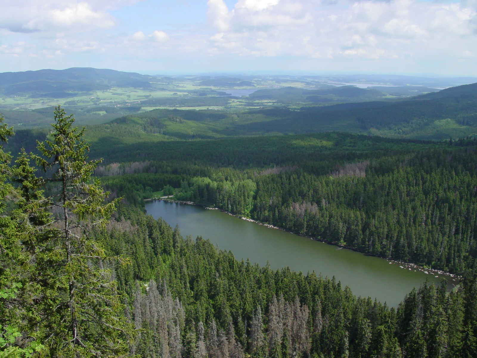
A scenic lake surrounded by dense forest with mountains in the background under a partly cloudy sky
Panoramic view of Plešné Lake from the Adalbert Stifter Monument in Šumava National Park

Šumava National Park history and protected-area timeline

The history of protection in Šumava dates back to 1911, when the first proposals for establishing a nature park were made. The Protected Landscape Area of Šumava was officially declared in December 1963, covering approximately 163,000 hectares and becoming the largest such protected area in Czechoslovakia at that time. In 1990, the area received international recognition as a UNESCO biosphere reserve. The national park itself was established on 20 March 1991, with the core zones separated from the wider protected landscape area. The creation of the national park was driven by the need to protect the most valuable natural ecosystems within the former protected area, including the extensive peat bogs, primeval forest remnants, and glacial lakes. Following World War II, the region underwent dramatic demographic changes when the predominantly German-speaking population was expelled, and the border zone became a restricted military area. This historical isolation, lasting until the political changes of 1989, inadvertently created conditions that allowed natural processes to continue with minimal human disturbance. The park's management history has included controversy, particularly regarding bark beetle control measures and the extent of non-intervention zones.

Šumava National Park landscape and geographic character

The landscape of Šumava National Park is defined by its mountainous terrain, part of one of the oldest mountain ranges in Central Europe. The geology consists primarily of metamorphic crystalline rocks and granites, shaped by the Variscan orogeny. The most distinctive landforms include the extensive Šumavské pláně plateau in the central area, glacial cirques carving the highest peaks, and the deep valleys carved by rivers such as the Vydra and Křemelná. The highest peak within the park is Plechý at 1,378 metres, while several other summits exceed 1,300 metres. The landscape includes remarkable geological features such as giant's cauldrons—erosional potholes formed by turbulent stream flow—particularly visible in the Povydří area. Peat soils dominate the higher elevations and plateau areas, supporting the extensive raised bog systems that are characteristic of the region. The hydrographic character is defined by the watershed position, with streams flowing either to the North Sea via the Vltava and Otava rivers or to the Black Sea via the Danube basin in the western portions.
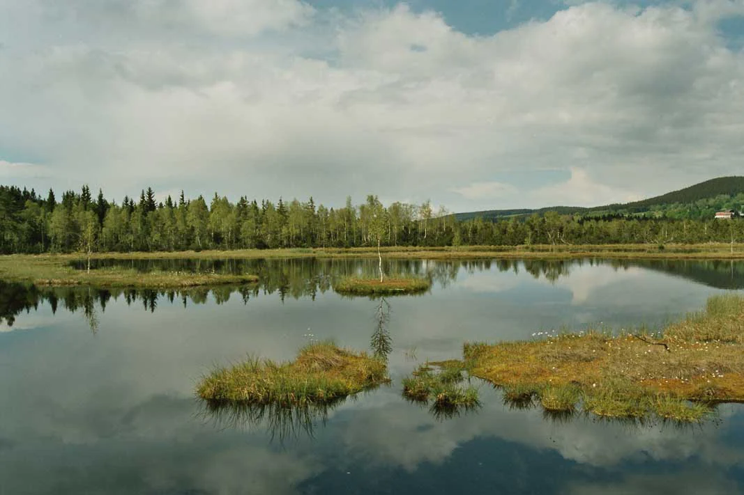
Reflective water surface with small grassy islands, forested shoreline, and mountains in the background under a cloudy sky
A calm wetland with small grassy islands reflecting in the water, surrounded by forest and mountains in Šumava National Park

Šumava National Park ecosystems, habitats, and plant life

The natural ecosystems of Šumava reflect the transition between oceanic and continental climate influences, supporting a remarkable diversity of habitats across the forest zones. The vegetation follows the typical altitudinal sequence from fir-beech forests through spruce-fir-beech communities to pure mountain spruce forests. However, much of the forest has been altered by historical planting of non-native spruce varieties and forestry operations, creating extensive even-aged spruce plantations. The park contains over 500 plant species and represents the character of Central European montane flora with affinities to the Alpine region. The peat bogs constitute one of the most significant ecological assets, hosting specialised vegetation adapted to acidic, nutrient-poor conditions. These raised bogs contain species with glacial relict distributions, including bog rosemary and other characteristic bog plants. The water systems, from the Vltava source streams to the intricate network of peat bog waterways, support specialised aquatic communities.
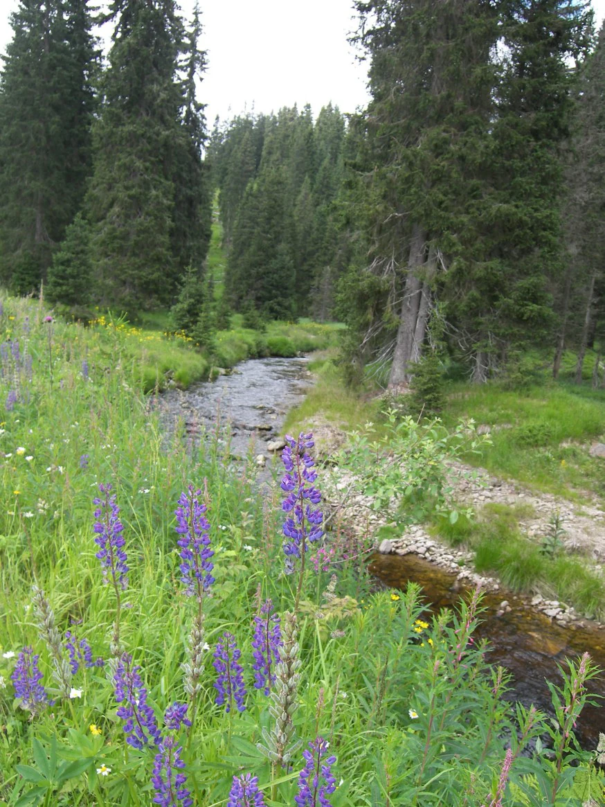
Purple lupine flowers in foreground, stream flowing through grassy meadow, surrounded by tall pine trees in a forested landscape.
A stream flows through a meadow with purple lupine flowers in Šumava National Park.

Šumava National Park wildlife and species highlights

The wildlife of Šumava reflects both the extensive forest habitats and the long period of relative isolation that characterised the border zone. The Eurasian lynx, successfully reintroduced in the 1970s, has established a stable population and represents one of the most significant conservation achievements in the park. The capercaillie population in Šumava is the only viable breeding population in the Czech Republic, making its preservation a matter of national importance. The river otter occurs throughout the park's waterways, which are among the most significant habitats for this species in the country. Birdlife includes three-toe woodpecker, Tengmalm's owl, and the alpine accentor, while up to three species of eagle may be observed within the park and surrounding protected landscape area. The park supports several endemic species found nowhere else in the world, including certain insects restricted to the Šumava peat bogs. Historical extinction of large mammals including brown bear, European bison, and elk occurred centuries ago, though some species have been reintroduced in recent decades.
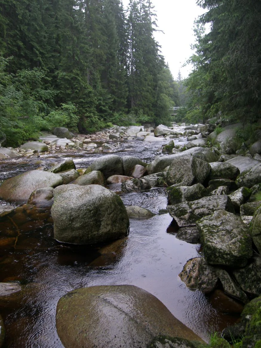
River flowing over rocks in a forested area with tall evergreen trees
Vydra River flowing through forested terrain with large boulders

Šumava National Park conservation status and protection priorities

Šumava National Park serves as a critical component of European nature conservation, forming part of the Natura 2000 network as both a Special Area of Conservation and a Special Protection Area for birds. The park's peat bogs were designated as a Ramsar site of international importance for wetland conservation in 1990. The fundamental conservation challenge involves balancing the preservation of natural processes with the realities of altered forest ecosystems. Non-native spruce plantations, susceptible to bark beetle and storm damage, occupy extensive areas and have generated ongoing debates about appropriate management responses. The park has adopted a policy of increasing non-intervention zones where natural forest dynamics can proceed, recognizing the ecological importance of natural disturbances in maintaining ecosystem health. Peat bog restoration programmes, including the Life for MIRES project from 2018 to 2024, have addressed historical drainage that damaged these sensitive wetland ecosystems. The protection framework distinguishes three zones with different levels of conservation intensity, from strict preservation in Zone I to more permissive management in Zone III.

Šumava National Park cultural meaning and human context

The cultural landscape of Šumava bears the imprint of centuries of human activity, particularly forestry, glass-making, and mining. The name Šumava itself derives from an old Slavic term for the sound of wind in the forest. Historical settlements, many established during the colonisation of the 17th and 18th centuries, were predominantly German-speaking until the post-World War II population transfers. The Iron Curtain border regime transformed much of the region into a restricted zone, with villages destroyed and population removed, inadvertently creating conditions that protected natural values. Archaeological evidence includes the Obří hrad (Giant's Castle), a Celtic hillfort from the Iron Age representing the highest-elevated Celtic site in Bohemia. Traditional architectural elements, particularly the characteristic Volary-style alpine houses, reflect the cultural connections to neighbouring Austrian and Bavarian regions. The park contains approximately 2,000 permanent residents in ten villages, where traditional land uses such as livestock grazing maintain open grassland habitats within the forested landscape.
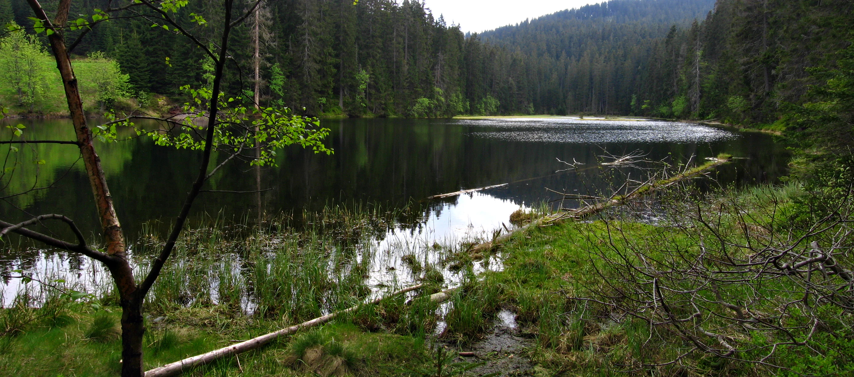
Calm lake reflecting surrounding forest and trees, with green shoreline and a fallen tree branch in the foreground
Lake Laka surrounded by dense forest in Šumava National Park

Top sights and standout views in Šumava National Park

The standout features of Šumava National Park include the three glacial lakes—Plešné, Prášilské, and Laka—remnants of the last Ice Age in these mountains. The peat bog complexes, particularly the Tříjezerní slať and Chalupská slať, represent some of the finest raised bog examples in Central Europe. The Boubín Primeval Forest provides one of the best examples of near-natural mountain forest in the region. The Poledník observation tower, converted from a former Cold War radar installation, offers panoramic views across the central Šumava plateau. The park's position as the largest national park in the Czech Republic, protecting the most extensive forest area in Central Europe, gives it significance beyond national boundaries as part of a transfrontier ecological network with the Bavarian Forest National Park.
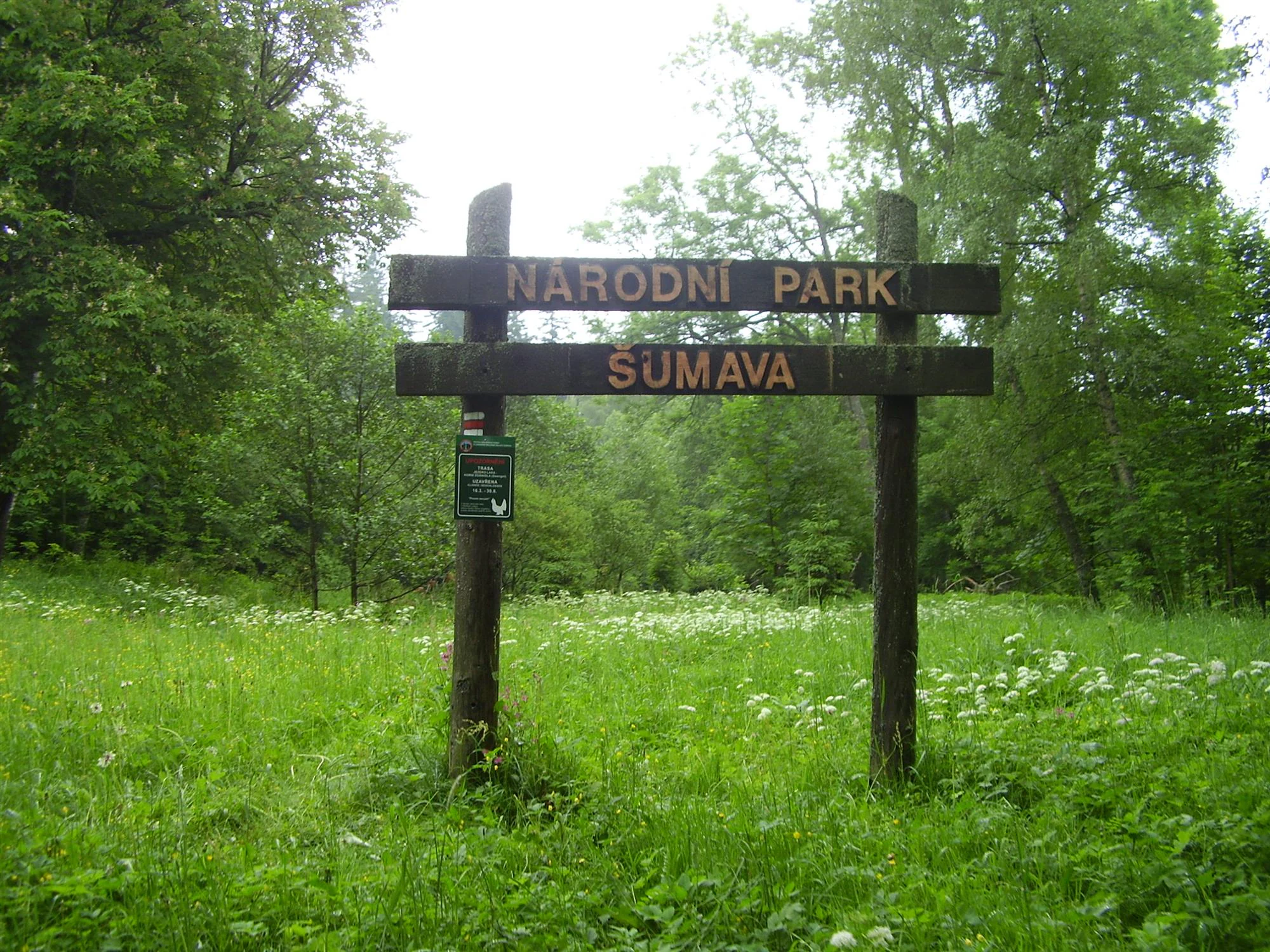
Wooden signpost reading 'NARODNI PARK SUMAVA' surrounded by green grass and wildflowers with trees in the background
Wooden entrance sign for Šumava National Park in a grassy field with forest background

Best time to visit Šumava National Park

The character of a visit to Šumava varies significantly with the seasons. Summer months bring the most accessible conditions for exploring the lake areas, peat bogs, and network of marked trails, with July and August offering the warmest temperatures and longest days. The transition seasons of spring and autumn provide different landscapes—spring brings forest regeneration and bird activity, while autumn colours on the mixed forest species create particularly striking scenes. Winter transforms the park into a snowy wilderness, with cross-country skiing and winter wildlife observation being primary attractions. The higher elevations and exposed plateaux experience strong winds and significant snow accumulation, with continuous snow cover lasting 120 to 150 days in the highest areas. The peak tourist season draws approximately two million visitors annually, concentrated particularly around the lake areas, Modrava, and Kvilda. The shoulder seasons and weekday visits offer more solitary experiences of this extensive landscape.

Monthly climate preview

Monthly precipitation patterns and temperature ranges measured at a representative elevation

Average Temperatures and Weather by Month in Šumava National Park

Long-term records for Šumava National Park show mean monthly temperatures ranging from -3.39 °C in January to peaks of 17.54 °C in July. Exploring the full climate profile reveals detailed monthly fluctuations in precipitation and temperature spans recorded over a thirty-year climatology period.
Annual mean7 °C
-3 °C18 °C
Jan-3°
Feb-2°
Mar
Apr
May12°
Jun16°
Jul18°
Aug17°
Sep13°
Oct
Nov
Dec-2°
Warmest month
July

17.5 °C

Coolest month
January

-3.4 °C

Wettest month
June

3.3 mm/day

Driest month
April

1.6 mm/day

Park location guide

Geography guide, regional context, and park location map for Šumava National Park

Šumava National Park park geography, regions, and map view in Czechia

Understand where Šumava National Park sits in Czechia through a broader geographic reading of the surrounding landscape, nearby location context, and its mapped position within the national park landscape.

How Šumava National Park fits into Czechia

Czech Republic is a landlocked Central European country with a population of approximately 10.9 million people. The nation was established as an independent state on January 1, 1993, following the dissolution of Czechoslovakia. Its capital and largest city is Prague, with other major urban centers including Brno, Ostrava, Plzeň, and Liberec.

Wider geography shaping Šumava National Park in Czechia

The Czech Republic is a landlocked country in Central Europe. It is bordered by Germany to the west, Austria to the south, Poland to the northeast, and Slovakia to the southeast. The landscape is predominantly hilly, with the territory covering 78,871 square kilometers.

Map view of Šumava National Park

Use this park location map to pinpoint Šumava National Park in Czechia, understand its exact geographic position, and read its mapped placement within the surrounding landscape more clearly.

Pigeon | © OpenStreetMap contributors

Location context for Šumava National Park

South Bohemian Region
Natural feature types

Browse the Full Collection of Šumava National Park Natural Features

Trace the diverse topography and hydrology of Šumava National Park by exploring its documented natural landmarks. This MoriAtlas collection offers a detailed perspective on the mountains, lakes, and peat bog systems that define this central European wilderness.
Recorded earthquake history

Explore the Historical Earthquake Registry for Šumava National Park

Discover a detailed collection of recorded seismic events associated with the surrounding terrain of Šumava National Park. MoriAtlas provides a clear, data-driven look into historical earthquake occurrences to support your geographical interest in this protected region.

Šumava National Park Earthquake History

Catalogued events

3 events

Strongest magnitude

Magnitude 3.4

Most recent event

Dec 10, 1998

This history includes earthquakes recorded inside the park or within 50 km of its borders

Visualize Šumava's diverse mountain environment, old-growth forests, and unique peat bog ecosystems.

Šumava National Park Photography: Explore Bohemian Forest Landscapes, Glacial Lakes, and Peat Bogs

Browse comprehensive imagery to understand the distinct landscapes and varied habitats of Šumava National Park, the Czech Republic's largest protected area. Explore the visual character of its vast forest ecosystems, glacial lakes, and significant peat bogs, revealing the essence of this unique Central European mountain environment.

A scenic lake surrounded by dense forest with mountains in the background under a partly cloudy sky

A flowing stream with moss-covered rocks surrounded by a forest with fallen autumn leaves

Reflective water surface with small grassy islands, forested shoreline, and mountains in the background under a cloudy sky

Purple lupine flowers in foreground, stream flowing through grassy meadow, surrounded by tall pine trees in a forested landscape.

River flowing over rocks in a forested area with tall evergreen trees

Wooden boardwalk trail surrounded by dense green forest vegetation extending into the distance

Calm lake reflecting surrounding forest and trees, with green shoreline and a fallen tree branch in the foreground

Wooden signpost reading 'NARODNI PARK SUMAVA' surrounded by green grass and wildflowers with trees in the background

Stone bridge spanning a flowing waterway through forested landscape with dense green trees

Wooden boardwalk with railings winding through a dense forest with tall evergreen trees and green undergrowth

Dense forest with tall trees and green undergrowth, sunlight filtering through the canopy

A red oval-shaped fruit attached to a green stem with serrated green leaves and small white flowers

Panoramic view of a calm lake surrounded by dense forest with a few people on a wooden platform on the left shore

River with rocky bed flowing through forested landscape with green trees and purple wildflowers

Close-up of green butterwort plants with star-shaped leaves among grass and small plants in a natural setting

Calm lake reflecting trees and vegetation in a forested landscape.

Park atlas

Trace connected protected landscapes and their unique geography across the Bohemian Forest, extending into neighboring regions.

Browse Other National Parks and Protected Areas Near Šumava National Park

Discover other national parks and protected areas near Šumava National Park, including transboundary forest complexes and neighboring mountain environments. Gain a wider perspective on regional protected landscapes, trace connected conservation efforts, and compare diverse geographic features across the Bohemian Forest atlas.
Watercolor painting showing mountains, forests, and valleys in a landscape.
National parkGermany
Park boundaries overlap#1 closest

West

Bavarian Forest National Park: Protected Landscape and Regional Geography Atlas

Explore mapped terrain and protected park boundaries in Germany.

Dive into the specifics of Bavarian Forest National Park, a key protected area noted for its distinct landscape and geographic importance. This MoriAtlas entry details the park's mapped boundaries and its setting within the surrounding regional geography, offering a clear atlas-style view of its natural terrain. Understand its identity as a national park and discover its place in Germany's protected lands.

Area
242.45 km²
Established
1970
IUCN
II
Visitors
1.3M annual
A watercolor painting showing a panoramic view of a green wetland area with trees, grass, and rolling hills in the background.
Nature reserveJihočeský kraj
About 1.5 km away#2 closest

East

Pravětínská Lada Nature Reserve: Geography and Protected Area Landscape Context

Wetland mosaics and peat bog terrain in the South Bohemian Region

Pravětínská Lada serves as a vital protected landscape where peatland and spring headwater ecosystems meet recovering farmland. Located in the Jihočeský kraj, this nature reserve demonstrates how small-scale terrain variations and moisture gradients support high ecological density within the wider Bohemian Forest. The site provides a concentrated look at the transitional boundary between wetland communities and secondary meadows.

Area
0.516 km²
Established
2000
IUCN
IV
Relief
Upland
Watercolor painting of a grassy meadow bordered by a forest line with soft green and muted earth tones.
Nature reserveJihočeský kraj
About 2.1 km away#3 closest

Northeast

Rašeliniště u Martinala: A Protected Nature Reserve in the Jihočeský kraj Foothills

Mapping transitional bog ecosystems and submontane habitats

Located in the Šumava foothills, Rašeliniště u Martinala is a protected nature reserve defined by its dual-parcel structure of peat-forming wetlands and juniper-rich dry grasslands. This site acts as a key ecological node, supporting a high density of protected species within the Jáchymovský potok drainage basin and representing a refined example of south Bohemian submontane landscape character.

Area
0.095 km²
Established
2011
IUCN
IV
Relief
Upland
A horizontal watercolor painting depicting a soft, atmospheric landscape with a foreground of purple and pink wetland grasses, a midground of scattered green coniferous trees, and hazy, distant mountain silhouettes in the background.
Nature reservePlzeňský kraj
About 2.4 km away#4 closest

Northwest

Prameniště Nature Reserve: Protected Wetland and Mountain Spring Systems in Plzeňský kraj

Mapping the hydrological headwaters of the Šumava Mountains

Prameniště Nature Reserve represents a critical cluster of protected mountain springs and peat bogs across the Pancířský hřbet ridge. By focusing on the source areas for the Křemelná and Řezná rivers, this reserve maintains essential hydrological integrity within the wider Plzeňský kraj landscape. Its mosaic of sub-alpine peatlands and montane spruce forests provides an important study of high-altitude wetland geography in the central European mountains.

Area
3.536 km²
Established
1994
IUCN
IV
Relief
Mountain
A horizontal watercolor illustration of a misty moorland with soft green hills, patches of forest, and marshy foreground vegetation, rendered in a light, atmospheric palette.
Nature reserveLandkreis Regen
About 5.8 km away#5 closest

Northwest

Rotfilz Nature Reserve: Geographic Profile of a Bavarian Forest Peatland

Protected moorland geography and raised bog pine woodland

Rotfilz is a significant nature reserve situated within the Landkreis Regen district of Lower Bavaria. Known for its mature bog pine woodland and ongoing peatland restoration, this protected area offers a look at the historical moorland mosaic of the Bavarian Forest. The terrain, defined by Pleistocene deposits and a clear hydrological boundary, provides a compact but essential site for studying Central European bog conservation and landform evolution.

Area
12.88 km²
Established
1973
IUCN
IV
A horizontal watercolor painting depicting a soft, atmospheric landscape with grassy foreground vegetation, a treeline, and distant rolling hills against a pale sky.
Nature reserveJihočeský kraj
About 6.3 km away#6 closest

Southeast

Rašeliniště Borková Nature Reserve: Protected Peatlands in the Jihočeský kraj

Mapped wetlands and relict mire ecosystems of southern Bohemia

Located along the Lipno reservoir, Rašeliniště Borková preserves a essential fragment of the original Vltavická brázda valley landscape. The area maps a compressed, multi-zoned wetland habitat that ranges from nutrient-poor sedge mires to stable bog pine woodland, providing a necessary refuge for mire-dependent invertebrates and breeding waterbirds.

Area
0.487 km²
Established
1995
IUCN
IV
Relief
Upland
Nature reserveJihočeský kraj
About 9 km away#7 closest

Southeast

Velké bahno Nature Reserve: Protected Wetland and Mire Geography in the Šumava Foothills

Essential conservation habitat within the Jihočeský kraj region of the Czech Republic

Velké bahno stands as a compact but vital nature reserve featuring spruce-alder swamps, wooded peatlands, and boggy clearings. Its position within the Šumava Protected Landscape Area highlights a concentration of sensitive mire habitats, protected flora, and rare species adapted to the wet, undulating paragneiss terrain of the Bohemian Forest foreland.

Area
0.915 km²
Established
1992
IUCN
IV
Relief
Upland
Natural monumentJihočeský kraj
About 14 km away#8 closest

East

V polích Natural Monument: Meadow Conservation in the Jihočeský kraj Region

A protected orchid-rich grassland above the Blanice river valley

V polích is a designated natural monument in the Czech Republic known for its managed hay-meadow habitats. This site plays a vital role in regional conservation by maintaining a rare, species-rich landscape that supports native orchid populations on a sunny, south-east facing slope in the Prachatice District.

Area
0.017 km²
Established
1992
IUCN
IV
Relief
Upland

Common questions about visiting, size, designation, and location context for Šumava National Park

Šumava National Park FAQs for park facts, access, geography, and protected area context

Find quick answers about Šumava National Park, including protected-area facts, park geography, trail and visitor context, and how the park fits into its surrounding country and regional landscape.
MoriAtlas Explorer

Continue Your Protected Areas Search Across the Global Atlas

Deepen your exploration by continuing the structured search for national parks and protected areas worldwide. Utilize the comprehensive filtering capabilities to compare different conservation landscapes and refine your understanding of global park geography. Discover more about the distribution and characteristics of protected natural areas.

Global natural geography