

Mori Atlas logo
Wildlife reserveCampo Verde Flora and Fauna Protection Area

A critical protected wildlife reserve bridging mountain forests and the Chihuahuan Desert

Campo Verde Flora and Fauna Protection Area: Mapping the Sierra Madre Occidental Transition

Campo Verde Flora and Fauna Protection Area spans over 1,080 square kilometers in northwestern Chihuahua, serving as a vital ecological bridge between the Sierra Madre Occidental and the arid Chihuahuan Desert. This protected landscape is defined by its pine oak woodlands and steep terrain, which host endemic species including the eared quetzal and thick billed parrot. Its designation highlights a long history of conservation across this unique transition zone in northern Mexico.

pine-oak woodlandSierra Madre OccidentalChihuahuan Desert transitionflora and fauna protection areamountain forestendemic species

Campo Verde Flora and Fauna Protection Area

Wildlife reserve

Park overview

Structured park overview, official facts, and landscape profile for Campo Verde Flora and Fauna Protection Area

Campo Verde Flora and Fauna Protection Area park facts, protected area profile, and essential visitor context

Review the core facts for Campo Verde Flora and Fauna Protection Area, including designation, size, terrain, visitor scale, habitats, and operating context in one park-focused overview.

About Campo Verde Flora and Fauna Protection Area

Campo Verde Flora and Fauna Protection Area is one of the larger natural protected areas in northern Mexico and one of the key reserves preserving the eastern flank of the Sierra Madre Occidental. Covering about 108,000 hectares across northwestern Chihuahua, the protected area extends into a landscape where pine–oak montane woodland gradually yields to the drier vegetation communities of the Chihuahuan Desert. This geographic position gives the reserve its particular ecological character, blending species typical of Mexico's northwestern mountain forests with elements of the arid northern plateaus.

The reserve's identity is shaped by the Sierra Madre Occidental pine–oak forests ecoregion, with palo blanco (Quercus laeta) forming a characteristic component of the canopy. These woodlands provide habitat for a wide range of forest-dwelling mammals, including American black bear, puma, and white-tailed deer, as well as smaller species such as the Zacatecan deer mouse and the Chihuahuan mouse. The montane vegetation also supports distinctive birdlife, including the Gould's wild turkey, the eared quetzal, the thick-billed parrot, the Aztec thrush, and Bewick's wren, several of which are range-restricted to this part of Mexico.

Beyond its terrestrial fauna, Campo Verde contains a notable herpetofauna. Reptiles recorded within the protected area include the Mexican Plateau horned lizard, northern pigmy skink, Chihuahuan skink, Mexican wandering garter snake, and blackbelly garter snake. Amphibians are particularly well represented by endemic and range-restricted species of the Sierra Madre Occidental, such as the Tarahumara salamander, Mexican tiger salamander, Lemos-Espinal's leopard frog, Tarahumara frog, and several regional toad species. CONABIO records indicate that more than 255 plant and animal species have been documented in the reserve, with 32 species considered at risk and four exotic species present.

Campo Verde has been part of Mexico's protected area system for decades, making it one of the older reserves in the country's northern network. Originally decreed a forest reserve and wildlife refuge by President Lázaro Cárdenas in 1938, the area was reclassified as a flora and fauna protection area in 2003 under the administration of the National Commission of Natural Protected Areas (CONANP). The reserve holds IUCN Category VI status, which recognizes the importance of combining biodiversity conservation with sustainable use of natural resources, reflecting both its ecological value and its place in the regional landscape economy of northwestern Chihuahua.

Quick facts and research context for Campo Verde Flora and Fauna Protection Area

Campo Verde is a Mexican flora and fauna protection area located in the state of Chihuahua in northern Mexico, near the Sinaloa border. It encompasses about 108,067 hectares of terrain that transitions between montane pine–oak forest and Chihuahuan Desert environments.

The reserve was originally designated as a forest reserve and wildlife refuge in 1938 and was reclassified as a flora and fauna protection area in 2003. It is managed by Mexico's National Commission of Natural Protected Areas under IUCN Category VI, indicating protected status with sustainable use of natural resources.

Protection and recognition

Documented terrestrial protection scope, designation year, and management framework records

Campo Verde Flora and Fauna Protection Area Protection Status and Designation History

Campo Verde Flora and Fauna Protection Area maintains a documented terrestrial protection scope established in the year 2003. Structured records compile official designation history and management context for rigorous conservation analysis.

Protection details

Protection scope
Terrestrial
Designated year
2003
Park context

Deeper park guide and search-rich context for Campo Verde Flora and Fauna Protection Area

Campo Verde Flora and Fauna Protection Area history, landscape, wildlife, and travel context

Explore Campo Verde Flora and Fauna Protection Area through its history, landscape character, ecosystems, wildlife, conservation priorities, cultural context, and seasonal travel timing in a structured park guide built for atlas discovery and search intent.

Why Campo Verde Flora and Fauna Protection Area stands out

Campo Verde is best known for its position at the eastern edge of the Sierra Madre Occidental pine, oak forests, where the mountain woodland gives way to the Chihuahuan Desert. This ecotonal setting gives the reserve a distinctive mix of montane and semi-arid species, including the palo blanco oak and a notable concentration of regionally endemic birds such as the eared quetzal and thick-billed parrot. The protected area is also recognized for the diversity of fauna documented within its boundaries, ranging from American black bear and puma to a suite of endemic rodents, salamanders, and toads associated with the Sierra Madre Occidental and the Mexican Plateau.

Campo Verde Flora and Fauna Protection Area history and protected-area timeline

Campo Verde was first given formal protection in 1938, when President Lázaro Cárdenas decreed it as a forest reserve and wildlife refuge. This early designation placed the area among the earliest protected natural reserves in northern Mexico, reflecting the mid-twentieth century Mexican government's efforts to safeguard key forest and wildlife resources in the Sierra Madre Occidental region.

The reserve's status was modernized in 2003, when the area was reclassified as a Mexican flora and fauna protection area. This new designation, managed under the National Commission of Natural Protected Areas (CONANP), broadened the institutional framework for its management and aligned it with Mexico's contemporary system of natural protected areas. The reclassification also implicitly recognized the area's significance for both biodiversity conservation and the sustainable use of natural resources, situating it within an IUCN Category VI framework.

Campo Verde Flora and Fauna Protection Area landscape and geographic character

The landscape of Campo Verde is defined by its position along the eastern flank of the Sierra Madre Occidental, one of the major mountain ranges of northwestern Mexico. Within the protected area, terrain rises from foothills toward higher elevations that support montane forest and gradually opens into the drier terrain characteristic of the Chihuahuan Desert to the east.

Vegetation patterns reflect this transition. Pine–oak woodland dominates, with palo blanco (Quercus laeta) forming a characteristic oak element of the canopy. As elevation and moisture patterns shift, the montane forest gives way to semi-arid vegetation communities associated with the Chihuahuan Desert, producing a mosaic habitat pattern rather than a single uniform forest type. This combination of rugged terrain and ecological transition defines the visual character of the protected area.

Campo Verde Flora and Fauna Protection Area ecosystems, habitats, and plant life

Campo Verde's ecological character is rooted in the Sierra Madre Occidental pine–oak forests ecoregion, which provides the structural and functional backbone of the reserve. The woodland is dominated by oak associations, including the palo blanco oak, mixed with pine, producing a forest type known for harboring endemic plants, mammals, and birds of the Sierra Madre range.

The reserve's location at the boundary between montane forest and the Chihuahuan Desert gives it an ecotonal quality, with the habitat mosaic supporting species associated with both woodland and semi-arid environments. This ecological overlap, along with the elevational gradient of the Sierra Madre Occidental, helps explain the comparatively high species count documented within the protected area and the presence of multiple range-restricted and at-risk species.

Campo Verde Flora and Fauna Protection Area wildlife and species highlights

The wildlife of Campo Verde reflects the mix of montane forest and Chihuahuan Desert environments. Among mammals, the reserve supports American black bear, puma, and white-tailed deer, alongside smaller and more range-restricted species such as the Mexican big-eared bat, the Zacatecan deer mouse, and the Chihuahuan mouse.

Birdlife is one of the reserve's standout features. The protected area hosts the Gould's wild turkey, the eared quetzal (a species strongly associated with Sierra Madre Occidental pine forests), the thick-billed parrot, the Aztec thrush, and Bewick's wren. Several of these species are of high conservation interest due to their restricted distributions in northwestern Mexico.

Herpetofauna is also significant. Reptiles documented within the reserve include the Mexican Plateau horned lizard, northern pigmy skink, Chihuahuan skink, Mexican wandering garter snake, and blackbelly garter snake. Amphibians include the Tarahumara salamander, Mexican tiger salamander, Lemos-Espinal's leopard frog, Tarahumara frog, and several toads that are characteristic of the Sierra Madre Occidental and adjacent Mexican Plateau.

Campo Verde Flora and Fauna Protection Area conservation status and protection priorities

Campo Verde holds long-standing conservation value as one of the older protected areas in northern Mexico, with formal protection dating back to 1938. Its modern status as a flora and fauna protection area, designated in 2003 and administered by the National Commission of Natural Protected Areas (CONANP), places it within Mexico's principal framework for conserving representative ecosystems while supporting sustainable resource use.

The reserve's significance is reinforced by its biodiversity profile: more than 255 plant and animal species have been documented, including 32 species classified as at risk. The combination of montane pine–oak woodland and Chihuahuan Desert transition habitats supports a range of endemic and range-restricted species, making the protected area an important refuge for the ecological character of the Sierra Madre Occidental's eastern slopes. Its IUCN Category VI status reflects a management approach that emphasizes both conservation and sustainability.

Top sights and standout views in Campo Verde Flora and Fauna Protection Area

Campo Verde's defining strength lies in the way its protected landscape captures the ecological transition between the Sierra Madre Occidental and the Chihuahuan Desert, with palo blanco oak being a particularly representative canopy species. The reserve supports a striking concentration of regionally characteristic wildlife, including eared quetzal, thick-billed parrot, and Gould's wild turkey, alongside mammals such as American black bear and puma.

Its long conservation history, stretching from a 1938 forest reserve and wildlife refuge decree to a modern 2003 flora and fauna protection area designation, adds institutional depth to its present-day role. CONABIO's documentation of over 255 species, with 32 considered at risk, underscores why the protected area remains a key component of Mexico's northern network of natural reserves.

Best time to visit Campo Verde Flora and Fauna Protection Area

As a temperate mountain woodland reserve on the eastern Sierra Madre Occidental, Campo Verde experiences cool winters and warmer summers, with seasonal variation that can affect both the accessibility of higher-elevation forest and the visibility of wildlife. Spring and early summer often bring active bird and amphibian periods, while autumn tends to offer more temperate conditions for exploring the oak and pine–oak woodlands.

Because the protected area sits at the transition into the Chihuahuan Desert, summer conditions can be markedly drier and warmer in the lower elevations, while the higher forested zones retain relatively milder temperatures. Visitors interested in birdlife may find cooler seasons productive for viewing montane species, when forest activity remains high and desert-edge heat is less intense.
Monthly climate preview

Long-term temperature and precipitation records across twelve representative months

Campo Verde Flora and Fauna Protection Area Climate and Monthly Temperature Normals

Representative coordinate records show measured temperature ranges from cool winter minimums to warm summer maximums alongside varying monthly precipitation rates. Analyzing complete twelve-month climate normals provides deeper insight into long-term environmental patterns across the protected landscape.
Annual mean16 °C
8 °C24 °C
Jan
Feb
Mar12°
Apr15°
May19°
Jun24°
Jul23°
Aug23°
Sep21°
Oct17°
Nov12°
Dec
Warmest month
June

24.1 °C

Coolest month
January

7.7 °C

Wettest month
July

4.1 mm/day

Driest month
May

0.1 mm/day

Park location guide

Geography guide, regional context, and park location map for Campo Verde Flora and Fauna Protection Area

Campo Verde Flora and Fauna Protection Area park geography, regions, and map view in Mexico

Understand where Campo Verde Flora and Fauna Protection Area sits in Mexico through a broader geographic reading of the surrounding landscape, nearby location context, and its mapped position within the national park landscape.

How Campo Verde Flora and Fauna Protection Area fits into Mexico

Mexico, officially the United Mexican States, is a country in North America spanning the Sierra Madre mountain ranges, coastal plains, and tropical regions. It borders the United States to the north, Guatemala and Belize to the southeast, and has coastlines along the Pacific Ocean, Gulf of Mexico, and Caribbean Sea. With a population exceeding 130 million, Mexico is home to one of the world's most significant concentrations of Indigenous languages alongside Spanish.

Wider geography shaping Campo Verde Flora and Fauna Protection Area in Mexico

Mexico occupies a land area of 1,972,550 km2, making it the thirteenth-largest country in the world. The terrain is highly diverse, featuring the Sierra Madre Occidental and Sierra Madre Oriental mountain ranges, the Mexican Plateau, coastal lowlands along the Pacific and Gulf/Caribbean margins, and the Yucatan Peninsula. The country spans multiple climate zones from desert in the north to tropical rainforest in the south.

Map view of Campo Verde Flora and Fauna Protection Area

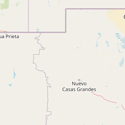
Use this park location map to pinpoint Campo Verde Flora and Fauna Protection Area in Mexico, understand its exact geographic position, and read its mapped placement within the surrounding landscape more clearly.

Pigeon | © OpenStreetMap contributors

Location context for Campo Verde Flora and Fauna Protection Area

Chihuahua
Park atlas

Compare surrounding mountain forests and desert transition zones across northern Mexico

Parks Near Campo Verde Flora and Fauna Protection Area and Regional Protected Landscapes

Browse other protected areas and mountain reserves situated along the rugged ecological transition zone of the Sierra Madre Occidental. Extending your geographic comparison provides a clearer view of regional wildlife habitats and high-elevation terrain.
Nature reserveSonora
About 77 km away#1 closest

Southwest

Northern Jaguar Reserve: Geography and Protected Landscape Atlas of Sonora

Foothill bushland between the Aros and Bavispe River valleys

Northern Jaguar Reserve represents a key protected block of dry tropical bushland in the Sierra Madre foothills of Sonora. This map-focused profile examines the topography, drainage systems, and structural habitat corridors that support one of the northernmost wild jaguar populations within a transition zone of mountain slopes and river-fed canyons.

Area
222 km²
Relief
Mountain
Climate
Subtropical
Access
Remote access
Wildlife reserveSonora
About 137 km away#2 closest

Northwest

Bavispe Flora and Fauna Protection Area: Sierra Madre Occidental Mountain Geography

Mapped protected forest tracts across Sonora ranges

Spanning five distinct mountain tracts in Sonora, this wildlife reserve preserves rare pine-oak forest communities within the Sierra Madre Occidental. Learn how these ridges and basins act as a vital hydrological anchor for the Yaqui River and provide critical corridors for wildlife through the diverse, transition-heavy terrain of northern Mexico.

Area
2,009 km²
Established
1936
IUCN
VI
Relief
Mountain
Wildlife reserveChihuahua
About 162 km away#3 closest

South

Tutuaca Flora and Fauna Protection Area: Sierra Madre Occidental Mountain Conservation Reserve

Expansive pine-oak forest habitat in Chihuahua, Mexico

Covering over 4,000 square kilometers, the Tutuaca Flora and Fauna Protection Area acts as a critical link in the Sierra Madre Occidental mountain spine. This wildlife reserve preserves dense pine-oak woodlands, rugged canyons, and high-elevation watersheds that characterize the biodiversity of northwestern Mexico. The area plays a vital role in sustainable resource management and habitat connectivity between Chihuahua and neighboring regions.

Area
4,369.86 km²
Established
2001
IUCN
VI
Relief
Mountain
Wildlife reserveChihuahua
About 200 km away#4 closest

Southeast

Papigochic Flora and Fauna Protection Area: Sierra Madre Occidental Forest Geography

An expansive mountain wildlife reserve in Chihuahua, Mexico.

Spanning over 2,200 square kilometers, this reserve preserves vital pine and oak forest ecosystems in the Sierra Tarahumara. The area is defined by its deep canyons, high-elevation forested ridgelines, and important role in safeguarding temperate montane habitats within northwestern Mexico.

Area
2,227.64 km²
Established
2003
IUCN
VI
Relief
Mountain
National parkOcampo Municipality
About 201 km away#5 closest

South

Basaseachic Falls National Park: National Park Geography and Mapped Boundaries

Explore protected lands within Ocampo Municipality.

Basaseachic Falls National Park serves as a key protected area within Ocampo Municipality, Mexico. This page provides detailed geographic information and mapped boundaries, essential for understanding its landscape context and its significance as a national park. Dive into the atlas-style data to appreciate the park's protected terrain and its contribution to the regional geography, offering a factual discovery experience.

Area
58.03 km²
Established
1981
IUCN
II
Relief
Mountain
A minimalist watercolor painting showing rolling green and yellow hills against a soft, light-colored background.
Wildlife reserveChihuahua
About 209 km away#6 closest

Northeast

Médanos de Samalayuca: Protected Silica Sand Dune Landscapes in Northern Chihuahua

A dynamic desert wildlife reserve and arid natural ecosystem

Located in northern Chihuahua, Médanos de Samalayuca is a protected wildlife reserve centered on a massive, shifting field of fine white silica sand. This desert landscape offers a stark contrast to the surrounding scrublands, providing an essential look at the geological forces and climatic extremes that shape the arid environments of the Chihuahuan Desert.

Area
631.82 km²
Established
2009
Relief
Lowland
Climate
Arid
National parkChihuahua
About 237 km away#7 closest

Southeast

Cumbres de Majalca National Park: National Park Discovery and Geographic Context in Chihuahua

Mapped protected landscape exploration in Chihuahua.

Delve into the protected landscape of Cumbres de Majalca National Park, a national park situated in the Chihuahua region of Mexico. This entry provides essential geographic context and details on its mapped boundaries, serving as a key point for atlas-based exploration of Mexico's protected areas. Understand its specific contribution to the regional geography and conservation landscape.

Area
47.72 km²
Established
1939
IUCN
II
Relief
Mountain
A horizontal watercolor painting showing distant mountains in shades of purple, soft green rolling hills, a central winding river or stream, and grassy foreground elements on a white background.
Protected landscapeNew Mexico
About 275 km away#8 closest

North

Gila National Forest: A Geographic Overview of New Mexico's Protected Wilderness Core

Mapped terrain, forest boundaries, and regional wilderness character

Gila National Forest stands as a critical protected landscape in New Mexico, encompassing immense mountain ranges, narrow river gorges, and extensive backcountry basins. This atlas entry details the forest's topographic transition from high-altitude ponderosa stands to desert lowlands, highlighting its status as the foundational site for the global wilderness movement and a stronghold for regional ecological diversity.

Area
10,969.7 km²
Established
1905
Relief
Mountain
Climate
Temperate

Common questions about visiting, size, designation, and location context for Campo Verde Flora and Fauna Protection Area

Campo Verde Flora and Fauna Protection Area FAQs for park facts, access, geography, and protected area context

Find quick answers about Campo Verde Flora and Fauna Protection Area, including protected-area facts, park geography, trail and visitor context, and how the park fits into its surrounding country and regional landscape.
MoriAtlas Explorer

Continue Your Protected Areas Search Across the Global Atlas

Deepen your exploration by continuing the structured search for national parks and protected areas worldwide. Utilize the comprehensive filtering capabilities to compare different conservation landscapes and refine your understanding of global park geography. Discover more about the distribution and characteristics of protected natural areas.

Global natural geography

