

Mori Atlas logo
Wildlife reservePapigochic Flora and Fauna Protection Area

A vast protected wilderness spanning the rugged Sierra Tarahumara and mountainous Chihuahua terrain.

Papigochic Flora and Fauna Protection Area: Mapping the Sierra Madre Occidental Forest Landscapes

(Área de Protección de Flora y Fauna Papigochic)

The Papigochic Flora and Fauna Protection Area protects an extensive block of temperate pine and oak forests across the eastern slopes of the Sierra Madre Occidental in Mexico. This rugged landscape features dramatic elevation gradients ranging from high-mountain coniferous stands to lower oak-woodland foothills. By analyzing the mapped boundaries, visitors can better understand the ecological continuity maintained alongside the adjacent Tutuaca reserve, which together form a cornerstone of forest conservation in the Sierra Tarahumara.

Sierra Madre Occidentalpine forestsoak woodlandsmontane ecosystemsSierra TarahumaraChihuahua

Papigochic Flora and Fauna Protection Area

Wildlife reserve

Park overview

Structured park overview, official facts, and landscape profile for Papigochic Flora and Fauna Protection Area

Papigochic Flora and Fauna Protection Area park facts, protected area profile, and essential visitor context

Review the core facts for Papigochic Flora and Fauna Protection Area, including designation, size, terrain, visitor scale, habitats, and operating context in one park-focused overview.

About Papigochic Flora and Fauna Protection Area

The Papigochic Flora and Fauna Protection Area is a substantial natural protected area in the Mexican state of Chihuahua, occupying a significant portion of the eastern Sierra Madre Occidental. Its territory lies in the Sierra Tarahumara, the culturally and ecologically important mountain range that gives the broader region its name, and connects directly with the Tutuaca Flora and Fauna Protection Area to the northwest. Together, the two reserves form a vast landscape of protected mountain forest in northern Mexico.

The reserve belongs to Mexico's Flora and Fauna Protection Area category, a designation aimed at conserving ecosystems and their biodiversity while allowing sustainable use of natural resources. Established in 2003, Papigochic is managed by the National Commission of Natural Protected Areas (CONANP) and is classified as an IUCN Category VI protected landscape. The area covers roughly 222,764 hectares, an extent that makes it one of the larger protected forest blocks along the eastern Sierra Madre.

Ecologically, Papigochic conserves a representative section of the Sierra Madre Occidental pine and oak forests, a temperate forest ecoregion that harbors exceptional biodiversity. The reserve's elevation gradient supports multiple vegetation communities, from dense high-elevation pine forests dominated by species such as Pinus arizonica, Pinus engelmannii, Pinus durangensis, Pinus ayacahuite, Pinus leiophylla, and Pinus lumholtzii, to mid-elevation mixed forests that include Douglas fir, Abies durangensis, Abies concolor, Cupressus arizonica, and Juniperus deppeana. At lower elevations on the eastern and southeastern slopes, oak woodlands become the dominant formation, with trees such as Quercus sideroxyla, Quercus arizonica, and Quercus crassifolia.

This ecological diversity underpins Papigochic's strong habitat value for wildlife. The reserve supports 126 recorded bird species, including several species of conservation concern such as the thick-billed parrot, bald eagle, peregrine falcon, Mexican spotted owl, and the striking eared quetzal. Mammals such as the American black bear, Abert's squirrel, Sierra Madre ground squirrel, and southern flying squirrel are also present, along with native freshwater fish species in the area's rivers and streams.

Papigochic stands out as a defining example of Mexico's strategy of protecting large, ecologically continuous stretches of the Sierra Madre Occidental. By safeguarding both the high mountain pine forests and the lower oak communities of the Sierra Tarahumara, the reserve helps maintain ecological processes, watershed functions, and habitat connectivity across one of the most important temperate forest regions in the country.

Quick facts and research context for Papigochic Flora and Fauna Protection Area

Papigochic Flora and Fauna Protection Area is a Mexican Flora and Fauna Protection Area (Área de Protección de Flora y Fauna) located in the state of Chihuahua, within the eastern Sierra Madre Occidental. It covers approximately 222,764 hectares and was officially designated in 2003. The reserve is classified as IUCN Category VI, indicating it is a protected area with sustainable use of natural resources, and is administered by Mexico's National Commission of Natural Protected Areas (CONANP).

The protected area conserves a representative portion of the Sierra Madre Occidental pine and oak forests, including high-elevation pine forests on the Sierra Tarahumara and lower oak woodlands on east-facing slopes. Inventory data from CONABIO records more than 665 plant and animal species in the area, of which roughly 40 are considered at risk and 14 are exotic. Papigochic is also recognized as an important habitat for endangered and threatened bird species such as the thick-billed parrot and the Mexican spotted owl.

Protection and recognition

Examining documented terrestrial protection parameters and conservation designations

Papigochic Flora and Fauna Protection Area Protection Status and Regional Scope

Papigochic Flora and Fauna Protection Area holds a documented terrestrial conservation scope outlining its established protected area status. Official records detail the regulatory framework and administrative recognition governing this regional landscape.

Protection details

Protection scope
Terrestrial
Transboundary protection
No
Park context

Deeper park guide and search-rich context for Papigochic Flora and Fauna Protection Area

Papigochic Flora and Fauna Protection Area history, landscape, wildlife, and travel context

Explore Papigochic Flora and Fauna Protection Area through its history, landscape character, ecosystems, wildlife, conservation priorities, cultural context, and seasonal travel timing in a structured park guide built for atlas discovery and search intent.

Why Papigochic Flora and Fauna Protection Area stands out

Papigochic is best known for protecting a major tract of the Sierra Madre Occidental pine and oak forests, one of the most ecologically significant temperate forest systems in Mexico. Its high-elevation pine forests on the Sierra Tarahumara feature a diverse mix of pine species, Douglas fir, and firs, while its lower oak woodlands on the eastern slopes preserve open-canopy oak communities interwoven with madroño and scattered pines. The reserve is also notable for its importance to threatened and endemic wildlife, particularly birds of conservation concern such as the thick-billed parrot, the eared quetzal, and the Mexican spotted owl. Together with the adjacent Tutuaca Flora and Fauna Protection Area, Papigochic forms a significant contiguous block of protected forest in the Sierra Madre Occidental.

Papigochic Flora and Fauna Protection Area history and protected-area timeline

The Papigochic Flora and Fauna Protection Area was formally designated in 2003 as part of Mexico's system of natural protected areas. It was established under the Flora and Fauna Protection Area framework, which is designed to conserve ecosystems and their biodiversity while still allowing sustainable use of natural resources by local communities.

Its inclusion in this protected area category reflects growing recognition during the early 2000s of the ecological importance of the eastern Sierra Madre Occidental, particularly its pine and oak forests and the wildlife they support. The reserve has been placed under the administration of Mexico's National Commission of Natural Protected Areas (CONANP), the federal agency responsible for managing the country's network of natural protected areas.

By linking with the adjacent Tutuaca Flora and Fauna Protection Area to the northwest, Papigochic helps form a larger continuous protected landscape across the Sierra Tarahumara. Information gathered through Mexico's National Biodiversity Information System (CONABIO) has contributed significantly to documenting the area's flora and fauna, recording over 665 plant and animal species, including around 40 species considered at risk.

Papigochic Flora and Fauna Protection Area landscape and geographic character

Papigochic occupies a large mountainous swath of the eastern Sierra Madre Occidental, an extensive mountain range that runs through northwestern Mexico. The terrain features rugged slopes, deep canyons, and forested ridgelines characteristic of the Sierra Tarahumara, the indigenous and cultural heart of the broader Sierra Madre region. Elevations range from lower forested foothills on the eastern side up to high mountain zones above 3,000 meters, producing a striking gradient of vegetation and scenery.

At the highest elevations, dense pine forests dominate the landscape, with closed-canopy stands of pines, Douglas fir, and true firs cloaking the mountain crests. Moving downslope, the terrain transitions into more open and varied pine and oak mixtures, especially on east and southeast-facing slopes, where oaks become more prominent and the canopy opens up into woodland savanna-like formations. Lower still, oak woodland gives way to transitional vegetation that blends into the warmer lowlands east of the Sierra.

The protected area's landscape is deeply shaped by the rivers and streams that drain the eastern Sierra Madre, carving valleys and contributing to the rugged topography. This combination of dramatic relief, varied elevations, and continuous forest cover creates a landscape of considerable ecological and scenic value, and forms the physical foundation of Papigochic's conservation importance.

Papigochic Flora and Fauna Protection Area ecosystems, habitats, and plant life

Papigochic protects a significant portion of the Sierra Madre Occidental pine and oak forests, one of the most ecologically distinctive temperate forest ecoregions in North America. The reserve's vegetation is organized clearly along an elevation gradient, allowing multiple plant communities to coexist within a single protected landscape.

At higher elevations, between roughly 2,400 and 3,200 meters, closed pine forests dominate. These communities feature a rich assemblage of pines, including Pinus arizonica, Pinus engelmannii, Pinus durangensis, Pinus ayacahuite, Pinus leiophylla, and Pinus lumholtzii. Mixed among them grow Douglas fir (Pseudotsuga menziesii var. glauca), Abies durangensis, Abies concolor, Cupressus arizonica, and Juniperus deppeana, creating dense montane coniferous forests. Understory broadleaf species such as Arbutus xalapensis, Arbutus arizonica, Fraxinus gooddingii, Populus tremuloides, and Prunus serotina add further diversity.

At mid and lower elevations on the eastern slopes, oak woodland becomes the characteristic formation. Trees here are shorter, ranging from about 5 to 15 meters in height, and form a more open canopy. Dominant oaks include Quercus sideroxyla, Quercus arizonica, and Quercus crassifolia, accompanied by madroño (Arbutus arizonica). Scattered pines such as Pinus engelmannii, Pinus leiophylla, and Pinus arizonica, along with one-seed juniper (Juniperus monosperma), appear as associate species. The understory of these woodlands contains a rich mix of herbaceous plants and grasses, including Penstemon campanulatus, Lupinus marschallianus, Pteridium aquilinum, Packera candidissima, Taraxacum officinale, Muhlenbergia montana, Bouteloua gracilis, Zuloagaea bulbosa, and Bromus anomalus.

Overall, Papigochic's ecological mosaic of coniferous forests, pine-oak mixtures, and oak woodlands supports a high level of plant diversity and provides essential habitat structure for the reserve's wildlife, particularly the bird and mammal species that depend on mature montane forest.

Papigochic Flora and Fauna Protection Area wildlife and species highlights

Papigochic supports a diverse and ecologically significant wildlife community shaped by its montane forests, oak woodlands, and freshwater systems. Avian diversity is particularly notable: the reserve is home to 126 recorded bird species, of which five are classified as threatened and three as endangered under Mexican conservation criteria.

Among the most ecologically important species is the thick-billed parrot (Rhynchopsitta pachyrhyncha), a charismatic high-elevation parrot strongly associated with the pine forests of the Sierra Madre Occidental. The Mexican spotted owl (Strix occidentalis lucida), another conservation priority species, also inhabits the mature montane forest. Raptors are well represented, with species including the bald eagle, Cooper's hawk, sharp-shinned hawk, zone-tailed hawk, common black hawk, and peregrine falcon.

Other notable birds include Gould's wild turkey (Meleagris gallopavo mexicanus), Clark's nutcracker, the striking eared quetzal (Euptilotis neoxenus), Montezuma quail, Arizona woodpecker, American dipper, Townsend's solitaire, brown-backed solitaire, Sinaloa martin, and the rare Aztec thrush. This combination of northern temperate species, Mexican endemics, and migratory birds gives Papigochic considerable ornithological significance.

Mammals in the reserve include the American black bear (Ursus americanus), Abert's squirrel (Sciurus aberti), the endemic Sierra Madre ground squirrel (Callospermophilus madrensis), and the southern flying squirrel (Glaucomys volans). The freshwater systems within the protected area support native fish species such as the Mexican stoneroller (Campostoma ornatum), the Yaquí sucker (Catostomus bernardini), and the bicolor minnow (Dionda dichroma), species that reflect the broader aquatic biodiversity of the Sierra Madre Occidental.

Papigochic Flora and Fauna Protection Area conservation status and protection priorities

Papigochic plays an important role in the long-term conservation of the Sierra Madre Occidental pine and oak forests, an ecoregion of global ecological significance that is increasingly affected by logging, land-use change, and climate stress. By protecting a continuous block of roughly 222,764 hectares along the eastern slopes of the Sierra Tarahumara, the reserve helps maintain forest cover, watershed function, and habitat connectivity in one of the most important temperate forest regions in Mexico.

The reserve is part of Mexico's Flora and Fauna Protection Area system, a category of protected area designed to conserve ecosystems and their biodiversity while allowing sustainable use of natural resources by local communities. This framework places Papigochic under IUCN Category VI, recognizing its protected status while acknowledging the role of compatible human activities. Management is overseen by the National Commission of Natural Protected Areas (CONANP).

According to data compiled by Mexico's National Biodiversity Information System (CONABIO), Papigochic supports more than 665 recorded plant and animal species, including approximately 40 species considered at risk under Mexican classifications and 14 exotic species. The reserve's conservation value is particularly strong for birds, with 126 recorded species including five threatened and three endangered taxa, among them the thick-billed parrot and the Mexican spotted owl.

By adjoining the Tutuaca Flora and Fauna Protection Area to the northwest, Papigochic contributes to a much larger contiguous protected landscape across the Sierra Tarahumara. This connectivity is critical for wide-ranging species such as the American black bear and for maintaining the ecological processes that sustain the Sierra Madre Occidental's pine and oak forests.

Papigochic Flora and Fauna Protection Area cultural meaning and human context

Papigochic lies within the Sierra Tarahumara, a mountain region named after the Rarámuri (Tarahumara) people, an indigenous community whose homeland extends through much of Chihuahua's mountainous west. The Sierra Tarahumara has long been central to Rarámuri culture, traditional land use, and community life, and many protected natural areas in the region overlap with areas of continuing indigenous presence.

The Flora and Fauna Protection Area designation, which allows sustainable use of natural resources alongside conservation, reflects an approach that recognizes the long-standing relationship between local and indigenous communities and the forests of the Sierra Madre Occidental. While the protected area's primary focus is the conservation of pine and oak forest ecosystems, its management framework is shaped by awareness of the cultural and historical importance of these landscapes to the people of the Sierra Tarahumara.

Top sights and standout views in Papigochic Flora and Fauna Protection Area

Papigochic's strongest identity lies in its scale and ecological coherence: it protects a vast, largely continuous block of the Sierra Madre Occidental pine and oak forests along the eastern slopes of the Sierra Tarahumara. Its vegetation zones range from dense high-elevation pine forests above 2,400 meters to open oak woodlands lower on the eastern slopes, supporting a rich diversity of plant species across an elevation gradient of more than 800 meters.

The reserve's wildlife profile is another defining feature, with 126 recorded bird species, including threatened species such as the thick-billed parrot and the Mexican spotted owl, and mammals such as the American black bear and the endemic Sierra Madre ground squirrel. Together with the adjacent Tutuaca Flora and Fauna Protection Area, Papigochic anchors one of the largest protected forest complexes in northern Mexico and is a key component of efforts to safeguard the long-term ecological integrity of the Sierra Madre Occidental.

Best time to visit Papigochic Flora and Fauna Protection Area

The climate of the Sierra Madre Occidental in Chihuahua is strongly seasonal, and timing can significantly shape the character of a visit to Papigochic. Spring and early summer bring warming temperatures and renewed growth in the pine and oak forests, making this period especially rewarding for observing wildflowers, active birdlife, and the lush green character of the woodlands.

Autumn is often considered a particularly attractive time in montane pine forests, when cooler temperatures settle into the high country and the forests take on a quieter, more contemplative atmosphere. Winter brings colder conditions and occasional snow at the highest elevations, transforming the landscape into a starkly beautiful, frosty mountain environment. Because much of the reserve consists of remote, rugged terrain, visitors interested in birdwatching, photography, or simply experiencing the Sierra Tarahumara's forests will generally benefit from planning around milder months when access and outdoor conditions are most favorable.

Monthly climate preview

Long-term representative temperature and precipitation patterns across twelve recorded months

Papigochic Flora and Fauna Protection Area Climate Normals and Weather by Month

Papigochic Flora and Fauna Protection Area records multi-year climatology showing distinct monthly variations in mean temperature and precipitation at a representative elevation of 2220 meters. Reviewing the complete monthly profile provides deeper analytical context on long-term thermal rhythms and moisture distribution across the protected landscape.
Annual mean13 °C
5 °C20 °C
Jan
Feb
Mar
Apr12°
May16°
Jun20°
Jul19°
Aug19°
Sep17°
Oct13°
Nov
Dec
Warmest month
June

20.4 °C

Coolest month
January

4.8 °C

Wettest month
July

5.2 mm/day

Driest month
April

0.2 mm/day

Park location guide

Geography guide, regional context, and park location map for Papigochic Flora and Fauna Protection Area

Papigochic Flora and Fauna Protection Area park geography, regions, and map view in Mexico

Understand where Papigochic Flora and Fauna Protection Area sits in Mexico through a broader geographic reading of the surrounding landscape, nearby location context, and its mapped position within the national park landscape.

How Papigochic Flora and Fauna Protection Area fits into Mexico

Mexico, officially the United Mexican States, is a country in North America spanning the Sierra Madre mountain ranges, coastal plains, and tropical regions. It borders the United States to the north, Guatemala and Belize to the southeast, and has coastlines along the Pacific Ocean, Gulf of Mexico, and Caribbean Sea. With a population exceeding 130 million, Mexico is home to one of the world's most significant concentrations of Indigenous languages alongside Spanish.

Wider geography shaping Papigochic Flora and Fauna Protection Area in Mexico

Mexico occupies a land area of 1,972,550 km2, making it the thirteenth-largest country in the world. The terrain is highly diverse, featuring the Sierra Madre Occidental and Sierra Madre Oriental mountain ranges, the Mexican Plateau, coastal lowlands along the Pacific and Gulf/Caribbean margins, and the Yucatan Peninsula. The country spans multiple climate zones from desert in the north to tropical rainforest in the south.

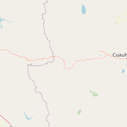
Map view of Papigochic Flora and Fauna Protection Area

Use this park location map to pinpoint Papigochic Flora and Fauna Protection Area in Mexico, understand its exact geographic position, and read its mapped placement within the surrounding landscape more clearly.

Pigeon | © OpenStreetMap contributors

Location context for Papigochic Flora and Fauna Protection Area

Chihuahua
Park atlas

Compare adjacent mountain reserves and connected forest blocks across the Sierra Madre Occidental.

Parks Near Papigochic Flora and Fauna Protection Area: Explore Related Protected Landscapes

Browse other protected areas sharing the rugged terrain and pine oak ecosystems surrounding Papigochic Flora and Fauna Protection Area. Comparing adjacent regional reserves provides deeper context on the expansive forest corridors spanning northern Mexico.
National parkOcampo Municipality
About 50 km away#1 closest

West

Basaseachic Falls National Park: National Park Geography and Mapped Boundaries

Explore protected lands within Ocampo Municipality.

Basaseachic Falls National Park serves as a key protected area within Ocampo Municipality, Mexico. This page provides detailed geographic information and mapped boundaries, essential for understanding its landscape context and its significance as a national park. Dive into the atlas-style data to appreciate the park's protected terrain and its contribution to the regional geography, offering a factual discovery experience.

Area
58.03 km²
Established
1981
IUCN
II
Relief
Mountain
Wildlife reserveChihuahua
About 54 km away#2 closest

Northwest

Tutuaca Flora and Fauna Protection Area: Sierra Madre Occidental Mountain Conservation Reserve

Expansive pine-oak forest habitat in Chihuahua, Mexico

Covering over 4,000 square kilometers, the Tutuaca Flora and Fauna Protection Area acts as a critical link in the Sierra Madre Occidental mountain spine. This wildlife reserve preserves dense pine-oak woodlands, rugged canyons, and high-elevation watersheds that characterize the biodiversity of northwestern Mexico. The area plays a vital role in sustainable resource management and habitat connectivity between Chihuahua and neighboring regions.

Area
4,369.86 km²
Established
2001
IUCN
VI
Relief
Mountain
National parkChihuahua
About 139 km away#3 closest

Northeast

Cumbres de Majalca National Park: National Park Discovery and Geographic Context in Chihuahua

Mapped protected landscape exploration in Chihuahua.

Delve into the protected landscape of Cumbres de Majalca National Park, a national park situated in the Chihuahua region of Mexico. This entry provides essential geographic context and details on its mapped boundaries, serving as a key point for atlas-based exploration of Mexico's protected areas. Understand its specific contribution to the regional geography and conservation landscape.

Area
47.72 km²
Established
1939
IUCN
II
Relief
Mountain
Protected areaSonora
About 155 km away#4 closest

Southwest

Área de protección de flora y fauna Sierra de Álamos-Río Cuchujaqui: Geography and Park Boundaries

Detailed atlas view of the Sonora biodiversity enclave and canyon systems.

Spanning over 92,000 hectares in Sonora, this protected area is defined by its dramatic transition from coastal plains to the Sierra Madre range. The geography centers on the deep, moisture-trapping barrancas of the Cuchujaqui River, which sustain a rare mixture of Neotropical and temperate species. Examine the structural complexity of these forested slopes and river-carved valleys that function as a essential habitat for large predators and diverse flora alike.

Area
928.9 km²
Established
1996
Nature reserveSonora
About 192 km away#5 closest

Northwest

Northern Jaguar Reserve: Geography and Protected Landscape Atlas of Sonora

Foothill bushland between the Aros and Bavispe River valleys

Northern Jaguar Reserve represents a key protected block of dry tropical bushland in the Sierra Madre foothills of Sonora. This map-focused profile examines the topography, drainage systems, and structural habitat corridors that support one of the northernmost wild jaguar populations within a transition zone of mountain slopes and river-fed canyons.

Area
222 km²
Relief
Mountain
Climate
Subtropical
Access
Remote access
Wildlife reserveChihuahua
About 200 km away#6 closest

Northwest

Campo Verde Flora and Fauna Protection Area: Atlas and Landscape Discovery in Chihuahua

A significant wildlife reserve in the Sierra Madre Occidental

Spanning the transition from high montane forests to semi arid desert, Campo Verde Flora and Fauna Protection Area represents a core component of Mexico's northern conservation network. Documented for its endemic flora and fauna, this wildlife reserve provides a rare look at the ecological mosaic of the Sierra Madre Occidental region.

Area
1,080.67 km²
Established
1938
IUCN
VI
Relief
Mountain
A soft watercolor illustration of rolling green hills, distant purple mountains, and stylized trees.
Protected areaChihuahua
About 265 km away#7 closest

South

Cerro Mohinora: Protected Volcanic Summit and Alpine Geography in Chihuahua

An analysis of volcanic terrain and high-elevation protected ecosystems.

Cerro Mohinora dominates the skyline as a prominent volcanic landmark within the Sierra Madre Occidental. This record details the protected area's geographic reach, examining its complex igneous history and the dramatic vertical transition from pine-covered slopes to its snowy summit, offering a clear map-oriented view of this significant Chihuahua natural landmark.

Established
2012
Relief
Mountain
Water
Minor water
Season
Seasonal
Wildlife reserveSonora
About 322 km away#8 closest

Northwest

Bavispe Flora and Fauna Protection Area: Sierra Madre Occidental Mountain Geography

Mapped protected forest tracts across Sonora ranges

Spanning five distinct mountain tracts in Sonora, this wildlife reserve preserves rare pine-oak forest communities within the Sierra Madre Occidental. Learn how these ridges and basins act as a vital hydrological anchor for the Yaqui River and provide critical corridors for wildlife through the diverse, transition-heavy terrain of northern Mexico.

Area
2,009 km²
Established
1936
IUCN
VI
Relief
Mountain

Common questions about visiting, size, designation, and location context for Papigochic Flora and Fauna Protection Area

Papigochic Flora and Fauna Protection Area FAQs for park facts, access, geography, and protected area context

Find quick answers about Papigochic Flora and Fauna Protection Area, including protected-area facts, park geography, trail and visitor context, and how the park fits into its surrounding country and regional landscape.
MoriAtlas Explorer

Continue Your Protected Areas Search Across the Global Atlas

Deepen your exploration by continuing the structured search for national parks and protected areas worldwide. Utilize the comprehensive filtering capabilities to compare different conservation landscapes and refine your understanding of global park geography. Discover more about the distribution and characteristics of protected natural areas.

Global natural geography