

Mori Atlas logo
Wildlife reserveMédanos de Samalayuca

Tracing the shifting silica dunes and vast arid geography of northern Chihuahua, Mexico

Médanos de Samalayuca: A Protected Wildlife Reserve in the Chihuahuan Desert Landscape

(Área de Protección de Flora y Fauna Médanos de Samalayuca)

Médanos de Samalayuca stands as a distinct protected area within the northern reaches of the Chihuahuan Desert. This expansive wildlife reserve is defined by its massive fields of fine white silica sand, which shift continuously under the influence of regional winds. Unlike the surrounding scrub-stabilized desert terrain, these dunes create a dynamic and exposed environment that marks a unique intersection of geology and conservation in the state of Chihuahua.

desertsand dunessilica sandChihuahuan Desertprotected areaflora and fauna protection area
A vibrant, flat-style digital illustration of a desert landscape featuring rolling sand dunes, sparse vegetation, and mountains under a sunny sky.

Médanos de Samalayuca

Wildlife reserve

Park overview

Structured park overview, official facts, and landscape profile for Médanos de Samalayuca

Médanos de Samalayuca park facts, protected area profile, and essential visitor context

Review the core facts for Médanos de Samalayuca, including designation, size, terrain, visitor scale, habitats, and operating context in one park-focused overview.

About Médanos de Samalayuca

Médanos de Samalayuca is one of the most visually dramatic desert landscapes in northern Mexico. Located in the state of Chihuahua and centered near the settlement of Samalayuca, the protected area encompasses a vast dune field at the geographic core of the Chihuahuan Desert. The dunes themselves are formed from fine, light-colored silica sand, giving the landscape a luminous quality under strong desert sun and a starkly different appearance from many of the world's more familiar dune systems.

What sets this region apart from the surrounding desert is the near absence of vegetation across the dune zone itself. Most of the Chihuahuan Desert is stabilized by dense, thorny scrub that anchors the soil and slows the movement of sand. In the Médanos de Samalayuca, however, the lack of such plant cover allows wind to move the silica sand almost continuously, reshaping ridges and corridors across the landscape and occasionally generating dust and sandstorms that significantly reduce visibility. The result is an environment defined as much by motion and wind as by stillness and heat.

Administratively, the protected area crosses parts of several municipalities, including Juárez, Ascensión, and Guadalupe, and is traversed by Federal Highway 45 and the railway line linking central Mexico to Ciudad Juárez. Since 2009 it has held the formal designation of Flora and Fauna Protection Area, recognizing both its ecological importance and its need for conservation management. Today, it stands as a destination for adventure-style desert tourism and as an iconic feature of northern Mexico's natural heritage.

Quick facts and research context for Médanos de Samalayuca

Médanos de Samalayuca lies in northern Chihuahua, Mexico, primarily within the municipality of Juárez near the settlement of Samalayuca. It forms part of the Chihuahuan Desert and is centered on an unusually bare expanse of migrating white silica sand dunes surrounded by thorny scrubland. The protected area covers roughly 63,000 hectares and experiences extreme temperatures, ranging from intense summer highs to freezing winter lows. It was formally designated a Flora and Fauna Protection Area in June 2009.

Protection and recognition

Documented protection records and management frameworks for Médanos de Samalayuca

Médanos de Samalayuca Protection Status and Terrestrial Conservation Scope

Terrestrial protection status records for Médanos de Samalayuca outline the established conservation scope and management framework. Structured data references provide verified administrative details without external recognition sources.

Protection details

Protection scope
Terrestrial
Transboundary protection
No
Park context

Deeper park guide and search-rich context for Médanos de Samalayuca

Médanos de Samalayuca history, landscape, wildlife, and travel context

Explore Médanos de Samalayuca through its history, landscape character, ecosystems, wildlife, conservation priorities, cultural context, and seasonal travel timing in a structured park guide built for atlas discovery and search intent.

Why Médanos de Samalayuca stands out

The park is best known for its expansive field of fine, white silica sand dunes, which are unusual within the Chihuahuan Desert for their lack of stabilizing vegetation and their constant movement under the wind. These shifting dunes create a striking, almost lunar landscape that contrasts sharply with the thorn-scrub desert that surrounds them. The combination of raw desert scenery, strong winds, sweeping horizons, and an unusually pale sand palette gives the area a distinctive visual identity that has also made it a recognizable filming location.
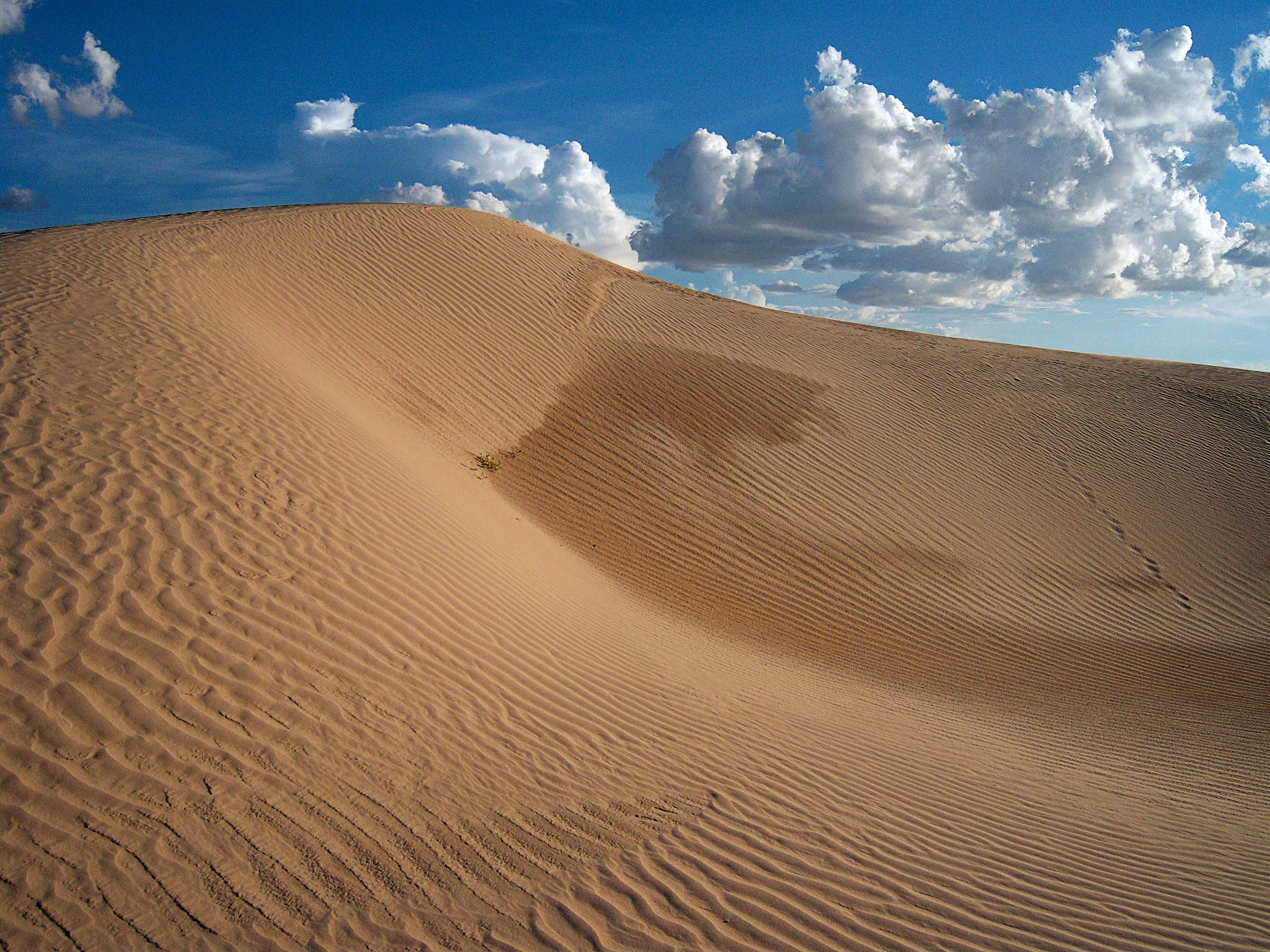
A wide angle view of golden, wind-rippled sand dunes stretching across the frame under a clear blue sky with white, fluffy clouds.
The expansive golden sand dunes of Médanos de Samalayuca under a bright sky.

Médanos de Samalayuca history and protected-area timeline

The dune landscape of Samalayuca has long been a defining geographical feature of northern Chihuahua, taking its name from the nearby settlement that has, for generations, served as a waypoint and reference point in this arid stretch of the country. For much of its history, the area was known primarily to local inhabitants, travelers crossing the desert, and the railway and highway corridors that connect central Mexico with Ciudad Juárez.

A turning point came on 5 June 2009, when a presidential decree signed by President Felipe Calderón Hinojosa formally established the Área de Protección de Flora y Fauna Médanos de Samalayuca. The designation acknowledged both the ecological value of the dune system and the pressures it faced from sand extraction, unregulated tourism, and surrounding land use, placing the landscape under a national conservation framework.

In the years since, the area has increasingly been recognized as a destination for adventure tourism, drawing visitors interested in dune driving, sandboarding, hiking, and the experience of one of Mexico's most unusual desert environments. The dunes have also become a fixture in Mexican and international cinema, appearing as a backdrop in films as varied as Luis Buñuel's Simón del Desierto and the 1984 productions Conan el Destructor and Dune.

Médanos de Samalayuca landscape and geographic character

The defining feature of Médanos de Samalayuca is an exceptionally open dune field composed of fine, light-toned silica sand. Unlike the surrounding territories of the Chihuahuan Desert, where thorny scrubland helps bind the soil, this dune zone is largely bare, allowing the wind to shape ridges, hollows, and mobile sand corridors almost continuously.

The terrain extends across northern Chihuahua primarily in the municipalities of Juárez, Ascensión, and Guadalupe, and is crossed by two major linear features: Federal Highway 45 and the railway linking Mexico City with Ciudad Juárez. These transport corridors give the landscape a frame of human infrastructure cutting through otherwise remote desert scenery.

Extreme climatic contrasts are a defining part of the experience of the landscape. Temperatures can climb to around 45 °C in high summer and plunge to roughly -16 °C during cold winter nights. Add to this the strong winds that drive the sands, and the result is an exceptionally dynamic desert environment, capable of shifting visibly over short periods and occasionally producing sandstorms that dramatically reduce visibility across wide stretches of the region.

Médanos de Samalayuca ecosystems, habitats, and plant life

Ecologically, Médanos de Samalayuca sits at the heart of the Chihuahuan Desert, one of North America's major desert regions and an area known for its hardy scrub vegetation, resilient wildlife, and wide temperature swings. The protected area's biodiversity reflects this desert context, hosting more than 580 species of plants and animals according to data compiled by Mexico's national biodiversity information system, CONABIO.

Among these species, 24 are listed under some risk category in the Mexican Official Standard NOM-059, highlighting the conservation significance of even seemingly sparse desert environments. A further 18 species are considered exotic, illustrating the ongoing influence of non-native elements on the local ecology.

The dune zone itself stands apart within the broader desert landscape. Where surrounding areas are dominated by thorny scrub that stabilizes soils and shapes habitat structure, the dune zone is unusually open, with shifting sand dominating the surface. This contrast between vegetated desert margins and bare, mobile sand in the core creates a distinctive ecological gradient, where different species and ecological communities find niches along the transition between stable and shifting ground.

Médanos de Samalayuca wildlife and species highlights

Although the shifting silica dunes at the core of the protected area appear barren, the broader Médanos de Samalayuca protected landscape supports a diverse desert fauna alongside its plant life. Across the area as a whole, more than 580 species of plants and animals have been documented, illustrating that the Chihuahuan Desert environment, despite its harsh appearance, sustains a wide range of life adapted to aridity, temperature extremes, and wind-driven sand movement.

Among documented fauna, 24 species fall under some category of risk in Mexico's official ecological protection standard, NOM-059, underlining the conservation value of species living in this desert and dune habitat. The presence of these at-risk species contributes to the rationale for the area's protected designation.

Médanos de Samalayuca conservation status and protection priorities

The principal conservation value of Médanos de Samalayuca lies in its protection of one of the most unusual landscapes within the Chihuahuan Desert: a large, mobile dune system composed of fine silica sand. Because dune fields like this are vulnerable to sand extraction, off-road vehicle impacts, and uncontrolled tourism, formal protection has been an important step in preserving the area's geomorphological and ecological integrity.

The 2009 designation as a Flora and Fauna Protection Area was a significant milestone in this regard. By placing the landscape under national protection, the decree created a framework to manage human pressures and safeguard a regionally distinctive ecosystem. Within the protected area, the contrast between vegetated desert margins and the bare, mobile dunes represents a conservation priority in itself, since such dune systems are relatively uncommon, slow to recover from disturbance, and home to specialized desert species.

The presence of more than two dozen species listed under Mexico's NOM-059 risk categories underscores the area's broader ecological importance beyond its iconic dunes. Conservation management of the area thus serves not only to preserve a striking landscape, but also to protect desert biodiversity in a region where arid ecosystems face increasing pressure.

Médanos de Samalayuca cultural meaning and human context

The Médanos de Samalayuca region has a strong sense of place rooted in the settlement of Samalayuca itself, the small community that gives the dunes their name and serves as a longstanding reference point for travelers and residents of northern Chihuahua. The dunes are part of how local identity in this part of the Chihuahuan Desert is understood and described.

The area's stark, minimalist scenery has also given it an enduring cultural presence beyond regional tourism. Its dramatic horizons and pale sands have served as a visual stand-in for deserts and otherworldly landscapes in film, appearing in Mexican productions such as Luis Buñuel's 1965 classic Simón del Desierto and Alejandro Jodorowsky's El Topo, as well as in international productions including Conan el Destructor (1984) and David Lynch's Dune (1984). This cinematic legacy has helped shape the area's wider image as one of Mexico's most visually iconic natural settings.

Top sights and standout views in Médanos de Samalayuca

Among the strongest points of distinction of Médanos de Samalayuca are its sweeping dunes of fine white silica sand, an unusually bare expanse within a desert otherwise dominated by stabilizing vegetation. The area combines dramatic desert scenery, strong winds, and extreme temperature ranges that together create an environment defined by movement, contrast, and exposure. Its formal protection since 2009, combined with its long-standing presence in film and growing role in adventure tourism, makes it both a working protected landscape and a culturally recognizable symbol of the Chihuahuan Desert.

Best time to visit Médanos de Samalayuca

Médanos de Samalayuca experiences a wide range of conditions across the year, and the character of a visit will shift with the seasons. Summers bring intense heat and very high daytime temperatures, with sunlight turning the pale silica dunes bright and stark. Winters can be surprisingly cold, with freezing overnight temperatures that require warm clothing despite the area's desert location. Spring and autumn often offer the most balanced conditions for outdoor exploration, with milder temperatures, softer light across the dunes, and generally more comfortable conditions for hiking, sandboarding, or guided desert excursions. Visitors should also be prepared for strong winds at any time of year, as these are a defining feature of the landscape and can occasionally produce sandstorms.

Monthly climate preview

Long-term monthly temperature and precipitation patterns in Chihuahua

Médanos de Samalayuca Climate Normals and Annual Temperature Rhythm

Historical climate data for Médanos de Samalayuca records average monthly temperatures ranging from cool winter lows to high summer peaks alongside modest precipitation rates. Examining the full twelve-month profile provides complete insight into long-term temperature ranges and precipitation normals.
Annual mean18 °C
7 °C29 °C
Jan
Feb10°
Mar14°
Apr18°
May23°
Jun29°
Jul28°
Aug27°
Sep24°
Oct19°
Nov12°
Dec
Warmest month
June

28.5 °C

Coolest month
December

7 °C

Wettest month
July

2 mm/day

Driest month
April

0.2 mm/day

Park location guide

Geography guide, regional context, and park location map for Médanos de Samalayuca

Médanos de Samalayuca park geography, regions, and map view in Mexico

Understand where Médanos de Samalayuca sits in Mexico through a broader geographic reading of the surrounding landscape, nearby location context, and its mapped position within the national park landscape.

How Médanos de Samalayuca fits into Mexico

Mexico, officially the United Mexican States, is a country in North America spanning the Sierra Madre mountain ranges, coastal plains, and tropical regions. It borders the United States to the north, Guatemala and Belize to the southeast, and has coastlines along the Pacific Ocean, Gulf of Mexico, and Caribbean Sea. With a population exceeding 130 million, Mexico is home to one of the world's most significant concentrations of Indigenous languages alongside Spanish.

Wider geography shaping Médanos de Samalayuca in Mexico

Mexico occupies a land area of 1,972,550 km2, making it the thirteenth-largest country in the world. The terrain is highly diverse, featuring the Sierra Madre Occidental and Sierra Madre Oriental mountain ranges, the Mexican Plateau, coastal lowlands along the Pacific and Gulf/Caribbean margins, and the Yucatan Peninsula. The country spans multiple climate zones from desert in the north to tropical rainforest in the south.

Map view of Médanos de Samalayuca

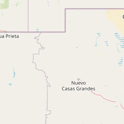
Use this park location map to pinpoint Médanos de Samalayuca in Mexico, understand its exact geographic position, and read its mapped placement within the surrounding landscape more clearly.

Pigeon | © OpenStreetMap contributors

Location context for Médanos de Samalayuca

Chihuahua

Visual reference for the shifting white silica sand dunes and protected arid ecosystem.

Médanos de Samalayuca Photos, Landscapes, and Desert Scenery

Visual documentation captures the expansive white silica sand dunes and dynamic arid terrain defining Médanos de Samalayuca. Protected area photography reveals the stark contrast between mobile desert corridors and the surrounding Chihuahuan Desert landscape.

A wide angle view of golden, wind-rippled sand dunes stretching across the frame under a clear blue sky with white, fluffy clouds.

Park atlas

Compare regional protected areas and arid desert terrain across northern Chihuahua.

Other Parks Near Médanos de Samalayuca and Protected Landscapes in Northern Mexico

Browse protected areas and desert reserves situated near Médanos de Samalayuca to examine broader arid ecosystems. Comparing adjacent regional geography reveals how shifting dune fields and scrublands connect across northern Mexico.
National parkNew Mexico
About 174 km away#1 closest

North

White Sands National Park: National Park with Unique Dune Landscape in New Mexico

Explore its protected boundaries and desert geography.

White Sands National Park is a protected national park renowned for its stunning gypsum dunes, offering a unique landscape within New Mexico's geography. This page provides detailed information on its mapped protected area, serving as a valuable resource for understanding the park's specific geographic context and its identity as a significant protected natural landscape.

Area
601.3 km²
Established
2019
IUCN
V
Visitors
729.1K annual
Watercolor painting showing layers of rolling hills and distant mountains in shades of soft green, pink, and yellow.
Protected landscapeNew Mexico
About 190 km away#2 closest

Northeast

Lincoln National Forest Protected Landscape: Mapping the New Mexico Environmental Gradient

Geography of the Sacramento, Capitan, and Guadalupe Mountains

Lincoln National Forest encompasses a remarkable vertical transition across three ranger districts in New Mexico. The area protects complex mountain landscapes including the east-west Capitan range and the ancient reef geology of the Guadalupe Mountains, serving as a critical example of ecological diversity within a single federal unit.

Area
4,467.31 km²
Established
1902
Visitors
735.2K annual
Relief
Mountain
A horizontal watercolor painting showing distant mountains in shades of purple, soft green rolling hills, a central winding river or stream, and grassy foreground elements on a white background.
Protected landscapeNew Mexico
About 192 km away#3 closest

Northwest

Gila National Forest: A Geographic Overview of New Mexico's Protected Wilderness Core

Mapped terrain, forest boundaries, and regional wilderness character

Gila National Forest stands as a critical protected landscape in New Mexico, encompassing immense mountain ranges, narrow river gorges, and extensive backcountry basins. This atlas entry details the forest's topographic transition from high-altitude ponderosa stands to desert lowlands, highlighting its status as the foundational site for the global wilderness movement and a stronghold for regional ecological diversity.

Area
10,969.7 km²
Established
1905
Relief
Mountain
Climate
Temperate
National parkCulberson County
About 196 km away#4 closest

Northeast

Guadalupe Mountains National Park: Mapped Boundaries and Protected Landscape Identity

Explore the geography and terrain of this Texas national park.

Guadalupe Mountains National Park is a key protected area within Culberson County, West Texas. This national park offers a distinct geographic focus, allowing for detailed exploration of its mapped boundaries and the unique natural landscapes that define its protected status. Understanding its place within the Trans-Pecos region provides valuable context for regional geography and atlas-based discovery of conservation lands in Texas.

Area
349.51 km²
Established
1972
IUCN
II
Visitors
206.4K annual
Wildlife reserveChihuahua
About 209 km away#5 closest

Southwest

Campo Verde Flora and Fauna Protection Area: Atlas and Landscape Discovery in Chihuahua

A significant wildlife reserve in the Sierra Madre Occidental

Spanning the transition from high montane forests to semi arid desert, Campo Verde Flora and Fauna Protection Area represents a core component of Mexico's northern conservation network. Documented for its endemic flora and fauna, this wildlife reserve provides a rare look at the ecological mosaic of the Sierra Madre Occidental region.

Area
1,080.67 km²
Established
1938
IUCN
VI
Relief
Mountain
National parkEddy County
About 233 km away#6 closest

Northeast

Carlsbad Caverns National Park: Detailed Protected Area and Landscape Exploration

View mapped terrain and geographic context for this Eddy County national park.

Gain a deep understanding of Carlsbad Caverns National Park through its specific geographic features and protected landscape identity. This entry provides foundational atlas-level information on the park's mapped boundaries and its role as a designated national park within the broader regional geography of Eddy County. It is designed to offer precise context for users focused on understanding the specific natural terrain and conservation geography of this important protected area, facilitating structured discovery.

Area
189.26 km²
Established
1930
IUCN
II
Visitors
410.8K annual
A horizontal watercolor illustration showing green foreground vegetation, rolling light green hills in the midground, and purple hazy mountains in the background against a white sky.
Wildlife reserveNew Mexico
About 236 km away#7 closest

Northwest

Gila Wilderness: An In-Depth Look at the Protected Landscape and Geography of New Mexico

Mapped terrain, alpine peaks, and diverse forest ecosystems within the American Southwest

The Gila Wilderness stands as a primary case study in landscape conservation, protecting a massive network of unroaded river canyons and forest-covered mountains in New Mexico. This region serves as a bridge between temperate montane zones and arid desert environments, creating a unique ecological atlas defined by significant altitudinal gradients, volcanic features, and extensive watershed networks across the Mogollon range.

Area
225,820 km²
Established
1924
IUCN
Ib
Relief
Mountain
National parkChihuahua
About 262 km away#8 closest

South

Cumbres de Majalca National Park: National Park Discovery and Geographic Context in Chihuahua

Mapped protected landscape exploration in Chihuahua.

Delve into the protected landscape of Cumbres de Majalca National Park, a national park situated in the Chihuahua region of Mexico. This entry provides essential geographic context and details on its mapped boundaries, serving as a key point for atlas-based exploration of Mexico's protected areas. Understand its specific contribution to the regional geography and conservation landscape.

Area
47.72 km²
Established
1939
IUCN
II
Relief
Mountain

Common questions about visiting, size, designation, and location context for Médanos de Samalayuca

Médanos de Samalayuca FAQs for park facts, access, geography, and protected area context

Find quick answers about Médanos de Samalayuca, including protected-area facts, park geography, trail and visitor context, and how the park fits into its surrounding country and regional landscape.
MoriAtlas Explorer

Continue Your Protected Areas Search Across the Global Atlas

Deepen your exploration by continuing the structured search for national parks and protected areas worldwide. Utilize the comprehensive filtering capabilities to compare different conservation landscapes and refine your understanding of global park geography. Discover more about the distribution and characteristics of protected natural areas.

Global natural geography