Mori Atlas logo
Nearby park discovery

Regional map analysis of protected lands surrounding the desert dune system

Protected Areas and Natural Landscapes Situated Near Médanos de Samalayuca in Chihuahua

Examine the geographic distribution of protected natural areas located in the vicinity of Médanos de Samalayuca. This atlas overview highlights the spatial arrangement of surrounding landscapes and terrain types across the Chihuahua region, facilitating a clearer understanding of local wilderness boundaries.

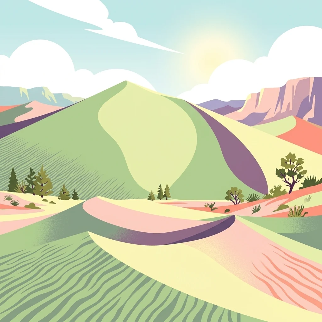
A vibrant, flat-style digital illustration of a desert landscape featuring rolling sand dunes, sparse vegetation, and mountains under a sunny sky.

A sweeping silica dune field at the heart of the Chihuahuan Desert.

Médanos de Samalayuca

Médanos de Samalayuca is a striking desert dune system in the northern part of the Mexican state of Chihuahua, within the municipality of Juárez. The landscape consists of shifting dunes of fine white silica sand set amid the much broader Chihuahuan Desert, one of the great desert regions of North America. Unlike surrounding areas of the desert, which are stabilized by dense thickets of thorny scrub, the dune zone itself is unusually free of vegetation, allowing sand to migrate freely and occasionally generating powerful sandstorms that reduce visibility across the region. Designated by presidential decree on 5 June 2009 as a Flora and Fauna Protection Area, the Médanos de Samalayuca today serves both as a protected natural landscape and as a center for adventure tourism. The dune field spans parts of the municipalities of Juárez, Ascensión, and Guadalupe, and is crossed from north to south by Federal Highway 45 and the Mexico–Ciudad Juárez railway line. Beyond its ecological importance, the area is a cultural and cinematic landmark. Its stark, otherworldly scenery has drawn filmmakers for decades, and it continues to attract visitors seeking one of the most visually distinctive desert environments in northern Mexico.

Location
Mexico
Park type
Wildlife reserve
Established
2009
Area
631.8 km²
Explore Médanos de Samalayuca Park Geography
Regional park map

See the ranked park cluster in its geographic setting

Nearby parks around Médanos de Samalayuca

This regional map shows the same 20 nearby parks ranked below around Médanos de Samalayuca. Select a ranked marker to highlight that park’s boundary where boundary data is available.
Reference park: Médanos de SamalayucaRanked nearby park20 nearby parks shown
20 nearby parks

Distance-ranked collection and regional park geography surrounding the desert landscape

Parks and Protected Areas Geographically Near Médanos de Samalayuca

Examine the ranked collection of protected areas situated geographically near Médanos de Samalayuca to analyze surrounding regional park geography. These entries provide structured comparison signals across territorial boundaries and recorded environmental characteristics without implying shared terrain.
National parkNew Mexico
About 174 km away#1 closest

North

White Sands National Park: National Park with Unique Dune Landscape in New Mexico

Explore its protected boundaries and desert geography.

White Sands National Park is a protected national park renowned for its stunning gypsum dunes, offering a unique landscape within New Mexico's geography. This page provides detailed information on its mapped protected area, serving as a valuable resource for understanding the park's specific geographic context and its identity as a significant protected natural landscape.

Area
601.3 km²
Established
2019
IUCN
V
Visitors
729.1K annual
Watercolor painting showing layers of rolling hills and distant mountains in shades of soft green, pink, and yellow.
Protected landscapeNew Mexico
About 190 km away#2 closest

Northeast

Lincoln National Forest Protected Landscape: Mapping the New Mexico Environmental Gradient

Geography of the Sacramento, Capitan, and Guadalupe Mountains

Lincoln National Forest encompasses a remarkable vertical transition across three ranger districts in New Mexico. The area protects complex mountain landscapes including the east-west Capitan range and the ancient reef geology of the Guadalupe Mountains, serving as a critical example of ecological diversity within a single federal unit.

Area
4,467.31 km²
Established
1902
Visitors
735.2K annual
Relief
Mountain
A horizontal watercolor painting showing distant mountains in shades of purple, soft green rolling hills, a central winding river or stream, and grassy foreground elements on a white background.
Protected landscapeNew Mexico
About 192 km away#3 closest

Northwest

Gila National Forest: A Geographic Overview of New Mexico's Protected Wilderness Core

Mapped terrain, forest boundaries, and regional wilderness character

Gila National Forest stands as a critical protected landscape in New Mexico, encompassing immense mountain ranges, narrow river gorges, and extensive backcountry basins. This atlas entry details the forest's topographic transition from high-altitude ponderosa stands to desert lowlands, highlighting its status as the foundational site for the global wilderness movement and a stronghold for regional ecological diversity.

Area
10,969.7 km²
Established
1905
Relief
Mountain
Climate
Temperate
National parkCulberson County
About 196 km away#4 closest

Northeast

Guadalupe Mountains National Park: Mapped Boundaries and Protected Landscape Identity

Explore the geography and terrain of this Texas national park.

Guadalupe Mountains National Park is a key protected area within Culberson County, West Texas. This national park offers a distinct geographic focus, allowing for detailed exploration of its mapped boundaries and the unique natural landscapes that define its protected status. Understanding its place within the Trans-Pecos region provides valuable context for regional geography and atlas-based discovery of conservation lands in Texas.

Area
349.51 km²
Established
1972
IUCN
II
Visitors
206.4K annual
Wildlife reserveChihuahua
About 209 km away#5 closest

Southwest

Campo Verde Flora and Fauna Protection Area: Atlas and Landscape Discovery in Chihuahua

A significant wildlife reserve in the Sierra Madre Occidental

Spanning the transition from high montane forests to semi arid desert, Campo Verde Flora and Fauna Protection Area represents a core component of Mexico's northern conservation network. Documented for its endemic flora and fauna, this wildlife reserve provides a rare look at the ecological mosaic of the Sierra Madre Occidental region.

Area
1,080.67 km²
Established
1938
IUCN
VI
Relief
Mountain
National parkEddy County
About 233 km away#6 closest

Northeast

Carlsbad Caverns National Park: Detailed Protected Area and Landscape Exploration

View mapped terrain and geographic context for this Eddy County national park.

Gain a deep understanding of Carlsbad Caverns National Park through its specific geographic features and protected landscape identity. This entry provides foundational atlas-level information on the park's mapped boundaries and its role as a designated national park within the broader regional geography of Eddy County. It is designed to offer precise context for users focused on understanding the specific natural terrain and conservation geography of this important protected area, facilitating structured discovery.

Area
189.26 km²
Established
1930
IUCN
II
Visitors
410.8K annual
A horizontal watercolor illustration showing green foreground vegetation, rolling light green hills in the midground, and purple hazy mountains in the background against a white sky.
Wildlife reserveNew Mexico
About 236 km away#7 closest

Northwest

Gila Wilderness: An In-Depth Look at the Protected Landscape and Geography of New Mexico

Mapped terrain, alpine peaks, and diverse forest ecosystems within the American Southwest

The Gila Wilderness stands as a primary case study in landscape conservation, protecting a massive network of unroaded river canyons and forest-covered mountains in New Mexico. This region serves as a bridge between temperate montane zones and arid desert environments, creating a unique ecological atlas defined by significant altitudinal gradients, volcanic features, and extensive watershed networks across the Mogollon range.

Area
225,820 km²
Established
1924
IUCN
Ib
Relief
Mountain
National parkChihuahua
About 262 km away#8 closest

South

Cumbres de Majalca National Park: National Park Discovery and Geographic Context in Chihuahua

Mapped protected landscape exploration in Chihuahua.

Delve into the protected landscape of Cumbres de Majalca National Park, a national park situated in the Chihuahua region of Mexico. This entry provides essential geographic context and details on its mapped boundaries, serving as a key point for atlas-based exploration of Mexico's protected areas. Understand its specific contribution to the regional geography and conservation landscape.

Area
47.72 km²
Established
1939
IUCN
II
Relief
Mountain
Wildlife reserveSonora
About 284 km away#9 closest

West

Bavispe Flora and Fauna Protection Area: Sierra Madre Occidental Mountain Geography

Mapped protected forest tracts across Sonora ranges

Spanning five distinct mountain tracts in Sonora, this wildlife reserve preserves rare pine-oak forest communities within the Sierra Madre Occidental. Learn how these ridges and basins act as a vital hydrological anchor for the Yaqui River and provide critical corridors for wildlife through the diverse, transition-heavy terrain of northern Mexico.

Area
2,009 km²
Established
1936
IUCN
VI
Relief
Mountain
Nature reserveSonora
About 286 km away#10 closest

Southwest

Northern Jaguar Reserve: Geography and Protected Landscape Atlas of Sonora

Foothill bushland between the Aros and Bavispe River valleys

Northern Jaguar Reserve represents a key protected block of dry tropical bushland in the Sierra Madre foothills of Sonora. This map-focused profile examines the topography, drainage systems, and structural habitat corridors that support one of the northernmost wild jaguar populations within a transition zone of mountain slopes and river-fed canyons.

Area
222 km²
Relief
Mountain
Climate
Subtropical
Access
Remote access
Wildlife reserveChihuahua
About 322 km away#11 closest

Southwest

Tutuaca Flora and Fauna Protection Area: Sierra Madre Occidental Mountain Conservation Reserve

Expansive pine-oak forest habitat in Chihuahua, Mexico

Covering over 4,000 square kilometers, the Tutuaca Flora and Fauna Protection Area acts as a critical link in the Sierra Madre Occidental mountain spine. This wildlife reserve preserves dense pine-oak woodlands, rugged canyons, and high-elevation watersheds that characterize the biodiversity of northwestern Mexico. The area plays a vital role in sustainable resource management and habitat connectivity between Chihuahua and neighboring regions.

Area
4,369.86 km²
Established
2001
IUCN
VI
Relief
Mountain
Wildlife reserveChihuahua
About 330 km away#12 closest

South

Papigochic Flora and Fauna Protection Area: Sierra Madre Occidental Forest Geography

An expansive mountain wildlife reserve in Chihuahua, Mexico.

Spanning over 2,200 square kilometers, this reserve preserves vital pine and oak forest ecosystems in the Sierra Tarahumara. The area is defined by its deep canyons, high-elevation forested ridgelines, and important role in safeguarding temperate montane habitats within northwestern Mexico.

Area
2,227.64 km²
Established
2003
IUCN
VI
Relief
Mountain
A soft watercolor painting of a wide, rolling mountain landscape with muted greens, yellows, and purples.
Wildlife reserveArizona
About 347 km away#13 closest

Northwest

Galiuro Wilderness: A Protected Mountain Landscape in Southeastern Arizona

Mapped geography and terrain of the Galiuro range

Trace the uplifted slabs and eroded canyons that define Galiuro Wilderness. This protected area rises from the Arizona plains to reveal a complex geography of brushy slopes, spring-fed riparian zones, and sky-high summit vistas.

Area
309 km²
Established
1932
IUCN
Ib
Relief
Mountain
National parkPima County
About 358 km away#14 closest

West

Saguaro National Park: Discover Its Protected Landscape Geography and Mapped Boundaries

Explore the natural terrain and regional context of this national park.

Saguaro National Park offers a focused exploration of a specific protected landscape, highlighting its unique geographic features and mapped boundaries within Pima County. This detail page provides an atlas perspective, allowing for a deep dive into the park's natural terrain and its regional significance. Understand the protected area's identity and its place within the wider geographical context.

Area
371.16 km²
Established
1994
IUCN
II
Visitors
946.4K annual
National parkOcampo Municipality
About 358 km away#15 closest

South

Basaseachic Falls National Park: National Park Geography and Mapped Boundaries

Explore protected lands within Ocampo Municipality.

Basaseachic Falls National Park serves as a key protected area within Ocampo Municipality, Mexico. This page provides detailed geographic information and mapped boundaries, essential for understanding its landscape context and its significance as a national park. Dive into the atlas-style data to appreciate the park's protected terrain and its contribution to the regional geography, offering a factual discovery experience.

Area
58.03 km²
Established
1981
IUCN
II
Relief
Mountain
A horizontal watercolor painting depicting a desert landscape with mountains in the distance, soft green and yellow foreground vegetation, and several yucca plants.
Protected landscapeUnited States of America
About 361 km away#16 closest

West

Rincon Mountain Wilderness: Geographic Atlas and Protected Landscape Overview

Sky island ecosystems and mountainous desert terrain in Arizona

This protected landscape encompasses the core of the Rincon Mountains, defining a classic triangular range oriented southwest to northeast. The wilderness serves as a vital ecological bridge, rising from arid Sonoran lowlands to cool, high-elevation montane forests. Its boundaries protect an intricate system of ridges and canyons that support isolated relict plant communities, offering a distinct study in regional desert mountain geography.

Relief
Mountain
Access
Moderate access
Scope
Terrestrial
Water
Minor water
National parkBrewster County
About 367 km away#17 closest

Southeast

Big Bend National Park: National Park, Mapped Protected Landscape, and Regional Geography

Explore Brewster County's protected natural terrain.

Big Bend National Park is a prominent national park defined by its protected landscape and geographic features within Brewster County. This destination provides users with detailed atlas-style information, focusing on the park's mapped boundaries and its contribution to the understanding of regional natural geography. Delve into the specific context of this protected area to enhance your geographic discovery.

Area
3,242.19 km²
Established
1944
IUCN
II
Visitors
568.1K annual
A horizontal watercolor illustration depicting soft, rolling hills, a small stream in the foreground, and pine forests, using a muted pastel palette.
Wildlife reserveChihuahua
About 369 km away#18 closest

Southeast

Área de Protección de Flora y Fauna Cañón de Santa Elena Wildlife Reserve Map and Geography

Chihuahuan Desert conservation area in Chihuahua, Mexico

This wildlife reserve protects a vast expanse of the Chihuahuan Desert along the Mexico-United States border. The landscape is defined by deep river-cut canyons, volcanic uplifts, and broad valleys. Discover the geological structure and ecological boundaries of this protected area, which mirrors the conservation efforts of neighboring regions to maintain a vital desert ecosystem.

Area
2,772.09 km²
Established
1994
Relief
Mountain
Climate
Arid
Wildlife reserveArizona
About 370 km away#19 closest

Northwest

Fishhooks Wilderness: An Arizona Desert Wildlife Reserve and Protected Landscape Atlas

Mapped terrain and arid geography in Graham County

Fishhooks Wilderness represents an intact, undeveloped stretch of southeastern Arizona desert managed by the Bureau of Land Management. The area provides a critical example of basin-and-range topography, where volcanic ridges and desert flats border the San Carlos Apache Indian Reservation. This record offers a clear perspective on the wilderness boundaries, ecological transition zones, and remote backcountry character of this distinctive regional landscape.

Area
42 km²
IUCN
Ib
Relief
Upland
Climate
Arid
A minimalist watercolor painting depicting soft green rolling hills in the foreground and faded pink mountain ridges in the background on a white paper background.
Protected areaNew Mexico
About 381 km away#20 closest

North

Manzano Mountain Wilderness: Rugged Protected Landscapes in Central New Mexico

Canyon-scarred mountain geography and forest ecosystems.

Manzano Mountain Wilderness is a significant protected area defined by its deep, radiating canyons and compressed elevational ranges. From pinyon-juniper foothills to the spruce-fir heights of the crest, this landscape offers a detailed look at the varied natural terrain found within the Cibola National Forest in New Mexico.

Area
149.23 km²
Established
1978
IUCN
Ib
Relief
Mountain
Distance methodology

Geographic measurements, not driving distances

How nearby park distances are calculated

Distances use park boundaries whenever the available geometry allows it. When one or both boundaries are missing, the mapped park locations provide a clearly labelled estimate. Every value represents straight-line geographic separation and does not use roads or routing.

Boundary distance

Calculated between the nearest points of both park boundaries.

Location-to-boundary estimate

Estimated from one mapped park location to the nearest boundary of the other park.

Mapped-location estimate

Estimated between the mapped locations of both parks.

MoriAtlas Explorer

Continue Exploring the Protected Landscapes of Médanos de Samalayuca

Deepen your understanding of Médanos de Samalayuca by reviewing its status as a protected wildlife reserve within the Chihuahuan Desert. MoriAtlas offers a detailed look at the geography, terrain, and regional context of this unique northern Mexican dune system for those interested in arid environment mapping.