
Streams
Park geography
A detailed look at the park's terrain, natural features, and regional landscape context.
Comprehensive Geographic Profile and Mapped Boundaries of Capitol Reef National Park, Utah
Examine the technical geography of Capitol Reef National Park, spanning 978.95 square kilometers across Utah. This profile details the park's structural boundaries, including the Waterpocket Fold and various peaks and arches, while providing an analysis of the arid climate and desert-riverine habitat characteristics.
Related tags
Desert LandscapesGeological FormationsMonoclineDark Sky ParkUtah National Parks
Desert landscape preserving the Waterpocket Fold monocline
Capitol Reef National Park
Capitol Reef National Park is a unit of the United States National Park Service located in south-central Utah. The park preserves approximately 241,904 acres of rugged desert landscape centered on the Waterpocket Fold, a massive geological monocline that extends for nearly 100 miles through the Colorado Plateau. This north-south trending formation, formed approximately 65 million years ago during the Laramide orogeny, represents the largest exposed monocline in North America. The park is named for the distinctive white domes of Navajo Sandstone that resemble the dome of the United States Capitol building. The Fremont River cuts through the fold, creating canyons and providing the rare presence of water in this otherwise arid landscape. Capitol Reef stands apart from Utah's more famous national parks as a quieter, less-visited destination that rewards travelers with spectacular geological formations, dark night skies, and remnants of human history dating back over a thousand years.
- Location
- United States of America
- Park type
- National park
- Established
- 1971
- Area
- 979 km²
Location overview
Regional division and high level geographic status in the United States
Capitol Reef National Park: Geographic Location in Utah, United States
Capitol Reef National Park is situated within the state of Utah in the United States of America. Designated as a non coastal, inland protected area, the park operates entirely within a single domestic jurisdiction.
- Countries
- United States of America
- Regions
- Utah
- Primary location
- Utah
- Geographic setting
- Inland
Boundary and coordinates
Exploring the 978.95 square kilometer footprint and spatial extent
Capitol Reef National Park Geographic Boundary Map and Spatial Limits
Interactive mapped outlines show the spatial shape and geographic layout of the protected terrain. Derived measurements provide the estimated 978.95 square kilometer area alongside calculated center coordinates and span limits.
- Boundary area
- 990.6 km²
- Boundary perimeter
- 318.9 km
- Northernmost point
- 38.5345° N
- Southernmost point
- 37.5986° N
- Easternmost point
- 110.8622° W
- Westernmost point
- 111.4233° W
- Geographic centre
- 38.1773° N, 111.1764° W
- North–south span
- 103.9 km
- East–west span
- 49.2 km
Terrain and natural features
Mountain classification and recorded geographic formations within the protected landscape
Capitol Reef National Park Terrain and Named Natural Features
Capitol Reef National Park holds stored mountain relief classifications alongside recorded streams, peaks, cliffs, and arches. Linked feature cards supply names, types, measurements, and spatial relationships for each mapped element.
Selected named natural features
Cliffs
Circle Cliffs
2,210 m
Streams
Oak Creek
Streams
Beaver Bay Canyon
Mountain saddles
Slickrock Divide
1,797 m
Streams
Wingate Wander Slot 1
Environmental setting
Arid climate zones, desert habitats, and canyon relief types across the terrain
Capitol Reef National Park Environmental Setting and Physical Classifications
Recorded landscape features, sparse forest cover, and seasonal variations provide complementary ways to read the physical setting of Capitol Reef National Park. Associated classifications link directly to relevant atlas destinations for broader regional exploration.
- Relief
- Mountain
- Climate
- Arid
- Water
- Minor water
- Forest cover
- Sparse forest
- Seasonality
- Seasonal
Landscape features
Mountains · Valleys · Plateau · Cliffs · Canyon · Rivers · Desert
Habitat types
Desert habitat · Riverine habitat
Park atlas
Compare contiguous protected areas and map the unique geological formations defining Utah's desert region, extending beyond Capitol Reef National Park.
Discover Nearby National Parks and Protected Areas Beyond Capitol Reef National Park's Monocline Landscapes
Browse an extensive atlas of national parks and protected areas, revealing diverse desert landscapes and remarkable geological formations across the Colorado Plateau and surrounding regions near Capitol Reef National Park. Use this geographic comparison to trace regional park patterns, understand connected conservation efforts, and discover the broader protected land context within Utah and the American Southwest.
Protected landscapeUnited States of America
Park boundaries overlap#1 closest
South

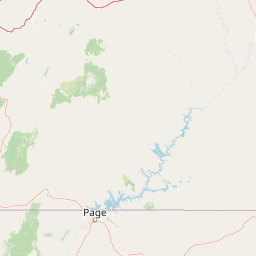
Glen Canyon National Recreation Area: Protected Landscape and High Desert Geography Map
Colorado Plateau canyons, sandstone strata, and reservoir environments
Explore the geological architecture of Glen Canyon National Recreation Area, a vast federal protected landscape. The area showcases towering Navajo Sandstone cliffs, deep blue reservoir arms, and remote backcountry canyons that exemplify the distinct high desert terrain of the Colorado Plateau in the United States.
- Area
- 5,075.23 km²
- Established
- 1972
- Visitors
- 5.2M annual
- Relief
- Upland

Protected landscapeUtah
45 km away#2 closest
North
Manti, La Sal National Forest: Geographic Overview of Utah's Mountain and Canyon Landscapes
Mapped protected forest boundaries across the Colorado Plateau
Spanning over one million acres, Manti, La Sal National Forest defines a critical segment of Utah geography. This protected landscape encompasses diverse terrain including subalpine mountains, aspen-rich uplands, and deep canyon networks. Use this atlas to examine the distinct environmental characteristics that separate the northern forested plateaus from the southern wilderness canyons.
- Area
- 5,143.09 km²
- Established
- 1950
- IUCN
- V
- Visitors
- 900K annual
National parkUtah
78 km away#3 closest
East
Canyonlands National Park: A Mapped Protected Landscape in Utah's Geography
Explore its vast geography and protected area boundaries.
Canyonlands National Park stands as a significant protected entity within the state of Utah, characterized by its immense scale and dramatic geological formations. This page facilitates an atlas-style exploration of its terrain, emphasizing its mapped boundaries and its crucial role as a protected landscape. Gain a deeper appreciation for its unique geographic setting and its place within the broader regional context.
- Area
- 1,366.21 km²
- Established
- 1964
- IUCN
- II
- Visitors
- 818.5K annual
National parkUtah
86 km away#4 closest
Southwest
Bryce Canyon National Park: Utah's Mapped Protected Landscape and Geographic Context
Explore the unique geology and protected boundaries of Bryce Canyon National Park.
Bryce Canyon National Park offers a distinct protected landscape within the geography of Utah, characterized by its unique geological formations. This entry provides essential context for understanding its mapped boundaries and natural terrain, serving as a vital component for atlas-based discovery of protected areas. Investigate the specific geographic setting and conservation significance of this iconic national park.
- Area
- 145.02 km²
- Established
- 1928
- IUCN
- II
- Visitors
- 2.5M annual
National parkArizona
102 km away#5 closest
South
Grand Canyon National Park: Arizona National Park Protected Landscape & Geography
Explore mapped boundaries and regional atlas context.
Grand Canyon National Park stands as a premier national park, showcasing a unique protected landscape within Arizona's diverse geography. This detailed entry focuses on the park's specific geographic identity, its mapped boundaries, and its significance within the regional atlas. Discover the contours of this protected area and its place in the natural terrain of the American Southwest.
- Area
- 4,926.08 km²
- Established
- 1919
- IUCN
- II
- Visitors
- 4.9M annual

Protected landscapeArizona
129 km away#6 closest
Southwest
Kaibab National Forest: Protected Plateau Landscapes and Forested Geography in Arizona
High-elevation forest terrain bordering the Grand Canyon
Spanning over 1.6 million acres in Arizona, Kaibab National Forest is characterized by its split geographic configuration, with distinct sections flanking the North and South rims of the Grand Canyon. The terrain ranges from the high-altitude Kaibab Plateau to volcanic uplands near Williams, encompassing four designated wilderness areas and varied forest ecosystems that provide a critical buffer for the surrounding canyon country.
- Area
- 6,500 km²
- Established
- 1909
- Relief
- Mountain
- Climate
- Temperate
National parkUtah
133 km away#7 closest
Northeast
Arches National Park: Utah National Park Protected Landscape Exploration
Explore mapped terrain and geographic context.
Delve into the specifics of Arches National Park, a protected national park located in Utah. This atlas-focused entry provides detailed insight into the park's protected landscape features and geographic distribution. Understand the mapped park boundaries and the unique natural terrain that shapes this significant conservation area within the United States' broader regional geography.
- Area
- 310.31 km²
- Established
- 1971
- IUCN
- II
- Visitors
- 1.5M annual
Wildlife reserveUtah
About 147 km away#8 closest
North
Mount Nebo Wilderness: Protected Alpine Ridges and Canyons of the Southern Wasatch Range
Exploring the high-elevation terrain and geological diversity of central Utah
Mount Nebo Wilderness offers a detailed look at the southern terminus of the Wasatch Range, featuring high-altitude summits, subalpine forested corridors, and the iconic badland formations of the Devil's Kitchen. This protected area provides a critical geographic anchor for the region, overlooking Utah Valley and connecting to the wider desert landscapes of the Great Basin through a series of rugged mountain canyons and high-elevation ridgelines.
- Relief
- Mountain
- Climate
- Alpine
- Access
- Moderate access
- Scope
- Terrestrial
MoriAtlas Explorer
Continue Exploring Capitol Reef National Park's Protected Geography and Map Boundaries
Deepen your understanding of Capitol Reef National Park's unique protected landscape and its position within Utah's broader regional geography. By examining its mapped boundaries and natural terrain, you can gain valuable insights for atlas-style discovery. This provides essential context for appreciating Capitol Reef National Park as a distinct protected area within the United States.
Browse next
Global natural geography
Explore related park routes
Explore MoriAtlas Global ParksBrowse All MoriAtlas ParksGlobal Park Map DiscoveryMoriAtlas: Browse All CountriesBrowse All MoriAtlas ContinentsNational Park Environment AtlasGrand Canyon National Park AtlasYellowstone National Park AtlasYosemite National Park Atlas and GeographySerengeti National Park AtlasGalápagos National Park Protected LandscapeBanff National Park Geography and AtlasKruger National Park Atlas EntryUluṟu-Kata Tjuṯa National Park AtlasExplore Uluru-Kata Tjuta National Park GeographyPlitvice Lakes National Park AtlasFiordland National Park Protected LandscapeGreat Smoky Mountains National Park AtlasAfghanistan National Parks and Protected AreasAlbania National Parks and Protected AreasAlgeria National Parks and Protected AreasAmerican Samoa National Parks and Protected AreasAndorra National Parks and Protected AreasAngola National Parks and Protected AreasAntarctica National Parks and Protected AreasAntigua and Barbuda Park List