Mori Atlas logo
National parkCapitol Reef National Park

Mapping the natural terrain and protected boundaries of Capitol Reef National Park.

Capitol Reef National Park: Utah's Protected National Park Landscape and Geography

Capitol Reef National Park stands as a significant protected area within the diverse geography of Utah. This page serves as a dedicated entry point for understanding the park's unique mapped landscape and its role as a national park. Explore the geographic context and protected land identity that define Capitol Reef National Park for atlas-based discovery and analysis.

Desert LandscapesGeological FormationsMonoclineDark Sky ParkUtah National ParksWaterpocket Fold

Capitol Reef National Park

National park

Park overview

Structured park overview, official facts, and landscape profile for Capitol Reef National Park

Capitol Reef National Park park facts, protected area profile, and essential visitor context

Review the core facts for Capitol Reef National Park, including designation, size, terrain, visitor scale, habitats, and operating context in one park-focused overview.

About Capitol Reef National Park

Capitol Reef National Park represents one of the most geologically significant and scenically dramatic protected areas in the American Southwest. The park's core feature, the Waterpocket Fold, is a massive warp in the Earth's crust that exposes nearly 100 miles of layered rock formations spanning hundreds of millions years of geological history. Unlike the more famous parks to the north and south, Capitol Reef remains relatively uncrowded, offering visitors an opportunity to experience Utah's desert landscapes without the heavy crowds found at Zion, Bryce Canyon, or Arches. The park's elongated shape along State Route 24 provides the primary east-west corridor through this remote section of Utah, connecting Canyonlands National Park to the east with Bryce Canyon to the west. The park encompasses a remarkable diversity of terrain, from the Fremont River flood plain at Fruita to the high desert plateaus and deep canyons of the Waterpocket Fold. The preservation of this landscape protects not only geological wonders but also biological diversity, with over 840 plant species recorded, including more than 40 rare or endemic species.

Quick facts and research context for Capitol Reef National Park

Capitol Reef National Park occupies portions of Wayne, Garfield, Sevier, and Emery counties in south-central Utah. The park spans roughly 60 miles north to south but averages only 6 miles in width. The area was originally promoted in the 1920s as Wayne Wonderland by local boosters Ephraim P. Pectol and Joseph S. Hickman. President Franklin D. Roosevelt established Capitol Reef National Monument in 1937, and it achieved full national park status on December 18, 1971. The park was designated a Gold Tier Dark Sky Park in 2015 due to its exceptional darkness and minimal artificial light pollution.

Protection and recognition

Tracing the official 1971 establishment and terrestrial conservation boundaries of the park.

Capitol Reef National Park Protection Status and Conservation Designation

Capitol Reef National Park features a terrestrial protection framework established in 1971 to safeguard its unique geologic structures and wilderness areas. Regional researchers can explore the official conservation records, designation details, and geographic boundaries that define the park's protected status.

Protection details

Protection scope
Terrestrial
Designated year
1971
Transboundary protection
No
Park context

Deeper park guide and search-rich context for Capitol Reef National Park

Capitol Reef National Park history, landscape, wildlife, and travel context

Explore Capitol Reef National Park through its history, landscape character, ecosystems, wildlife, conservation priorities, cultural context, and seasonal travel timing in a structured park guide built for atlas discovery and search intent.

Why Capitol Reef National Park stands out

Capitol Reef is best known for the Waterpocket Fold, a spectacular monocline that forms a north-south barrier of colorful sandstone cliffs, domes, buttes, and monoliths. The park's namesake feature consists of white Navajo Sandstone domes that bear a visual resemblance to the United States Capitol building. Visitors are drawn to the park's spectacular scenic drives, including the Scenic Drive through the heart of the fold and the Notom-Bullfrog Road along the eastern side. The Fremont River canyon provides one of the few natural corridors through this otherwise impassable terrain. The historic Fruita settlement, established by Mormon pioneers in the 1880s, adds cultural depth with its preserved schoolhouse and orchards still maintained by the National Park Service.

Capitol Reef National Park history and protected-area timeline

The human history of Capitol Reef spans more than a thousand years. The Fremont culture people inhabited the area around the perennial Fremont River around the year 1000, cultivating maize and squash and storing grain in stone granaries constructed from local basalt boulders. All Native American cultures in the area abandoned the region in the 13th century, likely due to prolonged drought. Later, Southern Paiutes moved into the area and attributed the Fremont granaries to a race of tiny people they called moki. The first documented non-indigenous exploration came in 1872 when Almon H. Thompson, a geographer with John Wesley Powell's expedition, crossed the Waterpocket Fold. Mormon settlers arrived in the 1870s and 1880s, establishing communities including Fruita, Caineville, and Aldridge along the Fremont River. Local booster Ephraim P. Pectol promoted the area as Wayne Wonderland beginning in the 1920s. President Franklin D. Roosevelt established Capitol Reef National Monument in 1937, though it did not open to the public until 1950. The monument was significantly expanded in 1968 under President Lyndon B. Johnson, and the area achieved full national park status when President Richard Nixon signed legislation on December 18, 1971.

Capitol Reef National Park landscape and geographic character

The landscape of Capitol Reef National Park is defined by the spectacular Waterpocket Fold, a geological monocline that creates a dramatic north-south barrier of colorful rock formations. The fold exposes layers of sedimentary rock representing hundreds of millions of years of geological history, including the distinctive white Navajo Sandstone that forms the park's namesake domes. The terrain encompasses brilliantly colored sandstone cliffs, gleaming white domes, deep canyons, towering buttes, and remote slot canyons. The Fremont River has carved canyons through parts of the fold, providing one of the few passages through this rocky barrier. The majority of the park consists of arid desert, with the average width spanning just 6 miles. The park contains several notable features including Cathedral Valley with its Temples of the Sun and Moon, Grand Wash with its narrow canyon walls, and the spectacular Cohab Canyon. The area's elevation ranges from approximately 4,000 feet along the Fremont River to over 7,000 feet on the higher plateaus.

Capitol Reef National Park ecosystems, habitats, and plant life

Capitol Reef National Park supports over 840 plant species, with more than 40 classified as rare and endemic to the area. The park's ecological character is defined by desert shrubland and riparian environments along the Fremont River, where water supports more lush vegetation than the surrounding arid terrain. The park spans multiple life zones from the desert floor to higher elevations where pinyon pine and juniper dominate. The dramatic rock formations provide specialized habitats for various wildlife species. The presence of the Fremont River, one of the few perennial streams in the region, creates an important riparian corridor that supports biodiversity in this otherwise arid landscape. The geological formations themselves create diverse microhabitats, from shady canyon floors to exposed cliff faces, each supporting different plant and animal communities adapted to the harsh desert conditions.

Capitol Reef National Park wildlife and species highlights

While the Wikipedia source provides limited specific wildlife details, Capitol Reef's desert and riparian habitats support a variety of wildlife adapted to the arid environment. The Fremont River corridor provides crucial habitat for species dependent on water sources in this desert landscape. The park's diverse terrain, from canyon floors to exposed rock faces, supports various bird species, reptiles, and small mammals. The presence of historic Fremont culture sites with basalt boulders indicates the area has long supported wildlife, as the boulders were used by indigenous peoples for granaries and tool production.

Capitol Reef National Park conservation status and protection priorities

Capitol Reef National Park plays a significant role in protecting one of North America's most spectacular geological formations. The Waterpocket Fold represents the largest exposed monocline on the continent, and its preservation ensures that future generations can experience this remarkable geological feature. The park protects a diverse array of desert ecosystems and the Fremont River, an important water source in the arid Colorado Plateau region. In 2015, the park was recognized as a Gold Tier Dark Sky Park, acknowledging the exceptional quality of its night skies and commitment to minimizing light pollution. The park's plant diversity, including over 40 rare or endemic species, represents another conservation priority. The National Park Service maintains the historic Fruita orchards planted by Mormon pioneers, preserving both the cultural landscape and providing a unique harvest experience for visitors.

Capitol Reef National Park cultural meaning and human context

The cultural history of Capitol Reef spans multiple periods of human occupation. The Fremont people, a pre-Columbian culture, lived along the Fremont River around the year 1000, leaving behind stone granaries that still dot the landscape. Later Southern Paiutes named these structures moki huts and attributed them to a mythical race of tiny people. Mormon settlers arrived in the 1880s, establishing Fruita as their primary community along the fertile Fremont River flood plain. These pioneers planted orchards, built kilns for lime production, and developed mining operations for limestone and uranium in the early 20th century. The community was later abandoned, and some structures have been restored by the National Park Service, including the Fruita School House. The park preserves evidence of these various cultural periods, from indigenous petroglyphs to historic pioneer structures, providing a window into the human history of this remote desert landscape.

Top sights and standout views in Capitol Reef National Park

Capitol Reef offers visitors remarkable geological wonders including the Waterpocket Fold monocline, white Navajo Sandstone domes, and spectacular slot canyons. The scenic drives provide access to the park's most iconic landscapes, including the 7.9-mile Scenic Drive through the heart of the fold and the Notom-Bullfrog Road traversing the eastern side. The historic Fruita area preserves Mormon-era structures and maintained orchards where visitors can pick fruit seasonally. The park offers exceptional dark night skies, hiking trails ranging from easy walks to challenging backcountry routes, and popular canyoneering opportunities including the technical Cassidy Arch route. The Fremont River provides one of the few reliable water sources in the region and creates a verdant riparian corridor through the desert.

Best time to visit Capitol Reef National Park

Capitol Reef National Park is open year-round, with visitation peaking during the warmer months from May through September. Summer temperatures can be extreme, with daytime highs frequently exceeding 100 degrees Fahrenheit, requiring visitors to take precautions against heat. The most pleasant conditions typically occur in spring and fall, when temperatures are milder and the desert landscape displays seasonal wildflowers or fall colors. Winter visits offer solitude and the possibility of snow-dusted rock formations, though some roads may become impassable. The park's relative remoteness and lack of major amenities compared to other Utah parks means it experiences significantly fewer visitors year-round, making it an ideal destination for those seeking a quieter desert wilderness experience.
Park guides

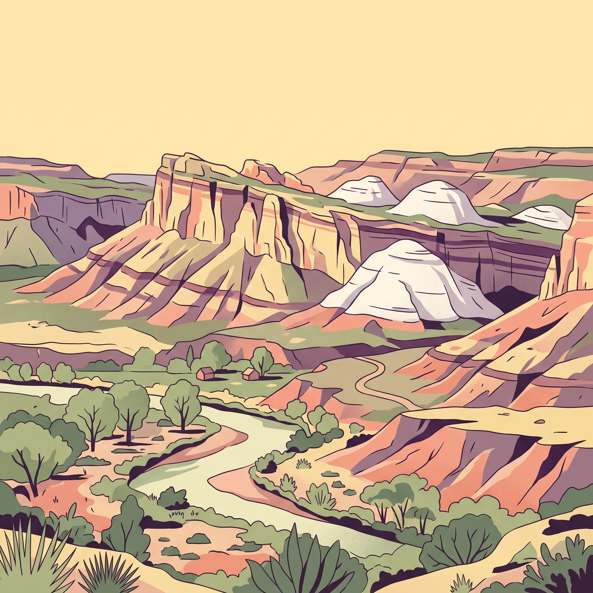
Targeted answers for exploring the Waterpocket Fold and desert terrain

Capitol Reef National Park Focused Guides and Expert Visitor Insights

Selected readings provide focused answers to key questions about navigating the remote desert terrain of Capitol Reef National Park. Published topics examine seasonal timing considerations and weather patterns across the Waterpocket Fold.
Monthly climate preview

Long-term monthly precipitation patterns and temperature trends across Utah desert terrain

Monthly Climate Normals and Average Temperatures for Capitol Reef National Park

Representative climate data from 1991 to 2020 show mean monthly temperatures ranging from minus 1.8 degrees Celsius in winter up to 23.8 degrees Celsius during peak summer periods. Exploring the complete monthly profile provides essential context on dry precipitation cycles and severe temperature swings within the protected Utah landscape.
Annual mean10 °C
-2 °C24 °C
Jan-2°
Feb
Mar
Apr
May14°
Jun20°
Jul24°
Aug22°
Sep17°
Oct10°
Nov
Dec-2°
Warmest month
July

23.8 °C

Coolest month
December

-1.9 °C

Wettest month
August

1 mm/day

Driest month
June

0.3 mm/day

Park location guide

Geography guide, regional context, and park location map for Capitol Reef National Park

Capitol Reef National Park park geography, regions, and map view in United States of America

Understand where Capitol Reef National Park sits in United States of America through a broader geographic reading of the surrounding landscape, nearby location context, and its mapped position within the national park landscape.

How Capitol Reef National Park fits into United States of America

The United States of America is a federal presidential republic and one of the world's largest countries by area and population. It consists of 50 states across a vast territory spanning multiple time zones, with its capital in Washington, D.C. and largest city in New York City. The nation has a diverse economy, influential political system, and significant cultural and military presence globally.

Wider geography shaping Capitol Reef National Park in United States of America

The United States occupies a vast territory in North America, bordered by Canada to the north and Mexico to the south. The 48 contiguous states stretch from the Atlantic to the Pacific Ocean, while Alaska occupies the northwestern region and Hawaii is an archipelago in the Pacific. The country encompasses diverse terrain including the Rocky Mountains, Appalachian Mountains, Great Plains, and extensive river systems.

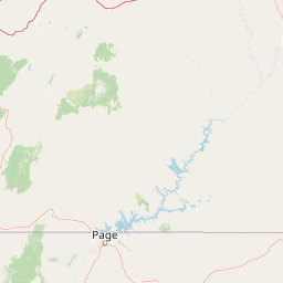
Map view of Capitol Reef National Park

Use this park location map to pinpoint Capitol Reef National Park in United States of America, understand its exact geographic position, and read its mapped placement within the surrounding landscape more clearly.

Pigeon | © OpenStreetMap contributors

Location context for Capitol Reef National Park

Utah
Natural feature types

Explore the Named Natural Features and Geological Landmarks of Capitol Reef National Park

Deepen your understanding of the terrain by examining the diverse natural landmarks mapped across the Capitol Reef region. This index provides a structured way to identify the unique geological formations and canyon landscapes that define this part of the Colorado Plateau, curated by MoriAtlas.
Recorded earthquake history

Explore the Historical Earthquake Catalogue for Capitol Reef National Park

Review documented seismic events associated with the region surrounding Capitol Reef National Park. This MoriAtlas resource allows for a clear examination of historical magnitude and depth data without speculative hazard analysis or future prediction.

Capitol Reef National Park Earthquake History

Catalogued events

48 events

Strongest magnitude

Magnitude 5.2

Most recent event

Mar 10, 2026

This history includes earthquakes recorded inside the park or within 50 km of its borders

Park atlas

Compare contiguous protected areas and map the unique geological formations defining Utah's desert region, extending beyond Capitol Reef National Park.

Discover Nearby National Parks and Protected Areas Beyond Capitol Reef National Park's Monocline Landscapes

Browse an extensive atlas of national parks and protected areas, revealing diverse desert landscapes and remarkable geological formations across the Colorado Plateau and surrounding regions near Capitol Reef National Park. Use this geographic comparison to trace regional park patterns, understand connected conservation efforts, and discover the broader protected land context within Utah and the American Southwest.
Protected landscapeUnited States of America
Park boundaries overlap#1 closest

South

Glen Canyon National Recreation Area: Protected Landscape and High Desert Geography Map

Colorado Plateau canyons, sandstone strata, and reservoir environments

Explore the geological architecture of Glen Canyon National Recreation Area, a vast federal protected landscape. The area showcases towering Navajo Sandstone cliffs, deep blue reservoir arms, and remote backcountry canyons that exemplify the distinct high desert terrain of the Colorado Plateau in the United States.

Area
5,075.23 km²
Established
1972
Visitors
5.2M annual
Relief
Upland
Protected landscapeUtah
45 km away#2 closest

North

Manti, La Sal National Forest: Geographic Overview of Utah's Mountain and Canyon Landscapes

Mapped protected forest boundaries across the Colorado Plateau

Spanning over one million acres, Manti, La Sal National Forest defines a critical segment of Utah geography. This protected landscape encompasses diverse terrain including subalpine mountains, aspen-rich uplands, and deep canyon networks. Use this atlas to examine the distinct environmental characteristics that separate the northern forested plateaus from the southern wilderness canyons.

Area
5,143.09 km²
Established
1950
IUCN
V
Visitors
900K annual
National parkUtah
78 km away#3 closest

East

Canyonlands National Park: A Mapped Protected Landscape in Utah's Geography

Explore its vast geography and protected area boundaries.

Canyonlands National Park stands as a significant protected entity within the state of Utah, characterized by its immense scale and dramatic geological formations. This page facilitates an atlas-style exploration of its terrain, emphasizing its mapped boundaries and its crucial role as a protected landscape. Gain a deeper appreciation for its unique geographic setting and its place within the broader regional context.

Area
1,366.21 km²
Established
1964
IUCN
II
Visitors
818.5K annual
National parkUtah
86 km away#4 closest

Southwest

Bryce Canyon National Park: Utah's Mapped Protected Landscape and Geographic Context

Explore the unique geology and protected boundaries of Bryce Canyon National Park.

Bryce Canyon National Park offers a distinct protected landscape within the geography of Utah, characterized by its unique geological formations. This entry provides essential context for understanding its mapped boundaries and natural terrain, serving as a vital component for atlas-based discovery of protected areas. Investigate the specific geographic setting and conservation significance of this iconic national park.

Area
145.02 km²
Established
1928
IUCN
II
Visitors
2.5M annual
National parkArizona
102 km away#5 closest

South

Grand Canyon National Park: Arizona National Park Protected Landscape & Geography

Explore mapped boundaries and regional atlas context.

Grand Canyon National Park stands as a premier national park, showcasing a unique protected landscape within Arizona's diverse geography. This detailed entry focuses on the park's specific geographic identity, its mapped boundaries, and its significance within the regional atlas. Discover the contours of this protected area and its place in the natural terrain of the American Southwest.

Area
4,926.08 km²
Established
1919
IUCN
II
Visitors
4.9M annual
Protected landscapeArizona
129 km away#6 closest

Southwest

Kaibab National Forest: Protected Plateau Landscapes and Forested Geography in Arizona

High-elevation forest terrain bordering the Grand Canyon

Spanning over 1.6 million acres in Arizona, Kaibab National Forest is characterized by its split geographic configuration, with distinct sections flanking the North and South rims of the Grand Canyon. The terrain ranges from the high-altitude Kaibab Plateau to volcanic uplands near Williams, encompassing four designated wilderness areas and varied forest ecosystems that provide a critical buffer for the surrounding canyon country.

Area
6,500 km²
Established
1909
Relief
Mountain
Climate
Temperate
National parkUtah
133 km away#7 closest

Northeast

Arches National Park: Utah National Park Protected Landscape Exploration

Explore mapped terrain and geographic context.

Delve into the specifics of Arches National Park, a protected national park located in Utah. This atlas-focused entry provides detailed insight into the park's protected landscape features and geographic distribution. Understand the mapped park boundaries and the unique natural terrain that shapes this significant conservation area within the United States' broader regional geography.

Area
310.31 km²
Established
1971
IUCN
II
Visitors
1.5M annual
Wildlife reserveUtah
About 147 km away#8 closest

North

Mount Nebo Wilderness: Protected Alpine Ridges and Canyons of the Southern Wasatch Range

Exploring the high-elevation terrain and geological diversity of central Utah

Mount Nebo Wilderness offers a detailed look at the southern terminus of the Wasatch Range, featuring high-altitude summits, subalpine forested corridors, and the iconic badland formations of the Devil's Kitchen. This protected area provides a critical geographic anchor for the region, overlooking Utah Valley and connecting to the wider desert landscapes of the Great Basin through a series of rugged mountain canyons and high-elevation ridgelines.

Relief
Mountain
Climate
Alpine
Access
Moderate access
Scope
Terrestrial

Common questions about visiting, size, designation, and location context for Capitol Reef National Park

Capitol Reef National Park FAQs for park facts, access, geography, and protected area context

Find quick answers about Capitol Reef National Park, including protected-area facts, park geography, trail and visitor context, and how the park fits into its surrounding country and regional landscape.
MoriAtlas Explorer

Continue Your Protected Areas Search Across the Global Atlas

Deepen your exploration by continuing the structured search for national parks and protected areas worldwide. Utilize the comprehensive filtering capabilities to compare different conservation landscapes and refine your understanding of global park geography. Discover more about the distribution and characteristics of protected natural areas.

Global natural geography