Mori Atlas logo
Nature reserveChangqing Nature Reserve

Examining the vertical forest landscape and protected biodiversity corridors in central China

Changqing Nature Reserve: A Detailed Geographic Overview of Qinling Mountain Habitats

(Shaanxi Changqing National Nature Reserve)

Changqing Nature Reserve encompasses 300 square kilometers of rugged Qinling mountain terrain in southern Shaanxi Province. This protected area features a significant vertical habitat range that extends from river valleys up to high alpine peaks, forming a critical mosaic of bamboo forests and mixed woodland. As a cornerstone of regional conservation, the reserve supports a complex ecosystem that links riverine corridors with dense mountain slopes.

giant panda habitatQinling Mountainscrested ibisgolden snub-nosed monkeytakintemperate forest

Changqing Nature Reserve

Nature reserve

Park overview

Structured park overview, official facts, and landscape profile for Changqing Nature Reserve

Changqing Nature Reserve park facts, protected area profile, and essential visitor context

Review the core facts for Changqing Nature Reserve, including designation, size, terrain, visitor scale, habitats, and operating context in one park-focused overview.

About Changqing Nature Reserve

Changqing Nature Reserve is a national-level protected area in the Qinling Mountains of southern Shaanxi, China, anchoring an important corridor of mid-elevation mountain forest between the better-known panda reserves to the west and other Qinling habitat further east. Positioned around the town of Huayang in Yang County, the reserve extends across roughly 300 square kilometers of steep ridges, river valleys, and mixed forest. Its name, Changqing, translates to mean everlasting green, reflecting the lush forested character of the terrain it protects.

The reserve's elevation profile climbs to over 3,000 meters, producing a layered landscape of lower-elevation broadleaf forest, mid-elevation mixed forests with bamboo understory that sustain giant pandas, and higher subalpine zones. River corridors and ravines cut through the reserve, creating varied microhabitats that support an unusually broad range of large mammals and birds for a single Chinese protected area.

Beyond its ecological role, Changqing is significant because of its institutional profile. It was established in 1995, and in 2014 it became one of the first protected areas in the world to be added to the IUCN Green List of well-managed conservation sites. The reserve sits within a region, the Qinling Mountains, that has long been recognized as a biogeographic divide between northern and southern China, and Changqing contributes substantially to maintaining the integrity of that natural corridor.

Quick facts and research context for Changqing Nature Reserve

Changqing Nature Reserve lies in the Qinling Mountains of southern Shaanxi Province, in Yang County of Hanzhong City, roughly 300 kilometers south of Xi'an. It was established in 1995 as a national-level nature reserve in China and is classified as an IUCN Category V protected landscape.

The reserve covers about 300 square kilometers, with terrain rising to a maximum elevation of 3,071 meters. It protects Qinling Mountain ecosystems that support giant pandas, crested ibises, golden snub-nosed monkeys, takin, and a reported 31 species of endangered plants, and it was among the first areas worldwide to be listed on the IUCN Green List in 2014.

Protection and recognition

Terrestrial conservation framework and official designation history for Changqing Nature Reserve

Changqing Nature Reserve Protection Status and Designated Area Facts

Changqing Nature Reserve maintains a documented terrestrial protection scope and structured conservation classification within its regional landscape. Official administrative records outline the governance framework and international recognition parameters associated with this protected natural habitat.

Protection details

Protection scope
Terrestrial
Transboundary protection
No
Park context

Deeper park guide and search-rich context for Changqing Nature Reserve

Changqing Nature Reserve history, landscape, wildlife, and travel context

Explore Changqing Nature Reserve through its history, landscape character, ecosystems, wildlife, conservation priorities, cultural context, and seasonal travel timing in a structured park guide built for atlas discovery and search intent.

Why Changqing Nature Reserve stands out

Changqing is renowned for being a key habitat in the Qinling Mountains for the giant panda, and it stands out as one of the few protected areas where the crested ibis, golden snub-nosed monkey, and takin are all found within the same landscape. It gained particular fame in 2018 when an adult brown giant panda was documented in the reserve, the ninth such individual ever recorded in the Qinling range. The reserve is also noted for its role as one of the world's most significant panda habitats, with research suggesting it has historically supported very large panda populations. Its combination of conservation outcomes and recognized management quality places it among the best-known biodiversity reserves in central China.

Changqing Nature Reserve history and protected-area timeline

Changqing Nature Reserve was formally established in 1995 as a national-level nature reserve under China's protected-area system, formalizing protection for a portion of the southern Qinling Mountains that had long supported populations of giant pandas and other endangered wildlife.

Beyond its ecological history, the landscape around the reserve carries deeper cultural layers. The nearby town of Huayang sits in a corridor associated with the Battle of Xingshi, a 244 CE engagement of the Three Kingdoms period in which the Cao Wei state attempted and failed to invade the neighboring Shu Han territory. The surrounding terrain has therefore been part of both a natural heritage landscape and a historical frontier zone for many centuries.

The reserve gained further recognition in March 2014 after a wild giant panda was found unwell in a river channel near the historic old town of Huayang and was taken in by the Shaanxi Rare Wildlife Rescue and Breeding Research Center for treatment. The reserve also drew scientific attention in March 2018 when an adult brown giant panda was documented, the first in 26 years and the ninth such individual ever recorded in the Qinling range. In 2014, at the IUCN World Parks Congress in Sydney, Changqing was included in the inaugural IUCN Green List of well-managed protected areas, marking international recognition of its management approach.

Changqing Nature Reserve landscape and geographic character

Changqing occupies a rugged section of the southern Qinling Mountains, with terrain that rises from forested river valleys through steep slopes to ridgelines and alpine peaks. The reserve's highest point reaches 3,071 meters, creating a pronounced vertical range of habitats within a relatively compact area, and the landscape is incised by mountain streams and ravines that drain into the broader Han River system.

The lower elevations of the reserve are dominated by broadleaf and mixed forests that give the area its evergreen character, giving way at mid-elevations to dense mixed stands featuring bamboo understory that is critical for giant panda foraging. Above the bamboo zone, the slopes transition into cooler coniferous and subalpine vegetation, giving the reserve a layered, habitat-rich topography.

The town of Huayang lies along one of the main valley corridors and serves as a gateway into the reserve. Streams running through and around this corridor have created the riverine environments that have occasionally drawn giant pandas out of the higher forest into the lower elevations, including the 2014 and 2018 wildlife encounters that drew public attention to the area.

Changqing Nature Reserve ecosystems, habitats, and plant life

The ecosystems of Changqing span the full ecological gradient of the southern Qinling, from warm-temperate broadleaf forests along the lower valleys to cold-temperate coniferous forests and subalpine vegetation near the highest ridges. This vertical layering creates a rich mosaic of vegetation types within a relatively small area, supporting both temperate East Asian forest species and more cold-adapted high-elevation communities.

Bamboo-rich middle slopes are a defining ecological feature of the reserve, providing the essential food resource that sustains the area's giant panda population and shaping the broader forest community around it. The understory of these mid-elevation forests also supports the complex of rare plants for which the reserve is noted, including a reported 31 endangered plant species.

Water features, including mountain streams and ravines fed by snowmelt and rainfall, intersect the forest zones and add a riparian ecological element to the reserve. The combination of forest types, altitudinal zones, and water features produces a habitat mosaic that has been recognized as one of the most ecologically significant panda landscapes in the world.

Changqing Nature Reserve wildlife and species highlights

Changqing is exceptional among Chinese nature reserves for the breadth and significance of its large mammal and bird fauna. It is one of the few areas where the giant panda, the crested ibis, the golden snub-nosed monkey, and the takin all occur within a single protected landscape, drawing together four of China's most important conservation flagship species.

The giant panda is the reserve's most prominent resident, with research suggesting that Changqing has historically been one of the world's largest panda habitats. The reserve is also notable for occasional sightings of brown giant pandas, a rare color variant known almost exclusively from the Qinling Mountains, which highlights the area's unique role in panda conservation.

Golden snub-nosed monkeys inhabit the higher forested ridges and bamboo forests, where their dependence on cool, humid forests makes the reserve's elevation profile especially relevant. Takin, large mountain ungulates that depend on steep, forested terrain, move through the same altitudinal mosaic. The crested ibis, once considered one of the world's rarest birds, has become an important presence in the reserve, reflecting the broader recovery of populations in the surrounding Yang County region and reinforcing Changqing's role in restoring a species that had retreated to the very edges of this part of the Qinling.

Changqing Nature Reserve conservation status and protection priorities

Changqing's conservation significance lies in the package of species it protects and the integrity of the habitat that supports them. As a national-level nature reserve established in 1995, it anchors a large block of protected Qinling forest that helps maintain wildlife corridors between other panda and golden snub-nosed monkey habitats in the range.

The reserve's recognition on the IUCN Green List in 2014, as part of the inaugural group of well-managed protected areas, reflects international acknowledgment of its management standards and outcomes. This recognition places Changqing among an elite group of global sites identified for both biodiversity values and effective governance.

The reserve has also served as a living conservation laboratory. The 2014 rescue of a sick wild panda near Huayang provided insights into the threats facing the local panda population, including nutritional stress, disease, and habitat limitations, while the 2018 documentation of a brown panda offered one of the few opportunities to study this rare variant in the wild. Together with protection for the crested ibis and other endangered species, these experiences reinforce the reserve's importance for species-level conservation as well as landscape-level protection.

Changqing Nature Reserve cultural meaning and human context

The region around Changqing Nature Reserve carries a layered cultural history that extends well beyond its modern conservation role. The area lies along historical routes connecting the Han River basin with the heart of the ancient Qinling frontier, and the nearby town of Huayang has been part of this corridor for centuries.

Most strikingly, the landscape of the reserve sits adjacent to the site of the Battle of Xingshi, a 244 CE conflict of the Three Kingdoms period in which Cao Wei forces attempted a failed invasion of Shu Han territory. The terrain through which the reserve's rivers now flow was therefore a contested military frontier nearly 1,800 years ago, and the historical and natural landscapes of the area effectively overlap.

At a more local level, communities in Yang County and around Huayang have long coexisted with the wildlife of the Qinling, including the cranes and ibises that once neared extinction and have since been associated with the region's cultural revival and conservation identity.

Top sights and standout views in Changqing Nature Reserve

Changqing's strongest qualities are its combination of flagship species and ecological depth within a single Qinling landscape. Few reserves in the world bring together the giant panda, golden snub-nosed monkey, takin, and crested ibis in a contiguous protected area, giving Changqing an unusually well-rounded conservation profile.

Its vertical habitat range, extending from river valleys to peaks above 3,000 meters, supports an unusually complete mosaic of Qinling forest types, including the bamboo-rich middle slopes that sustain pandas. The reserve's recognition on the inaugural IUCN Green List in 2014 and its role in recording rare brown pandas add institutional and scientific distinction to its biodiversity value.

Best time to visit Changqing Nature Reserve

The Qinling Mountains around Changqing have a temperate, four-season climate, and the character of the landscape shifts meaningfully through the year. Spring and early summer bring fresh green growth across the forests and are often considered a particularly attractive time to experience the reserve's vegetation at its most lush, while autumn brings cooler temperatures and shifting forest colors across the mid-elevation slopes.

Winter brings snow to higher elevations and can produce quieter, more austere conditions in the upper parts of the reserve, although access and weather can be more challenging. Wildlife observation, particularly for active species such as giant pandas and golden snub-nosed monkeys, is generally associated with the milder months, while each season offers a distinct character of the landscape itself. Visitors should note that the reserve's principal values are ecological rather than tourism-oriented, and any visit should be planned around conservation considerations.
Monthly climate preview

Long-term temperature ranges and monthly precipitation averages for Changqing Nature Reserve

Changqing Nature Reserve Climate Normals and Annual Weather Patterns

Historical climate data from 1991 to 2000 reveals significant variation in average temperatures and monthly precipitation levels across Changqing Nature Reserve. Examining the complete twelve-month profile provides a clearer understanding of long-term environmental conditions at this protected coordinate.
Annual mean11 °C
-1 °C23 °C
Jan-1°
Feb
Mar
Apr12°
May17°
Jun21°
Jul23°
Aug22°
Sep17°
Oct11°
Nov
Dec
Warmest month
July

22.8 °C

Coolest month
January

-1.3 °C

Wettest month
July

5 mm/day

Driest month
December

0.2 mm/day

Park location guide

Geography guide, regional context, and park location map for Changqing Nature Reserve

Changqing Nature Reserve park geography, regions, and map view in China

Understand where Changqing Nature Reserve sits in China through a broader geographic reading of the surrounding landscape, nearby location context, and its mapped position within the national park landscape.

How Changqing Nature Reserve fits into China

China is a unitary communist state in East Asia, governed by the Chinese Communist Party. The country's capital is Beijing, while Shanghai is the largest city by urban population. China has 33 province-level divisions including provinces, autonomous regions, municipalities, and special administrative regions. The nation has a long history spanning thousands of years, with achievements including the invention of gunpowder, paper, printing, and the compass.

Wider geography shaping Changqing Nature Reserve in China

China is located in East Asia, bordering fourteen countries: Russia, North Korea, Vietnam, Laos, Myanmar, India, Bhutan, Nepal, Pakistan, Afghanistan, Tajikistan, Kyrgyzstan, Kazakhstan, and Mongolia. The country spans diverse terrain including deserts, mountains, plateaus, and river valleys. Major river systems include the Yellow River and Yangtze River. The coastline stretches along the East China Sea, South China Sea, and Yellow Sea.

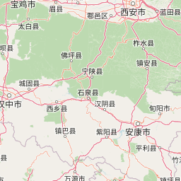
Map view of Changqing Nature Reserve

Use this park location map to pinpoint Changqing Nature Reserve in China, understand its exact geographic position, and read its mapped placement within the surrounding landscape more clearly.

Pigeon | © OpenStreetMap contributors
Park atlas

Compare adjacent mountain reserves and regional forest habitats in the Qinling range

Explore Other Parks Near Changqing Nature Reserve and Surrounding Protected Areas

Browse protected areas and mountain habitats adjacent to Changqing Nature Reserve to analyze regional ecological continuity. Expanding the geographic comparison reveals broader conservation patterns across the surrounding watershed and forested mountain ranges.
National parkChina
Mapped location lies within the park boundary#1 closest

Southwest

Giant Panda National Park: China's Premier Panda Habitat and Protected Landscape

Mapped terrain and conservation significance in the mountains of western China.

Giant Panda National Park is a critically important protected area in China, established to conserve the primary habitat for the giant panda. This national park, spanning a vast mountainous region across Sichuan, Gansu, and Shaanxi, integrates numerous former reserves into a unified landscape. It serves as a vital sanctuary, protecting approximately 80 percent of the world's wild panda population and offering deep insights into the geographic distribution and ecological requirements of these endangered animals.

Area
27,134 km²
Established
2020
IUCN
II
Relief
Mountain
A horizontal watercolor illustration depicting a soft, rolling landscape with green fields, a winding stream, a line of trees, and distant hills against a plain background.
National parkSichuan
About 334 km away#2 closest

West

Jiuzhaigou National Park: Mapped Geography and Protected Area Overview in Sichuan, China

Travertine terrace systems and high mountain forest landscapes

Located on the edge of the Qinghai-Tibet Plateau, Jiuzhaigou is a protected landscape characterized by a network of clear alpine lakes known as haizi and extensive coniferous forest blocks. The park showcases a rare interplay of water and mineral-rich rock, creating expansive travertine dams and cascading waterfalls across its three main gullies. This atlas entry focuses on the regional geography, habitat distribution, and natural terrain that constitute the essential character of this prominent conservation area within the Min Mountains.

Area
720 km²
Established
1978
Relief
Mountain
Climate
Alpine
A soft, watercolor painting of a terraced landscape with shallow pools, grassy slopes, and distant tree-lined hills.
Protected areaSichuan
About 338 km away#3 closest

West

Huanglong Scenic and Historic Interest Area: Protected Alpine Landscapes and Travertine Map

High-altitude karst geography in the Minshan Mountains of Sichuan

Huanglong Scenic and Historic Interest Area presents a unique geological profile centered on a long valley of stepped travertine pools that cascade through alpine forests and meadows. This protected area offers a distinct look at the high-mountain geography of Sichuan, providing a clear view of how mineral-rich springs, deep canyons, and glaciated summits create a layered and ecologically significant environment for rare wildlife.

Area
600 km²
Established
1992
Nature reserveSichuan
About 483 km away#4 closest

Southwest

Wolong National Nature Reserve: Mapping Sichuan's Rugged Mountain Protected Lands

A critical mountain nature reserve in the Qionglai range.

Delve into the geography of Wolong National Nature Reserve, a cornerstone of China's protected areas. This site offers insight into the vertical ecology of the eastern Qionglai Mountains, where steep river valleys and extensive bamboo forests characterize the transition toward the Tibetan Plateau. Access map-based insights into this essential wildlife corridor and its role in the larger regional landscape.

Area
2,000 km²
Established
1963
Relief
Mountain
Climate
Alpine
Protected areaHunan
About 541 km away#5 closest

Southeast

Wulingyuan Scenic and Historic Interest Area: Quartz-Sandstone Peak Forest and Protected Geography

Explore the tectonic landscape and forest-covered plateau in Hunan Province.

Wulingyuan Scenic and Historic Interest Area represents a massive protected landscape in Hunan, China, defined by its extraordinary density of quartz-sandstone pillars. This atlas record documents the geological signature of these vertical rock formations, the surrounding gorge networks, and the high-canopy forest environment that characterizes this significant regional landform.

Area
264 km²
Established
1982
Relief
Mountain
Climate
Subtropical
Protected landscapeHenan
About 562 km away#6 closest

East

郑州黄河风景名胜区: Geographic Profile of a Henan Protected Landscape

Mapping the confluence of the Yellow River and Mang Mountain

The 郑州黄河风景名胜区 is a prominent protected landscape in Henan that highlights the dynamic geography of the Yellow River basin. Characterized by the transition between loess highlands and river floodplains, this area offers an essential study of how terrain and water define regional boundaries. Users can examine the specific topographical features, including Wulong Peak and the river-facing ridges, that distinguish this site within the broader Central China atlas.

Area
20 km²
Established
1981
Relief
Upland
Climate
Temperate
National parkQinghai
About 669 km away#7 closest

West

Sanjiangyuan National Park: Qinghai's High-Altitude Headwater Protected Landscape

Mapped geography of the Yellow, Yangtze, and Mekong river sources.

Sanjiangyuan National Park, situated in the high-altitude Qinghai region of China, is a crucial protected area established to safeguard the headwaters of three of Asia's most significant rivers: the Yellow, Yangtze, and Mekong. Covering an immense area with an average elevation exceeding 4,700 meters, the park preserves vital alpine wetlands, grasslands, and the source ecosystems that sustain hundreds of millions downstream. Its protected landscape identity is defined by its extreme elevation, vast marshlands, and its role as a critical water source, offering unparalleled opportunities for geographic and atlas-style exploration of pristine high-altitude terrain.

Area
190,700 km²
Established
2021
IUCN
II
Relief
Highland
Nature reserveZhaotong
About 808 km away#8 closest

Southwest

Dashanbao Black-necked Crane National Nature Reserve Geographic and Atlas Overview

Protected highland wetlands within the Zhaotong regional geography.

Dashanbao Black-necked Crane National Nature Reserve is a nationally significant protected area in Zhaotong, representing a rare high-elevation wintering habitat for migratory cranes. This rugged plateau landscape features shallow marshlands, alpine grasslands, and an interconnected system of lakes that support delicate highland ecological zones. Use this atlas resource to understand the park terrain and its formal conservation boundaries within the broader context of northeast Yunnan.

Area
192 km²
Established
1990
Relief
Mountain
Climate
Subtropical

Common questions about visiting, size, designation, and location context for Changqing Nature Reserve

Changqing Nature Reserve FAQs for park facts, access, geography, and protected area context

Find quick answers about Changqing Nature Reserve, including protected-area facts, park geography, trail and visitor context, and how the park fits into its surrounding country and regional landscape.
MoriAtlas Explorer

Continue Your Protected Areas Search Across the Global Atlas

Deepen your exploration by continuing the structured search for national parks and protected areas worldwide. Utilize the comprehensive filtering capabilities to compare different conservation landscapes and refine your understanding of global park geography. Discover more about the distribution and characteristics of protected natural areas.

Global natural geography