
Mori Atlas logo
National parkCoiba National Park

Explore the mapped boundaries, tropical island terrain, and extensive coral reef systems of this critical Panamanian protected area

Coiba National Park: A Comprehensive Geographic Atlas of Panama's Most Significant Marine and Terrestrial Protected Landscape

(Parque Nacional Coiba)

Coiba National Park stands as a major protected region off the Pacific coast of Panama, encompassing the largest island in Central America and an expansive surrounding marine territory in the Gulf of Chiriquí. This geographic dataset highlights the diversity of the park, from its dense tropical lowland forests and ancient timber stands to its complex network of mangrove-fringed coastlines, rocky islets, and offshore coral reefs. The protected system serves as an essential refuge for rare endemic subspecies and diverse marine life sheltered within the stable conditions of the gulf.

Pacific islandtropical forestcoral reefsmarine protected areaUNESCO World Heritage Siteisland biogeography

Coiba National Park

National park

Park overview

Structured park overview, official facts, and landscape profile for Coiba National Park

Coiba National Park park facts, protected area profile, and essential visitor context

Review the core facts for Coiba National Park, including designation, size, terrain, visitor scale, habitats, and operating context in one park-focused overview.

About Coiba National Park

Coiba National Park is one of the cornerstones of Panama's natural heritage, anchoring the country's largest Pacific island and its surrounding seascape under a single integrated protection framework. Located in the Gulf of Chiriquí off the province of Veraguas, the park stretches from forested interior hillsides and mangrove edges on the main island out into open ocean, where submerged reefs and pelagic habitat extend the protected landscape far beyond any shoreline.

The main island of Coiba is the largest in Central America, and its sheer size gives the park a continental-scale sense of biodiversity even within a single island ecosystem. Forests cover much of the island, including large stands of ancient trees, and the relative absence of human disturbance, a result of the island's long use as a penal colony, has helped preserve habitats that have been heavily altered on the Panamanian mainland.

What sets Coiba apart ecologically is the combination of long-term geographic isolation and the protection of an unusually productive marine environment. Because Coiba separated from continental Panama thousands of years ago when sea levels rose after the last glacial period, its plants and animals evolved in relative independence. At the same time, the Gulf of Chiriquí's oceanographic conditions support highly diverse reefs and large-marine-fauna populations, making the park a meeting point of island biogeography and tropical marine ecology.

Together, these qualities make Coiba National Park a rare example of a protected area where terrestrial evolutionary processes and marine ecosystem richness are conserved side by side. Its recognition by UNESCO and BirdLife International reflects this dual importance.

Quick facts and research context for Coiba National Park

Coiba National Park lies in the Veraguas province of Panama, facing the Pacific Ocean in the Gulf of Chiriquí. It was created in 1992 and added to the UNESCO World Heritage List in 2005 under natural criteria ix and x.

The park protects Coiba, the largest island in Central America, together with roughly three dozen smaller islands and a major surrounding marine area that includes coral reefs, mangroves, and deep-water habitats. It has also been recognized as an Important Bird Area by BirdLife International.

Protection and recognition

Examine the designated protection scope, history, and management framework

Coiba National Park Protection Status and International Recognition Record

Coiba National Park holds a mixed protection scope established through designated historical records from 2005. Systematic conservation profiles track official management frameworks and international recognition standards across the protected landscape.

Protection details

Protection scope
Mixed
Designated year
2005
Transboundary protection
No
Park context

Deeper park guide and search-rich context for Coiba National Park

Coiba National Park history, landscape, wildlife, and travel context

Explore Coiba National Park through its history, landscape character, ecosystems, wildlife, conservation priorities, cultural context, and seasonal travel timing in a structured park guide built for atlas discovery and search intent.

Why Coiba National Park stands out

Coiba National Park is best known for the exceptional biological isolation of its main island, which has produced several endemic subspecies that exist nowhere else, most famously the Coiba Island howler monkey and the Coiba spinetail. The island's forests remain largely untouched, preserving ancient tree species that have vanished from the mainland. The park is equally renowned for its marine biodiversity. The Gulf of Chiriquí acts as a natural buffer against Pacific temperature swings, allowing coral reefs and pelagic species such as humpback whales, manta rays, sharks, sea turtles, and large pelagic fish to thrive within park boundaries.
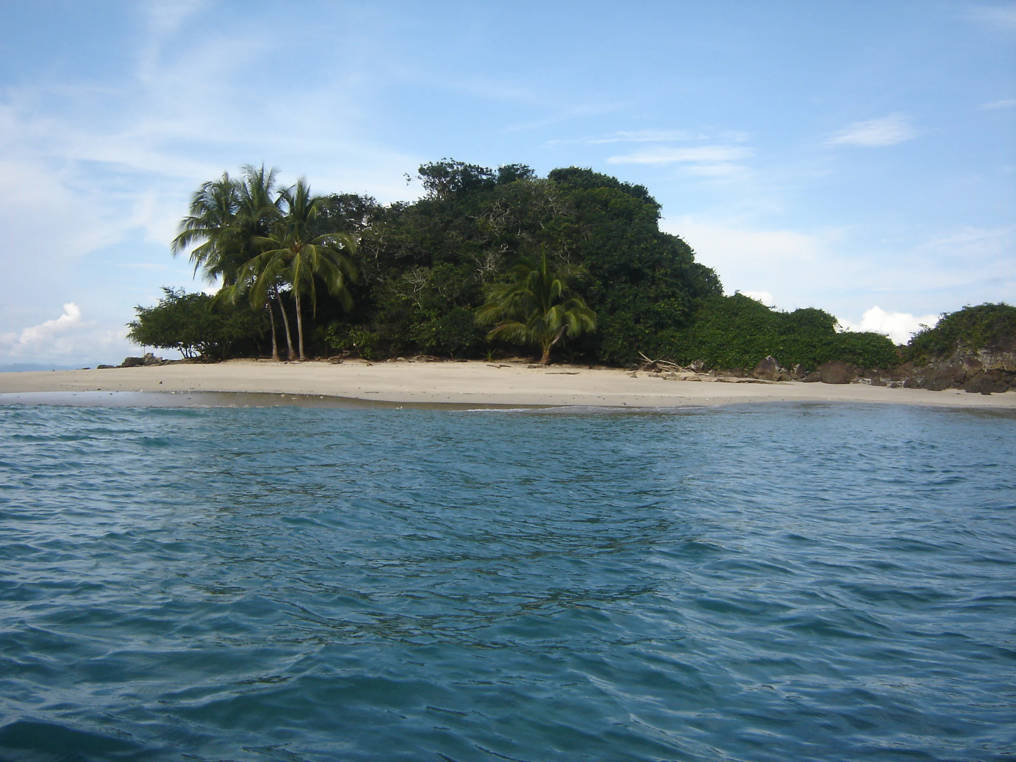
Coiba National Park history and protected-area timeline

The natural history of Coiba begins long before any human presence on the island. Coiba separated from the Panamanian mainland between roughly 12,000 and 18,000 years ago, when rising sea levels at the end of the last ice age cut it off from the continent. The plants and animals that remained on the new island evolved in isolation, and over many generations most species diverged from their mainland relatives, producing the suite of endemic subspecies the park is known for today.

The modern human history of Coiba is dominated by its long use as a place of punishment and confinement. A penal colony was established on the island in 1919, and during the periods of military rule under Omar Torrijos and Manuel Noriega, the Coiba prison developed a fearsome reputation for harsh conditions, torture, executions, and political killings. Historians estimate that as many as around 300 people may have died there during those decades. Because the island was associated with the prison, it was largely avoided by local populations and remained essentially undeveloped outside the penal settlement.

The closure of the prison in 2004 marked a turning point. Freed from its grim association and protected by its lack of development, the island's largely undisturbed forests and waters became the foundation of a major conservation initiative. Panama had already designated the area as Coiba National Park in 1992, but the post-2004 transition allowed the reserve to take on a stronger research and protection role. In 2005, UNESCO inscribed Coiba National Park and its Special Zone of Marine Protection on the World Heritage List, recognizing both its terrestrial and marine values.

Local tradition keeps some of the darker chapters of the island's prison era alive in folklore, including stories of hauntings around the old penal buildings, which remain a part of Coiba's cultural memory alongside its ecological identity.

Coiba National Park landscape and geographic character

Coiba's landscape is dominated by the bulk of the main island, which is the largest in Central America and covers a substantial part of the park. The interior rises into forested hills, with much of the island still cloaked in tropical forest, including a large proportion of ancient, relatively untouched stands. The coastlines of Coiba and its smaller islands alternate between long sandy beaches, rugged rocky shores, and stretches edged by mangroves.

Surrounding the islands, the Gulf of Chiriquí defines the park's marine landscape. Submerged coral reefs, seagrass beds, and deep pelagic waters give the protected seascape remarkable depth and variety. The buffer provided by the gulf's oceanography makes the marine environment unusually stable for the eastern Pacific, allowing reef systems to persist in conditions that would stress reefs elsewhere in the region.

The archipelago includes dozens of smaller islands and islets scattered across the protected area, each adding its own microhabitat of beaches, rocky outcrops, and reef-fringed shorelines. Together, the combination of forested island interiors, mangrove margins, sandy beaches, and offshore reefs creates a layered landscape where terrestrial and marine scenery are tightly connected.

Coiba National Park ecosystems, habitats, and plant life

Ecologically, Coiba National Park represents a fusion of island biogeography and tropical marine ecosystem protection. Because the main island was cut off from the mainland thousands of years ago, its forests host a community of plants and animals that have evolved apart from their continental relatives. Several endemic subspecies are tied specifically to Coiba, while the island's forests also preserve tree species that have disappeared from mainland Panama because of deforestation and overharvesting.

The marine ecosystems protected within the park are equally distinctive. The Gulf of Chiriquí's physical conditions buffer the area against the temperature swings of El Niño events, which often damage coral reefs elsewhere in the eastern Pacific. This stability supports thriving coral reef systems and an unusually diverse community of reef-associated and pelagic species.

Mangroves fringe parts of the coastline, linking the terrestrial forests to the sea and providing critical habitat for fish, invertebrates, and shorebirds. These mangrove systems, along with seagrass beds and reef structures, together form a connected coastal habitat mosaic that supports much of the park's marine productivity.

Coiba National Park wildlife and species highlights

Wildlife is at the heart of Coiba National Park's identity. On land, the forests shelter several endemic subspecies, most notably the Coiba Island howler monkey and the Coiba spinetail, both of which have evolved in isolation on the island. Coiba is also one of the last strongholds in Central America where the scarlet macaw can still be found in significant wild numbers, and the island's relatively undisturbed forest allows many forest-dwelling birds and mammals to persist at densities rare on the mainland.

The park has been recognized as an Important Bird Area by BirdLife International because it supports important populations of brown-backed doves, Coiba spinetails, and three-wattled bellbirds, among other species. Birdwatchers and researchers value Coiba for the combination of island-endemic forms and wider Neotropical birdlife that can occur within the same forest.

In the surrounding waters, the wildlife profile is equally striking. The park's marine zone is home to a large community of marine fishes, sharks, sea turtles, manta rays, dolphins, and cetaceans including humpback whales, pilot whales, and killer whales. Pelagic species such as marlin and other large fish move through the gulf, taking advantage of the productive waters around the islands.

Coiba National Park conservation status and protection priorities

Coiba National Park stands out as a conservation success born from an unusual history. The island's long use as a penal colony had the unintended effect of keeping it largely undeveloped, so when Panama designated the area as a national park in 1992 and later added the surrounding marine zone, the ecosystems were already in a relatively intact state. The closure of the prison in 2004 cleared the way for a fuller conservation focus.

UNESCO World Heritage inscription in 2005 recognized two complementary values: the island's role as a laboratory of evolutionary processes, where isolation has produced unique endemic forms, and the marine area's role as a refuge for coral reefs and large marine fauna in a part of the Pacific where these ecosystems are otherwise under serious pressure. The park's protection of reefs buffered against El Niño impacts is particularly important for regional marine conservation.

Conservation efforts within the park also aim to safeguard tree species that have been wiped out on the mainland by deforestation and overexploitation, effectively giving Coiba a role as a living archive of Central American lowland forest biodiversity. The combined terrestrial and marine protection framework is one of the park's defining contributions to regional conservation.

Coiba National Park cultural meaning and human context

Coiba's cultural identity is inseparable from its decades as a penal colony. Between 1919 and 2004, the island functioned as a place of imprisonment, and under the military regimes of Omar Torrijos and Manuel Noriega it became associated with severe mistreatment, political killings, and hundreds of deaths. Locals largely avoided the island during this period, and it remained outside the orbit of ordinary settlement and economic development.

Today, folklore about the old prison and its alleged hauntings remains part of how Panamanians talk about Coiba, even as the island has shifted in public perception from a feared place of punishment to a celebrated natural reserve. The contrast between the island's prison-era reputation and its current image as a sanctuary for wildlife and ecosystems is a defining element of its cultural memory.

Top sights and standout views in Coiba National Park

Coiba National Park's strongest points of distinction lie in the unusual combination of an isolated, largely intact tropical island with a protected marine environment of exceptional diversity. The presence of endemic subspecies such as the Coiba Island howler monkey and the Coiba spinetail, alongside surviving populations of scarlet macaws, gives the park a unique place among Central American protected areas.

Its marine highlights are equally important. Coral reefs buffered from El Niño impacts, large populations of sharks and manta rays, and the seasonal presence of humpback whales and other cetaceans make the surrounding Gulf of Chiriquí one of the most rewarding marine protected areas on the Pacific coast of the Americas.

Best time to visit Coiba National Park

Because Coiba lies in the tropical Pacific, the park is broadly accessible year round, but the character of a visit can shift with the seasons. The dry season generally brings calmer seas, clearer skies, and excellent conditions for snorkeling, diving, and boat-based exploration around the islands and reefs, which is when underwater visibility and surface conditions tend to be most favorable.

In contrast, the wetter months bring lusher forest conditions and the arrival of migratory marine life such as humpback whales along the Pacific coast of Panama. Visitors interested in whale encounters and richly green forests often favor this period, while those focused on coral reef visibility and quieter weather generally prefer the drier part of the year. Avoiding the peak of any major storm periods supports smoother access to the more remote islands.
Monthly climate preview

Long term temperature and monthly precipitation statistics for Coiba National Park

Coiba National Park Climate Normals and Annual Weather Patterns

Historical measurements from NASA POWER record monthly temperature variation alongside shifting precipitation totals across the representative coordinate. Exploring the complete twelve month climate profile reveals full numerical breakdowns for temperature ranges and rainfall.
Annual mean28 °C
27 °C29 °C
Jan28°
Feb28°
Mar29°
Apr29°
May28°
Jun27°
Jul27°
Aug27°
Sep27°
Oct27°
Nov27°
Dec27°
Warmest month
March

28.9 °C

Coolest month
November

26.6 °C

Wettest month
September

12 mm/day

Driest month
February

0.7 mm/day

Park location guide

Geography guide, regional context, and park location map for Coiba National Park

Coiba National Park park geography, regions, and map view in Panama

Understand where Coiba National Park sits in Panama through a broader geographic reading of the surrounding landscape, nearby location context, and its mapped position within the national park landscape.

How Coiba National Park fits into Panama

Panama is a presidential republic located at the southern end of Central America in North America. It gained independence from Spain in 1821 and from Colombia in 1903, the latter enabling the construction of the Panama Canal under U.S. supervision between 1904 and 1914. The canal was transferred to Panamanian control in 1999 following the Torrijos-Carter Treaties. With a population of approximately 4.3 million and an area of about 75,400 km², Panama has a high-income economy driven primarily by canal tolls, banking, commerce, and tourism.

Wider geography shaping Coiba National Park in Panama

Panama is located at the southern end of the Central American isthmus, stretching from the Caribbean coast in the north to the Pacific coast in the south. The country shares land borders with Costa Rica to the west and Colombia to the southeast. The terrain consists of coastal plains, mountain ranges including the Cordillera Central and Cordillera de Talamanca, and river valleys. The Panama Canal bisects the country, connecting the Atlantic and Pacific Oceans.

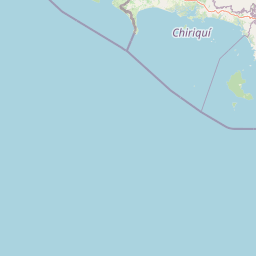
Map view of Coiba National Park

Use this park location map to pinpoint Coiba National Park in Panama, understand its exact geographic position, and read its mapped placement within the surrounding landscape more clearly.

Pigeon | © OpenStreetMap contributors

Location context for Coiba National Park

Veraguas Province
Park atlas

Compare surrounding protected landscapes and island marine environments

Exploring Parks Near Coiba National Park and Connected Regional Reserves

Browsing parks near Coiba National Park allows visitors to evaluate adjacent marine reserves and tropical forest sanctuaries across the region. Extending the geographic comparison reveals broader patterns in coastal conservation and isolated island biogeography.
National parkPanama
Mapped park locations coincide#1 closest

Coiba National Park: Mapped Geography and Protected Landscapes in Panama

Tropical forest interiors and expansive marine boundaries

Coiba National Park protects a significant expanse of tropical forest and marine habitat off the coast of Panama. Its landscape, characterized by mountainous terrain and surrounding reef systems, provides a critical environment for endemic subspecies and diverse marine life within the Pacific gulf.

IUCN
II
Marine protected areaPanama
About 90 km away#2 closest

Northwest

Gulf of Chiriquí National Marine Park: Panama's Protected Marine Landscape

Discover its mapped boundaries and regional geographic context.

The Gulf of Chiriquí National Marine Park is a crucial marine protected area located in Panama, offering unique insights into coastal and marine geography. This page provides detailed atlas-level information on its protected landscape, mapped extent, and conservation significance, essential for understanding its place within the region's natural geography and protected areas.

IUCN
II
National parkPanama
About 122 km away#3 closest

East

Cerro Hoya National Park: Panama's Protected Landscape with Mapped Geographic Detail

Explore the national park's mapped boundaries and regional atlas context.

Cerro Hoya National Park presents a unique opportunity for geographic discovery, focusing on its role as a protected landscape within Panama. This park detail page allows for an in-depth atlas-style exploration of its mapped boundaries and its contribution to the regional geography of Central America. Understand the protected-area identity and the natural context that defines this significant national park, providing valuable data for landscape analysis and map-based research.

Area
333.4 km²
Established
1984
IUCN
II
Relief
Mountain
Wildlife reserveChiriquí Province
About 142 km away#4 closest

North

Fortuna Forest Reserve: Protected Mountain Landscapes and Volcanic Terrain in Chiriqui Province

A critical wildlife reserve and biodiversity center in the Panamanian highlands

Situated in the rugged mountains of western Panama, Fortuna Forest Reserve offers an expansive view of high-elevation cloud forests and steep watersheds. This wildlife reserve is defined by its extreme endemic species concentration and specialized volcanic soils, serving as a primary research site for tropical mountain ecosystem studies. Its boundaries integrate dense forest cover with operational hydroelectric energy systems within the broader Chiriqui Province landscape.

Area
206.54 km²
Established
1976
IUCN
VI
Relief
Mountain
National parkHerrera Province
About 157 km away#5 closest

Northeast

Sarigua National Park: A Protected National Park Landscape in Herrera Province

Explore mapped boundaries and regional geographic context.

Sarigua National Park represents a significant protected area within Herrera Province, Panama. This page details its identity as a national park, emphasizing its mapped geography and the regional context it inhabits. Users seeking to understand the specific protected landscape, its boundaries, and its place within the broader atlas of natural areas will find comprehensive discovery-oriented content.

IUCN
II
Relief
Lowland
Climate
Tropical
Access
Access unknown
National parkPanama
About 182 km away#6 closest

Northeast

Omar Torrijos "El Cope" National Park: Mapped Boundaries and Protected Landscape in Panama

Explore the geographic setting and natural terrain of this Panamanian national park.

Omar Torrijos "El Cope" National Park is a designated protected area offering rich opportunities for geographic discovery. Users can explore its mapped boundaries, understand its place within Panama's natural landscapes, and gain insight into the park's regional geographic context. This page provides a structured atlas-style view, highlighting the park's identity as a significant protected landform within Central America.

IUCN
II
Scope
Terrestrial
Wildlife reserveLos Santos Province
About 198 km away#7 closest

East

Isla Iguana Wildlife Refuge: A Protected Island and Coral Reef Sanctuary in Los Santos Province

Mapping the terrestrial and marine boundaries of a key Panamanian wildlife refuge.

Isla Iguana Wildlife Refuge encompasses a unique blend of tropical dry forest and expansive coral reef systems. Located off the coast of the Los Santos Province, the refuge serves as an important Pacific habitat for nesting sea turtles and migratory whales. This detailed overview covers the island's layered coastal topography, reef structures, and its role as a critical protected area within the marine geography of Panama.

Area
0.53 km²
Established
1981
Relief
Lowland
Scope
Mixed
Marine protected areaBocas del Toro Province
About 203 km away#8 closest

North

Isla Bastimentos National Marine Park: Marine Protected Area Geography and Atlas Context

Explore the protected landscape within Bocas del Toro Province.

Isla Bastimentos National Marine Park represents a critical marine protected area offering essential geographic data for atlas-based research. Situated in Panama's Bocas del Toro Province, this entity provides a focal point for understanding protected marine territories and their mapped extent. Discover the park's specific location within the province, contributing to a detailed regional geography and a broader understanding of conservation landscapes.

Area
132.26 km²
Established
1988
IUCN
II
Relief
Lowland

Common questions about visiting, size, designation, and location context for Coiba National Park

Coiba National Park FAQs for park facts, access, geography, and protected area context

Find quick answers about Coiba National Park, including protected-area facts, park geography, trail and visitor context, and how the park fits into its surrounding country and regional landscape.
MoriAtlas Explorer

Continue Your Protected Areas Search Across the Global Atlas

Deepen your exploration by continuing the structured search for national parks and protected areas worldwide. Utilize the comprehensive filtering capabilities to compare different conservation landscapes and refine your understanding of global park geography. Discover more about the distribution and characteristics of protected natural areas.

Global natural geography