Mori Atlas logo
Park earthquake history

A structured historical catalogue of seismic events mapped by epicentre distance from the canyon gorge.

Recorded Earthquake History and Seismic Activity Near Coquihalla Canyon Provincial Park

Review a detailed record of historical earthquakes associated with the Coquihalla Canyon Provincial Park landscape. This catalogue presents verified seismic events indexed by date, magnitude, and precise distance from the park boundary to provide a clearer view of regional activity patterns. All information is organized to assist in tracking documented ground motion history within the immediate geographical corridor of this British Columbia protected area.

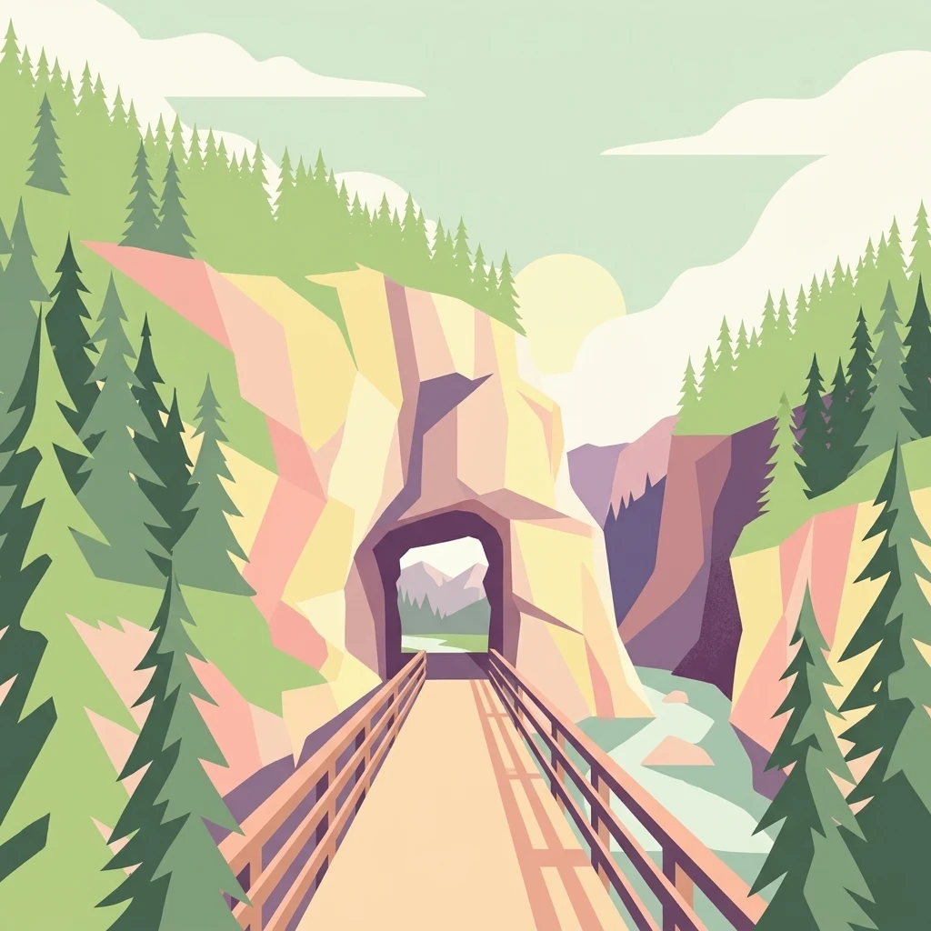
A minimalist, geometric illustration showing a wooden footbridge leading into a dark tunnel carved through a rocky canyon, surrounded by evergreen trees, with a river flowing through the gorge below.

A narrow river gorge threaded with historic railway tunnels near Hope, British Columbia.

Coquihalla Canyon Provincial Park

Coquihalla Canyon Provincial Park is a small but visually striking protected area in southwestern British Columbia, Canada, set along the north shore of the Coquihalla River near the town of Hope. The park protects a deeply eroded granite gorge where the river cuts through ancient metamorphic and volcanic bedrock, producing steep canyon walls, rapids, and cascades that shift dramatically with seasonal water levels. The park's defining cultural and visual landmark is the series of abandoned railway tunnels known as the Othello Tunnels, originally cut through the canyon walls for the Kettle Valley Railway in the early twentieth century. Today these tunnels, along with the surrounding Kettle Valley Rail Trail, form one of the most distinctive combinations of natural canyon scenery and industrial heritage in the Canadian Pacific interior. Although compact in size, the park draws visitors for its layered character: a working river landscape shaped by geology and floods, a corridor of historic engineering threaded straight through bedrock, and a gateway to the broader Trans Canada Trail network.

Location
Canada
Park type
State or regional park
Established
1986
Area
1.6 km²
Coquihalla Canyon Provincial Park Geography

Compare Coquihalla Canyon Provincial Park dates, depths, places, and distances

Explore earthquake history near Coquihalla Canyon Provincial Park

Coquihalla Canyon Provincial Park’s results use reported epicentre geography and calculated park distance, not a claim that all catalogued earthquakes occurred within the canyon. The event date, magnitude, depth, reported locality, separation, and source access remain available for comparison without attributing canyon formation or effects to the records, asserting seismic cause, or forecasting hazard.

Sort by
Magnitude
Location

This page describes catalogued earthquakes associated with the park by epicentre location and distance. It does not establish causation, assess current danger, or predict future earthquakes.

No earthquake records match the current filters

Park atlas

Continue from cliffs, canyon, forest, rivers and waterfalls to another park profile

Browse beyond Coquihalla Canyon’s earthquake catalogue

Coquihalla Canyon Provincial Park’s earthquake section gives way to an independent atlas destination; the source park is a 1.59 km² upland landscape with major water across cliffs, canyon, forest, rivers and waterfalls. Its recommendation does not transfer provincial status, terrain or evidence to the next page and says nothing about proximity, seismic similarity, hazard or risk.
State or regional parkBritish Columbia
14 km away#1 closest

North

Emory Creek Provincial Park: Protected River Valley Landscapes in British Columbia

Historical boomtown site within the Fraser Canyon corridor

Located on the western bank of the Fraser River, Emory Creek Provincial Park preserves a landscape shaped by nineteenth century gold rushes and Canadian Pacific Railway construction. This protected area offers insight into the forested riverside terrain and historical geography that define one of the most storied corridors in southern British Columbia.

Established
1956
IUCN
II
Water
Major water bodies
A horizontal watercolor painting depicting a soft-focus mountain landscape with rolling green meadows, patches of coniferous forest, and distant pale mountains under a white sky.
State or regional parkBritish Columbia
17 km away#2 closest

Southeast

E. C. Manning Provincial Park: A Comprehensive Geographic Atlas and Protected Area Overview

Mountainous terrain and ecological transitions in southern British Columbia

Spanning the cross section of the Canadian Cascades, E. C. Manning Provincial Park preserves a high-elevation landscape of wildflowers, glacial valleys, and mountain ridges. The protected area links temperate coastal rainforests with the arid interior, providing a study in regional hydrology and subalpine ecology defined by the Hozameen Range and the northern reaches of the Pacific Crest Trail.

Area
836.71 km²
Established
1941
IUCN
II
Visitors
1.1M annual
A wide watercolor painting showing layers of purple mountains in the distance, a misty valley, and green pine trees in the foreground under a pale pink and yellow sky.
Protected landscapeBritish Columbia
About 30 km away#3 closest

Northeast

Coquihalla Summit Recreation Area: A Protected Landscape in the British Columbia Mountains

Mapping ecological transition zones and mountain terrain

Covering 5,750 hectares of rugged slopes and high-elevation ridges, Coquihalla Summit Recreation Area anchors a vital ecological transition between the coastal and interior climates of British Columbia. This mapped protected area offers a deep look into the granite peaks of the North Cascades and the historic remnants of transportation corridors spanning over a century.

Area
57.5 km²
Established
1987
Relief
Mountain
Scope
Terrestrial
State or regional parkBritish Columbia
About 34 km away#4 closest

Southwest

Ferry Island Provincial Park: Geography, Riparian Terrain, and Protected River Boundaries

A study of Fraser River alluvial landscapes and provincial park land use

Ferry Island Provincial Park provides a rare protected island setting along the Fraser River in British Columbia. Spanning 29 hectares near the Agassiz-Rosedale Bridge, this Class C park represents an important alluvial riparian ecosystem within the heavily cultivated Fraser Valley, offering key insights into regional river-corridor geography and protected land management.

Area
0.29 km²
Established
1963
IUCN
II
Access
Access unknown
National parkWashington
40 km away#5 closest

South

North Cascades National Park: US National Park Protected Landscape and Geographic Context

Explore mapped boundaries and regional Washington geography.

Gain insight into North Cascades National Park, a vital US National Park located in Washington. This entry focuses on its protected land status, mapped geographic extent, and its role within the regional atlas. Users seeking to understand the park's landscape character, natural terrain, and its specific location in Washington will find this an essential point for detailed park geography exploration and protected area discovery.

Area
2,042.26 km²
Established
1968
IUCN
II
Visitors
16.5K annual
A watercolor painting showing a panoramic view of mountain peaks in the distance above green foothills and plains.
Protected landscapeWashington
42 km away#6 closest

South

Mount Baker, Snoqualmie National Forest: Mapped Geography and Protected Landscape Analysis

Exploratory atlas of Washington's primary Cascade Range wilderness

Delve into the structural geography of Mount Baker, Snoqualmie National Forest. This protected area corridor serves as a major ecological transition zone between the Puget Sound lowlands and the interior Cascades, characterized by extensive glaciers, wild river systems, and iconic stratovolcanoes that define the regional landscape of Washington state.

Area
6,978 km²
Established
1974
Relief
Mountain
Climate
Alpine
A horizontal watercolor painting showing a range of purple-tinted mountain peaks above a green forest and a light pinkish shoreline.
Wildlife reserveWashington
42 km away#7 closest

Southwest

Mount Baker Wilderness: Mapped Volcanic Peaks and Glacial Geography in Washington State

Protected wilderness boundaries in the Northern Cascades

Mount Baker Wilderness encompasses a vast mountain landscape characterized by an active stratovolcano and significant permanent snowfields. The terrain features a vertical gradient from dense west side conifer forests to exposed alpine summits, creating a distinct ecological corridor connected to neighboring protected areas in the Pacific Northwest.

Area
485.58 km²
Established
1984
IUCN
Ib
Relief
Mountain
A soft watercolor painting of a calm river or lake flowing through a green meadow with a forest and mountain range in the background.
Protected landscapeWashington
44 km away#8 closest

South

Ross Lake National Recreation Area: A Glacial Reservoir Landscape in Washington

Mapping the Skagit River and North Cascades alpine corridor

Located in the heart of Washington, Ross Lake National Recreation Area preserves a unique landscape of connected reservoirs and deep, glacier-cut valleys. This protected area acts as a vital geographic link within the North Cascades, offering access to high-altitude peaks, riverine forests, and the distinct turquoise waters of Diablo Lake.

Area
475.81 km²
Established
1968
IUCN
V
Visitors
998K annual
MoriAtlas Explorer

Explore the Geological and Historic Landscape of Coquihalla Canyon Provincial Park

Investigate the natural boundaries, river-carved geography, and historic rail corridors of this protected area using the MoriAtlas mapping suite. Understand the shifting riparian environment and granite cliff features of this essential British Columbia landmark.