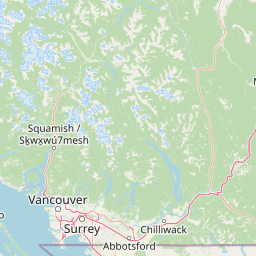

Why Coquihalla Canyon Provincial Park stands out
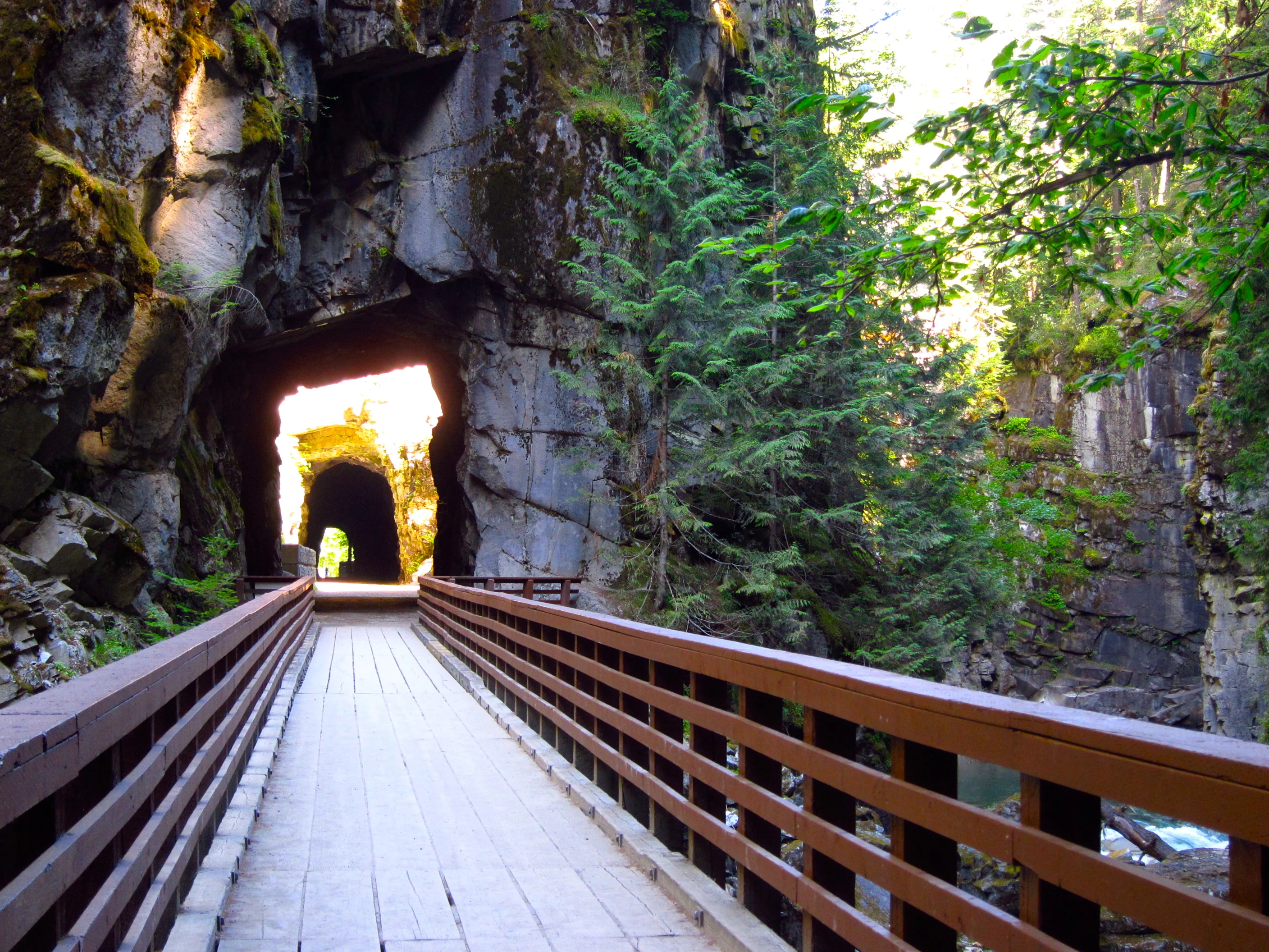
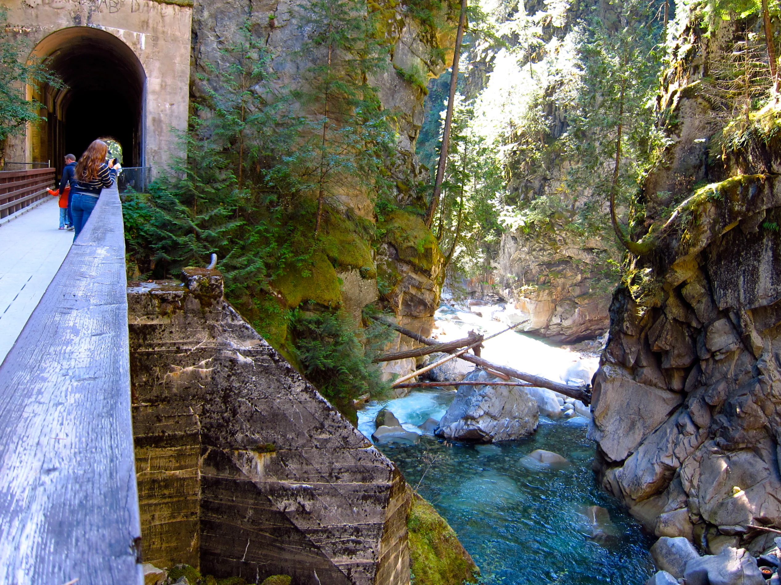
The park is best known for the Othello Tunnels, a chain of four former Kettle Valley Railway tunnels bored through solid granite in a near-straight line across the looping bends of the Coquihalla River. Walking through these dark rock corridors and emerging onto the steel and concrete spans between them has become one of the signature short trail experiences in British Columbia's Fraser Canyon region. Equally central to the park's identity is the canyon itself, a narrow, roughly 100 metre deep gorge carved by the Coquihalla River where granite batholiths intrude into older metamorphic rocks. The combination of plunging canyon walls, cascading river water, and the human-made tunnels and bridges suspended along the cliffside gives the place an unusually layered character for such a small protected area.
Coquihalla Canyon Provincial Park history and protected-area timeline
The landscape that the park now protects was traversed long before any railway was built. Side hill cuts in the canyon area preserve trace evidence of the Hope to Nicola cattle trail, which may date back to the 1840s and was substantially upgraded by the colonial administration in the mid-1870s. At its narrowest point, a timber trestle carried the trail across the river, but the opening of the Canadian Pacific Railway main line through the Fraser Canyon in the mid-1880s reduced the trail's importance. After the Kettle Valley Railway's construction in the 1910s destroyed much of the older route, the pioneer trail was effectively abandoned.
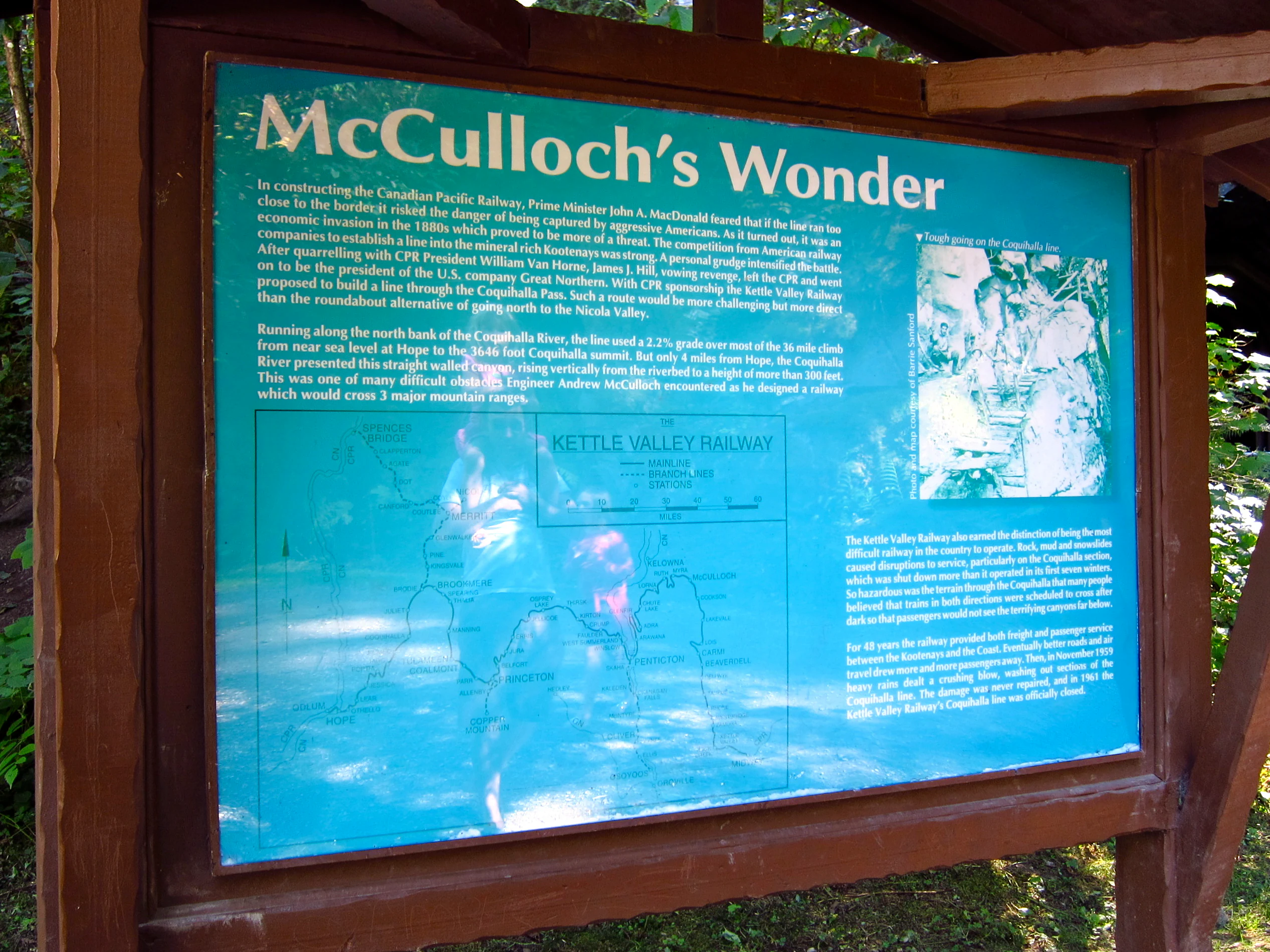
The railway era transformed the canyon in a different way. The Kettle Valley Railway, a Canadian Pacific subsidiary, advanced eastward from Hope in 1915, reaching the stretch that would become the Othello Tunnels within months. Chief engineer Andrew McCulloch, a Shakespeare enthusiast, is generally credited with naming stations from Juliet westward to Othello after characters from Shakespearean plays. Workers bored tunnels in a near-straight line through the cliffs, with surveyors reportedly lowered in wicker baskets to plan a more economical route than a single long tunnel following every bend of the river.
Between 1915 and the early 1920s, four tunnels and connecting bridges were completed, and a small station was built at Othello. Passenger service operated from 1916 until November 1959, when repeated flood damage to the track and bridges made continued rail use impractical. The Coquihalla line was officially abandoned, and tracks were lifted in 1961 and 1962.
The recreational era began in 1964, when a recreational reserve was placed on the area, which had largely served local residents and anglers. In 1985, the Hope Chamber of Commerce received provincial funding to enhance the tunnels for tourism, and military personnel installed a suspension bridge between two of the tunnel openings. In May 1986, the province established the 135 hectare Coquihalla Canyon Recreation Area, and the tunnels were simultaneously designated a national historic site. Park status followed in 1997, and a boundary expansion in 2004 brought the area to roughly 159 hectares.
The park's history has been repeatedly shaped by flooding. Major flood events in 1924, 1932, 1990, 1995, and 2021 damaged tunnels, bridges, and the rail bed, prompting ongoing restoration work that has included rock scaling, pedestrian bridge rebuilds, and stabilization work inside the tunnels themselves.
Coquihalla Canyon Provincial Park landscape and geographic character
The defining feature of the park is a steep, twisting section of the Coquihalla River canyon cut into hard, ancient rock. Granite batholiths have intruded through older metamorphic rock that itself formed from earlier sedimentary and volcanic deposits, and this geological history is the reason the canyon walls are both so steep and so visually textured. Erosion along weaknesses in the rock keeps the cliffs actively shedding material, and the winding river below produces cascades and rapids through the narrow gorge.
The canyon reaches a depth of roughly 100 metres, and its walls close in to widths as narrow as three metres in some places, the very constriction that once demanded a timber trestle on the old cattle trail. The course of the river meanders sharply through this section, which is why the railway engineers chose to bore straight through the cliffs rather than follow every bend. Large seasonal fluctuations in water volume, combined with debris carried downstream, regularly create log jams and reshape the channel.
At the southern end of the park, the smaller Nicolum River meets the Coquihalla, adding a quieter side valley to the landscape and influencing the local riparian character. Above the canyon rims, the surrounding terrain continues into the broader forested mountain scenery of the Hope area and the eastern Fraser Canyon corridor.
Coquihalla Canyon Provincial Park ecosystems, habitats, and plant life
Ecologically, the park is best understood as a narrow ribbon of river canyon habitat pressed into a largely forested mountain landscape. The Coquihalla River corridor supports riparian vegetation along its banks, while the steep canyon walls host rock-loving plant communities adapted to thin soils and frequent disturbance from rockfall and debris flows.
Seasonal flooding is a defining ecological process in the canyon. High water events scour the river channel, reset log jams, and redistribute gravel bars, while also depositing organic material that influences downstream habitats. The dynamic interplay between rockfall from the cliffs and the river's shifting course means the canyon is a constantly renewed rather than static environment.
The park sits within the broader ecological context of the Cascade and Coast Mountain transition zone in southwestern British Columbia. Although its footprint is small, it contributes a protected stretch of an important salmon-bearing river system and preserves a representative sample of the rugged, disturbance-driven canyon habitats that characterize this part of the province.
Coquihalla Canyon Provincial Park wildlife and species highlights
The Coquihalla River itself is a key wildlife feature of the park, supporting salmon and other fish species that move through the canyon system. The river corridor provides habitat connectivity for aquatic species between higher elevation tributaries and the larger Fraser River network downstream.
The cliff and canyon environments attract typical interior British Columbia fauna, including raptors that nest or hunt along the steep rock faces. Riparian stretches near the mouth of the Nicolum River and along quieter gravel bars offer habitat for songbirds, while the surrounding forests support mammals such as deer and smaller carnivores typical of the region. The park's relatively small size means most wildlife movements are tied to the broader forest and river landscape that surrounds it rather than the protected area alone.
Coquihalla Canyon Provincial Park conservation status and protection priorities
The park's conservation value lies primarily in its protection of a representative stretch of the Coquihalla River canyon, including its geological character, riparian habitats, and the connectivity it provides within a larger river system. As an IUCN Category III protected area, it functions as a natural monument centered on the dramatic interplay between canyon geology and the river.
Recognition of the Othello Tunnels as a national historic site adds a heritage conservation dimension to the park, anchoring ongoing investment in stabilizing the tunnels, bridges, and adjacent slopes. The site also serves as a focal point for managing public access through a sensitive landscape that has been repeatedly affected by flooding and slope instability.
Maintenance efforts have included rock scaling, installation of wire mesh barriers, rock bolts, and targeted shotcrete work to reduce rockfall risk inside and around the tunnels. These interventions reflect an ongoing balance between preserving an engineered historic corridor and protecting visitors from the inherent instability of a steep, flood-prone canyon.
Coquihalla Canyon Provincial Park cultural meaning and human context
The park carries strong cultural meaning tied to two intersecting themes: early pioneer movement through the Fraser Canyon region and the railway age that transformed southwestern British Columbia. The remnant cuts of the Hope to Nicola cattle trail speak to the era when drovers moved horses along narrow mountain paths above the river, before railways reorganized travel and settlement in the region.
The Shakespearean station naming scheme along the Kettle Valley Railway is a small but distinctive cultural footnote, with Andrew McCulloch's literary enthusiasm leaving names like Juliet and Othello scattered across an otherwise rugged working landscape. The repurposing of the rail corridor into the Kettle Valley Rail Trail, which forms part of the Trans Canada Trail, embeds the park in a broader contemporary culture of long-distance hiking and heritage tourism.
The site has also become part of popular culture through its appearances in film and television productions filmed in the dramatic canyon and tunnel setting, extending its recognition well beyond its footprint.
Top sights and standout views in Coquihalla Canyon Provincial Park
The Othello Tunnels stand as the park's signature highlight, offering a walk through four historic railway tunnels linked by bridges and cliffside trail, with the Coquihalla River thundering below. The narrow, roughly 100 metre deep granite gorge itself is equally compelling, with cascades, rapids, and shifting log jams that constantly reshape the canyon floor.
The mouth of the Nicolum River adds a quieter counterpoint to the main canyon, while the broader Kettle Valley Rail Trail segment ties the park into the Trans Canada Trail network. The combination of industrial heritage, dramatic river canyon, and easy accessibility from Hope gives the park an unusually concentrated set of highlights for such a compact protected area.
Best time to visit Coquihalla Canyon Provincial Park
Late spring through early fall generally offers the most settled conditions for experiencing the canyon, when river levels tend to be lower and trail surfaces are most reliably accessible. Summer brings long daylight hours useful for short walks through the tunnels and along the rim, though this is also when snowmelt and storm events can elevate water levels and occasionally affect access.
The park's character shifts substantially with the seasons. High water periods, often tied to spring snowmelt and major fall storms, intensify the rapids and can leave debris along the trail, while quieter late summer and early fall days typically provide clearer views of the canyon walls and a more stable walking experience. Visitors should be aware that flooding events have historically led to temporary closures of parts of the tunnel route.