
Mori Atlas logo
National parkCuronian Spit National Park

Mapping the shifting dunes, forested ridges, and vital bird migration corridors of this narrow Baltic peninsula.

Curonian Spit National Park: A Protected Coastal Landscape within Kaliningrad Oblast, Russia

(National Park "Kurshskaya Kosa")

Curonian Spit National Park preserves the Russian segment of a distinct sandy peninsula that separates the Baltic Sea from the Curonian Lagoon. This protected area features some of the tallest moving dune systems in Europe, alongside stabilized forest stands and rare coastal meadows. Beyond its geological significance, the park functions as a major avian corridor, historically anchored by the pioneering bird research conducted at the Rossitten station.

coastal spitsand dunesmoving dunesdune forestBaltic SeaCuronian Lagoon

Curonian Spit National Park

National park

Park overview

Structured park overview, official facts, and landscape profile for Curonian Spit National Park

Curonian Spit National Park park facts, protected area profile, and essential visitor context

Review the core facts for Curonian Spit National Park, including designation, size, terrain, visitor scale, habitats, and operating context in one park-focused overview.

About Curonian Spit National Park

Curonian Spit National Park encompasses the Russian half of the Curonian Spit, a sandy peninsula stretching along the southeastern shore of the Baltic Sea. The spit forms a natural barrier between the open Baltic waters to the west and the vast Curonian Lagoon to the east, creating a distinctive twin-shore landscape where dunes, pine forests, meadows, and small fishing settlements all coexist in a narrow band of land.

The park protects an exceptional example of a cultural-natural landscape, where human efforts over centuries to stabilize moving sands have produced forested dune ranges and a mosaic of habitats. Walking trails lead through ancient pine plantations, the famously contorted trees of the Dancing Forest, and dune ridges offering sweeping panoramas over both the Baltic Sea and the Curonian Lagoon. The varied forests reflect both native conifers and introduced species, while the meadows and lagoons provide rich habitat for birdlife.

Culturally, the park preserves traces of the region's layered history, from old postal road alignments and former royal hunting reserves to the legacy of Prussian and Russian foresters who pioneered sand stabilization techniques. Settlements such as Rybachy (formerly Rossitten), Lesnoy, and Morskoye remain within the park's boundaries, reflecting a long tradition of coastal community life.

Recognized internationally as a UNESCO World Heritage Site, the Russian and Lithuanian sections of the spit together represent one of Europe's most distinctive protected coastal complexes, valued for both their ecological importance and their enduring cultural landscape.

Quick facts and research context for Curonian Spit National Park

Curonian Spit National Park lies in the Zelenogradsky District of Kaliningrad Oblast, occupying the southern, Russian section of the Curonian Spit along the Baltic coast. It borders the Lithuanian Curonian Spit National Park to the north, with the two parks together forming a single transboundary protected landscape.

Established as a national park in 1987, the area is classified as an IUCN Category II protected area and was inscribed as a UNESCO World Heritage Site in 2000 under cultural criteria. Its territory includes functional zones ranging from strict nature protection to recreation and traditional use, with the administrative center at the settlement of Rybachy.

Protection and recognition

Documented terrestrial protection metrics and official establishment year for Curonian Spit National Park

Curonian Spit National Park Protection Status and Designation History

Curonian Spit National Park maintains a documented terrestrial protection status established in the year 2000. Structured data profiles outline the management scope and designation history for this protected area.

Protection details

Protection scope
Terrestrial
Designated year
2000
Transboundary protection
No
Park context

Deeper park guide and search-rich context for Curonian Spit National Park

Curonian Spit National Park history, landscape, wildlife, and travel context

Explore Curonian Spit National Park through its history, landscape character, ecosystems, wildlife, conservation priorities, cultural context, and seasonal travel timing in a structured park guide built for atlas discovery and search intent.

Why Curonian Spit National Park stands out

Curonian Spit National Park is best known for its dramatic dune landscape, particularly the moving sand dunes that rank among the tallest in Europe. The park combines active aeolian formations with stabilized forested dunes, creating a vivid record of how shifting sands have shaped, and been tamed by, this narrow coastal strip. Equally central to the park's identity is its role as a major bird migration corridor. The historic Rossitten ornithological station, founded in 1901, anchors a long tradition of bird ringing and migration research, giving the park international importance for ornithology alongside its geological and forest heritage.

A wide panoramic photograph showing sandy dunes with sparse vegetation in the foreground, a dense forest on the left, and a large body of water stretching to the horizon under a pale blue sky.
Panoramic view of the Curonian Spit sand dunes, forest edge, and the lagoon from Epha Height.

Curonian Spit National Park history and protected-area timeline

The Curonian Spit was formally protected as a national park on November 6, 1987, when the Council of Ministers of the Russian SFSR established it as a state natural national park (ГПНП). The initiative was driven by conservationists, local forestry authorities, and the Kaliningrad regional executive committee, who sought to preserve a unique natural monument of special ecological value while supporting limited tourism, recreation, forest research, and public education.

Long before its formal designation, the area already had a strong conservation legacy. Sections of the forest between modern Zelenogradsk and Lesnoy had never been logged, protected for centuries as a royal Prussian hunting reserve. Foresters such as Wilhelm Franz Efa dedicated their careers to studying and stabilizing the shifting sands, leaving a lasting imprint on the landscape. The Rossitten ornithological station, founded in 1901 by Johannes Thienemann, established the spit as a center for the scientific study of bird migration.

In 2000, the entire Curonian Spit, spanning both Russia and Lithuania, was inscribed on the UNESCO World Heritage List, recognizing its outstanding cultural landscape value. More recently, the park has expanded its institutional role, taking on management responsibilities for the Vishytynets National Park in 2024 to strengthen conservation and ecotourism in the region. Today, the park balances protection of its fragile dune and forest systems with growing public interest in its trails, viewpoints, and migrating bird populations.

Curonian Spit National Park landscape and geographic character

The Curonian Spit is a narrow sandy peninsula, with the national park protecting its Russian segment between the Baltic Sea and the Curonian Lagoon. The defining landform is the dune system: a sweeping succession of ridges, some still active and shifting, others long stabilized and forested. The dunes here rank among the largest in Europe, with their highest points reaching more than fifty meters above sea level.

The terrain is shaped by aeolian processes, with exposed sand surfaces in the active dune zone giving way to pine-clad ridges, black alder stands, and spruce formations on older, stabilized surfaces. A flat, forested plain called the palve lies between the sea and the lagoon in many stretches. The sand spit itself is underlain in part by ancient glacial remnants, such as the glacial island near Rybachy, which represents one of the oldest geological foundations of the entire landform.

Viewpoints like Müller's Height and Epha Height reveal the landscape's full character, opening onto the broad Baltic horizon to the west and the expansive waters of the Curonian Lagoon to the east, with dunes, lakes, meadows, and forest patches layered in between. Sand-meadow transitions and coastal wetlands add further texture to this dynamic coastal landscape.
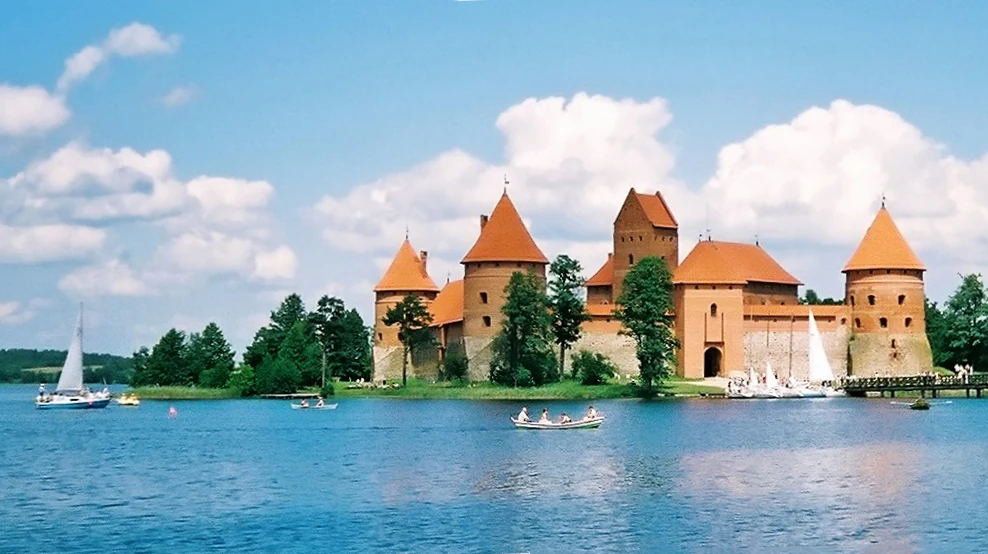
A wide shot of a red brick castle with orange conical roofs on an island in a blue lake, with sailboats and rowboats on the water under a blue sky with clouds.
Trakai Island Castle situated on a lake with sailboats and rowboats in the foreground under a blue sky.

Curonian Spit National Park ecosystems, habitats, and plant life

The ecosystems of Curonian Spit National Park are defined by the interplay of sand, sea, lagoon, and forest. The dominant habitat is a mosaic of coniferous forest on stabilized dunes, where pine, spruce, and black alder grow alongside introduced species such as giant thuja planted in older forestry plantings. In the protected Korolevsky Bor, centuries-old coniferous stands and ancient plantings form a mature, multilayered forest landscape unusual for such a young geological formation.

Between the forested dunes and the Curonian Lagoon lie flooded meadows and wetland edges that provide rich transitional habitats. The active dune areas host specialized plant communities adapted to shifting sands, while inland depressions form small lakes, such as Lake Chaika and Lake Lebed, supporting distinct aquatic and shore-side flora. The combination of coastal meadows, forest patches, dunes, and freshwater lagoon creates a striking habitat gradient compressed into a very narrow geographic band.
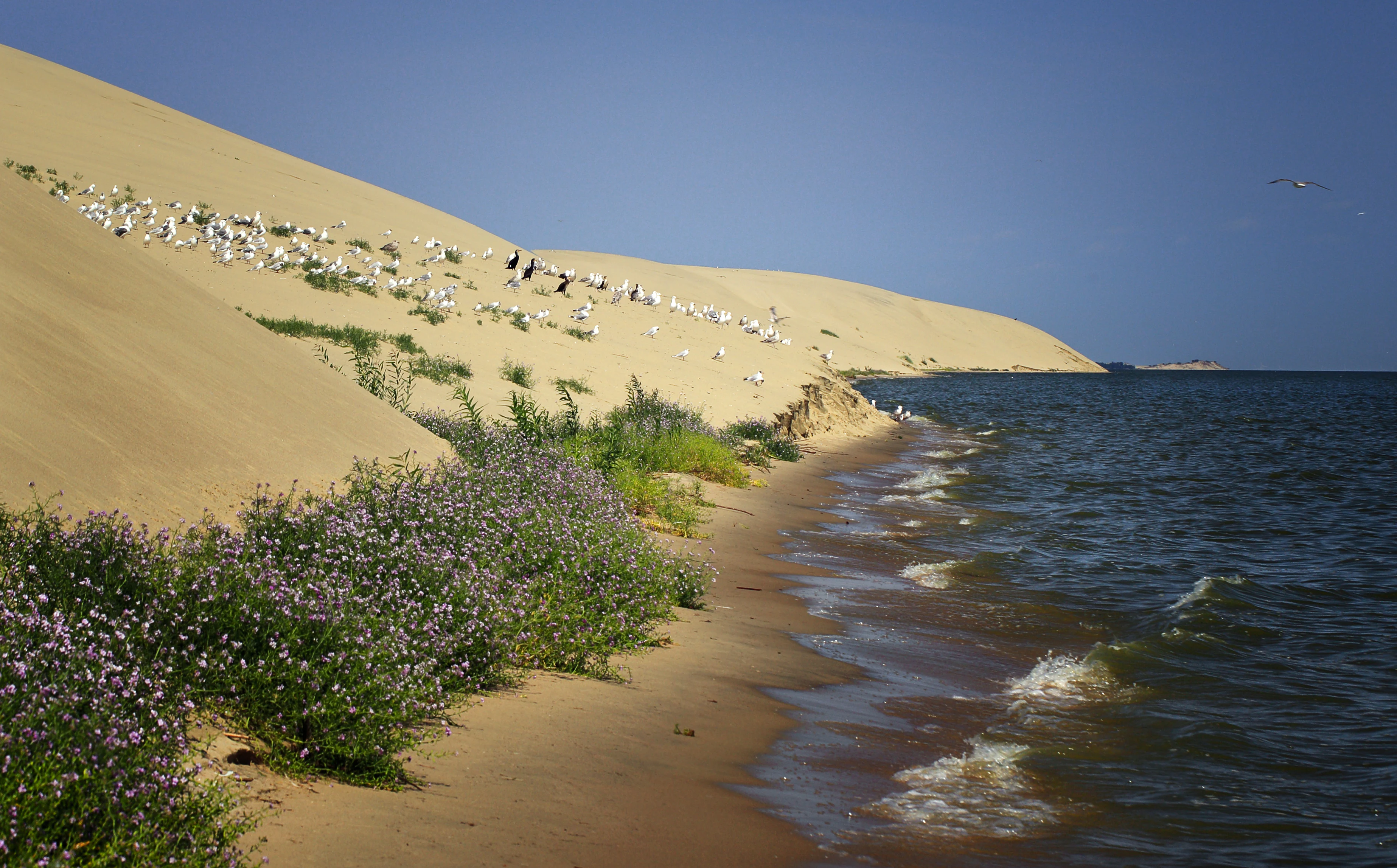
A sandy beach curves along the base of a large sand dune covered in resting seagulls, with purple wildflowers in the foreground and blue water lapping the shore under a clear sky.
Shore of the Curonian Lagoon with a large sand dune, resting seagulls, and purple wildflowers.

Curonian Spit National Park wildlife and species highlights

The Curonian Spit is one of the most important sites in Europe for migratory birds, and its avifauna is a defining feature of the national park. More than 260 bird species have been recorded, including over 100 nesting species and many migratory visitors. The chaffinch is the most characteristic breeding species, while wood warblers, barred warblers, and common starlings are among the more numerous songbirds.

Mammals are fewer in number but include moose, European roe deer, wild boar, red fox, pine marten, raccoon dog, badger, European hare, red squirrel, and beaver. Their presence across forest, meadow, and dune edge habitats contributes to the ecological balance of this narrow coastal environment.

The park's location on a major migration corridor has long made it a focal site for scientific bird ringing, and the park continues to host ornithological research and visitor education tied to this avian heritage.
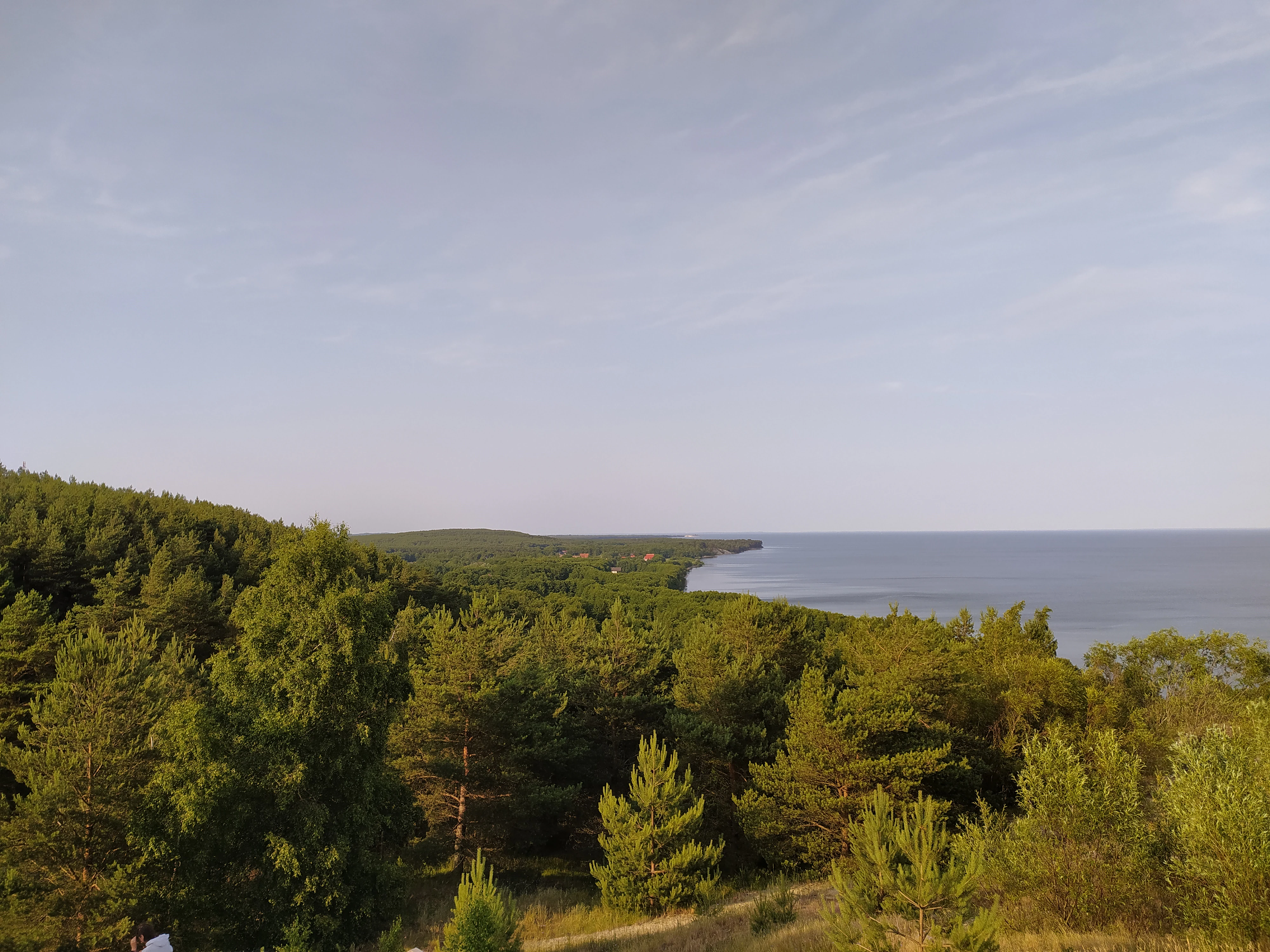
A wide landscape photograph taken from a high vantage point, showing a dense green pine forest covering a narrow strip of land that curves along a large body of water under a pale sky.
View from Epha Height looking towards the Lithuanian border and the town of Nida, showing the forested Curonian Spit and the coastline.

Curonian Spit National Park conservation status and protection priorities

Curonian Spit National Park plays a critical conservation role by protecting one of Europe's most fragile and dynamic coastal landscapes. The park's territory is organized into differentiated protection zones, ranging from strictly protected nature reserves to recreation and traditional-use areas, allowing sensitive management of the fragile dune, forest, and lagoon ecosystems.

The park's conservation importance is internationally recognized: in 2000, the entire Curonian Spit was inscribed on the UNESCO World Heritage List under cultural criteria, acknowledging the centuries-long interaction between people and shifting sands that shaped this landscape. The park is also classified as an IUCN Category II protected area, reflecting its national-level significance for biodiversity and landscape protection.

A central conservation theme is the stabilization of moving dunes, a process begun by foresters like Wilhelm Franz Efa and continued through modern forestry plantings and habitat management. The park also plays a transboundary conservation role, working alongside the Lithuanian Curonian Spit National Park to maintain ecological continuity across the international border. Ongoing concerns include the protection of migrating and nesting birds from disturbance, the preservation of fragile sand ecosystems, and the management of visitor pressure in this popular destination.

Curonian Spit National Park cultural meaning and human context

The cultural landscape of the Curonian Spit is deeply layered, shaped by centuries of interaction between coastal communities and shifting sands. The narrow strip of land supported fishing villages and forestry settlements whose names, such as Rybachy (formerly Rossitten) and Morskoye, reflect this dual identity of sea and forest livelihood. The park's administrative center remains at Rybachy, anchoring community life within the protected landscape.

Historically, parts of the spit were preserved as a royal Prussian hunting reserve, where trained falcons were kept. Foresters like Wilhelm Franz Efa pioneered sand stabilization techniques that left a permanent mark on the landscape, while scientists such as Johannes Thienemann built an enduring ornithological legacy through the Rossitten station. Postwar history brought further transformation, including a former German glider school linked to the area now known as the Dancing Forest.

Today, the cultural and historical heritage of the spit is recognized through the UNESCO World Heritage inscription and remains visible in the park's trail network, museum complex, historic forestry plantings, and continuing community traditions in its settlements.
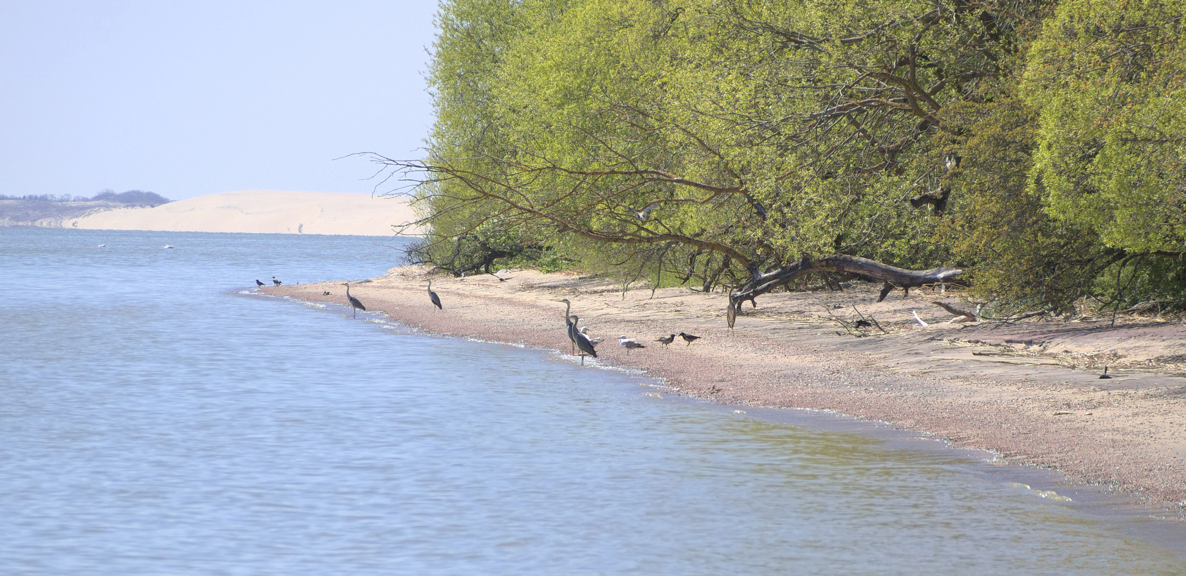
A landscape photo of a coastline with water on the left, a sandy beach with several dark birds standing on the shore, green trees on the right, and a large sand dune visible in the background under a clear sky.
Coastal view of the Curonian Spit near Rybachy showing a sandy beach, forest edge, birds, and a large sand dune in the distance.

Top sights and standout views in Curonian Spit National Park

Curonian Spit National Park stands out for its combination of tall moving dunes, ancient stabilized dune forests, and a globally important bird migration corridor, all compressed into one of Europe's narrowest protected landscapes. Its viewpoints at Epha Height, Müller's Height, and the dunes near Lake Lebed offer panoramic contrasts between Baltic Sea and Curonian Lagoon that are rare elsewhere on the continent.

Equally distinctive is the Dancing Forest, where contorted pine trunks form a living natural curiosity tied to the spit's unusual dune history. The historic Rossitten ornithological station connects the park to more than a century of international bird research, reinforcing its role as both a natural and scientific landmark.
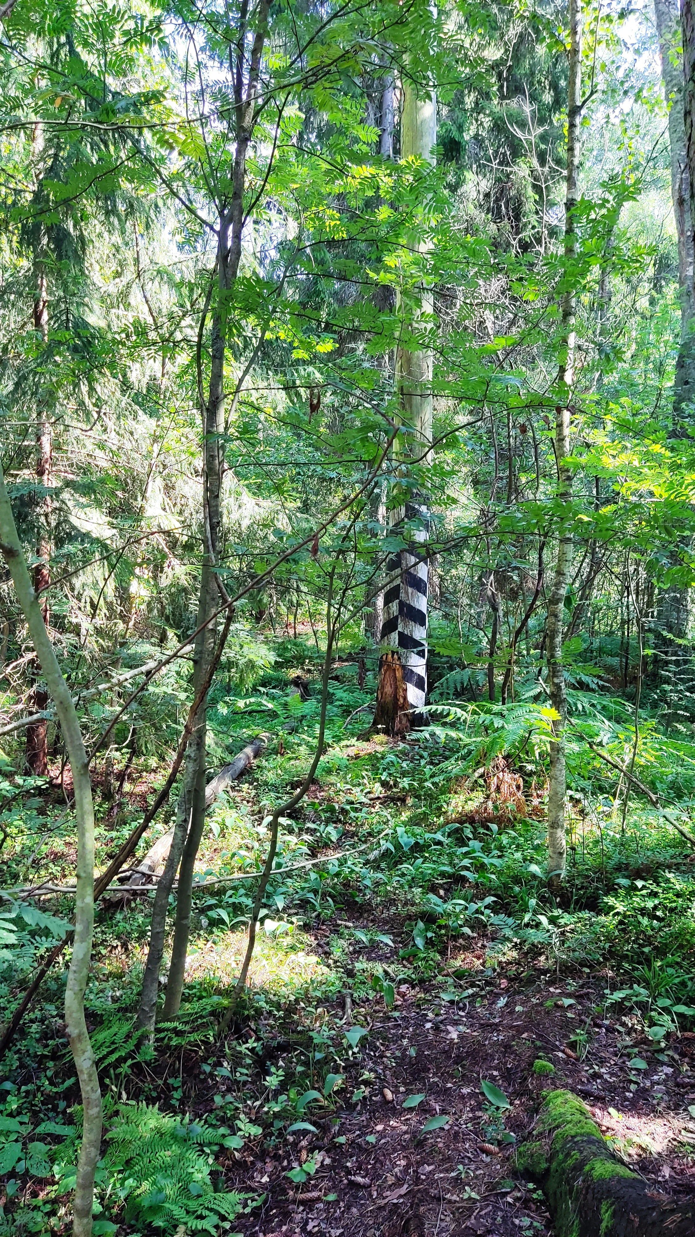
A vertical black and white striped pole standing in a green forest with a dirt path in the foreground.
A black and white striped milepost art object standing in a dense forest.

Best time to visit Curonian Spit National Park

Spring and early autumn are particularly rewarding seasons for visiting Curonian Spit National Park. These periods coincide with peak bird migration, when the spit's role as a major flyway becomes most visible, and with milder conditions for walking the dune and forest trails. Summer brings warm, moderately temperate weather suitable for the full range of viewpoints and beach landscapes, though it is also the busiest period.

Winter is mild for the region, with relatively moderate temperatures due to the transitional climate between maritime and continental influences, but some dune and forest experiences depend more strongly on snow-free conditions. For visitors seeking a balance of birdwatching, dune panoramas, and comfortable hiking conditions, late spring and early autumn are especially appealing.
Monthly climate preview

Long-term representative temperature ranges and precipitation patterns across the year

Curonian Spit National Park Climate Normals and Monthly Weather Statistics

Historical data records monthly temperature variations from sub-zero winter lows to warmer summer peaks alongside steady precipitation rates across the representative coordinate. Reviewing the complete twelve-month profile provides deeper insight into long-term climate normals and annual environmental rhythms.
Annual mean8 °C
-1 °C18 °C
Jan-1°
Feb-1°
Mar
Apr
May11°
Jun15°
Jul18°
Aug18°
Sep14°
Oct
Nov
Dec
Warmest month
August

18.3 °C

Coolest month
January

-0.7 °C

Wettest month
October

2.5 mm/day

Driest month
April

1.3 mm/day

Park location guide

Geography guide, regional context, and park location map for Curonian Spit National Park

Curonian Spit National Park park geography, regions, and map view in Russia

Understand where Curonian Spit National Park sits in Russia through a broader geographic reading of the surrounding landscape, nearby location context, and its mapped position within the national park landscape.

How Curonian Spit National Park fits into Russia

Russia is a transcontinental nation spanning eleven time zones, bordered by fourteen countries. It is the world's largest country by area, covering 17,098,246 km². Moscow is the capital and largest city, while Saint Petersburg is the second-largest and a major cultural centre.

Wider geography shaping Curonian Spit National Park in Russia

Russia spans Eastern Europe and North Asia, covering 17,098,246 km². It shares land borders with fourteen countries, more than any other nation, and spans eleven time zones. The landscape includes vast plains, mountain ranges such as the Urals and Caucasus, and extensive coastlines along the Arctic Ocean, Pacific Ocean, Baltic Sea, Black Sea, and Caspian Sea.

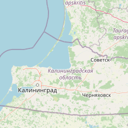
Map view of Curonian Spit National Park

Use this park location map to pinpoint Curonian Spit National Park in Russia, understand its exact geographic position, and read its mapped placement within the surrounding landscape more clearly.

Pigeon | © OpenStreetMap contributors

Location context for Curonian Spit National Park

Kaliningrad Oblast

Visual reference guide to moving sand dunes, pine forests, and coastal habitats.

Curonian Spit National Park Photos and Protected Landscape Scenery

Visual documentation captures the dramatic coastal terrain, towering sand dunes, and pine-clad ridges defining Curonian Spit National Park. Photographic records provide clear insight into the fragile protected landscape separating the open Baltic Sea from the Curonian Lagoon.

A wide panoramic photograph showing sandy dunes with sparse vegetation in the foreground, a dense forest on the left, and a large body of water stretching to the horizon under a pale blue sky.

A wide landscape view of large sand dunes with sparse dry shrubs in the foreground, leading to a blue sea horizon under a bright sky with white cumulus clouds.

A wide shot of a red brick castle with orange conical roofs on an island in a blue lake, with sailboats and rowboats on the water under a blue sky with clouds.

A sandy beach curves along the base of a large sand dune covered in resting seagulls, with purple wildflowers in the foreground and blue water lapping the shore under a clear sky.

A wide landscape photograph taken from a high vantage point, showing a dense green pine forest covering a narrow strip of land that curves along a large body of water under a pale sky.

A forest scene showing several pine trees with twisted, curved trunks surrounded by a low wooden fence on a forest floor covered in pine needles and moss.

A landscape photo of a coastline with water on the left, a sandy beach with several dark birds standing on the shore, green trees on the right, and a large sand dune visible in the background under a clear sky.

A vertical black and white striped pole standing in a green forest with a dirt path in the foreground.

A forest scene showing a mix of green pine trees and dead, leaning trees with brown needles, set against a blue sky with a mossy ground cover.

A forest scene with pine trees and a grassy clearing, with an informational sign visible in the bottom left corner.

A wide panoramic photograph of a sandy dune landscape with green bushes and trees, a wooden viewing platform on the right, and a forest in the distance under a bright sun.

Park atlas

Compare surrounding coastal terrain and regional protected areas

Parks Near Curonian Spit National Park And Related Protected Landscapes

Browse other parks and protected areas sharing similar coastal geography, sand dunes, and regional ecosystem traits. Expanding the search helps compare neighboring habitats across the broader Baltic corridor.
Watercolor painting of a coastal landscape featuring trees, birds, and soft pastel-colored hills
National parkKaliningrad Oblast
Mapped location lies within the park boundary#1 closest

South

Curonian Spit National Park: Coastal Dunes and Baltic Protected Landscape

Explore a UNESCO World Heritage sand spit with unique terrain.

Curonian Spit National Park offers a remarkable study in coastal geography and protected landscapes, situated on one of the longest sand spits globally. This protected area within Russia's Kaliningrad Oblast features dynamic dune systems, distinctive forest formations, and serves as a vital corridor for migratory birds. Its UNESCO status underscores its international significance for natural heritage and landscape exploration, providing rich context for regional geography within the MoriAtlas platform.

Area
66 km²
Established
1987
IUCN
II
Relief
Lowland
Watercolor painting of a landscape with a river flowing through grassy fields, trees, and mountains in the background
National parkLithuania
About 18 km away#2 closest

Northeast

Curonian Spit National Park: Atlas of Baltic Sand Dunes and Coastal Protected Areas

Exploring the narrow peninsula landscape of Lithuania

Curonian Spit National Park is a protected coastal terrain featuring massive sand dunes and coniferous forests situated along the Baltic Sea. This detailed map-based overview examines the geomorphology of the spit, the stabilization of the Nagliai reserve, and the regional geography that defines this unique ecological corridor within Lithuania.

Area
264.74 km²
Established
1991
IUCN
II
Visitors
400K annual
Regional parkLithuania
About 22 km away#3 closest

Northeast

Nemunas Delta Regional Park: Mapping the Wetland Mosaic of the Lithuanian Coast

Explore the complex hydrology and floodplain geography of this Ramsar-listed regional park

Nemunas Delta Regional Park protects a unique river delta landscape shaped by seasonal floods and intricate water channels. Covering the lowlands where the Nemunas River reaches the Baltic Sea, the park is a primary site for ornithological research and wetland conservation, home to Rusnė Island and Lake Krokų Lanka. This protected area offers profound insight into coastal delta formation and the ecological importance of lowland floodplains.

Area
239.5 km²
Established
1992
Relief
Lowland
Climate
Temperate
Nature reserveWarmian-Masurian Voivodeship
About 106 km away#4 closest

Southeast

Rezerwat przyrody Jezioro Siedmiu Wysp: Protected Wetland Geography and Map Overview

Wetland ecosystems in the Warmian-Masurian Voivodeship

Examine the geographic layout of Rezerwat przyrody Jezioro Siedmiu Wysp, encompassing Lake Oświn, the Oświnka River corridor, and extensive peat-forming marshes. This protected area offers insight into Masurian wetland dynamics, including the interplay between open water, meadow grazing by konik polski horses, and critical habitats for diverse waterfowl populations across the Polish border region.

Area
17.63 km²
Established
1956
Relief
Lowland
Climate
Temperate
Watercolor painting showing rolling hills, a lake, and green forests under a soft sky
National parkLithuania
About 112 km away#5 closest

Northeast

Žemaitija National Park: Mapped Glacial Terrain and Samogitian Protected Landscape

Explore protected areas and natural geography in Northwestern Lithuania.

Žemaitija National Park is a protected natural reserve in Lithuania, defined by its distinctive glacially sculpted landscape. This park preserves over 217 square kilometers of hilly terrain, featuring significant lake systems like Lake Plateliai and substantial forest cover interspersed with wetlands. Users can explore the park's unique topographic character, its mapped geographic features, and its role as a vital protected area within the Samogitian region, offering a rich context for atlas-based discovery.

Area
217.54 km²
Established
1991
IUCN
II
Relief
Highland
Protected landscapeWarmian-Masurian Voivodeship
About 117 km away#6 closest

Southwest

Park Krajobrazowy Wysoczyzny Elbląskiej: Mapping Upland Terrain and Protected Forest Zones

Geography of a distinctive morainic plateau in northern Poland

Investigate the natural landscape of Park Krajobrazowy Wysoczyzny Elbląskiej, a protected area in the Warmian-Masurian Voivodeship. Focus on the interplay between stream valleys, morainic ridges, and rare plant communities. This mapping resource details the ecological significance of the upland terrain and its transition toward coastal lowland borders.

Area
137.32 km²
Established
1985
Relief
Upland
Climate
Temperate
Nature reserveWarmian-Masurian Voivodeship
About 122 km away#7 closest

South

Rezerwat przyrody Mokradła Żegockie: Nature Reserve Map and Protected Landscape Overview

Lowland marshland habitat in the Warmian-Masurian Voivodeship of Poland

This nature reserve preserves a shallow, boggy depression surrounded by agricultural plains. It is recognized for its bird-rich ecosystem, containing open water, reedbeds, and willow shrubs that returned after the collapse of historic drainage works. Use this atlas resource to understand the park's terrain, mapped boundaries, and environmental role within the local geography.

Area
0.336 km²
Established
1991
Relief
Lowland
Scope
Terrestrial
Nature reserveWarmian-Masurian Voivodeship
About 123 km away#8 closest

Southwest

Rezerwat przyrody Dolina Stradanki: Protected Forest and River Valley Geography

Nature reserve within the Warmian-Masurian Voivodeship

Rezerwat przyrody Dolina Stradanki is a critical protected area in northern Poland, known for its intricate system of side valleys and mature beech forest. This reserve integrates hydrological and biological values, functioning as a key ecological unit within the Elbląg Upland Landscape Park. Explore the map of this glacial valley, which provides a high-quality habitat for diverse avifauna and protected flora.

Area
1.211 km²
Established
2006
Relief
Upland
Scope
Terrestrial

Common questions about visiting, size, designation, and location context for Curonian Spit National Park

Curonian Spit National Park FAQs for park facts, access, geography, and protected area context

Find quick answers about Curonian Spit National Park, including protected-area facts, park geography, trail and visitor context, and how the park fits into its surrounding country and regional landscape.
MoriAtlas Explorer

Continue Your Protected Areas Search Across the Global Atlas

Deepen your exploration by continuing the structured search for national parks and protected areas worldwide. Utilize the comprehensive filtering capabilities to compare different conservation landscapes and refine your understanding of global park geography. Discover more about the distribution and characteristics of protected natural areas.

Global natural geography