Mori Atlas logo
National parkDjukbinj National Park

Explore mapped park boundaries and regional natural landscape details for Djukbinj National Park.

Djukbinj National Park: Protected Landscape and Geographic Context in Northern Territory, Australia

Djukbinj National Park stands as a significant protected area within the vast geography of Australia's Northern Territory. This page offers an atlas-focused exploration of Djukbinj National Park, detailing its protected landscape identity and situating it within the broader regional context. Users can investigate the park's mapped boundaries and understand its place in the natural terrain of Northern Australia.

Northern Territory national parksCoastal savanna ecosystemsJoint management protected areasHeritage-listed sitesAboriginal land managementColonial history sites
Stylized illustration of a waterfall cascading into a river with trees and cliffs in the background

Djukbinj National Park

National park

Park overview

Structured park overview, official facts, and landscape profile for Djukbinj National Park

Djukbinj National Park park facts, protected area profile, and essential visitor context
Review the core facts for Djukbinj National Park, including designation, size, terrain, visitor scale, habitats, and operating context in one park-focused overview.

About Djukbinj National Park

Djukbinj National Park is located in the Northern Territory of Australia, positioned roughly 66 kilometers east-south-east of Darwin near the community of Humpty Doo. The park encompasses a diverse coastal savanna landscape characterized by flat to gently undulating terrain, seasonal wetlands, and patches of woodland vegetation typical of the Top End region. The establishment of Djukbinj as a national park in 1997 marked the culmination of a lengthy process that began with the resolution of the Wulna Land Claim, which recognized the traditional ownership of the Limilngan and Wulna peoples over the land. Under the terms of the joint management agreement, the Limilngan-Wulna Aboriginal Corporation retained ownership of the land while leasing it back to the Parks and Wildlife Commission for national park management. This model represents a significant approach to protected area management in Australia, combining institutional conservation with Aboriginal cultural heritage and traditional ecological knowledge.

Quick facts and research context for Djukbinj National Park

Djukbinj National Park occupies 554.41 km² of coastal savanna landscape in the Northern Territory, Australia. Located about 66 km east-south-east of Darwin, the park was established in 1997 under IUCN Category II protection. The area has a complex conservation history, having existed under various protected area designations before becoming a national park. The park is co-managed with the Limilngan-Wulna Aboriginal Corporation under a joint management agreement signed in 1994, following the resolution of the Wulna Land Claim.

Park context

Deeper park guide and search-rich context for Djukbinj National Park

Djukbinj National Park history, landscape, wildlife, and travel context
Explore Djukbinj National Park through its history, landscape character, ecosystems, wildlife, conservation priorities, cultural context, and seasonal travel timing in a structured park guide built for atlas discovery and search intent.

Why Djukbinj National Park stands out

Djukbinj National Park is best known for its historical significance at Escape Cliffs, where the Government of South Australia made its first attempt to establish a settlement in the Northern Territory during the colonial period. This site is listed on the Northern Territory Heritage Register and represents a pivotal moment in the region's colonial history. The park also stands out for its collaborative management model involving Aboriginal Traditional Owners, demonstrating how Indigenous knowledge and land stewardship integrate with modern conservation practices.

Shallow watercourse bordered by rocky shore and dirt path, surrounded by trees and open land under clear sky
Watercourse along Arnhem Highway in Djukbinj National Park with rocky shoreline and scattered trees

Djukbinj National Park history and protected-area timeline

The land that now comprises Djukbinj National Park has a complex history of protected area designation preceding its national park status. The territory now within the park included portions of the former Escape Cliffs Historical Reserve, Cape Hotham Forest Reserve, Cape Hotham Conservation Reserve, and the Marrakai Conservation Reserve. Of particular historical significance is Escape Cliffs, located within the former reserve, which marks the site of the first attempt by the Government of South Australia to establish a permanent settlement in the Northern Territory. This pioneering colonial settlement effort predates the later successful establishment of Darwin and represents an important chapter in the region's European settlement history. The Escape Cliffs site was formally listed on the Northern Territory Heritage Register on 12 January 2000, recognizing its cultural and historical importance. The establishment of Djukbinj National Park in 1997 followed the resolution of the Wulna Land Claim and the signing of a joint management agreement on 7 November 1994 between the Limilngan-Wulna Aboriginal Corporation and the former Conservation Commission of the Northern Territory.

Djukbinj National Park landscape and geographic character

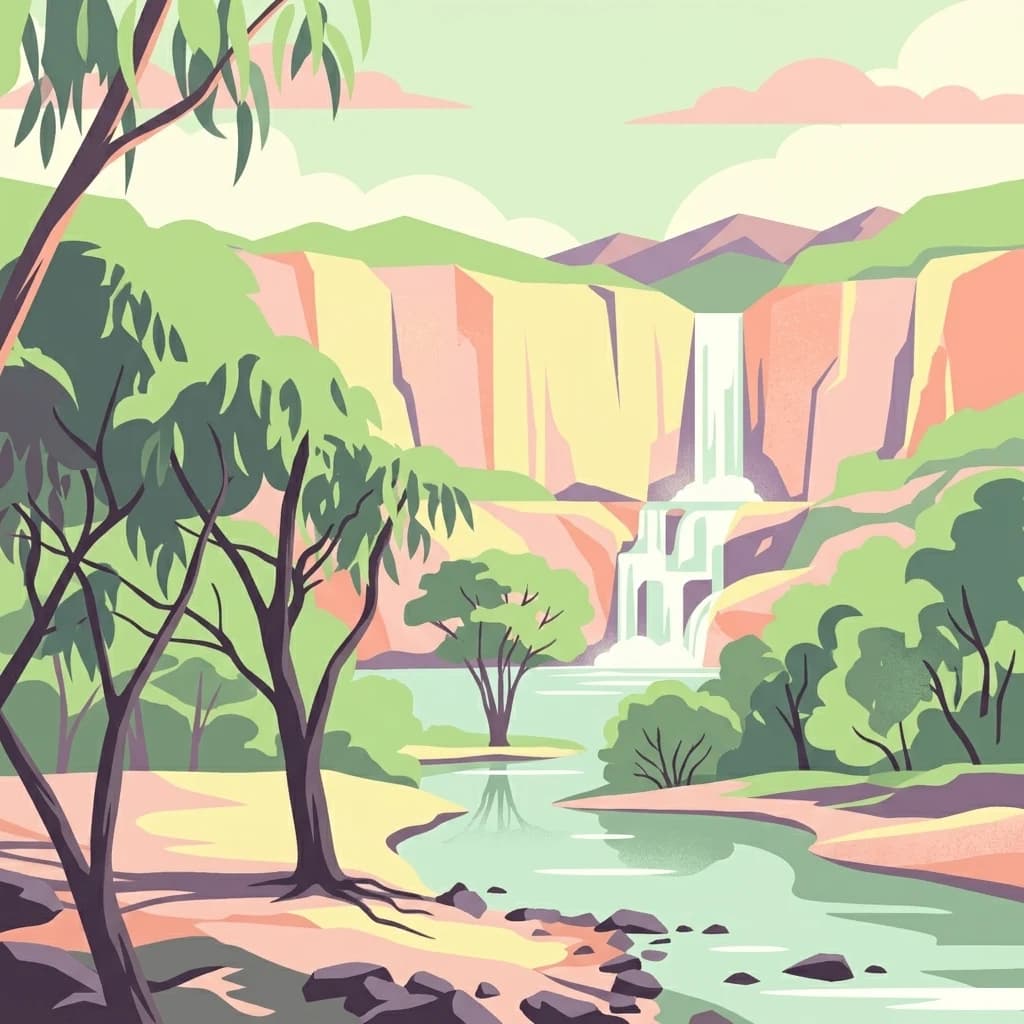
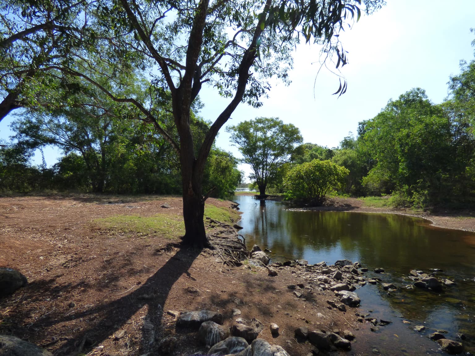
The Djukbinj National Park landscape consists of coastal savanna environments typical of the Northern Territory's Top End region. The terrain is predominantly flat to gently rolling, interspersed with seasonal wetlands and drainage channels that come alive during the wet season. Woodland patches, primarily consisting of eucalyptus and other native Australian tree species, dot the landscape alongside open grass-covered areas. The proximity to the coast influences the park's environmental character, with coastal influences affecting vegetation patterns and creating unique habitat interfaces between terrestrial and estuarine environments. The landscape supports a variety of soil types and vegetation communities that reflect the park's position in the seasonal tropics, characterized by distinct wet and dry seasons.

Djukbinj National Park ecosystems, habitats, and plant life

The natural environment of Djukbinj National Park reflects the biodiversity of the Northern Territory's coastal savanna ecosystems. The park supports a range of vegetation communities including woodland, open forest, and grassland habitats that vary with soil type and moisture availability. The seasonal wetland areas within the park provide important habitat functions, particularly during the wet season when waterbirds and other wildlife concentrate around temporary water bodies. The mixture of terrestrial and coastal habitats creates ecological diversity that supports numerous species adapted to the Top End's tropical conditions. While specific species details would require more detailed ecological surveys, the park's positioning within a recognized biodiversity hotspot of northern Australia indicates significant natural values.

Djukbinj National Park wildlife and species highlights

Djukbinj National Park provides habitat for wildlife species typical of the Northern Territory's tropical savanna and coastal environments. The seasonal wetlands and woodland habitats support populations of waterbirds, reptiles, and mammals adapted to the region's distinct wet and dry season cycles. The park's location within the Top End of the Northern Territory places it within a region recognized for its rich biodiversity, including numerous bird species, both resident and migratory. The mix of woodland, grassland, and wetland habitats creates diverse ecological niches that support varying wildlife communities throughout the year, with different species most observable during different seasons.

Djukbinj National Park conservation status and protection priorities

Djukbinj National Park represents an important conservation outcome in Australia's Northern Territory, protected under IUCN Category II for national park status. The park's establishment through the resolution of the Wulna Land Claim demonstrates a collaborative approach to conservation that integrates Indigenous land rights with protected area management. The joint management arrangement between the Limilngan-Wulna Aboriginal Corporation and the Parks and Wildlife Commission of the Northern Territory serves as a model for how traditional owner involvement can strengthen conservation outcomes. The protection of Escape Cliffs as a heritage-listed site further emphasizes the park's significance in preserving both natural and cultural values. The park contributes to the broader network of protected areas in the Northern Territory that conserve the region's distinctive coastal savanna ecosystems.

Djukbinj National Park cultural meaning and human context

The cultural context of Djukbinj National Park is deeply intertwined with the traditional lands of the Limilngan and Wulna peoples, whose connection to the area predates European settlement by millennia. The park's establishment following the Wulna Land Claim represents a recognition of Aboriginal heritage and native title rights in the conservation estate. Escape Cliffs holds additional historical significance as the site of South Australia's first attempt to settle the Northern Territory, representing an important moment in the colonial history of the region. This layering of Indigenous and colonial history makes Djukbinj culturally significant from both traditional owner and non-Indigenous historical perspectives. The ongoing involvement of the Limilngan-Wulna Aboriginal Corporation in park management ensures that Aboriginal cultural values remain central to how the area is protected and understood.

Top sights and standout views in Djukbinj National Park

The primary highlights of Djukbinj National Park include its significant role in Australian conservation history as a co-managed protected area with Aboriginal traditional owners, the historic Escape Cliffs site representing South Australia's first Northern Territory settlement attempt and now heritage-listed, and its coastal savanna landscapes supporting Top End biodiversity. The park offers visitors the opportunity to experience a landscape where Indigenous heritage and colonial history intersect, set within a natural environment representative of the Northern Territory's tropical savanna ecosystems. The collaborative management model represents an important approach to protected area stewardship in Australia.

Best time to visit Djukbinj National Park

The best time to visit Djukbinj National Park aligns with the Northern Territory's dry season, typically from May to October, when weather conditions are most comfortable for outdoor exploration. During the dry season, road access within the park is generally more reliable and wildlife viewing opportunities improve as animals concentrate around remaining water sources. The wet season from November to April brings seasonal flooding that can affect access to some areas but transforms the landscape with abundant waterbird activity and lush vegetation. Visitors interested in experiencing the park's full ecological character should consider the seasonal variation in conditions that shape the Top End environment.

Park location guide

Geography guide, regional context, and park location map for Djukbinj National Park

Djukbinj National Park park geography, regions, and map view in Australia
Understand where Djukbinj National Park sits in Australia through a broader geographic reading of the surrounding landscape, nearby location context, and its mapped position within the national park landscape.

How Djukbinj National Park fits into Australia

Australia is a constitutional monarchy and federal parliamentary democracy comprising six states and ten territories. With a population of nearly 28 million, it is one of the world's most urbanised countries, with most people concentrated on the eastern seaboard. The country has a high Human Development Index and is known for its cultural diversity, ancient Aboriginal heritage, and unique wildlife.

Wider geography shaping Djukbinj National Park in Australia

Australia occupies the entire Australian continent, the island of Tasmania, and numerous smaller islands. It is the world's flattest and driest inhabited continent, featuring vast deserts in the interior (the Outback), tropical rainforests along the eastern coast, and a coastline bordering the Indian and Pacific Oceans.

Map view of Djukbinj National Park

Use this park location map to pinpoint Djukbinj National Park in Australia, understand its exact geographic position, and read its mapped placement within the surrounding landscape more clearly.

Pigeon | © OpenStreetMap contributors

Location context for Djukbinj National Park

Northern Territory

Explore the visual character of its coastal savanna habitats, seasonal wetlands, and heritage landscapes, illustrating the Top End's protected terrain.

Djukbinj National Park Photos: Visual Atlas of Coastal Savanna Landscapes and Top End Scenery
Browse an extensive collection of imagery capturing the coastal savanna ecosystems and unique terrain of Djukbinj National Park in Australia's Northern Territory. These photos provide essential visual context for understanding the park's diverse habitats, historical sites like Escape Cliffs, and the overall character of this protected landscape.

Shallow watercourse bordered by rocky shore and dirt path, surrounded by trees and open land under clear sky

Park atlas

Compare nearby protected areas and trace connected coastal savanna landscapes, expanding your atlas of Northern Territory conservation.

Discover Nearby National Parks and Protected Areas around Djukbinj National Park in Australia's Northern Territory
After exploring Djukbinj National Park, browse other national parks and protected areas in Australia's Northern Territory, focusing on similar coastal savanna environments and jointly managed Indigenous lands. This geographic view allows for direct comparison of landscape types, conservation strategies, and regional distribution of protected ecosystems across the Top End.
National parkNorthern Territory

Mary River National Park: National Park in Northern Territory, Australia

Mapped protected landscape and regional geographic context.

Mary River National Park is an officially designated national park located in the vast Northern Territory of Australia. This protected area offers rich opportunities for geographic discovery, allowing users to explore its mapped boundaries and understand its significance within the regional landscape. Discover the natural context and atlas positioning of Mary River National Park, contributing to a broader understanding of protected lands in Northern Australia.

Area
1,215.25 km²
Established
1966
IUCN
II
Visitors
336.4K annual
National parkNorthern Territory

Charles Darwin National Park: Discover its Mapped Landscape, WWII Bunkers, and Larrakia Heritage

Northern Territory protected area with significant historical and geographic context.

Charles Darwin National Park represents a distinct protected landscape in Australia's Northern Territory, offering a rich tapestry of natural beauty and historical significance. This national park is renowned for its well-preserved World War II concrete bunker complex, serving as a direct link to Australia's wartime past. Beyond its military history, the park encompasses tropical savanna woodlands and coastal terrains that provide panoramic views of Darwin Harbour. Its indigenous heritage, including ancient shell middens, highlights thousands of years of Larrakia land use, making it a layered geographic and cultural discovery point.

Area
13.03 km²
Established
1998
IUCN
II
Climate
Tropical
National parkNorthern Territory

Litchfield National Park: Northern Territory National Park Protected Landscape Atlas

Explore regional geography and mapped park boundaries.

Litchfield National Park is a protected natural area located in Australia's Northern Territory, designated as a national park. This page offers detailed geographic context and explores the park's mapped boundaries, providing a foundational understanding of its protected landscape identity. Discover how Litchfield National Park fits within the broader atlas of Australian conservation lands, highlighting its regional geographic significance and mapped terrain.

Area
1,458.47 km²
Established
1991
IUCN
II
Visitors
329.6K annual
National parkAustralia

Kakadu National Park: Australia's Protected Landscape and Regional Geography

Explore Kakadu National Park's mapped boundaries and natural terrain.

Kakadu National Park stands as a significant national park entity within Australia, providing rich geographic context for atlas discovery. This page details the park's protected area identity, its mapped natural landscapes, and its place within the broader Australian continent's geography. Understand the unique regional setting and the specific topographic features that define Kakadu National Park for detailed exploration and comparative geographic analysis.

Area
19,804 km²
Established
1979
IUCN
II
Visitors
250K annual
National parkNorthern Territory

Garig Gunak Barlu National Park: Northern Territory's Remote Protected Coastal Wilderness & Map Atlas

Explore its unique marine protected area and mapped landscape context.

Garig Gunak Barlu National Park is a significant protected coastal wilderness, covering the entire Cobourg Peninsula in Australia's Northern Territory. This national park designation protects extensive terrestrial landscapes alongside vital adjacent marine waters. The park is renowned for its comprehensive safeguarding of marine turtle habitats and its designation as a Ramsar Wetland, emphasizing its ecological importance. Understanding Garig Gunak Barlu National Park involves exploring its mapped protected boundaries and its role as a crucial element of Northern Territory's protected landscapes, offering a unique atlas-style view of coastal conservation.

Area
2,260.06 km²
Established
2000
IUCN
II
Relief
Lowland
National parkKimberley

Niiwalarra Islands National Park: Protected Area and Kimberley Geography Explorer

Mapped landscape context for this Australian national park.

Gain a comprehensive atlas-style understanding of Niiwalarra Islands National Park, a designated national park situated in Australia's Kimberley region. This dedicated page provides insight into its protected landscape, its precise geographic boundaries as mapped within the region, and its overall significance as a natural area. Explore the structured geographic data that defines this park's identity and its unique place in the Australian atlas.

Area
33.52 km²
Established
2019
IUCN
Ia
Scope
Mixed
National parkWestern Australia

Drysdale River National Park: Western Australia National Park Geographic Atlas Entry

Mapped protected landscape and regional context.

Delve into the protected landscape of Drysdale River National Park, a designated national park located in Western Australia. This page serves as a focused entry point for understanding its geographic placement, mapped boundaries, and contribution to the broader regional atlas. Explore the specific terrain and protected area context of Drysdale River National Park, aiding in structured geographic discovery within Australia's vast natural areas.

Area
4,482.64 km²
Established
1974
IUCN
II
Relief
Mountain
National parkWestern Australia

Purnululu National Park: National Park Atlas and Mapped Protected Landscape

Explore Western Australia's Purnululu National Park geography.

Gain a structured atlas-style understanding of Purnululu National Park, a key protected area in Western Australia. This page details the park's geographic identity, its role as a national park, and its relationship to the surrounding regional landscapes. Engage with mapped park boundaries and factual context to appreciate its place in the broader Australian conservation geography.

Area
2,397.23 km²
Established
1987
IUCN
II
Relief
Mountain

Common questions about visiting, size, designation, and location context for Djukbinj National Park

Djukbinj National Park FAQs for park facts, access, geography, and protected area context
Find quick answers about Djukbinj National Park, including protected-area facts, park geography, trail and visitor context, and how the park fits into its surrounding country and regional landscape.
MoriAtlas Explorer

Continue Your Protected Areas Search Across the Global Atlas

Deepen your exploration by continuing the structured search for national parks and protected areas worldwide. Utilize the comprehensive filtering capabilities to compare different conservation landscapes and refine your understanding of global park geography. Discover more about the distribution and characteristics of protected natural areas.

Global natural geography