Peaks
Wallis Peak
265 m

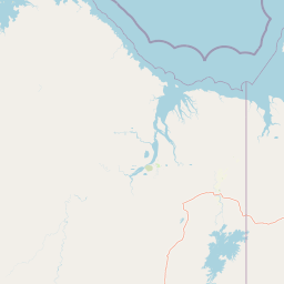
Detailed spatial analysis of terrain features, waterway networks, and boundary measurements.
This geographic profile covers the regional context and physical dimensions of Drysdale River National Park in Western Australia. The dataset includes measured boundary spans, mapped river systems such as the Drysdale and Carson Rivers, and associated terrain features including mountain peaks and waterfall sites within the protected area.
Related tags
Remote Kimberley wilderness protecting pristine river gorges and dramatic waterfalls
Drysdale River National Park is a vast protected wilderness area in the remote Kimberley region of Western Australia, situated approximately 2,168 kilometers northeast of Perth. As the largest and least accessible national park in the Kimberley, this remote reserve encompasses approximately 4,482 square kilometers of virtually untouched landscape featuring the Drysdale River system with its spectacular gorges, dramatic cliffs, and cascading waterfalls. The park protects a representative example of untouched Kimberley wilderness, characterized by open woodland, deep river gorges, and the pools and waterfalls that define the seasonal watercourses flowing through the area.
Regional and national context within the Australian continent
Analyzing the 4482 square kilometer footprint and geographic coordinates
Stored terrain classifications and recorded natural features across the park
Peaks
265 m
Streams
Streams
Rivers
Streams
Streams
Interpreting tropical relief, forest cover, and riverine water presence.
Mountains · Valleys · Cliffs · Forest · Rivers · Waterfalls
Temperate broadleaf forest · Riverine habitat · Wetland
Trace the regional geography of Western Australia's remote Kimberley, comparing vast protected landscapes and river systems.
Northwest

Understanding its landscape and mapped boundaries.
Lawley River National Park is a designated national park offering a focused exploration of its protected landscape and geographic identity within Western Australia. This entry provides structured details essential for understanding the park's mapped boundaries and its role in the regional conservation atlas. Examine the park's specific geographic context and its significance as a protected natural area without requiring travel logistics or visitor advice.
North
Mapped landscape context for this Australian national park.
Gain a comprehensive atlas-style understanding of Niiwalarra Islands National Park, a designated national park situated in Australia's Kimberley region. This dedicated page provides insight into its protected landscape, its precise geographic boundaries as mapped within the region, and its overall significance as a natural area. Explore the structured geographic data that defines this park's identity and its unique place in the Australian atlas.
West
Remote sandstone wilderness within Western Australia
Mitchell River National Park offers a deep look into the geomorphology of the Mitchell Plateau, featuring iconic sandstone features and permanent waterholes like Surveyors Pool. This protected wilderness in Western Australia serves as a critical study area for biodiversity, encompassing tropical savanna habitats, ancient rock art sites, and complex river systems that remain essential to the ecological integrity of the Kimberley region.
West
Explore mapped boundaries of this Western Australian national park.
Prince Regent National Park represents a distinct protected area within the expansive territory of Western Australia. This national park serves as a focal point for understanding regional geography and mapped landscape features. Users can explore its specific park boundaries and discover its contribution to the atlas of Western Australia's natural heritage, offering a deep dive into its protected status and geographic placement.
West
Western Australia Marine Protected Area and seafloor terrain
Spanning over 74,000 square kilometres of the Indian Ocean, Kimberley Marine Park encompasses an intricate underwater landscape. From shallow banks and pinnacles to deep oceanic trenches, the park serves as a vital refuge for migratory humpback whales, sea turtles, and dugongs within a complex Commonwealth marine reserve network.
East
Discover mapped boundaries and the national park's place in regional context.
Mirima National Park is a significant protected area offering insights into the natural landscapes of Western Australia. This page provides a detailed view of its protected landscape identity and its geographic position within the larger atlas of Australian conservation lands. Explore the mapped boundaries and understand how Mirima National Park contributes to the regional geography and the broader framework of protected areas.
South
Explore conservation geography and sandstone terrain in Western Australia.
Marion Downs Sanctuary is a expansive nature reserve located in the heart of the Kimberley region of Western Australia. The protected territory includes vast tropical savanna woodlands and rugged sandstone gorges linked to the Fitzroy River system. Gain insights into the mapped boundaries and natural terrain that make this location a vital refuge for diverse species within the broader Australian outback.
East
Explore the dramatic sandstone terrain and protected boundaries of this Top End gem.
Keep River National Park in Australia's Northern Territory is a protected landscape of immense geological and cultural significance. This park is best known for its striking sandstone formations, the scenic Keep River Gorge, and its importance as habitat for endangered species like the Gouldian finch. Its rugged terrain offers a distinct view into the Top End's natural heritage, providing rich context for understanding protected areas and regional geography through mapped exploration.
Further your understanding of Drysdale River National Park by examining its specific geographic setting and protected area identity within Western Australia. This MoriAtlas route allows for detailed map exploration of the park's natural terrain and boundaries, contributing to a comprehensive view of Australia's conservation landscapes. Continue your atlas discovery by focusing on the unique geographic attributes that define Drysdale River National Park and its regional context.