
Mori Atlas logo
Nature reserveEU-Vogelschutzgebiet Müggelspree

A vital riverine mosaic of meadows, pine forests, and migratory bird habitats in southeastern Berlin

EU-Vogelschutzgebiet Müggelspree Nature Reserve: Mapped Geography and Protected Wetland Atlas

(Europäisches Vogelschutzgebiet Westlicher Müggelspree)

The EU-Vogelschutzgebiet Müggelspree serves as a critical nature reserve along the lower Spree river, encompassing a diverse corridor of wet meadows, fens, and pine-forested sand dunes. Within the urban edge of Berlin, this area forms a significant component of the Natura 2000 ecological network, providing essential refuge for migratory bird populations and protected raptors. Its varied terrain, ranging from slow-moving water channels to extensive grassland, creates a complex landscape mosaic unique to the Spree lowland region.

bird protection areaSpecial Protection AreaNatura 2000wet meadowsfenspine forest
A flat-style digital illustration featuring a valley with stylized mountains, a waterfall, a winding river, and pine forests under a warm, pastel-colored sky.

EU-Vogelschutzgebiet Müggelspree

Nature reserve

Park overview

Structured park overview, official facts, and landscape profile for EU-Vogelschutzgebiet Müggelspree

EU-Vogelschutzgebiet Müggelspree park facts, protected area profile, and essential visitor context

Review the core facts for EU-Vogelschutzgebiet Müggelspree, including designation, size, terrain, visitor scale, habitats, and operating context in one park-focused overview.

About EU-Vogelschutzgebiet Müggelspree

The EU-Vogelschutzgebiet Müggelspree is a bird-focused protected area in the south-eastern corner of Berlin, anchored along the river section known as the Müggelspree as it approaches the Großer Müggelsee. It forms part of Berlin's network of nature reserves and is integrated into the European Union's Natura 2000 system, linking local conservation efforts with broader continental habitat protection.

The protected area brings together several distinct landscape types: the open, traditionally managed meadows of the Gosener Wiesen, the wetland mosaic of the Krumme Lake / Pelzlake reserve, the Schmöckwitzer Bruch with its marsh and forest transitions, and the interconnected lakes, channels, and river arms of the Spree. Pine forests on glacial sands, dune ridges, overgrowing moor channels, floating-leaf and submerged aquatic plant beds, and scattered remnants of floodplain woodland add further structural diversity to the site.

What sets Müggelspree apart is its position at the intersection of an extensive river valley and an urban metropolis. Within a short distance of dense city districts, the area preserves habitat conditions suitable for breeding wetland birds, secretive mire specialists, and large raptors such as the white-tailed eagle. This juxtaposition of ecological richness and urban accessibility gives the site a significance that goes beyond its modest total area, making it a noteworthy example of how bird protection areas can function even within major European cities.

Quick facts and research context for EU-Vogelschutzgebiet Müggelspree

The EU-Vogelschutzgebiet Müggelspree is an EU Special Protection Area for birds within the city limits of Berlin, lying in the Treptow-Köpenick district in the far south-east of the city. Established in November 1997 and formally designated under the European Birds Directive framework in February 2006, it is part of the Natura 2000 network that spans the European Union.

The site takes its name from the Müggelspree, the local name for the Spree in the protected area's vicinity, and encompasses meadows, pine forest on glacial sand, slow river and lake waters, and protected nature reserves such as Gosener Wiesen and Krumme Lake / Pelzlake. It holds an important role as both a breeding ground and a stopover site for migratory birds in the Spree valley lowlands.

Protection and recognition

Explore documented protection status and international recognition records for EU-Vogelschutzgebiet Müggelspree.

EU-Vogelschutzgebiet Müggelspree Protection Status and Official Designation Record

Examine the verified protection status and official designation history recorded for EU-Vogelschutzgebiet Müggelspree within global protected area databases. Review structured conservation facts and administrative records associated with this natural landscape.

Protection details

WDPA ID
555537448
Park context

Deeper park guide and search-rich context for EU-Vogelschutzgebiet Müggelspree

EU-Vogelschutzgebiet Müggelspree history, landscape, wildlife, and travel context

Explore EU-Vogelschutzgebiet Müggelspree through its history, landscape character, ecosystems, wildlife, conservation priorities, cultural context, and seasonal travel timing in a structured park guide built for atlas discovery and search intent.

Why EU-Vogelschutzgebiet Müggelspree stands out

The site is best known for its role as a breeding area and migration stopover for protected and threatened bird species in the Spree lowlands. Open wet meadows, fens, pine forest edges, and slow-moving waterways converge here to support a diverse community of birdlife within an urban setting. Species of particular note include fish-hunting kingfishers along the watercourses, harriers such as marsh and Montagu's type raptors, white-tailed eagles, black woodpeckers, and a suite of warblers, larks, and cranes. The combination of extensive grassland habitat alongside riverine and forest environments gives the area its distinctive ornithological character.
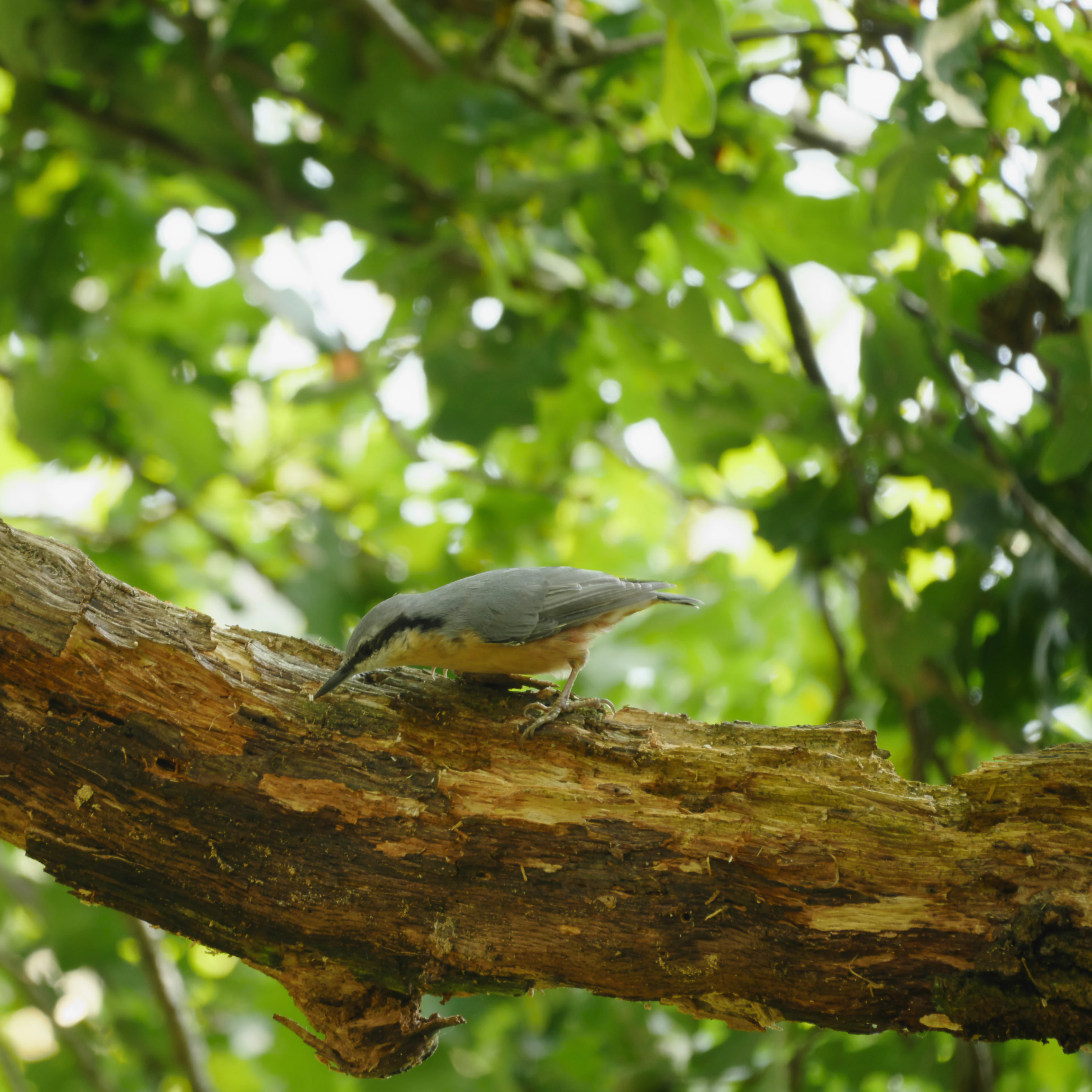
A Eurasian Nuthatch perched on a thick, textured tree branch with a background of out-of-focus green leaves.
A Eurasian Nuthatch perched on a tree branch in the Müggelspree region.

EU-Vogelschutzgebiet Müggelspree history and protected-area timeline

The site's protection history begins in November 1997, when it was originally identified as a special conservation area for birds. In February 2006, Berlin's Senate Department for Urban Development formally established it as a European bird protection area under the framework of the EU Birds Directive and the related Habitats Directive provisions that inform Natura 2000.

The area's designation brought several pre-existing local nature reserves together under a single European framework, including the Gosener Wiesen and Seddinsee reserve, the Krumme Lake / Pelzlake reserve, and the Schmöckwitzer Wiesen and Schmöckwitzer Bruch areas. Administratively, the protection area is overseen by the German Federal Agency for Nature Conservation (Bundesamt für Naturschutz) and holds the identification markers used in both the European Natura 2000 register and the global World Database on Protected Areas.

EU-Vogelschutzgebiet Müggelspree landscape and geographic character

The protected area sits in the flat Spree river lowlands of south-eastern Berlin, where broad glacial sand terraces meet the alluvial corridor of the Spree. Open wet meadows and fens dominate the southern sections, particularly around the Gosener Wiesen, while pine forest on sandy soils covers parts of the higher ground.

Riverine and lacustrine features shape much of the visual character of the area. Slow-moving stretches of the Müggelspree, sections of the Großer Müggelsee, and the connecting water bodies around the Dämeritzsee and Seddinsee provide open water framed by reedbeds, floating vegetation, and overgrowing moor channels. Dune ridges on the glacial sand islands within the floodplain, remnants of former floodplain forest, and the narrow channels of the Gosener Kanal all contribute to a varied mosaic of water, wetland, forest, and grassland landscapes.
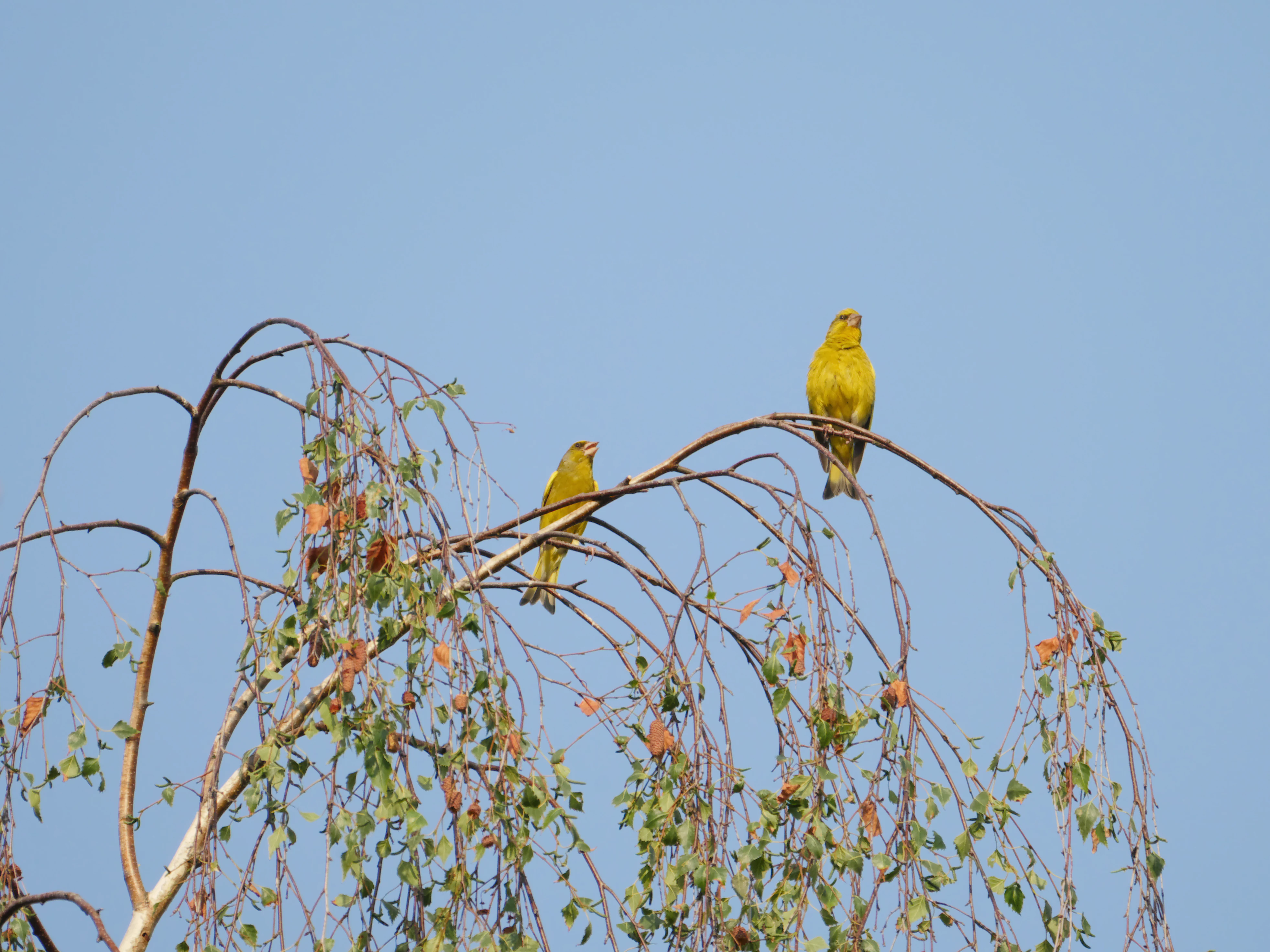
Two yellow-green male European greenfinches perched on the thin, downward-curving branches of a tree against a clear sky.
Two European greenfinches perched on the drooping branches of a tree in the Müggelspree protected area.

EU-Vogelschutzgebiet Müggelspree ecosystems, habitats, and plant life

Ecologically, the EU-Vogelschutzgebiet Müggelspree is defined by the close coexistence of open wet grassland, fen and moor formations, slow river and lake habitats, and pine forest on sandy soils. The traditional low-intensity grassland management of the meadows supports a herb-rich sward and provides important nesting and foraging conditions for ground-nesting birds.

The aquatic and semi-aquatic parts of the area, including the Müggelspree, surrounding lakes, and former moor channels, host beds of floating-leaf and submerged aquatic plants as well as reed communities, which in turn support fish populations and the birds that depend on them. Pine forests on the sand terraces host black woodpeckers and other cavity-using species, while floodplain forest remnants provide transitional habitats between the forest stands and the riverine wetlands. This combination of habitat types within a relatively compact area gives the site its particular ecological value for bird conservation.
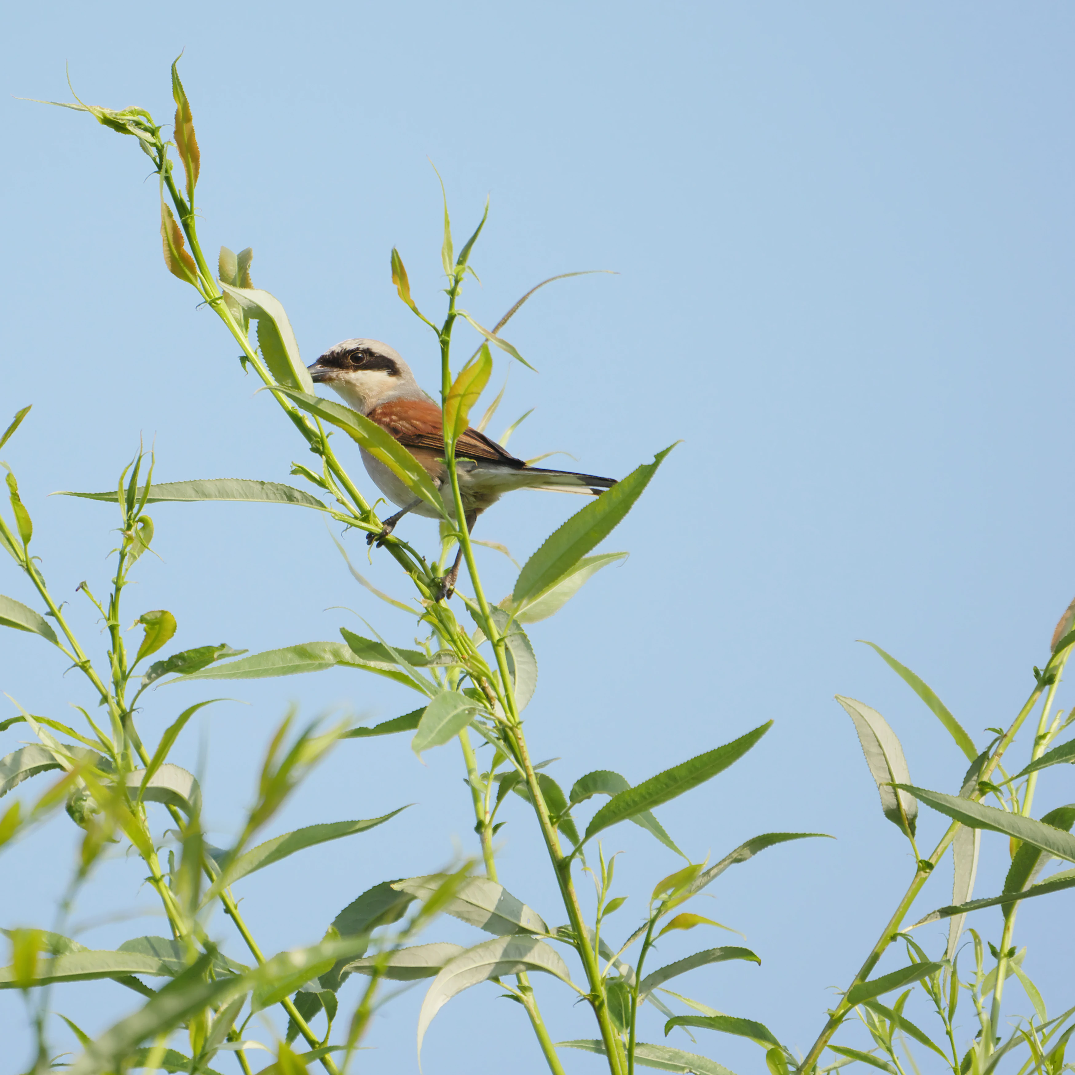
A male Red-backed Shrike bird with a distinct black mask and reddish-brown back perched on the green leafy stem of a plant against a clear blue sky.
A male Red-backed Shrike perched on a branch within the Müggelspree protected area.

EU-Vogelschutzgebiet Müggelspree wildlife and species highlights

The area is recognised first and foremost for its birdlife. Beyond the common urban species of Berlin, the protected area supports breeding populations of several specially protected or threatened species, including the European kingfisher, woodlark, common crane, red-backed shrike, marsh harrier, red and black kites, black woodpecker, white-tailed eagle, barred warbler, Eurasian reed warbler, black tern, corncrake, European honey buzzard, and red-breasted flycatcher.

Other species photographed and documented in the area include whinchat, greenfinch, Eurasian nuthatch, and marsh tit, reflecting the broader common bird community supported by the mixed meadow, woodland, and wetland habitats. The combination of open meadows for ground nesters, standing water for waterbirds and terns, and mature forest for cavity nesters and raptors is what gives the site its particular ornithological importance.
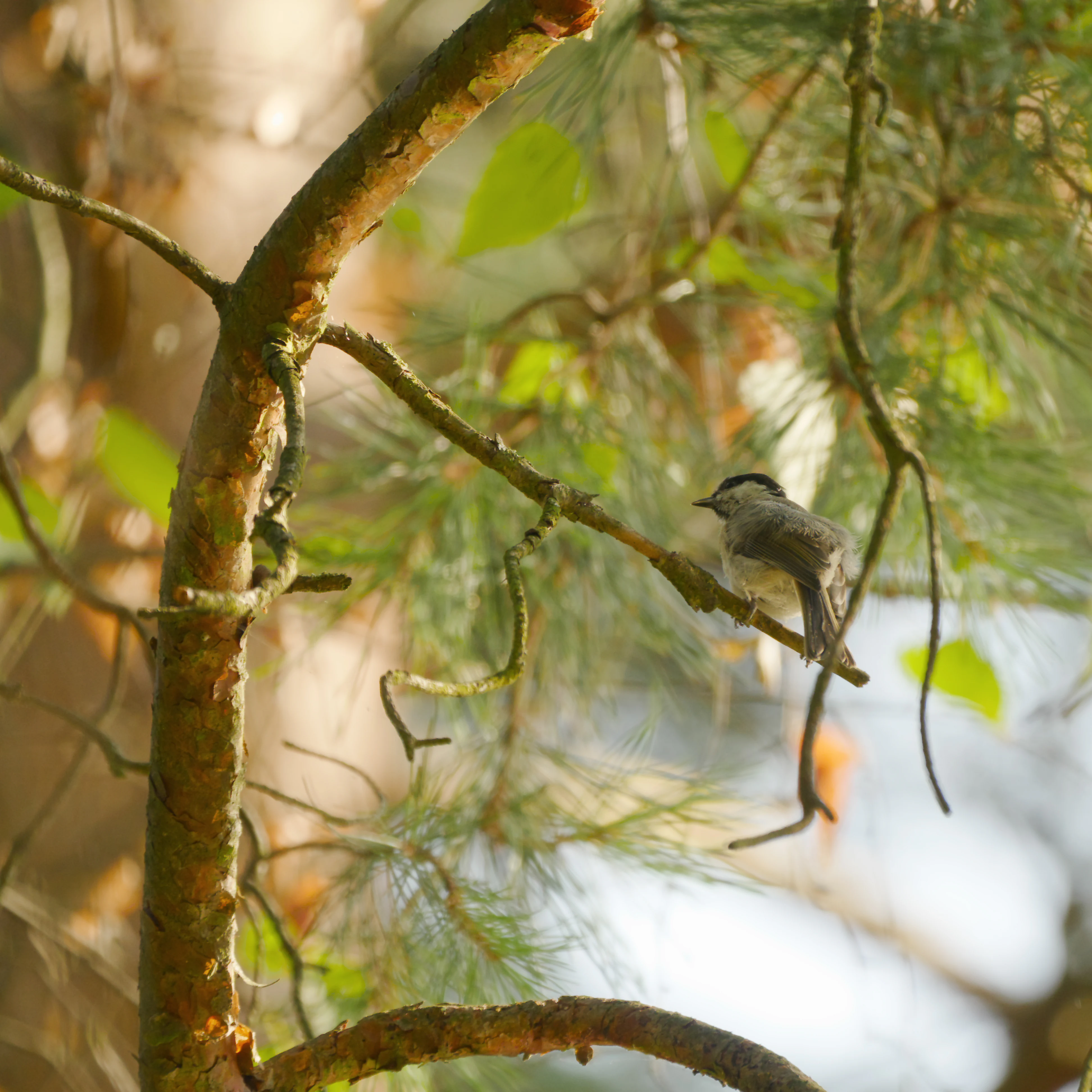
A small bird, identified as a marsh tit, perched on a thin branch of a pine tree in a forest setting.
A marsh tit perched on a branch within the Müggelspree protected area.

EU-Vogelschutzgebiet Müggelspree conservation status and protection priorities

As a Special Protection Area within the Natura 2000 network, the EU-Vogelschutzgebiet Müggelspree forms part of the European Union's coordinated effort to safeguard habitats of threatened bird species. Its designation under the Birds Directive subjects the area to management and protection standards that apply across EU member states, ensuring that breeding sites and migration habitats are maintained over the long term.

Locally, conservation value is reinforced by the inclusion of several pre-existing nature reserves within the SPA, consolidating protection for meadows, fens, forests, and waterways into a single framework. The site's ecological value lies in maintaining habitat conditions for species that have declined across much of central Europe, particularly wetland specialists and large raptors, while the broader Natura 2000 framework links the area into continental-level conservation planning.

Top sights and standout views in EU-Vogelschutzgebiet Müggelspree

The area's most distinctive qualities lie in its combination of wide, traditionally managed wet meadows, mature pine forests on glacial sand, and the calm, braided waterways of the Müggelspree and surrounding lakes. Together they support a working mosaic of habitats that is uncommon within a major urban environment.

The site's biodiversity profile is anchored by species such as the white-tailed eagle, marsh harrier, black woodpecker, kingfisher, common crane, and corncrake, placing it among the more ecologically rich bird protection areas in the Berlin-Brandenburg region. Its position at the south-eastern edge of Berlin, connecting to neighbouring Brandenburg landscapes, also gives it a transitional character between urban and rural habitat networks.
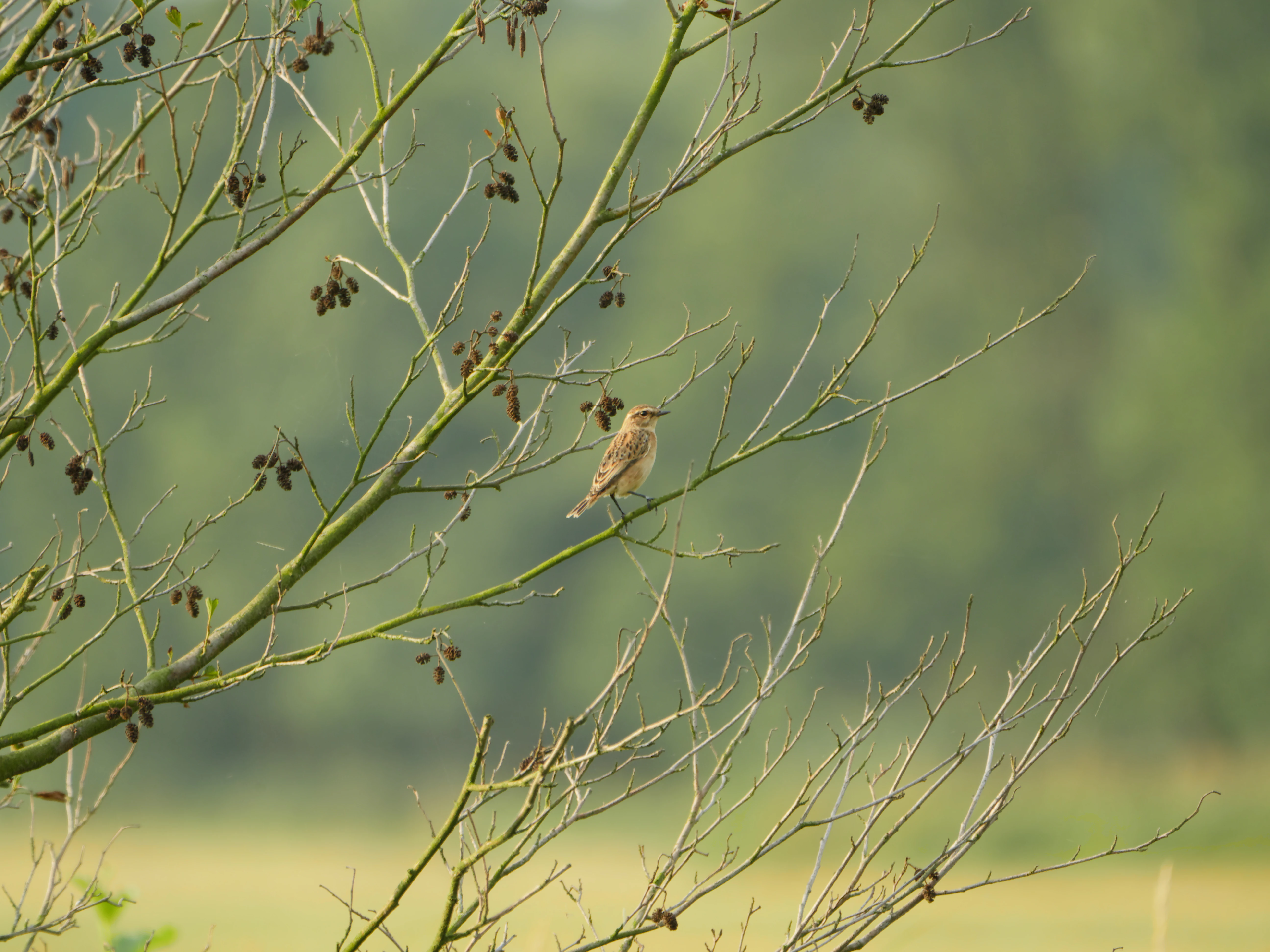
A small female whinchat bird perched on a thin, leafless branch in a natural field setting.
A female whinchat perched on a branch within the Müggelspree bird sanctuary.

Best time to visit EU-Vogelschutzgebiet Müggelspree

The site can be experienced through much of the year, but the late spring and early summer months are typically the most rewarding for observing breeding bird activity in the meadows, along the waterways, and in the forest edges. During this period, species such as whinchat, red-backed shrike, and reed warblers are most easily encountered in their breeding habitats.

Migration seasons bring their own character to the area, with spring and autumn passages offering opportunities to observe larger species and flocks moving through the Spree valley lowlands. In winter, the quiet meadows, frozen channels, and bare deciduous edges provide a different atmosphere and the chance to see hardy resident species and raptors more clearly against the open landscape.

Monthly climate preview

Long-term monthly temperature averages and precipitation trends for EU-Vogelschutzgebiet Müggelspree

EU-Vogelschutzgebiet Müggelspree Climate Normals and Annual Weather Patterns

Long-term recorded measurements for EU-Vogelschutzgebiet Müggelspree show a measured annual temperature range from sub-zero winter minimums to warm summer maximums alongside consistent daily precipitation. Reviewing the full monthly sequence provides detailed historical climate normals and representative point data for analytical geographic study.
Annual mean9 °C
-1 °C20 °C
Jan-1°
Feb
Mar
Apr
May14°
Jun18°
Jul20°
Aug20°
Sep15°
Oct
Nov
Dec
Warmest month
July

20.3 °C

Coolest month
January

-0.9 °C

Wettest month
July

2.4 mm/day

Driest month
April

1.1 mm/day

Park location guide

Geography guide, regional context, and park location map for EU-Vogelschutzgebiet Müggelspree

EU-Vogelschutzgebiet Müggelspree park geography, regions, and map view in Germany

Understand where EU-Vogelschutzgebiet Müggelspree sits in Germany through a broader geographic reading of the surrounding landscape, nearby location context, and its mapped position within the national park landscape.

How EU-Vogelschutzgebiet Müggelspree fits into Germany

Germany is a federal republic in Western and Central Europe with a population of over 83 million across sixteen constituent states. It is Europe's largest economy by nominal GDP and a major global exporter and importer. The capital is Berlin, and the country borders Denmark, Poland, Czech Republic, Austria, Switzerland, France, Luxembourg, Belgium, and the Netherlands.

Wider geography shaping EU-Vogelschutzgebiet Müggelspree in Germany

Germany is located in Western and Central Europe, spanning 357,022 km². It borders Denmark to the north, Poland and the Czech Republic to the east, Austria and Switzerland to the south, and France, Luxembourg, Belgium, and the Netherlands to the west. The country has coastlines on the Baltic Sea and North Sea to the north, with the Alps located in the southern region.

Map view of EU-Vogelschutzgebiet Müggelspree

Use this park location map to pinpoint EU-Vogelschutzgebiet Müggelspree in Germany, understand its exact geographic position, and read its mapped placement within the surrounding landscape more clearly.

Pigeon | © OpenStreetMap contributors

Location context for EU-Vogelschutzgebiet Müggelspree

Berlin

Visual reference for wetland habitats, river corridors, and protected terrain

EU-Vogelschutzgebiet Müggelspree Photos and Landscape Scenery

Visual records capture the wetland habitats, pine forests, and river corridors defining EU-Vogelschutzgebiet Müggelspree. Photographic documentation offers clear insight into the protected lowland terrain and regional bird sanctuary character.

A Eurasian Nuthatch perched on a thick, textured tree branch with a background of out-of-focus green leaves.

A juvenile red-backed shrike perched on a branch of an alder tree with small green seed cones against a pale sky.

Two yellow-green male European greenfinches perched on the thin, downward-curving branches of a tree against a clear sky.

A male Red-backed Shrike bird with a distinct black mask and reddish-brown back perched on the green leafy stem of a plant against a clear blue sky.

A small bird, identified as a marsh tit, perched on a thin branch of a pine tree in a forest setting.

A small juvenile red-backed shrike bird perched near the top of a thin, bare branch, set against a soft-focus green background.

A small female whinchat bird perched on a thin, leafless branch in a natural field setting.

A wide, eye-level view of the Gosener Wiesen marshlands in Germany, featuring foreground green grass, a band of tall reeds, and a background of dense forest under a bright, overcast sky.

Park atlas

Compare regional wetlands, lowland river corridors, and connected habitats

Parks Near EU-Vogelschutzgebiet Müggelspree and Surrounding Protected Areas

Browse other protected areas and regional reserves located near EU-Vogelschutzgebiet Müggelspree. Expanding the geographic comparison reveals broader lowland river corridors, wetland networks, and connected conservation landscapes across the surrounding region.
A wide watercolor illustration showing a calm lake with small tree-covered islands, bordered by green forests and distant hills under a pale sky.
Protected areaBrandenburg
About 2.7 km away#1 closest

South

Wernsdorfer See Protected Area: Geographic Mapping and Landscape Context in Brandenburg

Glacial wetland mosaic featuring dunes and reedbeds

Wernsdorfer See is an essential nature reserve in Brandenburg that showcases a rare mix of habitats, from open sandy dunes and grasslands to shallow marshland and reedbeds. Managed as part of the Natura 2000 network, the site serves as a vital refuge for bird species and rare wetland flora. This overview traces the geography and terrain of the Spree valley lowland, offering a structured perspective on its conservation landscape.

Area
1.387 km²
Established
1967
Relief
Lowland
Climate
Temperate
Nature reserveBerlin
About 5 km away#2 closest

West

Teufelsseemoor Köpenick: Protected Kettle Bog Geography and Urban Wetland Atlas

Glacial landscape and conservation zone in Berlin, Germany

Teufelsseemoor Köpenick is a key nature reserve in Berlin that showcases the transition from post-glacial kettle hole to a thriving peatland and swamp forest. This protected area stands out for its ecological gradient and serves as a model of urban wilderness conservation. The site is defined by the contrast between its still waters and the surrounding moraine ridges of the Müggelberge.

Area
0.065 km²
Established
2016
IUCN
IV
A watercolor painting showing a soft, abstract landscape with rolling hills, a central body of water, and a tree-lined shoreline.
Nature reserveBerlin
About 5.8 km away#3 closest

West

Krumme Lake Nature Reserve: Geographic Overview and Protected Wetland Boundaries in Berlin

A preserved mosaic of alder swamp forest and Dahme floodplain habitat

Krumme Lake preserves a dense network of wetland habitats within the pine-dominated forests of Berlin's Treptow-Köpenick borough. This protected nature reserve integrates groundwater-influenced ecosystems and riparian forest remnants, providing a sanctuary for diverse amphibians and invertebrates that have become increasingly rare in surrounding urbanized landscapes.

Area
0.452 km²
Established
2004
IUCN
IV
Relief
Lowland
Nature reserveBrandenburg
About 11 km away#4 closest

Southeast

Swatzke- und Skabyberge Nature Reserve and Protected Inland Dune Geography in Brandenburg

Mapping the sand heaths and forest ecosystems of northeastern Germany

Swatzke- und Skabyberge is a designated nature reserve in Brandenburg that preserves a rare inland dune complex. Originally shaped by long term military usage, this protected land now functions as a vital habitat for dry acid grasslands, lichen-rich pine forests, and wetland woodland fringes. It provides a unique study in how sand, fire, and moisture processes maintain biodiversity within the lowland German landscape.

Area
5.2 km²
Established
1999
IUCN
IV
A horizontal watercolor illustration depicting a soft, serene landscape with green trees, pink flowering trees, and gentle hills on a white background.
Nature reserveBrandenburg
About 11 km away#5 closest

South

Skabyer Torfgraben Nature Reserve: Geographic Mapping and Protected Area Overview

Wetland landscape corridors within Brandenburg, Germany

The Skabyer Torfgraben nature reserve provides a focused look at lowland stream ecosystems and rare through-flow peatland remnants. This protected area in the Dahme-Spreewald region serves as a crucial habitat mosaic, blending sandy birch-oak forests with sedge-dominated wet meadows. Examine its natural terrain and hydrological connections to the Dahme river within the context of German protected landscapes.

Area
3.049 km²
Established
1998
IUCN
IV
Relief
Lowland
A soft watercolor illustration of a lowland wetland landscape with a small pool of water, grasses, and scattered trees under a light sky.
Nature reserveBrandenburg
About 12 km away#6 closest

Southwest

Flutgrabenaue Waltersdorf Nature Reserve: Protected Wetland Geography and Regional Atlas

A significant floodplain sanctuary in the Brandenburg lowlands.

Flutgrabenaue Waltersdorf represents an ecologically rich lowland floodplain featuring sinuous watercourses, alder swamps, and traditional meadow habitats. Located south of Berlin, this reserve provides a vital geographic contrast to the urbanized infrastructure of the Brandenburg region. Use this overview to study the boundary, terrain characteristics, and regional importance of this protected marshland landscape.

Area
2.88 km²
Established
1998
IUCN
IV
Relief
Lowland
Watercolor painting of a rolling landscape with green grass, bushes, and soft-colored hills in the background.
Protected landscapeBerlin
About 12 km away#7 closest

Northwest

Kaulsdorfer Seen: A Protected Landscape in Berlin with Glacial and Industrial History

Exploring the groundwater protection zones and post-mining lakes of eastern Berlin

The Kaulsdorfer Seen area represents a distinct protected landscape located in Berlin. It showcases the transition between ice-age glacial regions, featuring two prominent lakes that evolved from sand and gravel pits into a mature ecosystem of willow thickets, woodland, and reeds. This site functions as an important drinking-water protection zone, offering a structured look at the complex interplay between urban development and natural resource conservation.

Area
0.937 km²
Water
Major water bodies
Nature reserveBrandenburg
About 14 km away#8 closest

South

Tiergarten Nature Reserve: Geography and Protected Habitat Mapping in Brandenburg, Germany

Ancient oak woodland, riparian wetlands, and historic forest trails.

Spanning 158 hectares, the Tiergarten nature reserve serves as an ecologically rich sanctuary of oak-hornbeam forests and wet meadows. This area, formerly a royal hunting ground, offers a dense mosaic of riparian zones along the Staabe river, protecting essential habitats within the broader Brandenburg landscape.

Area
1.58 km²
Established
1995
IUCN
IV

Common questions about visiting, size, designation, and location context for EU-Vogelschutzgebiet Müggelspree

EU-Vogelschutzgebiet Müggelspree FAQs for park facts, access, geography, and protected area context

Find quick answers about EU-Vogelschutzgebiet Müggelspree, including protected-area facts, park geography, trail and visitor context, and how the park fits into its surrounding country and regional landscape.
MoriAtlas Explorer

Continue Your Protected Areas Search Across the Global Atlas

Deepen your exploration by continuing the structured search for national parks and protected areas worldwide. Utilize the comprehensive filtering capabilities to compare different conservation landscapes and refine your understanding of global park geography. Discover more about the distribution and characteristics of protected natural areas.

Global natural geography