
Mori Atlas logo
Nature reserveKrumme Lake

A vital ecological corridor featuring alder swamp forests, sedge meadows, and historic Dahme River floodplain remnants

Krumme Lake Nature Reserve: Mapping the Protected Wetland Landscapes of Southeastern Berlin

(Naturschutzgebiet Krumme Lake Grünau)

Krumme Lake serves as a critical nature reserve in the southeast of Berlin, protecting a compact mosaic of wetland habitats nestled within the Stadtforst Grünau. This protected area safeguards a meandering remnant of the historic Dahme River system, where groundwater-influenced birch-oak woodlands and dense reed beds provide refuge for diverse amphibian species, including the northern crested newt. As both a designated nature protection zone and a water safety area, the landscape offers a rare, quiet intersection of wetland ecology and sandy pine forest within the broader urban geography of the German capital.

wetlandfloodplain forestnature reserveBerlinurban naturepine forest
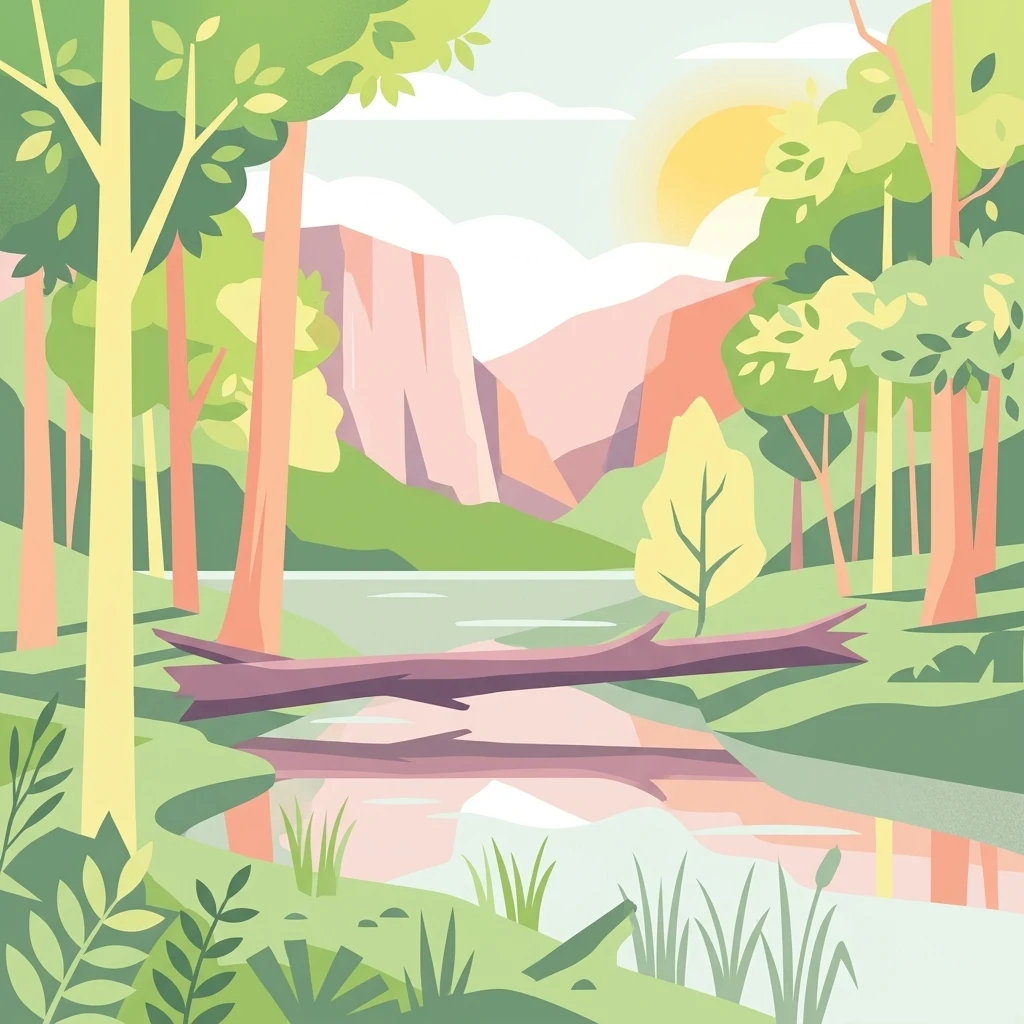
A flat vector illustration of a lake scene with a large fallen tree trunk resting in the water, surrounded by trees and distant hills under a gentle sun.

Krumme Lake

Nature reserve

Park overview

Structured park overview, official facts, and landscape profile for Krumme Lake Nature Reserve

Krumme Lake Nature Reserve park facts, protected area profile, and essential visitor context

Review the core facts for Krumme Lake Nature Reserve, including designation, size, terrain, visitor scale, habitats, and operating context in one park-focused overview.

About Krumme Lake Nature Reserve

Krumme Lake, formally the Naturschutzgebiet Krumme Lake Grünau, is a protected wetland landscape in the southeast of Berlin. Geographically it sits deep within the Stadtforst Grünau, the Grünau City Forest, between the urban edge at Grünau and the more loosely settled areas around Schmöckwitz and Karolinenhof in the borough of Treptow-Köpenick. The reserve covers around 45 hectares of forest and wetland that the surrounding city has gradually grown up against.

The site's center is a slow, meandering watercourse that was once a side branch of the Dahme River. Historically this branch, together with a parallel arm known historically as the Ochsenkopflaake, drained into the Dahme along what is now the western edge of the Karolinenhof settlement. Over time, as the city expanded and the floodplain forests were gradually altered, the former main channel was reduced to a winding, partially overgrown creek. Today's Krumme Lake is named for this meandering course, with the name reflecting the serpentine shape of the waterway rather than any open lake basin.

The reserve's ecological value lies in its mosaic of habitats. Although the broader forest around it is dominated by pine, the wetter core of the site carries alder swamp forest, sedge and reed beds, and birch-oak woodland shaped by groundwater. This patchwork supports moisture-loving plant communities and an unusually rich amphibian fauna for such a small area. Because the reserve includes both protected habitat and a designated water protection zone, it combines biodiversity conservation with the safeguarding of a nearby groundwater resource used by the city.

Quick facts and research context for Krumme Lake Nature Reserve

Krumme Lake is a nature reserve of roughly 45 hectares in southeast Berlin, within the Stadtforst Grünau between the localities of Grünau and Schmöckwitz. It is classified as IUCN Category IV, a Habitat/Species Management Area, and is jointly designated as a Naturschutzgebiet and a Wasserschutzgebiet. The reserve is identified by the code NSG 37 in Berlin's protected-area registry and is administered by Berlin's Senate Department for the Environment, Mobility, Consumer Protection, and Climate. The site is positioned along a former branch of the Dahme River and supports fragmentary floodplain woodland within a broader landscape of pine forest.

Protection and recognition

Terrestrial conservation scope, designation history, and documented management facts

Krumme Lake Protection Status and International Recognition Records

Conservation records compile the terrestrial protection status, designation framework, and management scope established for Krumme Lake. Official data profiles record conservation metrics, administrative parameters, and international databases associated with the protected area.

Protection details

Protection scope
Terrestrial
Transboundary protection
No
WDPA ID
329499
Park context

Deeper park guide and search-rich context for Krumme Lake Nature Reserve

Krumme Lake Nature Reserve history, landscape, wildlife, and travel context

Explore Krumme Lake Nature Reserve through its history, landscape character, ecosystems, wildlife, conservation priorities, cultural context, and seasonal travel timing in a structured park guide built for atlas discovery and search intent.

Why Krumme Lake Nature Reserve stands out

Krumme Lake is best known for being one of Berlin's surviving examples of a small Dahme floodplain wetland embedded in a pine forest matrix. Its combination of alder swamp forest, sedge and reed beds, and groundwater-influenced birch-oak woodland supports a notable amphibian fauna, including seven recorded amphibian species and the protected northern crested newt. It is also valued as a quiet, easily accessible nature experience within a heavily urbanized region.
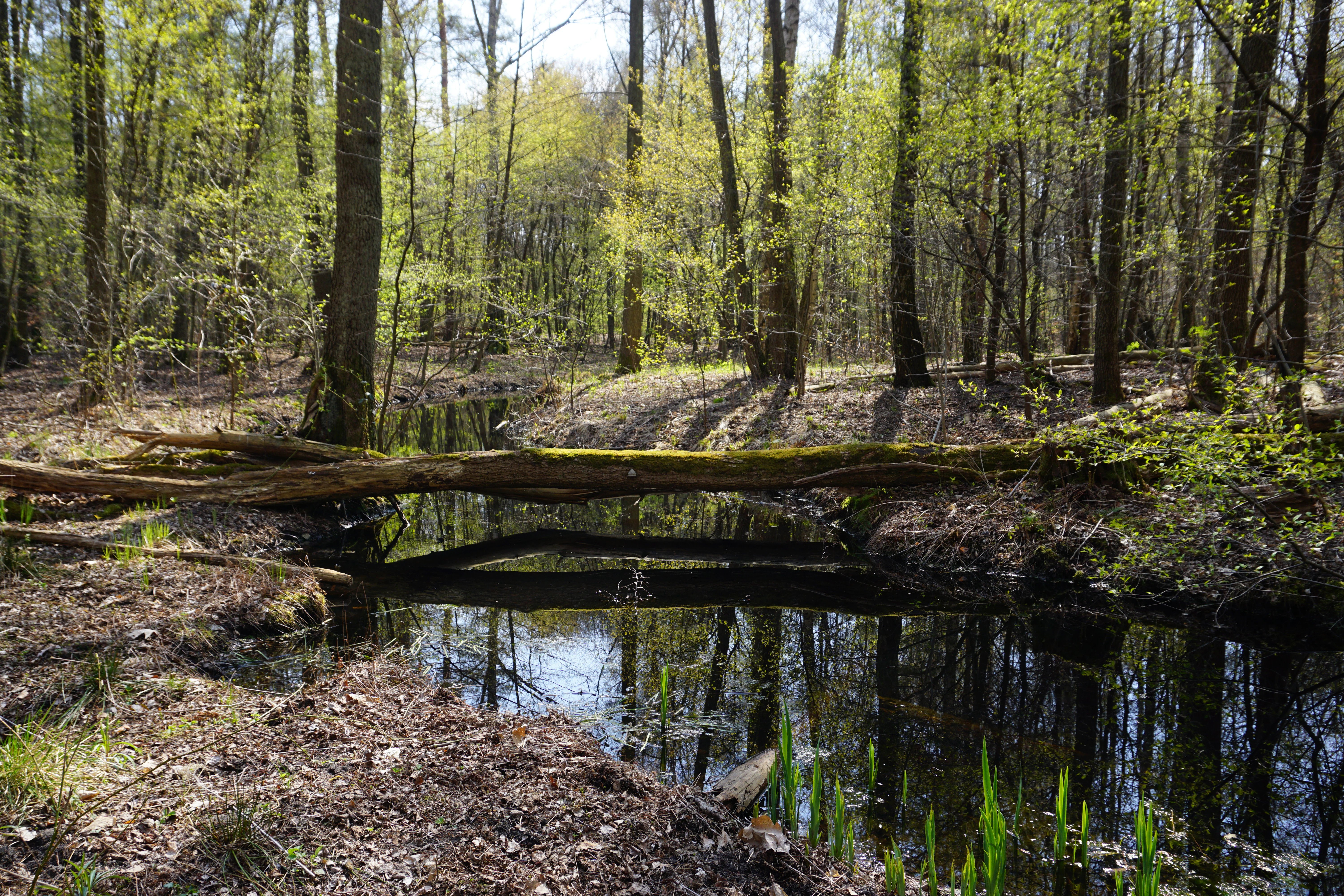
A peaceful stream winds through an alluvial forest in spring with a fallen log crossing the water and sunlight filtering through the fresh green leaves.
Springtime in the Krumme Lake nature reserve in Berlin.

Krumme Lake Nature Reserve history and protected-area timeline

Krumme Lake originates as a historical watercourse connected to the Dahme River system in what is now southeastern Berlin. The upper course of the stream was once known by the name Ochsenkopflaake, flowing near the edge of early settlements in the Schmöckwitz area and along the western boundary of what would become Karolinenhof. A side branch near the present-day Rehfeldstraße once carried part of this flow into Karolinenhof, while the remaining arm continued along what is now recognized as the Krumme Lake.

As Berlin expanded through the twentieth century and the surrounding settlements of Grünau, Schmöckwitz, and Karolinenhof were incorporated into the city, the former floodplain landscape was increasingly encircled by urban development. The remnant branch lost its direct connection to the main channel of the Dahme and gradually became the small, winding stream now preserved within the Grünau Forest.

The area's official protection history began in the early 2000s. Krumme Lake was formally designated as a nature reserve on 10 August 2004 under a regulation that remains the basis of its present-day management. That regulation was subsequently amended on 20 December 2017 to update the protected framework. Since designation, the reserve has been administered by Berlin's Senate Department for the Environment, Mobility, Consumer Protection, and Climate, reflecting the city's recognition of the site as both a biodiversity refuge and a water protection area within an otherwise heavily urbanized landscape.

Krumme Lake Nature Reserve landscape and geographic character

The landscape of Krumme Lake is defined by a narrow, sinuous watercourse winding through a forested depression, rather than by open water or dramatic relief. The meandering shape of the stream gives the place its name, suggesting the curved and irregular character of the channel as it threads through the surrounding woodland. Visually, the site reads as a quiet trench of wetland vegetation cut into a broader plain of dry, sandy forest.

Surrounding the wet core, the terrain is largely flat, dominated by sandy soils typical of the Berlin glacial plain. The forest matrix is shaped by pine stands that rise on drier ground, releasing into wetter, darker vegetation as elevation drops toward the creek. Within the floodplain itself, the surface is patterned by hummocks, gentle meander scrolls, and soft transitions between reed stands, sedge beds, and alder thickets. Remnant floodplain woodland along the stream edges still hints at the original riparian forest that once stretched more broadly along the Dahme.
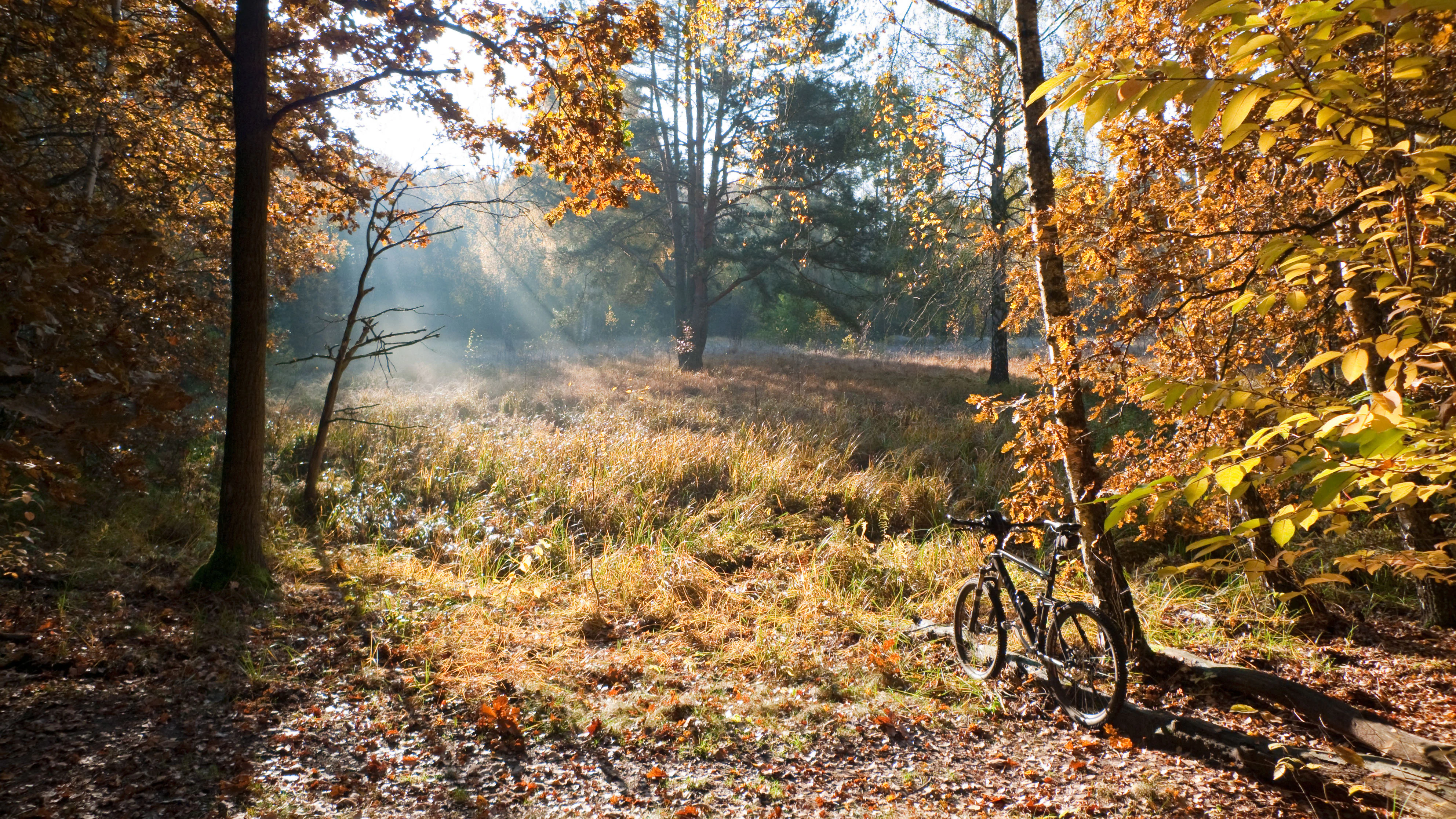
A bicycle parked near trees in an autumnal forest at Krumme Lake, with sunlight streaming through the leaves onto a grassy clearing.
Autumn light filtering through the trees at Krumme Lake Nature Reserve.

Krumme Lake Nature Reserve ecosystems, habitats, and plant life

Ecologically, Krumme Lake is a compact wetland complex embedded within a much larger pine-dominated forest. Although pines cover most of the surrounding Grünau Forest, the protected area preserves a strikingly different habitat pattern: alder swamp forest on the wettest soils, sedge and reed communities along the open water margins, and birch-oak woodland affected by groundwater on transitional ground. Together these form a small but coherent mosaic of floodplain-derived plant communities that have largely disappeared elsewhere in Berlin.

The plant communities of the reserve are adapted to permanently wet, or at least seasonally fluctuating, moisture conditions. Alder-dominated swamp forest occupies the most consistently waterlogged ground, while sedge beds and reed stands line the open water. The surrounding birch-oak stands, influenced by groundwater, add a transitional habitat that connects the wet core with the drier pine forest outside the reserve. Although the overall species inventory is modest in absolute terms, the ecological significance of Krumme Lake lies in this concentration of moisture-dependent habitats within a heavily urbanized region.
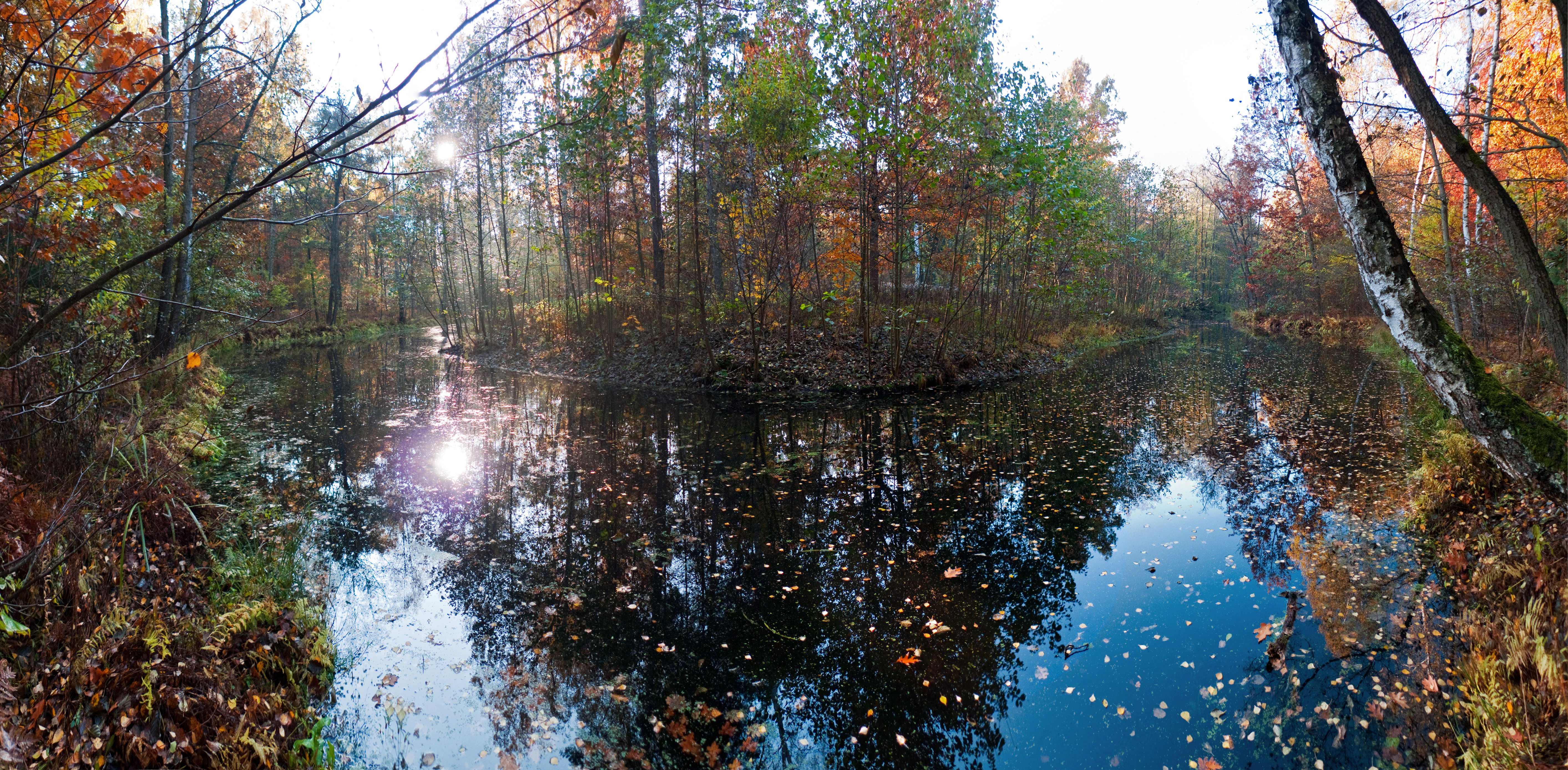
A panoramic view of a calm, reflective lake surrounded by a dense forest showing autumn colors in Berlin, Germany.
Autumn foliage reflecting in the calm waters of the Krumme Lake nature reserve.

Krumme Lake Nature Reserve wildlife and species highlights

Wildlife at Krumme Lake is shaped by the combination of small open water, dense wetland vegetation, and adjacent dry forest. Seven amphibian species have been recorded within the reserve, an unusually high number for such a small urban site, including the protected northern crested newt, which is considered especially noteworthy. The fragmented, slow-moving water surfaces, which resemble the backwaters and old arms once common along the Dahme, also provide habitat for the three-spined stickleback.

The meadows and meadow-like edges around the reserve have been recorded as supporting hundreds of species overall, with butterflies particularly well represented among the invertebrate fauna. While the surrounding pine forest carries its own bird and mammal communities, the protected area is most ecologically distinctive for its amphibian, fish, and invertebrate life concentrated along the wet corridor.

Krumme Lake Nature Reserve conservation status and protection priorities

Krumme Lake has conservation significance well beyond its modest size. It is classified as a Habitat/Species Management Area under IUCN Category IV, a designation that emphasizes targeted management of specific habitats and species rather than broader wilderness protection. Under German and Berlin law, it carries the stronger status of a Naturschutzgebiet, the country's strictest category of nature reserve, and is additionally a Wasserschutzgebiet, a water protection area that safeguards groundwater quality.

The reserve's conservation value stems from the rarity of its habitat type. Surviving floodplain-derived wetlands in Berlin have been heavily reduced by urbanization, channelization, and historical land use, leaving only fragmentary examples such as Krumme Lake. By protecting a winding remnant of the former Dahme floodplain embedded in pine forest, the site maintains habitat for moisture-dependent plant communities, several amphibian species including the protected northern crested newt, and a rich invertebrate fauna. Its dual designation also means conservation management here serves drinking-water protection, linking biodiversity safeguarding with urban resource management.

Krumme Lake Nature Reserve cultural meaning and human context

Although Krumme Lake is primarily significant for its ecological character, its setting carries cultural and historical resonance rooted in Berlin's southeastern rural past. The name of the watercourse, and references such as Ochsenkopflaake recorded for its historical upper course, reflect older rural and landscape terminology once common in villages around Grünau, Schmöckwitz, and Karolinenhof. The reserve sits within a city forest that long served the surrounding agricultural and, later, suburban communities.

The stream's gradual detachment from the Dahme mirrors the broader transformation of the area: places that were once open Dahme floodplain became enclosed woodland, and that woodland then was absorbed into the growing city. Today, the reserve forms a quiet reminder of that older landscape, experienced through narrow forest paths rather than through any visible built heritage.

Top sights and standout views in Krumme Lake Nature Reserve

Krumme Lake's strongest quality is its compact concentration of high-value wetland habitat within a heavily urbanized region. Despite covering only around 45 hectares, it preserves a connected mosaic of alder swamp forest, sedge and reed beds, and groundwater-influenced birch-oak woodland, all anchored by a meandering remnant of the historic Dahme River system.

Equally distinctive is its wildlife profile for such a small footprint: seven recorded amphibian species, the protected northern crested newt, suitable habitat for three-spined stickleback, and hundreds of recorded species overall on the surrounding meadows, with butterflies especially well represented. Combined with its dual designation as both a nature reserve and a water protection area, this makes Krumme Lake a small but ecologically dense site within Berlin's protected-area network.

Best time to visit Krumme Lake Nature Reserve

Krumme Lake can be visited year-round and offers a different character in each season. Spring brings fresh green growth along the wetland margins and an active period for amphibians as they move toward the breeding water. Summer reveals the reserve at its most lush, with mature reed stands and full forest canopy, and is also when butterflies and other invertebrates are most active in the surrounding meadows.

Autumn shifts the visual emphasis toward warm-toned wetland vegetation and changing forest colors, while winter opens up quieter views through the leafless canopy and brings frosts that highlight the meandering watercourse within the otherwise snow-dusted pine landscape. The reserve is best experienced in calm weather, when wetland sounds and quieter wildlife encounters become easier to perceive along the narrow forest paths.

Monthly climate preview

Measured temperature ranges and precipitation averages from NASA power climatology data

Krumme Lake Climate Normals and Long-Term Monthly Weather Patterns

Representative coordinate records show measured monthly temperature averages ranging from negative values to over thirty degrees alongside steady precipitation levels throughout the year. Reviewing the complete twelve-month sequence provides deeper context on long-term thermal rhythms and moisture distribution patterns for Krumme Lake.
Annual mean9 °C
-1 °C20 °C
Jan-1°
Feb
Mar
Apr
May14°
Jun18°
Jul20°
Aug20°
Sep15°
Oct
Nov
Dec
Warmest month
July

20.3 °C

Coolest month
January

-0.9 °C

Wettest month
July

2.4 mm/day

Driest month
April

1.1 mm/day

Park location guide

Geography guide, regional context, and park location map for Krumme Lake Nature Reserve

Krumme Lake Nature Reserve park geography, regions, and map view in Germany

Understand where Krumme Lake Nature Reserve sits in Germany through a broader geographic reading of the surrounding landscape, nearby location context, and its mapped position within the national park landscape.

How Krumme Lake Nature Reserve fits into Germany

Germany is a federal republic in Western and Central Europe with a population of over 83 million across sixteen constituent states. It is Europe's largest economy by nominal GDP and a major global exporter and importer. The capital is Berlin, and the country borders Denmark, Poland, Czech Republic, Austria, Switzerland, France, Luxembourg, Belgium, and the Netherlands.

Wider geography shaping Krumme Lake Nature Reserve in Germany

Germany is located in Western and Central Europe, spanning 357,022 km². It borders Denmark to the north, Poland and the Czech Republic to the east, Austria and Switzerland to the south, and France, Luxembourg, Belgium, and the Netherlands to the west. The country has coastlines on the Baltic Sea and North Sea to the north, with the Alps located in the southern region.

Map view of Krumme Lake Nature Reserve

Use this park location map to pinpoint Krumme Lake Nature Reserve in Germany, understand its exact geographic position, and read its mapped placement within the surrounding landscape more clearly.

Pigeon | © OpenStreetMap contributors

Location context for Krumme Lake Nature Reserve

Berlin

Visualizing the wetland habitats, pine forests, and meandering waterways of the nature reserve.

Krumme Lake Photos and Protected Landscape Scenery

Examine detailed Krumme Lake photography to understand the complex terrain of alder swamp forests, sedge beds, and groundwater-influenced woodland. Visual records reveal the distinct ecological character of this protected floodplain wetland within its surrounding pine forest matrix.

A peaceful stream winds through an alluvial forest in spring with a fallen log crossing the water and sunlight filtering through the fresh green leaves.

A snow-covered forest trail surrounded by trees blanketed in light snow, with bright sunlight filtering through the canopy.

A bicycle parked near trees in an autumnal forest at Krumme Lake, with sunlight streaming through the leaves onto a grassy clearing.

A panoramic view of a calm, reflective lake surrounded by a dense forest showing autumn colors in Berlin, Germany.

Park atlas

Compare adjacent wetland reserves and regional forest habitats

Exploring Parks Near Krumme Lake and Surrounding Protected Landscapes

Browse protected areas and natural reserves located near Krumme Lake across the surrounding regional terrain. Expanding the search helps compare connected wetland ecosystems, pine forests, and floodplain habitats throughout the wider territory.
Nature reserveBerlin
2 km away#1 closest

Northeast

Teufelsseemoor Köpenick: Protected Kettle Bog Geography and Urban Wetland Atlas

Glacial landscape and conservation zone in Berlin, Germany

Teufelsseemoor Köpenick is a key nature reserve in Berlin that showcases the transition from post-glacial kettle hole to a thriving peatland and swamp forest. This protected area stands out for its ecological gradient and serves as a model of urban wilderness conservation. The site is defined by the contrast between its still waters and the surrounding moraine ridges of the Müggelberge.

Area
0.065 km²
Established
2016
IUCN
IV
A wide watercolor illustration showing a calm lake with small tree-covered islands, bordered by green forests and distant hills under a pale sky.
Protected areaBrandenburg
4.9 km away#2 closest

East

Wernsdorfer See Protected Area: Geographic Mapping and Landscape Context in Brandenburg

Glacial wetland mosaic featuring dunes and reedbeds

Wernsdorfer See is an essential nature reserve in Brandenburg that showcases a rare mix of habitats, from open sandy dunes and grasslands to shallow marshland and reedbeds. Managed as part of the Natura 2000 network, the site serves as a vital refuge for bird species and rare wetland flora. This overview traces the geography and terrain of the Spree valley lowland, offering a structured perspective on its conservation landscape.

Area
1.387 km²
Established
1967
Relief
Lowland
Climate
Temperate
A horizontal watercolor painting of a calm river or wetland area with trees, shoreline grasses, and rolling hills in the background, executed in a soft, muted style.
Nature reserveBerlin
About 5.8 km away#3 closest

East

EU-Vogelschutzgebiet Müggelspree: Protected Nature Reserve and Spree Valley Geography

Bird sanctuary and wetland landscape in southeastern Berlin

As a protected bird sanctuary within the European Natura 2000 network, the EU-Vogelschutzgebiet Müggelspree features an intricate mix of river corridors, fens, and pine forests. This reserve maintains significant ecological connectivity through the Spree lowlands, providing stable breeding and passage environments for numerous avian species. Its unique landscape architecture offers a clear view into the intersection of glacial sand formations and active floodplain ecosystems on the outskirts of Berlin.

Area
8.002 km²
Established
1997
A soft watercolor illustration of a lowland wetland landscape with a small pool of water, grasses, and scattered trees under a light sky.
Nature reserveBrandenburg
About 6.1 km away#4 closest

Southwest

Flutgrabenaue Waltersdorf Nature Reserve: Protected Wetland Geography and Regional Atlas

A significant floodplain sanctuary in the Brandenburg lowlands.

Flutgrabenaue Waltersdorf represents an ecologically rich lowland floodplain featuring sinuous watercourses, alder swamps, and traditional meadow habitats. Located south of Berlin, this reserve provides a vital geographic contrast to the urbanized infrastructure of the Brandenburg region. Use this overview to study the boundary, terrain characteristics, and regional importance of this protected marshland landscape.

Area
2.88 km²
Established
1998
IUCN
IV
Relief
Lowland
Nature reserveBerlin
About 8.3 km away#5 closest

Northwest

Wasserwerk Johannisthal Nature Reserve: Mapping Berlin's Industrial and Hydrological Landscape

A protected urban groundwater zone in Treptow-Köpenick.

Explore the unique geography of Wasserwerk Johannisthal, a nature reserve in Berlin that balances industrial heritage with modern environmental management. This thirty-five-hectare site offers insights into urban protected areas, showing how historic water infrastructure is now secured for groundwater monitoring and remediation, set against the backdrop of the city's complex transport and green-space network.

Area
0.35 km²
Established
2007
IUCN
IV
Relief
Lowland
Protected landscapeBerlin
About 9.1 km away#6 closest

West

Vogelschutzgebiet am Wildmeisterdamm in Rudow: Berlin Urban Protected Woodland Map

Historical bird sanctuary and broadleaf landscape in Neukölln

Spanning roughly 3.75 hectares in the Gropiusstadt district, this site functions as an important refuge for urban birdlife amidst dense residential development. The woodland features a mix of oak, birch, and elm trees, preserved for their ecological continuity since the site first gained official protection in the early twentieth century.

Area
0.038 km²
Established
1934
IUCN
V
Relief
Lowland
A pale, minimalist watercolor painting depicting an open field with a winding stream, scattered trees, and distant rolling hills on a white background.
Nature reserveBerlin
About 9.7 km away#7 closest

Northwest

Biesenhorster Sand Nature Reserve: Protected Glacial Landscape in Berlin

Urban nature reserve featuring dry grassland and rare species habitats.

Located in eastern Berlin, Biesenhorster Sand preserves a significant glacial outwash plain that supports an extraordinary concentration of rare species. This nature reserve serves as a vital ecological corridor, protecting a mosaic of dry grassland and open sand terrain that contrasts with the surrounding urban fabric of Germany's capital.

Area
0.429 km²
Established
2021
Relief
Lowland
Scope
Terrestrial
Watercolor painting of a rolling landscape with green grass, bushes, and soft-colored hills in the background.
Protected landscapeBerlin
About 9.8 km away#8 closest

North

Kaulsdorfer Seen: A Protected Landscape in Berlin with Glacial and Industrial History

Exploring the groundwater protection zones and post-mining lakes of eastern Berlin

The Kaulsdorfer Seen area represents a distinct protected landscape located in Berlin. It showcases the transition between ice-age glacial regions, featuring two prominent lakes that evolved from sand and gravel pits into a mature ecosystem of willow thickets, woodland, and reeds. This site functions as an important drinking-water protection zone, offering a structured look at the complex interplay between urban development and natural resource conservation.

Area
0.937 km²
Water
Major water bodies

Common questions about visiting, size, designation, and location context for Krumme Lake Nature Reserve

Krumme Lake Nature Reserve FAQs for park facts, access, geography, and protected area context

Find quick answers about Krumme Lake Nature Reserve, including protected-area facts, park geography, trail and visitor context, and how the park fits into its surrounding country and regional landscape.
MoriAtlas Explorer

Continue Your Protected Areas Search Across the Global Atlas

Deepen your exploration by continuing the structured search for national parks and protected areas worldwide. Utilize the comprehensive filtering capabilities to compare different conservation landscapes and refine your understanding of global park geography. Discover more about the distribution and characteristics of protected natural areas.

Global natural geography