

Mori Atlas logo
Nature reserveForêt classée de Pinselly

Mapping the natural landscape and environmental features of this significant Ivory Coast nature reserve

Forêt classée de Pinselly: A Comprehensive Geographic Overview and Protected Area Atlas

Forêt classée de Pinselly stands as a vital protected area within Ivory Coast, serving as a critical landscape for regional ecological study and conservation. This resource provides detailed geographic context, mapping the terrain and boundaries that define the reserve's unique status. Users can examine the physical landscape and regional setting that contribute to the environmental integrity of this protected territory.

classified forestmountain forestsavanna mosaictropical forestevergreen valley forestFouta Djallon
A flat vector-style illustration of a forest landscape at sunrise, featuring a prominent thorny tree trunk in the foreground, a winding river in the valley, and cliffs in the background.

Forêt classée de Pinselly

Nature reserve

Park overview

Structured park overview, official facts, and landscape profile for Forêt classée de Pinselly

Forêt classée de Pinselly park facts, protected area profile, and essential visitor context

Review the core facts for Forêt classée de Pinselly, including designation, size, terrain, visitor scale, habitats, and operating context in one park-focused overview.

About Forêt classée de Pinselly

Forêt classée de Pinselly is a classified forest reserve on the southeastern edge of the Fouta Djallon massif in central Guinea. The Fouta Djallon is one of West Africa's great highland systems and forms the headwater region for several major West African river basins. Within this context, Pinselly represents the kind of high-elevation tropical landscape where forests, grassy openings, and moist valleys intermingle in close proximity, producing a richly varied habitat mosaic across a comparatively compact area.

The vegetation of the reserve is defined by three main elements: dry mountain forests, patches of high-grass savanna, and dense evergreen vegetation with very large trees in the valley bottoms. This structural diversity is what allows the protected area to host such a broad range of mammals. Forest elephants move through the wetter corridors, hippopotamuses depend on the more permanent water sources, and primates range across both the forested slopes and the savanna transitions.

Pinselly is especially important for primate conservation. The reserve is home to Diana monkeys, patas monkeys, olive baboons, and a particularly dense population of western chimpanzees. Because the western chimpanzee is recognized as a critically endangered subspecies, the forest's role in maintaining a stable, reproducing population gives the site significance well beyond its borders. Together with the nearby Soia classified forest, Pinselly is often described as a regional bastion for the subspecies in Guinea.

The reserve also carries a cultural dimension. Traditional village houses and local communities are present along the forest's fringe, embedding the protected landscape in the rural life of the Ouré-Kaba area. Designated in 1945, Pinselly carries a long-standing protected status that predates many of Guinea's later conservation initiatives, and the reserve continues to be viewed as a promising site for safari-style wildlife tourism thanks to its combination of biodiversity, scenery, and relative proximity to the capital.

Quick facts and research context for Forêt classée de Pinselly

Forêt classée de Pinselly is a protected classified forest located in Mamou Prefecture, in the Republic of Guinea, on the southeastern Fouta Djallon plateau. Its designation as a classified forest dates from 1945, giving it one of the older formal protection statuses among Guinean forest reserves. The territory is characterized by dry montane forests, high-grass savanna patches, and evergreen vegetation with exceptionally large trees concentrated along moist valley bottoms.

The reserve sits near the Ouré-Kaba community and is reached via routes extending roughly 300 kilometers from the capital Conakry. It is notable for hosting African forest elephants, hippopotamuses, primate diversity including Diana monkey, patas monkey, and olive baboon, and ungulates such as western bongo, bushbuck, and red-flanked duiker, while also serving as one of the principal refuges of the western chimpanzee.

Protection and recognition

Documented terrestrial protection scope and conservation designation records

Protection Status and International Recognition for Forêt classée de Pinselly

Forêt classée de Pinselly features documented terrestrial protection status within official conservation inventories. Structured records assemble verified management scope and designation parameters without imported international recognition sources.

Protection details

Protection scope
Terrestrial
Transboundary protection
No
Park context

Deeper park guide and search-rich context for Forêt classée de Pinselly

Forêt classée de Pinselly history, landscape, wildlife, and travel context

Explore Forêt classée de Pinselly through its history, landscape character, ecosystems, wildlife, conservation priorities, cultural context, and seasonal travel timing in a structured park guide built for atlas discovery and search intent.

Why Forêt classée de Pinselly stands out

Forêt classée de Pinselly is best known as one of the most important strongholds of the endangered western chimpanzee in West Africa, a status it shares with the neighboring Soia classified forest. The combination of dry mountain forests, moist evergreen valley vegetation, and high-grass savanna creates a mosaic that supports African forest elephants, hippopotamuses, a rich primate community, and rare ungulates such as the western bongo and the red-flanked duiker. Its scenic character is shaped by the Fouta Djallon highlands, where tall trees tower above wet valley floors and traditional communities live along the forest margins. The reserve's relatively accessible position from Conakry, roughly 300 kilometers away, has placed it among Guinea's most promising sites for low-impact wildlife tourism and chimpanzee-focused conservation.
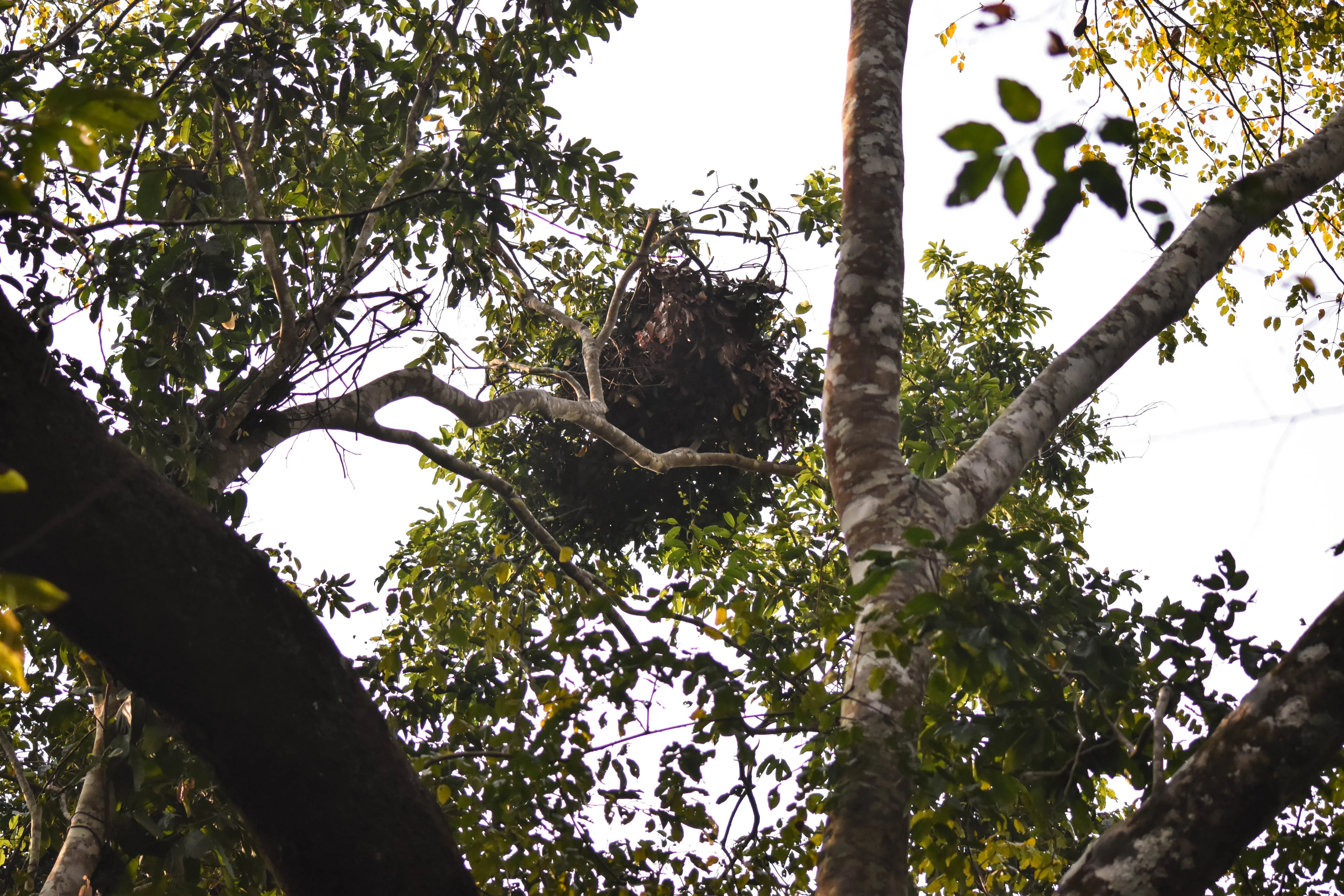
A dense bundle of leaves and twigs forming a chimpanzee nesting structure in a tree canopy, seen from below against a bright sky.
A chimpanzee sleeping nest high in the canopy of Forêt classée de Pinselly.

Forêt classée de Pinselly history and protected-area timeline

The forested area that today forms Forêt classée de Pinselly received its formal protection status in 1945, during the period of French colonial administration in what is now the Republic of Guinea. The classification placed the forest under legal protection and established it as part of the region's network of state-recognized reserves, an early example of formal conservation designation in Guinean forest ecosystems.

Since independence, the reserve has remained under the broader framework of Guinea's national protected area system. Although very little detailed administrative history is publicly documented, the long-standing classification has allowed the forest to retain its protected status while surrounding land use has continued to evolve, including the presence of traditional villages along the forest margin.

In more recent decades, Pinselly has drawn increasing attention for its role as a chimpanzee refuge and wildlife tourism opportunity. Combined with the nearby Soia classified forest, it is now regarded as one of the key natural areas within the Fouta Djallon landscape for the conservation of endangered West African primate populations.

Forêt classée de Pinselly landscape and geographic character

The landscape of Forêt classée de Pinselly is shaped by the Fouta Djallon highland plateau, which extends across much of central Guinea. The reserve sits on the southeastern portions of this massif, where elevation changes, river-carved valleys, and seasonal moisture gradients produce dramatic transitions between vegetation types across relatively short distances.

Within the classified forest, dry mountain forests occupy much of the upland terrain, while the valleys and lower slopes support denser, more humid vegetation in which exceptionally tall trees grow. Patches of high-grass savanna interrupt the forest cover and give the landscape an open, park-like character in places. The combination of closed-canopy valley forest, drier ridge forests, and grassy openings produces a varied visual rhythm characteristic of the Fouta Djallon foothills.
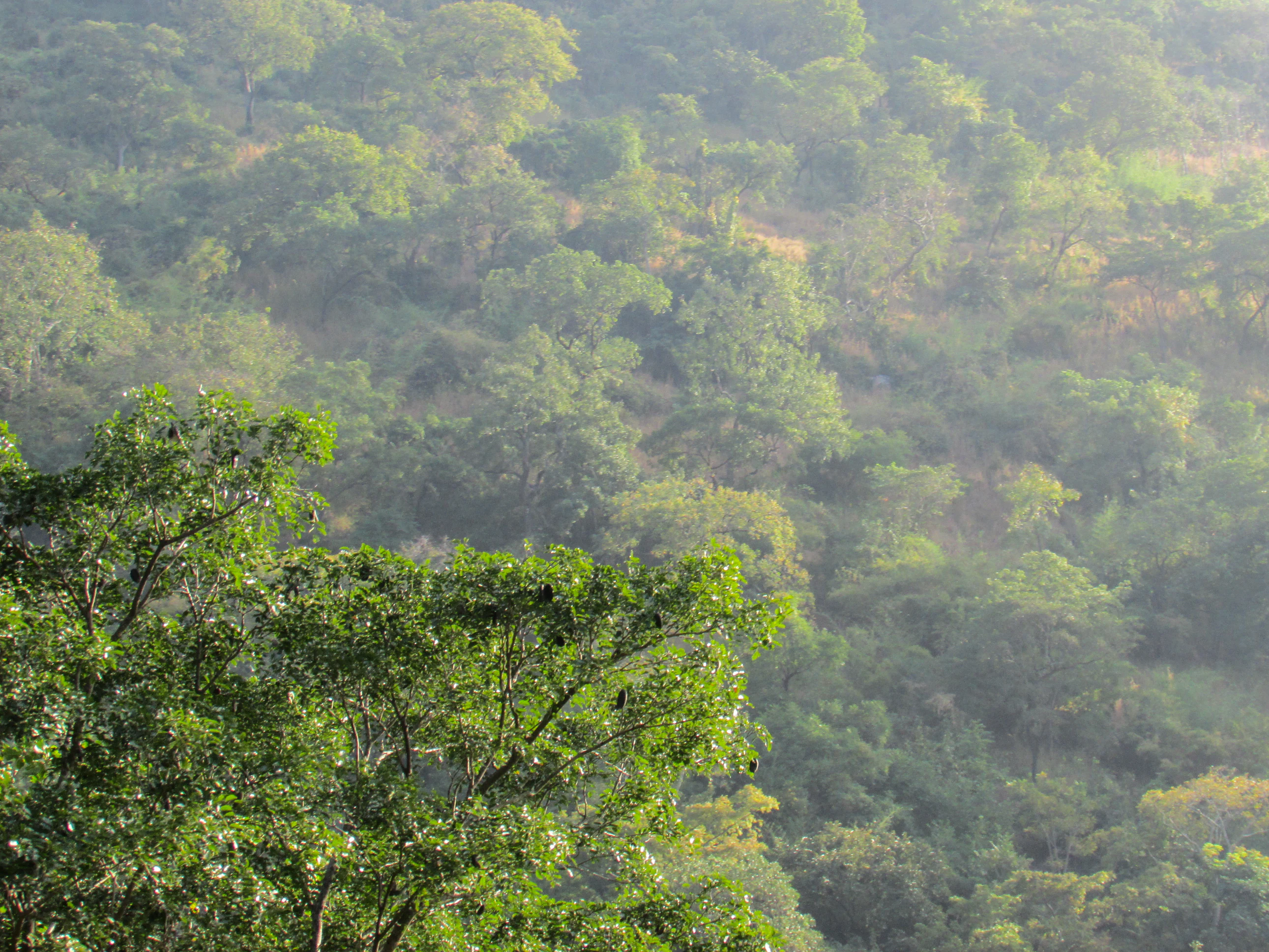
A wide, slightly hazy view of a dense, green forest covering a hillside, with a prominent tree in the immediate foreground.
A view of the dense forest canopy within the Pinselly Classified Forest.

Forêt classée de Pinselly ecosystems, habitats, and plant life

The ecological identity of Forêt classée de Pinselly rests on the coexistence of three distinct habitat types within a single protected area. Dry subtropical mountain forest dominates the uplands, savanna patches with tall grasses occupy transitional areas, and dense evergreen vegetation with very large trees fills the wetter valley systems. This habitat mosaic creates a range of microclimates, resource availability, and shelter conditions that together sustain a high diversity of mammals.

The savanna-grassland component provides grazing and browsing habitat for several ungulate species, while the forested slopes offer refuge for arboreal and forest-dependent primates. The valley systems, with their taller trees and more constant moisture, support the largest trees in the reserve and act as important movement corridors and nesting habitat for forest-dwelling species. Together these environments form a layered ecological structure that contributes to Pinselly's significance within the broader Fouta Djallon ecosystem.

Forêt classée de Pinselly wildlife and species highlights

Forêt classée de Pinselly supports a notably rich mammal community. The reserve is known to host African forest elephants, hippopotamuses, and a varied primate population including the Diana monkey, the patas monkey, and the olive baboon. Several ungulate species are also recorded here, including the western bongo, the bushbuck, and the red-flanked duiker.

Among all of these, the western chimpanzee stands out as the species of greatest conservation concern. The reserve is recognized as one of the densest populations of this subspecies, a status that elevates Pinselly from a locally important protected area to a site of regional primate conservation significance. Reports of chimpanzee sleeping nests within the forest underline the resident nature of the population. Together with the Soia classified forest nearby, Pinselly is regarded as a regional stronghold for endangered West African chimpanzee populations.

Forêt classée de Pinselly conservation status and protection priorities

Conservationally, Forêt classée de Pinselly is significant on two levels. First, as a classified forest under formal Guinean protection since 1945, it represents one of the older formal reserves in the country and continues to offer a layer of legal protection over its habitats. Second, beyond the administrative designation, the reserve has emerged as a genuine ecological stronghold because of its population of the endangered western chimpanzee, a subspecies under serious pressure across West Africa.

The presence of forest elephants, hippopotamuses, and a wide primate and ungulate community adds further conservation weight, since these species depend on the continuity of forest cover, water sources, and relatively undisturbed valley habitats. The mosaic of dry forests, savanna, and moist evergreen corridors provides year-round habitat functionality that is increasingly rare in the region.

The reserve is also viewed as an opportunity for broader conservation outcomes through wildlife tourism. Because it lies within a reachable distance of the capital Conakry and offers the potential for primate-focused safaris, Pinselly is often highlighted as a site where conservation, scientific interest, and sustainable tourism could intersect to support long-term habitat protection.

Forêt classée de Pinselly cultural meaning and human context

Forêt classée de Pinselly is bordered by traditional rural communities living at the interface between the protected forests and the agricultural landscapes of the Fouta Djallon. Houses and village structures of traditional construction are found at the very edge of the reserve, illustrating how the forest has long been intertwined with local livelihoods and customary land-use patterns.

The broader region is associated with the cultural geography of the Fouta Djallon, a highland area known in Guinea for its distinct historical, linguistic, and rural traditions. While Pinselly itself is primarily valued for its natural character, its cultural setting is part of what defines the visitor and conservation experience of the site.

Top sights and standout views in Forêt classée de Pinselly

Among the standout features of Forêt classée de Pinselly are its extraordinarily tall valley trees, the dense population of critically endangered western chimpanzees, and the ecological contrast between dry mountain forest and humid valley vegetation. The reserve's status as one of the key chimpanzee refuges in West Africa, paired with its relatively accessible location from Conakry, gives it a special position in Guinea's network of protected forests.

Additional highlights include habitat for African forest elephants, hippopotamuses, Diana monkeys, patas monkeys, olive baboons, and ungulates such as western bongo, bushbuck, and red-flanked duiker. The visual mix of mountain scenery, grassy openings, and dense evergreen corridors makes Pinselly a notable example of the Fouta Djallon's natural heritage.

Best time to visit Forêt classée de Pinselly

The Fouta Djallon region has a tropical climate with a distinct wet season and a drier season, and this generally shapes the experience of visiting Pinselly. The drier months typically offer easier road access through the highland tracks, clearer viewing conditions, and more comfortable conditions for walking within the reserve.

The wetter months bring lusher vegetation and fuller water systems, which can be visually impressive but may also make some forest roads and valley areas harder to traverse. Wildlife viewing opportunities are tied to the larger ecological cycles of the region rather than to narrow operational calendars, and the long-standing presence of resident chimpanzees and elephants means sightings are possible across much of the year when access permits.

Monthly climate preview

Long-term representative point measurements tracking monthly temperature and precipitation rhythm

Forêt classée de Pinselly Climate Normals and Annual Weather Patterns

Representative coordinate records show measured monthly temperature ranges alongside shifting daily precipitation averages across the protected landscape. Examining the complete twelve-month climatology profile reveals detailed variations in long-term weather patterns.
Annual mean25 °C
23 °C29 °C
Jan25°
Feb27°
Mar29°
Apr29°
May27°
Jun25°
Jul24°
Aug23°
Sep24°
Oct24°
Nov24°
Dec23°
Warmest month
March

29.2 °C

Coolest month
August

23.2 °C

Wettest month
August

18.1 mm/day

Driest month
December

0.1 mm/day

Park location guide

Geography guide, regional context, and park location map for Forêt classée de Pinselly

Forêt classée de Pinselly park geography, regions, and map view in Ivory Coast

Understand where Forêt classée de Pinselly sits in Ivory Coast through a broader geographic reading of the surrounding landscape, nearby location context, and its mapped position within the national park landscape.

How Forêt classée de Pinselly fits into Ivory Coast

Ivory Coast, officially the Republic of Côte d'Ivoire, is a West African country with a coastline on the Gulf of Guinea. It gained independence from France in 1960 and is now a presidential republic. The country is a major producer of cocoa and coffee, with Abidjan serving as its largest city and economic hub, while Yamoussoukro is the official capital.

Wider geography shaping Forêt classée de Pinselly in Ivory Coast

Ivory Coast is situated on the southern coast of West Africa along the Gulf of Guinea. It borders Guinea to the northwest, Liberia to the west, Mali to the northwest, Burkina Faso to the northeast, Ghana to the east, and the Atlantic Ocean to the south. The terrain includes coastal plains, interior highlands, and forested regions.

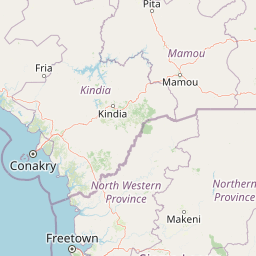
Map view of Forêt classée de Pinselly

Use this park location map to pinpoint Forêt classée de Pinselly in Ivory Coast, understand its exact geographic position, and read its mapped placement within the surrounding landscape more clearly.

Pigeon | © OpenStreetMap contributors

Explore mapped terrain, moist valley forests, and chimpanzee habitats through field photography.

Forêt classée de Pinselly Photos and Landscapes: Visualizing the Fouta Djallon Protected Area

Visual documentation captures the varied terrain, dry ridge forests, and tall evergreen vegetation defining Forêt classée de Pinselly. Photographic records provide clear reference value for understanding highland topography, seasonal moisture gradients, and regional protected-area characteristics.

A dense bundle of leaves and twigs forming a chimpanzee nesting structure in a tree canopy, seen from below against a bright sky.

A close-up, upward-angled view of a tall, thick tree trunk with grey bark covered in prominent, sharp thorns, leading into a green forest canopy.

A wide, slightly hazy view of a dense, green forest covering a hillside, with a prominent tree in the immediate foreground.

Park atlas

Compare regional highland reserves and adjacent West African forest habitats

Parks Near Forêt Classée de Pinselly and Surrounding Protected Landscapes

Browsing other protected areas near Forêt classée de Pinselly reveals shared highland terrain and regional savanna mosaic ecosystems. Comparative analysis of these neighboring habitats supports broader ecological research across the Fouta Djallon mountain plateau.
A wide watercolor illustration showing green hills and trees along a pale river valley with a soft sky.
Protected areaMamou Region
About 45 km away#1 closest

Northwest

Bafing-Source Protected Area: A Highland Wetland Landscape in the Mamou Region

Tracing the headwaters and plateau geography of the Bafing River basin

The Bafing-Source protected area serves as a significant hydrological anchor within the Fouta Djallon highlands of Guinea. This expansive site protects critical wetland catchments and plateau terrain that feed into the broader Senegal River system, demonstrating the vital link between highland ecosystems and downstream water security.

Area
3,172 km²
Established
2007
Relief
Highland
Climate
Tropical
National parkKarene District
About 58 km away#2 closest

Southwest

Outamba-Kilimi National Park: Sierra Leone National Park and Protected Landscape Atlas

Mapped natural terrain within Karene District.

Investigate Outamba-Kilimi National Park as a protected area, examining its geographic footprint and significance within Sierra Leone's natural landscapes. This detailed entry provides context on the park's mapped boundaries and its contribution to regional geography, serving as a key point for atlas-based exploration of conservation lands in the Karene District.

Area
1,109 km²
Established
1986
IUCN
II
Relief
Lowland
Watercolor illustration depicting a serene landscape with a river winding through savanna and distant purple-toned hills.
National parkKankan Region
About 161 km away#3 closest

East

Parc national du Haut-Niger: Protected Area Map and Geographic Landscape Profile

West African dry forest and savanna conservation zone

Parc national du Haut-Niger represents a significant conservation unit in the Kankan Region of Guinea. This protected area safeguards one of the last major stands of dry tropical forest in the region, offering a rich study in riverine geography and savanna ecology along the upper Niger River and its major tributaries.

Area
554 km²
Established
1997
IUCN
II
Relief
Mixed relief
Protected areaGuinea
About 165 km away#4 closest

West

Rio Pongo: A Protected Estuarine Wetland Landscape in Coastal Guinea

Mapping mangrove forests, tidal mudflats, and coastal ecology

Rio Pongo is a prominent protected area in Guinea, characterized by a complex network of brackish tidal channels and dense mangrove forests. The site serves as a crucial habitat for waterbirds and aquatic mammals, while its position at the edge of the Atlantic Ocean defines a dynamic, low-lying coastal terrain that remains vital for regional conservation and ecological research.

Area
300 km²
Established
1992
Water
Water-dominated
National parkFaranah Region
About 165 km away#5 closest

East

National Park of Upper Niger: Mapped Savanna and Forest Protected Area in Faranah Region

A key West African conservation site with critical riparian corridors.

Spanning 6,000 square kilometers, the National Park of Upper Niger serves as a primary reservoir for biodiversity in Guinea. The park features a distinct transition between open woodland savanna and forested river corridors along the Niger and Mafou Rivers. It remains a significant model for community-led conservation and habitat preservation in West Africa, representing one of the region's few areas with relatively low human impact.

Area
6,000 km²
Established
1997
IUCN
II
Relief
Mixed relief
National parkGuinea
About 165 km away#6 closest

East

National Park of Upper Niger: A Geographic Overview of Guinea Protected Lands

Savanna woodland and riparian forest conservation in West Africa

Located in eastern Guinea, the National Park of Upper Niger serves as a significant conservation stronghold for the region. Its diverse terrain includes vast savanna woodlands, essential riparian forest corridors along the Niger River, and the rare Mafou dry forest. This protected area provides a critical refuge for numerous mammal species and represents a key segment of the West African savanna-forest ecosystem.

Area
6,000 km²
Established
1997
Relief
Upland
Climate
Tropical
Protected areaGuinea
About 199 km away#7 closest

Northwest

Forêt classée de Nialama: Protected Landscape and Fouta Djalon Highland Geography

Exploring the forest mosaic and habitat boundaries in Guinea.

Forêt classée de Nialama represents a complex protected landscape covering 10,000 hectares of the Fouta Djalon highlands. The area features a distinct blend of gallery forest, bamboo stands, and seasonal wetlands. Known for its role in chimpanzee conservation and avian diversity, this site offers a window into the varied Sudano-Guinean terrain and highland forest ecosystems of Guinea.

Area
100 km²
A watercolor illustration depicting layers of green hills and purple mountain peaks against a soft pale sky.
Protected areaConakry Region
About 226 km away#8 closest

West

Forêt classée de Kakimbo: Protected Forest Geography and Coastal Landscape Mapping

Analyzing peri-urban protected areas within Conakry Region

Forêt classée de Kakimbo represents a significant peri-urban forest and protected area characterized by its tall canopy trees and karst-like cave formations. This record details the reserve's strategic position in the Conakry coastal plain, emphasizing its dual role in urban groundwater supply and carbon storage within the Ratoma commune landscape.

Established
1945
Relief
Lowland
Water
Minor water

Common questions about visiting, size, designation, and location context for Forêt classée de Pinselly

Forêt classée de Pinselly FAQs for park facts, access, geography, and protected area context

Find quick answers about Forêt classée de Pinselly, including protected-area facts, park geography, trail and visitor context, and how the park fits into its surrounding country and regional landscape.
MoriAtlas Explorer

Continue Your Protected Areas Search Across the Global Atlas

Deepen your exploration by continuing the structured search for national parks and protected areas worldwide. Utilize the comprehensive filtering capabilities to compare different conservation landscapes and refine your understanding of global park geography. Discover more about the distribution and characteristics of protected natural areas.

Global natural geography