
Mori Atlas logo
Nature reserveFungus Rock

Mapping the dramatic limestone topography and protected marine landscapes of western Gozo

Fungus Rock Nature Reserve: A Detailed Geographic Atlas of the Iconic Gozo Coastal Landmark

(Il-Ġebla tal-Ġeneral)

Fungus Rock stands as a prominent limestone islet and protected nature reserve marking the entrance to the Dwejra lagoon on the western coast of Gozo. Rising sharply above deep Mediterranean waters, the islet provides a distinct study in coastal geology and centuries of human-managed botanical history. Analyze the park boundaries and surrounding marine terrain to understand how this landmark shapes the modern geography of the Maltese archipelago.

limestone isletcoastal landmarkDwejra nature reserveGozosnorkeling and divingMediterranean coastal geology
Vector illustration showing a scenic mountain valley with a waterfall flowing into a river, surrounded by pine trees and clouds.

Fungus Rock

Nature reserve

Park overview

Structured park overview, official facts, and landscape profile for Fungus Rock

Fungus Rock park facts, protected area profile, and essential visitor context

Review the core facts for Fungus Rock, including designation, size, terrain, visitor scale, habitats, and operating context in one park-focused overview.

About Fungus Rock

Fungus Rock, known to Maltese speakers as Il-Ġebla tal-Ġeneral, is a striking natural landmark on the western coast of Gozo in the central Mediterranean. The islet consists of a single massive lump of limestone rising steeply out of the sea at the entrance to the inland lagoon of Dwejra. Its flat upper plateau, vertical flanks, and small footprint combine to give the rock the unmistakable profile that has long made it one of the most photographed features of the Gozitan coast.

Geologically, the rock belongs to the same limestone system that forms the rest of the Maltese archipelago. Its layered sedimentary structure is typical of the region, and the surrounding underwater terrain continues that geology below the surface in the form of sheer drops, narrow gullies, and small sea caves. Where the Azure Window once arched over the blue water nearby, the sea now opens into the inlet, leaving Fungus Rock as one of the dominant solid features of the bay.

Ecologically, the rock and its immediate shoreline fall within the Dwejra nature reserve, one of the more distinctive coastal protected areas of the Maltese islands. The combination of vertical limestone, sheltered lagoon waters, and open reef has produced a varied marine habitat that supports snorkelers and divers year-round. On land, the rock itself has remained largely untouched, preserving both its unusual shape and the memory of the rare plant that once defined its reputation.

Culturally, the rock carries a layered identity. It is at once a natural monument, a historic site of medicinal-botanical interest, and a modern visitor landmark. Its history with the Knights Hospitaller, its association with famous coastal scenery, and its current role as a dive site ensure that Fungus Rock remains a focal point of any account of Gozo's western coast.

Quick facts and research context for Fungus Rock

Fungus Rock is a 60-metre-high limestone islet off the coast of Gozo, the second largest island in the Maltese archipelago. It lies at the mouth of the Dwejra inlet, within an area administratively tied to the town of San Lawrenz, and forms part of a designated nature reserve. The islet is uninhabited and uninhabitable in any practical sense, yet it is one of the most historically celebrated natural features in the Maltese islands, owing to the rare medicinal plant that once grew on its summit.

Protection and recognition

Examine the documented conservation framework and management scope for Fungus Rock.

Fungus Rock Protection Status and Official Designation Records

Fungus Rock features a mixed protection scope governed by established conservation frameworks and documented management oversight. Official designation records detail the legal status and international recognition associated with this protected landscape.

Protection details

Protection scope
Mixed
Transboundary protection
No
Park context

Deeper park guide and search-rich context for Fungus Rock

Fungus Rock history, landscape, wildlife, and travel context

Explore Fungus Rock through its history, landscape character, ecosystems, wildlife, conservation priorities, cultural context, and seasonal travel timing in a structured park guide built for atlas discovery and search intent.

Why Fungus Rock stands out

Fungus Rock is known above all for the parasitic plant Cynomorium coccineum, popularly called the Maltese fungus, which once grew on its flat top. The plant was treated in early modern times as a valuable herbal remedy, and the Knights Hospitaller built an entire system of protection and surveillance around the rock just to control access to it. The islet is also recognized as an iconic landmark of the Dwejra coastline and, together with its dramatic underwater scenery, as a popular snorkeling and diving site. The rock's name reflects an enduring mix of natural history, folk botany, and Maltese local culture. Even today, the unusual reddish parasitic plant remains the most direct link between the place name and the strange botanical curiosity that put the rock on the map.
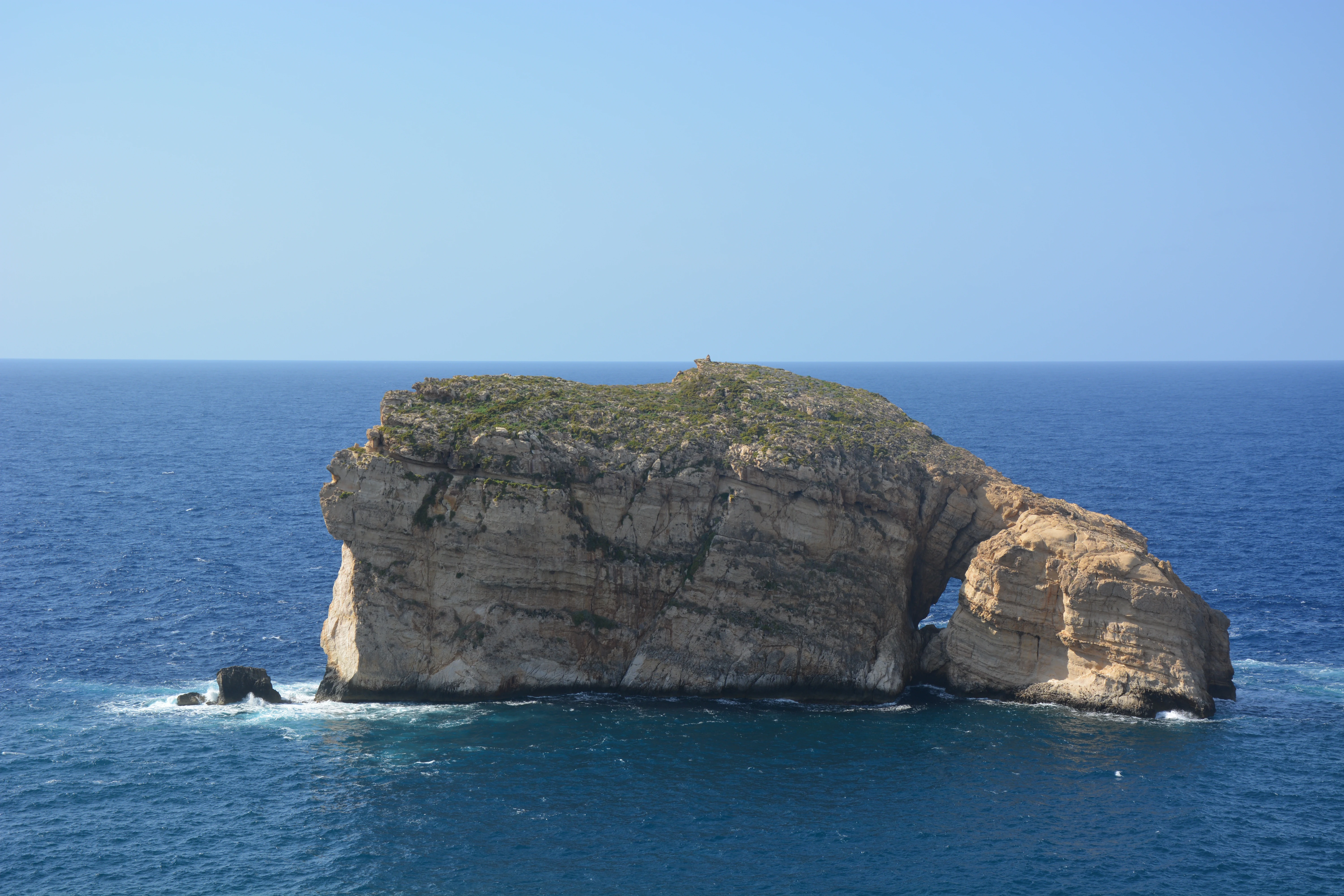
A limestone islet rising from deep blue Mediterranean waters under a clear sky.
Fungus Rock, a distinctive limestone islet located off the coast of Gozo, Malta.

Fungus Rock history and protected-area timeline

Fungus Rock entered written history because of the unusual plant that grew on its summit, the parasitic flowering species now called Cynomorium coccineum, long referred to as the Maltese fungus. Although it is not a true fungus, the plant has a dark, fleshy appearance and a strong, unpleasant smell, and it drew the attention of early modern European physicians who believed that it might have valuable medicinal properties. Doctors of the period treated the dried plant as a styptic for wounds, a remedy for dysentery, and a general cure-all, and it was considered rare enough that dried specimens became gifts reserved for distinguished visitors to the Maltese islands.

The Knights Hospitaller, who took control of Malta in 1530 and ruled the islands for several centuries, valued the plant so highly that they introduced serious restrictions on access to the rock itself. In 1746, Grand Master Manuel Pinto da Fonseca declared Fungus Rock off-limits to the public. Trespassers risked being sentenced to three years of hard labor as oarsmen in the Knights' galleys, an unusually harsh penalty that reflects how important the plant was considered. To enforce the prohibition, Pinto stationed a permanent guard on or near the rock and even constructed a precarious basket cable car connecting the islet to the mainland roughly fifty metres away, so that the guard and supplies could be moved without allowing unauthorized access. The sides of the rock were also deliberately smoothed to make climbing more difficult.

In more recent centuries, the medicinal aura surrounding the plant faded, but its scientific and cultural interest did not. Pharmacologists have continued to study what older sources referred to as Fucus coccineus melitensis, keeping the rock connected to ongoing research on traditional plant remedies. With the passage of time, the focus shifted from strict prohibition to protection, as the area around the rock became part of the Dwejra nature reserve.

A more visible chapter in the rock's modern history unfolded on March 8, 2017, when the nearby Azure Window, the natural limestone arch that had long framed the seascape around Dwejra, collapsed into the sea during a storm. With the arch gone, Fungus Rock's visual and cultural role within the bay became more prominent than ever, and the islet now stands as one of the most recognizable surviving features of a coastline whose silhouette has been permanently altered.

Fungus Rock landscape and geographic character

Fungus Rock is a compact block of pale Maltese limestone that rises sharply out of the sea to a height of roughly 60 metres. Its shape is unusually distinctive because of the contrast between a flat or gently rounded upper surface and nearly vertical sides, giving the impression of a single massive stone slab resting in the water. The islet covers only a tiny fraction of a hectare, yet its height and isolation make it a visually dominant feature of the bay.

The surrounding scenery is shaped by the geology that defines the entire western coast of Gozo. Limestone cliffs frame the inland side of Dwejra, and the seabed around the rock drops away into deep blue water, interrupted by submerged boulders, narrow channels, and small sea caves carved into the rock by centuries of wave action. With the loss of the Azure Window, the entrance to the lagoon now reads as an open sea passage framed by cliffs and the islet itself, rather than the former arch-and-window composition that visitors once knew.

Above the surface, the rock's exposed limestone face bears the marks of its long human history in subtle ways. The smoothed sections recorded in older accounts, the remains of structures once used by the rock's guards, and the weathered outline of the sheer cliff all contribute to a landscape that reads simultaneously as wild coastline and as a place with a deeply managed past.
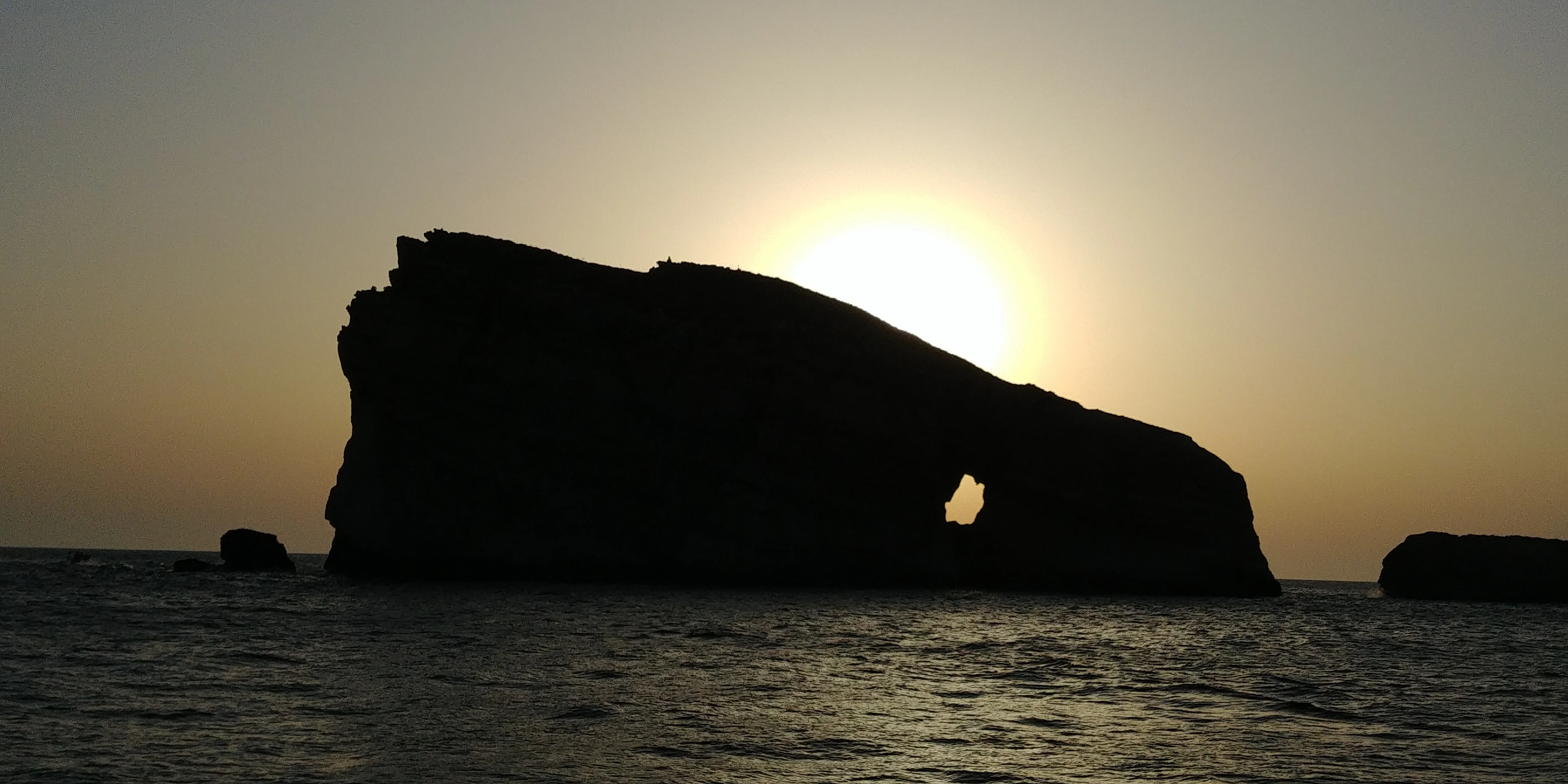
A backlit silhouette of Fungus Rock limestone islet surrounded by the sea during sunset.
Sunset silhouetting the limestone islet of Fungus Rock.

Fungus Rock ecosystems, habitats, and plant life

From a strictly ecological perspective, Fungus Rock sits inside the Dwejra nature reserve, a coastal protected area on Gozo that conserves a mix of limestone cliff habitat, sheltered lagoon waters, and open marine environments. The reserve is part of the broader Mediterranean coastal ecosystem, where thin soils, salt-laden winds, and limited freshwater produce distinctive plant communities along the clifftops and a varied marine fauna below the surface.

The rock itself supports very little vegetation because most of its surface consists of bare limestone. The most famous plant associated with it, Cynomorium coccineum, is a parasitic species that draws its nutrients from host plants rather than soil, which is precisely what allows it to survive on such a harsh, exposed surface. Where soil has accumulated in cracks and ledges, typical Mediterranean coastal plants can take hold, though the overall flora of the rock is sparse compared with the richer plant communities found on the surrounding mainland cliffs.

In the water around the islet, the ecology shifts to a marine setting typical of Maltese coastal areas. Submerged rock faces, boulder slopes, and small caverns provide shelter for Mediterranean reef species, while the deeper channels attract larger pelagic visitors. The combination of submerged structure and clear water around Fungus Rock is what makes the area ecologically as well as scenically distinctive.

Fungus Rock wildlife and species highlights

Because the rock's exposed surface is mostly bare limestone, terrestrial wildlife on Fungus Rock itself is limited. The most celebrated biological feature associated with the islet is not a classic animal species but the parasitic flowering plant Cynomorium coccineum, whose unusual growth habit and reddish appearance long gave the rock its name. Insects associated with Mediterranean cliff habitats, including pollinators adapted to sparse, wind-swept environments, are part of the rock's modest terrestrial fauna.

The richer wildlife story unfolds in the surrounding sea. Divers and snorkelers visiting the area regularly report encounters with Mediterranean reef fish, octopuses in rocky crevices, and a variety of smaller invertebrates that inhabit the boulders and gullies near the rock. Larger marine animals occasionally pass through the deeper water offshore, and the bay itself provides habitat for species that prefer sheltered conditions near vertical rock walls.

Birdlife in the broader Dwejra area adds another element to the site's natural character, contributing to the everyday atmosphere of the cliffs and sea below the rock. While Fungus Rock itself does not host a distinct seabird colony, the cliffs and islet together form part of a coastal mosaic that supports the typical Mediterranean shorebird patterns found elsewhere on Gozo.

Fungus Rock conservation status and protection priorities

Fungus Rock is protected as part of the Dwejra nature reserve, which is administratively linked to the town of San Lawrenz on Gozo. The reserve designation reflects both the rock's long-standing natural significance and the broader ecological value of the Dwejra coastline, whose combination of cliffs, lagoon, and open sea is one of the most distinctive coastal environments in the Maltese islands.

The conservation story of the rock stretches back much further than its formal protection, however. The strict access rules introduced by the Knights Hospitaller in the eighteenth century functioned, in their own way, as an early form of conservation, ensuring that the rare plant growing on the summit was not overharvested. Modern management of the reserve continues this tradition in a more scientific framework, balancing protection of the terrestrial rock habitat with the realities of public access to the surrounding shoreline and sea.

The 2017 collapse of the Azure Window added a new dimension to conservation thinking at Dwejra. With one of the area's defining natural landmarks lost, attention has turned to the surviving iconic features of the bay, including Fungus Rock, and to questions about managing future changes in this dynamic coastal landscape.

Fungus Rock cultural meaning and human context

Fungus Rock's cultural identity is unusually rich for such a small natural feature. Among Maltese speakers the islet is known as Il-Ġebla tal-Ġeneral, which translates as the General's Rock, a name that hints at the deep imprint of military and chivalric institutions on local memory. During the long rule of the Knights Hospitaller, the rock became one of the small set of places across the Maltese islands closely tied to the identity and authority of the order.

Local folklore, naming traditions, and historical accounts from the period of the Knights preserved the rock's reputation as the home of a mysterious and valuable plant. Even after the early modern medicinal reputation of the Maltese fungus faded, the place continued to feature in the cultural geography of Gozo, alongside landmarks like the Azure Window, the Inland Sea, and the salt pans nearby.

Today the rock is woven into the experience of visitors arriving at Dwejra by land or sea. It appears in local photography, in dive-site descriptions, and in living descriptions of Gozo's coastal scenery. Its already distinctive identity took on an additional layer of meaning after the loss of the Azure Window, marking it as one of the surviving anchor points of an evolving landscape that continues to shape local culture.

Top sights and standout views in Fungus Rock

Fungus Rock's standout qualities are its compact but dramatic limestone profile, its place at the entrance to the Dwejra bay, and the unusual botanical history connected to the rare plant that once grew on its flat summit. Together with the surrounding cliffs and the deep blue water of the inlet, the rock forms one of the most photographed and recognizable coastal scenes on the island of Gozo.

The islet is also notable for the unusual degree of human management it experienced in earlier centuries, from smoothed cliff faces and posted guards to a cable-car basket linking it to the mainland. That history, combined with its modern role as a snorkeling and diving destination and its position within the Dwejra nature reserve, gives Fungus Rock a layered identity that blends geology, botany, history, and present-day recreation in a single small but striking natural feature.

Best time to visit Fungus Rock

Fungus Rock can be appreciated in every season because its appeal is not tied to flowering or migration cycles in the way that some natural sites are. The rock's profile, the surrounding cliffs, and the colors of the water remain features of the year-round landscape, and the Mediterranean climate of Gozo ensures that sea temperatures are welcoming to snorkelers and divers for much of the year.

Spring and early autumn tend to bring especially clear light and comfortable conditions for viewing the rock from the shore or from boats in the bay, while summer offers the warmest sea conditions for water-based exploration. Photographers seeking the famous view of the sun framed through the rock will need to plan around the season in which the sun sets in the right direction over the sea, as the original positioning of the sight line no longer aligns with every part of the year.
Monthly climate preview

Long-term representative records for monthly weather patterns at Gozo

Fungus Rock Climate Normals, Annual Temperature and Precipitation Rhythm

Historical measurements from 1991 to 2020 outline the baseline monthly temperature and precipitation rhythm recorded at a representative coordinate within Fungus Rock. Examining the complete twelve-month profile reveals detailed baseline climate trends and long-term averages for this protected location.
Annual mean20 °C
14 °C27 °C
Jan15°
Feb14°
Mar15°
Apr16°
May19°
Jun22°
Jul25°
Aug27°
Sep25°
Oct23°
Nov19°
Dec16°
Warmest month
August

26.6 °C

Coolest month
February

13.9 °C

Wettest month
November

3 mm/day

Driest month
July

0.1 mm/day

Park location guide

Geography guide, regional context, and park location map for Fungus Rock

Fungus Rock park geography, regions, and map view in Malta

Understand where Fungus Rock sits in Malta through a broader geographic reading of the surrounding landscape, nearby location context, and its mapped position within the national park landscape.

How Fungus Rock fits into Malta

Malta is a small island nation in the Mediterranean, located between Italy, Tunisia, and Libya. With a population of about 520,000 spread over 316 km², it is one of the world's most densely populated countries. The country has a long history of foreign rule and is known for its strategic position, historic sites, and membership in the EU, Commonwealth, and UN.

Wider geography shaping Fungus Rock in Malta

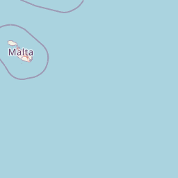
Malta is located in the Mediterranean Sea between Sicily and North Africa, approximately 80 km south of Italy, 284 km east of Tunisia, and 333 km north of Libya. The archipelago sits at coordinates 35°54′N 14°31′E.

Map view of Fungus Rock

Use this park location map to pinpoint Fungus Rock in Malta, understand its exact geographic position, and read its mapped placement within the surrounding landscape more clearly.

Pigeon | © OpenStreetMap contributors

Location context for Fungus Rock

Gozo

Visual exploration of limestone terrain, sheer sea cliffs, and marine habitats

Fungus Rock Photos, Scenery, and Protected Coastal Landscapes

Photographic records reveal the distinct geological profile, steep limestone walls, and marine habitats surrounding Fungus Rock. Visual analysis helps researchers examine the protected coastal terrain, rugged shoreline scenery, and dramatic seascape features of the Gozitan coast.

A limestone islet rising from deep blue Mediterranean waters under a clear sky.

A large, weathered limestone islet with a natural archway, rising from deep blue water under a bright sky.

A backlit silhouette of Fungus Rock limestone islet surrounded by the sea during sunset.

Park atlas

Compare adjacent limestone cliffs, marine reserves, and regional Mediterranean geography.

Exploring Parks Near Fungus Rock and Surrounding Coastal Protected Areas

Visitors exploring Fungus Rock can browse nearby protected areas and coastal nature reserves to examine shared Mediterranean geological formations. Comparing adjacent terrain reveals wider regional conservation patterns across the surrounding Maltese coastline.
A flat-style vector illustration depicting a coastal beach scene with reddish sand, rolling green hills in the background, a blue ocean with gentle waves, and a few beach umbrellas in the foreground.
Protected areaGozo
About 8.5 km away#1 closest

East

Ramla Bay: Geographic Mapping and Protected Landscape Analysis of the Gozo Coast

Coastal terrain, red-sand geology, and Mediterranean rural landscapes.

Ramla Bay represents a significant protected coastal pocket on the island of Gozo. Beyond its well-known red-sand beach, the area encompasses a wider valley landscape defined by limestone headlands and agricultural plateaus. Use this mapped overview to understand the interaction between the Mediterranean coastline and the rugged rural hinterland of the Maltese islands.

Relief
Lowland
Climate
Mediterranean
Access
Easy access
Scope
Terrestrial
A horizontal watercolor painting showing soft green hills, grassy marshland, and a calm water channel under a light, hazy sky.
Nature reserveGozo
About 14 km away#2 closest

East

Comino Nature Reserve: Geography, Protected Marine Areas, and Karst Terrain in Gozo

Island ecology and coastal landscape mapping

Examine the protected geography of Comino, an island nature reserve near Gozo defined by limestone plateaus and sheltered bays. This overview covers the ecological boundaries of the Natura 2000 marine area, the distribution of coastal sea caves, and the topographic patterns of this Important Bird Area.

Area
3.5 km²
Relief
Lowland
Climate
Mediterranean
Access
Moderate access
A horizontal watercolor painting depicting a soft-toned, abstract coastal landscape with gentle green hills, grassy foreground patches, and a calm, pale pool of water against a white background.
Marine protected areaMalta
About 20 km away#3 closest

Southeast

Ras ir-Raħeb Marine Protected Area: Geographic Profile and Mapped Coastal Landscape

Coastal cliffs and protected marine zones in north western Malta.

Ras ir-Raħeb serves as a pivotal marine protected area along the Malta coastline, where high limestone cliffs meet complex underwater habitats. This site links historical archaeological remnants with modern ecological conservation, offering a unique geographic snapshot of the Rabat plateau edge. Its mapped boundaries encompass both the terrestrial promontory and the essential seagrass meadows beneath the surface, providing a critical reference point for Mediterranean coastal geography and protected land status.

Established
2005
Relief
Upland
Climate
Mediterranean
Access
Moderate access
A pale, minimalist watercolor painting depicting St Paul's Island in Malta, showing green rolling landforms and a hint of a structure against a light background.
Protected areaMalta
About 21 km away#4 closest

Southeast

St Paul's Island Protected Landscape and Maltese Coastal Geography Overview

Uninhabited Mediterranean island and heritage landmark

St Paul's Island represents a unique Mediterranean limestone islet featuring maritime garigue habitat and historic ruins. Located near the Mellieħa coastline, this protected area provides a compact example of Maltese coastal geography, defined by exposed cliffs and an enduring connection to local maritime history.

Area
0.101 km²
Relief
Lowland
Scope
Mixed
Water
Water-dominated
National parkMalta
About 27 km away#5 closest

Southeast

Ta' Qali National Park: Malta's Largest Urban Protected Landscape and Recreation Hub

Mapped Gardens, Event Venues, and Recreational Zones

Ta' Qali National Park serves as a vital green lung in central Malta, showcasing a landscape transformed from a wartime airfield into a modern urban protected area. This national park is recognized for its extensive recreational zones, meticulously designed formal gardens, and a prominent open-air concert venue that hosts major cultural events. Its relatively flat terrain and planned infrastructure offer a distinct map-based perspective on urban parkland, highlighting its significance as a major public amenity and a key feature of Malta's landscape.

Area
0.35 km²
IUCN
V
Relief
Lowland
Climate
Mediterranean
A soft, pastel-toned watercolor painting of a rolling green landscape with a small body of water in the foreground and a silhouette of a building on a hill in the distance.
Wildlife reserveMalta
About 28 km away#6 closest

Southeast

Buskett Gardens Wildlife Reserve: Geography and Protected Landscape Map of Malta

A rare sheltered woodland valley in the central Mediterranean

Buskett Gardens serves as a critical protected woodland in the heart of the Maltese islands. Nestled in the fertile Wied il-Luq valley, the site offers an unusually green, shaded environment of broadleaved trees and conifers. This reserve functions as an Important Bird Area and a historic cultural landscape, providing a lush contrast to the exposed limestone plateau of rural Malta.

Area
0.47 km²
Relief
Upland
Scope
Terrestrial
Water
Minor water
A pale, minimalist watercolor illustration showing soft, rolling green and yellow hills against a white background.
Nature reserveMalta
About 35 km away#7 closest

Southeast

Filfla Nature Reserve: The Protected Limestone Plateau and Geography of Malta

Tracing the limestone cliffs and seabird sanctuary of the Maltese archipelago

Filfla is a small, uninhabited limestone islet lying 4.5 kilometres south of the main island of Malta. Defined by its 60-metre sea cliffs and flat plateau, this protected nature reserve functions as a crucial Important Bird Area and a landmark for regional Mediterranean biodiversity. Examine the mapped boundaries and geological profile of this site to understand its status as the southernmost extremity of the Maltese archipelago.

Area
0.06 km²
Established
1980
Relief
Upland
Climate
Mediterranean
A horizontal watercolor illustration showing soft, blended washes of green, yellow, and pale pink depicting an abstract rolling landscape or horizon line against a white background.
Natural monumentMalta
About 38 km away#8 closest

Southeast

Għar Dalam Natural Monument: A Protected Maltese Cave and Paleontological Landmark

Geological and prehistoric landscape context in southeastern Malta

Għar Dalam is a protected natural monument in Malta that preserves a complex phreatic cave passage and essential fossil records of extinct dwarf species. This cave site acts as a major cornerstone for understanding the prehistoric Mediterranean, documenting the arrival of early Neolithic cultures and the long-term evolution of island-bound animal life through stratified sediment analysis.

Established
1933
Relief
Lowland
Climate
Mediterranean
Access
Easy access

Common questions about visiting, size, designation, and location context for Fungus Rock

Fungus Rock FAQs for park facts, access, geography, and protected area context

Find quick answers about Fungus Rock, including protected-area facts, park geography, trail and visitor context, and how the park fits into its surrounding country and regional landscape.
MoriAtlas Explorer

Continue Your Protected Areas Search Across the Global Atlas

Deepen your exploration by continuing the structured search for national parks and protected areas worldwide. Utilize the comprehensive filtering capabilities to compare different conservation landscapes and refine your understanding of global park geography. Discover more about the distribution and characteristics of protected natural areas.

Global natural geography