
Bays
Park geography
Technical analysis of marine boundaries, spatial dimensions, and regional geographic context.
Geography and Physical Profile of the Great Australian Bight Marine National Park in South Australia
This geographic profile examines the spatial extent of the Great Australian Bight Marine National Park located in South Australia. It details the marine area coverage of 1233.22 square kilometers and defines the park boundaries across the Great Australian Bight, providing essential data on the regional layout and marine environmental scope.
Related tags
Marine Protected AreaWhale SanctuaryCoastal EcosystemSouthern OceanAustralian Wildlife
Remote coastal marine sanctuary protecting critical whale calving grounds
Great Australian Bight Marine National Park
Great Australian Bight Marine National Park is a marine protected area located in the Australian state of South Australia, approximately 918 kilometers west of Adelaide along the remote southern coastline. The park encompasses two distinct sections of coastal ocean extending up to 3 nautical miles from shore, stretching from the Western Australia border in the west to the Tchalingaby Sandhills in the east. Established in 1996 under South Australia's National Parks and Wildlife Act, this IUCN Category II protected area was created primarily to safeguard the calving waters of the Southern right whale and to preserve habitat for the Australian sea lion. The marine national park forms part of a larger marine park complex known collectively as the Great Australian Bight Marine Park, which represents one of Australia's most significant coastal marine protection zones.
- Location
- Australia
- Park type
- Marine protected area
- Established
- 1996
- Area
- 1,233.2 km²
Location overview
Coastal and marine protected area records in South Australia
Geographic Setting of Great Australian Bight Marine National Park
Australia and South Australia contain the geographic boundaries for Great Australian Bight Marine National Park. Official classification records confirm the coastal and marine status of the park without transboundary attributes.
- Countries
- Australia
- Regions
- South Australia
- Primary location
- South Australia
- Geographic setting
- Coastal · Marine
Boundary and coordinates
Spatial dimensions and marine coverage area across the southern coastline
Boundary Maps and Spatial Extent of Great Australian Bight Marine National Park
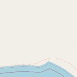
The interactive marine boundary map provides crucial spatial context for the protected offshore waters. Accompanying geographic records detail the estimated marine area of over 1230 square kilometers along with regional center points.
- Boundary area
- 1,249.8 km²
- Boundary perimeter
- 507.5 km
- Northernmost point
- 31.5737° S
- Southernmost point
- 31.9378° S
- Easternmost point
- 132.0014° E
- Westernmost point
- 129.0014° E
- Geographic centre
- 31.6694° S, 130.3608° E
- North–south span
- 40.4 km
- East–west span
- 284.2 km
Terrain and natural features
Catalog of stored marine terrain types and recorded natural features
Great Australian Bight Marine National Park Terrain and Named Features
Examine recorded terrain classifications and named natural features contained within the protected area. Linked feature cards supply official types and spatial relationships for structured reference.
Selected named natural features
Environmental setting
Marine habitat types, dominant water presence, and year round operational attributes
Great Australian Bight Marine National Park Environmental Settings and Classifications
Stored classifications provide structured parameters for reading the physical setting of Great Australian Bight Marine National Park. Recorded categories link directly to relevant atlas destinations where available.
- Water
- Water-dominated
- Forest cover
- No forest cover
- Seasonality
- Year-round
Habitat types
Marine habitat
Park atlas
Trace the regional spread of marine and coastal conservation landscapes across the Great Australian Bight and South Australia.
Discover Other National Parks and Protected Areas Near Great Australian Bight Marine National Park
Browse additional national parks, marine protected areas, and coastal reserves across the Great Australian Bight region, extending your discovery from Great Australian Bight Marine National Park. Comparing these adjacent and contextual protected landscapes offers deeper geographic understanding of the interconnected Australian southern coast.
National parkWestern Australia
Park boundaries overlap#1 closest
West

Eucla National Park: Remote Coastal Protected Landscape in Western Australia
Explore limestone cliffs, sand dunes, and historic sites.
Eucla National Park showcases the dramatic interface of the Great Australian Bight with Western Australia's coastline. This protected area features striking limestone cliffs, vast migrating sand dune systems like the Delisser sandhills, and undulating mallee scrub. Discover the atmospheric ruins of the historic Eucla Telegraph Station, partially engulfed by dunes, and understand the unique geographic context and protected landscape identity of this remote national park.
- Area
- 35.6 km²
- IUCN
- II
- Access
- Remote access
- Water
- Major water bodies
Marine protected areaSouth Australia
Mapped location lies within the park boundary#2 closest
West
Great Australian Bight Marine Park: Mapping South Australia Marine Conservation
Coastal cliffs, continental shelf, and marine whale sanctuaries
Examine the geographic framework of the Great Australian Bight Marine Park, where arid southern coastlines meet the deep, productive waters of the Southern Ocean. This protected marine region features a tiered design connecting state-managed coastal areas with extensive offshore commonwealth reserves, providing a comprehensive look at regional marine geography.
- Access
- Access unknown
- Scope
- Marine
- Water
- Water-dominated
- Forest
- No forest cover
National parkSouth Australia
About 20 km away#3 closest
West
Nullarbor National Park: Mapped Boundaries and Geographic Context in South Australia
Explore the protected landscape and terrain of this South Australian national park.
Nullarbor National Park is a key protected area offering valuable insights into Australia's natural landscapes. This page facilitates a detailed atlas-style exploration of the park's geographic setting and mapped boundaries within South Australia, highlighting its role as a national park and a component of regional conservation efforts.
- Area
- 323.1 km²
- Established
- 1979
- IUCN
- VI
- Relief
- Lowland
Nature reserveSouth Australia
31 km away#4 closest
Southeast
Fowlers Bay Conservation Park: Coastal Protected Area and Regional Geography
A remote conservation landscape on the Great Australian Bight
Fowlers Bay Conservation Park stands as a vital protected area in South Australia, where vertical limestone cliffs meet horizontal chenopod plains. The park provides an essential look at the interaction between Southern Ocean maritime forces and the arid western Eyre Peninsula, offering a rare window into the transition zones of the Great Australian Bight coast.
- Area
- 87.27 km²
- Established
- 1993
- IUCN
- VI
- Relief
- Lowland
Nature reserveSouth Australia
About 60 km away#5 closest
East
Boondina Conservation Park: Protected Landscapes and Regional Geography in South Australia
A remote nature reserve within the Yellabinna mallee woodland network.
Boondina Conservation Park is a 125 square kilometre nature reserve in far western South Australia. It forms part of the expansive Yellabinna Reserves, buffering semi-arid mallee woodland environments and supporting regional ecological processes. This IUCN Category VI area stands out for its co-management with the Far West Coast Aboriginal Corporation and its role as a preserved natural landscape where traditional land use continues.
- Area
- 125.55 km²
- Established
- 1993
- IUCN
- VI
- Relief
- Lowland
Nature reserveSouth Australia
70 km away#6 closest
East
Chadinga Conservation Park: Coastal Dunes and Salt Lake Geography in South Australia
Remote protected dune systems and arid saline landscapes
Chadinga Conservation Park protects a significant stretch of coastal dune country west of Lake MacDonnell. This arid landscape, defined by salt lakes and mallee scrub, serves as a crucial habitat for rare species, offering a raw and undisturbed look at the coastal geography of the South Australian coastline.
- Area
- 118.54 km²
- Established
- 1993
- IUCN
- VI
- Relief
- Lowland
Marine protected areaSouth Australia
About 89 km away#7 closest
Southeast
Murat Marine Park: Geography and Protected Marine Landscape of South Australia
Marine protected area atlas and bathymetric overview
Murat Marine Park represents an offshore sanctuary within the Great Australian Bight. This marine protected area features a blend of sediment-dominated shelf habitats and the submerged Yatala Reef, providing essential feeding grounds for diverse marine life. Explore the mapped territory and understand its placement within the wider South-west Marine Parks Network through a geographic and atlas-focused lens.
- Area
- 937.77 km²
- Established
- 2012
- IUCN
- II
- Relief
- Lowland
Nature reserveSouth Australia
228 km away#8 closest
Southeast
Eba Island Conservation Park: Coastal Landforms and Nature Reserve Geography in South Australia
A protected offshore sanctuary within Streaky Bay's coastal landscape.
Eba Island Conservation Park represents a key protected area within the coastal geography of South Australia. Composed primarily of calcarenite and limestone, the reserve features a diverse range of coastal landforms, including rugged jagged ridges, active blowholes, and sheltered coves, providing an essential habitat for seabird colonies.
- Area
- 1.34 km²
- Established
- 1966
- IUCN
- Ia
- Relief
- Lowland
MoriAtlas Explorer
Continue exploring the geography and protected landscape of Great Australian Bight Marine National Park
Deepen your understanding of Great Australian Bight Marine National Park by exploring its mapped boundaries and unique geographic context. This dedicated atlas entry provides essential information for grasping its role as a marine protected area and appreciating its natural landscape. Continue your discovery of South Australia's protected territories and their regional significance.
Browse next
Global natural geography
Explore related park routes
Explore MoriAtlas Global ParksBrowse All MoriAtlas ParksGlobal Park Map DiscoveryMoriAtlas: Browse All CountriesBrowse All MoriAtlas ContinentsNational Park Environment AtlasGrand Canyon National Park AtlasYellowstone National Park AtlasYosemite National Park Atlas and GeographySerengeti National Park AtlasGalápagos National Park Protected LandscapeBanff National Park Geography and AtlasKruger National Park Atlas EntryUluṟu-Kata Tjuṯa National Park AtlasExplore Uluru-Kata Tjuta National Park GeographyPlitvice Lakes National Park AtlasFiordland National Park Protected LandscapeGreat Smoky Mountains National Park AtlasAfghanistan National Parks and Protected AreasAlbania National Parks and Protected AreasAlgeria National Parks and Protected AreasAmerican Samoa National Parks and Protected AreasAndorra National Parks and Protected AreasAngola National Parks and Protected AreasAntarctica National Parks and Protected AreasAntigua and Barbuda Park List