

Mori Atlas logo
Marine protected areaGreat Australian Bight Marine National Park

Understanding the geographic scope and landscape context of this protected marine expanse in South Australia.

Great Australian Bight Marine National Park: Mapped Marine Protected Area and Regional Geography

Great Australian Bight Marine National Park represents a significant marine protected area within the broader geography of South Australia. This atlas-focused entry details the park's mapped boundaries and its contribution to the regional natural landscape. Users can explore the unique characteristics of this protected marine environment and understand its place within the Australian context, providing a clear geographic and conservation-oriented discovery experience.

Marine Protected AreaWhale SanctuaryCoastal EcosystemSouthern OceanAustralian WildlifeMarine Mammals

Great Australian Bight Marine National Park

Marine protected area

Park overview

Structured park overview, official facts, and landscape profile for Great Australian Bight Marine National Park

Great Australian Bight Marine National Park park facts, protected area profile, and essential visitor context
Review the core facts for Great Australian Bight Marine National Park, including designation, size, terrain, visitor scale, habitats, and operating context in one park-focused overview.

About Great Australian Bight Marine National Park

Great Australian Bight Marine National Park represents one of South Australia's most important marine conservation achievements, protecting a biologically rich stretch of the southern Australian coastline. The park's two sections span a significant portion of the state's western coastline, encompassing the ocean waters immediately adjacent to one of Australia's most remote and sparsely populated regions. The marine environment here benefits from upwelling currents that bring nutrient-rich waters to the surface, supporting productive food webs that sustain populations of marine mammals, seabirds, and fish species. The coastal landscape, while not technically part of the national park, provides essential context for understanding the marine ecosystem's character, with limestone cliffs and dune systems shaping the interface between land and sea.

Quick facts and research context for Great Australian Bight Marine National Park

Located in South Australia near the town of Ceduna, the Great Australian Bight Marine National Park covers approximately 1,233 square kilometers of coastal and shelf waters. The park protects a stretch of coastline characterized by dramatic cliffs, sandy beaches, and productive marine ecosystems. It was formally proclaimed on September 26, 1996, and is managed by the South Australian Department for Environment and Water. The park forms part of a connected marine protection network that includes the adjacent Great Australian Bight Marine Park Whale Sanctuary, established in 1995 to provide additional protection for migratory whale populations.

Park context

Deeper park guide and search-rich context for Great Australian Bight Marine National Park

Great Australian Bight Marine National Park history, landscape, wildlife, and travel context
Explore Great Australian Bight Marine National Park through its history, landscape character, ecosystems, wildlife, conservation priorities, cultural context, and seasonal travel timing in a structured park guide built for atlas discovery and search intent.

Why Great Australian Bight Marine National Park stands out

Great Australian Bight Marine National Park is best known as a critical calving ground for Southern right whales, which migrate here each year to give birth and nurse their young in the protected coastal waters. The park also provides important habitat for the Australian sea lion, one of Australia's endemic pinniped species. The marine environment features productive plankton-rich waters supporting diverse marine life, while the adjoining coastline displays the characteristic stark beauty of the Great Australian Bight region with its limestone cliffs and extensive sand beaches.

Great Australian Bight Marine National Park history and protected-area timeline

The Great Australian Bight Marine National Park was officially proclaimed on September 26, 1996, under South Australia's National Parks and Wildlife Act 1972. The establishment of this marine protected area marked a significant step in Australia's marine conservation efforts, recognizing the ecological importance of the Great Australian Bight region. Originally, the park's proclamation included certain mining and petroleum exploration rights, but these were removed in 2004 through amendments to South Australia's Mining Act 1971 and Petroleum Act 1940, as well as the Commonwealth's Petroleum (Submerged Lands) Act 1982. This legislative change strengthened the park's protection status by eliminating potential conflicts with resource extraction activities. The park exists within a broader marine protection framework that includes the Great Australian Bight Marine Park Whale Sanctuary, proclaimed in 1995, and since late 2012, has also been incorporated into the Far West Coast Marine Park.

Great Australian Bight Marine National Park landscape and geographic character

The Great Australian Bight Marine National Park protects ocean waters adjoining a coastline of striking geological character. The region's geology is dominated by ancient limestone formations that form dramatic cliffs along parts of the shoreline, interspersed with extensive sandy beaches and coastal dune systems. The Tchalingaby Sandhills mark the eastern extent of the protected area, representing the park's transition zone. The marine environment itself features a relatively shallow continental shelf that slopes gradually into deeper waters, with the park extending up to 3 nautical miles from the coastline. The combination of productive coastal waters and the dramatic backdrop of the Bight's coastline creates a distinctive marine and landscape character that distinguishes this protected area.

Great Australian Bight Marine National Park ecosystems, habitats, and plant life

The marine ecosystem of the Great Australian Bight supports remarkable biodiversity, largely driven by the region's oceanographic conditions. The coastal waters experience upwelling events that bring nutrient-rich deep waters to the surface, fueling phytoplankton productivity that cascades through the food web. This productivity supports substantial populations of marine mammals, particularly the Southern right whale which uses the protected calving grounds annually. The Australian sea lion, an endemic species found only in southern Australian waters, relies on coastal habitats within the park for foraging and resting. The productive waters also support diverse fish communities, cephalopods, and crustaceans that form the base of the marine food web.

Great Australian Bight Marine National Park wildlife and species highlights

The Great Australian Bight Marine National Park provides critical habitat for several marine mammal species of conservation significance. Southern right whales migrate to these waters each winter and spring to calve in the sheltered coastal environment, making this one of the most important calving grounds for the species in Australian waters. Australian sea lions, which breed at scattered colonies along the southern coast, utilize the park's waters for foraging. The marine environment supports abundant seabirds including albatrosses, petrels, and gannets that forage in the productive waters. Fish species including snapper, whiting, and various shark species inhabit the park's waters, while the invertebrate fauna includes southern rock lobster and various cephalopod species.

Great Australian Bight Marine National Park conservation status and protection priorities

The establishment of Great Australian Bight Marine National Park reflects recognition of the region's exceptional ecological significance within Australia's marine protected area network. The park's primary conservation focus centers on protecting critical habitat for Southern right whales during their breeding season, when pregnant females migrate to the protected calving grounds to give birth and raise their calves. The protection of Australian sea lion foraging habitat represents another key conservation objective. The removal of mining and petroleum exploration rights in 2004 strengthened the park's conservation integrity by eliminating potential sources of marine pollution and habitat disturbance. As part of the larger Great Australian Bight Marine Park complex, the national park contributes to ecosystem-scale marine protection along South Australia's western coast.

Great Australian Bight Marine National Park cultural meaning and human context

The Great Australian Bight region holds significance for Aboriginal peoples with traditional connections to the coastal lands and waters of southern South Australia. The marine environment has supported Indigenous communities for thousands of years, with marine resources forming important components of traditional diets and cultural practices. The region remains part of ongoing Native Title considerations and Indigenous land management partnerships. The park's proximity to the town of Ceduna, a small coastal settlement that developed as a service center for the surrounding pastoral and fishing communities, provides human context to this otherwise remote coastline.

Top sights and standout views in Great Australian Bight Marine National Park

The Great Australian Bight Marine National Park protects one of Australia's most significant whale calving areas, where Southern right whales congregate annually to give birth and raise their young in sheltered coastal waters. The park forms part of a connected marine protection network spanning the Great Australian Bight, representing a major conservation achievement for Australia's southern coastline. The productive marine environment supports diverse wildlife including Australian sea lions, abundant seabirds, and commercially important fish species. The park's establishment in 1996, followed by the removal of resource extraction rights in 2004, demonstrates evolving marine conservation priorities in South Australia.

Best time to visit Great Australian Bight Marine National Park

The optimal time to experience the Great Australian Bight Marine National Park's wildlife is during the winter and spring months when Southern right whales are present in the calving grounds. From approximately June through October, pregnant females arrive to give birth in the protected coastal waters, offering opportunities to observe whale behavior from the shoreline or on boat excursions. Summer months bring calmer seas and more accessible conditions for marine activities, though whale activity diminishes as the animals depart for southern feeding grounds. Weather patterns in this remote region can change rapidly, and visitors should be prepared for the characteristic strong winds and variable conditions of the southern Australian coast.

Park location guide

Geography guide, regional context, and park location map for Great Australian Bight Marine National Park

Great Australian Bight Marine National Park park geography, regions, and map view in Australia
Understand where Great Australian Bight Marine National Park sits in Australia through a broader geographic reading of the surrounding landscape, nearby location context, and its mapped position within the national park landscape.

How Great Australian Bight Marine National Park fits into Australia

Australia is a constitutional monarchy and federal parliamentary democracy comprising six states and ten territories. With a population of nearly 28 million, it is one of the world's most urbanised countries, with most people concentrated on the eastern seaboard. The country has a high Human Development Index and is known for its cultural diversity, ancient Aboriginal heritage, and unique wildlife.

Wider geography shaping Great Australian Bight Marine National Park in Australia

Australia occupies the entire Australian continent, the island of Tasmania, and numerous smaller islands. It is the world's flattest and driest inhabited continent, featuring vast deserts in the interior (the Outback), tropical rainforests along the eastern coast, and a coastline bordering the Indian and Pacific Oceans.

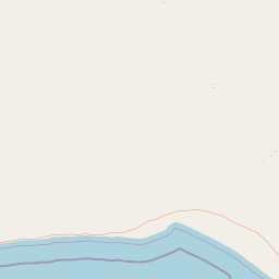
Map view of Great Australian Bight Marine National Park

Use this park location map to pinpoint Great Australian Bight Marine National Park in Australia, understand its exact geographic position, and read its mapped placement within the surrounding landscape more clearly.

Pigeon | © OpenStreetMap contributors

Location context for Great Australian Bight Marine National Park

South Australia
Park atlas

Trace the regional spread of marine and coastal conservation landscapes across the Great Australian Bight and South Australia.

Discover Other National Parks and Protected Areas Near Great Australian Bight Marine National Park
Browse additional national parks, marine protected areas, and coastal reserves across the Great Australian Bight region, extending your discovery from Great Australian Bight Marine National Park. Comparing these adjacent and contextual protected landscapes offers deeper geographic understanding of the interconnected Australian southern coast.
National parkSouth Australia

Nullarbor National Park: Mapped Boundaries and Geographic Context in South Australia

Explore the protected landscape and terrain of this South Australian national park.

Nullarbor National Park is a key protected area offering valuable insights into Australia's natural landscapes. This page facilitates a detailed atlas-style exploration of the park's geographic setting and mapped boundaries within South Australia, highlighting its role as a national park and a component of regional conservation efforts.

Area
323.1 km²
Established
1979
IUCN
VI
Relief
Lowland
National parkWestern Australia

Eucla National Park: Remote Coastal Protected Landscape in Western Australia

Explore limestone cliffs, sand dunes, and historic sites.

Eucla National Park showcases the dramatic interface of the Great Australian Bight with Western Australia's coastline. This protected area features striking limestone cliffs, vast migrating sand dune systems like the Delisser sandhills, and undulating mallee scrub. Discover the atmospheric ruins of the historic Eucla Telegraph Station, partially engulfed by dunes, and understand the unique geographic context and protected landscape identity of this remote national park.

Area
35.6 km²
IUCN
II
Access
Remote access
Water
Major water bodies
National parkSouth Australia

Lake Gairdner National Park: National Park with Unique South Australian Geography and Mapped Boundaries

South Australian protected area with distinct landscape characteristics.

Lake Gairdner National Park serves as a key protected area within the geographic expanse of South Australia. This national park offers a unique focus for atlas exploration, highlighting its specific landscape features and mapped boundaries. Users can delve into the park's protected status and its contribution to the regional geography, providing valuable context for understanding Australia's diverse natural protected lands and their cartographic representation.

Area
5,531.77 km²
Established
1991
IUCN
VI
Relief
Lowland
National parkSouth Australia

Coffin Bay National Park: Protected Landscape and Geographic Context in South Australia

Explore the mapped boundaries and regional geography of this national park.

Coffin Bay National Park presents a distinct protected landscape within South Australia, offering a valuable point of entry for geographic discovery. This page details the park's national park designation and its mapped territory, crucial for understanding its role in Australia's atlas of natural areas. Delve into the park's specific geographic context and the outlines of its protected lands, providing a clear picture of its landscape within the state's broader terrain.

Area
309.76 km²
Established
1982
IUCN
II
Relief
Lowland
National parkSouth Australia

Lincoln National Park National Park: Mapped Protected Area and Geographic Landscape Identity

South Australia's protected landscape with detailed park boundaries.

Gain a comprehensive atlas perspective on Lincoln National Park, a designated national park in South Australia. This resource details the park's mapped boundaries, offering clear geographic context and highlighting its role as a protected landscape. Understand its place within the regional geography of South Australia, providing essential data for landscape exploration and atlas-based research.

Area
216.38 km²
Established
1941
IUCN
II
Relief
Upland
National parkSouth Australia

Lake Torrens National Park: Explore South Australia's Remarkable Inland Salt Lake Geography

A unique protected landscape of arid plains and expansive salt flats.

Lake Torrens National Park offers an unparalleled exploration of Australia's remote outback, centered around a vast, ancient salt lake basin. This national park in South Australia provides a canvas of stark, minimalist terrain, featuring shimmering saltpans, arid gibber plains, and rocky outcrops. Understand the park's unique geographic identity, its ecological significance as a temporary wetland habitat, and its dramatic visual appeal for landscape photography and geological interest. It is a key protected area showcasing the extreme environment of Australia's interior.

Area
5,676.68 km²
Established
1991
IUCN
VI
Relief
Lowland
National parkSouth Australia

Mount Remarkable National Park: Protected Landscape Atlas and South Australia Geography

Explore mapped boundaries and natural terrain.

Mount Remarkable National Park serves as a vital protected area within South Australia's unique geographic setting. This MoriAtlas entry details the park's mapped boundaries and surrounding natural terrain, providing structured insight into its landscape character and regional geographic importance. Understand the park as a key element of Australia's protected lands atlas.

Area
166.18 km²
Established
1972
IUCN
VI
Visitors
50K annual
National parkSouth Australia

Nilpena Ediacara National Park: South Australia National Park and Protected Landscape Identity

Mapped protected area within the regional geography of South Australia.

Nilpena Ediacara National Park represents a significant protected landscape within South Australia. This entry provides a detailed geographic context for the park, focusing on its role as a national park and its mapped boundaries. Delve into the specific atlas-driven understanding of this protected area, its landscape context, and its significance within the broader geographic framework of the Australian state.

Area
606.17 km²
Established
2021
IUCN
VI
Relief
Mountain

Common questions about visiting, size, designation, and location context for Great Australian Bight Marine National Park

Great Australian Bight Marine National Park FAQs for park facts, access, geography, and protected area context
Find quick answers about Great Australian Bight Marine National Park, including protected-area facts, park geography, trail and visitor context, and how the park fits into its surrounding country and regional landscape.
MoriAtlas Explorer

Continue Your Protected Areas Search Across the Global Atlas

Deepen your exploration by continuing the structured search for national parks and protected areas worldwide. Utilize the comprehensive filtering capabilities to compare different conservation landscapes and refine your understanding of global park geography. Discover more about the distribution and characteristics of protected natural areas.

Global natural geography