

Mori Atlas logo
National parkCoffin Bay National Park

Discover the mapped geography and protected area identity of Coffin Bay National Park.

Coffin Bay National Park: South Australia's Protected Landscape Atlas Entry

Coffin Bay National Park stands as a significant protected landscape within the Australian state of South Australia. This park detail page offers an atlas-centric view, highlighting its mapped boundaries and geographic setting. Users can explore the park's place within the broader regional geography and understand its identity as a national park through structured geographic data and landscape context. Gain insight into the protected land's distinct features and its relation to the surrounding South Australian terrain.

Coastal national parksLimestone cliffsWetland habitatsBirdwatchingSouth Australian parksPeninsula landscapes

Coffin Bay National Park

National park

Park overview

Structured park overview, official facts, and landscape profile for Coffin Bay National Park

Coffin Bay National Park park facts, protected area profile, and essential visitor context
Review the core facts for Coffin Bay National Park, including designation, size, terrain, visitor scale, habitats, and operating context in one park-focused overview.

About Coffin Bay National Park

Coffin Bay National Park occupies the entire Coffin Bay Peninsula, a landform that creates a natural division between the sheltered waters of Coffin Bay to the north and the exposed Southern Ocean to the south and west. The park's terrain is characterized by coastal heath atop dune systems, freshwater swamps that fill natural depressions, and the prominent limestone cliffs that define the western shoreline. These cliffs, particularly around Point Avoid, create a striking backdrop where white-bellied sea eagles and ospreys nest and hunt along the coast. The peninsula extends into the ocean with islands such as Golden Island and Price Island lying offshore, providing additional habitat for seabirds and marine life. Access to the park is straightforward near the town of Coffin Bay, but the interior and northern sections require four-wheel-drive vehicles on sand tracks. A camping area at Yangie Bay provides the primary overnight accommodation option within the park, with fees payable at entry points.

Quick facts and research context for Coffin Bay National Park

Coffin Bay National Park covers 309.76 square kilometres along the Coffin Bay Peninsula in South Australia. The park was established on December 2, 1982, and is managed by the South Australian Department for Environment and Water. The landscape features limestone cliffs along the western coast, extensive coastal dunes, freshwater swamps, and beaches such as Almonta and Gunyah to the east of Point Avoid. The park is adjacent to the Thorny Passage Marine Park, which extends protection into the surrounding waters. A historic whaling site at Point Sir Isaac is listed on the South Australian Heritage Register.

Park context

Deeper park guide and search-rich context for Coffin Bay National Park

Coffin Bay National Park history, landscape, wildlife, and travel context
Explore Coffin Bay National Park through its history, landscape character, ecosystems, wildlife, conservation priorities, cultural context, and seasonal travel timing in a structured park guide built for atlas discovery and search intent.

Why Coffin Bay National Park stands out

Coffin Bay National Park is best known for its dramatic limestone cliffs and pristine white sand beaches that line much of its western coastline. The peninsula's coastal dunes and wetland areas support significant bird populations, with the park recognized as an Important Bird Area by BirdLife International. The area is particularly notable for its population of endangered shorebirds including pied and sooty oystercatchers, fairy terns, and hooded plovers. The combination of accessible surf beaches, remote four-wheel-drive tracks leading to wild coastlines, and the opportunity to observe sea eagles and albatrosses soaring along the cliffs makes this park a distinctive coastal wilderness destination.

Coffin Bay National Park history and protected-area timeline

The land that now forms Coffin Bay National Park has been inhabited by Indigenous peoples for thousands of years, though the Wikipedia source does not provide specific cultural details. The park was formally established as a national park on December 2, 1982, giving it protection status under South Australian legislation. A significant historical feature within the park is the Coffin Bay Whaling Site at Point Sir Isaac, which represents the region's earlier maritime economy. This site is now listed on the South Australian Heritage Register, acknowledging its historical importance. The establishment of the park protected the peninsula's unique coastal ecosystems and scenic landscapes from development pressures that had affected other parts of the Eyre Peninsula coastline.

Coffin Bay National Park landscape and geographic character

The physical landscape of Coffin Bay National Park presents a diverse array of coastal landforms arranged along the peninsula. The western coastline is dominated by limestone cliffs that rise above white sand beaches, creating an environment reminiscent of more famous coastal parks in southern Australia. Behind the cliffs, extensive coastal dune systems have developed, stabilized by heathy vegetation. The peninsula's northern sections contain freshwater swamps that provide wetland habitat amid the otherwise sandy terrain. The eastern side of the park, particularly around Point Avoid, features more sheltered beaches at Almonta and Gunyah that are popular for surfing. Offshore, reef systems extend from Point Avoid toward Golden Island, with Price Island lying further out in the Southern Ocean. The overall effect is a peninsula landscape where the contrast between sheltered bay waters and exposed ocean coastline creates remarkable visual diversity within a relatively compact area.

Coffin Bay National Park ecosystems, habitats, and plant life

The ecological character of Coffin Bay National Park is defined by its coastal heath, dune, and wetland habitats that together support remarkable biodiversity. The coastal heath that covers much of the peninsula features diverse native plant communities adapted to the sandy, nutrient-poor soils and salty winds. The wetland areas, though not extensive, provide crucial habitat for waterbirds and other species during wet periods. The park's location on a peninsula extending into the Southern Ocean positions it along major seabird migration routes, bringing albatrosses and petrels to the offshore waters. The adjacent Thorny Passage Marine Park extends protection into the marine environment, creating an integrated coastal and marine protected area that recognizes the connections between terrestrial and ocean ecosystems.

Coffin Bay National Park wildlife and species highlights

The wildlife of Coffin Bay National Park is highlighted by its significant seabird populations and shorebird assemblages. White-bellied sea eagles and ospreys are commonly seen hunting along the coastline and cliffs, their large nests visible on the limestone outcrops. Further offshore, various albatross and petrel species frequent the waters surrounding the peninsula. The park has been recognized as an Important Bird Area by BirdLife International because it supports globally significant populations of several shorebird species. The park holds more than one percent of the world populations of pied oystercatchers and sooty oystercatchers, while also supporting significant numbers of fairy terns, hooded plovers, western whipbirds, rock parrots, and blue-breasted fairy-wrens. The volunteer group Friends of Coffin Bay Parks has worked to restore native vegetation and control feral animals and weeds, supporting the park's wildlife populations.

Coffin Bay National Park conservation status and protection priorities

Coffin Bay National Park represents an important conservation outcome for South Australia's coastal environments, protecting a peninsula landscape that might otherwise have been developed for housing or tourism infrastructure. The park's inclusion in the national reserve system ensures the long-term protection of its coastal heath, dune, and wetland habitats along with the species they support. The designation of the adjoining waters as part of Thorny Passage Marine Park creates an integrated coastal-marine protected area that addresses the ecological connections between terrestrial and marine ecosystems. The Important Bird Area recognition highlights the park's international significance for shorebird conservation, particularly for oystercatcher species that breed on the peninsula's beaches. The ongoing work by Friends of Coffin Bay Parks to re-introduce native plants and remove invasive species demonstrates active conservation management beyond passive protection.

Coffin Bay National Park cultural meaning and human context

The human history of the Coffin Bay region includes a whaling operation that operated at Point Sir Isaac within what is now the national park. The Coffin Bay Whaling Site, now listed on the South Australian Heritage Register, represents the region's maritime heritage and the historical relationship between local communities and the ocean. This heritage site provides a tangible connection to the area's past and adds cultural depth to the natural landscape. While the Wikipedia source does not provide details about Aboriginal traditional use of the peninsula, the broader Eyre Peninsula region has been home to Indigenous peoples for many thousands of years.

Top sights and standout views in Coffin Bay National Park

The standout features of Coffin Bay National Park include the spectacular limestone cliffs along the western coastline that provide dramatic ocean views and nesting habitat for sea eagles. The surf beaches at Almonta and Gunyah on the eastern side offer excellent surfing conditions in a relatively accessible location. The opportunity to drive to remote coastal locations via four-wheel-drive tracks, camp at Yangie Bay, and observe albatrosses and other seabirds against a backdrop of white cliffs and turquoise water defines the park's appeal. The Important Bird Area designation underscores the park's significance for shorebird conservation, particularly for the endangered populations of pied and sooty oystercatchers that breed on its beaches.

Best time to visit Coffin Bay National Park

The best time to visit Coffin Bay National Park depends on what visitors hope to experience. Summer months bring warmer conditions ideal for beach activities and surfing at Almonta and Gunyah beaches, though this is also the peak visitor season. Autumn and spring tend to offer more comfortable temperatures for hiking and wildlife observation, with migratory seabirds more commonly seen during these transition seasons. Winter brings quieter conditions to the park and is an excellent time for those seeking solitude, though the weather can be cooler and some facilities may have reduced operating hours. The park can be visited year-round, but the shoulder seasons of autumn and spring often provide the most pleasant conditions for exploring the peninsula's diverse landscapes and observing its wildlife.
Park location guide

Geography guide, regional context, and park location map for Coffin Bay National Park

Coffin Bay National Park park geography, regions, and map view in Australia
Understand where Coffin Bay National Park sits in Australia through a broader geographic reading of the surrounding landscape, nearby location context, and its mapped position within the national park landscape.

How Coffin Bay National Park fits into Australia

Australia is a constitutional monarchy and federal parliamentary democracy comprising six states and ten territories. With a population of nearly 28 million, it is one of the world's most urbanised countries, with most people concentrated on the eastern seaboard. The country has a high Human Development Index and is known for its cultural diversity, ancient Aboriginal heritage, and unique wildlife.

Wider geography shaping Coffin Bay National Park in Australia

Australia occupies the entire Australian continent, the island of Tasmania, and numerous smaller islands. It is the world's flattest and driest inhabited continent, featuring vast deserts in the interior (the Outback), tropical rainforests along the eastern coast, and a coastline bordering the Indian and Pacific Oceans.

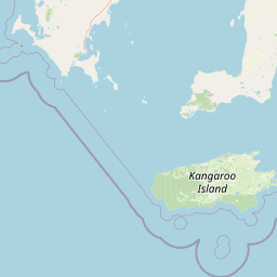
Map view of Coffin Bay National Park

Use this park location map to pinpoint Coffin Bay National Park in Australia, understand its exact geographic position, and read its mapped placement within the surrounding landscape more clearly.

Pigeon | © OpenStreetMap contributors

Location context for Coffin Bay National Park

South Australia
Park atlas

Browse adjacent protected landscapes and trace the unique peninsula geography across Eyre Peninsula

Explore More Parks Near Coffin Bay National Park, Discover South Australia's Coastal Protected Areas
Continue exploring from Coffin Bay National Park by browsing other protected areas, identifying diverse coastal landscapes, and tracing the regional geography across the Eyre Peninsula. Compare these national parks and reserves to understand the broader conservation network and how varied ecosystems are preserved throughout South Australia's maritime region.
National parkSouth Australia

Lincoln National Park National Park: Mapped Protected Area and Geographic Landscape Identity

South Australia's protected landscape with detailed park boundaries.

Gain a comprehensive atlas perspective on Lincoln National Park, a designated national park in South Australia. This resource details the park's mapped boundaries, offering clear geographic context and highlighting its role as a protected landscape. Understand its place within the regional geography of South Australia, providing essential data for landscape exploration and atlas-based research.

Area
216.38 km²
Established
1941
IUCN
II
Relief
Upland
National parkSouth Australia

Flinders Chase National Park: A Detailed National Park Entry for Map Exploration in South Australia

Explore mapped boundaries and regional geographic context.

This dedicated entry for Flinders Chase National Park provides critical geographic and protected-area data, functioning as a key point within the MoriAtlas for understanding Australia's conservation landscapes. Investigate the specific mapped boundaries of this national park, situate it within the regional geography of South Australia, and grasp its identity as a distinct protected land. The information here supports structured exploration for anyone seeking detailed atlas context on natural park entities.

Area
326.61 km²
Established
1972
IUCN
II
Relief
Upland
National parkSouth Australia

Deep Creek National Park: Protected Coastal Terrain and Geographic Context in South Australia

Discover South Australia's largest remaining natural vegetation area.

Deep Creek National Park offers a unique protected landscape on South Australia's Fleurieu Peninsula, extending 18 kilometers along the rugged coast. This national park is renowned for its rolling hills, gullies, and dramatic views across Backstairs Passage to Kangaroo Island. It serves as a crucial conservation area, preserving the largest continuous segment of natural vegetation in a region largely transformed by development, making its geography and protected status highly significant.

Area
44.96 km²
Established
1971
IUCN
II
Relief
Mixed relief
National parkSouth Australia

Onkaparinga River National Park: National Park Protected Landscape in South Australia

Explore mapped boundaries and regional geographic context.

Onkaparinga River National Park is a designated national park within South Australia, offering a focused point for understanding protected landscapes. This entry provides detailed geographic context, highlighting the park's mapped boundaries and its place within the regional atlas. Engage with the specific geography and protected-area identity of Onkaparinga River National Park to enhance your landscape exploration.

Area
15.42 km²
Established
1993
IUCN
II
Relief
Upland
National parkSouth Australia

Belair National Park National Park: South Australia Protected Landscape and Map Exploration

Explore the geographic context and mapped boundaries of this South Australian protected area.

Belair National Park represents a significant protected land entity within South Australia, offering specific geographic insights relevant to atlas exploration. As a designated national park, its mapped boundaries and landscape character are essential for understanding regional conservation efforts. This profile provides foundational information on the park's identity as a protected natural area, anchoring its position within the geography of South Australia for detailed map-based discovery and regional context.

Area
8.35 km²
Established
1891
IUCN
II
Visitors
358.6K annual
National parkAdelaide Hills

Cleland National Park: Mapped Protected Landscape and Regional Geographic Context

Discover the natural terrain and park boundaries within Adelaide Hills.

Cleland National Park offers a critical lens into the protected landscapes of South Australia's Adelaide Hills. As a national park, its mapped boundaries and geographic position are key elements for understanding regional natural terrain. This resource facilitates atlas-style exploration of Cleland National Park, highlighting its importance within the conservation framework and providing a foundation for detailed geographic study.

Area
11.25 km²
Established
1945
IUCN
II
Visitors
100K annual
National parkSouth Australia

Wapma Thura, Southern Flinders Ranges National Park: South Australia's Protected Natural Landscape

Explore mapped boundaries and regional geography.

Wapma Thura, Southern Flinders Ranges National Park offers a distinct protected landscape within South Australia. This page serves as a portal for understanding its geographic setting, its role as a national park, and its place within the state's atlas of natural areas. Examine the mapped terrain and protected boundaries to grasp the park's unique geographic characteristics.

Established
2021
IUCN
II
Relief
Mountain
Scope
Terrestrial
National parkSouth Australia

Mount Remarkable National Park: Protected Landscape Atlas and South Australia Geography

Explore mapped boundaries and natural terrain.

Mount Remarkable National Park serves as a vital protected area within South Australia's unique geographic setting. This MoriAtlas entry details the park's mapped boundaries and surrounding natural terrain, providing structured insight into its landscape character and regional geographic importance. Understand the park as a key element of Australia's protected lands atlas.

Area
166.18 km²
Established
1972
IUCN
VI
Visitors
50K annual

Common questions about visiting, size, designation, and location context for Coffin Bay National Park

Coffin Bay National Park FAQs for park facts, access, geography, and protected area context
Find quick answers about Coffin Bay National Park, including protected-area facts, park geography, trail and visitor context, and how the park fits into its surrounding country and regional landscape.
MoriAtlas Explorer

Continue Your Protected Areas Search Across the Global Atlas

Deepen your exploration by continuing the structured search for national parks and protected areas worldwide. Utilize the comprehensive filtering capabilities to compare different conservation landscapes and refine your understanding of global park geography. Discover more about the distribution and characteristics of protected natural areas.

Global natural geography