

Mori Atlas logo
National parkWapma Thura–Southern Flinders Ranges National Park

Discover the mapped boundaries and regional geography of this important South Australian national park.

Wapma Thura–Southern Flinders Ranges National Park: South Australia's Protected Landscape and Geographic Context

Wapma Thura–Southern Flinders Ranges National Park stands as a significant protected area within the vast geography of South Australia. This page provides an atlas-oriented exploration of the park's identity as a national park, detailing its mapped natural landscape and regional context. Understand the geographic scope and protected land boundaries that define this South Australian natural area.

National ParksSouth AustraliaFlinders RangesMountain LandscapesAboriginal Cultural HeritageGorges

Wapma Thura–Southern Flinders Ranges National Park

National park

Park overview

Structured park overview, official facts, and landscape profile for Wapma Thura, Southern Flinders Ranges National Park

Wapma Thura, Southern Flinders Ranges National Park park facts, protected area profile, and essential visitor context

Review the core facts for Wapma Thura, Southern Flinders Ranges National Park, including designation, size, terrain, visitor scale, habitats, and operating context in one park-focused overview.

About Wapma Thura, Southern Flinders Ranges National Park

Wapma Thura–Southern Flinders Ranges National Park represents a significant addition to South Australia's national park estate, established in late 2021 through the consolidation of several former conservation parks and a portion of Mount Remarkable National Park. The park occupies a strategic position in the southern Flinders Ranges, a mountain region that forms the northern extremity of the Mount Lofty Ranges and presents some of South Australia's most distinctive terrain. The landscape is characterized by steep ridges, rocky gorges, andscarpment features that have been shaped by millions of years of geological processes. The consolidation of previously separate conservation areas into a unified national park provides enhanced ecological connectivity and administrative coherence for conservation management in this region. The involvement of Nukunu traditional owners in the park's management through collaborative arrangements reflects contemporary approaches to protected area governance that recognize the importance of Aboriginal cultural heritage alongside ecological values. The park's establishment was supported by the South Australian Government's Parks 2025 strategy and federal funding, reflecting political commitment to expanding nature-based tourism opportunities in regional South Australia.

Quick facts and research context for Wapma Thura, Southern Flinders Ranges National Park

Wapma Thura–Southern Flinders Ranges National Park is located in South Australia, approximately 200 kilometres north of Adelaide. The park was created through the consolidation of former conservation areas including Telowie Gorge Conservation Park, Wirrabara Range Conservation Park, Spaniards Gully Conservation Park, and the Napperby Block from Mount Remarkable National Park. The park protects significant mountain and gorge terrain in the southern Flinders Ranges, with the Napperby Block covering approximately 1,672 hectares of ridge and steep western slopes. This area represents an important conservation upgrade from former conservation park status to national park designation, providing stronger ecological protection. The park lies adjacent to the town of Wirrabara and within reasonable distance of Port Pirie.

Protection and recognition

Documenting terrestrial boundaries and official designation history for regional conservation.

Wapma Thura, Southern Flinders Ranges National Park Protection Status and Designation Details

Explore the verified terrestrial boundaries, established designation year, and official management scope of Wapma Thura, Southern Flinders Ranges National Park. Analyzing official regional data records helps conservation researchers and geographers map international protection frameworks across the diverse South Australian landscape.

Protection details

Protection scope
Terrestrial
Designated year
2021
Park context

Deeper park guide and search-rich context for Wapma Thura, Southern Flinders Ranges National Park

Wapma Thura, Southern Flinders Ranges National Park history, landscape, wildlife, and travel context

Explore Wapma Thura, Southern Flinders Ranges National Park through its history, landscape character, ecosystems, wildlife, conservation priorities, cultural context, and seasonal travel timing in a structured park guide built for atlas discovery and search intent.

Why Wapma Thura, Southern Flinders Ranges National Park stands out

Wapma Thura, Southern Flinders Ranges National Park is best known for its rugged mountain landscapes and deep gorges characteristic of the southern Flinders Ranges. Telowie Gorge represents one of the park's signature natural features, a dramatic cleavage in the ranges that has attracted visitors and naturalists for generations. The park is also distinguished by its strong Aboriginal cultural dimension, with the Wapma Thura name from the Nukunu people meaning Snake People and reflecting the Dreamtime serpent totem that holds deep significance for traditional custodians. The recent creation of this national park as part of the Remarkable Southern Flinders Project also signals its emerging reputation as a destination for adventure tourism, with new mountain bike and hiking trails planned to showcase the region's outdoor recreation potential.

Wapma Thura, Southern Flinders Ranges National Park history and protected-area timeline

The creation of Wapma Thura–Southern Flinders Ranges National Park represents the culmination of a gradual expansion of protected areas in the southern Flinders Ranges over several decades. The individual components that now comprise the national park have different establishment histories. Telowie Gorge Conservation Park was originally protected as Telowie Gorge National Park in 1970 before being reconstituted under the National Parks and Wildlife Act 1972, with the conservation park designation formalised in 1972. Wirrabara Conservation Park originated as a native forest reserve in 1950 before achieving conservation park status in December 2017. Spaniards Gully Conservation Park was proclaimed in December 2017, consisting of two separate allotments in the Hundred of Darling. The Napperby Block, added to Mount Remarkable Conservation Park in 1993, covers 16.72 square kilometres of ridge and western slopes immediately east of the town of Napperby. The formal proclamation of the unified national park occurred on 25 November 2021, creating a conservation area of significantly enhanced status. The Southern Flinders Precinct planning process, initiated in 2020 under the Remarkable Southern Flinders Project, provided the framework for this consolidation and the associated tourism development investment of $10 million in new trails and visitor facilities.

Wapma Thura, Southern Flinders Ranges National Park landscape and geographic character

The landscape of Wapma Thura–Southern Flinders Ranges National Park exemplifies the characteristic terrain of the southern Flinders Ranges, presenting a landscape of ridges, valleys, and dramatic gorges carved into ancient rock formations. The park encompasses the ridge and steep western slopes of the southern Flinders Ranges, with elevations varying across the terrain to create diverse microclimates and habitat conditions. Telowie Gorge, one of the park's most notable features, is a dramatic gorge formation that cuts through the ranges, offering scenic natural passages and opportunities for geological observation. The landscape supports a mixture of open eucalypt woodland, rocky outcrop communities, and valley floor vegetation, with the topography influencing moisture availability and fire behavior across the park. The visual character of the park combines the distinctive rusty-red and grey tones of Flinders Range geology with the green-grey foliage of adapted vegetation communities, creating a recognisably Australian mountain landscape.

Wapma Thura, Southern Flinders Ranges National Park ecosystems, habitats, and plant life

The nature of Wapma Thura–Southern Flinders Ranges National Park reflects the ecological character of the southern Flinders Ranges, a region that supports distinctive plant and animal communities adapted to semi-arid conditions. The park's vegetation communities vary with aspect, elevation, and soil conditions, ranging from ridge-top communities of open shrubland through to more dense woodland in protected valleys and gorge areas. The Flinders Ranges region is recognized for its high level of endemism, with numerous species found nowhere else in the world. The park lies within a transition zone between more mesic vegetation of the Mount Lofty Ranges to the south and the arid conditions of the interior, creating a complex mosaic of ecological communities. The consolidation of previously fragmented conservation areas into a connected national park provides enhanced habitat connectivity for wildlife movement and supports more effective conservation management through integrated fire and invasive species management across a larger area.

Wapma Thura, Southern Flinders Ranges National Park wildlife and species highlights

The wildlife of Wapma Thura–Southern Flinders Ranges National Park reflects the biodiversity of the Flinders Ranges, a region known for its distinctive arid-land fauna. The park supports populations of various mammal species adapted to the semi-arid mountain environment, including various marsupials and small mammals that utilize the diverse habitat structures the landscape provides. Birdlife is well represented in the park, with numerous species utilizing the woodland, rocky outcrop, and gorge habitats for foraging and nesting. The reptile fauna of the Flinders Ranges is particularly diverse, with various lizards and snakes occupying different microhabitats across the terrain. The park's location within a conservation corridor connecting previously separated protected areas supports wildlife movement and genetic exchange between populations, which is particularly important for species with large home ranges or specific habitat requirements.

Wapma Thura, Southern Flinders Ranges National Park conservation status and protection priorities

The establishment of Wapma Thura–Southern Flinders Ranges National Park represents a significant conservation advancement in South Australia's protected area network. The upgrade from multiple conservation parks to national park status provides stronger statutory protection and recognises the ecological importance of this mountain landscape within the broader Flinders Ranges bioregion. The consolidation of formerly fragmented conservation areas into a connected park supports more effective ecological management through improved habitat connectivity and coordinated management of threats such as invasive species and fire. The collaborative management arrangement with Nukunu traditional owners demonstrates contemporary approaches to conservation that integrate cultural knowledge and values with scientific land management. The park contributes to the representation of Flinders Ranges ecosystems within South Australia's protected area system, with the national park designation signalling the highest level of conservation commitment.

Wapma Thura, Southern Flinders Ranges National Park cultural meaning and human context

Wapma Thura–Southern Flinders Ranges National Park holds significant cultural meaning for the Nukunu people, the traditional owners of this country. The name Wapma Thura translates to Snake People and reflects the Dreamtime serpent totem that is central to Nukunu cultural identity and connection to this landscape. The Nukunu people have maintained ongoing connection to this country across millennia, and their involvement in the park's management represents recognition of this enduring relationship. The landscape contains places of cultural significance that are connected to traditional stories and practices, with the snake totem representing important linkages between people, Country, and Dreamtime. The collaborative management approach, where Nukunu traditional custodians co-manage the park with the National Parks and Wildlife Service, reflects evolving understanding of the importance of incorporating Aboriginal perspectives and knowledge into protected area governance.

Top sights and standout views in Wapma Thura, Southern Flinders Ranges National Park

The highlights of Wapma Thura–Southern Flinders Ranges National Park include the dramatic Telowie Gorge, one of the region's most impressive natural features that offers spectacular scenery and geological interest. The park's newly elevated national park status makes it a significant destination for understanding Flinders Ranges conservation values and the evolution of South Australia's protected area network. The integration of Aboriginal cultural heritage, particularly the Nukunu connection represented in the Wapma Thura name, provides visitors with insight into the deep history of human presence in this landscape. The emerging adventure tourism infrastructure supported by the Remarkable Southern Flinders Project, including mountain bike and hiking trails, positions the park as a destination for outdoor recreation while maintaining conservation values. The park's composition of formerly separate conservation areas creates opportunities for visitors to experience a range of landscape types within a single protected area.

Best time to visit Wapma Thura, Southern Flinders Ranges National Park

The best time to visit Wapma Thura–Southern Flinders Ranges National Park depends on the type of experience sought, with the park offering different attractions across seasons. The cooler months from autumn through to spring generally provide more comfortable conditions for hiking and outdoor activities, with mild daytime temperatures and reduced risk of heat stress. Winter and early spring often bring increased vegetation greenness and flowering of desert peas and other wildflowers that add color to the landscape. Summer months can bring very hot conditions in this semi-arid region, so visitors planning activities during December to February should plan accordingly and carry adequate water supplies. The park can be visited year-round, though visitors should be aware that some tracks and visitor facilities may have seasonal access considerations depending on weather conditions and management requirements.
Monthly climate preview

Analyze long term temperature and precipitation normals for the South Australian landscape

Climate Profile for Wapma Thura, Southern Flinders Ranges National Park

Long term climatological data from a representative coordinate at 249 meters elevation shows warm periods exceeding 40 degrees Celsius alongside dry cycles. Accessing the complete profile reveals detailed weather by month trends, average precipitation rates, and historical temperature ranges for Wapma Thura, Southern Flinders Ranges National Park.
Annual mean17 °C
10 °C25 °C
Jan25°
Feb25°
Mar22°
Apr18°
May14°
Jun11°
Jul10°
Aug11°
Sep14°
Oct17°
Nov20°
Dec23°
Warmest month
January

25.3 °C

Coolest month
July

9.8 °C

Wettest month
September

1.3 mm/day

Driest month
March

0.5 mm/day

Park location guide

Geography guide, regional context, and park location map for Wapma Thura, Southern Flinders Ranges National Park

Wapma Thura, Southern Flinders Ranges National Park park geography, regions, and map view in Australia

Understand where Wapma Thura, Southern Flinders Ranges National Park sits in Australia through a broader geographic reading of the surrounding landscape, nearby location context, and its mapped position within the national park landscape.

How Wapma Thura, Southern Flinders Ranges National Park fits into Australia

Australia is a constitutional monarchy and federal parliamentary democracy comprising six states and ten territories. With a population of nearly 28 million, it is one of the world's most urbanised countries, with most people concentrated on the eastern seaboard. The country has a high Human Development Index and is known for its cultural diversity, ancient Aboriginal heritage, and unique wildlife.

Wider geography shaping Wapma Thura, Southern Flinders Ranges National Park in Australia

Australia occupies the entire Australian continent, the island of Tasmania, and numerous smaller islands. It is the world's flattest and driest inhabited continent, featuring vast deserts in the interior (the Outback), tropical rainforests along the eastern coast, and a coastline bordering the Indian and Pacific Oceans.

Map view of Wapma Thura, Southern Flinders Ranges National Park

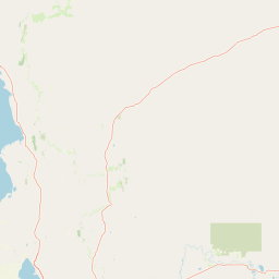
Use this park location map to pinpoint Wapma Thura, Southern Flinders Ranges National Park in Australia, understand its exact geographic position, and read its mapped placement within the surrounding landscape more clearly.

Pigeon | © OpenStreetMap contributors

Location context for Wapma Thura, Southern Flinders Ranges National Park

South Australia
Park atlas

Compare adjacent protected landscapes, mapping the regional spread of conservation across South Australia's diverse terrain.

Explore Related National Parks and Protected Areas Around Wapma Thura–Southern Flinders Ranges National Park

Expand your exploration beyond Wapma Thura–Southern Flinders Ranges National Park by browsing other national parks and protected areas in the surrounding Southern Flinders Ranges region of South Australia. Uncover the geographic context of these conservation landscapes and compare their unique features to deepen your understanding of the area's natural and cultural heritage.
National parkSouth Australia
About 21 km away#1 closest

North

Mount Remarkable National Park: Protected Landscape Atlas and South Australia Geography

Explore mapped boundaries and natural terrain.

Mount Remarkable National Park serves as a vital protected area within South Australia's unique geographic setting. This MoriAtlas entry details the park's mapped boundaries and surrounding natural terrain, providing structured insight into its landscape character and regional geographic importance. Understand the park as a key element of Australia's protected lands atlas.

Area
166.18 km²
Established
1972
IUCN
VI
Visitors
50K annual
Natural monumentSouth Australia
About 50 km away#2 closest

South

Clements Gap Conservation Park: A South Australian Natural Monument and Cultural Landscape

Mapping bushland corridors and historic heritage in the Mid North region.

Clements Gap Conservation Park occupies a 7.9 square kilometre footprint, offering a glimpse into the natural terrain of the Mid North region. The area functions as a protected monument that preserves native bushland alongside the built traces of a historic township, showcasing the layered human and environmental geography characteristic of the Spencer Gulf hinterland.

Area
7.9 km²
Established
1963
IUCN
III
Relief
Upland
Nature reserveSouth Australia
About 75 km away#3 closest

Northeast

Black Rock Conservation Park: Protected Woodlands and Regional Geography in South Australia

Mapping ecological boundaries and outwash plain terrain

Black Rock Conservation Park provides a protected glimpse into the mid-north South Australian environment. This 119 hectare nature reserve preserves low woodland and chenopod understorey, serving as a significant bird habitat characterized by steep creek banks and outwash slopes originating from the surrounding rocky high points.

Area
1.19 km²
Established
1972
IUCN
III
Relief
Lowland
Nature reserveSouth Australia
About 81 km away#4 closest

North

The Dutchmans Stern Conservation Park: Landscape Mapping and Regional Geography

Explore the ridgeline terrain of the southern Flinders Ranges

Discover the geographic identity of The Dutchmans Stern Conservation Park, a 3,695-hectare nature reserve in South Australia. This protected area centers on an elongated mountain ridge that supports distinct eucalypt habitats, including river red gum gullies and blue gum woodlands. The park boundary encompasses a vital topographic mosaic that provides a natural sanctuary within the broader, long-grazed pastoral plains of the southern Flinders Ranges.

Area
36.95 km²
Established
1987
IUCN
VI
Relief
Mountain
Protected areaSouth Australia
About 101 km away#5 closest

Southeast

Caroona Creek Conservation Park: Geographic Overview and Protected Landscape Analysis

Exploring the transitional terrain and gorge country of South Australia

Caroona Creek Conservation Park sits as a distinctive protected area between the Mid North and the Flinders Ranges. The reserve is defined by its dramatic northern Tourilie Gorge, varied calcrete ridgelines, and riparian habitat along the creek. This location serves as an essential example of the semi-arid environmental transition, offering a focused look at the intersection of rocky geological formations and alluvial drainage plains in South Australia.

Area
54.22 km²
Established
2010
IUCN
VI
Relief
Upland
Protected landscapeSouth Australia
About 104 km away#6 closest

West

Ironstone Hill Conservation Park: Geography and Protected Land Map Overview

An essential protected landscape in the Eyre Peninsula of South Australia.

Ironstone Hill Conservation Park protects fragile sandy dune systems and dense mallee vegetation within an arid zone. This conservation area acts as a vital link in the regional natural network, neighboring both private reserves and active mineral-bearing ranges. The park provides an essential study of semi-arid terrain and rare species habitat in the heart of the Eyre Peninsula.

Area
196.5 km²
Established
2010
IUCN
VI
Relief
Upland
Nature reserveSouth Australia
About 109 km away#7 closest

North

Buckaringa Sanctuary: Geographic Atlas and Protected Landscape Overview

Nature reserve terrain in the southern Flinders Ranges

Buckaringa Sanctuary serves as a key case study in arid landscape conservation within South Australia. This entry examines the reserve's unique geological features, including the deeply incised gorges and rocky ridges that define the Flinders Ranges. Through a focus on mapped boundaries and regional ecology, the content provides a clear understanding of the sanctuary's position in the Australian landscape, highlighting its role as a protected refuge of sandstone formations and native scrubland.

Area
20 km²
Established
1990
Relief
Mountain
Climate
Arid
Wildlife reserveSouth Australia
About 118 km away#8 closest

Southwest

Bird Islands Conservation Park: A Protected Coastal Landscape in South Australia

Key wildlife reserve on the Spencer Gulf coastline

Bird Islands Conservation Park represents a vital coastal habitat within South Australia. Covering islands and mainland sections near Wallaroo, the area integrates sand dunes, intertidal flats, and mangrove woodlands. This conservation site provides essential refuge for migratory shorebirds while maintaining a complex link between marine and terrestrial ecosystems on the Yorke Peninsula.

Area
3.69 km²
Established
1968
IUCN
VI
Relief
Lowland

Common questions about visiting, size, designation, and location context for Wapma Thura, Southern Flinders Ranges National Park

Wapma Thura, Southern Flinders Ranges National Park FAQs for park facts, access, geography, and protected area context

Find quick answers about Wapma Thura, Southern Flinders Ranges National Park, including protected-area facts, park geography, trail and visitor context, and how the park fits into its surrounding country and regional landscape.
MoriAtlas Explorer

Continue Your Protected Areas Search Across the Global Atlas

Deepen your exploration by continuing the structured search for national parks and protected areas worldwide. Utilize the comprehensive filtering capabilities to compare different conservation landscapes and refine your understanding of global park geography. Discover more about the distribution and characteristics of protected natural areas.

Global natural geography