

Mori Atlas logo
Nature reserveBuckaringa Sanctuary

Mapping the rugged sandstone gorges and conservation landscapes of the southern Flinders Ranges

Buckaringa Sanctuary: A Detailed Geographic Atlas of Protected Lands in South Australia

Buckaringa Sanctuary represents a vital protected landscape situated in the southern Flinders Ranges of South Australia. Spanning roughly twenty square kilometres, the reserve features a complex geological profile of folded sedimentary ridges, steep-sided gorges, and arid plains. This atlas provides a detailed look at the sanctuary's role as a private conservation stronghold, where the natural terrain provides a refuge for native species amidst a landscape shaped by historical pastoral use and ongoing environmental restoration.

private sanctuaryAustralian Wildlife Conservancysouthern Flinders Rangesarid landscapesandstone gorgescypress pine woodland

Buckaringa Sanctuary

Nature reserve

Park overview

Structured park overview, official facts, and landscape profile for Buckaringa Sanctuary

Buckaringa Sanctuary park facts, protected area profile, and essential visitor context

Review the core facts for Buckaringa Sanctuary, including designation, size, terrain, visitor scale, habitats, and operating context in one park-focused overview.

About Buckaringa Sanctuary

Buckaringa Sanctuary is a private conservation property in the southern Flinders Ranges, owned and managed by the Australian Wildlife Conservancy and best understood as a working arid-zone reserve where landscape, wildlife, and active management intersect. The sanctuary occupies about twenty square kilometres of folded sedimentary country, dominated by sandstone, siltstone, and shale sequences that have been cut through by streams flowing at right angles to the strata. Those watercourses have shaped the two defining landforms of the property, Buckaringa Gorge and Middle Gorge, leaving behind steep-walled valleys filled with crevices, caves, and tumbled boulder piles. Elsewhere, the terrain transitions into exposed ridges, bedrock plains with shallow stony soils, and small alluvial flats where deeper soils have accumulated away from the rock outcrops.

The reserve sits in a hot, dry climate with cool winters and an average annual rainfall of only around 329 millimetres, conditions typical of the semi-arid Flinders Ranges margin. This harsh setting, combined with more than a century of grazing and cultivation on what was once a pastoral lease, has reshaped the vegetation. Despite that legacy, Buckaringa retains a mosaic of habitat types: hummock grassland, Acacia shrubland, low woodland dominated by northern cypress pine, patches of mallee scrub dominated by Eucalyptus porosa and Eucalyptus viridis, and narrow ribbons of river red gum woodland along the creeks. On the hill slopes, Callitris glaucophylla and Casuarina pauper woodlands cling to the rocky ground, while the floors of the gorges support tall Eucalyptus camaldulensis woodland beneath cliff walls that rise sharply above the riparian zones.

Buckaringa's significance extends well beyond its scenery. The sanctuary is one of the most important strongholds for the yellow-footed rock-wallaby in Australia, and the long-term conservation of this species is the defining purpose of the reserve. That focus has driven a sustained program of feral animal control, fox and goat eradication, restoration of natural water flows, and erosion management, transforming how the landscape functions for the wildlife that depends on it. As both a refuge for threatened arid-zone fauna and a model of private sanctuary management in South Australia, Buckaringa stands out as a place where the conservation objective shapes the land as visibly as the geology does.

Quick facts and research context for Buckaringa Sanctuary

Buckaringa Sanctuary lies in the southern Flinders Ranges of South Australia, near Quorn, and covers roughly twenty square kilometres of rugged, semi-arid country. It is owned and managed by the Australian Wildlife Conservancy.

The sanctuary protects a mix of hummock grassland, Acacia shrubland, cypress pine woodland, mallee scrub, and river red gum creek lines, set within a landscape of folded sedimentary ridges and steep-sided gorges carved through the ABC Range. It is particularly significant as one of the largest known colonies of the vulnerable yellow-footed rock-wallaby.

Protection and recognition

Documented terrestrial protection scope and conservation designation records

Buckaringa Sanctuary Protection Status and International Recognition Data

Buckaringa Sanctuary maintains a recorded terrestrial protection scope within the global conservation framework. Detailed records outline the established designation parameters and institutional recognition metrics for this protected landscape.

Protection details

Protection scope
Terrestrial
Transboundary protection
No
Park context

Deeper park guide and search-rich context for Buckaringa Sanctuary

Buckaringa Sanctuary history, landscape, wildlife, and travel context

Explore Buckaringa Sanctuary through its history, landscape character, ecosystems, wildlife, conservation priorities, cultural context, and seasonal travel timing in a structured park guide built for atlas discovery and search intent.

Why Buckaringa Sanctuary stands out

Buckaringa is best known for hosting one of the largest colonies of the yellow-footed rock-wallaby, a threatened macropod whose survival is the sanctuary's central management focus. The reserve's rugged gorges, boulder piles, and rocky cliffs provide exactly the kind of refuge habitat this species depends on, away from the predation pressure found in more open terrain. Equally central to the sanctuary's identity is its role as a working example of private conservation in arid South Australia, with active feral animal control fencing, predator eradication, and vegetation restoration shaping the landscape almost as much as the underlying geology does.

Buckaringa Sanctuary history and protected-area timeline

Buckaringa was first taken up as a pastoral lease in the 1880s, and for more than a century it was used primarily for sheep grazing and cereal cropping. That long agricultural history continued until 1990, when grazing ceased and the property began to transition toward a conservation role.

In the early 1990s the property was acquired by Earth Sanctuaries and operated as a wildlife reserve. In 2002 it was purchased by the Australian Wildlife Conservancy, which remains the owner and manager of the sanctuary today. Since the AWC takeover, management has focused on feral animal control, habitat restoration, and the long-term protection of the yellow-footed rock-wallaby, including a program to map the sanctuary's eight vegetation communities.

Long-term population monitoring of the rock-wallabies at Buckaringa has been ongoing for decades, with surveys from January 1979 to January 1984 estimating between eleven and twenty animals in Middle Gorge alone. Since the 1980s, broader sanctuary-wide estimates for the species have fluctuated widely while persisting at substantial numbers, reflecting both the variable conditions of arid Australia and the impact of sustained conservation work.

Buckaringa Sanctuary landscape and geographic character

Buckaringa's landscape is defined by the underlying geology of the southern Flinders Ranges. Folded sedimentary sequences of sandstone, siltstones, and shales form the bedrock of the sanctuary, and over geological time, streams cutting through the ridges on the ABC Range at right angles to the strata have carved out the property's most distinctive features: Buckaringa Gorge and Middle Gorge. These steep-sided gorges are filled with crevices, caves, and intricate piles of fallen boulders, creating complex microhabitats in an otherwise open landscape.

Away from the gorges, much of the sanctuary consists of rocky ridges and bedrock plains covered in shallow soils and rock debris. Flatter alluvial zones away from the rock outcrops carry deeper soils, and these zones tend to support denser and more continuous vegetation. The elevation relief within the gorges is dramatic in local terms, with steep cliffs and rocky outcrops rising up to about one hundred metres above the riparian woodlands below.

The whole property lies within an arid climatic zone, with cool winters and hot summers and a low average annual rainfall of around 329 millimetres. Together, the folded sedimentary geology, the deeply incised gorges, and the arid setting give Buckaringa its distinctive mix of rugged refuge terrain and open stony country.

Buckaringa Sanctuary ecosystems, habitats, and plant life

Buckaringa supports a mosaic of arid and semi-arid habitats shaped by both geology and a long history of grazing and cultivation. The vegetation has been substantially altered by more than a hundred years of agricultural use, yet enough remains to give the sanctuary a varied ecological character.

The dominant habitats include hummock grassland, Acacia shrubland, and low woodland dominated by northern cypress pine. Patches of relatively intact mallee scrub occur across parts of the property, particularly where vegetation communities dominated by Eucalyptus porosa and Eucalyptus viridis survive from earlier conditions. The hill slopes carry Callitris glaucophylla and Casuarina pauper woodlands, while the riparian zones along the gorges support tall Eucalyptus camaldulensis (river red gum) woodland beneath the cliffs.

According to the Australian Wildlife Conservancy, the sanctuary contains eight formally recognised vegetation communities. Active management includes ongoing ecological surveys and a dedicated vegetation mapping program, both of which are intended to clarify how the habitats have been altered and how they can best be restored. The combination of intact gorge woodlands, mallee remnants, and recovering ground cover vegetation makes the property ecologically distinctive within the Flinders Lofty Block.

Buckaringa Sanctuary wildlife and species highlights

Although the full biodiversity of Buckaringa is still being documented, the sanctuary is recognised as an important refuge for arid-zone fauna, with sixty bird species and four mammal species recorded to date. The most ecologically significant resident is the yellow-footed rock-wallaby, for which Buckaringa holds one of the largest known colonies in Australia and whose protection is the sanctuary's primary management objective.

Birdlife at Buckaringa includes wedge-tailed eagles, emus, sulphur-crested cockatoos, peregrine falcons, sacred kingfishers, and blue-winged parrots, along with other arid-country species typical of the Flinders Ranges. The blue-winged parrot is listed as vulnerable in South Australia, while the peregrine falcon is listed as rare, giving Buckaringa an important role in maintaining populations of threatened bird species as well as mammals.

The sanctuary's four known mammal species are the western grey kangaroo, the red kangaroo, the euro, and the yellow-footed rock-wallaby. The rock-wallabies are particularly associated with the rocky gorges and boulder piles of the property, which offer the kind of refuge habitat that reduces predation risk. Population estimates for the species across the sanctuary have ranged from roughly three hundred to sixteen hundred animals since the 1980s, indicating a persistent but fluctuating population that continues to depend on the rugged terrain and active predator control for its survival.

Buckaringa Sanctuary conservation status and protection priorities

Buckaringa Sanctuary is owned and managed by the Australian Wildlife Conservancy, a private conservation organisation that purchased the property in 2002. The sanctuary's central conservation goal is the protection of the yellow-footed rock-wallaby, a species listed as vulnerable under Australia's Environment Protection and Biodiversity Conservation Act 1999, as vulnerable in South Australia under the National Parks and Wildlife Act 1972, and as near threatened globally on the IUCN Red List.

Conservation management at Buckaringa is built around a comprehensive feral animal control program. Since 2002, AWC staff have eradicated thousands of foxes, rabbits, and feral goats, and have modified a twenty-three-kilometre goat-resistant fence along the sanctuary boundary to support these efforts. The removal of introduced herbivores such as goats and rabbits is intended to reduce direct competition with rock-wallabies for food, while predator control targets foxes and feral cats, both of which are major threats to small mammals and ground-nesting birds.

Beyond animal control, conservation work at Buckaringa includes erosion management, restoration of natural water flows along the creeks, and revegetation of native plant communities. Surveys and vegetation mapping underpin these efforts, helping managers track changes in habitat condition over time. The sanctuary is widely cited as a strong example of active, science-based management of a private conservation property in arid South Australia.

Top sights and standout views in Buckaringa Sanctuary

Buckaringa Sanctuary combines deeply incised sandstone gorges, cypress pine and mallee woodlands, and arid rocky plains in a compact private reserve at the edge of the Flinders Ranges. The sanctuary's most distinctive feature is its role as one of the largest known strongholds of the yellow-footed rock-wallaby, an outcome directly linked to decades of feral animal control and habitat restoration.

Equally notable are the reserves themselves: thousands of feral herbivores removed, a twenty-three-kilometre predator-resistant fence, and ongoing work to restore natural creek flows and native vegetation. The result is a reserve where the conservation program is as visible a feature of the landscape as the gorges themselves, and where eighty-eight recorded species so far continue to grow as surveys progress.

Best time to visit Buckaringa Sanctuary

Buckaringa lies in an arid region with cool winters and hot summers and low annual rainfall. Cooler months tend to be more comfortable for outdoor activity and offer a chance to see the landscape at its most vegetated following winter rains, while summer conditions are typically harsh, with high temperatures and limited surface water.

Wildlife viewing opportunities exist year-round but are best planned around cooler weather, when both animals and observers are more active during the day. Because Buckaringa is a working conservation property rather than a publicly oriented tourist destination, any visit will depend on arrangements made through the Australian Wildlife Conservancy rather than on seasonal tourism infrastructure.
Monthly climate preview

Long-term representative monthly temperature and precipitation rhythms in South Australia

Buckaringa Sanctuary Climate Normals and Annual Temperature Patterns

Buckaringa Sanctuary exhibits a measured annual temperature rhythm ranging from cooler mid-year monthly averages to warm summer maximums alongside consistent precipitation rates. Examining the full twelve-month climate profile provides deeper monthly context for historical temperature averages at this representative protected coordinate.
Annual mean19 °C
10 °C28 °C
Jan28°
Feb27°
Mar23°
Apr19°
May14°
Jun11°
Jul10°
Aug11°
Sep15°
Oct19°
Nov22°
Dec25°
Warmest month
January

27.7 °C

Coolest month
July

9.9 °C

Wettest month
February

0.9 mm/day

Driest month
March

0.3 mm/day

Park location guide

Geography guide, regional context, and park location map for Buckaringa Sanctuary

Buckaringa Sanctuary park geography, regions, and map view in Australia

Understand where Buckaringa Sanctuary sits in Australia through a broader geographic reading of the surrounding landscape, nearby location context, and its mapped position within the national park landscape.

How Buckaringa Sanctuary fits into Australia

Australia is a constitutional monarchy and federal parliamentary democracy comprising six states and ten territories. With a population of nearly 28 million, it is one of the world's most urbanised countries, with most people concentrated on the eastern seaboard. The country has a high Human Development Index and is known for its cultural diversity, ancient Aboriginal heritage, and unique wildlife.

Wider geography shaping Buckaringa Sanctuary in Australia

Australia occupies the entire Australian continent, the island of Tasmania, and numerous smaller islands. It is the world's flattest and driest inhabited continent, featuring vast deserts in the interior (the Outback), tropical rainforests along the eastern coast, and a coastline bordering the Indian and Pacific Oceans.

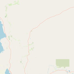
Map view of Buckaringa Sanctuary

Use this park location map to pinpoint Buckaringa Sanctuary in Australia, understand its exact geographic position, and read its mapped placement within the surrounding landscape more clearly.

Pigeon | © OpenStreetMap contributors

Location context for Buckaringa Sanctuary

South Australia
Park atlas

Continue comparing connected arid reserves and rugged southern Flinders ranges terrain.

Explore Protected Areas Near Buckaringa Sanctuary and Surrounding Regional Parks

Browsing other protected areas near Buckaringa Sanctuary reveals shared geological formations across the surrounding region. Comparing adjacent private reserves and regional park terrain expands understanding of arid zone conservation corridors.
National parkSouth Australia
About 31 km away#1 closest

North

Lake Torrens National Park: Explore South Australia's Remarkable Inland Salt Lake Geography

A unique protected landscape of arid plains and expansive salt flats.

Lake Torrens National Park offers an unparalleled exploration of Australia's remote outback, centered around a vast, ancient salt lake basin. This national park in South Australia provides a canvas of stark, minimalist terrain, featuring shimmering saltpans, arid gibber plains, and rocky outcrops. Understand the park's unique geographic identity, its ecological significance as a temporary wetland habitat, and its dramatic visual appeal for landscape photography and geological interest. It is a key protected area showcasing the extreme environment of Australia's interior.

Area
5,676.68 km²
Established
1991
IUCN
VI
Relief
Lowland
Nature reserveSouth Australia
About 32 km away#2 closest

South

The Dutchmans Stern Conservation Park: Landscape Mapping and Regional Geography

Explore the ridgeline terrain of the southern Flinders Ranges

Discover the geographic identity of The Dutchmans Stern Conservation Park, a 3,695-hectare nature reserve in South Australia. This protected area centers on an elongated mountain ridge that supports distinct eucalypt habitats, including river red gum gullies and blue gum woodlands. The park boundary encompasses a vital topographic mosaic that provides a natural sanctuary within the broader, long-grazed pastoral plains of the southern Flinders Ranges.

Area
36.95 km²
Established
1987
IUCN
VI
Relief
Mountain
National parkSouth Australia
About 71 km away#3 closest

South

Mount Remarkable National Park: Protected Landscape Atlas and South Australia Geography

Explore mapped boundaries and natural terrain.

Mount Remarkable National Park serves as a vital protected area within South Australia's unique geographic setting. This MoriAtlas entry details the park's mapped boundaries and surrounding natural terrain, providing structured insight into its landscape character and regional geographic importance. Understand the park as a key element of Australia's protected lands atlas.

Area
166.18 km²
Established
1972
IUCN
VI
Visitors
50K annual
National parkAustralia
About 92 km away#4 closest

Northeast

Ikara-Flinders Ranges National Park: Mapped Boundaries and Regional Geography

Australia's protected landscape and national park terrain.

Investigate the geographic characteristics and protected-area identity of Ikara-Flinders Ranges National Park. This entry highlights its mapped boundaries and landscape context, offering a foundational understanding of this Australian national park for atlas-based discovery. Users can explore the natural terrain and regional setting that define Ikara-Flinders Ranges National Park.

Nature reserveSouth Australia
About 99 km away#5 closest

Southeast

Black Rock Conservation Park: Protected Woodlands and Regional Geography in South Australia

Mapping ecological boundaries and outwash plain terrain

Black Rock Conservation Park provides a protected glimpse into the mid-north South Australian environment. This 119 hectare nature reserve preserves low woodland and chenopod understorey, serving as a significant bird habitat characterized by steep creek banks and outwash slopes originating from the surrounding rocky high points.

Area
1.19 km²
Established
1972
IUCN
III
Relief
Lowland
National parkSouth Australia
About 100 km away#6 closest

North

Nilpena Ediacara National Park: South Australia National Park and Protected Landscape Identity

Mapped protected area within the regional geography of South Australia.

Nilpena Ediacara National Park represents a significant protected landscape within South Australia. This entry provides a detailed geographic context for the park, focusing on its role as a national park and its mapped boundaries. Delve into the specific atlas-driven understanding of this protected area, its landscape context, and its significance within the broader geographic framework of the Australian state.

Area
606.17 km²
Established
2021
IUCN
VI
Relief
Mountain
National parkSouth Australia
About 109 km away#7 closest

South

Wapma Thura, Southern Flinders Ranges National Park: South Australia's Protected Natural Landscape

Explore mapped boundaries and regional geography.

Wapma Thura, Southern Flinders Ranges National Park offers a distinct protected landscape within South Australia. This page serves as a portal for understanding its geographic setting, its role as a national park, and its place within the state's atlas of natural areas. Examine the mapped terrain and protected boundaries to grasp the park's unique geographic characteristics.

Established
2021
IUCN
II
Relief
Mountain
Scope
Terrestrial
Natural monumentSouth Australia
About 159 km away#8 closest

South

Clements Gap Conservation Park: A South Australian Natural Monument and Cultural Landscape

Mapping bushland corridors and historic heritage in the Mid North region.

Clements Gap Conservation Park occupies a 7.9 square kilometre footprint, offering a glimpse into the natural terrain of the Mid North region. The area functions as a protected monument that preserves native bushland alongside the built traces of a historic township, showcasing the layered human and environmental geography characteristic of the Spencer Gulf hinterland.

Area
7.9 km²
Established
1963
IUCN
III
Relief
Upland

Common questions about visiting, size, designation, and location context for Buckaringa Sanctuary

Buckaringa Sanctuary FAQs for park facts, access, geography, and protected area context

Find quick answers about Buckaringa Sanctuary, including protected-area facts, park geography, trail and visitor context, and how the park fits into its surrounding country and regional landscape.
MoriAtlas Explorer

Continue Your Protected Areas Search Across the Global Atlas

Deepen your exploration by continuing the structured search for national parks and protected areas worldwide. Utilize the comprehensive filtering capabilities to compare different conservation landscapes and refine your understanding of global park geography. Discover more about the distribution and characteristics of protected natural areas.

Global natural geography