

Mori Atlas logo
National parkNilpena Ediacara National Park

Discover the mapped boundaries and regional atlas significance of this Australian national park.

Nilpena Ediacara National Park: Protected Landscape and Geographic Context in South Australia

Nilpena Ediacara National Park stands as a distinct protected area within the vast geography of South Australia. This page serves as a gateway to understanding the park's identity as a national park, its position within the regional landscape, and its contributions to the atlas of Australian protected lands. Explore its geographic scope and the context it provides for understanding conservation areas.

Ediacaran fossilsFlinders RangesPaleontologyUNESCO World Heritage candidateSouth AustraliaAncient fossils

Nilpena Ediacara National Park

National park

Park overview

Structured park overview, official facts, and landscape profile for Nilpena Ediacara National Park

Nilpena Ediacara National Park park facts, protected area profile, and essential visitor context
Review the core facts for Nilpena Ediacara National Park, including designation, size, terrain, visitor scale, habitats, and operating context in one park-focused overview.

About Nilpena Ediacara National Park

Nilpena Ediacara National Park occupies a dramatic landscape in the northern Flinders Ranges, protecting one of Earth's most important paleontological treasures. The park's significance extends far beyond its fossil heritage to encompass the broader geological, ecological, and cultural values of the Flinders Ranges region. The Ediacaran fossils found here document a pivotal chapter in the history of life on our planet, representing organisms that existed during a crucial period when multicellular life was first emerging. The park was created through a partnership between the South Australian Government, traditional owners, researchers, and the community, reflecting a shared commitment to preserving this irreplaceable scientific resource. The establishment of the national park in 2021 followed the acquisition of portions of Nilpena Station, expanding protection to include areas where some of the most significant fossil discoveries were made. The park now serves as both a protected scientific resource and an educational destination where visitors can engage with deep time through guided experiences.

Quick facts and research context for Nilpena Ediacara National Park

Nilpena Ediacara National Park is located in South Australia's Far North, approximately 30 kilometres south-west of Leigh Creek. The park protects one of the world's most significant Ediacaran fossil sites, containing the most extensive and diverse assemblages of these ancient soft-bodied marine organisms. Originally declared as a fossil reserve in 1958 and later as a conservation park in 2007, the area was upgraded to national park status in 2021 following the acquisition of adjacent pastoral land. The park encompasses the Ediacara Hills and covers 60,617 hectares. It is managed under IUCN Category VI, which permits sustainable use of natural resources while maintaining conservation objectives.

Park context

Deeper park guide and search-rich context for Nilpena Ediacara National Park

Nilpena Ediacara National Park history, landscape, wildlife, and travel context
Explore Nilpena Ediacara National Park through its history, landscape character, ecosystems, wildlife, conservation priorities, cultural context, and seasonal travel timing in a structured park guide built for atlas discovery and search intent.

Why Nilpena Ediacara National Park stands out

Nilpena Ediacara National Park is best known for its extraordinary preservation of Ediacaran biota, among the oldest known complex multicellular organisms on Earth. The park contains globally significant fossil assemblages including Dickinsonia, Spriggina, and numerous other species that represent the earliest animals with defined heads and body plans. These fossils can be observed in situ within the park, offering visitors a rare opportunity to view specimens exactly where they were discovered. The site provides the most extensive examples of Ediacaran fossils in the world and serves as a crucial reference point for understanding the origins of animal life.

Nilpena Ediacara National Park history and protected-area timeline

The scientific significance of Nilpena Ediacara was first recognized in 1946 when geologist Reg Sprigg discovered fossils in the Ediacara Hills, including the first known evidence of an animal with a distinct head. This discovery was momentous because it revealed a previously unknown class of organisms that predated the Cambrian explosion, providing a missing link in the evolutionary record. Sprigg named the genus Spriggina after himself. Despite the significance of the find, the area received formal protection only gradually, beginning with declaration as a fossil reserve in 1958, followed by a conservation reserve under the Crown Lands Act in 1993, and ultimately as the Ediacara Conservation Park in 2007. American paleontologist Mary L. Droser and her team have conducted extensive research at Nilpena Station since around 2001, while South Australian Museum paleontologist Diego Garcia-Bellido has also contributed significantly to understanding these fossils. The Flinders Ranges Ediacara Foundation was established in 2018 to advocate for protection and management of the fossils. In 2019, the South Australian Government purchased approximately 60,000 hectares of Nilpena Station to expand the protected area tenfold. The entire area was reclassified as Nilpena Ediacara National Park in June 2021 and officially opened in April 2023. The remaining pastoral land was acquired in August 2025, completing the park's expansion.

Nilpena Ediacara National Park landscape and geographic character

The landscape of Nilpena Ediacara National Park is characterised by the ancient sedimentary terrain of the Flinders Ranges, a mountain range formed through billions of years of geological processes. The Ediacara Hills form a prominent topographic feature, with a central dolomite plateau that defines the Ediacara syncline. The terrain consists of flat-lying sedimentary rocks that have been folded and uplifted over geological time, creating the characteristic stepped landscape of the region. The surrounding terrain includes remnants of mining history associated with the Ediacara mineral field, reflecting the area's more recent human occupation. The landscape supports chenopod habitats typical of arid and semi-arid interior South Australia, with vegetation adapted to the harsh conditions of the Far North.

Nilpena Ediacara National Park ecosystems, habitats, and plant life

The ecological character of Nilpena Ediacara National Park reflects the arid and semi-arid conditions of South Australia's Far North. The park contains important chenopod habitats, which support specialised plant communities adapted to low rainfall and extreme temperatures. While the primary focus of protection is the fossil heritage, the park also encompasses areas of ecological significance including remnant vegetation communities and the broader desert landscape of the Flinders Ranges. The region's biodiversity, while limited by aridity, includes a range of adapted species that have evolved to survive in this challenging environment. The transition from marine environments that existed during the Ediacaran period to the contemporary arid terrestrial landscape represents hundreds of millions of years of environmental change.

Nilpena Ediacara National Park wildlife and species highlights

The contemporary wildlife of Nilpena Ediacara reflects the arid interior of South Australia, with species adapted to the harsh conditions of the Flinders Ranges. The Adnyamathanha people, whose traditional lands encompass this area, have long understood the connections between country and the wildlife it supports. The name Ediacara itself has been linked to the Adnyamathanha word for the zebra finch, a small bird endemic to the region. While the park is not primarily known for contemporary wildlife viewing, the broader Flinders Ranges region supports a diversity of reptiles, birds, and mammals adapted to the semi-arid environment. The Ediacaran fossils themselves represent an ancient marine fauna that lived in seas that covered this area approximately 550 million years ago, long before the evolution of modern wildlife.

Nilpena Ediacara National Park conservation status and protection priorities

Nilpena Ediacara National Park represents one of the world's most important conservation outcomes for paleontological heritage. The park protects the most extensive examples of Ediacaran fossils globally, with the fossils holding international significance for understanding the origins of animal life. The park is classified as IUCN Category VI, reflecting a management approach that balances conservation with sustainable use of natural resources. The fossils are also listed on the South Australian Heritage Register, providing additional statutory protection. The park is central to South Australia's bid for UNESCO World Heritage listing for the Flinders Ranges, with the nomination submitted in April 2021 and a vote expected in 2026. The Flinders Ranges Ediacara Foundation works in partnership with land managers, researchers, traditional owners, and the community to ensure the fossils remain accessible to the public while being protected for future generations.

Nilpena Ediacara National Park cultural meaning and human context

Nilpena Ediacara National Park lies on the traditional lands of the Adnyamathanha people, who have maintained connection to this country for countless generations. The name Ediacara has a complex etymology with multiple theories about its origins, including possible derivation from Aboriginal languages and from the Adnyamathanha word for the zebra finch. The area holds places of significance to the Adnyamathanha people, and the establishment of the national park has involved partnership with traditional owners. The Flinders Ranges Ediacara Foundation includes traditional owners in its governance structure, ensuring that Indigenous knowledge and perspectives inform the management of this internationally significant site. The relationship between the scientific importance of the fossils and the cultural significance of the landscape to the Adnyamathanha people represents an important convergence of values in the park's management.

Top sights and standout views in Nilpena Ediacara National Park

The park offers guided Fossil Field Exploration Tours during the cooler months, allowing visitors to observe fossils in situ exactly where they were discovered. The most notable fossil finds include Dickinsonia, one of the most recognizable Ediacaran species, and Spriggina, the first animal with a clearly defined head. The Ediacara Hills themselves provide a striking landscape feature that frames the fossil sites. The park represents the culmination of decades of effort to achieve proper protection for these globally significant fossils, with the transition from pastoral use to national park status completing in 2025. The ongoing UNESCO World Heritage bid highlights the international recognition of this site's importance in understanding the early evolution of complex life.

Best time to visit Nilpena Ediacara National Park

The best time to visit Nilpena Ediacara National Park is during the cooler months of the year, when the Fossil Field Exploration Tours operate several days per week. Summer temperatures in the Far North of South Australia can be extremely high, making outdoor exploration uncomfortable and potentially dangerous. The cooler months provide more pleasant conditions for both touring the fossil sites and exploring the broader landscape. Visitors should note that access to the fossil beds is only available through guided tours, which must be booked in advance. The park opened to the public in April 2023, so visitor facilities and access arrangements continue to develop.

Park location guide

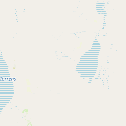
Geography guide, regional context, and park location map for Nilpena Ediacara National Park

Nilpena Ediacara National Park park geography, regions, and map view in Australia
Understand where Nilpena Ediacara National Park sits in Australia through a broader geographic reading of the surrounding landscape, nearby location context, and its mapped position within the national park landscape.

How Nilpena Ediacara National Park fits into Australia

Australia is a constitutional monarchy and federal parliamentary democracy comprising six states and ten territories. With a population of nearly 28 million, it is one of the world's most urbanised countries, with most people concentrated on the eastern seaboard. The country has a high Human Development Index and is known for its cultural diversity, ancient Aboriginal heritage, and unique wildlife.

Wider geography shaping Nilpena Ediacara National Park in Australia

Australia occupies the entire Australian continent, the island of Tasmania, and numerous smaller islands. It is the world's flattest and driest inhabited continent, featuring vast deserts in the interior (the Outback), tropical rainforests along the eastern coast, and a coastline bordering the Indian and Pacific Oceans.

Map view of Nilpena Ediacara National Park

Use this park location map to pinpoint Nilpena Ediacara National Park in Australia, understand its exact geographic position, and read its mapped placement within the surrounding landscape more clearly.

Pigeon | © OpenStreetMap contributors

Location context for Nilpena Ediacara National Park

Far NorthSouth Australia
Park atlas

Discover more of South Australia's diverse protected landscapes, tracing the ancient Flinders Ranges geography.

Explore Nearby National Parks and Protected Areas Beyond Nilpena Ediacara National Park
After exploring Nilpena Ediacara National Park's globally significant Ediacaran fossil sites, continue browsing a curated list of additional national parks and protected areas across the Flinders Ranges and wider South Australian geography. Compare varied conservation landscapes, trace ancient geological formations, and discover more regional protected heritage, extending your atlas-based exploration.
National parkSouth Australia

Lake Torrens National Park: Explore South Australia's Remarkable Inland Salt Lake Geography

A unique protected landscape of arid plains and expansive salt flats.

Lake Torrens National Park offers an unparalleled exploration of Australia's remote outback, centered around a vast, ancient salt lake basin. This national park in South Australia provides a canvas of stark, minimalist terrain, featuring shimmering saltpans, arid gibber plains, and rocky outcrops. Understand the park's unique geographic identity, its ecological significance as a temporary wetland habitat, and its dramatic visual appeal for landscape photography and geological interest. It is a key protected area showcasing the extreme environment of Australia's interior.

Area
5,676.68 km²
Established
1991
IUCN
VI
Relief
Lowland
National parkSouth Australia

Vulkathunha-Gammon Ranges National Park: South Australia National Park Atlas Exploration

Mapped boundaries and regional geographic context.

Dive into the specifics of Vulkathunha-Gammon Ranges National Park, a designated national park situated in South Australia. This detailed resource focuses on its role as a protected landscape, providing users with critical geographic information. Understand the park's mapped boundaries and its relation to the broader regional geography, perfect for anyone engaged in atlas-based exploration of Australia's natural areas.

Area
1,257.23 km²
Established
1970
IUCN
II
Relief
Mountain
National parkSouth Australia

Lake Frome National Park: Mapped Protected Area and Regional Geographic Identity in South Australia

Explore South Australia's unique landscape and park boundaries.

Lake Frome National Park offers a distinct focus for exploring the geography and protected landscape of South Australia. As a national park, it contributes to the mapped conservation network of the region, allowing for detailed study of its environmental context and geographic positioning. Discover the mapped terrain and regional park boundaries that define this significant protected area, crucial for a comprehensive atlas-based understanding of South Australia's natural heritage.

Area
2,582.4 km²
Established
1991
IUCN
VI
Relief
Lowland
National parkSouth Australia

Mount Remarkable National Park: Protected Landscape Atlas and South Australia Geography

Explore mapped boundaries and natural terrain.

Mount Remarkable National Park serves as a vital protected area within South Australia's unique geographic setting. This MoriAtlas entry details the park's mapped boundaries and surrounding natural terrain, providing structured insight into its landscape character and regional geographic importance. Understand the park as a key element of Australia's protected lands atlas.

Area
166.18 km²
Established
1972
IUCN
VI
Visitors
50K annual
National parkSouth Australia

Lake Gairdner National Park: National Park with Unique South Australian Geography and Mapped Boundaries

South Australian protected area with distinct landscape characteristics.

Lake Gairdner National Park serves as a key protected area within the geographic expanse of South Australia. This national park offers a unique focus for atlas exploration, highlighting its specific landscape features and mapped boundaries. Users can delve into the park's protected status and its contribution to the regional geography, providing valuable context for understanding Australia's diverse natural protected lands and their cartographic representation.

Area
5,531.77 km²
Established
1991
IUCN
VI
Relief
Lowland
National parkSouth Australia

Wapma Thura, Southern Flinders Ranges National Park: South Australia's Protected Natural Landscape

Explore mapped boundaries and regional geography.

Wapma Thura, Southern Flinders Ranges National Park offers a distinct protected landscape within South Australia. This page serves as a portal for understanding its geographic setting, its role as a national park, and its place within the state's atlas of natural areas. Examine the mapped terrain and protected boundaries to grasp the park's unique geographic characteristics.

Established
2021
IUCN
II
Relief
Mountain
Scope
Terrestrial
National parkNew South Wales

Mutawintji National Park: New South Wales Protected Area for Atlas Exploration

Mapping rugged outback terrain, gorges, and ancient rock art.

Mutawintji National Park in New South Wales offers a profound exploration of Australia's outback geography, significant Indigenous heritage, and protected landscapes. Discover the park's unique terrain, defined by the Byngnano Range, vibrant gorges, and river red gum-lined creeks, all rich with ancient Aboriginal rock art. This national park is a prime example of mapped protected area discovery, highlighting both natural beauty and critical conservation achievements.

Area
689.12 km²
Established
1998
IUCN
II
Relief
Mountain
National parkNew South Wales

Kinchega National Park: National Park Protected Area in New South Wales

Explore the mapped Darling River terrain and outback landscapes.

Kinchega National Park stands as a protected national park entity within New South Wales, Australia. Its geographic significance is deeply tied to the Darling River, which shapes its unique riparian ecosystems and contrasts with the surrounding semi-arid outback terrain. This park offers a valuable point for atlas-based discovery, allowing exploration of its mapped boundaries, landscape context, and the conservation of its distinct natural and cultural heritage within the regional geography.

Area
442.59 km²
Established
1967
IUCN
II
Climate
Arid

Common questions about visiting, size, designation, and location context for Nilpena Ediacara National Park

Nilpena Ediacara National Park FAQs for park facts, access, geography, and protected area context
Find quick answers about Nilpena Ediacara National Park, including protected-area facts, park geography, trail and visitor context, and how the park fits into its surrounding country and regional landscape.
MoriAtlas Explorer

Continue Your Protected Areas Search Across the Global Atlas

Deepen your exploration by continuing the structured search for national parks and protected areas worldwide. Utilize the comprehensive filtering capabilities to compare different conservation landscapes and refine your understanding of global park geography. Discover more about the distribution and characteristics of protected natural areas.

Global natural geography