

Mori Atlas logo
National parkVulkathunha-Gammon Ranges National Park

Discover the mapped boundaries and regional geography of this significant national park.

Vulkathunha-Gammon Ranges National Park: South Australia's Protected Landscape Atlas

Vulkathunha-Gammon Ranges National Park stands as a critical protected area within the expansive geography of South Australia. This page offers detailed insights into its mapped boundaries, providing a clear geographic context for understanding this unique national park. Explore the natural landscape features and understand its place within the regional atlas, ideal for researchers and geographic explorers seeking precise protected-area data.

Flinders RangesGeological heritageEdiacaran fossilsPlateau landscapeGorgesAboriginal cultural landscape

Vulkathunha-Gammon Ranges National Park

National park

Park overview

Structured park overview, official facts, and landscape profile for Vulkathunha-Gammon Ranges National Park

Vulkathunha-Gammon Ranges National Park park facts, protected area profile, and essential visitor context
Review the core facts for Vulkathunha-Gammon Ranges National Park, including designation, size, terrain, visitor scale, habitats, and operating context in one park-focused overview.

About Vulkathunha-Gammon Ranges National Park

Vulkathunha-Gammon Ranges National Park represents one of the most geologically significant protected areas in Australia, situated within the northern Flinders Ranges of South Australia. The park encompasses an extensive tract of rugged mountainous country immediately southwest of the Arkaroola Protection Area, characterized by a distinctive plateau formation where flat-lying geological strata have been carved by millions of years of erosion into spectacular gorges and deep chasms. The central plateau, known as The Plateau, spans much of the southwestern portion of the park and is contiguous with the Blue Range to the northeast, forming a remarkably uniform high-elevation landscape that stands in sharp contrast to the folded and buckled terrain found in the southern Flinders. Benbonyathe Hill, at 1,064 meters above sea level, represents the highest summit in the Flinders north of Wilpena Pound, while other notable peaks including Elephant Hill, Mount Changeweather, Four Winds Hill, and Prow Point punctuate the otherwise subdued skyline of the plateau rim. The park's geological significance extends beyond mere topography. The ranges contain fossil assemblages of extraordinary paleontological importance, with rocks preserving evidence of some of Earth's earliest complex multicellular organisms. These Ediacaran fossils provide critical insights into the emergence of animal life during a crucial period in planetary history. In recognition of this universal significance, the park was included in a World Heritage nomination submitted to UNESCO in April 2021 as part of a broader serial nomination encompassing multiple geological sites within the Flinders Ranges.

Quick facts and research context for Vulkathunha-Gammon Ranges National Park

Located in South Australia approximately 600 kilometers north of Adelaide, the park covers 1,257 square kilometers of rugged mountainous terrain. The Gammon Ranges feature a unique geological character distinct from the rest of the Flinders, with flat-lying strata forming a high plateau rather than the folded cuestas found elsewhere in the region. Major peaks include Benbonyathe Hill, Mount McKinlay, and Gammon Hill, all exceeding 1,000 meters in elevation. The park contains the former pastoral leases of Yankaninna and Balcanoona stations and is adjacent to the Arkaroola Protection Area. In 2021, the area was submitted to UNESCO for World Heritage consideration under the Flinders Ranges geological successions.

Park context

Deeper park guide and search-rich context for Vulkathunha-Gammon Ranges National Park

Vulkathunha-Gammon Ranges National Park history, landscape, wildlife, and travel context
Explore Vulkathunha-Gammon Ranges National Park through its history, landscape character, ecosystems, wildlife, conservation priorities, cultural context, and seasonal travel timing in a structured park guide built for atlas discovery and search intent.

Why Vulkathunha-Gammon Ranges National Park stands out

The Vulkathunha-Gammon Ranges are best known for their exceptional geological and paleontological significance. The park protects a sequence of rocks spanning approximately 350 million years that document the evolution of early animal life, including well-preserved Ediacaran fossil assemblages. The landscape features a spectacular plateau-and-gorge terrain that is geologically distinct from other parts of the Flinders Ranges. The area also holds deep cultural significance as the traditional Country of the Adnyamathanha people, who maintain ongoing connections to the land. The park's mining history and the legendary snake Arkaroo from Aboriginal mythology add layers of historical intrigue.

Vulkathunha-Gammon Ranges National Park history and protected-area timeline

The human history of Vulkathunha-Gammon Ranges spans millennia of Aboriginal occupation followed by centuries of European exploration and pastoral settlement. The Adnyamathanha people are the traditional custodians of this Country, maintaining cultural connections to the landscape that extend into the present day. European discovery of the ranges is attributed to explorer Edward Eyre, who became the first non-Aboriginal person to see the area during his 1840 expedition along the western side of the Flinders Ranges. Three years later, Surveyor General Edward Charles Frome explored the eastern side of the region, reaching the area after being blocked by what became Lake Frome. Subsequent exploration by surveyor J.M. Painter in 1857, working alongside George Goyder, resulted in the first recorded ascents of Gammon Hill and Mount McKinlay, though the party did not penetrate to the central plateau. The late 1940s marked a pivotal period in exploration when Warren Bonython led expeditions that finally traversed The Plateau in all directions, opening the interior of the ranges to wider understanding. The pastoral era saw establishment of stations including Yankaninna and Balcanoona, with the land first passing into government care in 1968 before formal declaration as a national park in 1980. The park encompasses historical sites including Grindell's Hut, the restored cottage where John Grindell served as a cattle station manager in the early twentieth century, and the ruins of the Bolla Bollana Brick Kiln and Copper Smelter from a brief mining operation in the 1870s.

Vulkathunha-Gammon Ranges National Park landscape and geographic character

The physical landscape of Vulkathunha-Gammon Ranges differs fundamentally from the rest of the Flinders Ranges in both formation and appearance. While the southern Flinders features the characteristic buckled and folded strata that create the famous cuestas of Wilpena Pound, the Gammon Ranges are composed of roughly flat-lying geological strata that have produced a remarkably uniform high plateau. Into this plateau, waterways have carved spectacular gorges, particularly along the southeastern face of the Blue Range where features such as Bunyip Chasm, The Terraces, and Fern Chasm present dramatic vertical walls and narrow passages. The plateau surface remains relatively flat despite the surrounding terrain, with the highest points marked by rounded hills rather than dramatic peaks. The edges of these hills present a striking transition from gentle upper slopes to sheer precipices dropping hundreds of meters to the creek beds below. The ranges are surrounded by a series of lower outlying ridges that enclose distinctive circular basins known as pounds, including Illinawortina Pound, Mainwater Pound, and Arcoona Pound. Beyond the ranges themselves, the park extends eastward across a forty-kilometer strip of lower country reaching to the shores of Lake Frome, creating a transition from the mountainous core to the expansive salt lake beyond.

Vulkathunha-Gammon Ranges National Park ecosystems, habitats, and plant life

The ecological character of the Vulkathunha-Gammon Ranges reflects the intersection of semi-arid climatic conditions with the diverse habitats created by the park's varied topography. The Flinders Ranges environment supports a range of vegetation communities adapted to the challenging climate, with species assemblages that differ across elevation zones and aspects. The park sits within a broader landscape that supports several restricted-range bird species, as recognized through its inclusion in the Gammon Ranges and Arkaroola Important Bird Area. The region's position within the Flinders Ranges geological successions provides context for understanding the long evolutionary history that has shaped both the landscape and its contemporary ecology.

Vulkathunha-Gammon Ranges National Park wildlife and species highlights

The fauna of Vulkathunha-Gammon Ranges reflects both the challenges and opportunities presented by this rugged semi-arid environment. The park lies south of the dingo fence, a region where wild dogs and foxes are subject to regular control measures. Among the native mammals protected within the park, the yellow-footed rock wallaby represents a notable species adapted to the rocky terrain. Feral goats present a significant management challenge throughout the Flinders Ranges, their ability to traverse the stony terrain allowing populations to thrive despite the absence of natural predators. Control programs employing ground-based hunters and aerial culling from helicopters have achieved measurable success in reducing goat numbers, with resulting improvements in undergrowth vegetation. Fox control through large-scale baiting programs as part of Operation Bounceback has substantially reduced predator numbers, while rabbit populations have declined dramatically following the introduction of rabbit calicivirus. The birdlife of the park supports populations of several species of conservation significance, including the short-tailed grasswren, pied honeyeater, chirruping wedgebill, and cinnamon quail-thrush, all of which are restricted to this region of Australia.

Vulkathunha-Gammon Ranges National Park conservation status and protection priorities

Vulkathunha-Gammon Ranges National Park holds significant conservation value across multiple dimensions. The park protects an outstanding example of Earth's geological history, with rock formations spanning approximately 350 million years and containing exceptionally preserved Ediacaran fossil assemblages that illuminate the origins of animal life. This universal significance was recognized through the park's inclusion in a World Heritage nomination submitted to UNESCO in 2021 under criterion (viii), representing one of seven geographically separate areas that together illustrate the geological evolution of the Flinders Ranges. Beyond geological values, the park protects important semi-arid ecosystems and provides habitat for species of conservation concern including the yellow-footed rock wallaby and several restricted-range bird species. The park's co-operative management model involving the Adnyamathanha people represents an important approach to integrating traditional ecological knowledge with contemporary conservation practice. Past mining controversies, including claims in Weetootla Gorge and proposals to extract magnesite, have been resolved through government commitment to extinguish all mining claims within the area, providing stronger protection for the park's outstanding universal values.

Vulkathunha-Gammon Ranges National Park cultural meaning and human context

The cultural landscape of Vulkathunha-Gammon Ranges encompasses both the living heritage of the Adnyamathanha people and the layered history of European exploration and pastoral settlement. The Adnyamathanha maintain ongoing connections to this Country, with the current generation residing largely on neighboring stations at Mount Serle, Aboriginal lands at Nepabunna, and Nantawarrina. Their involvement in park management through a co-operative system represents meaningful participation in the protection of their traditional lands. The park contains extensive territory used by Aboriginal people for traditional hunting of kangaroos and emus, extending from the ranges to the shores of Lake Frome. The Aboriginal name for the area, Arkaroo, refers to a legendary great snake said to have drunk all the water from Lake Frome before writhing into the depths of the ranges, where the booming noises heard today are attributed to his rumbling stomach. This legend has contributed to the placename Arkaroola used throughout the region. The European history of the ranges includes colorful episodes of pastoral settlement, exploration, and even brief mining activity that have left physical traces including restored huts and archaeological ruins.

Top sights and standout views in Vulkathunha-Gammon Ranges National Park

The Vulkathunha-Gammon Ranges offer exceptional experiences for visitors willing to venture into this remote and rugged landscape. The central plateau and Blue Range provide extraordinary bushwalking opportunities through terrain that remains accessible only to experienced hikers, with features like Bunyip Chasm, Fern Chasm, and The Terraces presenting spectacular gorges carved into the ancient rock. The restored Grindell's Hut in Illinawortina Pound offers unique accommodation for visitors exploring the park's interior, while the survey cairn built by J.M. Painter's 1857 expedition provides a tangible connection to the region's exploration history. The park's paleontological significance, with its Ediacaran fossil assemblages documenting the origins of animal life, represents a scientific treasure of global importance. The Adnyamathanha cultural connections to the landscape, including the legend of Arkaroo and ongoing involvement in park management, add depth to the visitor experience.

Best time to visit Vulkathunha-Gammon Ranges National Park

The cooler months from April to October represent the most comfortable period for exploring Vulkathunha-Gammon Ranges, when daytime temperatures are moderate and the risk of extreme heat is minimized. Summer temperatures in the Flinders Ranges can be very high, making sustained outdoor activity hazardous. Water availability throughout the park is limited and unreliable, with many waterholes known to dry completely during extended droughts. Visitors planning extended bushwalks must carry adequate water supplies and be prepared for the remote and challenging nature of the terrain. The park's relative remoteness means that access roads, particularly the Copley-Arkaroola road through Italowie Gap, may require careful consideration of vehicle capabilities and current conditions.
Park location guide

Geography guide, regional context, and park location map for Vulkathunha-Gammon Ranges National Park

Vulkathunha-Gammon Ranges National Park park geography, regions, and map view in Australia
Understand where Vulkathunha-Gammon Ranges National Park sits in Australia through a broader geographic reading of the surrounding landscape, nearby location context, and its mapped position within the national park landscape.

How Vulkathunha-Gammon Ranges National Park fits into Australia

Australia is a constitutional monarchy and federal parliamentary democracy comprising six states and ten territories. With a population of nearly 28 million, it is one of the world's most urbanised countries, with most people concentrated on the eastern seaboard. The country has a high Human Development Index and is known for its cultural diversity, ancient Aboriginal heritage, and unique wildlife.

Wider geography shaping Vulkathunha-Gammon Ranges National Park in Australia

Australia occupies the entire Australian continent, the island of Tasmania, and numerous smaller islands. It is the world's flattest and driest inhabited continent, featuring vast deserts in the interior (the Outback), tropical rainforests along the eastern coast, and a coastline bordering the Indian and Pacific Oceans.

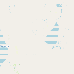
Map view of Vulkathunha-Gammon Ranges National Park

Use this park location map to pinpoint Vulkathunha-Gammon Ranges National Park in Australia, understand its exact geographic position, and read its mapped placement within the surrounding landscape more clearly.

Pigeon | © OpenStreetMap contributors

Location context for Vulkathunha-Gammon Ranges National Park

South Australia
Park atlas

Compare geological heritage and cultural landscapes across the wider Flinders Ranges region for deeper exploration

Continue Your Park Discovery: Nearby Protected Areas and Landscapes Around Vulkathunha-Gammon Ranges National Park
Browse national parks and protected areas that share geographic context or protected-landscape characteristics with Vulkathunha-Gammon Ranges National Park. Compare geological heritage, unique plateau-and-gorge terrain, and regional conservation efforts across similar South Australian landscapes, extending your atlas discovery.
National parkSouth Australia

Lake Frome National Park: Mapped Protected Area and Regional Geographic Identity in South Australia

Explore South Australia's unique landscape and park boundaries.

Lake Frome National Park offers a distinct focus for exploring the geography and protected landscape of South Australia. As a national park, it contributes to the mapped conservation network of the region, allowing for detailed study of its environmental context and geographic positioning. Discover the mapped terrain and regional park boundaries that define this significant protected area, crucial for a comprehensive atlas-based understanding of South Australia's natural heritage.

Area
2,582.4 km²
Established
1991
IUCN
VI
Relief
Lowland
National parkSouth Australia

Nilpena Ediacara National Park: South Australia National Park and Protected Landscape Identity

Mapped protected area within the regional geography of South Australia.

Nilpena Ediacara National Park represents a significant protected landscape within South Australia. This entry provides a detailed geographic context for the park, focusing on its role as a national park and its mapped boundaries. Delve into the specific atlas-driven understanding of this protected area, its landscape context, and its significance within the broader geographic framework of the Australian state.

Area
606.17 km²
Established
2021
IUCN
VI
Relief
Mountain
National parkSouth Australia

Lake Torrens National Park: Explore South Australia's Remarkable Inland Salt Lake Geography

A unique protected landscape of arid plains and expansive salt flats.

Lake Torrens National Park offers an unparalleled exploration of Australia's remote outback, centered around a vast, ancient salt lake basin. This national park in South Australia provides a canvas of stark, minimalist terrain, featuring shimmering saltpans, arid gibber plains, and rocky outcrops. Understand the park's unique geographic identity, its ecological significance as a temporary wetland habitat, and its dramatic visual appeal for landscape photography and geological interest. It is a key protected area showcasing the extreme environment of Australia's interior.

Area
5,676.68 km²
Established
1991
IUCN
VI
Relief
Lowland
National parkSouth Australia

Mount Remarkable National Park: Protected Landscape Atlas and South Australia Geography

Explore mapped boundaries and natural terrain.

Mount Remarkable National Park serves as a vital protected area within South Australia's unique geographic setting. This MoriAtlas entry details the park's mapped boundaries and surrounding natural terrain, providing structured insight into its landscape character and regional geographic importance. Understand the park as a key element of Australia's protected lands atlas.

Area
166.18 km²
Established
1972
IUCN
VI
Visitors
50K annual
National parkNew South Wales

Mutawintji National Park: New South Wales Protected Area for Atlas Exploration

Mapping rugged outback terrain, gorges, and ancient rock art.

Mutawintji National Park in New South Wales offers a profound exploration of Australia's outback geography, significant Indigenous heritage, and protected landscapes. Discover the park's unique terrain, defined by the Byngnano Range, vibrant gorges, and river red gum-lined creeks, all rich with ancient Aboriginal rock art. This national park is a prime example of mapped protected area discovery, highlighting both natural beauty and critical conservation achievements.

Area
689.12 km²
Established
1998
IUCN
II
Relief
Mountain
National parkSouth Australia

Wapma Thura, Southern Flinders Ranges National Park: South Australia's Protected Natural Landscape

Explore mapped boundaries and regional geography.

Wapma Thura, Southern Flinders Ranges National Park offers a distinct protected landscape within South Australia. This page serves as a portal for understanding its geographic setting, its role as a national park, and its place within the state's atlas of natural areas. Examine the mapped terrain and protected boundaries to grasp the park's unique geographic characteristics.

Established
2021
IUCN
II
Relief
Mountain
Scope
Terrestrial
National parkNew South Wales

Narriearra Caryapundy Swamp National Park: National Park Protected Landscape and Geographic Atlas

Explore mapped boundaries and regional context within New South Wales.

Narriearra Caryapundy Swamp National Park is a designated national park focused on preserving its unique protected landscape. This entry provides essential geographic context, detailing the park's mapped boundaries and its role within the regional atlas of New South Wales. Understand the protected natural area's identity and its place within the broader geographic framework for atlas exploration.

Area
1,534 km²
Established
2020
Relief
Lowland
Climate
Arid
National parkSouth Australia

Lake Gairdner National Park: National Park with Unique South Australian Geography and Mapped Boundaries

South Australian protected area with distinct landscape characteristics.

Lake Gairdner National Park serves as a key protected area within the geographic expanse of South Australia. This national park offers a unique focus for atlas exploration, highlighting its specific landscape features and mapped boundaries. Users can delve into the park's protected status and its contribution to the regional geography, providing valuable context for understanding Australia's diverse natural protected lands and their cartographic representation.

Area
5,531.77 km²
Established
1991
IUCN
VI
Relief
Lowland

Common questions about visiting, size, designation, and location context for Vulkathunha-Gammon Ranges National Park

Vulkathunha-Gammon Ranges National Park FAQs for park facts, access, geography, and protected area context
Find quick answers about Vulkathunha-Gammon Ranges National Park, including protected-area facts, park geography, trail and visitor context, and how the park fits into its surrounding country and regional landscape.
MoriAtlas Explorer

Continue Your Protected Areas Search Across the Global Atlas

Deepen your exploration by continuing the structured search for national parks and protected areas worldwide. Utilize the comprehensive filtering capabilities to compare different conservation landscapes and refine your understanding of global park geography. Discover more about the distribution and characteristics of protected natural areas.

Global natural geography