Why Narriearra Caryapundy Swamp National Park stands out
Narriearra Caryapundy Swamp National Park is best known for its ephemeral wetland systems that create critical habitat in the Australian outback, and for being the largest private land acquisition for conservation in New South Wales history. The park protects important populations of the Grey grasswren, a nationally threatened bird species, as well as providing habitat for red kangaroos, wedge-tailed eagles, and brolgas. The combination of semi-arid rangeland with intermittent wetland filling events makes this one of the more ecologically significant protected areas in the dry interior of eastern Australia.
Narriearra Caryapundy Swamp National Park history and protected-area timeline
The establishment of Narriearra Caryapundy Swamp National Park represents a watershed moment in Australian conservation history. In June 2020, the Government of New South Wales purchased the 153,415-hectare Narriearra station from private landowners, converting what had been productive cattle grazing land into a protected national park. This acquisition superseded all previous records for private land purchase for conservation in the state, representing both the largest single transaction and the most significant strategic addition to the NSW national park system in decades. The purchase price was not publicly disclosed, but the transaction was widely recognized as a major investment in the state's natural heritage.
Prior to acquisition, the Narriearra property had been used for cattle grazing, a land use that had altered the ecological character of the area over many decades. The decision to purchase the property for conservation reflected growing recognition of the ecological values contained within the ephemeral wetland systems and the need to protect these habitats from stock grazing pressure. The wetlands had never been formally included in the state's conservation estate, meaning this purchase filled a significant gap in the protected area network of northwestern New South Wales.
In December 2021, a portion of the park was formally designated as a Ramsar Wetland of International Importance, receiving international recognition as Caryapundy Swamp. This designation under the Ramsar Convention on Wetlands provides additional legal protection and international recognition of the wetlands' significance. The Tibooburra Local Aboriginal Land Council has been invited to participate in the naming process for the new park, acknowledging the deep cultural connections between Aboriginal peoples and this landscape.
Narriearra Caryapundy Swamp National Park landscape and geographic character
The landscape of Narriearra Caryapundy Swamp National Park comprises a complex intermixture of semi-arid rangeland and ephemeral wetland systems that together create a distinctive visual character. The dominant terrain consists of open plains and low undulating country typical of the northwest slopes region of New South Wales, where vegetation transitions from the more heavily timbered slopes of the eastern highlands to the increasingly sparse cover of the arid interior. Within this broader landscape, the wetland depressions represent localized areas of higher productivity and visual contrast, where water accumulation following rainfall events transforms the character of the terrain.
The white tree stands mentioned in source descriptions likely refer to stands of river red gum or other eucalypt species that occur along drainage lines and around wetland margins, their pale-hued foliage providing visual prominence against the surrounding grasslands. These tree formations create structural complexity in an otherwise open landscape, providing habitat for birds and mammals while serving as landmarks in the extensive flat terrain. The surrounding areas support open grassy vegetation with low shrub layer, characteristic of semi-arid grazing lands that respond to seasonal rainfall with bursts of productivity.
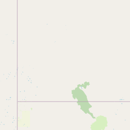
The northern boundary is marked by the Dingo Fence, a massive barrier stretching over 5,600 kilometers across the Australian interior. This fence, originally constructed to protect southern sheep-producing regions from dingo predation, has become an artificial boundary that influences wildlife movement patterns across the continent. The fence's presence creates a distinct demarcation between the pastoral lands of New South Wales and the more freely roaming wildlife populations of Queensland.
Narriearra Caryapundy Swamp National Park ecosystems, habitats, and plant life
The ecological character of Narriearra Caryapundy Swamp National Park is defined by the interaction between semi-arid rangeland ecosystems and intermittent wetland habitats. The ephemeral wetland systems represent the most ecologically significant features within the park, creating unpredictable periods of water availability that support distinctive assemblages of plants and animals. These wetlands fill following significant rainfall events in the upstream catchment, with the frequency and duration of filling events varying according to seasonal climate patterns. When wet, these areas become surprisingly productive, supporting dense stands of emergent vegetation and providing critical habitat for waterbird species.
The vegetation of the surrounding rangelands comprises a mixture of native grasses and low shrubs adapted to the variable climate conditions. Species composition varies with soil type and position in the landscape, with more fertile clay soils supporting different plant communities than the sandy rises and red earth plains. The transition between wetland and upland habitats creates a mosaic of ecological communities that maximizes biodiversity within the limited area. Native Australian grasses including various wiregrass and bluegrass species provide the foundation for the terrestrial ecosystem, while the wetlands support sedges, reeds, and aquatic plants.
The Ramsar designation of Caryapundy Swamp acknowledges the international significance of these wetland habitats, particularly their importance for waterbird conservation. The unpredictable nature of wetland filling events means that the area does not maintain permanent open water, but rather experiences cycles of flooding and drying that shape the ecological character of the system. This dynamic regime supports species adapted to both wet and dry conditions, creating a resilient ecosystem with built-in redundancy.
Narriearra Caryapundy Swamp National Park wildlife and species highlights
Narriearra Caryapundy Swamp National Park supports a diverse assemblage of wildlife adapted to the challenging conditions of far northwestern New South Wales. The park provides habitat for several species of conservation significance, with the Grey grasswren representing one of the most notable inhabitants. This small, cryptically colored bird inhabits dense vegetation around wetlands and drainage lines, where it forages for seeds and small invertebrates among the emergent grasses and reeds. The species has a limited distribution in Australia, making protected areas like Narriearra critically important for its survival.
Large mammals present in the park include the red kangaroo, Australia's largest marsupial and a characteristic species of the arid and semi-arid interior. These iconic animals move across the landscape in search of green feed, particularly following rainfall events that stimulate plant growth. Wedge-tailed eagles soar above the open country, using thermal currents to search for prey items including small mammals, reptiles, and carrion. These large raptors nest in tall trees and on cliffs, with the tree stands within the park providing potential nesting habitat.
Brolgas, large grey cranes with distinctive red facial patches, are associated with wetland areas throughout northern Australia and occur within the park when water is available. These graceful birds feed in shallow water and adjacent grasslands, consuming vegetation, frogs, and invertebrates. Other bird species likely present include various honeyeaters, parrots, and ground-dwelling birds adapted to the open rangeland environment. The combination of wetland and terrestrial habitats supports a richer bird community than would occur in either habitat type alone.
Narriearra Caryapundy Swamp National Park conservation status and protection priorities
The establishment of Narriearra Caryapundy Swamp National Park represents a major advance in the conservation of Australia's semi-arid and arid landscapes. Prior to this purchase, the ephemeral wetlands of the far northwest had been largely excluded from formal protection, despite their ecological significance. The acquisition brought 153,405 hectares of private land into the public conservation estate, creating a landscape-scale protected area that addresses a significant gap in the NSW national park network. This conservation outcome was achieved through willing seller negotiation, demonstrating the potential for private land acquisition to expand protected area coverage.
The Ramsar designation of Caryapundy Swamp in December 2021 added an additional layer of international recognition and obligation. As a Wetland of International Importance, the area is recognized under the Ramsar Convention as having significant biodiversity value, particularly for waterbird populations. This designation brings the site to the attention of the international conservation community and creates obligations for wise use and sustainable management. The Ramsar listing represents the culmination of a rapid conservation trajectory, from private grazing land to national park to international wetland recognition within just a few years.
The park's location adjacent to Sturt National Park creates a conservation corridor of approximately 500,000 hectares, providing habitat connectivity at a landscape scale. This connected protected landscape supports wildlife movement and ecological processes that require large areas, improving the conservation effectiveness of both parks. The corridor approach recognizes that effective conservation in semi-arid environments requires spatial extent, as species populations fluctuate with rainfall patterns and need access to broad areas to maintain viable numbers.
Narriearra Caryapundy Swamp National Park cultural meaning and human context
The landscape of Narriearra Caryapundy Swamp National Park has been home to Aboriginal peoples for tens of thousands of years, with the nearby Pindera Downs Aboriginal area demonstrating the rich cultural heritage of the region. The invitation extended to the Tibooburra Local Aboriginal Land Council to suggest a name for the new park reflects recognition of these enduring connections between Aboriginal communities and the land. This naming process provides an opportunity to incorporate Aboriginal language and knowledge into the park's identity.
The Pindera Downs area, which lies adjacent to the new park, is noted as being rich in cultural artefacts of Aboriginal Australians, demonstrating the long history of human occupation and connection to country. The ephemeral wetlands would have provided important resources for Aboriginal people, offering water, food, and raw materials during periods when the landscape was wet. The open rangeland surrounding the wetlands supported hunting of kangaroos and other game, while the vegetation provided materials for tools and shelters.
The cultural context of this landscape extends beyond individual sites to encompass the broader patterns of Aboriginal land management that shaped Australian environments over millennia. The naming invitation represents an opportunity to move beyond viewing the landscape as purely a natural system and instead recognize the integrated cultural and natural values that characterize Australian landscapes.
Top sights and standout views in Narriearra Caryapundy Swamp National Park
Narriearra Caryapundy Swamp National Park stands out as a conservation landmark as Australia's largest private land acquisition for conservation in New South Wales history. The park protects critical ephemeral wetland habitat in the outback, providing sanctuary for the threatened Grey grasswren and supporting populations of red kangaroos, wedge-tailed eagles, and brolgas. The Ramsar designation of Caryapundy Swamp in 2021 recognizes the international significance of these wetlands. The park creates a vast 500,000-hectare conservation corridor when combined with Sturt National Park, establishing one of the largest connected protected landscapes in eastern Australia.
Best time to visit Narriearra Caryapundy Swamp National Park
The best time to visit Narriearra Caryapundy Swamp National Park depends largely on rainfall patterns, as the park's ephemeral wetlands dictate the character of the visitor experience. Following significant rainfall in the region, wetlands fill and the landscape transforms dramatically, with abundant birdlife and green vegetation creating optimal conditions for wildlife observation. The cooler months from April to October generally offer more comfortable conditions for exploring the park, with daytime temperatures more moderate than during the summer months. Visitors should be aware that access to some areas may be affected by wet conditions following rainfall, as unsealed roads can become impassable when saturated. The remote location of the park requires careful planning for fuel, supplies, and vehicle preparation, as services are limited in the surrounding region.