

Mori Atlas logo
National parkLincoln National Park

Discover the mapped boundaries and regional terrain of this national park in South Australia.

Lincoln National Park: Protected Area Atlas and Geographic Landscape Context in South Australia

Lincoln National Park stands as a significant protected area within the broader geography of South Australia. This page provides users with detailed insights into the park's mapped boundaries, helping to understand its protected landscape identity. Explore how Lincoln National Park fits into the regional atlas, offering a focused view of its natural terrain and geographic context for structured discovery.

Coastal national parksIsland ecosystemsMallee woodlandsLimestone cliffsSand dunesWhale migration

Lincoln National Park

National park

Park overview

Structured park overview, official facts, and landscape profile for Lincoln National Park

Lincoln National Park park facts, protected area profile, and essential visitor context

Review the core facts for Lincoln National Park, including designation, size, terrain, visitor scale, habitats, and operating context in one park-focused overview.

About Lincoln National Park

Lincoln National Park occupies the majority of the Jussieu Peninsula, a detached landform connected to the Eyre Peninsula mainland by a narrow isthmus. The park's geography is defined by its elongated northern coastline curving toward Cape Donington, which marks the southern entrance to Port Lincoln's deep, sheltered harbour. The eastern coastline along Spencer Gulf extends from Cape Donington to Taylor's Landing opposite Taylor Island, while the southern boundary traces from Mary Ellis Wreck Beach westward to Jussieu Bay. This southern coastline presents the park's most dramatic terrain, with exposed sand dunes behind Sleaford Bay giving way to formidable limestone cliffs guarding Jussieu Bay. The waters surrounding the peninsula are known for their roughness and dangerous rips, contributing to the area's wilderness character and historical incidents including the 1907 wreck of the ketch Mary Ellis. Beyond the mainland, the park protects a constellation of islands including the Bicker Isles and Horse Rock in Port Lincoln, Rabbit Island, Donington Island, Owen Island and others in Spencer Gulf, and more remote islands including Liguanea Island and Albatross Island near Thistle Island in the Great Australian Bight. The park is classified as an IUCN Category II protected area and is managed by South Australia's Department for Environment and Water.

Quick facts and research context for Lincoln National Park

Lincoln National Park covers 216.38 square kilometres on South Australia's Eyre Peninsula, protecting the majority of the Jussieu Peninsula and over a dozen offshore islands. The park features a diverse coastline transitioning from sweeping sand dunes along Sleaford Bay to rugged limestone cliffs at Jussieu Bay, with the eastern shore facing Spencer Gulf. The landscape supports coastal mallee eucalypt woodlands around granite outcrops, with vegetation becoming sparser on the exposed southern dune systems. The park contains over 100 kilometres of walking trails forming part of the regional Investigator Trail network. The Cape Donington Lighthouse, a 32-metre hexagonal concrete tower built in 1905, remains operational and marks the southern entrance to Port Lincoln harbour.

Protection and recognition

Mapping the official conservation framework and management scope of the park.

Official Protection Status and Protected Area Designation of Lincoln National Park

Public records outline the specific protection status and official management scope defining Lincoln National Park within the regional conservation network. Accessing validated designation details helps researchers and visitors analyze how the park boundaries integrate with regional environmental protections.

Protection details

Protection scope
Mixed
Transboundary protection
No
Park context

Deeper park guide and search-rich context for Lincoln National Park

Lincoln National Park history, landscape, wildlife, and travel context

Explore Lincoln National Park through its history, landscape character, ecosystems, wildlife, conservation priorities, cultural context, and seasonal travel timing in a structured park guide built for atlas discovery and search intent.

Why Lincoln National Park stands out

Lincoln National Park is best known for its dramatic coastal landscapes combining towering limestone cliffs at Wanna and Jussieu Bay with extensive sand dune systems along Sleaford Bay, creating one of South Australia's most visually striking peninsula wilderness areas. The park is distinguished by its island ecosystem component, protecting numerous islands in Port Lincoln and Spencer Gulf that support significant seabird colonies and marine mammal populations. The area holds particular importance for migratory bird species including red-necked stints and sandpipers that travel from the Arctic Circle and Siberia to spend the southern hemisphere summer in the park. Southern right whales can be observed in the surrounding waters between July and November during their seasonal migration along the southern Australian coast.

Lincoln National Park history and protected-area timeline

Lincoln National Park's formal protection began on 28 August 1941 when land in sections 2, 5, 6, and 13 of the Hundred of Flinders was dedicated as a Flora and Fauna Reserve under the Crown Lands Act 1929. On 9 November 1967, these lands and additional sections were proclaimed as Lincoln National Park under the National Parks Act 1966. The park was reconstituted under the National Parks and Wildlife Act 1972 on 27 April 1972, formally incorporating numerous islands including Smith Island, Hopkins Island, Lewis Island, Little Island, Owen Island, Albatross Island, Liguanea Island, and Rabbit Island. Between 1972 and 1992, the park significantly expanded through additions at Stamford Hill, Cape Donington, Wanna, and many coastal islands. The Stamford Hill area holds particular historical significance, with its original Barngarla name being Gaidyaba. In 1993, the Lincoln Conservation Reserve was added to the park's management regime before being declared as the Lincoln Conservation Park. A boundary extension in June 1999 extended protection down to mean low water mark. In 2004, Memory Cove and several islands were excised to form the separate Memory Cove Wilderness Protection Area under the Wilderness Protection Act 1992.

Lincoln National Park landscape and geographic character

The physical landscape of Lincoln National Park presents a compelling combination of coastal geomorphology and exposed peninsula terrain. The Jussieu Peninsula itself is a distinct landform separated from the Eyre Peninsula mainland by a narrow isthmus where the Sleaford Mere Conservation Park abuts the park's western border. The northern coastline sweeps in a broad curve toward Cape Donington, the peninsula's northernmost point and site of the operational Cape Donington Lighthouse. This coast faces onto the protected waters of Port Lincoln harbour. The eastern coastline along Spencer Gulf presents a more exposed character, extending from Cape Donington past Donington Island and multiple small coves to Taylor's Landing opposite Taylor Island. The southern coastline represents the park's most spectacular terrain, where extensive sand dunes rise behind Sleaford Bay creating a dune landscape accessible via the Sleaford to Wanna four-wheel drive track. These dunes give way eastward to the dramatic limestone cliffs that guard Jussieu Bay, a rugged and visually striking section of coastline exposed to the full force of the Southern Ocean. The park's island components add further landscape diversity, from the relatively sheltered islands in Port Lincoln to the more remote and exposed islands in the Great Australian Bight.

Lincoln National Park ecosystems, habitats, and plant life

The ecological character of Lincoln National Park reflects the transition between South Australia's coastal mallee landscapes and the unique island ecosystems of Spencer Gulf and the Great Australian Bight. The mainland portions of the park are largely covered by coastal mallee eucalypt woodlands growing in association with scattered granite outcrops that punctuate the landscape. This mallee vegetation, characterized by multi-stemmed eucalypts adapted to the semi-arid coastal conditions, provides the dominant vegetation framework across the peninsula. The sand dune systems along the southern coastline support a more sparse shrub coverage adapted to the mobile, exposed dune substrate. The granite outcrops scattered throughout the park create microhabitats supporting specialized plant communities. The islands within the park protect additional habitat types including rocky shore communities, seabird nesting areas, and marine environments supporting various species. The waters surrounding the park, particularly Spencer Gulf, host important marine ecosystems including seagrass communities and support the migratory movements of marine mammals.

Lincoln National Park wildlife and species highlights

Lincoln National Park supports a diverse terrestrial and marine fauna assemblage reflecting its position at the junction of several ecological regions. The park is home to substantial populations of kangaroos, wallabies, and emus that inhabit the mallee and woodland areas throughout the peninsula. Historical concerns about feral fox predation on native wildlife have been addressed through extensive baiting and culling programs, and the reduction in fox numbers has allowed notable rebounds in goanna and bush stone curlew populations. The park has also been the site of successful reintroductions of brush-tailed bettongs and malleefowl, both threatened species that are now becoming increasingly common within the park boundaries. The avifauna of the park is particularly significant, with numerous resident species complemented by migratory birds that travel to the area for the southern hemisphere summer. Red-necked stints and sandpipers undertake remarkable journeys from the Arctic Circle and Siberia to spend the warmer months in the park. The marine environment supports southern right whales during their seasonal migrations between July and November, and Australian sea lions can be observed resting on rocks and small islands along the coast.

Lincoln National Park conservation status and protection priorities

Lincoln National Park represents an important protected area within South Australia's coastal conservation estate, classified as an IUCN Category II national park reflecting its primary purpose of ecosystem conservation and protection. The park conserves a representative sample of the Eyre Peninsula's coastal mallee ecosystems while also protecting significant island habitats that would otherwise lack formal protection. The park's heritage values extend beyond natural systems to include indigenous cultural sites with evidence of Barngarla and Nauo occupation spanning thousands of years, as well as early European exploration and settlement history. The management of the park has evolved to address threats including invasive species, with the successful fox control program demonstrating measurable conservation outcomes through native species recovery. The marine environment surrounding the peninsula, including the waters of Spencer Gulf and the Great Australian Bight, receives indirect protection through the park's coastal boundary extension to mean low water mark, supporting the broader marine ecosystem that includes migratory whale corridors and seabird feeding grounds.

Lincoln National Park cultural meaning and human context

The cultural context of Lincoln National Park encompasses a significant timeline of human interaction with the Jussieu Peninsula landscape. The Barngarla and Nauo Aboriginal peoples were the original inhabitants of the region, leaving archaeological evidence throughout the national park including stone working sites, fish trap installations, and shell middens that attest to long-term coastal resource use. Following European discovery by Matthew Flinders in 1802, the peninsula acquired names reflecting this colonial encounter, with Cape Donington named after Flinders' birthplace. An obelisk monument at Stamford Hill, dedicated in 1844 by Sir John Franklin, commemorates Flinders' achievements and is listed on the South Australian Heritage Register. Early European settlement concentrated around Cape Donington where the first grain crop was sown in 1875, supported by woodcutting, grazing, and guano mining industries. The Donington Cottage from this era still stands and is accessible to the public. The 1907 wreck of the ketch Mary Ellis on Sleaford Bay, despite the vessel's total destruction, resulted in no casualties and left Mary Ellis Wreck Beach as a named historical site within the park.

Top sights and standout views in Lincoln National Park

The standout features of Lincoln National Park include the spectacular coastal contrasts between Sleaford Bay's sweeping sand dunes and the rugged limestone cliffs of Jussieu Bay, the extensive trail network offering over 100 kilometres of walking through diverse terrain, and the park's island wilderness component protecting critical seabird and marine mammal habitat. The Cape Donington Lighthouse provides both a navigational landmark and historical perspective on the peninsula's maritime significance. The park's multi-layered heritage combining indigenous Barngarla and Nauo sites, Flinders' exploration legacy, and 19th-century settlement artifacts creates a nuanced cultural landscape. Marine wildlife viewing opportunities, particularly southern right whale migrations from July to November and year-round Australian sea lion presence, add another dimension to the park's appeal. The successful recovery of threatened species including brush-tailed bettongs and malleefowl through reintroduction programs demonstrates active conservation management.

Best time to visit Lincoln National Park

The optimal time to visit Lincoln National Park depends on the experience sought, with the southern hemisphere summer months from December to February offering the warmest conditions for beach activities and camping, though this coincides with the peak period for dangerous rips and rough seas along the exposed southern coastline. The winter months from June to August provide milder conditions for bushwalking and wildlife observation, though some tracks may be affected by wet conditions. Whale watching for southern right whales is best from July through November when these majestic creatures pass through the surrounding waters during their annual migration. The shoulder seasons of spring and autumn offer balanced conditions for walking and outdoor activities, with wildflower displays in spring adding natural colour to the mallee landscapes. Visitors planning activities on the southern beaches should always check current conditions and heed safety warnings given the known dangers of the area's rips and currents.
Monthly climate preview

Long term temperature and precipitation patterns in coastal South Australia

Lincoln National Park Climate and Monthly Weather Normals

Long term observations from a coastal coordinate near sea level reveal moderate temperatures: average maximums approach thirty degrees Celsius in warm months while winter minimums drop toward ten degrees. Reviewing the complete twelve month profile reveals the precise seasonal distribution of rainfall, showing distinct peaks during cooler months and minimal precipitation in summer.
Annual mean16 °C
14 °C19 °C
Jan19°
Feb19°
Mar19°
Apr17°
May16°
Jun15°
Jul14°
Aug14°
Sep14°
Oct15°
Nov16°
Dec18°
Warmest month
February

19.4 °C

Coolest month
August

13.6 °C

Wettest month
June

2.3 mm/day

Driest month
January

0.5 mm/day

Park location guide

Geography guide, regional context, and park location map for Lincoln National Park

Lincoln National Park park geography, regions, and map view in Australia

Understand where Lincoln National Park sits in Australia through a broader geographic reading of the surrounding landscape, nearby location context, and its mapped position within the national park landscape.

How Lincoln National Park fits into Australia

Australia is a constitutional monarchy and federal parliamentary democracy comprising six states and ten territories. With a population of nearly 28 million, it is one of the world's most urbanised countries, with most people concentrated on the eastern seaboard. The country has a high Human Development Index and is known for its cultural diversity, ancient Aboriginal heritage, and unique wildlife.

Wider geography shaping Lincoln National Park in Australia

Australia occupies the entire Australian continent, the island of Tasmania, and numerous smaller islands. It is the world's flattest and driest inhabited continent, featuring vast deserts in the interior (the Outback), tropical rainforests along the eastern coast, and a coastline bordering the Indian and Pacific Oceans.

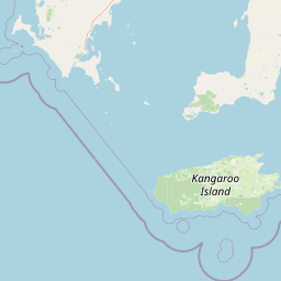
Map view of Lincoln National Park

Use this park location map to pinpoint Lincoln National Park in Australia, understand its exact geographic position, and read its mapped placement within the surrounding landscape more clearly.

Pigeon | © OpenStreetMap contributors

Location context for Lincoln National Park

South Australia
Natural feature types

Browse the Full Collection of Natural Features within Lincoln National Park

Explore the complete set of documented natural landforms and geographic features associated with the diverse coastal environment of Lincoln National Park. Use this structured index to navigate the dunes, cliffs, and islands that define the geography of the Eyre Peninsula.
Recorded earthquake history

Explore Historical Earthquake Records Associated with Lincoln National Park

Review the established record of seismic events documented near the coastal landscapes of Lincoln National Park. This MoriAtlas data compilation offers a clear view of historical earthquake activity, providing depth and magnitude metrics for informed geographic and environmental analysis.

Lincoln National Park Earthquake History

Catalogued events

2 events

Strongest magnitude

Magnitude 4.4

Most recent event

May 27, 2003

This history includes earthquakes recorded inside the park or within 50 km of its borders

Park atlas

Trace the regional geography of protected areas, comparing coastal wilderness and island ecosystems throughout the Eyre Peninsula.

Discover Other National Parks and Coastal Protected Areas Near Lincoln National Park, Eyre Peninsula

Browse other national parks and protected areas near Lincoln National Park, encompassing coastal wilderness, diverse mallee woodlands, and significant island ecosystems on the Eyre Peninsula. Compare their unique geographic features, trace patterns of conservation landscapes in South Australia, and discover adjacent natural environments beyond one specific park's boundaries.
Wildlife reserveSouth Australia
5.7 km away#1 closest

North

Kathai Conservation Park: Protected Wildlife Reserve on the Eyre Peninsula

Mapping the Uley catchment basin and mallee forest terrain

Kathai Conservation Park serves as a crucial protected landscape in South Australia, anchored by the prominent Northside Hill. The reserve maintains critical habitat for coastal white mallee and rare vegetation within the wider Uley catchment basin, showcasing how small protected areas sustain regional ecological diversity.

Area
0.81 km²
Established
1985
IUCN
III
Relief
Upland
National parkSouth Australia
22 km away#2 closest

Northwest

Coffin Bay National Park: Protected Landscape and Geographic Context in South Australia

Explore the mapped boundaries and regional geography of this national park.

Coffin Bay National Park presents a distinct protected landscape within South Australia, offering a valuable point of entry for geographic discovery. This page details the park's national park designation and its mapped territory, crucial for understanding its role in Australia's atlas of natural areas. Delve into the park's specific geographic context and the outlines of its protected lands, providing a clear picture of its landscape within the state's broader terrain.

Area
309.76 km²
Established
1982
IUCN
II
Relief
Lowland
National parkAustralia
About 67 km away#3 closest

Southeast

Dhilba Guuranda-Innes National Park: A Detailed Look at Its Australian Protected Landscape

Explore the park's mapped geography and natural terrain.

This section offers a focused atlas exploration of Dhilba Guuranda-Innes National Park, detailing its significance as a protected natural area within Australia. Gain understanding of its unique geographic characteristics, mapped boundaries, and its contribution to the country's diverse natural landscapes. This provides detailed context for anyone interested in Australia's protected land inventory and regional geography.

Area
94.15 km²
Established
1970
Visitors
200K annual
Relief
Mixed relief
National parkAustralia
About 67 km away#4 closest

Southeast

Innes National Park National Park: Mapped Protected Landscape and Regional Geography

Explore its geographic setting and natural terrain.

Delve into the protected landscape and geographic particulars of Innes National Park. This entry provides detailed insights into its mapped boundaries and the surrounding natural terrain within Australia. Understanding Innes National Park's place in the broader geographic atlas helps users compare and contrast protected areas across different regions and nations.

IUCN
II
Marine protected areaSouth Australia
About 78 km away#5 closest

South

Western Kangaroo Island Marine Park: Geographic Profile and Protected Marine Environment

South Australian marine geography and protected seafloor zones.

Western Kangaroo Island Marine Park guards a vital swath of the continental shelf and upper slope in South Australia. The protected area features a unique submerged ancient coastline and deep nutrient-rich waters that support diverse marine ecological processes within the Spencer Gulf Shelf Province.

Area
2,335.31 km²
Established
2012
IUCN
II
Relief
Lowland
Protected areaSouth Australia
About 80 km away#6 closest

East

Carribie Conservation Park: Mapped Geography and Protected Area Overview in South Australia

Ecological terrain and native vegetation remnants on the Yorke Peninsula

Carribie Conservation Park is a 19-hectare protected area situated on the southern Yorke Peninsula of South Australia. The terrain consists of an undulating sandy plain characterized by two contrasting vegetation zones: a northern mallee scrub and a southern sheoak and tea-tree woodland. As a formal conservation site, it provides a vital window into the original botanical character of the region.

Area
0.19 km²
Established
1968
IUCN
III
Relief
Lowland
Wildlife reserveSouth Australia
81 km away#7 closest

North

Hincks Conservation Park: Protected Wildlife Reserve in South Australia

Mapping regional biodiversity and conservation landscapes

Hincks Conservation Park functions as a key protected area within the semi-arid coastal hinterland of the Eyre Peninsula. This reserve preserves an essential fragment of native vegetation against a surrounding backdrop of agricultural development. The site highlights the importance of managed land corridors in maintaining ecological connectivity across the central-eastern reaches of South Australia.

Area
8.78 km²
Established
1941
IUCN
VI
Relief
Lowland
Nature reserveSouth Australia
82 km away#8 closest

West

Greenly Island Conservation Park: Geography and Protected Nature Reserve Map

Island protected area off the South Australian Eyre Peninsula.

This offshore nature reserve preserves an exposed, rocky island environment in the Southern Ocean. As a protected area for marine mammal haul-out sites, it provides a unique look at isolated coastal terrain and strict conservation management along the western shoreline of South Australia.

Area
1.68 km²
Established
1967
IUCN
Ia
Relief
Lowland

Common questions about visiting, size, designation, and location context for Lincoln National Park

Lincoln National Park FAQs for park facts, access, geography, and protected area context

Find quick answers about Lincoln National Park, including protected-area facts, park geography, trail and visitor context, and how the park fits into its surrounding country and regional landscape.
MoriAtlas Explorer

Continue Your Protected Areas Search Across the Global Atlas

Deepen your exploration by continuing the structured search for national parks and protected areas worldwide. Utilize the comprehensive filtering capabilities to compare different conservation landscapes and refine your understanding of global park geography. Discover more about the distribution and characteristics of protected natural areas.

Global natural geography