Mori Atlas logo
National parkGulf of Khnifiss National Park

Discover the mapped terrain and protected area boundaries of this key national park in Western Sahara.

Gulf of Khnifiss National Park: National Park, Protected Landscape, and Geographic Atlas

(Khenifiss National Park)

Gulf of Khnifiss National Park represents a significant protected landscape within Western Sahara, offering a focal point for geographic discovery and atlas exploration. As a designated national park, its mapped boundaries and natural terrain provide crucial context for understanding the region's geography. This page serves as an authoritative entry point for exploring the park's protected area identity and its place within the broader natural landscape context.

Coastal LagoonRamsar SiteImportant Bird AreaSaharan CoastlineMigratory BirdsWetland Conservation

Gulf of Khnifiss National Park

National park

Park overview

Structured park overview, official facts, and landscape profile for Gulf of Khnifiss National Park

Gulf of Khnifiss National Park park facts, protected area profile, and essential visitor context

Review the core facts for Gulf of Khnifiss National Park, including designation, size, terrain, visitor scale, habitats, and operating context in one park-focused overview.

About Gulf of Khnifiss National Park

Gulf of Khnifiss National Park represents one of Morocco's more ecologically significant protected areas, established to conserve a rare combination of coastal, wetland, and desert environments along the Atlantic frontier. The park's territory extends from the shoreline of the Atlantic Ocean inland across a landscape characterized by sabkha salt flats, sand dunes, and limestone plateaus that embody classic Saharan topography. The coastal segment centers on the Khenfiss lagoon, an extensive shallow water body that constitutes the largest lagoon system on Morocco's Atlantic coast. This lagoon environment supports a rich diversity of birdlife and serves as a critical stopover and wintering area within the East Atlantic Flyway, a major migratory route connecting Arctic breeding grounds with African wintering territories. The park was created with explicit governmental intention to develop ecotourism infrastructure while maintaining the ecological integrity of this sensitive coastal-desert interface. The establishment of the national park reflected Morocco's broader commitment to biodiversity conservation and sustainable development in its southern territories, building upon the site's prior designations as a natural reserve and Ramsar wetland.

Quick facts and research context for Gulf of Khnifiss National Park

Gulf of Khnifiss National Park occupies a strategic position along the Atlantic coast of Morocco, approximately midway between the towns of Tan-Tan to the north and Tarfaya to the south. The protected area spans roughly 1,850 square kilometers and incorporates both coastal and inland desert environments. The park was formally elevated to national park status on September 26, 2006, though it originated as a natural reserve in 1960 and later achieved Ramsar designation in 1980. National Route 1, which follows Morocco's Atlantic coastline, passes directly through the park territory. The lagoon system within the park represents the largest lagoon along the Moroccan Atlantic coast and serves as a critical habitat for waterbird populations.

Park context

Deeper park guide and search-rich context for Gulf of Khnifiss National Park

Gulf of Khnifiss National Park history, landscape, wildlife, and travel context

Explore Gulf of Khnifiss National Park through its history, landscape character, ecosystems, wildlife, conservation priorities, cultural context, and seasonal travel timing in a structured park guide built for atlas discovery and search intent.

Why Gulf of Khnifiss National Park stands out

Gulf of Khnifiss National Park is best known for its remarkable Khenfiss lagoon, the largest lagoon on Morocco's Atlantic coastline, which serves as a vital avian habitat and breeding ground. The park's defining character derives from the dramatic contrast between its coastal wetland environments and the adjacent Saharan desert landscapes, creating a unique ecological tension between marine and terrestrial systems. The lagoon supports permanent populations of ruddy shelducks, marbled ducks, and Audouin's gulls, while drawing approximately 20,000 migratory waterbirds during the winter season. This concentration of birdlife, set against the backdrop of desert dunes and limestone plateaus, makes the park a distinctive destination for wildlife observation and ecological study.

Gulf of Khnifiss National Park history and protected-area timeline

The protection history of Gulf of Khnifiss spans multiple decades of escalating conservation status. The area was first protected as a natural reserve in 1960, establishing initial institutional recognition of its ecological significance. In 1980, the site achieved international prominence through designation as a Wetland of International Importance under the Ramsar Convention, with the formal name Baie de Khnifiss and reference number 209. This Ramsar designation acknowledged the lagoon's critical role as a bird habitat and its importance within the broader West African wetland network. The natural reserve was subsequently upgraded to Permanent Biological Reserve status in 1983, further institutionalizing conservation protection. The site was nominated to the UNESCO World Heritage Tentative List in the natural category on October 12, 1998, reflecting Morocco's view of the area as possessing outstanding universal value. The current national park designation was formally established on September 26, 2006, elevating the protected area to full national park status under IUCN Category II.

Gulf of Khnifiss National Park landscape and geographic character

The physical landscape of Gulf of Khnifiss National Park presents a striking juxtaposition of marine, wetland, and desert landforms along a relatively narrow coastal zone. The park's coastal section is dominated by the Khenfiss lagoon, a substantial shallow water body separated from the open Atlantic by a thin barrier beach, creating a protected marine environment with ecological characteristics distinct from both the ocean and terrestrial systems. Moving inland, the terrain transitions abruptly into classic Saharan landscapes dominated by extensive sabkha salt flats, wind-shaped sand dunes, and rolling limestone plateaus that extend toward the continental interior. The coastal dunes frame the lagoon shoreline, providing visual definition to the wetland boundary while simultaneously demonstrating the dynamic interaction between Aeolian processes and coastal geomorphology. This blend of coastal lagoon, dune systems, salt flats, and elevated limestone terrain creates a visually distinctive landscape that differs markedly from Morocco's more familiar Atlas Mountain and Mediterranean coastal environments.

Gulf of Khnifiss National Park ecosystems, habitats, and plant life

The ecological character of Gulf of Khnifiss National Park is defined by the interaction between its coastal lagoon ecosystem and the surrounding Saharan desert environment, creating a unique biodiversity hotspot within this biogeographic transition zone. The Khenfiss lagoon serves as the ecological heart of the protected area, supporting a rich community of waterbirds that rely on its shallow waters, emergent vegetation, and surrounding mudflats for foraging and breeding habitat. The lagoon maintains permanent populations of several species, including the ruddy shelduck, marbled duck, and Audouin's gull, the latter being a species of particular conservation concern in the broader Mediterranean region. During the winter months, the lagoon hosts approximately 20,000 migratory waterbirds, representing a substantial concentration of avifauna within the West African-Eastern Atlantic migratory system. The surrounding desert environments, while less biologically productive than the wetland areas, support specialized xeric-adapted species capable of surviving in this harsh coastal fringe of the Sahara.

Gulf of Khnifiss National Park wildlife and species highlights

The wildlife of Gulf of Khnifiss National Park is most notably characterized by its extraordinary bird populations, particularly the waterbird assemblages that utilize the lagoon environment throughout the year. The permanent avian residents include ruddy shelducks, which maintain year-round presence in the lagoon area, marbled ducks, a species with restricted distribution in North Africa, and Audouin's gulls, a Mediterranean breeding species that uses the site as a wintering ground. The winter period transforms the lagoon into a major concentrationsite for migratory waterbirds, with approximately 20,000 individual birds representing numerous species utilizing the protected waters during the colder months. The park's designation as an Important Bird Area by BirdLife International specifically recognizes its significance for supporting wintering populations of waterbirds, making it a site of international conservation importance for migratory bird populations that traverse the East Atlantic Flyway.

Gulf of Khnifiss National Park conservation status and protection priorities

Gulf of Khnifiss National Park holds significant conservation importance at multiple scales, from national Moroccan biodiversity policy to international framework designations. The park's Ramsar designation since 1980 places it within the global network of wetlands of international importance, acknowledging its critical role in waterbird conservation and ecological function. Its subsequent recognition as an Important Bird Area by BirdLife International further validates the site's significance for supporting significant populations of wintering waterbirds, with the approximately 20,000 birds present during winter months representing meaningful concentrations within the East Atlantic Flyway. The park's creation in 2006 reflected Morocco's strategic approach to protecting representative examples of its diverse ecological landscapes, with the coastal-desert interface of the Atlantic coast representing a biome that had received limited formal protection within the national protected area network. The dual focus on conservation and ecotourism development indicates management intent to balance ecological protection with sustainable use, though the specific management frameworks and implementation details remain subjects of ongoing institutional development.

Gulf of Khnifiss National Park cultural meaning and human context

Gulf of Khnifiss National Park is situated in the Laâyoune-Sakia El Hamra region of Morocco, an area with complex geopolitical context as part of the broader Western Sahara territory. The local landscape has been shaped by the presence of small settlements along this coastal zone, including Akhfenir, which serves as a reference point for the park's location. The region has historically supported traditional land use patterns associated with pastoral activities and small-scale fishing, reflecting the adaptation of human communities to the challenging environmental conditions of this Saharan coastal fringe. The establishment of the park as a major ecotourism destination represents a contemporary land use designation that overlays these historical patterns of human-environment interaction.

Top sights and standout views in Gulf of Khnifiss National Park

The defining highlights of Gulf of Khnifiss National Park center on its remarkable ecological diversity compressed into a relatively compact coastal-desert interface. The Khenfiss lagoon stands as the park's centerpiece, representing the largest lagoon system on Morocco's Atlantic coastline and serving as a critical avian habitat. The dramatic visual contrast between the wetland waters and the adjacent Saharan dunes creates a landscape of exceptional photographic and observational appeal. The concentration of approximately 20,000 migratory waterbirds during winter months represents a wildlife spectacle of international significance, offering opportunities for bird observation that rival more famous wetland sites. The park's dual status as both a Ramsar site and an Important Bird Area provides institutional recognition of its conservation value, while the recent establishment as a national park signals ongoing development of visitor infrastructure and management capacity.

Best time to visit Gulf of Khnifiss National Park

The optimal time to visit Gulf of Khnifiss National Park aligns with the winter months when migratory waterbird populations reach their peak concentrations in the lagoon area. From approximately November through March, the park hosts its greatest avifaunal diversity and abundance, with the 20,000 birds that winter in the lagoon providing exceptional wildlife observation opportunities. The cooler temperatures of the winter season also make outdoor exploration more comfortable compared to the intense heat of summer months when desert interior temperatures can become extreme. Spring and autumn seasons offer transitional conditions and may provide good combinations of reasonable weather with reduced but still meaningful bird presence. Summer visits, while possible, are characterized by higher temperatures and reduced bird activity as migratory species have departed to northern breeding grounds.
Monthly climate preview

Long-term representative point measurements tracking monthly averages and precipitation patterns.

Gulf of Khnifiss National Park Climate Normals and Annual Temperature Rhythm

Representative coordinates record measured monthly temperature ranges and precipitation levels across a multi-year climatology period from 1991 to 2020. Detailed monthly records reveal full annual thermal variations and precipitation rhythms for deeper geographic analysis.
Annual mean20 °C
16 °C23 °C
Jan16°
Feb17°
Mar18°
Apr19°
May20°
Jun21°
Jul22°
Aug23°
Sep23°
Oct22°
Nov20°
Dec17°
Warmest month
August

22.6 °C

Coolest month
January

16.2 °C

Wettest month
November

0.6 mm/day

Driest month
June

0.1 mm/day

Park location guide

Geography guide, regional context, and park location map for Gulf of Khnifiss National Park

Gulf of Khnifiss National Park park geography, regions, and map view in Western Sahara

Understand where Gulf of Khnifiss National Park sits in Western Sahara through a broader geographic reading of the surrounding landscape, nearby location context, and its mapped position within the national park landscape.

How Gulf of Khnifiss National Park fits into Western Sahara

Western Sahara is a UN-recognized non-self-governing territory in north-western Africa covering approximately 272,000 km² of desert terrain. The territory has been disputed since Spain withdrew in 1976, with Morocco controlling about 70% of the territory and the Polisario Front controlling the remainder. It remains Africa's last undetermined colonial status.

Wider geography shaping Gulf of Khnifiss National Park in Western Sahara

Western Sahara is located in north-western Africa along the Atlantic Ocean, spanning approximately 25°N latitude. The territory consists primarily of flat desert plains with minimal topographic variation. It borders Morocco and Algeria to the north and Mauritania to the east and south. The landscape is characterized by arid desert conditions.

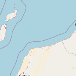
Map view of Gulf of Khnifiss National Park

Use this park location map to pinpoint Gulf of Khnifiss National Park in Western Sahara, understand its exact geographic position, and read its mapped placement within the surrounding landscape more clearly.

Pigeon | © OpenStreetMap contributors

Location context for Gulf of Khnifiss National Park

Western Sahara
Park atlas

Compare the unique coastal wetlands, Saharan landscapes, and diverse protected areas surrounding this Moroccan gem.

Explore Nearby National Parks and Protected Areas Beyond Gulf of Khnifiss National Park

Browse an curated list of national parks and significant protected areas located near Gulf of Khnifiss National Park, encompassing neighboring coastal regions, desert interfaces, and wetland conservation sites in Morocco. This geographic comparison allows for a deeper understanding of regional protected landscapes and their unique ecological characteristics across the North African Atlantic fringe.
Watercolor painting depicting mountains, a body of water, and vegetation
National parkLaâyoune-Sakia El Hamra
Mapped park locations coincide#1 closest

Khenifiss National Park: A Protected Landscape within Laâyoune-Sakia El Hamra Region

Explore its mapped protected area and regional geography.

Khenifiss National Park offers a distinct entry into protected landscape exploration within the Laâyoune-Sakia El Hamra region. This park detail page provides core geographic context, focusing on its mapped boundaries and its significance as a protected natural area. Dive into the structured data that defines Khenifiss National Park, facilitating a deeper atlas-based understanding of its landscape and regional distribution.

Area
1,850 km²
Established
2006
IUCN
II
Relief
Lowland
Protected landscapeCanarias
About 180 km away#2 closest

West

Parque rural de Betancuria: Protected Landscape, Fuerteventura, Canarias

A rugged volcanic and geological interior landscape

Investigate the topographical intensity of Parque rural de Betancuria, home to the Betancuria Massif and unique Basal Complex exposures. This protected landscape documents a long history of geological transformation and traditional human adaptation to the arid Fuerteventura environment.

Area
165.443 km²
Established
1987
Relief
Mountain
Climate
Arid
Watercolor painting of a landscape with grassy areas, a winding river, and mountains under a light sky
National parkCanary Islands
About 180 km away#3 closest

Northwest

Timanfaya National Park: Dramatic Volcanic Landscape in the Canary Islands

Explore Spain's unique geological national park.

Timanfaya National Park offers an extraordinary exploration of volcanic terrain, a protected area that defines geological conservation in the Canary Islands. Its landscape, shaped by powerful eruptions, features vast lava fields, striking volcanic cones, and visible geothermal activity. As Spain's only purely geological national park, Timanfaya provides a unique context for understanding volcanic processes and appreciating the raw beauty of its protected natural environment, serving as a key landmark within the archipelago's geography.

Area
51.07 km²
Established
1974
IUCN
II
Relief
Mountain
National parkMorocco
About 321 km away#4 closest

Northeast

Souss-Massa National Park: Moroccan Coastal Protected Landscape and Geographic Map

Explore vital protected areas and mapped natural terrain on the Atlantic coast.

Souss-Massa National Park is a critical national park situated along the Atlantic coast of Morocco. This protected landscape offers a unique atlas-style view of its diverse geography, including vital wetlands, sand dunes, and coastal steppe. Delve into the mapped boundaries and understand the park's ecological significance within Morocco's regional landscape context.

Area
338 km²
Established
1991
IUCN
II
Relief
Lowland
Protected landscapeCanarias
About 321 km away#5 closest

West

Parque rural de Doramas Protected Landscape: Gran Canaria Geographic and Terrain Atlas

Exploring laurel forest strongholds and rugged ravine geography.

Parque rural de Doramas encompasses over 3,500 hectares of diverse northern Gran Canaria terrain, where steep-sided barrancos support rare laurisilva and monteverde vegetation. This protected landscape serves as a living remnant of the island's once-vast indigenous forests, offering a unique opportunity to study the relationship between human-influenced agricultural slopes and wild, humid forest refuges found deep within the island's northern flanks.

Area
35.86 km²
Relief
Upland
Climate
Mediterranean
Scope
Terrestrial
Protected landscapeCanary Islands
About 323 km away#6 closest

West

Parque rural del Nublo: Volcanic Peaks and Protected Highland Terrain in Gran Canaria

Mapping the dramatic erosional landscapes and endemic ecosystems of central Gran Canaria.

Spanning the core of Gran Canaria, Parque rural del Nublo is a vast protected landscape characterized by its rugged volcanic topography. The area features the iconic Roque Nublo monolith, deeply incised barrancos, and a mosaic of pine forests and endemic scrubland. This territory represents a critical intersection of geological evolution and aboriginal history, containing major UNESCO-listed cultural sites within its complex highland boundaries.

Area
267.64 km²
Established
1994
IUCN
VI
Relief
Mountain
Protected landscapeCanarias
About 378 km away#7 closest

West

Parque rural de Anaga: Mapping the Volcanic Relief and Laurisilva Forests of Canarias

A detailed geographic overview of the Anaga massif protected landscape.

Parque rural de Anaga preserves a dramatic landscape of volcanic plugs, deeply incised valleys, and endemic-rich cloud forests in the Canary Islands. Understand the complex terrain and protected area boundaries that define this historic massif, from its coastal cliffs to its high mountain ridges.

Area
144.187 km²
Established
1994
Relief
Mountain
Climate
Subtropical
Watercolor illustration of a mountainous landscape with green and purple hues, featuring rolling hills, distant mountains, and a light sky.
National parkTenerife
About 410 km away#8 closest

West

Teide National Park: Spain's Highest Peak and Distinctive Volcanic Landscape

Explore protected volcanic terrain and mapped geography on Tenerife.

Teide National Park protects the highest point in Spain, Mount Teide, within a spectacular caldera and surrounding volcanic terrain on Tenerife. This national park offers a unique landscape for geographic discovery, showcasing dramatic lava flows, volcanic cones, and endemic flora. Its protected boundaries define a significant area of natural interest, making it a key landmark for atlas exploration of island geography and protected lands.

Area
189.9 km²
Established
1954
IUCN
II
Visitors
4.5M annual

Common questions about visiting, size, designation, and location context for Gulf of Khnifiss National Park

Gulf of Khnifiss National Park FAQs for park facts, access, geography, and protected area context

Find quick answers about Gulf of Khnifiss National Park, including protected-area facts, park geography, trail and visitor context, and how the park fits into its surrounding country and regional landscape.
MoriAtlas Explorer

Continue Your Protected Areas Search Across the Global Atlas

Deepen your exploration by continuing the structured search for national parks and protected areas worldwide. Utilize the comprehensive filtering capabilities to compare different conservation landscapes and refine your understanding of global park geography. Discover more about the distribution and characteristics of protected natural areas.

Global natural geography