Mori Atlas logo
National parkGwaii Haanas National Park Reserve and Haida Heritage Site

Discover the geographic boundaries and regional park context of this significant protected area.

Gwaii Haanas National Park Reserve and Haida Heritage Site: Protected Landscape Atlas

(Gwaii Haanas National Park Reserve, National Marine Conservation Area Reserve, and Haida Heritage Site)

Gwaii Haanas National Park Reserve and Haida Heritage Site stands as a protected national park entity within the Haida Gwaii archipelago. This page details its specific geographic location, mapped protected area boundaries, and its role within the natural landscape context. Explore the atlas view of this unique protected region, focusing on its distinct topographic and geographic features.

Temperate RainforestMarine ConservationIndigenous HeritageCoastal IslandsPacific NorthwestHaida Culture

Gwaii Haanas National Park Reserve and Haida Heritage Site

National park

Park overview

Structured park overview, official facts, and landscape profile for Gwaii Haanas National Park Reserve and Haida Heritage Site

Gwaii Haanas National Park Reserve and Haida Heritage Site park facts, protected area profile, and essential visitor context

Review the core facts for Gwaii Haanas National Park Reserve and Haida Heritage Site, including designation, size, terrain, visitor scale, habitats, and operating context in one park-focused overview.

About Gwaii Haanas National Park Reserve and Haida Heritage Site

Gwaii Haanas stands as a distinctive model of indigenous partnership in conservation, born from the Haida Nation's determined efforts to protect their ancestral territories from industrial logging in the 1970s and 1980s. The South Moresby movement, which sought to prevent logging on Burnaby Island, evolved into a broader campaign that culminated in the 1985 Haida Heritage Site designation and the 1987 South Moresby Memorandum of Understanding between Canada and British Columbia. The subsequent 1993 Gwaii Haanas Agreement formally established cooperative management, creating the Archipelago Management Board with equal representation from the Council of the Haida Nation and the Government of Canada. This partnership has enabled protection of both cultural heritage and ecological values, with the Haida concept of integration between land and sea reflected in the boundary-spanning protected area that includes both terrestrial and marine zones. The reserve remains in reserved status pending resolution of outstanding land claims, yet functions with full national park management principles.

Quick facts and research context for Gwaii Haanas National Park Reserve and Haida Heritage Site

Gwaii Haanas spans approximately 1,470 square kilometres of terrestrial land and includes a marine conservation area reserve of roughly 3,400 square kilometres, with nearly 5,000 square kilometres protected in total. The archipelago lies in Haida Gwaii, formerly known as the Queen Charlotte Islands, off the coast of British Columbia. The reserve was established in 1988 following decades of conservation advocacy that began in the 1970s. The landscape features deep fjords, rugged mountains exceeding 1,100 metres in elevation, over 40 freshwater lakes, and more than 100 salmon spawning streams, with roughly 90 percent forested and 9 percent alpine or sub-alpine tundra.

Protection and recognition

Tracking the terrestrial designation history and official conservation framework established in 1981.

Official Protection Status of Gwaii Haanas National Park Reserve and Haida Heritage Site

Geographers can examine the documented protection status and terrestrial boundaries established for Gwaii Haanas National Park Reserve and Haida Heritage Site. Analyzing documented designation years and regional frameworks helps researchers compare conservation efforts across isolated island networks and global databases.

Protection details

Protection scope
Terrestrial
Designated year
1981
Park context

Deeper park guide and search-rich context for Gwaii Haanas National Park Reserve and Haida Heritage Site

Gwaii Haanas National Park Reserve and Haida Heritage Site history, landscape, wildlife, and travel context

Explore Gwaii Haanas National Park Reserve and Haida Heritage Site through its history, landscape character, ecosystems, wildlife, conservation priorities, cultural context, and seasonal travel timing in a structured park guide built for atlas discovery and search intent.

Why Gwaii Haanas National Park Reserve and Haida Heritage Site stands out

Gwaii Haanas is best known for its unique position as a jointly managed Haida and Canadian protected area, its exceptional temperate rainforest ecosystems, and the UNESCO World Heritage Site of Ninstints on Anthony Island, which preserves the remains of a Haida village with standing totem poles and cedar longhouse foundations. The marine environment serves as a primary feeding habitat for humpback whales, while the terrestrial landscape supports the Haida Gwaii Watchmen Program that maintains cultural continuity at historic village sites. The area represents one of the world's few protected regions extending from mountain summits to the deep ocean.

Gwaii Haanas National Park Reserve and Haida Heritage Site history and protected-area timeline

The establishment of Gwaii Haanas emerged from intense conservation conflict during the 1970s and early 1980s when plans to expand logging operations to Burnaby Island sparked organized resistance. The Haida Nation responded in 1985 by designating the Haida Heritage Site, encompassing roughly the southern third of the archipelago and including both terrestrial and marine areas. Despite this designation, logging continued amid legal and political disputes until 1987 when the federal and provincial governments signed the South Moresby Memorandum of Understanding, halting operations. The 1988 South Moresby Agreement created the national park reserve, originally named South Moresby National Park Reserve but renamed in 1993 following the Gwaii Haanas Agreement between Canada and the Council of the Haida Nation. This accord expressed mutual respect for both Canadian and Haida designations and established the cooperative management framework that continues today.

Gwaii Haanas National Park Reserve and Haida Heritage Site landscape and geographic character

The physical landscape of Gwaii Haanas presents remarkable diversity across its 138 islands, ranging from deep fjords carving through rugged terrain to gentle salmon spawning streams and sub-alpine tundra zones. The San Christoval Range dominates the interior with peaks exceeding 1,100 metres, from which water drains to fill over 40 freshwater lakes before flowing through more than 100 salmon-spawning streams to the ocean. Approximately 90 percent of the terrestrial area is forested, while roughly 9 percent comprises alpine and sub-alpine tundra, with the remaining one percent consisting of lakes and wetlands. Hotspring Island, known as G̱andll K'in Gwaayaay in the Haida language, adds geological interest with its natural hot spring. The coastal environment transitions from the wind-battered, boggy western shores receiving over 4,000 millimetres of annual rainfall to the more sheltered eastern leeward coast.

Gwaii Haanas National Park Reserve and Haida Heritage Site ecosystems, habitats, and plant life

The ecological character of Gwaii Haanas is defined by coastal temperate rainforest, one of the rarest forest types on Earth. The western coast forests, shaped by extreme wind and rain exposure, feature stunted western red cedar and hemlock in boggy conditions. The leeward eastern slopes support classic coastal temperate rainforest with towering western hemlock, Sitka spruce, and western red cedar forming the dominant overstory. The marine environment maintains intimate connection to terrestrial systems in Haida worldview, with the marine conservation area reserve protecting critical habitats including primary feeding areas for North Pacific humpback whales. The marine ecosystem once featured sea otters that maintained balance by controlling sea urchin populations, and their historical extirpation during the Maritime Fur Trade led to unbalanced sea urchin overpopulation threatening kelp forest health.

Gwaii Haanas National Park Reserve and Haida Heritage Site wildlife and species highlights

The islands support distinct evolved flora and fauna that often differ from mainland species due to thousands of years of isolation. Many continental species are absent, while others have evolved into unique subspecies, such as the Haida black bear, which is larger than its mainland relative. Introduced species including Sitka deer, ermine, raccoon, squirrel, and beaver now exist in large numbers, impacting native ecosystems. An estimated 750,000 seabirds nest along Gwaii Haanas shorelines from May through August, with burrow-nesting species such as rhinoceros auklets, ancient murrelets, and tufted puffins particularly prominent. Bald eagles commonly nest along the coastline, and the islands' position along the Pacific Flyway provides critical migration habitat for dozens of bird species during spring and autumn.

Gwaii Haanas National Park Reserve and Haida Heritage Site conservation status and protection priorities

Gwaii Haanas represents a landmark in conservation for its integrated land-to-sea protection approach and its pioneering cooperative management model between indigenous nations and federal government. The designation of the National Marine Conservation Area Reserve in 2010 extended protection to 3,400 square kilometres of marine habitat, creating one of the only places worldwide where a representative area is protected from mountain top to ocean depth. The site holds UNESCO World Heritage status for the Ninstints cultural landscape and has been nominated for potential future World Heritage inscription representing the entire Gwaii Haanas area. The cooperative management through the Archipelago Management Board demonstrates how conservation outcomes can be enhanced through indigenous partnership and recognition of traditional knowledge systems.

Gwaii Haanas National Park Reserve and Haida Heritage Site cultural meaning and human context

Gwaii Haanas lies within the territory of the Haida people, whose oral histories describe presence in the islands since the first trees arrived at Xaagyah Gwaay.yaay (Bolkus Islands) as glaciers retreated, supported by pollen evidence indicating tree arrival approximately 14,500 years ago. The Haida Heritage Site designation recognizes ongoing cultural connections, with Haida people maintaining a continuing presence at SG̱ang Gwaay and four other village sites from May through September through the Haida Gwaii Watchmen Program. Ninstints (Nan Sdins or SG̱ang Gwaay Llnaagay) on Anthony Island preserves the remarkable remains of a traditional Northwest Coast First Nations village, designated as both a UNESCO World Heritage Site and a National Historic Site of Canada in 1981. Other historic villages within the boundaries include Cumshewa, Clew (Tanu), and Djí-gua.

Top sights and standout views in Gwaii Haanas National Park Reserve and Haida Heritage Site

The UNESCO World Heritage Site of Ninstints preserving Haida village ruins and totem poles represents the pinnacle of cultural heritage, while the cooperative management model demonstrates indigenous-led conservation. The temperate rainforest ecosystem, primary humpback whale feeding habitat, and the unique mountain-to-ocean protection spanning nearly 5,000 square kilometres make this a globally significant protected area. Hotspring Island offers geological interest, and the Haida Gwaii Watchmen Program maintains living cultural connections at historic village sites. The landscape diversity from fjords to sub-alpine zones, combined with the integration of marine and terrestrial protection, creates an exceptional conservation model.

Best time to visit Gwaii Haanas National Park Reserve and Haida Heritage Site

The optimal season for visiting Gwaii Haanas runs from May through September when Haida Watchmen are present at village sites and weather conditions are most favorable for marine access. The summer months offer the warmest temperatures and longest daylight hours for exploring the archipelago by kayak or boat. However, visitors should expect variable weather and should prepare for the characteristic west coast conditions. The spring and fall shoulder seasons may offer fewer visitors but also potentially less predictable conditions. All visitors must attend a mandatory orientation before entering the reserve due to its remote character and ecological sensitivity.

Park guides

Targeted answers for exploring seasonal timing, weather conditions, and marine access

Gwaii Haanas National Park Reserve and Haida Heritage Site Focused Guide Preview

Focused reference resources help visitors navigate specific planning questions across the archipelago. Published guides examine seasonal timing factors and summer marine conditions for the protected reserve.
Monthly climate preview

Exploring the long term monthly temperature and precipitation patterns of Haida Gwaii

Weather by Month and Climate Normals for Gwaii Haanas National Park Reserve

Long term climatology from a representative park coordinate reveals a temperate maritime rhythm where average temperatures peak in August near 14.81 degrees Celsius and daily precipitation rises in November. Accessing the complete monthly profile provides detailed minimum and maximum temperature comparisons alongside comprehensive wetness intervals across the seasonal cycle.
Annual mean9 °C
6 °C15 °C
Jan
Feb
Mar
Apr
May
Jun12°
Jul14°
Aug15°
Sep13°
Oct11°
Nov
Dec
Warmest month
August

14.8 °C

Coolest month
February

5.8 °C

Wettest month
November

7.3 mm/day

Driest month
July

2.2 mm/day

Park location guide

Geography guide, regional context, and park location map for Gwaii Haanas National Park Reserve and Haida Heritage Site

Gwaii Haanas National Park Reserve and Haida Heritage Site park geography, regions, and map view in Canada

Understand where Gwaii Haanas National Park Reserve and Haida Heritage Site sits in Canada through a broader geographic reading of the surrounding landscape, nearby location context, and its mapped position within the national park landscape.

How Gwaii Haanas National Park Reserve and Haida Heritage Site fits into Canada

Canada is a federal parliamentary constitutional monarchy spanning North America from the Atlantic to the Pacific and Arctic Oceans. With a population of over 41 million, it is officially bilingual in English and French at the federal level. The country gained independence from the United Kingdom through a gradual process culminating in 1982.

Wider geography shaping Gwaii Haanas National Park Reserve and Haida Heritage Site in Canada

Canada occupies the northern portion of North America, sharing its longest international border with the United States. The country extends from the Atlantic Ocean to the Pacific Ocean and northward into the Arctic Ocean, giving it the longest coastline of any nation.

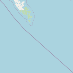
Map view of Gwaii Haanas National Park Reserve and Haida Heritage Site

Use this park location map to pinpoint Gwaii Haanas National Park Reserve and Haida Heritage Site in Canada, understand its exact geographic position, and read its mapped placement within the surrounding landscape more clearly.

Pigeon | © OpenStreetMap contributors

Location context for Gwaii Haanas National Park Reserve and Haida Heritage Site

British ColumbiaHaida Gwaii
Natural feature types

Browse the Natural Landscape Features of Gwaii Haanas National Park Reserve and Haida Heritage Site

Investigate the specific topographic and aquatic features that shape the environment of Gwaii Haanas National Park Reserve and Haida Heritage Site. MoriAtlas organizes these landmarks to assist in deeper geographic discovery of this protected archipelago's mountain, forest, and marine terrain.
Recorded earthquake history

Explore Historical Earthquake Records for Gwaii Haanas National Park Reserve

Review recorded seismic activity associated with the landscapes of Gwaii Haanas National Park Reserve and Haida Heritage Site. This catalogue provides accessible historical data, including event magnitude and epicentre proximity, to support informed geographic exploration of the region through MoriAtlas.

Gwaii Haanas Earthquake History

Catalogued events

268 events

Strongest magnitude

Magnitude 7.8

Most recent event

Mar 25, 2026

This history includes earthquakes recorded inside the park or within 50 km of its borders

Park atlas

Trace the regional park geography of British Columbia and the Pacific Northwest, comparing coastal islands, temperate rainforests, and marine protected areas.

Discover Other National Parks and Protected Areas Near Gwaii Haanas National Park Reserve and Haida Heritage Site

After exploring Gwaii Haanas National Park Reserve and Haida Heritage Site, delve into a broader collection of national parks and protected areas across the Pacific Northwest, including other coastal islands and temperate rainforest regions. This geographic overview allows you to compare diverse conservation landscapes, map regional protected-area spread, and understand the varied ecosystems of British Columbia.
Protected landscapeBritish Columbia
76 km away#1 closest

Northwest

Duu Guusd Heritage Site/Conservancy: Coastal Geography and Protected Land Map

A unified land and sea protected landscape in Haida Gwaii, British Columbia

Spanning over 227,000 hectares, Duu Guusd Heritage Site/Conservancy creates a massive protected corridor along the Pacific coast of British Columbia. This area links terrestrial forest ecosystems with marine waters, preserving complex island landscapes and significant Haida cultural sites throughout the northwestern corner of Graham Island.

Area
2,277.12 km²
Established
2008
IUCN
II
Relief
Mixed relief
State or regional parkBritish Columbia
About 158 km away#2 closest

Northeast

Klewnuggit Inlet Marine Provincial Park: Regional Geography and Protected Area Mapping

Coastal inlet, freshwater lakes, and northern forest ecosystems.

Klewnuggit Inlet Marine Provincial Park showcases the dramatic meeting of mountain, forest, and sea. Spanning from the sheltered waters of the Grenville Channel to inland freshwater systems, the park offers a detailed study of northern coastal geography, fjord-like marine channels, and diverse bird and marine wildlife habitats.

Area
18 km²
Established
1993
IUCN
II
Relief
Mixed relief
Marine protected areaBritish Columbia
About 176 km away#3 closest

North

Kitson Island Marine Provincial Park Map and Coastal Protected Area Atlas

Protected island and estuarine landscape in British Columbia

Kitson Island Marine Provincial Park encompasses a vital coastal island and the adjacent Flora Bank at the mouth of the Skeena River. This protected marine environment provides a rare example of accessible sandy beach terrain on the North Coast. Use this atlas resource to understand the park boundaries, island geography, and estuarine interface within the broader Inside Passage conservation network.

Area
0.45 km²
Established
1993
IUCN
II
Relief
Lowland
State or regional parkBritish Columbia
About 186 km away#4 closest

Northeast

Diana Lake Provincial Park: Mapping Coastal Rainforest and Wetland Geography in British Columbia

An examination of North Coast forest and freshwater ecosystems

Diana Lake Provincial Park represents a significant protected area in British Columbia, showcasing the diverse ecological character of the North Coast. The park boundary encompasses a mosaic of old-growth rainforest, open blanket bogs, and freshwater aquatic systems. By protecting these varied terrains, the region maintains vital habitats for Pacific salmon species while providing a structured landscape for understanding the wet maritime environment of the Pacific Northwest.

Area
2.33 km²
Established
1980
IUCN
II
Relief
Upland
Nature reserveBritish Columbia
About 189 km away#5 closest

Northeast

Gamble Creek Ecological Reserve: Protected Nature Reserve Geography and Forest Map

British Columbia North Coast forest and peatland research landscape.

Situated on the North Coast of British Columbia, Gamble Creek Ecological Reserve is a designated nature reserve comprising forest and bog ecosystems. The protected area serves as an important site for studying plant communities, including sphagnum moss and coastal bog species, within a unique altitudinal transition between coastal hemlock and subalpine zones.

Area
10.26 km²
Established
1991
IUCN
Ia
Relief
Mixed relief
Protected areaBritish Columbia
About 192 km away#6 closest

East

Hakai Lúxvbálís Conservancy: Protected Coastal Landscapes and Geography in British Columbia

Coastal wilderness, island terrain, and marine foreshore habitats

Spanning over 51,000 hectares of upland, Hakai Lúxvbálís Conservancy is defined by its connection between forested island ridges and the Pacific marine environment. This protected area on the British Columbia Central Coast offers a deep look into temperate rainforest geography and indigenous-led conservation frameworks that prioritize ecosystem integrity across island and sea.

Area
1,229.98 km²
Established
2008
IUCN
II
Relief
Lowland
Protected areaBritish Columbia
About 215 km away#7 closest

East

Fiordland Conservancy Protected Area: Mapping British Columbia's Glacial Fjord Coastline

A remote coastal wilderness in the Kitimat Ranges

Fiordland Conservancy guards an important stretch of the central British Columbia coast, where the steep, forested slopes of the Kitimat Ranges meet deep marine inlets. Known for its role in protecting the province's fjord environments, the area consists of an undeveloped, roadless landscape accessible only by sea, showcasing a dramatic transition from tidal shorelines to high mountain peaks.

Area
768.25 km²
Established
1987
IUCN
Ib
Relief
Mountain
Protected areaBritish Columbia
217 km away#8 closest

East

Kitlope Heritage Conservancy: Coastal Temperate Rainforest and Mountain Watersheds

A vast protected area in the Kitimat-Stikine region of British Columbia

Spanning from the Gardner Canal to glaciated inland summits, the Kitlope Heritage Conservancy protects an entire, undisturbed watershed. It is defined by its transition from saltwater fjords through ancient, salmon-bearing river valleys to high granite peaks, acting as a vital benchmark for coastal ecosystem integrity in the Pacific Northwest.

Area
3,220.2 km²
Established
1996
IUCN
Ib
Relief
Mountain

Common questions about visiting, size, designation, and location context for Gwaii Haanas National Park Reserve and Haida Heritage Site

Gwaii Haanas National Park Reserve and Haida Heritage Site FAQs for park facts, access, geography, and protected area context

Find quick answers about Gwaii Haanas National Park Reserve and Haida Heritage Site, including protected-area facts, park geography, trail and visitor context, and how the park fits into its surrounding country and regional landscape.
MoriAtlas Explorer

Continue Your Protected Areas Search Across the Global Atlas

Deepen your exploration by continuing the structured search for national parks and protected areas worldwide. Utilize the comprehensive filtering capabilities to compare different conservation landscapes and refine your understanding of global park geography. Discover more about the distribution and characteristics of protected natural areas.

Global natural geography