
Visitor Planning
When to Visit Haleakalā National Park: The Essential Timing Overview
Determining the best time to visit Haleakalā National Park is not a matter of finding a single perfect month, but rather aligning your itinerary with the extreme climatic variations inherent to the park’s geography. Because the park spans from sea level in the coastal Kipahulu district to the volcanic summit reaching over 3,000 meters, visitors essentially experience two distinct climate zones simultaneously. The principal trade-off for any traveller involves deciding between the high-altitude, cool, and often arid crater landscape versus the humid, lush, and rain-prone tropical environment of the coast.
The Summit and Crater Paradox
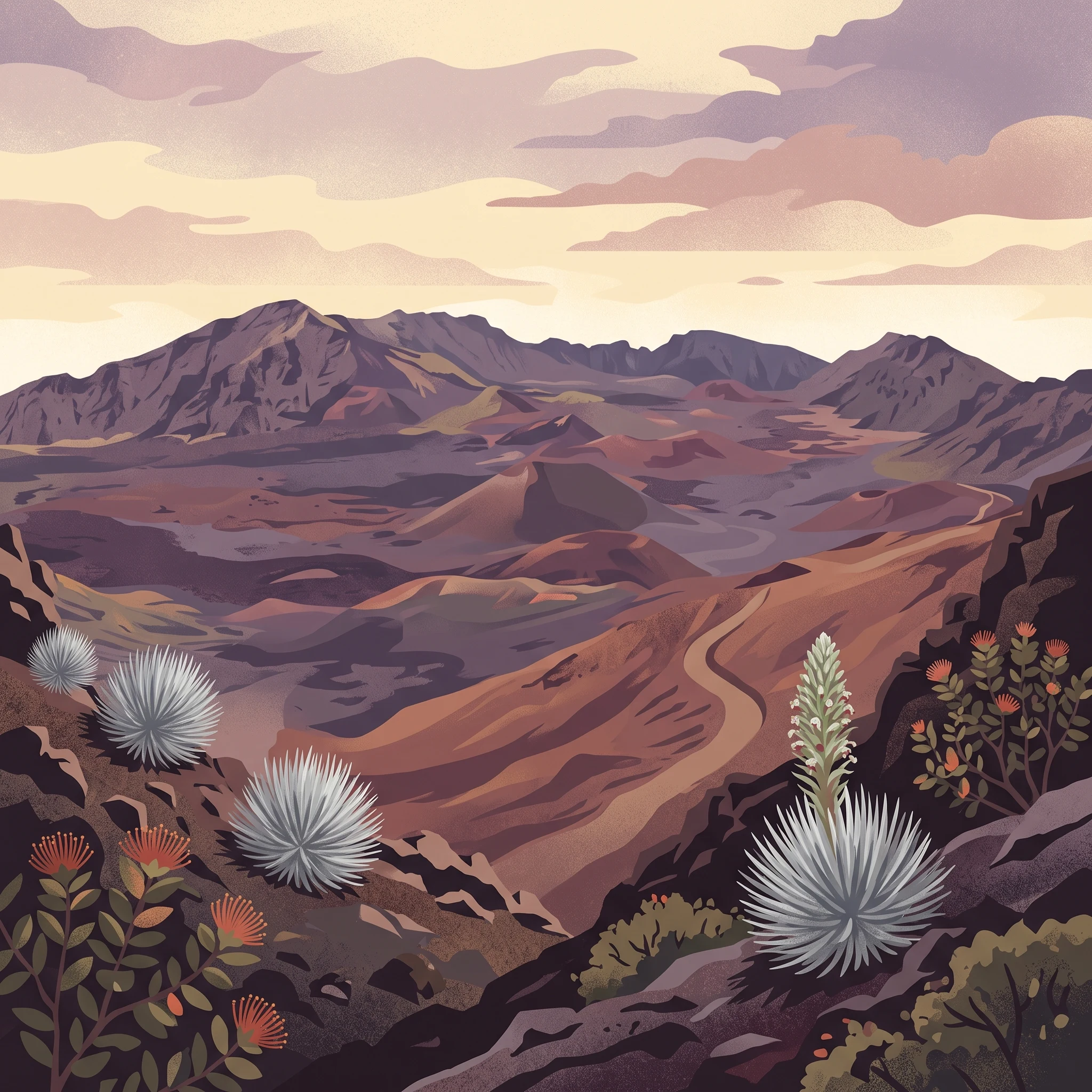
For those drawn to the volcanic crater, the summit’s elevation dictates the planning strategy. The air at the summit is significantly thinner and colder than at the island's coastal resorts, with temperatures frequently dropping near or below freezing at night. This high-altitude environment is defined by intense solar radiation during the day and rapid, unpredictable weather shifts. If your goal is to descend into the crater for hiking or to observe the sunrise from the rim, you must prepare for conditions that remain consistently cool year-round. While rainfall is lower at the summit than in the Kipahulu rainforest, wind chill and heavy cloud cover can dramatically alter the perceived temperature, making the mountain environment feel much harsher than the island's tropical baseline.
Understanding the Coastal Humidity
In stark contrast to the volcanic summit, the Kipahulu district is governed by windward tropical patterns. This area remains warm and humid throughout the year, with daytime averages consistently ranging between 21 and 27 degrees Celsius. However, this warmth comes with the reality of frequent, often heavy, rainfall. Because Kipahulu is positioned on the windward side of the mountain, it receives significant moisture that sustains its waterfalls and pools. Travellers hoping to swim in the natural freshwater basins must account for the fact that rain is a constant factor here. Unlike the summit where visibility is the primary concern for stargazing, the main constraint in Kipahulu is water safety, as sudden flash floods can occur after inland rainfall, even if the immediate area feels bright and sunny.
Balancing Seasonal Priorities
When planning your visit, the interaction between these elevation-based factors should drive your decision-making. If you prioritize crater exploration, focus on months where the probability of clear, stable air is highest to maximize visibility for the silversword sightings and star-gazing sessions. If you prioritize the coastal waterfalls and pools, your focus should shift toward managing expectations around tropical humidity and potential stream closures due to rain. Rather than seeking a universally ideal time, recognize that your experience will be defined by how you prepare for these two extremes. The most successful visits involve flexible planning that acknowledges the rapid weather changes common to both the high-altitude volcanic rim and the low-lying tropical coast.
Seasonal Planning
Best Months to Visit Haleakalā National Park by Visitor Priority
Balancing Summit Clarity and Coastal Comfort
Choosing the best time to visit requires balancing two distinct climate regimes within the same park. The high-altitude summit, reaching over 10,000 feet, experiences vastly different conditions than the lush, sea-level Kipahulu district. Because the summit lies above the tropical inversion layer, visibility and precipitation patterns differ significantly from the windward coast. Travellers looking for the best stargazing and sunrise conditions should prioritize the drier months, while those focused on coastal hiking and swimming in the Kipahulu pools benefit from periods when tradewinds are less volatile, though moisture remains a consistent factor there.
Peak Windows for Summit Visibility
The most consistent window for clear, dry summit conditions typically falls between late spring and early autumn. Specifically, from May through September, the mountain experiences lower average daily precipitation compared to the winter months. These months offer the most reliable opportunities for stargazing, as the air remains thinner and drier, minimizing the cloud cover that frequently obscures the crater rim. While temperatures at the summit remain cool regardless of the season, the reduction in rainfall during this period makes long-distance hiking on the Sliding Sands or Halemau u trails more predictable. Travellers visiting during these months should still anticipate rapid weather shifts, as cold temperatures and high-altitude radiation are constant factors regardless of the date on the calendar.
Timing for Tropical Coastal Access
For visitors primarily interested in the coastal Kipahulu region, the seasonal rhythm is dictated more by tradewinds and rainfall frequency than by extreme temperature shifts. While the coast remains warm year-round, with average daytime highs consistently between 25 and 27 degrees Celsius, the risk of flash flooding in the 'Ohe'o gulch increases during the wetter winter months. Planning a visit between April and June can offer a favorable compromise, as these months often feature slightly more stable weather patterns before the height of summer. Because Kipahulu is windward and receives heavy annual rainfall, there is no truly dry season, but minimizing the risk of high-water closures helps ensure better access to the coastal trails and swimming basins. Regardless of the month, verify current conditions with park authorities, as local flash flood risks can emerge quickly even when island-wide weather appears mild.
Annual Climate Overview
Haleakalā National Park Weather and Climate by Month
Understanding the climate within Haleakalā National Park requires looking beyond a single regional average. Because the park encompasses such a drastic range of elevations, from the sea-level Kipahulu coast to the 3,055-meter summit, weather patterns act independently across its geography. Visitors should note that long-term climate normals, such as those recorded over the past thirty years, provide a baseline for what to expect but do not function as daily weather forecasts.
Annual Temperature Trends and Seasonal Stability
Throughout the year, temperatures in lower-elevation coastal regions remain remarkably consistent. Monthly mean temperatures typically hover between 22 and 25 degrees Celsius. The warmest period generally occurs between July and September, where average maximums reach their annual peaks. Conversely, the cooler months of January and February see the lowest mean temperatures. While these values indicate a comfortable, tropical baseline for the coastal Kipahulu district, they do not account for the significant cooling effect of the mountain’s altitude. As one ascends toward the crater rim, the air temperature drops consistently, often creating a difference of 15 to 17 degrees Celsius compared to the coast. Regardless of the month, the summit environment is governed by these lower temperatures, making it essential to prepare for much cooler conditions than the coastal averages suggest.
Precipitation Patterns and Wind Influence
Rainfall distribution across the park is heavily influenced by the mountain’s position on the windward side of Maui. The data indicates that while rainfall is present year-round, the distribution is not perfectly uniform. Drier periods are observed in the spring and early summer, particularly from April through July, where daily precipitation averages stay at the lower end of the annual spectrum. These months often provide the most stable windows for outdoor activities that require dry conditions. In contrast, late autumn and winter months, particularly from November through March, generally experience higher frequency and volume of precipitation.
Wind serves as another critical climate component. The recorded wind normals show a steady presence, with higher speeds often coinciding with the transition into the summer months. Peak wind averages occur from June through August, which can significantly impact the perceived temperature at the summit. When high winds combine with the damp conditions common at high altitudes, the wind chill factor can make even moderate temperatures feel uncomfortably cold.
Daylight Variability and Solar Exposure
Daylight duration follows a predictable annual arc, though the variance is relatively narrow due to the park’s tropical latitude. The shortest days occur in December, providing approximately 10.7 hours of light, while the longest days appear in June with over 13 hours of daylight. This shift is most relevant for visitors planning long backcountry hikes or those aiming to time their arrival for specific sunrise or sunset viewings. Intense solar radiation is a constant factor in the high-elevation zones, even when temperatures remain low. Because the summit sits above the tropical inversion layer, the lack of cloud cover and the high elevation mean that UV exposure remains high throughout the year, regardless of the month or the time of day.
Seasonal dynamics
Understanding Seasonal Weather Patterns at Haleakalā National Park
Defining the Two Climatic Cycles of Haleakalā
While popular travel planning often defaults to a four-season model, Haleakalā National Park functions on a more binary rhythm defined by moisture patterns and trade wind intensity. Travelers should view the year not through the lens of spring or autumn, but as a transition between a drier, more stable window and a more humid, rain-prone cycle. This distinction is critical because the park's massive verticality means that lower coastal areas and high-altitude summit zones react differently to these larger cycles.
The Dry-Dominant Phase: May through September
From late spring through the end of summer, the park experiences its most consistent weather conditions. This period is characterized by lower daily precipitation averages and a tendency for the trade winds to remain relatively steady, which helps maintain clearer skies above the tropical inversion layer at the summit. During these months, the average daily maximum temperatures across the lower elevations climb to their annual peak, typically reaching the high 20s in degrees Celsius.
For visitors, this phase offers the greatest predictability for crater access and stargazing, as the statistical probability of afternoon cloud cover or summit-level precipitation is at its lowest for the year. The humidity remains somewhat steady compared to the winter months, providing a more comfortable experience for extended hiking along the Sliding Sands or Halemau'u trails. However, because this is the driest window, it is also when the landscape may appear the most arid at high elevations.
The Humid Transition: October through April
As the calendar shifts into late autumn and progresses through winter, the park enters a phase marked by increased atmospheric moisture and a higher frequency of windward precipitation. This is particularly noticeable in the Kipahulu district, where the combination of trade winds and topography frequently results in heavy localized rainfall. While the summit temperatures remain consistently cool to cold regardless of the season, the surrounding environment during these months can become significantly more saturated, and the cloud ceiling often drops lower, occasionally enveloping the crater in thick mist.
It is important to note that this period does not mean constant rain, but rather an increase in variability. Sudden shifts from sunshine to heavy downpours are more common during this phase. The lower daylight hours in December and January also compress the time available for safe exploration in the backcountry, making early starts essential for anyone planning a long day hike in the wilderness area.
Navigating the Shoulder Periods
Conditions rarely flip between these two phases on a specific date. April and May represent a vital transition period where the wetter winter patterns begin to wane, and the more stable, drier summer weather takes hold. Similarly, October serves as a bridge, where the peak heat of summer begins to dissipate, and the increased likelihood of seasonal storms starts to emerge. Travelers should expect these transitional months to be the most unpredictable, as they may encounter either the tail end of winter moisture or the early onset of summer stability. During these times, checking official park alerts for trail conditions is essential, as saturated ground from the preceding months can impact trail stability and accessibility even as the skies begin to clear.
Seasonal Experiences
Seasonal Changes in Haleakalā National Park Activities and Landscapes
Hiking the Crater Floor and Wilderness Landscapes
The interior of the Haleakalā crater, a vast erosional basin of cinder cones and rugged desert-like terrain, demands consistent environmental conditions for a safe experience. High-altitude walking, particularly along the Sliding Sands or Halemauu trails, is most reliably pursued when cloud cover and precipitation are at their lowest annual points. During the drier months, roughly spanning May through September, the landscape is often clearer, allowing hikers to better navigate the stark, volcanic vistas without the obscuring effects of frequent summit-level clouds or the mud that can collect in the lower sections of the wilderness area. While these months offer increased visibility, the intensity of the sun at nearly 10,000 feet of elevation remains a significant consideration. Hikers should anticipate that these drier periods provide the most stable ground for navigating the loose volcanic substrate, which can become increasingly difficult to traverse during periods of high moisture.
Coastal Exploration and Water Features in Kipahulu
The Kipahulu district, located at sea level along the windward coast of Maui, operates under a different environmental rhythm compared to the summit. Access to swimming in the lower freshwater pools, such as the Oheo Gulch, is fundamentally tied to the unpredictability of stream flow. Although no month is entirely without the possibility of rain in this tropical region, the late spring and summer months often see a relative dip in precipitation compared to the winter months, which can see more frequent storm systems impacting the windward slopes. Because flash flooding remains an inherent risk regardless of the calendar month, visitors should view drier windows as times of reduced risk, but never as an invitation to disregard local warnings or ranger guidance. The lush, tropical vegetation of the Pipiwai Trail is a constant, but the experience of walking through this cloud forest is often more comfortable when humidity levels are slightly lower, such as in the mid-year window.
Stargazing and Nighttime Observations
The summit is renowned for its position above the tropical inversion layer, providing a window into the night sky that is relatively stable throughout the year. The most reliable conditions for stargazing occur when clear skies prevail, a state most commonly associated with the dry-dominant phase of the annual climate. During the winter months, increased wind speeds at the summit,often reaching their peak in the first quarter of the year,can create more turbulent viewing conditions and greater discomfort for those standing on the rim for extended periods. Visitors prioritizing celestial observations often look to the months between June and September to minimize the chance of thick cloud decks lingering over the crater rim, although even in these months, the mountain environment remains dynamic and capable of shifting rapidly.
Visitor Priorities
Choosing the Best Time to Visit Haleakalā National Park by Interest
Planning for Summit Hiking and Stargazing
If your primary motivation for visiting is traversing the volcanic interior or observing the night sky, you should target the window from May through September. During these months, the park experiences its lowest precipitation averages, typically ranging between 1.01 and 1.3 millimeters per day, which significantly increases the likelihood of clear, cloud-free conditions above the inversion layer. The stable, drier weather pattern during this period minimizes the risk of sudden summit closures due to extreme weather or heavy fog, allowing for safer and more reliable navigation on the Sliding Sands or Halemauu trails. Stargazing remains most productive during this phase, as the lack of sustained cloud cover provides the best window to witness the exceptional clarity for which the summit is known. The compromise for choosing this period is higher wind speeds, which can average around 7.4 meters per second in the summer months. Visitors should be prepared for intense solar exposure and rapid temperature drops once the sun dips below the horizon, regardless of the relative dryness.
Accessing the Kipahulu Coast and Waterfalls
Visitors prioritizing the lush Kipahulu district and its iconic swimming holes should look toward the shoulder months of April to June. While the entire island of Maui remains tropical, this period often sees a moderation in the frequency of intense, sustained storm fronts that can turn the 'Ohe'o Gulch streams into significant hazards. Although Kipahulu is naturally humid and prone to rain throughout the year, the late spring window offers a balance where ground saturation levels may be slightly lower compared to the height of the winter rainy season. The essential trade-off here is predictability. Even in the relatively drier months, the windward coast of the island can experience sudden, localized downpours. Regardless of when you visit, you must treat the Kipahulu stream conditions as unpredictable. The risk of flash floods remains present year-round, and the difficulty of navigating these areas often hinges more on daily rainfall fluctuations than on broad seasonal trends.
Maximizing Daylight for Extended Exploration
For travelers who want the longest possible days to explore both the summit rim and the coastal areas, the months of June and July offer the maximum daylight, peaking at over 13 hours. This duration is particularly beneficial for those hoping to combine a sunrise visit at the summit with a drive to the Kipahulu district. Attempting to bridge both sections of the park in a single day is logistically taxing, and the extended light provides a wider margin for error when navigating the complex road networks involved. The primary compromise for this extended daylight is the increased crowd activity at popular viewpoints. Because these months align with broader summer travel patterns, popular parking areas at the summit and trailheads often reach capacity earlier in the morning, requiring visitors to secure reservations well in advance and plan for early, pre-dawn arrivals to maintain their desired itinerary.
Access and Logistics
Seasonal Access Considerations for Haleakalā National Park
Navigating Park Operations and Access
While climate patterns provide a useful framework for planning when to travel, the actual day-to-day accessibility of the park is managed through specific operational protocols. Visitors should be aware that the park encompasses two physically separate districts, each with its own access requirements. The summit area, rising above 9,000 feet, is reached via a winding mountain road, while the coastal Kipahulu District is accessed via a different route along the eastern shore. Because these areas are separated by several hours of driving, your itinerary must account for travel time between these distinct landscapes.
Official Status and Alerts
Access to specific trails, roads, and facilities can change rapidly due to severe weather events, maintenance, or park management decisions. While historical trends suggest drier conditions during the mid-year months, this does not guarantee open roads or accessible facilities. Always verify the current status of the park entrance, road closures, and trail conditions through the official National Park Service website before starting your drive. This is especially important for the summit road, which may be impacted by high winds or visibility issues even when lower elevations appear clear.
Visitor Center Availability
There are three visitor centers across the park: the Haleakalā Visitor Center at the summit, the Headquarters Visitor Center along the entrance road, and the Kipahulu Visitor Center on the coast. These facilities typically operate on a daily schedule, but their status is subject to staff availability and seasonal operating adjustments. Restrooms are generally maintained 24 hours per day at these locations, though they may experience temporary closures during severe weather or maintenance windows. Check current operating hours on the park website to ensure you have access to information and sanitary facilities during your visit.
Requirements for Entry
Entrance to the park requires a recreational use pass, which is valid for seven consecutive days. This pass allows for unlimited re-entry during your visit, which can be useful if you plan to split your time between the summit and the coast over several days. Fees vary based on the method of transport, with separate rates for individuals, motorcycles, and private vehicles. Some visitors may find the regional annual pass a more cost-effective option if they intend to visit other national parks in the Hawaiian Islands during the same calendar year. Be prepared to present your pass or digital confirmation upon entry at the toll booths.
Safety and Preparation
Seasonal Weather and Safety Preparation for Haleakala National Park
Navigating Elevation and Temperature Fluctuations
The most critical aspect of seasonal preparation at Haleakalā involves managing the sharp transition between the park's coastal district and its high-altitude summit. While coastal Kipahulu remains consistently tropical, the summit frequently experiences temperatures significantly lower than those at sea level. Visitors often arrive from warmer island elevations wearing light clothing, only to find the summit environment requires layers designed for cool, wind-exposed conditions. Regardless of the time of year, packing for multiple climates is essential, as the cooling effect of elevation is a year-round constant. Check official weather reports for the summit area specifically, as coastal forecasts will not reflect the conditions you encounter at the volcano rim.
Preparing for Summit Wind and Daylight
The summit's environment is defined by its position above the tropical inversion layer, which makes it prone to persistent wind and high-intensity sunlight. During the drier, calmer months, the primary challenge is intense sun exposure, while the windier periods can exacerbate the feeling of cold. Visitors planning sunrise or stargazing sessions should prepare for low-light conditions and temperatures that may feel much colder due to wind chill. Because daylight length varies throughout the year, adjust your arrival time for stargazing or sunrise based on the specific month of your visit to ensure you have adequate time for parking and transit. Always verify the current status of park access roads and sunrise reservation requirements before finalizing your itinerary, as these operational details are subject to change regardless of the season.
Safety Considerations for Coastal and Crater Environments
Safety in the Kipahulu district requires a different set of preparations than the summit. Unlike the arid volcanic crater, this lower-elevation area is characterized by tropical humidity and frequent localized rain. This environment requires effective moisture management and protection against insects. Because flash flooding can occur in stream-fed areas, visitors should prioritize current safety information provided by park staff at the visitor centers. Never enter water or venture into flood-prone zones without confirming current conditions. In the crater interior, where help is distant, self-sufficiency is the primary safety strategy. Always inform a trusted contact of your planned route and expected return time when entering the wilderness area. If you possess health concerns regarding elevation, particularly involving heart or respiratory conditions, consult with a medical professional prior to your trip. When in the park, monitor your physical response to the altitude and be prepared to adjust your activity level or turn back if you experience symptoms.
Final Planning Decisions
Selecting the Best Time for Your Haleakalā National Park Visit
Finalizing your visit date to Haleakalā National Park relies on weighing your tolerance for climatic extremes against the specific experiences you hope to capture. The park presents two distinct environments, the high-altitude summit and the lush, tropical Kipahulu coast, which often operate under different weather regimes on the same calendar day. Decisions for your travel dates should prioritize which of these two zones anchors your itinerary.
Aligning Personal Goals with Climate Realities
If your primary objective is stargazing or crater hiking, the drier, more stable conditions typically found between May and September offer the most reliable windows for success. During these months, the reduction in rainfall and potential for clearer nights over the summit rim significantly enhance visibility for astronomy. However, these months can also coincide with higher visitation, meaning your preference for quiet trails must be balanced against the likelihood of more predictable weather. If you prioritize the Kipahulu coastal experience, the focus shifts toward managing the risk of sudden precipitation. While the coast remains warm year-round, visiting outside the rain-heavy transition periods can minimize the likelihood of closure for the Oheo pools and trails. Choosing to visit in the shoulder months or during the dryer mid-year phase provides a better chance of consistent access to these water features, though you must always maintain flexibility for localized weather shifts.
Practical Decision Framework
Rather than seeking a single ideal month for the entire park, focus on your activity hierarchy. If crater exploration is your priority, aim for the window from May to September to leverage the lower precipitation normals and higher probability of clear summit skies. If your trip centers on the Kipahulu district, prioritize the more stable months to reduce, though not eliminate, the risk of flash flooding. Regardless of your chosen dates, accept that the environment at the summit remains unpredictable, with significant temperature drops and wind chill that can occur even in the warmest months. Finalize your plans by acknowledging that the best time to visit is the one that aligns with your interest in either the arid, high-altitude volcanic landscape or the humid, tropical coastal rainforest. Always verify current operating status, road accessibility, and safety alerts directly through official sources before finalizing your itinerary, as climate normals provide statistical guidance rather than specific forecasts for your travel dates.