Mori Atlas logo
National parkHaleakalā National Park

Navigate the mapped boundaries and unique regional terrain of this protected natural area.

Haleakalā National Park: A National Park Defined by Protected Landscape and Geographic Context

Haleakalā National Park stands as a significant protected landscape within Maui County, offering a distinct geographic identity for atlas exploration. This page serves as the canonical entry point for understanding the park's mapped boundaries and its place within the region's natural terrain. Users can discover the park's protected-area status and its unique landscape characteristics, contributing to a richer understanding of its geographic context for structured discovery.

volcanic landscapeendemic speciesHawaiian ecosystemssilverswordnational parkwilderness area

Haleakalā National Park

National park

Park overview

Structured park overview, official facts, and landscape profile for Haleakalā National Park

Haleakalā National Park park facts, protected area profile, and essential visitor context

Review the core facts for Haleakalā National Park, including designation, size, terrain, visitor scale, habitats, and operating context in one park-focused overview.

About Haleakalā National Park

Haleakalā National Park represents one of the most ecologically significant protected areas in the United States, protecting unique Hawaiian ecosystems that evolved in isolation over millions of years. The park sits atop the massive shield volcano that forms the eastern portion of Maui, with its summit crater representing a dramatic landscape of cinder cones, volcanic vents, and ancient lava flows. The mountain last erupted between 1480 and 1600 AD, making it a relatively young volcanic system in geological terms. The park's two distinct sections, the summit area and the coastal Kipahulu region, are separated by the Kipahulu Valley and cannot be directly connected by road; visitors must travel the winding Hana Highway to reach the coastal section. The summit area features a well-maintained scenic drive with numerous overlooks, leading to a visitor center at approximately 9,740 feet elevation where visitors can witness the famous sunrise and sunset phenomena. The Kipahulu section preserves fragile Hawaiian tropical rainforest and contains the famous 'Ohe'o pools along Palikea Stream, where visitors can swim in natural freshwater pools fed by waterfalls descending from the valley above.

Quick facts and research context for Haleakalā National Park

Haleakalā National Park is located on the island of Maui in Maui County, Hawaii, approximately 20 miles east of the town of Pukalani. The park features a massive erosional crater 6.99 miles across, 2 miles wide, and 2,600 feet deep. The summit rises to over 10,000 feet, creating dramatic climate zones from tropical rainforest at lower elevations to alpine conditions at the peak. The park maintains more than 24,700 acres of designated wilderness and receives approximately one million visitors annually who come to witness sunrise from the summit, explore the crater trails, and experience the unique Hawaiian ecosystems.

Protection and recognition

A geographical overview of documented conservation boundaries and management scopes

Haleakalā National Park Protection Status and Official Designation History

Haleakalā National Park features a mixed protection scope established within the global system of protected areas since its official designation in 1980. Tracking documented conservation statuses and administrative records provides critical geographic context for understanding the long term management scope of the region.

Protection details

Protection scope
Mixed
Designated year
1980
Park context

Deeper park guide and search-rich context for Haleakalā National Park

Haleakalā National Park history, landscape, wildlife, and travel context

Explore Haleakalā National Park through its history, landscape character, ecosystems, wildlife, conservation priorities, cultural context, and seasonal travel timing in a structured park guide built for atlas discovery and search intent.

Why Haleakalā National Park stands out

Haleakalā is best known for its dramatic volcanic crater landscape, which despite its name is technically an erosional valley formed by centuries of erosion. The park is famous for the endangered Haleakalā silversword, a silver-haired plant that grows nowhere else on Earth and once blanketed the mountain slopes in such quantities that the landscape appeared snow-covered. The summit is renowned as one of the best stargazing locations in the United States, lying above the tropical inversion layer with exceptionally clear skies. Visitors flock to witness sunrise and sunset from the volcanic rim, and the park's Hosmer's Grove contains an unusual collection of non-native conifer species from the Himalayas, Japan, Australia, and North America.

Haleakalā National Park history and protected-area timeline

The land that now comprises Haleakalā National Park was originally part of Hawaii National Park, established in 1916 alongside the volcanoes of Mauna Loa and Kilauea on the island of Hawai'i. In 1961, Hawaii Volcanoes National Park was separated into its own unit, and the Maui parklands were redesignated as Haleakalā National Park. The park was officially designated on July 1, 1961, with its boundaries significantly expanded in 2005 to protect additional wilderness areas. In 1980, the park was designated as an International Biosphere Reserve, recognizing its global significance for biodiversity conservation. The park has faced ongoing challenges from introduced feral species including deer, goats, and pigs that graze on native vegetation, and conservation efforts have focused on protecting endangered species including the reintroduction of the nēnē (Hawaiian goose) in 1946 with assistance from the Boy Scouts. The current superintendent is Natalie Gates, who has led the park since 2013.

Haleakalā National Park landscape and geographic character

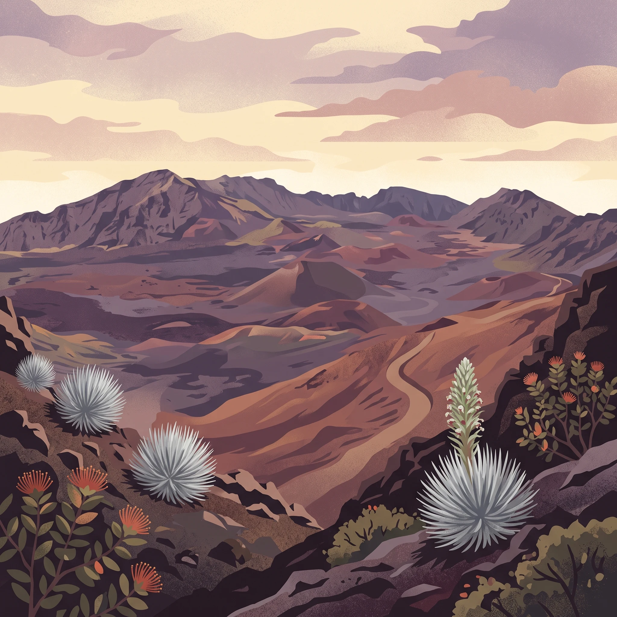
The landscape of Haleakalā National Park is defined by its dramatic volcanic terrain, transitioning from tropical coastal environments through cloud forest and subalpine shrubland to alpine desert at the summit. The central feature is Haleakalā Crater, a massive erosional valley measuring nearly 7 miles across and 2,600 feet deep, dotted with numerous cinder cones and volcanic features. The interior of the crater presents an almost lunar landscape of exposed lava flows, ash deposits, and twisted volcanic rock. Above the crater rim, the summit area offers panoramic views of the surrounding Pacific Ocean and, on clear days, the neighboring islands of Lana'i, Moloka'i, and Hawai'i. The Kipahulu coastal section features lush rainforest, cascading waterfalls, and the series of pools known as 'Ohe'o that follow Palikea Stream to the ocean. The entire landscape sits within the trade wind belt, with moisture-laden clouds typically banking against the eastern slopes while the summit often protrudes above the cloud layer into brilliant sunshine.

Haleakalā National Park ecosystems, habitats, and plant life

Haleakalā National Park protects remarkable ecological diversity across its dramatic elevation gradient, from tropical rainforest to alpine environments. The park contains multiple distinct habitat zones including coastal wetlands, tropical rainforest, subalpine shrubland, and alpine lava fields. Over 850 species of plants grow within the park, including four endemic species of geraniums. The park is famous for the Haleakalā silversword (Argyroxiphium sandwicense subsp. macrocephalum), a remarkable plant that lives only on the volcano's slopes and can live for decades before producing a dramatic flowering stalk. Hosmer's Grove at the summit represents an unusual anthropogenic forest planted with species from around the world including deodar cedar from the Himalayas, Japanese cedar, Australian eucalyptus, and various North American conifers. The park's elevation and isolation create unique conditions that support extraordinary biodiversity, including a remarkable concentration of tardigrade species discovered by biologist Sam Gon III in the 1980s, who described Haleakalā as the richest place on Earth for these microscopic organisms.

Haleakalā National Park wildlife and species highlights

Haleakalā National Park is home to an extraordinary concentration of endangered species, more than any other national park in the United States. Three endemic Hawaiian honeycreepers are found only in the park's forests on East Maui: the Maui 'alauahio, the 'akohekohe, and the critically endangered kiwikiu (Maui parrotbill), with only approximately 200 individuals remaining. The park supports the largest remaining population of the Hawaiian goose, known as nēnē, which was reintroduced to the park in 1946 after being extirpated. The invertebrate fauna is exceptionally diverse, with many endemic snail species in the Partulina genus living in the rainforest understory, and the Haleakalā flightless moth found only in the alpine summit area. Yellow-faced bees (Nalo Meli Maoli) inhabit various habitats throughout the mountain. However, native forest birds face severe threats from mosquito-borne avian malaria, and conservation efforts including incompatible insect technique releases are underway to control mosquito populations.

Haleakalā National Park conservation status and protection priorities

Haleakalā National Park holds global significance as a biosphere reserve and protects species found nowhere else on Earth, making it critical for conservation of Hawaiian endemic biodiversity. The park's endangered species face multiple threats including habitat loss from development, predation by introduced mammals, disease carried by mosquitoes, and climate change impacts on fragile alpine ecosystems. The Haleakalā silversword has been particularly threatened by climate change, with hotter temperatures and reduced rainfall affecting population health, leading the National Park Service to install protective fences. The park participates in the Birds Not Mosquitoes program, which releases male mosquitoes carrying Wolbachia bacteria to suppress populations through incompatible mating. Invasive feral ungulates including deer, goats, and pigs continue to damage native vegetation and cause soil erosion, and ongoing management efforts focus on controlling these populations. As of 2018, the park faced deferred maintenance costs exceeding $24 million, with the Haleakalā Friends group conducting monthly volunteer service trips to assist with conservation work.

Haleakalā National Park cultural meaning and human context

The name Haleakalā carries deep cultural significance in Hawaiian tradition, meaning "house of the sun" and referencing a legendary encounter between the demigod Maui and the sun. According to the traditional story, Maui climbed the mountain and lassoed the sun to slow its journey across the sky, lengthening the day so that his mother's tapa cloth could dry. The mountain holds significance in Hawaiian cultural and spiritual traditions as a place where supernatural events were believed to occur. The park contains sites of traditional Hawaiian importance, and the landscape itself is integral to Hawaiian identity and history. The park's management acknowledges the cultural context of the landscape and works to incorporate indigenous perspectives in conservation and interpretation. The Hawaiian language names for features throughout the park preserve the linguistic heritage of the islands, with terms like 'Ohe'o for the pools and Kipahulu for the coastal valley.

Top sights and standout views in Haleakalā National Park

The summit of Haleakalā offers one of the most spectacular sunrise experiences in the world, with visitors often arriving before dawn to secure viewing spots at the crater rim. The two main trails descending into the crater, the Halemau'u and Sliding Sands trails, provide access to the volcanic interior and overnight stays in three backcountry cabins. The coastal Kipahulu section features the famous 'Ohe'o pools where visitors can swim in natural freshwater basins beneath waterfalls. The astronomy opportunities at the summit are exceptional, with the park lying above the tropical inversion layer and offering views of both celestial objects and Earth-orbiting satellites tracked by the Maui Space Surveillance System at the adjacent observatory. Hosmer's Grove provides a unique collection of introduced conifer species creating an unusual high-altitude forest environment. The endangered silversword, appearing as a silver-gray rosette of leaves on the volcanic slopes, represents one of the most iconic and sought-after sightings for visitors.
Monthly climate preview

Long-term monthly average temperatures and daily precipitation in Maui County

Haleakalā National Park Climate Normals and Monthly Weather Patterns

Long-term records at a representative elevation of Haleakalā National Park show consistent warmth and moderate daily precipitation variations across all twelve months. Accessing the complete historical cycle provides a clear basis for comparing seasonal trends across the protected terrain of Maui County.
Annual mean24 °C
22 °C25 °C
Jan22°
Feb22°
Mar22°
Apr23°
May23°
Jun24°
Jul25°
Aug25°
Sep25°
Oct25°
Nov24°
Dec23°
Warmest month
September

25.1 °C

Coolest month
February

21.9 °C

Wettest month
March

2.5 mm/day

Driest month
June

1 mm/day

Park location guide

Geography guide, regional context, and park location map for Haleakalā National Park

Haleakalā National Park park geography, regions, and map view in United States of America

Understand where Haleakalā National Park sits in United States of America through a broader geographic reading of the surrounding landscape, nearby location context, and its mapped position within the national park landscape.

How Haleakalā National Park fits into United States of America

The United States of America is a federal presidential republic and one of the world's largest countries by area and population. It consists of 50 states across a vast territory spanning multiple time zones, with its capital in Washington, D.C. and largest city in New York City. The nation has a diverse economy, influential political system, and significant cultural and military presence globally.

Wider geography shaping Haleakalā National Park in United States of America

The United States occupies a vast territory in North America, bordered by Canada to the north and Mexico to the south. The 48 contiguous states stretch from the Atlantic to the Pacific Ocean, while Alaska occupies the northwestern region and Hawaii is an archipelago in the Pacific. The country encompasses diverse terrain including the Rocky Mountains, Appalachian Mountains, Great Plains, and extensive river systems.

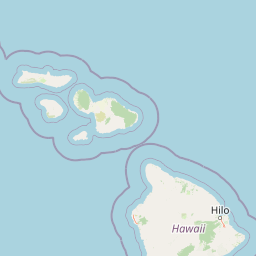
Map view of Haleakalā National Park

Use this park location map to pinpoint Haleakalā National Park in United States of America, understand its exact geographic position, and read its mapped placement within the surrounding landscape more clearly.

Pigeon | © OpenStreetMap contributors

Location context for Haleakalā National Park

HawaiiMaui County
Natural feature types

Browse the Full Collection of Natural Features in Haleakalā National Park

Examine the diverse geography of Haleakalā National Park through a curated index of its most significant natural landmarks. MoriAtlas provides structured access to the volcanic craters, riparian systems, and mountain features that define this protected landscape on Maui.
Recorded earthquake history

Explore the Historical Earthquake Record for Haleakalā National Park

Review documented seismic events and epicentre data associated with the geographic expanse of Haleakalā National Park. This historical catalogue provides a clear perspective on regional seismic activity through structured records and distance analysis, serving as a reliable resource for those researching the volcanic geography of Maui.

Haleakalā National Park Earthquake History

Catalogued events

83 events

Strongest magnitude

Magnitude 5.1

Most recent event

Jul 29, 2026

This history includes earthquakes recorded inside the park or within 50 km of its borders

Park atlas

Compare surrounding protected landscapes and map the regional spread of parks across the Hawaiian Islands.

Discover Other National Parks and Protected Areas Near Haleakalā National Park

Continue your park discovery beyond Haleakalā National Park by browsing other national parks and protected natural areas across the Hawaiian Islands, tracing their diverse terrains and conservation landscapes. Use this geographic overview to compare unique volcanic features, diverse ecosystems, and regional protected area spreads, gaining a deeper atlas perspective.
Marine protected areaHawaii
20 km away#1 closest

West

Hawaiian Islands Humpback Whale National Marine Sanctuary Geographic and Protected Area Map

Explore marine boundaries and reef ecosystems in the Hawaii archipelago.

The Hawaiian Islands Humpback Whale National Marine Sanctuary provides essential protection for vast underwater habitats stretching across the Hawaiian archipelago. This protected area supports a specialized ecosystem featuring diverse coral reefs and significant whale breeding grounds. Understanding the sanctuary requires examining its unique spatial gradient from shallow shorelines to deep oceanic waters and its role in regional conservation.

Area
3,626 km²
Established
1992
IUCN
IV
Access
Easy access
National parkUnited States of America
133 km away#2 closest

Southeast

Hawaiʻi Volcanoes National Park: National Park Geographic Atlas and Protected Landscape

Mapped volcanic terrain and regional protected area context.

Delve into the geographic identity of Hawaiʻi Volcanoes National Park, a notable protected area within the United States of America. This park offers unique volcanic landscapes and provides an invaluable resource for understanding mapped terrain, regional geography, and the specific boundaries of conservation lands. Explore its distinct environmental features and discover its significance through a detailed atlas-oriented lens.

Area
1,434.45 km²
Established
1916
IUCN
II
Visitors
1.4M annual
Marine protected areaHawaii
About 1,550 km away#3 closest

Northwest

Papahānaumokuākea Marine National Monument: Mapped Geography and Protected Pacific Seas

A sprawling marine reserve spanning Northwestern Hawaiian islands and atolls.

Papahānaumokuākea Marine National Monument covers a vast expanse of the Pacific, including coral reefs, submerged banks, and ten islands and atolls. This protected area offers significant insights into remote oceanic geography, featuring critical habitats for endemic species and layered maritime historical sites. Explore the structural map and landscape composition of this immense marine protected zone.

Area
1,508,870 km²
Established
2006
Relief
Lowland
Climate
Tropical
Marine protected areaCalifornia
3,615 km away#4 closest

Northeast

Monterey Bay National Marine Sanctuary: California Marine Protected Area and Coastal Atlas

Mapping deep submarine canyons and expansive Pacific coastal ecosystems.

Monterey Bay National Marine Sanctuary represents one of the most biologically significant marine protected areas in the United States. Spanning 276 miles of California shoreline, the sanctuary encompasses varied aquatic terrain including towering kelp forests, rocky reefs, and the massive Monterey Submarine Canyon. This protected marine landscape serves as a crucial region for oceanic research and environmental conservation.

Area
15,780 km²
Established
1992
Relief
Mixed relief
Climate
Mediterranean
Marine protected areaCalifornia
3,638 km away#5 closest

Northeast

Cordell Bank National Marine Sanctuary: Geographic Atlas and Marine Protected Area Context

Submerged granite seamount and offshore California marine ecosystem

Cordell Bank National Marine Sanctuary is an expansive protected marine zone situated off the California coast. The sanctuary preserves a rare granite underwater mountain that acts as a biodiversity hotspot. Learn about the submerged terrain, continental shelf boundaries, and ecological importance of this significant North American marine conservation area.

Area
3,330 km²
Established
1989
Relief
Lowland
Climate
Mediterranean
Marine protected areaCalifornia
3,641 km away#6 closest

Northeast

Greater Farallones National Marine Sanctuary: Protected Marine Geography and Atlas Data

Essential marine protected area off the coast of California.

Greater Farallones National Marine Sanctuary protects a vital network of oceanic habitats off California, including sandy beaches, tidal flats, subtidal reefs, and open ocean waters. This marine protected area serves as a critical link in the Pacific coast's network of conservation landscapes, offering a deep look at the geographic connectivity between coastal estuaries and offshore continental shelf environments.

Area
8,530 km²
Established
1981
Relief
Lowland
Climate
Mediterranean
Protected areaMarshall Islands
About 3,701 km away#7 closest

West

Bikar Atoll Protected Area: Geographic Overview of a Remote Marshall Islands Coral Atoll

A pristine, uninhabited coral sanctuary and critical Pacific marine habitat.

Bikar Atoll is a remote, diamond-shaped coral ring located in the Ratak Chain of the Marshall Islands. Defined by its shallow lagoon, continuous reef structure, and arid islets, the atoll serves as a vital nesting site for seabirds and green turtles. This protected area remains one of the most ecologically undisturbed sites in the Pacific, offering rare insight into natural atoll morphology and island conservation.

Area
0.5 km²
Established
2025
Relief
Lowland
Climate
Tropical
Marine protected areaCalifornia
3,704 km away#8 closest

Northeast

Chumash Heritage National Marine Sanctuary: California Marine Protected Area Atlas

Mapping coastal transition zones and submarine seafloor features

Spanning over 4,500 square miles off the Central Coast of California, the Chumash Heritage National Marine Sanctuary represents a critical ecological intersection between northern and southern marine species. The sanctuary includes dramatic underwater terrain like Arguello Canyon, Rodriguez Seamount, and the Santa Lucia Bank, creating a complex habitat that sustains kelp forests and diverse maritime resources.

Area
11,770 km²
Established
2024
IUCN
V
Relief
Mixed relief

Common questions about visiting, size, designation, and location context for Haleakalā National Park

Haleakalā National Park FAQs for park facts, access, geography, and protected area context

Find quick answers about Haleakalā National Park, including protected-area facts, park geography, trail and visitor context, and how the park fits into its surrounding country and regional landscape.
MoriAtlas Explorer

Continue Your Protected Areas Search Across the Global Atlas

Deepen your exploration by continuing the structured search for national parks and protected areas worldwide. Utilize the comprehensive filtering capabilities to compare different conservation landscapes and refine your understanding of global park geography. Discover more about the distribution and characteristics of protected natural areas.

Global natural geography