Mori Atlas logo
National parkKaa-Iya del Gran Chaco National Park and Integrated Management Natural Area

Discover the mapped boundaries and regional context of this significant national park.

Kaa-Iya del Gran Chaco National Park and Integrated Management Natural Area: Bolivia's Protected Landscape Geography

(Parque Nacional y Área Natural de Manejo Integrado Kaa-Iya del Gran Chaco)

Kaa-Iya del Gran Chaco National Park and Integrated Management Natural Area represents a key protected landscape within Bolivia, offering a unique entry into the nation's diverse geography and conservation efforts. This park detail page provides essential context for understanding its place within the broader atlas of protected areas, focusing on its mapped boundaries and contribution to regional landscape character. Explore the geographic identity of this national park and its significance for understanding Bolivia's natural heritage through structured map-based discovery.

National ParkGran ChacoJaguar ConservationLarge Protected AreaBoliviaSouth America

Kaa-Iya del Gran Chaco National Park and Integrated Management Natural Area

National park

Park overview

Structured park overview, official facts, and landscape profile for Kaa-Iya del Gran Chaco National Park and Integrated Management Natural Area

Kaa-Iya del Gran Chaco National Park and Integrated Management Natural Area park facts, protected area profile, and essential visitor context
Review the core facts for Kaa-Iya del Gran Chaco National Park and Integrated Management Natural Area, including designation, size, terrain, visitor scale, habitats, and operating context in one park-focused overview.

About Kaa-Iya del Gran Chaco National Park and Integrated Management Natural Area

Kaa-Iya del Gran Chaco National Park represents Bolivia's most ambitious conservation initiative and one of the largest protected areas in the Southern Hemisphere. The park occupies a vast territory in the Gran Chaco, a distinctive ecoregion characterized by flat terrain, semi-deciduous forests, and seasonal wetlands that stretch across portions of Paraguay, Bolivia, and Argentina. This enormous tract of wilderness remains one of the least populated and most inaccessible regions in Bolivia, with human settlements concentrated primarily along the western edges while the interior zones remain essentially uninhabited. The park's dual classification as both a National Park and an Integrated Management Natural Area reflects a innovative governance approach that balances strict conservation with sustainable resource use by local indigenous communities. The Izoceño-Guaraní peoples have maintained a presence in this region for generations, and their traditional territories overlap significantly with the park boundaries. This co-management arrangement, formalized through an agreement with the Capitanía del Alto y Bajo Izozog in 1995, represents a pioneering model for indigenous participation in protected area administration across South America.

Quick facts and research context for Kaa-Iya del Gran Chaco National Park and Integrated Management Natural Area

Kaa-Iya del Gran Chaco covers 34,411 square kilometers in southeastern Bolivia, making it the largest national park in the country. The park sits at elevations between 100 and 839 meters above sea level within the Gran Chaco biogeographic region. Annual rainfall ranges from 400 to 1,400 millimeters, creating a seasonal environment with distinct wet and dry periods. The Parapetí River serves as the principal watercourse, while numerous smaller streams and seasonal wetlands dot the landscape. The park was established on September 21, 1995, and operates under co-management between SERNAP (Bolivia's protected area service) and the Upper and Lower Izozog Authority, an indigenous Izoceño-Guaraní organization.

Park context

Deeper park guide and search-rich context for Kaa-Iya del Gran Chaco National Park and Integrated Management Natural Area

Kaa-Iya del Gran Chaco National Park and Integrated Management Natural Area history, landscape, wildlife, and travel context
Explore Kaa-Iya del Gran Chaco National Park and Integrated Management Natural Area through its history, landscape character, ecosystems, wildlife, conservation priorities, cultural context, and seasonal travel timing in a structured park guide built for atlas discovery and search intent.

Why Kaa-Iya del Gran Chaco National Park and Integrated Management Natural Area stands out

Kaa-Iya del Gran Chaco is internationally recognized as one of the premier locations for jaguar conservation and wildlife viewing in the world. The park contains the largest continuous tropical wooded area on the planet, representing the most extensive remaining expanse of Gran Chaco forest in South America. Camera trap studies conducted by the Wildlife Conservation Society have documented more than 1,000 jaguars within the park boundaries, making it one of the most important strongholds for this large felid species. Beyond jaguars, the park protects significant populations of other large predators including pumas, ocelots, and maned wolves, as well as the distinctive Chacoan peccary, an endangered ungulate found almost exclusively in this region.

Kaa-Iya del Gran Chaco National Park and Integrated Management Natural Area history and protected-area timeline

Kaa-Iya del Gran Chaco was established on September 21, 1995, through Bolivian legislation that designated this vast territory as both a National Park and an Integrated Management Natural Area. The creation of the park responded to growing concerns about the ecological integrity of the Gran Chaco, one of South America's most threatened biomes, as well as recognition of the region's cultural significance to indigenous communities. The park's establishment followed negotiations between the Bolivian government and the Upper and Lower Izozog Authority, representing the Izoceño-Guaraní peoples whose ancestral lands the park now encompasses. This co-management agreement, signed on November 24, 1995, granted indigenous communities formal authority over resource use and conservation decisions within their traditional territories. The park's creation also acknowledged the historical presence of Jesuit missions in the region, including the ruins of San Ignacio de Zamucos, which operated from 1724 to 1745 in the southeastern portion of what is now the protected area.

Kaa-Iya del Gran Chaco National Park and Integrated Management Natural Area landscape and geographic character

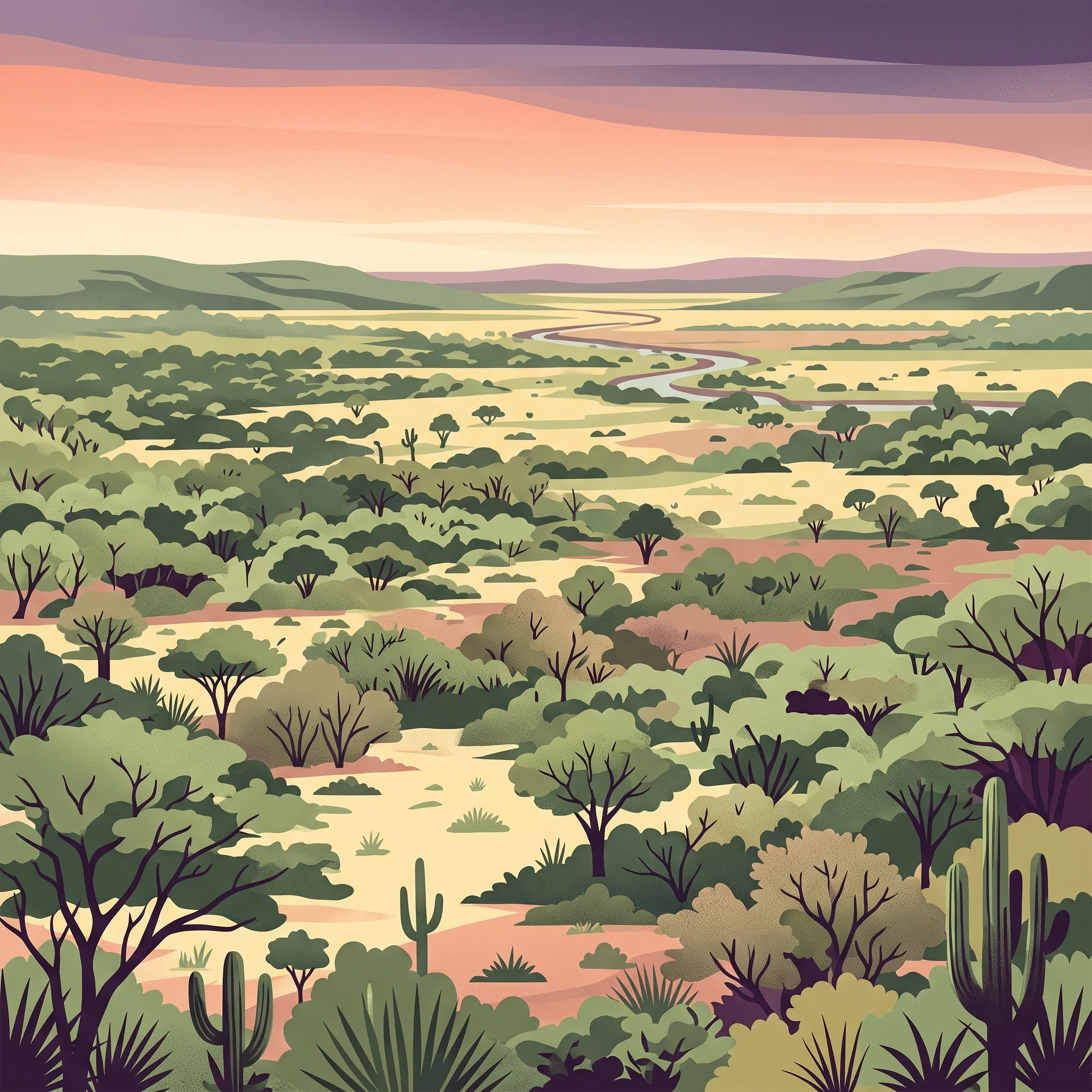
The terrain of Kaa-Iya del Gran Chaco consists primarily of flat to gently rolling plains characteristic of the Gran Chaco, a vast alluvial basin that extends across eastern Bolivia, Paraguay, and northern Argentina. The landscape features a mosaic of semi-deciduous forest, savanna woodlands, and seasonal wetlands known as bajadas, which flood during the rainy season and dry to create productive grasslands during the winter months. Elevation ranges from approximately 100 meters in the lower lying areas to 839 meters at the highest points within the park. The Parapetí River and its tributaries drain much of the eastern portion, creating seasonal floodplains that support distinctive riparian and wetland habitats. In the southeastern section, ancient sand dunes have created a unique topographic feature, providing habitat for species adapted to this unusual sandy environment. The vegetation varies across the landscape, with denser forest in the northwest giving way to more open woodlands and grasslands in the lower elevation zones.

Kaa-Iya del Gran Chaco National Park and Integrated Management Natural Area ecosystems, habitats, and plant life

The ecological diversity of Kaa-Iya del Gran Chaco reflects the complex interplay of climate, soil conditions, and water availability that characterizes the Gran Chaco region. The park contains approximately 880 registered species of vascular plants, with an estimated 1,500 species of higher plants total, representing remarkable botanical richness. Dominant tree species include the red quebracho, black soto, purple guayacán, and cuchi, species that have historically supported regional logging and extractive economies. The park's status as the largest continuous tropical woodland in the world means it contains some of the most extensive remaining examples of Chacoan forest ecosystems, which have been heavily converted elsewhere across their range. The variable rainfall patterns and seasonal flooding create a dynamic environment where different habitat types transition across the landscape, supporting both forest-dependent species and those associated with more open habitats.

Kaa-Iya del Gran Chaco National Park and Integrated Management Natural Area wildlife and species highlights

The fauna of Kaa-Iya del Gran Chaco is exceptionally diverse, with 350 registered species including 89 snake species, 301 bird species, 65 small mammal species, and 59 large mammal species. The park is internationally famous for its large cat populations, particularly the jaguar, with more than 1,000 individuals estimated to inhabit the protected area according to camera trap studies. This makes Kaa-Iya one of the most important jaguar strongholds anywhere in the species' range. Other large predators include pumas, ocelots, and the distinctive maned wolf, each occupying different ecological niches within the park's diverse habitats. The Chacoan peccary, locally known as tagua or quilimero pig, represents one of the most characteristic large mammals of the region and remains common within the park. Notable bird species include the harpy eagle and black-and-white hawk-eagle, both apex predators of the avian world. The southeastern sand dunes support populations of guanacos, representing the northernmost extent of this species in Bolivia.

Kaa-Iya del Gran Chaco National Park and Integrated Management Natural Area conservation status and protection priorities

Kaa-Iya del Gran Chaco plays a critical role in preserving what remains of South America's Gran Chaco, one of the most threatened biomes on the continent. The park protects the largest continuous tract of Chacoan forest and serves as a refuge for populations of large carnivores that have been extirpated from much of their historical range. The jaguar population, estimated at more than 1,000 individuals, represents a significant contribution to regional and continental conservation targets for this iconic species. The co-management arrangement between SERNAP and the Upper and Lower Izozog Authority demonstrates a model for integrating indigenous land stewardship with national conservation objectives. However, the park faces significant threats from hydrocarbon exploration activities, including seismic prospecting and petroleum drilling, as well as from agricultural expansion and illegal hunting. The diversion of the Parapetí River for irrigation purposes has also altered hydrological patterns in portions of the protected area.

Kaa-Iya del Gran Chaco National Park and Integrated Management Natural Area cultural meaning and human context

The cultural landscape of Kaa-Iya del Gran Chaco reflects centuries of indigenous occupation by Guaraní, Chiquitano, and Ayoreo peoples. The western portions of the park contain the highest population density, with more than twenty Guaraní communities concentrated in the Bañados de Izoso area, including settlements such as Guarirenda, Rincón, Huirapendi, and Yapiroa. The largest Chiquitano community, San Pablo, is located in the northern sector. Some Ayoreo groups, including traditionally nomadic populations, continue to inhabit the region, with some groups remaining uncontacted. The Jesuit mission of San Ignacio de Zamucos, active from 1724 to 1745, left ruins in the southeastern portion of the park, representing the historical intersection of colonial and indigenous histories in this region. The park's governance structure formally incorporates indigenous representation through the Upper and Lower Izozog Authority, giving local communities meaningful participation in management decisions.

Top sights and standout views in Kaa-Iya del Gran Chaco National Park and Integrated Management Natural Area

Kaa-Iya del Gran Chaco stands as one of the last great wilderness areas in South America, protecting the largest remaining expanse of Gran Chaco forest on the continent. The park's jaguar population, exceeding 1,000 individuals, makes it one of the most important locations for conservation of this iconic large cat. The co-management arrangement with indigenous Izoceño-Guaraní communities represents an innovative model for protected area governance that integrates traditional land use with conservation objectives. The ruins of San Ignacio de Zamucos provide a window into the colonial history of the region. The park's vast size and minimal human occupation in interior zones have allowed natural processes to continue largely unimpeded, maintaining ecological integrity across this enormous territory.

Best time to visit Kaa-Iya del Gran Chaco National Park and Integrated Management Natural Area

The optimal time to visit Kaa-Iya del Gran Chaco depends on what visitors hope to experience. The dry season, typically from May through October, offers easier access as roads become more passable and wildlife becomes more concentrated around remaining water sources, making animal sighting opportunities somewhat improved. However, the wet season from November through April transforms the landscape, with seasonal wetlands filling and the forest canopy displaying vibrant greenery. The rainy period can make many roads impassable, particularly from December to March, severely limiting accessibility. Visitors interested in wildlife viewing, particularly jaguar tracking, should be prepared for remote and challenging conditions regardless of season, as the park lacks significant tourism infrastructure and access requires careful planning. The cooler dry season months generally offer more comfortable conditions for exploration, though temperatures remain warm throughout the year in this lowland tropical environment.
Park location guide

Geography guide, regional context, and park location map for Kaa-Iya del Gran Chaco National Park and Integrated Management Natural Area

Kaa-Iya del Gran Chaco National Park and Integrated Management Natural Area park geography, regions, and map view in Bolivia
Understand where Kaa-Iya del Gran Chaco National Park and Integrated Management Natural Area sits in Bolivia through a broader geographic reading of the surrounding landscape, nearby location context, and its mapped position within the national park landscape.

How Kaa-Iya del Gran Chaco National Park and Integrated Management Natural Area fits into Bolivia

Bolivia, officially the Plurinational State of Bolivia, is a landlocked country in central South America. It features diverse geography including the Andean mountain range, Amazonian plains, Gran Chaco, and the Pantanal wetland. The country has a population of approximately 11.4 million and is administratively divided into nine departments, with La Paz as the seat of government and Sucre as the constitutional capital.

Wider geography shaping Kaa-Iya del Gran Chaco National Park and Integrated Management Natural Area in Bolivia

Bolivia is located in central South America, bordered by Brazil to the north and east, Paraguay to the southeast, Argentina to the south, Chile to the southwest, and Peru to the west. The country is divided between a western Andean region and tropical lowlands to the east and north. It includes the Amazonian plain, Gran Chaco, temperate valleys, the high-altitude Altiplano plateau, and part of the Pantanal wetland along its eastern border.

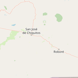
Map view of Kaa-Iya del Gran Chaco National Park and Integrated Management Natural Area

Use this park location map to pinpoint Kaa-Iya del Gran Chaco National Park and Integrated Management Natural Area in Bolivia, understand its exact geographic position, and read its mapped placement within the surrounding landscape more clearly.

Pigeon | © OpenStreetMap contributors

Location context for Kaa-Iya del Gran Chaco National Park and Integrated Management Natural Area

Santa Cruz Department
Park atlas

Map the regional context and discover the protected area geography surrounding Bolivia's largest national park, Kaa-Iya del Gran Chaco.

Explore Nearby National Parks and Protected Landscapes Beyond Kaa-Iya del Gran Chaco National Park
Continue your exploration of South American protected areas by browsing other national parks and protected landscapes geographically related to Kaa-Iya del Gran Chaco National Park and Integrated Management Natural Area. This atlas view allows for deeper comparison of conservation zones, regional park distribution, and diverse ecosystems across the expansive Gran Chaco region.
National parkSanta Cruz Department

Otuquis National Park and Integrated Management Natural Area: Mapped Protected Landscape in Santa Cruz Department

Bolivia's designated national park for atlas exploration.

Gain detailed geographic context for Otuquis National Park and Integrated Management Natural Area, a significant protected landscape within Bolivia's Santa Cruz Department. This page serves as a dedicated entry point for understanding the park's mapped boundaries, its role as a national park, and its natural terrain within the regional atlas. Explore its unique geographic features and its place within Bolivia's network of protected areas.

Area
10,059.5 km²
Established
1997
IUCN
II
Relief
Lowland
National parkChuquisaca Department

Iñao National Park and Integrated Management Natural Area: Bolivia National Park and Protected Landscape

Explore the Serranía del Iñao's geography and conservation role.

Iñao National Park and Integrated Management Natural Area is a protected territory located within Chuquisaca Department, Bolivia, centered on the prominent Serranía del Iñao mountain range. This page offers detailed geographic context and an atlas perspective on the park's landscape, its role as a national park, and its contribution to regional conservation efforts in the Andean foothills.

Area
2,630.9 km²
Established
2004
IUCN
II
Scope
Terrestrial
National parkSanta Cruz Department

Amboró National Park: Its Protected Area Identity and Geographic Context

Mapped boundaries and regional landscape details.

Amboró National Park is a designated national park situated within the Santa Cruz Department, Bolivia. This entry provides detailed insights into its protected landscape, focusing on its geographical significance and mapped boundaries. Users can explore how Amboró National Park fits into the broader regional geography, enhancing their understanding of conservation areas and mapped natural terrains for atlas-based research and discovery. Its specific location and protected status are crucial for understanding its ecological and geographic role.

Area
4,425 km²
Established
1984
IUCN
II
Relief
Mountain
Protected areaGran Chaco Province

Aguaragüe National Park and Integrated Management Natural Area: Bolivia's Easternmost Sub-Andean Protected Landscape

Explore its mapped mountain geography and ecological diversity.

Aguaragüe National Park and Integrated Management Natural Area is a crucial protected area in Bolivia's Gran Chaco Province, defined by the Serranía del Aguaragüe mountain range. This landscape offers a unique opportunity to explore a geographic transition zone where Southern Andean Yungas montane forests converge with Dry Chaco ecosystems. The park's protected boundaries encompass a rugged mountain backbone rising from the lowlands, representing a vital segment of Bolivia's Sub-Andean geography and protected natural areas.

Area
1,083.07 km²
Established
2000
IUCN
II
Relief
Mountain
National parkCochabamba Department

Carrasco National Park: National Park Status and Protected Landscape Geography

Explore mapped boundaries within Cochabamba Department.

Carrasco National Park, situated within the Cochabamba Department, represents a critical national park entity. This focus provides users with an atlas-centric view of its protected landscape, detailing its geographic significance and mapped features. Understand the park's terrain and regional context, offering a clear perspective on its conservation value and mapped presence.

Area
6,226 km²
Established
1991
IUCN
II
Relief
Mountain
National parkPotosí Department

Torotoro National Park: Paleontology and Karst Landscape Exploration in Bolivia

Discover prehistoric footprints within dramatic Andean canyon geography.

Torotoro National Park in the Potosí Department is a protected area distinguished by its rich paleontological significance and unique semi-arid mountain terrain. Featuring dramatic canyon systems plunging hundreds of meters deep, the park showcases thousands of Cretaceous dinosaur footprints alongside its complex karst topography, complete with caves and sinkholes, offering a profound glimpse into both ancient life and sculpted natural geography.

Area
165 km²
Established
1989
IUCN
II
Relief
Mountain
National parkSanta Cruz Department

Noel Kempff Mercado National Park: Detailed Protected Landscape Map and Geography

Explore national park boundaries and regional landscape context in Santa Cruz.

Noel Kempff Mercado National Park is a crucial protected area offering deep insights into Bolivia's natural geography. This entry provides specific details on its mapped landscape and geographic position within the Santa Cruz Department, enabling users to explore its protected boundaries and understand its regional context for atlas-based discovery. Dive into the mapped terrain and natural features that define this significant national park.

Area
15,523 km²
Established
1979
IUCN
II
Relief
Mixed relief
National parkArgentina

Baritú National Park National Park: Mapped Protected Landscapes in Argentina's Geography

Understand the natural terrain and geographic setting of this Argentinian park.

Baritú National Park represents a distinct national park entity within Argentina, crucial for understanding the country's protected landscapes and regional geography. This page provides specific atlas-level detail on its mapped boundaries and the surrounding natural terrain. Explore Baritú National Park as a key geographic feature contributing to the broader understanding of conservation areas across South America, grounded in factual, map-oriented discovery.

Area
720 km²
Established
1974
IUCN
II
Relief
Mountain

Common questions about visiting, size, designation, and location context for Kaa-Iya del Gran Chaco National Park and Integrated Management Natural Area

Kaa-Iya del Gran Chaco National Park and Integrated Management Natural Area FAQs for park facts, access, geography, and protected area context
Find quick answers about Kaa-Iya del Gran Chaco National Park and Integrated Management Natural Area, including protected-area facts, park geography, trail and visitor context, and how the park fits into its surrounding country and regional landscape.
MoriAtlas Explorer

Continue Your Protected Areas Search Across the Global Atlas

Deepen your exploration by continuing the structured search for national parks and protected areas worldwide. Utilize the comprehensive filtering capabilities to compare different conservation landscapes and refine your understanding of global park geography. Discover more about the distribution and characteristics of protected natural areas.

Global natural geography