Mori Atlas logo
National parkOtuquis National Park and Integrated Management Natural Area

Discover the mapped boundaries and regional geography of this significant national park.

Otuquis National Park and Integrated Management Natural Area: Protected Landscape in Bolivia's Santa Cruz Department

Otuquis National Park and Integrated Management Natural Area represents a key protected landscape within the Santa Cruz Department of Bolivia. As a designated national park, it offers critical insights into the region's natural geography and mapped conservation areas. Users can explore the park's specific geographic identity and its context within the broader Bolivian atlas, understanding its significance as a protected natural area.

Pantanal wetlandsNational parkWildlife viewingBirdwatchingJaguar habitatFloodplain ecosystem

Otuquis National Park and Integrated Management Natural Area

National park

Park overview

Structured park overview, official facts, and landscape profile for Otuquis National Park and Integrated Management Natural Area

Otuquis National Park and Integrated Management Natural Area park facts, protected area profile, and essential visitor context
Review the core facts for Otuquis National Park and Integrated Management Natural Area, including designation, size, terrain, visitor scale, habitats, and operating context in one park-focused overview.

About Otuquis National Park and Integrated Management Natural Area

Otuquis National Park represents a cornerstone of Bolivia's protected area network and a vital conservation stronghold within the Pantanal ecoregion. The Pantanal itself is a vast interior delta where the Paraguay River and its tributaries flood seasonally, creating one of the most productive ecosystems in South America. Otuquis protects this critical habitat at a strategic location where the wetland complex extends into Bolivian territory, connecting with protected areas in Brazil and Paraguay to form a transfrontier conservation landscape. The integrated management designation for a portion of the park reflects a pragmatic approach to conservation in a region where local communities have maintained traditional land use patterns for generations. This dual-category approach allows for biodiversity protection while permitting sustainable activities in designated zones, balancing ecological integrity with human livelihood needs.

Quick facts and research context for Otuquis National Park and Integrated Management Natural Area

Otuquis National Park lies in the extreme southeast of Santa Cruz Department, Bolivia, within Germán Busch and Cordillera provinces, bordering Brazil to the east and Paraguay to the southeast. The protected area covers approximately 1,006,000 hectares, with about 903,000 hectares designated as strict national park and the remaining 103,000 hectares as an Integrated Management Natural Area. Established in 1997, it holds IUCN Category II designation. The park sits within the Pantanal ecoregion, a vast transitional zone where the Amazon basin meets the Chaco, creating a unique mosaic of wetland habitats.

Park context

Deeper park guide and search-rich context for Otuquis National Park and Integrated Management Natural Area

Otuquis National Park and Integrated Management Natural Area history, landscape, wildlife, and travel context
Explore Otuquis National Park and Integrated Management Natural Area through its history, landscape character, ecosystems, wildlife, conservation priorities, cultural context, and seasonal travel timing in a structured park guide built for atlas discovery and search intent.

Why Otuquis National Park and Integrated Management Natural Area stands out

Otuquis is particularly renowned for its exceptional wildlife viewing opportunities, especially for large mammals and birds. The park supports healthy populations of jaguars, pumas, and other Neotropical cats, making it one of the premier locations in Bolivia for observing these elusive predators in the wild. During the dry season, millions of birds converge on the wetlands to feed on abundant fish populations, creating spectacular flocking displays that draw birders from around the world. The park also protects significant populations of marsh deer, capybara, and various caiman species within its diverse wetland habitats.

Otuquis National Park and Integrated Management Natural Area history and protected-area timeline

The park was established in 1997 as Bolivia moved to strengthen its protected area system during a period of increased environmental awareness and institutional development. The creation of Otuquis reflected a growing recognition of the Pantanal's international significance and the need to protect Bolivia's portion of this unique wetland ecosystem. The park's name honors the Otuke indigenous people, whose ancestral territories encompass much of the protected area and who maintain connections to the land despite external pressures on their traditional lifestyles. The establishment also came during a broader trend in Latin America toward creating parks that incorporate both strict protection and sustainable use zones, a model that proved particularly suitable for the Pantanal's complex ecology and human geography.

Otuquis National Park and Integrated Management Natural Area landscape and geographic character

The landscape of Otuquis is defined by the Pantanal's characteristic flood dynamics, where vast expanses of grassland and savanna transform with the seasonal rise and fall of waters. The terrain is generally flat, with subtle elevation changes that influence drainage patterns and create a mosaic of permanently flooded areas, seasonally inundated zones, and higher ground that remains dry even during peak flooding. Palm trees dot the savanna, while gallery forests follow watercourses and provide crucial habitat corridors. The Paraguay River forms part of the park's eastern boundary, and numerous smaller channels, lagoons, and ponds scatter across the landscape, creating the intricate wetland matrix that defines the Pantanal character.

Otuquis National Park and Integrated Management Natural Area ecosystems, habitats, and plant life

As a protected area within the Pantanal ecoregion, Otuquis safeguards a remarkable diversity of habitats that support numerous species. The seasonal flooding regime drives ecological productivity, with nutrients deposited by floodwaters supporting abundant aquatic life and vigorous plant growth. The combination of wetlands, grasslands, and forest patches creates heterogeneous conditions that support both aquatic and terrestrial species. The park sits at the convergence of ecosystems influenced by the Amazon to the north, the Gran Chaco to the south, and the Brazilian Shield, giving the region a transitional quality that enhances biodiversity. Vegetation ranges from floating aquatic mats in permanent water bodies to dense evergreen forests along riverbanks and semi-deciduous forests on higher ground.

Otuquis National Park and Integrated Management Natural Area wildlife and species highlights

Otuquis supports an impressive array of wildlife, with particular significance for large mammals and birds. Jaguars roam the park in healthy numbers, alongside pumas, ocelots, and pampas cats, representing one of the most diverse Neotropical cat communities in Bolivia. Marsh deer, the largest deer species in South America, inhabit the wetlands alongside capybara, the world's largest rodent. Reptile diversity includes spectacled caiman, caiman lizards, and yellow anacondas. The birdlife is exceptional, with millions of individuals congregating during certain seasons to feed on fish populations in the shrinking water bodies. Waterfowl, waders, raptors, and a variety of songbirds all thrive in this productive wetland environment.

Otuquis National Park and Integrated Management Natural Area conservation status and protection priorities

The park plays a crucial role in protecting the Pantanal ecosystem, which faces numerous pressures from agricultural expansion, cattle ranching, and infrastructure development throughout its range. Otuquis provides refuge for species that require large contiguous habitats and supports ecological processes that depend on intact floodplain dynamics. Its location at the tri-border area with Brazil and Paraguay positions it as a key node in regional conservation planning, connecting with protected areas across the frontier to maintain habitat connectivity for wide-ranging species like jaguars. The integrated management zone within the park represents an approach to balancing conservation objectives with the needs of local communities who have historically used the area, though the effectiveness of this model depends on adequate management resources and enforcement capacity.

Otuquis National Park and Integrated Management Natural Area cultural meaning and human context

The park is named for the Otuke indigenous people, whose ancestral lands encompass much of the protected area. The Otuke language belongs to the Arawakan family, and the community maintains cultural connections to the landscape despite the pressures of modernization and external governance structures. Traditional activities such as fishing, small-scale agriculture, and limited resource gathering have shaped human-wildlife interactions in the region for generations. The integrated management component of the park acknowledges this human presence, though the nature and extent of contemporary indigenous involvement in park management varies. Understanding and respecting the rights and perspectives of indigenous communities remains important for effective conservation in the area.

Top sights and standout views in Otuquis National Park and Integrated Management Natural Area

Otuquis offers exceptional wildlife viewing opportunities in one of South America's most productive wetland ecosystems. The chance to observe jaguars in their natural Pantanal habitat ranks among the most sought-after wildlife experiences in Bolivia. Seasonal bird aggregations create remarkable viewing opportunities as millions of birds exploit concentrated fish populations. The landscape itself, with its seasonal transformations between flooded and dry conditions, offers a visually distinctive experience that differs markedly from highland or mountain parks elsewhere in Bolivia. The transfrontier setting connects visitors to a larger conservation landscape spanning three countries.

Best time to visit Otuquis National Park and Integrated Management Natural Area

The optimal time to visit Otuquis depends on the experience sought. The dry season, roughly from May through October, concentrates wildlife around remaining water sources and makes animals easier to observe. This period also coincides with the peak bird activity when millions of birds feed on fish in shrinking lagoons. The wet season from November to April floods much of the landscape, creating a different but equally compelling experience of the Pantanal's aquatic character. Some roads and access areas may be difficult during peak flooding. The shoulder seasons offer a balance between accessibility and wildlife viewing opportunities.

Park location guide

Geography guide, regional context, and park location map for Otuquis National Park and Integrated Management Natural Area

Otuquis National Park and Integrated Management Natural Area park geography, regions, and map view in Bolivia
Understand where Otuquis National Park and Integrated Management Natural Area sits in Bolivia through a broader geographic reading of the surrounding landscape, nearby location context, and its mapped position within the national park landscape.

How Otuquis National Park and Integrated Management Natural Area fits into Bolivia

Bolivia, officially the Plurinational State of Bolivia, is a landlocked country in central South America. It features diverse geography including the Andean mountain range, Amazonian plains, Gran Chaco, and the Pantanal wetland. The country has a population of approximately 11.4 million and is administratively divided into nine departments, with La Paz as the seat of government and Sucre as the constitutional capital.

Wider geography shaping Otuquis National Park and Integrated Management Natural Area in Bolivia

Bolivia is located in central South America, bordered by Brazil to the north and east, Paraguay to the southeast, Argentina to the south, Chile to the southwest, and Peru to the west. The country is divided between a western Andean region and tropical lowlands to the east and north. It includes the Amazonian plain, Gran Chaco, temperate valleys, the high-altitude Altiplano plateau, and part of the Pantanal wetland along its eastern border.

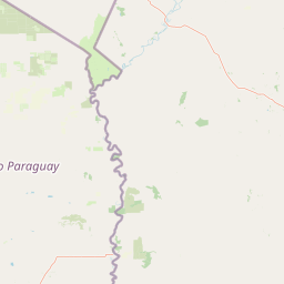
Map view of Otuquis National Park and Integrated Management Natural Area

Use this park location map to pinpoint Otuquis National Park and Integrated Management Natural Area in Bolivia, understand its exact geographic position, and read its mapped placement within the surrounding landscape more clearly.

Pigeon | © OpenStreetMap contributors

Location context for Otuquis National Park and Integrated Management Natural Area

Santa Cruz Department
Park atlas

Understand the geographic context of the Pantanal wetland system and compare distinct protected areas.

Explore Parks and Protected Areas Surrounding Otuquis National Park and Integrated Management Natural Area
Browse a curated selection of national parks and protected areas that share geographic proximity or ecological context with Otuquis National Park and Integrated Management Natural Area. Compare their diverse landscapes, conservation priorities, and regional spread to gain deeper insights into the broader protected-area network across the Pantanal ecosystem.
National parkBolivia

Kaa-Iya del Gran Chaco National Park and Integrated Management Natural Area: Bolivia's National Park and Protected Landscape

Explore the mapped geography and regional natural landscape.

Kaa-Iya del Gran Chaco National Park and Integrated Management Natural Area stands as a crucial component of Bolivia's protected lands, offering a distinct entry point for exploring its natural geography. This page details the park's status as a national park and integrated management natural area, providing context for its mapped boundaries and its role within the country's diverse landscapes. Engage with structured information designed to illuminate the park's geographic setting and its significance for atlas-style exploration and understanding of Bolivia's protected areas.

Area
34,411.1 km²
Established
1995
Relief
Upland
Climate
Subtropical
National parkChuquisaca Department

Iñao National Park and Integrated Management Natural Area: Bolivia National Park and Protected Landscape

Explore the Serranía del Iñao's geography and conservation role.

Iñao National Park and Integrated Management Natural Area is a protected territory located within Chuquisaca Department, Bolivia, centered on the prominent Serranía del Iñao mountain range. This page offers detailed geographic context and an atlas perspective on the park's landscape, its role as a national park, and its contribution to regional conservation efforts in the Andean foothills.

Area
2,630.9 km²
Established
2004
IUCN
II
Scope
Terrestrial
Protected areaGran Chaco Province

Aguaragüe National Park and Integrated Management Natural Area: Bolivia's Easternmost Sub-Andean Protected Landscape

Explore its mapped mountain geography and ecological diversity.

Aguaragüe National Park and Integrated Management Natural Area is a crucial protected area in Bolivia's Gran Chaco Province, defined by the Serranía del Aguaragüe mountain range. This landscape offers a unique opportunity to explore a geographic transition zone where Southern Andean Yungas montane forests converge with Dry Chaco ecosystems. The park's protected boundaries encompass a rugged mountain backbone rising from the lowlands, representing a vital segment of Bolivia's Sub-Andean geography and protected natural areas.

Area
1,083.07 km²
Established
2000
IUCN
II
Relief
Mountain
National parkSanta Cruz Department

Amboró National Park: Its Protected Area Identity and Geographic Context

Mapped boundaries and regional landscape details.

Amboró National Park is a designated national park situated within the Santa Cruz Department, Bolivia. This entry provides detailed insights into its protected landscape, focusing on its geographical significance and mapped boundaries. Users can explore how Amboró National Park fits into the broader regional geography, enhancing their understanding of conservation areas and mapped natural terrains for atlas-based research and discovery. Its specific location and protected status are crucial for understanding its ecological and geographic role.

Area
4,425 km²
Established
1984
IUCN
II
Relief
Mountain
National parkSanta Cruz Department

Noel Kempff Mercado National Park: Detailed Protected Landscape Map and Geography

Explore national park boundaries and regional landscape context in Santa Cruz.

Noel Kempff Mercado National Park is a crucial protected area offering deep insights into Bolivia's natural geography. This entry provides specific details on its mapped landscape and geographic position within the Santa Cruz Department, enabling users to explore its protected boundaries and understand its regional context for atlas-based discovery. Dive into the mapped terrain and natural features that define this significant national park.

Area
15,523 km²
Established
1979
IUCN
II
Relief
Mixed relief
National parkFormosa Province

Río Pilcomayo National Park: Protected Humid Chaco Wetland Landscape & Geography

Explore mapped boundaries and unique floodplain terrain in Formosa Province.

Río Pilcomayo National Park represents a significant protected natural area within Argentina's Formosa Province, characterized by the unique ecosystems of the Humid Chaco. The park's landscape is defined by extensive floodplains, marshes, lakes, and forests, all influenced by the Pilcomayo River's dynamic hydrological cycle. As a Ramsar site, it safeguards crucial habitats, including those for the endangered jaguar, and showcases iconic Caranday palm savannas. This detailed atlas entry provides insights into its mapped geography and the vital protected landscape it preserves.

Area
518.89 km²
Established
1951
IUCN
II
Relief
Lowland
National parkArgentina

El Impenetrable National Park: A Protected National Park within Argentina's Geography

Explore its mapped boundaries and regional landscape context.

Delve into El Impenetrable National Park, a designated national park situated in Argentina. This entry provides critical geographic context, detailing its mapped protected area boundaries and its role within the national landscape. Understand its unique regional setting and explore its significance as a protected natural space for atlas-based discovery.

Area
1,289 km²
Established
2014
Relief
Lowland
Climate
Subtropical
National parkCochabamba Department

Carrasco National Park: National Park Status and Protected Landscape Geography

Explore mapped boundaries within Cochabamba Department.

Carrasco National Park, situated within the Cochabamba Department, represents a critical national park entity. This focus provides users with an atlas-centric view of its protected landscape, detailing its geographic significance and mapped features. Understand the park's terrain and regional context, offering a clear perspective on its conservation value and mapped presence.

Area
6,226 km²
Established
1991
IUCN
II
Relief
Mountain

Common questions about visiting, size, designation, and location context for Otuquis National Park and Integrated Management Natural Area

Otuquis National Park and Integrated Management Natural Area FAQs for park facts, access, geography, and protected area context
Find quick answers about Otuquis National Park and Integrated Management Natural Area, including protected-area facts, park geography, trail and visitor context, and how the park fits into its surrounding country and regional landscape.
MoriAtlas Explorer

Continue Your Protected Areas Search Across the Global Atlas

Deepen your exploration by continuing the structured search for national parks and protected areas worldwide. Utilize the comprehensive filtering capabilities to compare different conservation landscapes and refine your understanding of global park geography. Discover more about the distribution and characteristics of protected natural areas.

Global natural geography