
Mori Atlas logo
Wildlife reserveKirsanov Sanctuary

Examining the geography and mapped landscape of a vital riverine corridor in Western Kazakhstan

Kirsanov Sanctuary: A Complex Wildlife Reserve within the Ural River Floodplain Ecosystem

(Kirsanov Sanctuary (Republican-level Complex Sanctuary))

Kirsanov Sanctuary protects a strategic 61,000-hectare corridor along the Ural River in West Kazakhstan, serving as a critical refuge for riverine biodiversity. This republic-level wildlife reserve encompasses a mosaic of gallery forests, oxbow lakes, and wet meadows that support beaver populations and diverse avian species. By analyzing the terrain and mapped boundaries of this sanctuary, one gains insight into the complex interplay between riparian ecosystems and the surrounding steppe landscapes of the region.

riverine habitatfloodplainbeaver conservationreintroduction programriparian forestgallery forest
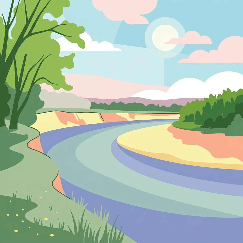
A flat-style digital illustration depicting a winding river flowing through a lush floodplain, bordered by trees and grassy banks under a sunny sky.

Kirsanov Sanctuary

Wildlife reserve

Park overview

Structured park overview, official facts, and landscape profile for Kirsanov Sanctuary

Kirsanov Sanctuary park facts, protected area profile, and essential visitor context

Review the core facts for Kirsanov Sanctuary, including designation, size, terrain, visitor scale, habitats, and operating context in one park-focused overview.

About Kirsanov Sanctuary

Kirsanov Sanctuary occupies a distinctive ecological niche in West Kazakhstan: the protected floodplain and valley of the Ural River. Rather than guarding a mountainous wilderness or a desert expanse, the sanctuary follows the meandering course of a lowland river, creating a long ribbon of habitat where moisture-loving forest, open meadow, and steppe fringe meet. This setting is what gives the reserve both its conservation value and its unusual character.

The reserve was founded in 1967 primarily to conserve the Eurasian beaver, then a scarce animal in Kazakhstan whose natural population survived mainly along the banks of the Ural. The original 10-year mandate focused on breeding beavers and translocating them to other parts of the country, and was later extended for another decade. In 1986 it was formally reconstituted as a complex sanctuary of republican significance, broadening its protection to include the entire river-valley ecosystem, not just the beaver population it was created to support.

At roughly 61,000 hectares, the sanctuary is shaped by the river itself. Its protected strip runs about 50 kilometers along the Ural's floodplain and extends roughly 10 kilometers across the valley. The terrain includes numerous islands, oxbows, meanders, wet meadows, and patches of forest, producing a mosaic of habitats that supports a wider community of mammals, birds, and fish. As one of only three republican-level complex sanctuaries in Kazakhstan, and the country's only sanctuary specifically tied to the protection of the commercially valuable beaver, Kirsanov holds a unique and enduring position in the national network of protected areas.

Quick facts and research context for Kirsanov Sanctuary

Kirsanov Sanctuary lies south of the village of Kirsanovo in West Kazakhstan Oblast, covering the floodplain of the Ural (Zhayyk) River across Borlin, Terekti, and Akzhayyk districts. It was established in 1967 and confirmed as a republican complex sanctuary in 1986, and is the only sanctuary in Kazakhstan dedicated to the protection of the commercially valuable Eurasian beaver. Its area spans roughly 61,000 hectares, extending about 50 kilometers along the river and 10 kilometers across the valley.

Protection and recognition

Documented terrestrial protection scope, designation year, and international recognition details

Kirsanov Sanctuary Protection Status and Designation History

Kirsanov Sanctuary maintains documented terrestrial protection established in 1986 under structured conservation frameworks. Official records track the designated management scope, operational history, and international recognition criteria.

Protection details

Protection scope
Terrestrial
Designated year
1986
Transboundary protection
No
Park context

Deeper park guide and search-rich context for Kirsanov Sanctuary

Kirsanov Sanctuary history, landscape, wildlife, and travel context

Explore Kirsanov Sanctuary through its history, landscape character, ecosystems, wildlife, conservation priorities, cultural context, and seasonal travel timing in a structured park guide built for atlas discovery and search intent.

Why Kirsanov Sanctuary stands out

Kirsanov Sanctuary is best known as a beaver stronghold within the Ural River basin and as the historic source population from which beavers were reintroduced to other regions of Kazakhstan. Beyond its beaver protection role, the sanctuary is recognized as a key refuge for river-valley habitats of the Ural (Zhayyk), combining gallery forests, meadows, and steppe edges into a single protected corridor.
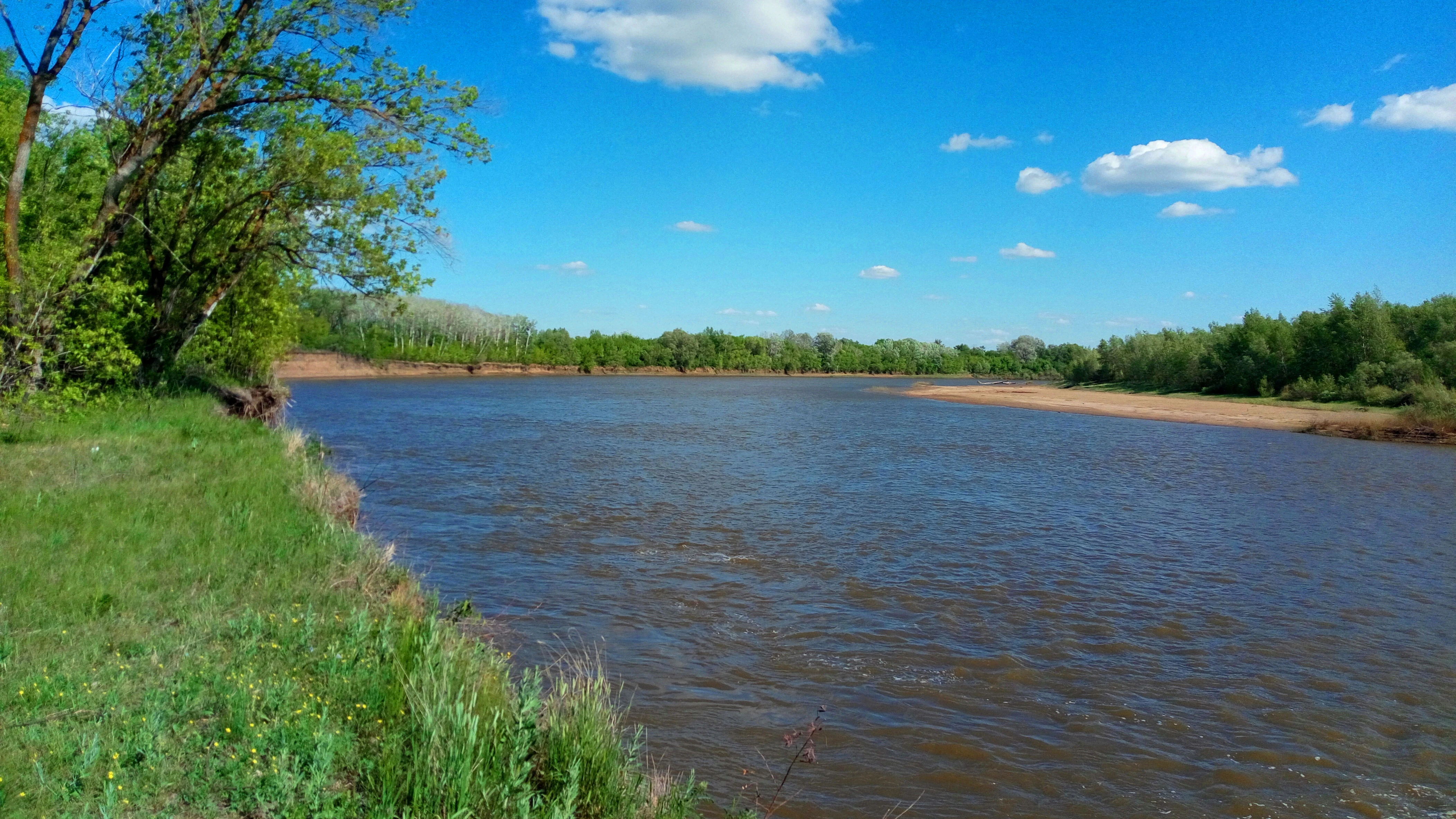
A wide view of a brown river flowing between green, tree-lined banks under a bright blue sky with scattered clouds.
The Ural River flowing through Kirsanov Sanctuary.

Kirsanov Sanctuary history and protected-area timeline

Kirsanov Sanctuary was established in 1967 in the West Kazakhstan region, covering parts of what are now Borlin, Terekti, and Akzhayyk districts in the floodplain of the Ural (Zhayyk) River. Its founding purpose was narrowly focused: the Eurasian beaver, a fur-bearing species of high economic value, had survived in Kazakhstan only along the banks of the Ural, and the sanctuary was created to protect the remaining population and to enable its deliberate reintroduction to other regions of the country.

The reserve was initially set up for a ten-year term centered on beaver breeding and translocation, and its mandate was subsequently extended for another decade as the program continued. In 1986, by decision of the Council of Ministers of Kazakhstan, the area was redesignated as a complex sanctuary of republican significance, expanding the protection framework from a single-species focus to the broader river-valley ecosystem. The 1986 redesignation effectively confirmed Kirsanov's role in the national system of protected areas and broadened its long-term conservation mandate.

Today the sanctuary continues to operate as a republican-level complex protected area under the oversight of Kazakhstan's林业和狩猎委员会 (Committee for Forestry and Hunting, transliterated), while its' original beaver-monitoring role, including annual population counts, salt-lick maintenance for ungulates, and artificial nesting structures for birds, remains a defining part of its identity.

Kirsanov Sanctuary landscape and geographic character

The landscape of Kirsanov Sanctuary is shaped almost entirely by the Ural (Zhayyk) River and its floodplain. The protected area forms a long, narrow corridor about 50 kilometers in length along the course of the river, extending roughly 10 kilometers across the valley floor. This produces a classic lowland riverine terrain: a shifting network of channels, backwaters, oxbow lakes, and river islands interwoven with wet meadows and forested patches.

Within this floodplain corridor, the terrain transitions continuously between aquatic habitats, moist galleries of willow and poplar, open grassy meadows, and the drier steppe margins that border the valley. The presence of numerous islands and peninsulas along the river creates sheltered, slow-moving waters that are particularly favorable for beavers and many fish species. The combination of water, riparian vegetation, and adjacent steppe gives the sanctuary an unusually high habitat diversity for a reserve its size.

Kirsanov Sanctuary ecosystems, habitats, and plant life

The sanctuary's nature reflects the ecological meeting point of river, meadow, and steppe that defines the Ural valley in this part of Kazakhstan. The riverine forests form the ecological backbone of the reserve: black poplar, aspen, oak, birch, and willow grow in the wetter parts of the valley, while surrounding meadows and steppe patches round out the habitat mosaic.

Wetland and aquatic habitats are a defining feature of Kirsanov. Oxbows, lakes, and slow-moving stretches of the river provide habitat for fish such as common carp, pike perch, pike, and roach-like тарань, while the main channel of the Ural is also historically associated with large sturgeons, including stellate sturgeon (севрюга) and beluga (белуга). The varied water-land mosaic supports a broad wildlife community and gives the sanctuary importance beyond any single species.

Kirsanov Sanctuary wildlife and species highlights

Wildlife at Kirsanov Sanctuary is anchored by mammals closely tied to the river habitat. The Eurasian beaver is the flagship species and the reason the sanctuary was created; it remains the focus of annual population counts and active habitat management. Other mammals protected within the reserve include moose, wild boar, roe deer, red deer, pine marten, badger, and hare, all benefiting from the mixture of forest cover, meadows, and steppe edge.

The sanctuary is also notable for its birdlife. Black grouse, along with various duck species, inhabit the area, and conservation work includes the placement of artificial nesting structures to support breeding birds as part of the reserve's broader wildlife management program. Aquatic habitats add fish to the protected fauna, with common carp, pike perch, pike, and roach-like тарань in lakes and backwaters, and valuable sturgeon species, including stellate sturgeon and beluga, historically present in the main channel of the Ural River.

Kirsanov Sanctuary conservation status and protection priorities

Kirsanov Sanctuary holds a distinctive place in Kazakhstan's conservation system as one of only three republican-level complex sanctuaries in the country and the only one specifically oriented toward the protection of the commercially valuable Eurasian beaver. Its establishment in 1967 as a narrowspecies sanctuary, and its later upgrade in 1986 to a complex sanctuary, reflects a progression from focused species protection to broader ecosystem management.

Conservation work at Kirsanov combines strict habitat protection with active management. In addition to regulated hunting and land-use regimes typical of sanctuary status, the reserve conducts biotechnical measures such as annual beaver counts, the preparation of salt-lick sites for hoofed animals, and the installation of nesting structures to support local bird populations. Through its long-running beaver breeding and translocation program, the sanctuary has played a direct role in restoring beaver populations to other parts of Kazakhstan, making it one of the country's more consequential sites for mammal conservation.

Top sights and standout views in Kirsanov Sanctuary

Kirsanov Sanctuary stands out for its combination of single-species origin and broader river-valley protection: beginning as a beaver conservation project in 1967 and re-established in 1986 as a republican-level complex sanctuary. Its 61,000-hectare corridor along the Ural (Zhayyk) River unites riparian forests, wet meadows, steppe fringes, oxbows, and river islands into a single protected mosaic.

The sanctuary is also distinguished by its active management program, including annual beaver population counts, salt-lick sites for ungulates, and artificial nesting structures for birds, paired with its historic role as the source population for beaver reintroductions across Kazakhstan. These traits together make Kirsanov a small but strategically important component of the country's protected-area network.

Best time to visit Kirsanov Sanctuary

Spring and early summer tend to be the most biologically active periods along the Ural floodplain, when rising water levels expand wetland and meadow habitats, deciduous trees leaf out in the riverine forests, and bird activity, particularly waterfowl and grouse, is at its peak. Late summer and early autumn bring more stable water levels and drier meadow conditions, supporting wildlife observation along forest-meadow edges.

Winter offers a quieter but ecologically distinctive experience, when frozen channels, bare deciduous forests, and reduced vegetation cover make animal tracks and ungulate activity more visible, though temperatures in West Kazakhstan can be harsh. Because the sanctuary is managed primarily for conservation rather than tourism, any visit is best framed around the seasonal character of the river-valley landscape rather than around visitor infrastructure.

Monthly climate preview

Long-term representative temperature and monthly precipitation statistics for Kirsanov Sanctuary

Kirsanov Sanctuary Climate Normals and Annual Weather Patterns

Historical data recorded at Kirsanov Sanctuary documents a wide annual temperature range spanning from severe winter minimums to warm summer maximums alongside steady daily precipitation averages. Examining the full twelve-month climate profile reveals comprehensive long-term averages for monthly weather patterns and temperature extremes across the protected area.
Annual mean6 °C
-13 °C24 °C
Jan-13°
Feb-12°
Mar-4°
Apr
May16°
Jun21°
Jul24°
Aug22°
Sep15°
Oct
Nov-3°
Dec-10°
Warmest month
July

23.8 °C

Coolest month
January

-13.3 °C

Wettest month
October

1.3 mm/day

Driest month
August

0.8 mm/day

Park location guide

Geography guide, regional context, and park location map for Kirsanov Sanctuary

Kirsanov Sanctuary park geography, regions, and map view in Kazakhstan

Understand where Kirsanov Sanctuary sits in Kazakhstan through a broader geographic reading of the surrounding landscape, nearby location context, and its mapped position within the national park landscape.

How Kirsanov Sanctuary fits into Kazakhstan

Kazakhstan is a Central Asian country spanning vast steppes and plains, bordered by Russia, China, Kyrgyzstan, Uzbekistan, and Turkmenistan, with a coastline along the Caspian Sea. It gained independence from the Soviet Union in 1991 and has a population of approximately 20.5 million people. The country is officially secular but predominantly Muslim, with Kazakh and Russian as official languages.

Wider geography shaping Kirsanov Sanctuary in Kazakhstan

Kazakhstan occupies a vast territory in Central Asia, extending into Eastern Europe. Its terrain consists largely of hilly plateaus and plains, with lowlands covering about a third of the area. The southern and eastern regions are mountainous. The country borders Russia to the north and west, China to the east, Kyrgyzstan to the southeast, Uzbekistan to the south, and Turkmenistan to the southwest. It has a coastline along the Caspian Sea.

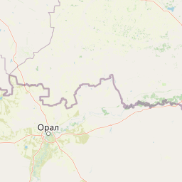
Map view of Kirsanov Sanctuary

Use this park location map to pinpoint Kirsanov Sanctuary in Kazakhstan, understand its exact geographic position, and read its mapped placement within the surrounding landscape more clearly.

Pigeon | © OpenStreetMap contributors

Location context for Kirsanov Sanctuary

West Kazakhstan Region

Explore floodplain terrain, riparian forests, and protected riverine habitats.

Kirsanov Sanctuary Photos and Landscapes: Visual Guide to Ural River Scenery

Visual documentation captures the lowland riverine terrain, oxbow lakes, and gallery forests shaping Kirsanov Sanctuary. Photographic records reveal the protected floodplain mosaic along the Ural River, illustrating regional habitat diversity and wildlife refuges.

A wide view of a brown river flowing between green, tree-lined banks under a bright blue sky with scattered clouds.

A wide, flat green meadow under a clear blue sky with a distant line of trees on the horizon.

Park atlas

Compare surrounding regional geography and connected protected landscapes

Other Parks and Protected Areas Near Kirsanov Sanctuary

Browsing parks near Kirsanov Sanctuary reveals a broader network of river valleys and protected reserves across the surrounding region. Analyzing these adjacent protected areas provides essential context for regional conservation corridors and lowland riverine habitats.
National parkRussia
About 177 km away#1 closest

North

Buzuluksky Bor National Park: Mapping an Isolated Forest in the Russian Steppe

Examining the unique geomorphology and forest-steppe ecological boundaries.

Buzuluksky Bor National Park serves as an extraordinary natural laboratory in Russia, defined by its 106,000 hectares of pine forest set against a backdrop of open grasslands. This protected area features deep sandy substrates of marine origin, undulating dune landscapes, and the deeply incised Borovka River valley, providing a vital study site for forest-steppe dynamics and long-term conservation research.

Area
1,060 km²
Established
2007
IUCN
II
Relief
Lowland
A horizontal watercolor illustration depicting a line of evergreen trees along a shoreline with rolling hills in the background.
National parkSamara Oblast
About 178 km away#2 closest

North

Buzuluksky Bor National Park: A Mapped Analysis of Protected Pine Forest Landscapes

Regional Geography of the Samara and Orenburg Borderlands

Buzuluksky Bor National Park represents a significant conservation hub, safeguarding centuries-old pine stands within a pronounced riverine depression. This protected area offers deep insights into the transition between bore forest types and the broader steppe ecosystems of southeastern European Russia.

Area
1,067.88 km²
Established
2008
IUCN
II
Relief
Lowland
Watercolor illustration of a river flowing through a valley with green hills and scattered trees in the background
National parkSamara Oblast
About 259 km away#3 closest

Northwest

Samarskaya Luka National Park: Mapped Geography and Protected Area Landscape Context

An atlas-focused overview of the Zhiguli Mountains and Volga River meander.

Samarskaya Luka National Park covers 134,000 hectares of diverse terrain in Samara Oblast. This overview examines the protected area's karst limestone uplands, dense forests, and river floodplains. Access map-integrated data on the Volga River bend and the unique geological formations defining this regional ecosystem.

Area
1,340 km²
Established
1984
IUCN
II
Relief
Mixed relief
A watercolor painting showing a panoramic landscape of green, rolling hills with light forest cover and a body of water in the middle ground.
National parkSamara Oblast
About 259 km away#4 closest

Northwest

Samarskaya Luka National Park: Geography, Karst Terrain, and Volga River Boundaries

Protected mountain, forest, and floodplain landscapes in Samara Oblast

Samarskaya Luka National Park anchors the Middle Volga Biosphere Reserve with its rugged limestone cliffs, extensive karst sinkholes, and rare steppe-forest habitats. The park represents a key geographic transition zone where high-elevation mountain terrain meets the expansive Volga floodplains and reservoirs, providing a vital study area for regional forest-steppe ecosystems.

Area
1,319 km²
Established
1984
IUCN
II
Relief
Mountain
Wildlife reserveWest Kazakhstan Region
About 286 km away#5 closest

Southwest

Zhaltyrkol Sanctuary: A Wildlife Reserve in the West Kazakhstan Steppe Mosaic

Mapping wetland habitats along the Kushum and Ural River basins.

Zhaltyrkol Sanctuary encompasses a unique steppe-and-wetland mosaic, featuring shallow lakes such as Zhaltyrkol and Itbatyr. It provides a protected habitat for waterfowl and game species, maintaining essential breeding grounds within the flat, open terrain of the West Kazakhstan Region.

Area
190 km²
Established
1967
IUCN
IV
Relief
Lowland
Watercolor illustration of green hills, a body of water, and pink and yellow vegetation
National parkSaratov Oblast
About 324 km away#6 closest

Northwest

Khvalynsky National Park: Protected Landscape and Regional Geography Atlas

Discover mapped park boundaries in Saratov Oblast

Khvalynsky National Park is a significant protected area designated as a national park within the Saratov Oblast. This entry provides detailed atlas-based insights into its geographic scope, protected landscape features, and its context within the wider regional geography of Southeastern European Russia. Explore the mapped terrain and understand how this park contributes to the conservation landscape of the Volga region.

Area
255 km²
Established
1994
IUCN
II
Visitors
35K annual
Watercolor painting showing a scenic landscape with mountains, a river, and trees
National parkBashkortostan
About 330 km away#7 closest

Northeast

Bashkiriya National Park: Mapping Karst Landscapes and Ural Forest Geography

Exploring protected terrain in the Bashkortostan region

Bashkiriya National Park anchors a critical conservation area along the southern Ural Mountains, characterized by its deep canyons, limestone grottoes, and vast subterranean cave networks. The park serves as a bridge for biodiversity at the continental edge, where river-carved valleys and dense taiga forests create a distinct, protected landscape for regional research and geographic study.

Area
920 km²
Established
1986
IUCN
II
Relief
Mixed relief
Watercolor painting of a lush green landscape featuring a flowing river, conifer trees, rolling hills, and a small waterfall on the right side.
National parkBashkortostan
About 330 km away#8 closest

Northeast

Bashkiriya National Park: Protected Karst Landscapes and Ural Mountain Geography

Southern Ural forest ecosystems and karst cave networks

Bashkiriya National Park protects over 900 square kilometers of mountainous terrain and river valleys in the Republic of Bashkortostan. The park serves as a prime example of the Southern Ural transition, featuring an intricate mix of karst sinkholes, surface streams, and mature broadleaf forests that support diverse temperate wildlife and avian communities.

Area
920 km²
Established
1986
IUCN
II
Visitors
30K annual

Common questions about visiting, size, designation, and location context for Kirsanov Sanctuary

Kirsanov Sanctuary FAQs for park facts, access, geography, and protected area context

Find quick answers about Kirsanov Sanctuary, including protected-area facts, park geography, trail and visitor context, and how the park fits into its surrounding country and regional landscape.
MoriAtlas Explorer

Continue Your Protected Areas Search Across the Global Atlas

Deepen your exploration by continuing the structured search for national parks and protected areas worldwide. Utilize the comprehensive filtering capabilities to compare different conservation landscapes and refine your understanding of global park geography. Discover more about the distribution and characteristics of protected natural areas.

Global natural geography