

Mori Atlas logo
State or regional parkKiskatinaw Provincial Park

Mapping the distinctive incised meander and the unique 1942 wooden bridge within northeastern British Columbia

Kiskatinaw Provincial Park: Exploring the Historic River Meanders and Alaska Highway Heritage

Kiskatinaw Provincial Park serves as a notable protected area in the Peace River Regional District of British Columbia, centered on the striking geomorphology of a deep, horseshoe-shaped incised meander of the Kiskatinaw River. The landscape features steep, forested canyon walls and exposed rock faces carved by the river's sinuous path. Beyond its geological significance, the park preserves the historic Kiskatinaw Bridge, a curved wooden trestle structure from 1942 that stands as a unique monument to the early construction era of the Alaska Highway.

incised meanderriver gorgeAlaska Highway heritagehistoric wooden bridgetrestle bridgeboreal forest
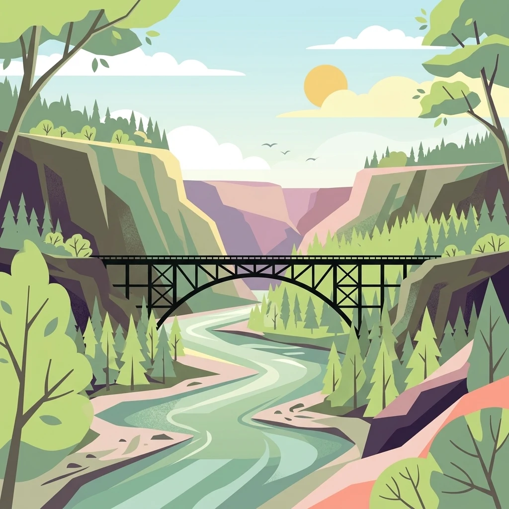
A flat-style vector illustration depicting a steel arched bridge crossing a river within a deep, tree-lined canyon under a soft, sunny sky.

Kiskatinaw Provincial Park

State or regional park

Park overview

Structured park overview, official facts, and landscape profile for Kiskatinaw Provincial Park

Kiskatinaw Provincial Park park facts, protected area profile, and essential visitor context

Review the core facts for Kiskatinaw Provincial Park, including designation, size, terrain, visitor scale, habitats, and operating context in one park-focused overview.

About Kiskatinaw Provincial Park

Kiskatinaw Provincial Park sits in the Peace River Country of northeastern British Columbia, a region defined by rolling boreal forest, sedimentary terrain, and the broad river systems that drain toward the Peace River. The park itself occupies a focused stretch of land around a single dramatic topographic feature: a horseshoe-shaped incised meander in the Kiskatinaw River, a tributary of the larger Peace watershed. The river has cut a deep loop into the landscape, producing steep valley walls and an unusually shaped canyon that becomes the focal point of the park's identity.

The park's second defining element is its built heritage. The Kiskatinaw Bridge, completed during the rushed construction of the Alaska Highway in 1942, was engineered as a curved, banked wooden trestle to accommodate the highway's original alignment across the difficult river bend. When a replacement bridge and a new highway segment were completed several kilometers west in 1978, the original structure was retained rather than removed, and it has since become one of the most photographed and historically valued roadside features in the Peace River region.

Although the park is small in scale, the combination of river-canyon scenery, boreal woodland, accessible riverbank camping, and the heritage bridge gives it an unusually distinctive sense of place. BC Parks manages the area primarily for weekend recreational use by local residents, while designating it as a meaningful roadside interpretation point for travelers following the Alaska Highway corridor between Dawson Creek and points farther north. For a small protected area, Kiskatinaw Provincial Park carries a layered identity shaped by geology, wartime infrastructure, and the still-active presence of boreal forest and wildlife.

Quick facts and research context for Kiskatinaw Provincial Park

Kiskatinaw Provincial Park is a compact protected area in northeastern British Columbia, administered by BC Parks within the Peace River Regional District and closely associated with Dawson Creek. It was formally designated on May 1, 1962 to safeguard the prominent horseshoe-shaped incised meander of the Kiskatinaw River, a deep, sinuous curve carved into the Peace River Country landscape.

The park is small in area but carries outsized heritage value because it contains the Kiskatinaw Bridge, a curved, banked wooden trestle completed in just nine months in 1942 as part of the original Alaska Highway. Even after highway traffic was rerouted to a new bridge in 1978, the original structure remains as the only surviving curved, banked trestle bridge of its kind in Western Canada, giving the park a distinct road-corridor identity alongside its natural appeal.

Protection and recognition

Documented terrestrial protection scope and official designation records for Kiskatinaw Provincial Park

Kiskatinaw Provincial Park Protection Status and Conservation Recognition

Evaluation of Kiskatinaw Provincial Park protection status includes documented terrestrial management scope and conservation records. Structured geographic data tracks official designation frameworks without administrative assumptions.

Protection details

Protection scope
Terrestrial
Transboundary protection
No
Park context

Deeper park guide and search-rich context for Kiskatinaw Provincial Park

Kiskatinaw Provincial Park history, landscape, wildlife, and travel context

Explore Kiskatinaw Provincial Park through its history, landscape character, ecosystems, wildlife, conservation priorities, cultural context, and seasonal travel timing in a structured park guide built for atlas discovery and search intent.

Why Kiskatinaw Provincial Park stands out

Kiskatinaw Provincial Park is best known for the dramatic horseshoe-shaped incised meander of the Kiskatinaw River, a deep, looping bend that frames the landscape and offers one of the most photographed river views along the historic Alaska Highway route. The river's sharp curve is the geological centerpiece of the park and the reason the surrounding area was set aside for protection. Equally notable is the Kiskatinaw Bridge itself: a curved, banked wooden trestle bridge built in 1942, which today stands as the only surviving example of this design in Western Canada. Together, the carved river bend and the wartime wooden bridge form the park's unmistakable visual and historical signature.
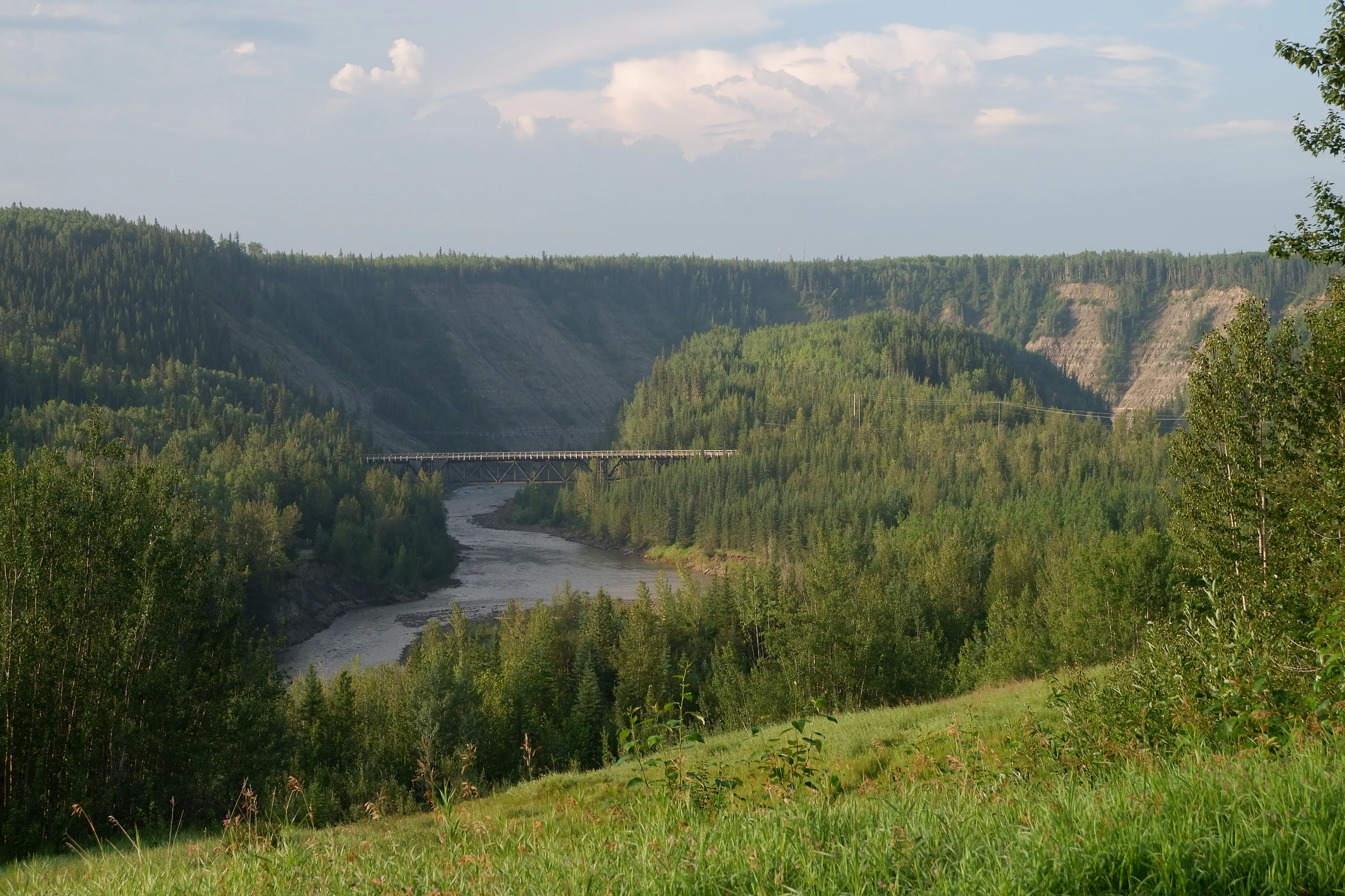
A wide shot of a forested river valley with a wooden bridge crossing the river in the distance, viewed from a grassy hillside.
The historic wooden bridge spanning the Kiskatinaw River within Kiskatinaw Provincial Park.

Kiskatinaw Provincial Park history and protected-area timeline

Kiskatinaw Provincial Park is closely tied to one of the most consequential infrastructure projects of the Second World War in northern North America: the construction of the Alaska Highway. After the Japanese attack on Pearl Harbor in December 1941, Canada and the United States moved quickly to build a road that would connect the U.S. territory of Alaska with the rest of the continent. The rugged terrain of northeastern British Columbia proved one of the most demanding sections of the route, particularly where the highway needed to cross a deep, looping bend of the Kiskatinaw River.

To overcome the incised meander, engineers designed and constructed a curved, banked wooden trestle bridge across the river bend. The bridge was completed in only nine months during 1942, measuring nearly 58 metres in length and incorporating a nine-degree curve that allowed the original road to maintain its chosen path along the rim of the canyon. The structure became one of the memorable features of the wartime highway.

In 1962, recognizing both the unusual geological formation and the cultural significance of the bridge, the British Columbia government formally established Kiskatinaw Provincial Park. By the late 1970s, however, the wooden bridge had been in service for more than three decades, and in 1978 the Ministry of Highways and Public Works built a replacement bridge three kilometres to the west, realigning the Alaska Highway onto a straighter, more modern route. Rather than dismantling the original crossing, authorities preserved it, and it continues to function as a vehicular and pedestrian route for visitors to the park. Today it stands as the only surviving curved, banked trestle bridge in Western Canada, giving the park a heritage dimension that goes well beyond its modest footprint.

Kiskatinaw Provincial Park landscape and geographic character

The landscape of Kiskatinaw Provincial Park is defined overwhelmingly by the horseshoe-shaped incised meander of the Kiskatinaw River. The river follows a tight, looping path that has been cut deeply into the surrounding terrain, producing steep, curving valley walls and an unusually sinuous canyon form. From the higher ground of the park, the gorge presents a sweeping view of forested slopes, exposed rock faces, and the silvery curve of the river far below, making it the most visually arresting feature in the landscape.

Around the canyon rim, the terrain transitions into the broader Peace River Country: a mix of gentle relief, mixed forest stands, and small interior drainage patterns typical of northeastern British Columbia. The canyon walls and the forested plateau above give the park a layered visual character, with close-up views of the river bend available from viewpoints and bridges, and longer views opening out across the surrounding woodland.

Kiskatinaw Provincial Park ecosystems, habitats, and plant life

The park's natural setting is shaped by the forested plateau and the sheltered microclimate of the river canyon. Dominant tree species include balsam poplar, white spruce, and trembling aspen, which together create a mixed boreal-style woodland typical of the Peace River region. The combination of river margin, canyon walls, and adjacent upland forest gives the site a compact but varied vegetative texture for such a small protected area.

The river itself acts as an ecological anchor, influencing moisture levels, soil conditions, and the kinds of vegetation that thrive along its banks. This, in turn, shapes the wildlife patterns observed around the park, with moose and deer sometimes drawn to the river corridor and surrounding forest, while smaller mammals and songbirds occupy the mixed woodland and campsite edges.

Kiskatinaw Provincial Park wildlife and species highlights

Wildlife viewing at Kiskatinaw Provincial Park reflects the broader character of the Peace River Country's mixed boreal forest. Moose and deer are reported in the vicinity of the campground area, where the combination of forest cover and proximity to the Kiskatinaw River makes the habitat attractive to larger ungulates. These are intermittent and patchy sightings rather than guaranteed encounters, but they form part of the park's everyday wildlife character.

Smaller mammals such as squirrels and chipmunks are more commonly seen, along with a range of songbirds that inhabit the poplar, spruce, and aspen stands of the park. The river corridor and canyon edges provide additional habitat complexity, supporting the kinds of birdlife typical of riverine woodlands in this part of British Columbia. For a small park, wildlife observation tends to be incidental rather than the primary reason for visiting, but it remains a recognizable presence throughout the campground and bridge viewpoints.

Kiskatinaw Provincial Park conservation status and protection priorities

Kiskatinaw Provincial Park was established primarily to safeguard a distinctive geological formation rather than to conserve a specific ecological community. The horseshoe-shaped incised meander of the Kiskatinaw River is the central conservation feature, representing a textbook example of an entrenched river meander that illustrates long-term river erosion processes in the Peace River drainage.

In addition to its geological value, the park preserves an intact example of an early Alaska Highway alignment together with the original curved wooden trestle bridge. Protection of this cultural and engineering heritage complements the natural values of the site, giving the park a combined geoheritage and transportation heritage profile that makes it a recognized roadside interpretive landscape along the historic Alaska Highway corridor.

Kiskatinaw Provincial Park cultural meaning and human context

The park carries cultural significance largely through its connection to the Alaska Highway and the broader story of wartime road-building in northern North America. The Kiskatinaw Bridge stands as an artifact of the urgent infrastructure response following the 1941 attack on Pearl Harbor, when Canada and the United States forged a road through difficult terrain to link Alaska with the southern road network. For many travelers and historians of the highway, the bridge remains an iconic symbol of that effort.

Top sights and standout views in Kiskatinaw Provincial Park

The defining highlights of Kiskatinaw Provincial Park are deeply concentrated around a single dramatic landscape and a single historic structure. The horseshoe-shaped incised meander of the Kiskatinaw River provides one of the most striking roadside river views in northeastern British Columbia, while the adjacent Kiskatinaw Bridge, a curved wooden trestle built in just nine months in 1942, anchors the park's heritage identity as the only surviving example of its design type in Western Canada.

Together, these highlights give the park a compact but distinctive profile: a place where a textbook example of river geomorphology meets one of the most photographed artifacts of the original Alaska Highway route, all accessible from a small campground on the rim of the canyon.

Best time to visit Kiskatinaw Provincial Park

The character of a visit to Kiskatinaw Provincial Park changes with the seasonal rhythm of the Peace River Country. Summer is the most accommodating period, when warm temperatures, long daylight hours, and accessible roads make the campground and bridge viewpoints easy to reach, and when the boreal mix of poplar, spruce, and aspen is in full leaf. Wildlife around the campsite, including songbirds and the occasional moose or deer, tends to be most active in these warmer months.

Shoulder-season visits in late spring and early autumn can also be rewarding, when milder weather still allows camping and the river gorge and bridge scenery takes on a quieter atmosphere. The winter context, dominated by snow and freezing temperatures, transforms the park into a much harsher environment in which the bridge's wooden structure becomes especially prominent against the white landscape, though conditions make it primarily a pass-through rather than a camping destination.
Monthly climate preview

Long-term representative point measurements tracking monthly temperature and precipitation patterns

Kiskatinaw Provincial Park Climate Normals and Annual Temperature Rhythm

Kiskatinaw Provincial Park records a wide annual temperature spread alongside measured monthly precipitation variations across the representative coordinate. Exploring the complete twelve-month climatology profile reveals detailed multi-year averages for temperature and precipitation.
Annual mean1 °C
-14 °C16 °C
Jan-14°
Feb-11°
Mar-7°
Apr
May
Jun13°
Jul16°
Aug15°
Sep
Oct
Nov-7°
Dec-13°
Warmest month
July

15.8 °C

Coolest month
January

-13.9 °C

Wettest month
June

2.9 mm/day

Driest month
February

1.1 mm/day

Park location guide

Geography guide, regional context, and park location map for Kiskatinaw Provincial Park

Kiskatinaw Provincial Park park geography, regions, and map view in Canada

Understand where Kiskatinaw Provincial Park sits in Canada through a broader geographic reading of the surrounding landscape, nearby location context, and its mapped position within the national park landscape.

How Kiskatinaw Provincial Park fits into Canada

Canada is a federal parliamentary constitutional monarchy spanning North America from the Atlantic to the Pacific and Arctic Oceans. With a population of over 41 million, it is officially bilingual in English and French at the federal level. The country gained independence from the United Kingdom through a gradual process culminating in 1982.

Wider geography shaping Kiskatinaw Provincial Park in Canada

Canada occupies the northern portion of North America, sharing its longest international border with the United States. The country extends from the Atlantic Ocean to the Pacific Ocean and northward into the Arctic Ocean, giving it the longest coastline of any nation.

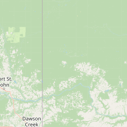
Map view of Kiskatinaw Provincial Park

Use this park location map to pinpoint Kiskatinaw Provincial Park in Canada, understand its exact geographic position, and read its mapped placement within the surrounding landscape more clearly.

Pigeon | © OpenStreetMap contributors

Location context for Kiskatinaw Provincial Park

British Columbia

Visual exploration of the horseshoe meander and historic trestle bridge

Kiskatinaw Provincial Park Photos and River Gorge Scenery

Visual documentation captures the dramatic river canyon and forested terrain of Kiskatinaw Provincial Park through detailed landscape photography. Examining these protected area views reveals the distinct geomorphology of the sinuous river bend and the iconic wooden bridge structure.

A wide shot of a forested river valley with a wooden bridge crossing the river in the distance, viewed from a grassy hillside.

A curved wooden trestle bridge spans a river canyon surrounded by a dense green forest, viewed from the road level.

Park atlas

Compare nearby regional reserves and connected natural landscapes across the territory

Explore Parks Near Kiskatinaw Provincial Park And Surrounding Protected Areas

Browse other protected areas and regional parks located near Kiskatinaw Provincial Park for broader geographic comparison. Expanding the search helps reveal connected wilderness corridors and adjacent terrain types across the surrounding region.
A minimalist watercolor illustration showing a light blue lake, green trees, and soft yellow ground.
Wildlife reserveAlberta
About 122 km away#1 closest

Southeast

Saskatoon Lake Migratory Bird Sanctuary: Protected Wetland Landscape in Alberta

Geographic overview of sanctuary boundaries and habitat zones

Examine the territorial footprint and environmental setting of Saskatoon Lake Migratory Bird Sanctuary. This site highlights the intersection of shallow aquatic basins and boreal parkland vegetation, providing a deep look into protected areas within the Grande Prairie region of Alberta.

Area
11.5 km²
Established
1948
IUCN
III
State or regional parkBritish Columbia
About 155 km away#2 closest

Northwest

Graham-Laurier Provincial Park: Protected Boreal Landscape and Geographic Context

Remote wilderness exploration in the Peace River region

Graham-Laurier Provincial Park represents a massive, intact wilderness area in northeastern British Columbia. Defined by boreal forests, undulating ridges, and the cascading waters of Christina Falls, this region serves as a crucial natural refuge within the Muskwa-Kechika Management Area. Access is centered on rugged forest service roads and backcountry trails, making the area a primary destination for self-reliant exploration and terrain study.

Area
999.82 km²
Established
1999
IUCN
II
Relief
Mountain
State or regional parkBritish Columbia
About 189 km away#3 closest

Northwest

Pink Mountain Provincial Park: Regional Geography and Protected Alpine Landscapes

Muskwa Foothills terrain and scientific conservation history.

Situated in the eastern foothills of the Rocky Mountains, Pink Mountain Provincial Park is defined by its transition from forested valleys to high-altitude tundra. This protected area stands as a unique ecological corridor, preserving major Mesozoic fossil sites and providing a habitat for diverse northern wildlife species that thrive in the cold-adapted vegetation of the Muskwa Foothills.

Area
0.98 km²
Established
1999
IUCN
II
Relief
Mountain
State or regional parkBritish Columbia
About 232 km away#4 closest

Northwest

Redfern-Keily Provincial Park: A Deep Dive into Muskwa Ranges Protected Geography

Remote Glacial Landscapes and Northern Wilderness Terrain

Redfern-Keily Provincial Park encompasses a significant stretch of remote wilderness in the Muskwa Ranges of northeastern British Columbia. Anchored by the eight-kilometer Redfern Lake and surrounding glaciers like the Ithaca and Achaean, the area serves as a primary example of intact boreal and subalpine geography. The terrain offers a rugged look at high-elevation ecosystems and glacial history within the Muskwa-Kechika Management Area.

Area
807.12 km²
Established
1999
IUCN
II
Relief
Mountain
State or regional parkBritish Columbia
About 283 km away#5 closest

Northwest

Prophet River Hot Springs Provincial Park: Protected Landscape and Geothermal Geography

Remote backcountry wilderness in northeastern British Columbia

Prophet River Hot Springs Provincial Park is a specialized protected area known for its unique tufa mounds and geothermal features. Set against the mountainous backdrop of the Muskwa Ranges, this backcountry destination offers a compelling study of boreal and subalpine geography, accessible only by hiking or horseback through undisturbed wilderness corridors.

Area
1.84 km²
Established
1999
IUCN
II
Relief
Mountain
National parkAlberta
About 285 km away#6 closest

Southeast

Jasper National Park National Park: Mapped Protected Landscape and Alberta Geography

Explore Alberta's regional park context and natural terrain.

Jasper National Park is a key protected national park in Alberta, Canada, offering extensive natural landscapes. This park page details its precise geographic location, outlines its protected boundaries, and provides context within the regional geography of Western Canada. Discover the mapped terrain and the park's significance as a protected area within a broader atlas perspective.

Area
10,878 km²
Established
1907
IUCN
II
Visitors
2.4M annual
State or regional parkBritish Columbia
About 316 km away#7 closest

Northwest

Kwadacha Wilderness Provincial Park: Geographic Boundaries and Regional Protected Area Context

Untouched mountain wilderness in northern British Columbia

Kwadacha Wilderness Provincial Park provides a rare, roadless mountain experience within the northeastern interior of British Columbia. Characterized by high-relief alpine ridges, dense boreal forests, and challenging river systems, the park represents an essential wilderness corridor that remains free from human infrastructure and standard road access, prioritizing ecological integrity over recreation.

Area
1,302.79 km²
Established
1973
IUCN
Ib
Relief
Mountain
State or regional parkBritish Columbia
About 387 km away#8 closest

Northwest

Finlay-Russel Provincial Park and Protected Area: Mapping Northern British Columbia Wilderness

A remote river corridor in the Muskwa-Kechika Management Area.

Located in northern British Columbia, Finlay-Russel Provincial Park and Protected Area preserves an essential 85-kilometre river corridor along the Finlay River. This expansive wilderness territory serves as an integral part of the Muskwa-Kechika Management Area, showcasing deep boreal forest landscapes and rugged river valley terrain far from established road networks.

Area
1,092.05 km²
Established
2001
IUCN
II
Access
Remote access

Common questions about visiting, size, designation, and location context for Kiskatinaw Provincial Park

Kiskatinaw Provincial Park FAQs for park facts, access, geography, and protected area context

Find quick answers about Kiskatinaw Provincial Park, including protected-area facts, park geography, trail and visitor context, and how the park fits into its surrounding country and regional landscape.
MoriAtlas Explorer

Continue Your Protected Areas Search Across the Global Atlas

Deepen your exploration by continuing the structured search for national parks and protected areas worldwide. Utilize the comprehensive filtering capabilities to compare different conservation landscapes and refine your understanding of global park geography. Discover more about the distribution and characteristics of protected natural areas.

Global natural geography