Why Kootenay National Park stands out
Kootenay National Park is best known for three distinctive features: the Radium Hot Springs, which offer mineral-rich thermal pools at the foot of Sinclair Canyon; the Paint Pots, an acidic mineral spring system where iron oxide deposits create striking red-ochre coloured mud and where Ktunaxa people historically collected pigments; and the extraordinary fossil beds near Marble Canyon, where scientists have discovered more than 50 new species from Cambrian-era shales dating to the Wuliuan stage, comparable in significance to the nearby Burgess Shale. The park is also renowned for the Rockwall trail, a multi-day backcountry hiking route along the limestone cliffs of the Vermilion Range.
Kootenay National Park history and protected-area timeline
The land that now comprises Kootenay National Park has been inhabited by humans for approximately 10,000 years, with the Ktunaxa people being the most significant indigenous group with historical connections to the area, particularly the hot springs. European explorers and fur traders began passing through the region in the early 19th century, with George Simpson traversing what would become Simpson Pass in 1841 during his circumnavigation of the world. The Palliser expedition of 1858 identified Vermilion Pass as a potential transportation route. In the 1880s, an early homesteader included what would become Radium Hot Springs in his land claim, though the springs were ultimately acquired by Roland Stuart and his partner H.A. Pearse in 1890 through a provincial Crown grant. Railway engineer Robert Randolph Bruce recognized the potential for a road through the area and advocated for its construction starting in 1910. After the British Columbia government encountered budget difficulties with their portion of the road, Bruce travelled to Ottawa to pitch the idea of creating a national park so that road construction could be funded as a park improvement. The Banff-Windermere Agreement was signed in March 1919, and the federal government took ownership of the land in July of that year. Kootenay National Park was formally created by Order in Council on April 21, 1920. The road was completed and opened to the public by June 1923, and the hot springs were eventually expropriated by the federal government in 1922 after negotiations with Stuart failed.
Kootenay National Park landscape and geographic character
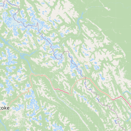
The landscape of Kootenay National Park is defined by a series of north-south trending mountain ranges and the river valleys that separate them. The southwestern portion of the park lies within the Southern Rocky Mountain Trench, a broad valley that marks the transition between the Rocky Mountains and the Columbia Mountains. As the highway follows Sinclair Creek westward toward the Columbia River, the terrain enters the Kootenay Ranges, which include the Brisco Range with Mount Berland and Mount Kindersley, and the Stanford Range with Redstreak Mountain and Mount Sinclair. The park then follows the Kootenay River valley for approximately 27 kilometres, flanked by the Mitchell Range and the Vermilion Range of the Park Ranges. At the bridge over the Kootenay River, the park turns northward to follow the Vermilion River through the pass between Mount Wardle and Spar Mountain. Small lakes in the park are relatively rare and occur primarily in the Vermilion River drainage basin at high altitude in cirques or hanging valleys, with Floe Lake, Kaufmann Lake, and Talc Lake being notable examples. The eastern mountains of the park are composed of younger sedimentary rocks from the Rocky Mountains, while the southwestern corner contains older rocks from the Purcell Mountains.
Kootenay National Park ecosystems, habitats, and plant life
Kootenay National Park supports three distinct ecoregions that reflect its elevation range and climate patterns. The Montane ecoregion occupies the lower elevations, particularly at the western entrance and along the Kootenay River valley, receiving between 300 and 600 millimetres of precipitation annually, with 30 to 45 percent falling as snow. These lower elevations feature forests of Douglas fir, lodgepole pine, western larch, trembling poplar, and western redcedar, with a diverse shrub understory including soapberry, kinnikinnick, and various berry species. The Subalpine ecoregion, found in areas such as the Vermilion River valley, Marble Canyon, and around Floe Lake, experiences cooler and moister conditions with mean annual temperatures below one degree Celsius and approximately 800 millimetres of precipitation, over half as snow. Here, Engelmann spruce, white spruce, subalpine fir, and subalpine larch dominate the forest canopy. The Alpine ecoregion at the highest elevations is characterized by cold temperatures, heavy snowfall, and a lack of forest cover, with heathers, arctic willow, cinquefoils, moss campion, and mountain avens as the dominant vegetation. The park's climate is generally drier than areas to the west due to the Kootenay Ranges capturing moisture, and the Continental Divide provides some protection from extreme arctic air masses.
Kootenay National Park wildlife and species highlights
A wildlife survey documented 242 species of mammals, birds, amphibians, and reptiles within Kootenay National Park. The largest wildlife species are the ungulates, including bighorn sheep, mountain goat, moose, Rocky Mountain elk, red deer, white-tailed deer, and mule deer. Both black bears and grizzly bears inhabit the park, while coyotes and martens represent the most widespread and common carnivores. Bobcats and cougars are present in the southern regions, while timber wolves, lynxes, wolverines, minks, fishers, badgers, river otters, and various weasel species have also been identified but are less commonly observed. The most common small mammals include snowshoe hares, red-backed voles, deer mice, red squirrels, and Columbian ground squirrels. While most bird species use the park only during summer or as part of migration routes, approximately 32 species are year-round residents. Notable birds include boreal owls, yellow-rumped warblers, golden-crowned kinglets, common yellowthroats, American robins, spotted sandpipers, chipping sparrows, two-barred crossbills, rufous hummingbirds, and water pipits. The three reptile species found in the park are the rubber boa, common garter snake, and western terrestrial garter snake.
Kootenay National Park conservation status and protection priorities
Kootenay National Park is part of the Canadian Rocky Mountain Parks World Heritage Site, which was inscribed on the UNESCO World Heritage List in 1984 and expanded in 1990 to include additional provincial parks. The World Heritage designation recognizes the site for meeting natural criteria related to geological processes, the record of life, and exceptional natural beauty. The park's conservation significance is underscored by the discovery of extraordinary fossil beds near Marble Canyon, where Cambrian-era shales have yielded more than 50 new species in just two weeks of exploration, providing remarkable insights into the explosive radiation of multicellular life during the Cambrian explosion. The park's various ecoregions, from montane forests through subalpine zones to alpine meadows, represent important habitat protection within the Canadian Rockies ecosystem. Fire plays a natural role in the park's ecology, with significant burn areas from fires in 2003 and 2004 in the northern portions now featuring pioneering vegetation like fireweed and lodgepole pine, while an emerging drier climate is allowing the Interior Douglas-fir zone to expand into areas previously dominated by other forest types.
Kootenay National Park cultural meaning and human context
The Ktunaxa people have the longest documented connection to the Kootenay region, having used the hot springs and surrounding areas for several hundred years before European contact. Pictographs found in the hot spring caves provide physical evidence of Ktunaxa presence and their use of the thermal waters. The Ktunaxa also collected ochre from the Paint Pots for use as pigments, a practice that continued for centuries before the establishment of the park. The park's creation through the Banff-Windermere Agreement represents an important moment in Canadian federal-provincial relations, as it resolved jurisdictional matters and established a model for expanding the national park system into British Columbia. The name Radium Hot Springs, and the adjacent town of Radium Hot Springs, originated from early 20th-century beliefs about the therapeutic properties of radium, though modern understanding has clarified that the mineral content is primarily other dissolved solids rather than radium.
Top sights and standout views in Kootenay National Park
Kootenay National Park offers visitors a distinctive combination of geological wonders, natural hot springs, and backcountry recreation within a World Heritage landscape. The Radium Hot Springs pools, ranging from 35 to 47 degrees Celsius, provide year-round relaxation at the foot of Sinclair Canyon near the park's western entrance. The Paint Pots present a unique opportunity to observe iron-rich mineral springs and the historical legacy of ochre collection by indigenous peoples and commercial mining operations. The Rockwall trail provides one of the most spectacular multi-day backcountry hiking experiences in the Canadian Rockies, following the eastern escarpment of the Vermilion Range with connections to Yoho National Park. The park's exceptional fossil beds near Marble Canyon represent one of the most significant paleontological discoveries in recent decades, with the Wuliuan-age assemblages providing remarkable detail into early arthropod evolution. Visitors can also explore Sinclair Canyon, Marble Canyon, Numa Falls, and Floe Lake, all accessible from Highway 93.
Best time to visit Kootenay National Park
Kootenay National Park is open year-round, though the primary tourist season runs from June through September when campgrounds are fully operational and the highway is accessible. Most campgrounds are open from early May to late September, with limited winter camping available only at the Dolly Varden campground. The summer months offer the best conditions for hiking, wildlife viewing, and hot springs enjoyment, with warm daytime temperatures and generally stable weather patterns. The park's humid continental climate brings brief, cool summers and long, snowy winters, with the mountain ranges creating a rain shadow effect that makes the park drier than surrounding areas. Spring and autumn provide fewer crowds and the opportunity to observe seasonal changes in the landscape, though trail conditions may be affected by snow or mud. Winter visitors can enjoy cross-country skiing and snowmobiling in designated areas, with the hot springs offering a warm retreat from cold mountain conditions.