
Mori Atlas logo
Nature reserveKrebsbachtal bei Kaichen

A diverse habitat mosaic of wet meadows, orchards, and mixed forest nestled within central Germany

Krebsbachtal bei Kaichen Nature Reserve: Mapping the Protected Stream Valley Landscapes in Hesse

(Naturschutzgebiet „Krebsbachtal bei Kaichen")

The Krebsbachtal bei Kaichen nature reserve in Hesse offers a refined study of a compact, 34-hectare habitat complex defined by the Krebsbach stream valley. This protected area illustrates a nuanced landscape gradient, transitioning from moist riparian meadows and nutrient-poor dry grasslands to managed orchard slopes and dense mixed forest bordering the Hainwald. Established to preserve traditional Hessen land-use patterns, the valley serves as an essential ecological corridor and a significant example of small-scale, high-density environmental diversity in central Germany.

nature reservestream valleywet meadowsmeadowdry grasslandorchard meadows
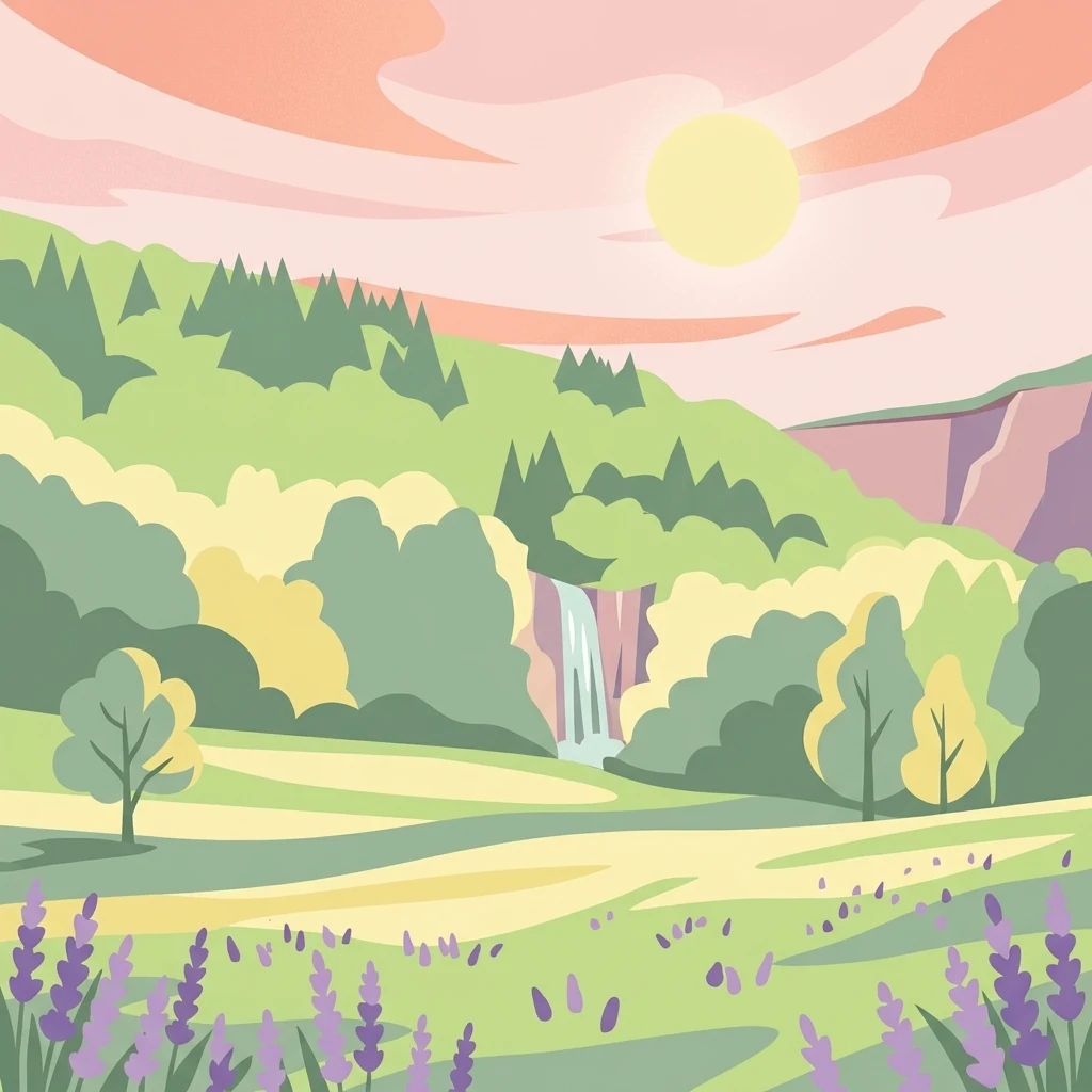
A digital illustration depicting a sunny landscape with rolling green hills, a small waterfall in the distance, and lavender-colored flowers in the foreground under a stylized sunset sky.

Krebsbachtal bei Kaichen

Nature reserve

Park overview

Structured park overview, official facts, and landscape profile for Krebsbachtal bei Kaichen

Krebsbachtal bei Kaichen park facts, protected area profile, and essential visitor context

Review the core facts for Krebsbachtal bei Kaichen, including designation, size, terrain, visitor scale, habitats, and operating context in one park-focused overview.

About Krebsbachtal bei Kaichen

Krebsbachtal bei Kaichen is a small but ecologically dense nature reserve in the rolling countryside of central Hesse. It lies in the Main-Kinzig-Kreis, just across the administrative line from the Wetteraukreis, and stretches along the valley of the Krebsbach between the villages of Erbstadt and Heldenbergen, both part of the town of Nidderau, and Kaichen, a district of Niddatal. The protected area covers about 34 hectares and includes both the valley floor and parts of the wooded slopes of the Hainwald, which rises above the stream.

The defining quality of the reserve is the variety of habitats packed into this relatively short, roughly 2.5 kilometer stretch of valley. Open wet and moist meadows line the stream, while nutrient-poor lean grasslands occupy drier terraces and edges. Traditional orchard meadows (Streuobstwiesen), hedgerows, small ponds, and mixed deciduous-coniferous forest of the Hainwald together form a mosaic of habitats that is rare in the wider region. This combination of grassland types, woody structures, and water features is what gives the reserve its ecological significance and is the explicit rationale behind its 1988 designation.

The reserve plays a role well beyond its modest size. In a landscape where modern agriculture and settlement expansion have simplified much of the surrounding countryside, Krebsbachtal bei Kaichen preserves a working example of the traditional, small-scale Hessen cultural landscape: hay meadows still being mown, fruit trees still being managed, hedgerows still maintained as field boundaries, and forests still managed as mixed woodland. It therefore provides refuge for species that depend on this kind of varied, low-intensity land use, and it serves as an anchor for the ecological identity of the local area.

Quick facts and research context for Krebsbachtal bei Kaichen

Krebsbachtal bei Kaichen is a designated Naturschutzgebiet (nature reserve) of approximately 34 hectares located in the Main-Kinzig-Kreis in Hesse, Germany, lying between the municipalities of Nidderau and Niddatal. The protected landscape follows the Krebsbach, a small tributary of the Nidder river, and incorporates parts of the adjacent Hainwald mixed forest. The reserve was formally designated on 12 August 1988 to preserve a regionally exceptional concentration of wet meadows, lean grasslands, hedgerows, orchard meadows, and forest communities that together create habitat for rare species. Old boundary stones along the stream itself mark the historical border between the Kingdom of Prussia (previously the Electorate of Hesse) and the Grand Duchy of Hesse.

Protection and recognition

Terrestrial protected area framework and designation records for Krebsbachtal bei Kaichen

Krebsbachtal bei Kaichen Protection Status and Conservation Recognition

Terrestrial protected area records for Krebsbachtal bei Kaichen outline documented conservation boundaries and management scope without international recognition sources. Factual designation context clarifies the established protection status for this regional landscape.

Protection details

Protection scope
Terrestrial
Transboundary protection
No
Park context

Deeper park guide and search-rich context for Krebsbachtal bei Kaichen

Krebsbachtal bei Kaichen history, landscape, wildlife, and travel context

Explore Krebsbachtal bei Kaichen through its history, landscape character, ecosystems, wildlife, conservation priorities, cultural context, and seasonal travel timing in a structured park guide built for atlas discovery and search intent.

Why Krebsbachtal bei Kaichen stands out

The reserve is distinguished above all by its unusually high density of different habitat types within a small area: wet meadows, low-nutrient dry grasslands, orchard meadows, hedgerow corridors, ponds, and mixed forest all occur together along the Krebsbach valley. This structural richness, unusual for the surrounding region, is the explicit reason the area was placed under formal protection in 1988 and remains its defining feature today.
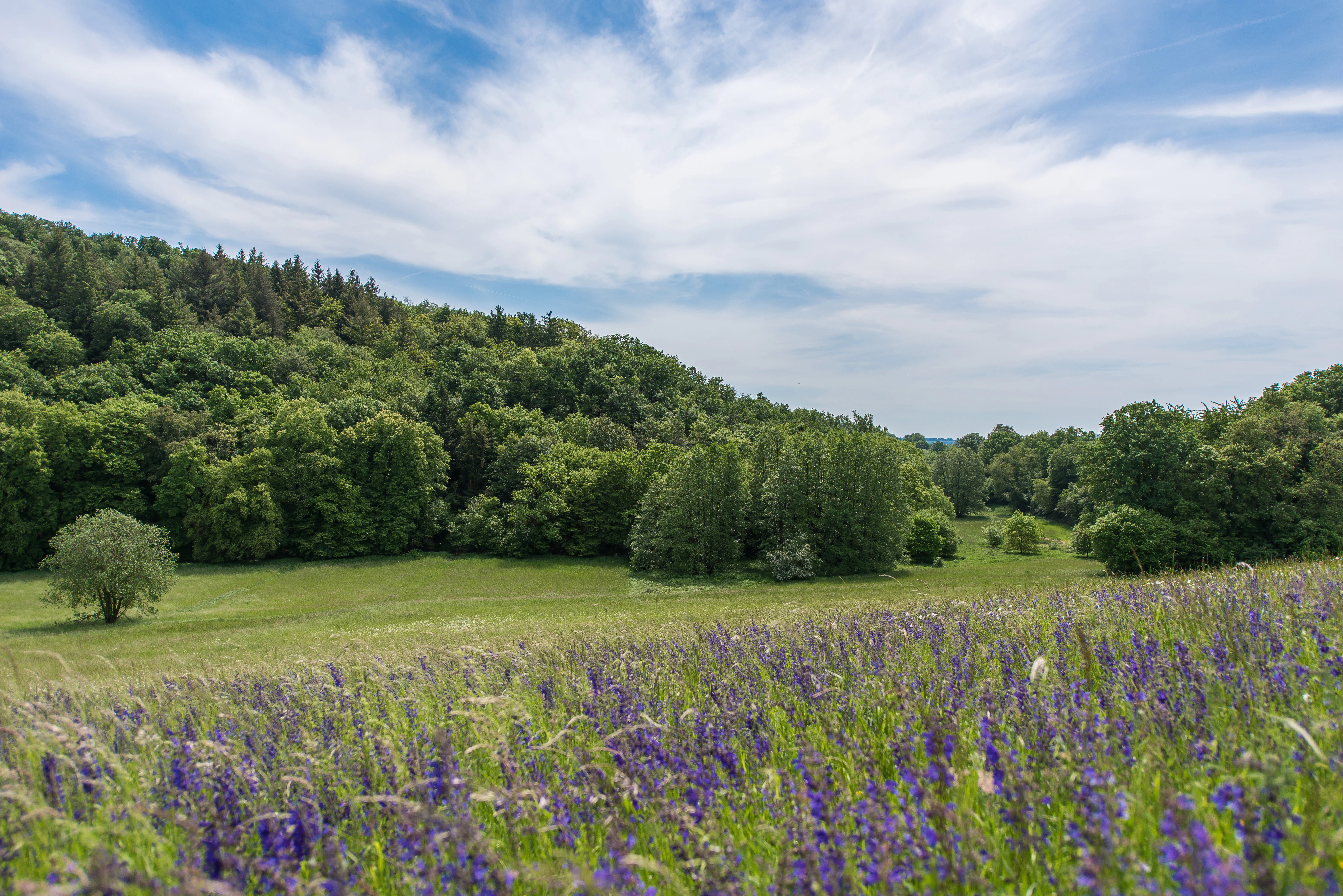
Wide shot of a vibrant purple wildflower meadow in the foreground, leading to a grassy field and a lush green forest hillside under a sky with scattered white clouds.
A flowering meadow at the edge of a forest within the Krebsbachtal bei Kaichen nature reserve.

Krebsbachtal bei Kaichen history and protected-area timeline

The protected area was formally established on 12 August 1988, when the ordinance creating the Naturschutzgebiet „Krebsbachtal bei Kaichen" was issued. The reserve straddles the boundary between two administrative units: the Kaichen district of the town of Niddatal in the Wetteraukreis and the Erbstadt and Heldenbergen districts of the town of Nidderau in the Main-Kinzig-Kreis.

The stated purpose of the 1988 ordinance was to permanently secure and maintain the scenic beauty of the Krebsbach valley, with its regionally unique structural richness of lean grasslands, wet and moist meadows, hedgerows, orchard meadows, and species-rich forest communities, and to preserve them as habitat for rare plant and animal species. The reserve thus built on, and gave legal protection to, a landscape whose character had already developed over generations through traditional agricultural and forestry use.

Older layers of history remain visible within the reserve. Along the banks of the Krebsbach, old boundary stones inscribed with the letters „KP" (Königreich Preußen, formerly Kurfürstentum Hessen before 1866) and „GH" (Großherzogtum Hessen) recall the historical political border between two former German states that once ran through the valley.

Krebsbachtal bei Kaichen landscape and geographic character

The Krebsbachtal bei Kaichen occupies a shallow, narrow valley in the gently rolling countryside of central Hesse, formed by the Krebsbach stream. The valley runs for roughly 2.5 kilometers between Kaichen to the south and Erbstadt and Heldenbergen to the north. The Hainwald, a mixed forest, follows the valley along its higher slopes, giving the protected area a clear three-part structure: stream and meadow at the bottom, transitional scrub and orchard meadows on the lower slopes, and mixed forest above.

The terrain is modest in elevation but visually varied. Flat or gently sloping wet meadows lie closest to the watercourse, with drier, leaner grasslands occupying slightly higher terraces. Orchards, hedgerows, and small woodland patches break up the slopes, creating a finely textured valley floor that contrasts with the denser, darker woodland of the Hainwald above. Ponds and small wet depressions add further surface variation. Old boundary stones along the Krebsbach are a subtle but distinctive man-made feature of the landscape, marking the historical line between two former German states.

Krebsbachtal bei Kaichen ecosystems, habitats, and plant life

Ecologically, the reserve is defined by its close juxtaposition of multiple habitat types. The stream itself is fringed by wet and moist meadows that flood or stay damp for parts of the year, while drier, low-nutrient lean grasslands exist only a short distance away on better-drained ground. Between these open habitats run hedgerows and traditional orchard meadows, or Streuobstwiesen, with scattered fruit trees that link the grassland and the forest edge.

The Hainwald, the mixed forest that rises along parts of the valley, brings woodland species into contact with the open habitats below. Together, this patchwork of wet meadow, dry grassland, hedgerow, orchard, and mixed forest provides habitat for many rare and legally protected plant and animal species, and it gives the reserve an ecological richness that is unusual for a site of this size in the region. Small ponds and temporary wet depressions add still-water habitats that complement the flowing water of the Krebsbach.

Krebsbachtal bei Kaichen wildlife and species highlights

Although detailed species inventories are not laid out in the source material, the reserve is explicitly described as providing Lebensraum for many rare and protected animal and plant species. The combination of habitats along the Krebsbach valley, including wet meadows, dry lean grasslands, hedgerows, orchard meadows, ponds, and mixed forest, allows for a wide range of animal groups to occur: meadow-dependent insects and grassland flora in the open habitats, amphibians and aquatic invertebrates in and along the stream and ponds, woodland fauna in the Hainwald, and a variety of bird and small mammal species using the hedgerows and orchard trees as corridors and nesting sites. The reserve is recognized locally as an important refuge for species tied to traditional, low-intensity Hessen countryside.

Krebsbachtal bei Kaichen conservation status and protection priorities

Krebsbachtal bei Kaichen was placed under formal protection in 1988 as a Naturschutzgebiet under Hessian nature conservation law because of its regionally exceptional concentration of different habitat types. The 1988 ordinance specifically names the goal of permanently safeguarding the valley's mix of lean grasslands, wet and moist meadows, hedgerows, orchard meadows, and species-rich forests as habitat for rare flora and fauna. In a modern agricultural region where large parts of the landscape have been simplified through intensified land use, the reserve preserves a working example of small-scale, traditional land management, including mown meadows, managed orchards, and mixed woodland, which is itself a key conservation strategy for the many species that depend on these structurally rich, low-intensity habitats.

Krebsbachtal bei Kaichen cultural meaning and human context

The Krebsbachtal is a piece of living cultural landscape. Hedges, orchard meadows (Streuobstwiesen), hay meadows, and mixed forest management reflect generations of low-intensity agricultural and forestry practice in Hesse. Old boundary stones along the Krebsbach, marked „KP" for the Kingdom of Prussia (previously the Electorate of Hesse) and „GH" for the Grand Duchy of Hesse, recall the historical border between these two states that once ran through the valley. Together, the reserve preserves not only natural values but also the more subtle cultural and historical imprint of land use and political geography in central Hesse.

Top sights and standout views in Krebsbachtal bei Kaichen

Within its modest 34 hectares, Krebsbachtal bei Kaichen concentrates a remarkable diversity of habitats: stream and wet meadows, lean dry grasslands, orchard meadows, hedgerows, ponds, and mixed forest of the Hainwald. Designated in 1988, it is recognized as a regionally exceptional example of small-scale Hessen cultural landscape that remains biologically valuable for rare and protected species. Historical boundary stones along the Krebsbach add a layer of visible political history to a reserve whose primary importance today lies in its ecological and landscape values.

Best time to visit Krebsbachtal bei Kaichen

The reserve is described as particularly attractive in spring, when the valley shows its fresh green meadows and blooming orchard trees. Late spring and early summer are also good for observing the contrast between wet and dry grassland habitats and for generally appreciating the diversity of the valley. As a nature reserve, visits are intended to be low-impact; the area is best experienced on foot along the valley and the forest edges, and visiting in mild, dry weather makes the combination of meadow, hedgerow, and woodland habitats most visible.

Monthly climate preview

Long-term representative monthly averages for temperature and precipitation

Krebsbachtal bei Kaichen Climate Normals and Annual Temperature Rhythm

Krebsbachtal bei Kaichen records measured long-term temperatures spanning from sub-zero winter minimums to warm summer maximums alongside steady daily precipitation amounts. Detailed monthly comparisons provide a complete baseline for evaluating the local climate rhythm across the representative coordinate.
Annual mean9 °C
-1 °C19 °C
Jan-1°
Feb
Mar
Apr
May13°
Jun16°
Jul19°
Aug19°
Sep14°
Oct
Nov
Dec
Warmest month
July

18.8 °C

Coolest month
January

-0.6 °C

Wettest month
July

2.5 mm/day

Driest month
April

1.6 mm/day

Park location guide

Geography guide, regional context, and park location map for Krebsbachtal bei Kaichen

Krebsbachtal bei Kaichen park geography, regions, and map view in Germany

Understand where Krebsbachtal bei Kaichen sits in Germany through a broader geographic reading of the surrounding landscape, nearby location context, and its mapped position within the national park landscape.

How Krebsbachtal bei Kaichen fits into Germany

Germany is a federal republic in Western and Central Europe with a population of over 83 million across sixteen constituent states. It is Europe's largest economy by nominal GDP and a major global exporter and importer. The capital is Berlin, and the country borders Denmark, Poland, Czech Republic, Austria, Switzerland, France, Luxembourg, Belgium, and the Netherlands.

Wider geography shaping Krebsbachtal bei Kaichen in Germany

Germany is located in Western and Central Europe, spanning 357,022 km². It borders Denmark to the north, Poland and the Czech Republic to the east, Austria and Switzerland to the south, and France, Luxembourg, Belgium, and the Netherlands to the west. The country has coastlines on the Baltic Sea and North Sea to the north, with the Alps located in the southern region.

Map view of Krebsbachtal bei Kaichen

Use this park location map to pinpoint Krebsbachtal bei Kaichen in Germany, understand its exact geographic position, and read its mapped placement within the surrounding landscape more clearly.

Pigeon | © OpenStreetMap contributors

Location context for Krebsbachtal bei Kaichen

Hesse

Visualizing stream valleys, meadow habitats, and mixed forest environments

Krebsbachtal bei Kaichen Landscape Photos and Protected Area Scenery

Visual records capture the distinctive terrain, stream valley layouts, and micro-habitats found across the protected reserve. Examining these landscape views reveals the structural mosaic of wet meadows, orchards, and forest borders that define the local environment.

Wide shot of a vibrant purple wildflower meadow in the foreground, leading to a grassy field and a lush green forest hillside under a sky with scattered white clouds.

A wide view of a rolling green valley with patches of trees displaying autumn foliage colors.

Park atlas

Compare adjacent stream valleys, mixed forests, and regional nature reserves

Explore Parks Near Krebsbachtal bei Kaichen and Surrounding Protected Areas

Browse protected areas and natural reserves located near Krebsbachtal bei Kaichen in central Hesse. Comparing adjacent stream valleys and woodland habitats provides broader geographic context for regional conservation landscapes.
Nature reserveHesse
About 9.5 km away#1 closest

East

Im Rußland und in der Kuhweide bei Lindheim: Nature Reserve and Floodplain Geography

Protected grassland landscapes in the Wetterau, Hesse.

Located in the Wetteraukreis district of Hesse, this nature reserve protects extensive floodplain meadows along the Nidder river. The area is defined by its open grassland mosaic, providing critical refuge for meadowbirds and diverse amphibian populations. Access detailed map data and landscape context for this significant German conservation site.

Area
2.495 km²
Established
1984
Relief
Lowland
Climate
Temperate
Protected areaGermany
About 11 km away#2 closest

Northeast

Bruch von Heegheim Protected Area: A Wetland Landscape in the Nidder River Valley

Mapped wetland habitats and ecological site geography

Bruch von Heegheim is a specialized nature reserve that protects a delicate mosaic of shallow water bodies and reed-dominated marshes in the German district of Wetteraukreis. The site serves as a vital refuge for European tree frogs and breeding marshland birds, demonstrating how compact protected lands contribute to broader biodiversity conservation within agricultural floodplains.

Area
0.108 km²
Established
1976
Relief
Lowland
Climate
Temperate
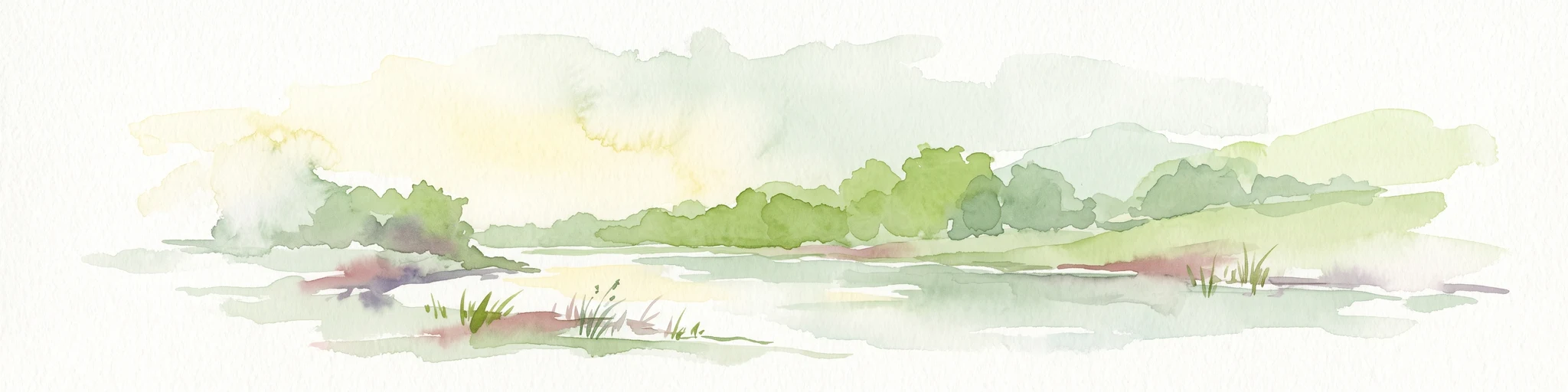
A soft watercolor painting of a pond with reeds in the foreground and a tree-lined bank in the background, set against a pale, washed-out sky.
Nature reserveHesse
About 12 km away#3 closest

Southwest

Enkheimer Ried Nature Reserve: Geographic Overview and Protected Area Boundaries

Wetland landscape analysis within the Hesse region of Germany

Enkheimer Ried functions as a distinct nature reserve and wetland anchor near Frankfurt. This entry examines its spatial composition, including the central Riedteich pond and the Tränkebach floodplain, providing a clear geographic context for this ecologically rich conservation site in the heart of the Rhine-Main urban environment.

Area
0.282 km²
Established
1973
IUCN
IV
Relief
Lowland
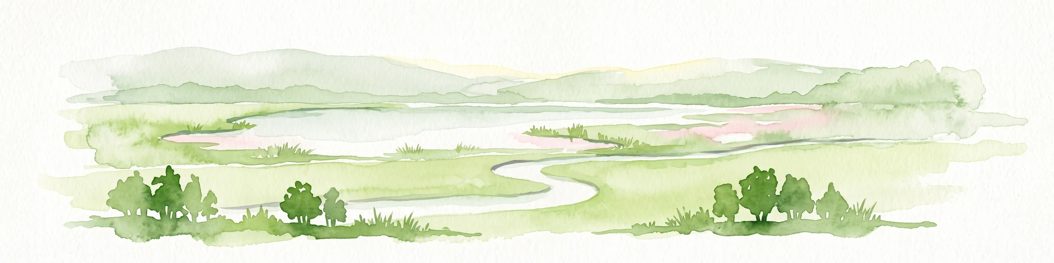
A horizontal watercolor illustration showing a meandering stream flowing through open green grasslands with scattered trees and low hills in the background.
Nature reserveHessen
About 13 km away#4 closest

Northeast

Nachtweid von Dauernheim Nature Reserve: Geographic Overview and Wetland Conservation

Saline meadows and floodplain habitats in Hessen

Nachtweid von Dauernheim is a specialized nature reserve in the Wetterau district, defined by its rare saline-influenced grassland flora and extensive sedge marshes. As a core rail bird biotope, the site anchors a wider wetland network alongside the Nidda river floodplain. This protected area offers a deep look into central Germany's unique hydrologic conditions and sensitive open-terrain conservation.

Area
0.789 km²
Established
1978
A horizontal watercolor painting showing a wetland landscape with gentle rolling hills, marshy vegetation, and scattered trees under a light sky.
Nature reserveHesse
About 13 km away#5 closest

North

Bingenheimer Ried Nature Reserve: Mapped Floodplain Geography in Hesse

A critical lowland mire and wetland conservation network

Located in the Horloff valley, Bingenheimer Ried represents an essential protected landscape characterized by seasonal flooding and shallow mire habitats. This nature reserve supports significant bird populations and diverse aquatic life, functioning as a primary reference point for floodplain management and conservation geography within the state of Hesse.

Area
0.85 km²
Established
1985
A horizontal watercolor illustration showing soft, abstract layers of hills, valleys, and forest greenery in pastel tones of green, yellow, and muted pink against a white background.
Nature reserveHessen
About 13 km away#6 closest

Southwest

Mühlbachtal von Bergen-Enkheim Nature Reserve: Geographic and Landscape Discovery

A protected valley refuge within the Hessen regional landscape

Mühlbachtal von Bergen-Enkheim is a nature reserve in Hessen, Germany, distinguished by its compact size and high botanical diversity. The valley, carved into the Berger Rücken ridge, maintains unique habitat types including wet meadows and traditional orchards. It provides a rare look at the floodplain forest relics that once defined the surrounding region, offering a clear study in urban-edge conservation geography.

Area
0.033 km²
Established
1986
IUCN
IV
A watercolor painting of a green, rolling meadow landscape with distant hills under a soft, light sky.
Nature reserveWetteraukreis
About 14 km away#7 closest

Northeast

Nidderauen von Stockheim Nature Reserve: A Detailed Geographic and Protected Landscape Map

Wetland floodplain geography in the Wetteraukreis region

This protected nature reserve spans 51 hectares of the Nidder river valley, forming a critical segment of the Auenverbund Wetterau. The landscape is defined by its mosaic of wet meadows, ponds, and tall herb vegetation, maintained by targeted conservation management and river restoration. Access the map-driven context of this European FFH site to understand its role in regional wetland preservation and habitat connectivity.

Area
0.512 km²
Established
1981
Relief
Lowland
Climate
Temperate
Nature reserveHessen
About 15 km away#8 closest

Southeast

Kinzigaue von Langenselbold: Nature Reserve and Protected Floodplain in Hessen

Riparian ecosystems, alluvial forests, and wetland geography

Spanning 129 hectares, Kinzigaue von Langenselbold represents a well-preserved riverine corridor in central Germany. The reserve integrates the meandering Kinzig river, mature gallery forests, and the Ruhlsee into a compact, protected landscape that serves as an essential habitat for diverse bird species and rare floodplain vegetation.

Area
1.287 km²
Established
1980
IUCN
IV

Common questions about visiting, size, designation, and location context for Krebsbachtal bei Kaichen

Krebsbachtal bei Kaichen FAQs for park facts, access, geography, and protected area context

Find quick answers about Krebsbachtal bei Kaichen, including protected-area facts, park geography, trail and visitor context, and how the park fits into its surrounding country and regional landscape.
MoriAtlas Explorer

Continue Your Protected Areas Search Across the Global Atlas

Deepen your exploration by continuing the structured search for national parks and protected areas worldwide. Utilize the comprehensive filtering capabilities to compare different conservation landscapes and refine your understanding of global park geography. Discover more about the distribution and characteristics of protected natural areas.

Global natural geography