
Why Kühkopf-Knoblochsaue stands out
Kühkopf-Knoblochsaue is best known for its classic Rhine floodplain mosaic, where softwood forest of pollarded willows and black poplars transitions into hardwood forest of oaks, elms, and ashes. The reserve is recognized as one of the foremost examples of a culturally and ecologically shaped Rhine floodplain in Germany, valued both for its biodiversity and for its role in Rhine flood retention. It is also closely identified with the Black Kite (Schwarzmilan), regarded as the symbolic animal of the Kühkopf, and with the centuries-old orchard landscape that still lines the long approach to the historic Guntershausen estate. The combination of remnant old river arms, regularly flooded meadows, pollarded willows, fruit-tree alleys, and historic manor farms gives the reserve a distinctive cultural and natural identity within the Hessian Rhine floodplain.
Kühkopf-Knoblochsaue history and protected-area timeline
Until the early seventeenth century the area around the Rhine loop at the Kühkopf was primarily a hunting ground of the local nobility. Parallel to this aristocratic use, the first estate farms (Hofgüter) began to appear. In 1617 the Metternich family's Auhaus was built, later the core of the Kälberteicher Hof, while the Gemmingen family's Auhaus evolved into the Hofgut Guntershausen that still anchors the reserve today. East, south, and north of the main loop lay several smaller Rhine islands, foreshadowing the present mosaic of merged floodplain land.
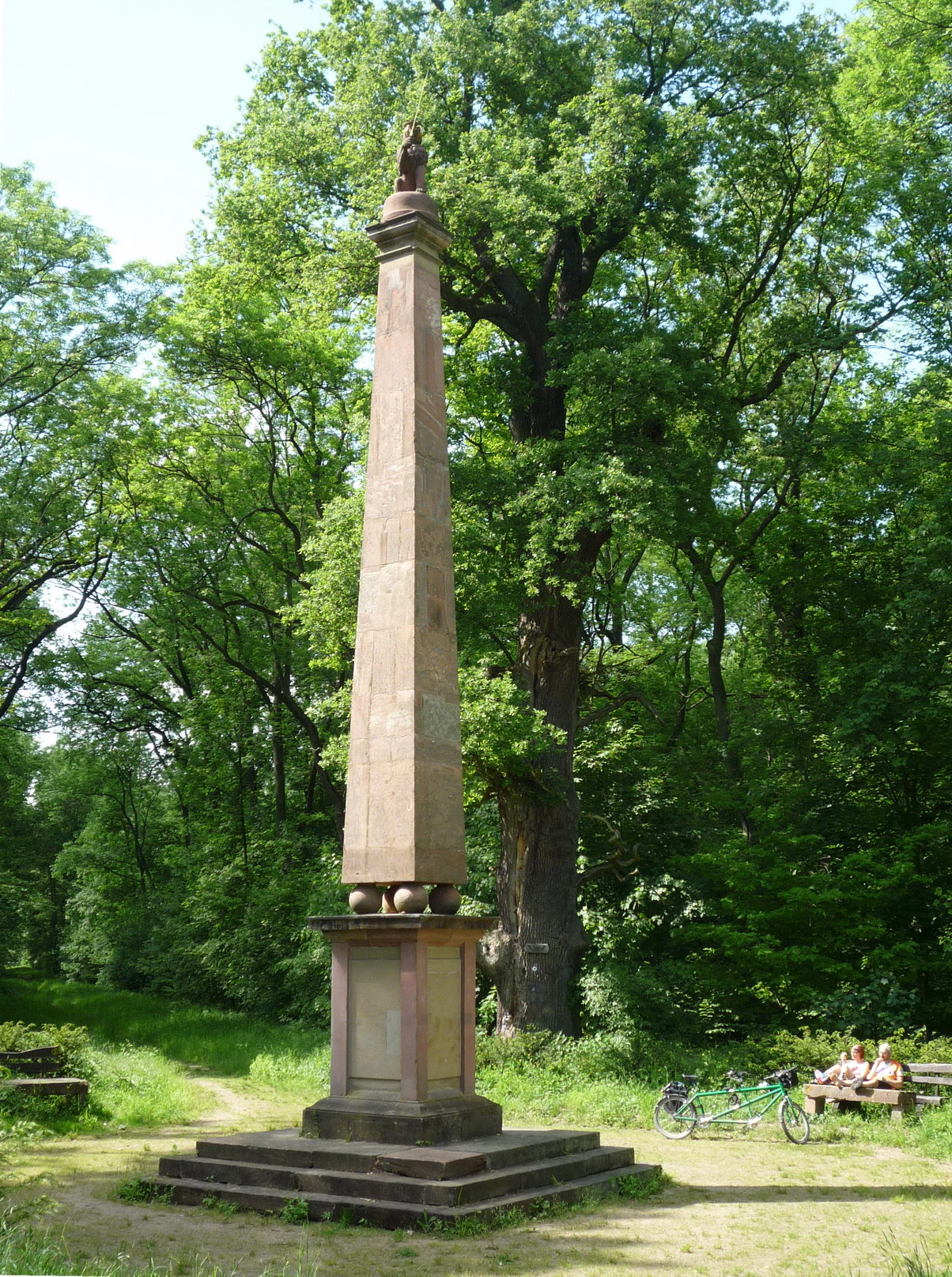
The reserve carries clear traces of the Thirty Years' War and the Austrian Succession War. The Schwedensäule in the Knoblochsaue commemorates the crossing of the Rhine by the Swedish King Gustav Adolf on 7 September 1631. In the later Austrian Succession War, during preparations to throw a bridge across from what was then the Maulbeerinsel east of the Kühkopf to the western bank, the Hungarian cavalry general Johann Daniel von Menzel was killed on 25 June 1744 by a French sharpshooter while reconnoitering water depths.
The decisive modern transformation came with the Rhine straightening (Rheinbegradigung) of 1828 to 1829 under Claus Kröncke, when the direct cut isolated the Kühkopf as an island and left the old river curve as the Stockstadt-Erfelder Altrhein. Until 1945 the separated area was administratively split between the Gemarkungen of Guntersblum and Gimbsheim on the left bank, with farming access maintained by ferries; Guntersblum operated the last Gierseilfähre (track-rope ferry) across the Rhine, while Gimbsheim ran a smaller passenger boat. This ferry-based chapter of the island's history ended in 2012 to 2013 with the discontinuation of the passenger service.
Farming shaped both land use and cultural memory. Oil was extracted on the Kühkopf until 1994, marked by the preserved "Pferdekopf" pumpjack near Hofgut Guntershausen. The deliberate non-repair of a dike breach in April 1983 marked a turning point for conservation: the formerly protected farmland was abandoned to natural processes and is now regularly flooded by the Rhine. The area's ecological importance was formally recognized on 20 March 1952, when it was placed under nature protection; it later received the Europareservat designation and was confirmed as an FFH site under the EU Habitats Directive in 2008.
Kühkopf-Knoblochsaue landscape and geographic character
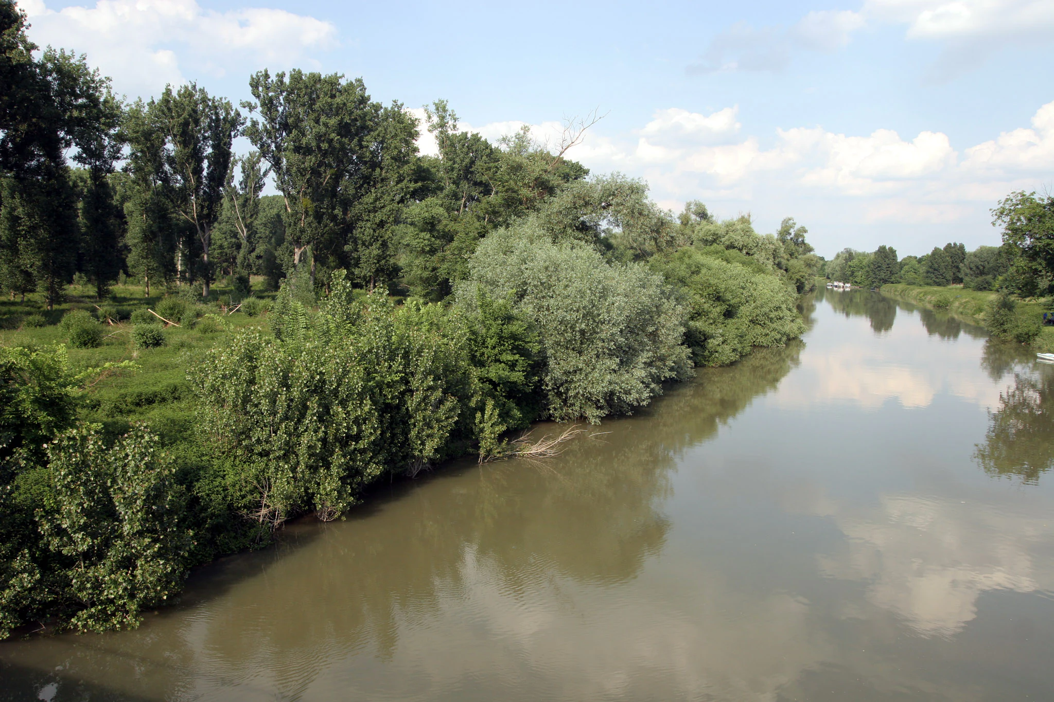
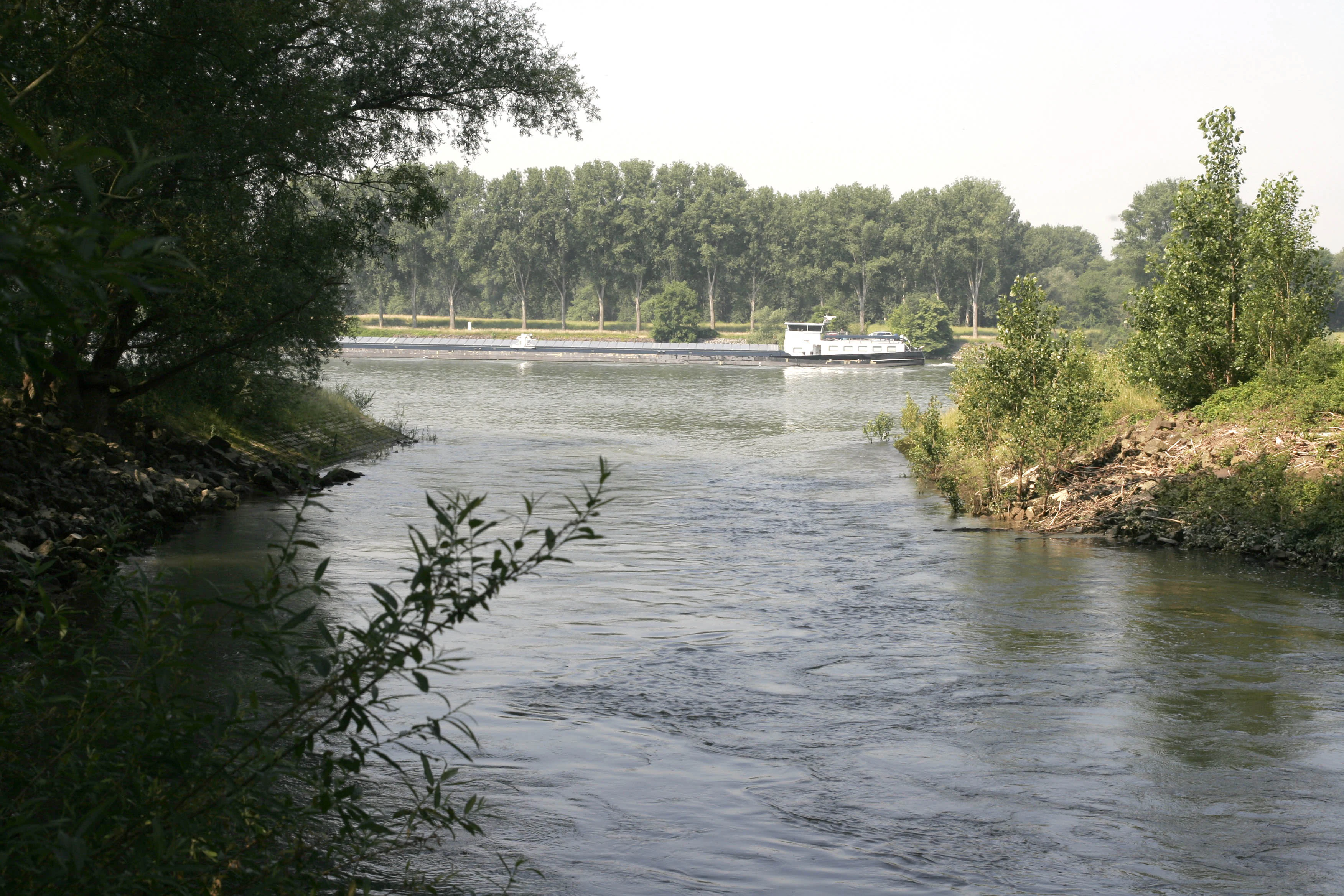
Kühkopf-Knoblochsaue occupies a broad, flat segment of the Upper Rhine lowland, dominated by the wide, slow current of the Rhine and the quieter waters of the old Stockstadt-Erfelder Altrhein. The relief is gentle to nearly level, with the main visual contrast coming not from elevation but from water, vegetation, and the contrast between active river channel and former channel.
The Kühkopf itself is a clearly bounded inland island, almost entirely encircled by water, with the Rhine on one side and the Altrhein on the other. The Knoblochsaue, formerly a separate island, is now connected to the mainland by silted-up floodplain, forming a peninsula that extends the protected landscape outward. Several smaller former islands to the north and south have similarly merged into the main area, so that what was once a chain of small islands is now a coherent, intricately shaped floodplain.
The landscape is defined by the alternation of flowing water, standing and slow-moving old arms, fringing softwood forest, more mature hardwood stands, and open meadow and orchard areas. Dike breaches, like the one left open since 1983, and the marshy Kolke known as the Neujahrsloch and the Bruderlöcher, illustrate the continuing geological dynamism of the floodplain, while the long apple-tree alleys continue to give parts of the reserve a strong human-ordered appearance within the largely natural setting.
Kühkopf-Knoblochsaue ecosystems, habitats, and plant life
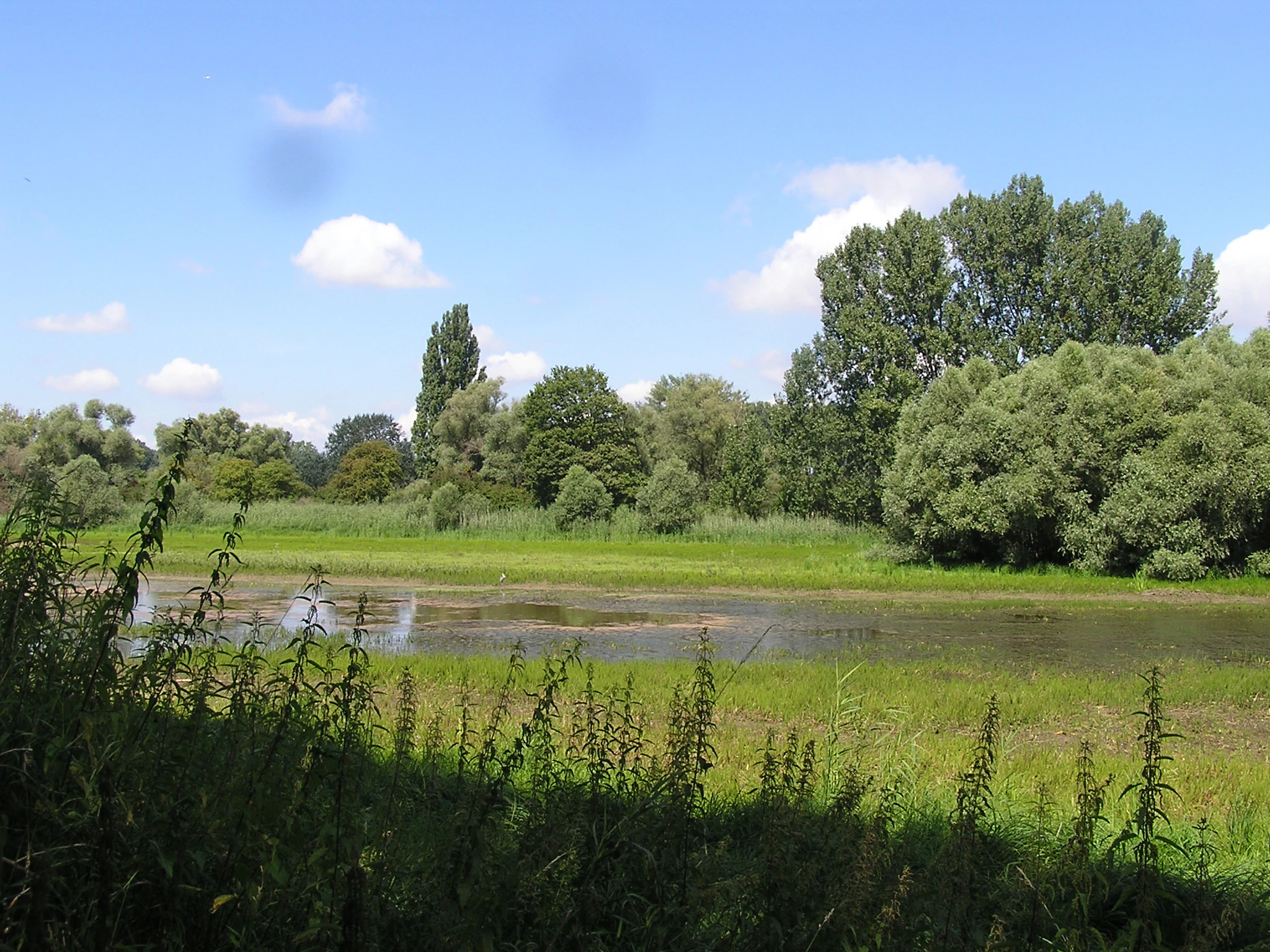
Ecologically, Kühkopf-Knoblochsaue represents one of the most intact and representative Rhine floodplain complexes in Hesse. It unites two major floodplain forest types: the Weichholzaue, dominated by softwood species such as the characteristic, gnarled pollarded willows and black poplars that thrive in frequently inundated zones close to the active channel; and the Hartholzaue further inland, where oaks, elms, and ashes form the more stable, higher floodplain forest.
Beyond the forested core, the reserve includes extensive marshy areas where reeds, grasses, and hardwood saplings create valuable habitat mosaics. These regularly flooded areas are fundamental to the area's value as resting and breeding habitat for a wide range of bird species. The deliberately maintained dike breach from April 1983 has since evolved into a zone of uncontrolled flooding that has been left to natural development, allowing open floodplain processes to operate again.
Since 2004, a dedicated renaturation project has focused on the Stromtalwiesen, the special floodplain meadows characteristic of large river valleys. Contrary to expectations, these species-rich meadows did not re-establish themselves on their own once farming stopped in 1983; managers now support recovery by transferring ripe seed material from characteristic species in similar sites, and the project has become an important element of the reserve's ecological management. The reserve is part of the Geo-Naturpark Bergstraße-Odenwald, underlining its broader landscape significance. In spring, large parts of the forest floor are covered by wild garlic (Bärlauch), and in winter the relatively high numbers of mistletoe clusters in the edge trees are particularly visible.
Kühkopf-Knoblochsaue wildlife and species highlights
Kühkopf-Knoblochsaue is particularly notable for its rich birdlife, supported by the combination of open water, marshland, floodplain meadows, mature forest, and the dynamic flooding regime of the Rhine. The reserve serves as an important resting and breeding area for numerous bird species along this stretch of the Upper Rhine, and the regular flooding maintains the open habitats many of these species require.
The symbolic animal of the Kühkopf is the Black Kite (Schwarzmilan), whose presence signals the continued health of the floodplain ecosystem. White Storks are also regularly observed feeding in the wet meadows; an old photograph from the area famously shows a White Stork catching and eating a grass snake. Red deer, wild boar, and foxes are widespread across the protected area, while common frogs and common toads are abundant in the wetter sections.
The mosaic of habitats supports a broader diversity of species typical of large Central European river floodplains, from riparian specialist birds breeding in the softwood forest to waterbirds using the Altrhein and the open marsh zones. Although the protected area's size and regular flooding make detailed counts difficult, the reserve's combination of habitat types gives it a profile far above the regional average for floodplain biodiversity.
Kühkopf-Knoblochsaue conservation status and protection priorities
Kühkopf-Knoblochsaue has been recognized for its ecological importance for many decades and ranks as Hesse's largest Naturschutzgebiet. It was placed under formal protection on 20 March 1952, and its status has since been actively reinforced through a layered system of European designations. It carries the title of Europareservat, and in 2008 it was confirmed as one of Hesse's larger FFH (Fauna-Flora-Habitat) sites under the European Union's Habitats Directive, giving the floodplain additional legal protection at the European level.
The reserve's conservation value rests on several pillars. It protects a rare and increasingly threatened type of Central European habitat: a largely intact Rhine floodplain forest system, combining Weichholzaue and Hartholzaue with reedbeds, marsh, and floodplain meadows. The continued ability of these habitats to function depends on the river's flooding dynamics, which is why the reserve also performs a key flood retention role as the largest continuous flood retention zone along the Hessian Rhine.
Active management supports ecological recovery where natural processes alone have proved insufficient. The dike breach left unrepaired since April 1983 is a deliberate experiment in allowing natural floodplain dynamics to resume on formerly farmed land. Since 2004, a renaturation project for the Stromtalwiesen has supplemented natural regeneration by transferring seeds of characteristic plant species, since the meadows did not return on their own after farming ceased. The reserve is also integrated into the Geo-Naturpark Bergstraße-Odenwald, strengthening its role as a refuge for floodplain biodiversity along the Upper Rhine.
Kühkopf-Knoblochsaue cultural meaning and human context
The cultural history of Kühkopf-Knoblochsaue runs parallel to its natural history. Throughout the early modern period, the area was a noble hunting ground and a growing cluster of manor farms. Notable surviving estate houses include the Metternich family's Auhaus, the seed of what became the Kälberteicher Hof, and the Gemmingen family's Auhaus, ancestor of Hofgut Guntershausen, which still anchors the reserve today and houses its information center.
The floodplain carries heavy traces of European military history. The Schwedensäule in the Knoblochsaue recalls the Rhine crossing of the Swedish King Gustav Adolf on 7 September 1631 during the Thirty Years' War, while in the Austrian Succession War the Hungarian general Johann Daniel von Menzel was killed in 1744 by a French sharpshooter during reconnaissance on what was then the separate Maulbeerinsel. Both events are documented in local monuments and historical maps.
Until 1945 the Kühkopf belonged administratively to the left-Rhine municipalities of Guntersblum and Gimbsheim, and a distinct ferry culture developed around the island. Guntersblum operated the last Gierseilfähre (track-rope ferry) across the Rhine, and Gimbsheim ran a smaller passenger ferry. The passenger service from Guntersblum via the ferry König Gunther was discontinued in 2013, but the history remains visible in the landscape and in cultural memory. The writer Elisabeth Langgässer, who knew the Ried from her teaching years in Griesheim, dedicated a circular walking trail in the reserve to her 1936 novel "Gang durch das Ried", which describes this very landscape.
Top sights and standout views in Kühkopf-Knoblochsaue
Kühkopf-Knoblochsaue is distinguished above all by its dual identity as a major European floodplain reserve and as a historic Rhine island landscape. The Kühkopf, once a peninsula at the tip of a great Rhin loop and now an inland island surrounded by the active Rhine and the Stockstadt-Erfelder Altrhein, gives the reserve a striking geographical signature.
Equally distinctive is the combination of intact softwood and hardwood floodplain forest with a centuries-old orchard tradition, still visible in the kilometer-long apple-tree alley leading from Hofgut Guntershausen to the former ferry landing. The reserve is also notable for its cultural layering, from the Schwedensäule commemorating Gustav Adolf's Rhine crossing to oil-extraction remains at Hofgut Guntershausen and the literary trail devoted to Elisabeth Langgässer, all set within one of Hesse's largest continuous flood retention zones.
Best time to visit Kühkopf-Knoblochsaue
The character of a visit to Kühkopf-Knoblochsaue shifts with the seasons in ways closely tied to the floodplain ecology. Spring is one of the most visually distinctive periods, when wide stretches of the forest floor are carpeted by wild garlic and orchard meadows and forest edges come into fresh leaf. It is also a strong season for bird activity, as migrants and breeding species use the wet meadows and old river arms.
Summer brings dense, full foliage across the floodplain forest and high water levels in the Altrhein, with the colorful open meadows and orchard areas particularly attractive for walking and cycling along the roughly 60 kilometers of trails. Late summer and early autumn are often the best period to observe the reserve's birdlife at close quarters, as water levels fluctuate and many species are concentrated along the remaining open water. Winter, while quieter, has its own character: the structure of the pollarded willows stands out against bare branches, and trees in the edge zones of the floodplain forest are visibly marked by clusters of mistletoe.