
Mori Atlas logo
Wildlife reserveKuiu Wilderness

A vast roadless wilderness of temperate rainforests, deep fjords, and alpine tundra within the Alexander Archipelago

Kuiu Wilderness: Protected Coastal Landscapes and Glaciated Terrain in Alaska

The Kuiu Wilderness preserves a significant expanse of undeveloped coastal land on Kuiu Island in southeast Alaska. Managed as part of the wider Tongass National Forest, this protected area features a unique vertical sequence of habitats, where lush Pacific temperate rainforests transition rapidly into muskeg wetlands and high-altitude alpine tundra. Its geography is defined by deep fjords and rugged headlands carved by past glacial activity, creating a remote and intact environment that remains accessible only by sea or air.

wilderness areatemperate rainforestTongass National ForestAlaskaKuiu Islandfjord landscape
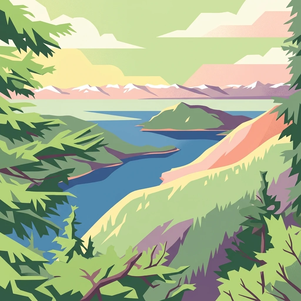
A stylized vector illustration of an Alaskan coastal landscape, featuring evergreen trees in the foreground, a blue bay, and distant snow-capped mountains under a light sky.

Kuiu Wilderness

Wildlife reserve

Park overview

Structured park overview, official facts, and landscape profile for Kuiu Wilderness

Kuiu Wilderness park facts, protected area profile, and essential visitor context

Review the core facts for Kuiu Wilderness, including designation, size, terrain, visitor scale, habitats, and operating context in one park-focused overview.

About Kuiu Wilderness

The Kuiu Wilderness sits at the heart of Kuiu Island, one of the larger land masses in the Alexander Archipelago of southeast Alaska. Because the island lies within the Tongass National Forest, the largest national forest in the United States, the wilderness is part of a much broader network of protected coastal landscapes that stretch along the Alaskan panhandle. Its location between the Inside Passage and the open Gulf of Alaska shoreline gives it a distinctive blend of sheltered and exposed coastal environments.

Geologically, Kuiu Island was shaped by powerful Pleistocene glaciation, and that glacial legacy is still legible in the landscape: deep fjords cut between steep mountains, and narrow bays reach far inland from the coast. Within the wilderness boundary, this rugged terrain supports a layered ecological mosaic. Pacific temperate rainforest, dominated by Sitka spruce and western hemlock, anchors the lowland and shoreline zones, while muskeg wetlands and subalpine meadows occupy the higher valleys and ridges. Alpine tundra conditions can occur at elevations as low as 2,000 feet, an unusually low threshold that reflects the cool, maritime climate.

Human imprint on the landscape is deliberately minimal. No roads cross the wilderness, and access requires either a boat journey or a floatplane arrival. The result is an area that retains much of its original ecological character and offers a strong sense of solitude. This combination of ecological richness and inaccessibility is central to the identity of the Kuiu Wilderness, and it has shaped both how the area is managed and how visitors experience it.

Quick facts and research context for Kuiu Wilderness

The Kuiu Wilderness is a protected wilderness area on Kuiu Island, located within the Tongass National Forest in southeast Alaska. It covers a large tract of rugged island terrain and is managed by the United States Forest Service under the highest level of federal wilderness protection.

Together with the adjacent Tebenkof Bay Wilderness, the Kuiu Wilderness helps form a roughly 200-square-mile preserve in the heart of the island. Both units protect Pacific temperate rainforest, estuarine shoreline, and subalpine environments with no road access. The nearest community is the small village of Kake, reached by the Alaska Marine Highway.

Protection and recognition

Terrestrial conservation scope and documented protected area records

Kuiu Wilderness Protection Status and International Recognition Data

Terrestrial protection status and management scope details define the baseline records for Kuiu Wilderness. Official designation histories and recognized conservation frameworks establish the structural context for the protected area.

Protection details

Protection scope
Terrestrial
Transboundary protection
No
Park context

Deeper park guide and search-rich context for Kuiu Wilderness

Kuiu Wilderness history, landscape, wildlife, and travel context

Explore Kuiu Wilderness through its history, landscape character, ecosystems, wildlife, conservation priorities, cultural context, and seasonal travel timing in a structured park guide built for atlas discovery and search intent.

Why Kuiu Wilderness stands out

Kuiu Wilderness is best known for its expansive old-growth Pacific temperate rainforest rising directly from coastal estuaries into subalpine terrain, all preserved in an undeveloped, roadless setting. The area showcases an unusually complete vertical sequence of habitats in a relatively compact geographic frame: lush lowland forests, open muskeg wetlands, and alpine tundra zones found at elevations as low as 2,000 feet. The wilderness is also distinguished by the way its glaciated coastline and deep fjords provide both sheltered and exposed waters for sea-kayaking and other backcountry travel. Visitors and managers often note that Kuiu Island's combination of ecological diversity and quiet, road-free character sets the area apart as one of the more intact wilderness blocks in Alaska's Alexander Archipelago.
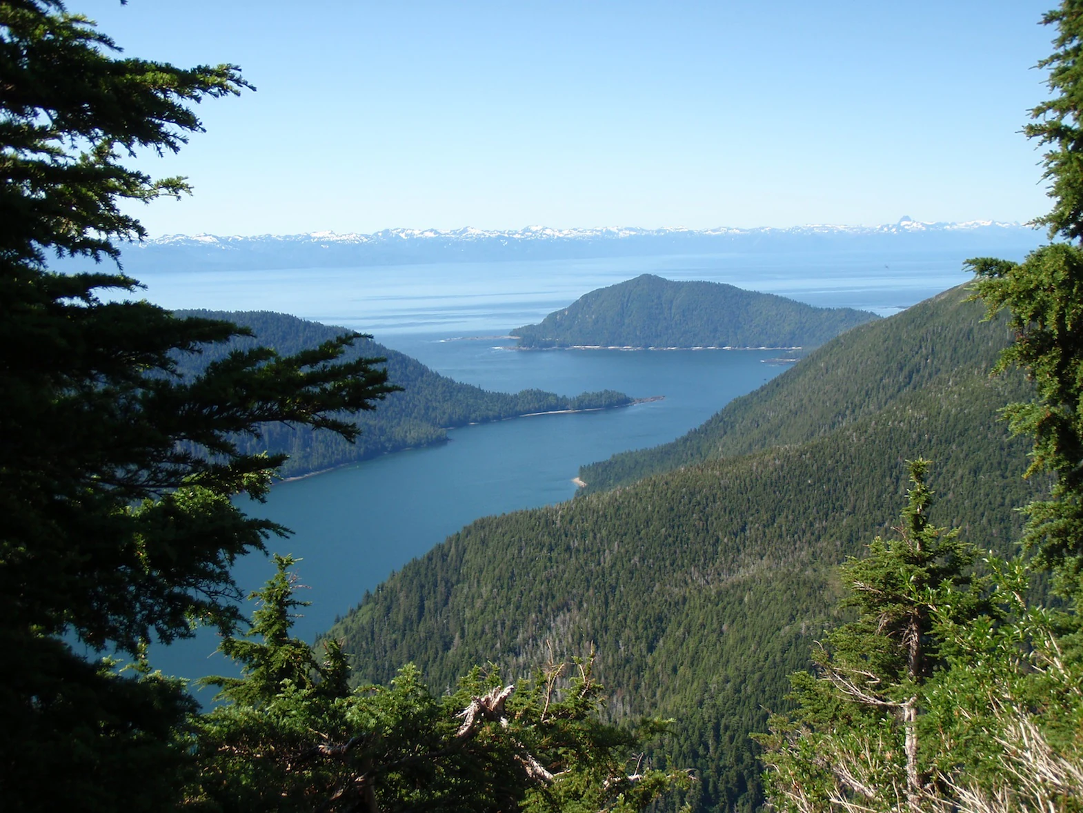
A high-angle view looking over a narrow blue inlet of water surrounded by dense coniferous forests, with distant snow-capped mountains visible on the horizon.
A scenic view overlooking the forested coastline and waters of Port Malmesbury within the Kuiu Wilderness.

Kuiu Wilderness history and protected-area timeline

The history of the Kuiu Wilderness is closely tied to the late twentieth-century expansion of federal wilderness protection in Alaska. Before European colonization, the island and its bays were home to significant populations of Tlingit people, particularly around Tebenkof Bay, where indigenous communities lived for generations in close relationship with the rich marine and forest resources of the region.

Modern legal protection came in two stages. The adjacent Tebenkof Bay Wilderness was first created through the Alaska National Interest Lands Conservation Act, signed into law on December 2, 1980, which dramatically expanded conservation designations across the state. The Kuiu Wilderness itself followed a decade later, established by Congress as part of the Tongass Timber Reform Act and signed on November 28, 1990. The Tongass Timber Reform Act reflected growing concern over logging practices in the Tongass National Forest and aimed to strengthen wilderness protections within it.

Together, the two wilderness designations effectively set aside a large core of Kuiu Island for conservation, even though the U.S. Forest Service continues to manage the surrounding national forest lands for multiple uses. In 1997, a rustic public-use shelter was constructed near the shoreline of Bay of Pillars, intentionally echoing the style of shelter cabins originally built in the 1930s by Civilian Conservation Corps crews working in southeast Alaska. That shelter today remains one of the few built facilities within the broader wilderness area.

Kuiu Wilderness landscape and geographic character

The landscape of Kuiu Wilderness is shaped by a strong glacial inheritance. Repeated Pleistocene glaciation carved the island into a pattern of steep, forested ridges and water-filled valleys, producing some of the classic features found throughout the Alexander Archipelago: deep fjords, narrow bays, rugged headlands, and alternating lowlands and highlands that rise abruptly from the sea.

Elevation climbs quickly from the shoreline. Although many parts of the island are relatively low, the interior includes substantial peaks, with Kuiu Mountain representing the highest point at roughly 3,355 feet. As elevation increases, the coastal rainforest gives way to transitional vegetation communities and ultimately to open subalpine and alpine terrain. Because maritime climate conditions keep growing seasons cool, alpine tundra can begin at elevations as low as 2,000 feet above sea level, creating a notably compressed ecological gradient.

The coastline itself is highly irregular. Sheltered waters reach deep into the interior through long, narrow bays, while outer shorelines face the more exposed conditions of the open ocean. The mix of calm inlets, tidal estuaries, and more rugged outer coast defines the way the land feels from both the sea and the air, and it sets the visual character that visitors encounter when traveling to the wilderness by boat or floatplane.

Kuiu Wilderness ecosystems, habitats, and plant life

Ecologically, the Kuiu Wilderness sits within the Pacific temperate rainforest biome, one of the world's great temperate rainforests and a hallmark of the Tongass region. Lowland forests are dominated by towering Sitka spruce and western hemlock, with the dense canopy and abundant moisture of the maritime climate supporting a layered understory and an unusually rich concentration of biomass.

Above the shoreline, the vegetation pattern shifts into muskeg, the open, peat-rich wetlands characteristic of poorly drained high-elevation terrain in coastal Alaska. These muskeg communities form a transitional zone between closed forest and the more exposed subalpine landscapes found higher on the island. Open meadows at higher elevations give way, in turn, to alpine tundra conditions that begin strikingly low in elevation compared with more continental mountain environments.

Estuaries throughout the wilderness add another ecological dimension. Sheltered bays and tidal flats form living boundaries between marine and terrestrial life, supporting salmon streams, intertidal communities, and a wide range of birds and mammals. Together, these distinct ecological layers, coastal forest, muskeg, subalpine, and estuarine, give the Kuiu Wilderness a habitat diversity that is compressed into a relatively small geographic frame.

Kuiu Wilderness wildlife and species highlights

Because the Kuiu Wilderness preserves a vertical sequence of habitats from shoreline to alpine tundra, and because it remains largely roadless, the area supports a robust community of species typical of southeast Alaska's coastal environment. The intact estuaries and salmon-bearing streams along the bays and inlets are central to the ecological web, providing nutrients that flow from marine to forest environments and sustaining both resident wildlife and seasonal migrants.

Forested lowlands and mid-elevation slopes provide habitat for species associated with old-growth temperate rainforest in the Tongass region, while the open muskeg, subalpine meadows, and alpine tundra offer feeding and breeding habitat for species adapted to more exposed conditions. The coastline itself, with its mix of protected inlets and open-water passages, supports seabirds, waterfowl, and marine mammals along with the more transient visitors that pass through during seasonal migrations.

Although specific wildlife inventories are not the focus of the available source material, the broader pattern across the Tongass and the Alexander Archipelago places the Kuiu Wilderness in an area known for bears, salmon-dependent ecosystems, and concentrations of marine and bird life. The combination of large unbroken habitat blocks and minimal human activity gives the wilderness meaningful value for species that depend on quiet, undisturbed conditions.

Kuiu Wilderness conservation status and protection priorities

The Kuiu Wilderness carries the strongest form of federal land protection available in the United States under the National Wilderness Preservation System. Its designation ensures that the area is managed to preserve its wilderness character, with limits on road construction, permanent facilities, motorized use, and most forms of industrial activity. This makes the wilderness a long-term anchor for ecological processes within the Tongass National Forest, where surrounding lands continue to be managed for multiple uses.

Conservation significance is closely tied to the habitat mosaic described earlier. Old-growth Sitka spruce and western hemlock forests, estuarine and salmon-bearing waters, muskeg wetlands, and alpine tundra each represent ecological communities that are sensitive to disturbance and that recover slowly once degraded. By keeping these communities intact and connected across a large, contiguous area, the wilderness helps safeguard both regional biodiversity and the broader ecological functions of the Tongass.

The wilderness also plays a role in the larger story of Alaskan conservation policy. Its establishment through the Tongass Timber Reform Act reflected a national debate over timber harvesting in southeast Alaska and reinforced the idea that large roadless reserves, not just smaller set-asides, were needed to protect the region's ecological values. Today, the wilderness continues to serve as a baseline against which the ecological health of the surrounding forest can be measured.

Kuiu Wilderness cultural meaning and human context

Long before the area became a federal wilderness, Kuiu Island and its waters supported significant Tlingit communities. The Tlingit, indigenous peoples of southeast Alaska, lived throughout the Alexander Archipelago for generations, and Tebenkof Bay in particular is noted as a place where substantial indigenous populations were based before European arrival.

The Tlingit relationship with this landscape was built around the rich marine resources of the bays, the salmon runs in local streams, and the broader temperate rainforest environment. Even after colonization and the imposition of new political and economic systems, indigenous communities in the region maintained connections to these places and to the resources that had long sustained them.

In the modern era, the cultural context of the Kuiu Wilderness still includes layers of more recent history. The Civilian Conservation Corps of the 1930s left a mark on southeast Alaska through the construction of rustic backcountry shelters, and the design of the Bay of Pillars shelter reflects a deliberate effort to keep that legacy visible in the landscape. The result is a wilderness whose cultural significance spans indigenous heritage, twentieth-century American conservation history, and the ongoing economic and ecological life of southeast Alaska.

Top sights and standout views in Kuiu Wilderness

The defining highlights of the Kuiu Wilderness center on the area's old-growth Pacific temperate rainforest, its dramatic glaciated coastline, and the unusual compression of ecosystems from sea level to alpine tundra. Few roadless areas in North America combine such ecological richness with such a strong sense of intact wilderness character.

Also notable is the wilderness's role as part of a larger Tongass conservation network. Together with the adjacent Tebenkof Bay Wilderness and surrounding national forest lands, Kuiu provides habitat continuity and ecological scale that few protected areas in the contiguous coastal landscape can match. Its history, from Tlingit presence to the Tongass Timber Reform Act, adds additional depth to the area's identity.

Best time to visit Kuiu Wilderness

Because southeast Alaska has a maritime climate dominated by cool, wet conditions, weather patterns shape the experience of visiting the Kuiu Wilderness more than any single peak season. Late spring and summer generally offer the mildest conditions, more daylight hours, and calmer weather windows for boat and floatplane access, while also supporting denser wildlife activity around salmon-bearing streams and along the shoreline.

Autumn can bring its own appeal, with cooler air, fewer visitors, and changing conditions in the coastal rainforest, though storms become more frequent. Winter brings heavy precipitation, short daylight, and more challenging marine conditions, making it a difficult time for most recreational travel to a roadless wilderness area. For most visitors, planning around the longest stretch of settled weather, while remaining flexible for marine conditions, is the practical anchor of any season-focused decision.

Monthly climate preview

Long term temperature averages and monthly precipitation distribution for Kuiu Wilderness

Kuiu Wilderness Climate Normals and Measured Annual Temperature Patterns

Representative coordinate measurements reveal the annual rhythm of average temperatures and monthly precipitation across Kuiu Wilderness. Detailed monthly climate records and extended statistical comparisons provide complete visibility into long term environmental norms.
Annual mean7 °C
1 °C13 °C
Jan
Feb
Mar
Apr
May
Jun11°
Jul13°
Aug13°
Sep11°
Oct
Nov
Dec
Warmest month
August

13.5 °C

Coolest month
January

1.3 °C

Wettest month
October

11.5 mm/day

Driest month
June

4.3 mm/day

Park location guide

Geography guide, regional context, and park location map for Kuiu Wilderness

Kuiu Wilderness park geography, regions, and map view in United States of America

Understand where Kuiu Wilderness sits in United States of America through a broader geographic reading of the surrounding landscape, nearby location context, and its mapped position within the national park landscape.

How Kuiu Wilderness fits into United States of America

The United States of America is a federal presidential republic and one of the world's largest countries by area and population. It consists of 50 states across a vast territory spanning multiple time zones, with its capital in Washington, D.C. and largest city in New York City. The nation has a diverse economy, influential political system, and significant cultural and military presence globally.

Wider geography shaping Kuiu Wilderness in United States of America

The United States occupies a vast territory in North America, bordered by Canada to the north and Mexico to the south. The 48 contiguous states stretch from the Atlantic to the Pacific Ocean, while Alaska occupies the northwestern region and Hawaii is an archipelago in the Pacific. The country encompasses diverse terrain including the Rocky Mountains, Appalachian Mountains, Great Plains, and extensive river systems.

Map view of Kuiu Wilderness

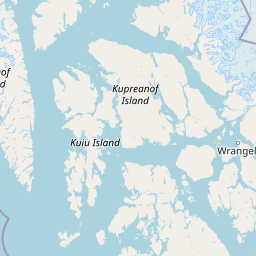
Use this park location map to pinpoint Kuiu Wilderness in United States of America, understand its exact geographic position, and read its mapped placement within the surrounding landscape more clearly.

Pigeon | © OpenStreetMap contributors

Location context for Kuiu Wilderness

Alaska

Explore protected area views, old-growth rainforests, and glaciated fjord terrain.

Kuiu Wilderness Photos and Landscape Scenery: Visualizing Southeast Alaska

Examine detailed Kuiu Wilderness photos to understand the rugged coastal terrain, dense temperate rainforests, and compressed subalpine habitats of southeast Alaska. Visual records reveal the remote island environment and protected landscape character preserved across the Alexander Archipelago.

A high-angle view looking over a narrow blue inlet of water surrounded by dense coniferous forests, with distant snow-capped mountains visible on the horizon.

Two people sit on a wooden bench inside a small, rustic wooden backcountry shelter with a shingled roof, surrounded by trees.

Park atlas

Compare adjacent coastal reserves and regional wilderness areas across southeast Alaska

Exploring Parks Near Kuiu Wilderness and Surrounding Protected Landscapes

Continue geographic discovery by comparing Kuiu Wilderness with other protected areas located throughout the surrounding coastal region. Examining adjacent forest lands and island reserves provides broader context on temperate rainforest ecosystems and glaciated terrain.
Wildlife reserveAlaska
About 86 km away#1 closest

North

Kootznoowoo Wilderness: Coastal Rainforest and Island Protected Area Map in Alaska

A vast temperate wilderness within the Tongass National Forest

Kootznoowoo Wilderness stands as a landmark protected landscape in Southeast Alaska, spanning the majority of Admiralty Island. Its geography is characterized by towering old-growth conifers, fern-covered understories, and a rugged coastline carved by glacial forces. This wildlife reserve provides a vital refuge for dense brown bear populations and remains one of the most intact examples of a maritime temperate rainforest in North America.

Area
3,962.19 km²
Established
1980
IUCN
Ib
Relief
Mixed relief
State or regional parkBritish Columbia
About 151 km away#2 closest

Northeast

Great Glacier Provincial Park: Glacial Geography and Protected Wilderness in Northern British Columbia

A rugged mountain landscape within the Stikine River corridor.

Great Glacier Provincial Park protects a compact, visually intense glacial environment along the Stikine River. Established to preserve the dramatic Great Glacier as it descends from the Boundary Ranges, this protected area features deep river valleys, steep mountainous slopes, and a unique ecological transition zone near the international border.

Area
93 km²
Established
2001
IUCN
II
Relief
Mountain
Protected landscapeAlaska
About 164 km away#3 closest

Northwest

Tongass National Forest: Geographic Overview of Alaska Coastal Wilderness

Mapped temperate rainforests, fjords, and mountain ranges

Trace the extensive boundaries of Tongass National Forest, a massive protected landscape in Southeast Alaska. This atlas detail covers the unique geography of the Alexander Archipelago, where island wilderness meets the tidewater glaciers and old growth forests of the Coast Mountains. Gain insight into the terrain, ecosystem distribution, and regional context of this globally rare coastal rainforest environment.

Area
68,000 km²
Established
1907
Visitors
1.9M annual
Relief
Mountain
Wildlife reserveAlaska
About 169 km away#4 closest

South

Forrester Island Wilderness: Mapped Protected Landscapes and Wildlife Reserve Geography

Isolated island terrain in the Alaska Maritime National Wildlife Refuge

This remote wilderness area in Alaska features a mountainous, forested profile and sheer coastal cliffs that drop directly into the Pacific Ocean. Its protected boundaries are vital for maintaining undisturbed marine mammal habitat and temperate coastal forest ecosystems, offering a distinct example of isolated island geography within the United States.

Area
10.29 km²
Established
1912
Relief
Upland
Climate
Temperate
State or regional parkBritish Columbia
About 198 km away#5 closest

East

Lava Forks Provincial Park: Geological Mapping and Protected Area Overview

Remote volcanic wilderness in northern British Columbia

This protected area preserves the fresh geological features created by the 1904 eruption of The Volcano. The site offers a detailed look at ash dunes, lava flows, and water-filled potholes within a remote northern British Columbia setting. Use this atlas resource to examine the park boundaries and the unique terrain that characterizes this significant transboundary conservation landscape.

Area
74.63 km²
Established
2001
IUCN
III
Relief
Mountain
Protected landscapeBritish Columbia
About 232 km away#6 closest

South

Duu Guusd Heritage Site/Conservancy: Coastal Geography and Protected Land Map

A unified land and sea protected landscape in Haida Gwaii, British Columbia

Spanning over 227,000 hectares, Duu Guusd Heritage Site/Conservancy creates a massive protected corridor along the Pacific coast of British Columbia. This area links terrestrial forest ecosystems with marine waters, preserving complex island landscapes and significant Haida cultural sites throughout the northwestern corner of Graham Island.

Area
2,277.12 km²
Established
2008
IUCN
II
Relief
Mixed relief
National parkAlaska
About 302 km away#7 closest

Northwest

Glacier Bay National Park and Preserve: Alaska National Park Geographic Atlas

Mapped protected area context within Alaska's natural landscapes.

Glacier Bay National Park and Preserve serves as a vital protected landscape in Alaska, offering deep insights into regional geography and park boundaries. This detail page provides an atlas-centric view of the park, focusing on its role as a protected natural area and its unique position within the geographic tapestry of Alaska. Engage with structured data that illuminates the park's mapped terrain and its significance as a conservation landscape.

Area
13,045 km²
Established
1980
IUCN
V
Visitors
545.8K annual
State or regional parkBritish Columbia
About 329 km away#8 closest

Southeast

Khutzeymateen Provincial Park: Protected Wilderness and Coastal Forest Geography

North Coast British Columbia protected area and estuary map.

Khutzeymateen Provincial Park represents a pivotal conservation achievement on the British Columbia North Coast. This wilderness sanctuary protects a critical estuarine complex where rugged mountain ranges meet a sheltered Pacific inlet. Beyond its designation as a grizzly bear stronghold, the park holds globally significant old-growth Sitka spruce forests, providing a rare look at an intact temperate rainforest landscape.

Area
450.52 km²
Established
1994
IUCN
Ib
Relief
Mountain

Common questions about visiting, size, designation, and location context for Kuiu Wilderness

Kuiu Wilderness FAQs for park facts, access, geography, and protected area context

Find quick answers about Kuiu Wilderness, including protected-area facts, park geography, trail and visitor context, and how the park fits into its surrounding country and regional landscape.
MoriAtlas Explorer

Continue Your Protected Areas Search Across the Global Atlas

Deepen your exploration by continuing the structured search for national parks and protected areas worldwide. Utilize the comprehensive filtering capabilities to compare different conservation landscapes and refine your understanding of global park geography. Discover more about the distribution and characteristics of protected natural areas.

Global natural geography