Mori Atlas logo
National parkGlacier Bay National Park and Preserve

Explore the mapped boundaries and distinct terrain of this protected natural area in Alaska.

Glacier Bay National Park and Preserve: Alaska National Park Protected Landscape & Geography

Glacier Bay National Park and Preserve stands as a prominent protected landscape within Alaska, offering a unique lens for geographic discovery. This national park entity provides a critical anchor for understanding the region's natural terrain and mapped natural boundaries. Users can delve into the specific geographic context of Glacier Bay, appreciating its place within Alaska's vast protected areas and exploring its distinct natural landscape.

GlaciersTidewater GlaciersWilderness AreaUNESCO World Heritage SiteMarine Protected AreaSoutheast Alaska

Glacier Bay National Park and Preserve

National park

Park overview

Structured park overview, official facts, and landscape profile for Glacier Bay National Park and Preserve

Glacier Bay National Park and Preserve park facts, protected area profile, and essential visitor context

Review the core facts for Glacier Bay National Park and Preserve, including designation, size, terrain, visitor scale, habitats, and operating context in one park-focused overview.

About Glacier Bay National Park and Preserve

Glacier Bay National Park and Preserve represents one of the most significant protected wilderness areas in the United States, encompassing a landscape of extraordinary geological and ecological complexity. Located in Southeast Alaska west of Juneau, the park stretches from the icy waters of Icy Strait at its southern extent to the Canadian border at Grand Pacific Glacier in the north, a distance of approximately 65 miles. The protection of this vast territory reflects over a century of conservation advocacy, beginning with John Muir's influential writings in the late 19th century that brought national attention to the region's glaciers and ecological significance. The park's establishment as a national monument in 1925 marked the culmination of scientific and political efforts to preserve this distinctive landscape, with subsequent expansion through presidential proclamations and congressional action culminating in the comprehensive designation of 1980. The landscape within Glacier Bay reveals a complex geological history spanning Paleozoic sedimentary formations, with the bay's dramatic topography shaped by successive glacial advances that reached their maximum extent just centuries ago. Today, the park protects nearly 600,000 acres of federally designated marine ecosystems, making it one of the largest marine protected areas in the United States. The interaction of glacial processes, tectonic activity, and marine influences creates an environment of remarkable diversity, from the tidewater glaciers that dominate the upper bay to the spruce and hemlock forests that characterize the lower reaches.

Quick facts and research context for Glacier Bay National Park and Preserve

Glacier Bay National Park and Preserve spans 3,223,384 acres along the Southeast Alaska coastline, with approximately 2,770,000 acres designated as wilderness area. The park was originally established as a national monument by President Calvin Coolidge in 1925 and redesignated as a national park and preserve in 1980 through the Alaska National Interest Lands Conservation Act. The protected area forms part of a binational UNESCO World Heritage Site encompassing Kluane, Wrangell-St. Elias, Glacier Bay, and Tatshenshini-Alsek parks. The tallest peak within the park is Mount Fairweather at 15,300 feet, part of the Fairweather Range that forms a dramatic backdrop to the glacial bay. The park contains seven active tidewater glaciers, with Johns Hopkins Glacier currently advancing at a rate of 10 to 15 feet per day, while others continue to retreat.

Protection and recognition

Analyzing transboundary parameters, mixed protection scope, and official designation frameworks.

Glacier Bay National Park and Preserve Protected Area Designation and Scope

Glacier Bay National Park and Preserve features a mixed protection scope and documented transboundary status within its regional conservation corridor. Evaluating official designations provides critical geographic context for mapping the protection frameworks and management parameters governing the coastal wilderness.

Protection details

Protection scope
Mixed
Transboundary protection
Yes
Park context

Deeper park guide and search-rich context for Glacier Bay National Park and Preserve

Glacier Bay National Park and Preserve history, landscape, wildlife, and travel context

Explore Glacier Bay National Park and Preserve through its history, landscape character, ecosystems, wildlife, conservation priorities, cultural context, and seasonal travel timing in a structured park guide built for atlas discovery and search intent.

Why Glacier Bay National Park and Preserve stands out

Glacier Bay is renowned for its spectacular tidewater glaciers, including Margerie Glacier, Johns Hopkins Glacier, and Grand Pacific Glacier, which collectively produce dramatic ice calving displays. The park preserves one of the world's most rapidly retreating glacial systems, with documented retreat of approximately 48 miles between 1794 and 1879 representing the fastest documented glacier retreat in history. The bay serves as an exceptional natural laboratory for studying ecological succession on newly deglaciated terrain, a research tradition initiated by ecologist William Skinner Cooper in 1916. The area's significance is underscored by its UNESCO World Heritage designation and its role as a Biosphere Reserve, protecting critical habitat for grizzly bears, marine mammals, and migratory bird populations.

Glacier Bay National Park and Preserve history and protected-area timeline

The history of Glacier Bay's protection reflects a convergence of scientific insight, indigenous advocacy, and evolving conservation philosophy in America. Tlingit peoples have inhabited these coastal regions for millennia, with archaeological evidence suggesting human presence in the broader area dating back approximately 10,000 years. European exploration of Glacier Bay began with Jean-François de Galaup, comte de Lapérouse's visit to Lituya Bay in 1786, followed by George Vancouver's expedition in 1794 that documented the bay's ice at its maximum historical extent. Naturalist John Muir's visits beginning in 1879 proved transformative, as his dispatches and subsequent publications brought national attention to the region and initiated the movement that would lead to its protection. William Skinner Cooper, an ecologist from the University of Minnesota, recognized the extraordinary scientific value of the retreating glaciers as natural laboratories for studying ecological succession, and he established test plots in 1916 that continue to be monitored today. The advocacy of Cooper and the Ecological Society of America proved instrumental in persuading President Calvin Coolidge to proclaim Glacier Bay a national monument under the Antiquities Act in 1925, despite opposition from the U.S. Geological Survey regarding potential mineral resources. Subsequent expansions in 1939 under President Franklin D. Roosevelt significantly enlarged the monument, and President Jimmy Carter used his Antiquities Act authority in 1978 to add the Alsek River lands. The Alaska National Interest Lands Conservation Act of December 2, 1980, formally established Glacier Bay National Park and Preserve, creating distinct protections for park and preserve lands while maintaining subsistence uses in appropriate areas.

Glacier Bay National Park and Preserve landscape and geographic character

The physical landscape of Glacier Bay National Park and Preserve presents one of the most dramatic topographies in North America, characterized by steep-walled fjords, towering mountain ranges, and the dynamic presence of glacial ice. The Fairweather Range forms the western boundary of the park, capped by the Brady Icefield and anchored by Mount Fairweather at 15,300 feet, the park's highest point. To the east, the Takhinsha Mountains and Chilkat Range create a mountainous peninsula bounded by Lynn Canal, with the park's boundary following ridgelines that separate it from Tongass National Forest. The bay itself extends northward from Icy Strait as a series of interconnected inlets, with glacial terrain characterized by U-shaped valleys, terminal moraines, and outwash deposits that extend up to 2,000 feet up mountain slopes. The geological foundation reveals Paleozoic sedimentary rocks, predominantly massive limestones and argillite, with younger igneous intrusions including diorite stocks and granitic formations. The landscape continues to evolve through active tectonic processes, with frequent earthquakes, post-glacial rebound, and the ongoing advance and retreat of glaciers. Where shoreline flats exist, they support dense vegetation including alder and devils club, while the newly deglaciated land above the current glacial extent reveals post-glacial meadows in early stages of ecological succession.

Glacier Bay National Park and Preserve ecosystems, habitats, and plant life

The ecological character of Glacier Bay National Park and Preserve reflects the dramatic transition from glacial to post-glacial environments, creating a mosaic of distinct habitats across the protected area. The lower bay supports wet tundra alongside Sitka spruce and Western hemlock forests, while the upper bay remains dominated by tidewater glaciers and the newly exposed terrain where plant succession is just beginning. Alpine tundra, extensive ice fields, and glaciated peaks occupy the highest elevations, creating a vertical zonation of ecosystems from sea level to alpine zones. The park preserves nearly 600,000 acres of marine ecosystems, representing one of the most significant marine protected areas in the United States. The marine environment supports productive kelp forests, productive fisheries, and critical habitat for marine mammals, while the terrestrial environments range from coastal rainforests to alpine tundra. The dynamic nature of this landscape, shaped by ongoing glacial retreat and ecological succession, provides unique opportunities for understanding ecosystem development in a changing climate.

Glacier Bay National Park and Preserve wildlife and species highlights

The wildlife populations of Glacier Bay National Park and Preserve reflect the ecological diversity of this vast protected area, encompassing terrestrial mammals, marine mammals, and prolific birdlife. Terrestrial mammals include both brown bears (grizzly bears) and black bears, moose, Sitka black-tailed deer, timber wolves, coyotes, red foxes, North American porcupines, marmots, Canadian lynx, wolverines, and mountain goats. The preserve lands support additional species through provisions of the Alaska National Interest Lands Conservation Act, which allows subsistence uses and sport hunting in designated preserve areas. Marine mammals swimming in the park's offshore waters include sea otters, harbor seals, Steller sea lions, harbor porpoises, orcas, minke whales, and humpback whales, with the productive waters supporting significant marine mammal populations. Bird diversity is particularly notable, with nesting species including bald eagles and golden eagles, five species of woodpeckers, two species of hummingbirds, common ravens, four falcon species, six hawk species, osprey, and ten owl species. This rich assemblage of wildlife depends on the diverse habitats protected within the park boundaries, from coastal marine environments to alpine tundra.

Glacier Bay National Park and Preserve conservation status and protection priorities

Glacier Bay National Park and Preserve holds exceptional conservation significance as both a national park and a component of a binational World Heritage Site. The park was inscribed as part of the Kluane-Wrangell-St. Elias-Glacier Bay-Tatshenshini-Alsek World Heritage Site in 1979, recognized for its spectacular glacier and icefield landscapes and the importance of habitat for grizzly bears, caribou, and Dall sheep. The designation was expanded to include Glacier Bay specifically in 1992, acknowledging the park's outstanding universal value. The park was also designated as a Biosphere Reserve in 1986 under the Man and the Biosphere Programme, recognizing its value for scientific research and conservation. The nearly 2.77 million acres designated as wilderness area provide the highest level of protection for this remote landscape. The National Park Service works collaboratively with Hoonah and Yakutat Tlingit Native American organizations in the management of the protected area, a partnership formalized in 1994. The ongoing retreat of glaciers provides critical insights into climate change impacts, making the park increasingly important as a natural laboratory for understanding environmental change.

Glacier Bay National Park and Preserve cultural meaning and human context

Glacier Bay National Park and Preserve encompasses two Tlingit ancestral homelands that remain culturally and spiritually significant to living communities today. The Tlingit people have maintained connections to this landscape through millennia, with historical dominance of the area established in recent centuries prior to European contact. The Alsek River serves as a route of discovery and migration from the coastal mountain range within the park to the Pacific Ocean in the preserve, a pathway that carries deep cultural meaning. The collaborative management agreement between the National Park Service and Tlingit organizations established in 1994 reflects a commitment to integrating indigenous knowledge and perspectives into park management. While subsistence hunting is prohibited within the park proper, it is permitted in the preserve lands in accordance with Alaska Native rights and the Alaska National Interest Lands Conservation Act. This approach recognizes the continuing relationship between the Tlingit people and the landscapes they have inhabited and utilized throughout their history.

Top sights and standout views in Glacier Bay National Park and Preserve

The defining highlight of Glacier Bay remains its extraordinary glacial landscape, where tidewater glaciers including Margerie and Johns Hopkins produce dramatic ice calving displays that rank among the most impressive in the world. The park offers exceptional wildlife viewing opportunities, from humpback whales and orcas in the marine environment to brown bears and mountain goats on the shoreline. The UNESCO World Heritage designation recognizes the transboundary significance of this landscape, which connects seamlessly with Canadian protected areas including Kluane National Park and Reserve and Tatshenshini-Alsek Provincial Park. The scientific legacy of ecological research initiated by William Skinner Cooper continues today, with the bay serving as a premier location for understanding post-glacial ecosystem development. Visitors can experience this remote wilderness through cruise ships, kayak expeditions, raft trips on the Alsek River, and backcountry travel, with the Glacier Bay Lodge providing in-park accommodations.

Best time to visit Glacier Bay National Park and Preserve

The summer months of June through August offer the most accessible and rewarding conditions for visiting Glacier Bay National Park and Preserve, with extended daylight hours, relatively mild temperatures, and the peak cruise ship season providing the majority of visitor access. The period from May through September experiences the lowest precipitation and most stable weather patterns, though the maritime climate ensures some rainfall throughout the year. The shoulder seasons of spring and fall provide fewer visitors and distinct seasonal experiences, though weather conditions become more variable and some services may be limited. Winter visits are possible but challenging, with limited access and reduced services reflecting the park's remote character. Wildlife viewing opportunities vary seasonally, with humpback whales more commonly observed during summer months and bear activity most prevalent in spring and early fall. The glacial viewing experience remains compelling throughout the visitor season, though the character of the landscape changes as snow coverage and ice conditions vary.
Monthly climate preview

Long term average temperatures and daily precipitation trends across the subarctic Alaskan terrain

Glacier Bay National Park and Preserve Weather by Month and Climate Profiles

Decades of climate data recorded at a representative elevation of 391 meters reveal cold winter averages dipping below minus three degrees Celsius and mild summer peaks approaching eleven degrees Celsius. Exploring the complete twelve month profile reveals seasonal precipitation shifts from drier midyear weeks to wet late-season periods.
Annual mean3 °C
-3 °C11 °C
Jan-3°
Feb-2°
Mar-2°
Apr
May
Jun
Jul11°
Aug11°
Sep
Oct
Nov
Dec-2°
Warmest month
August

11 °C

Coolest month
January

-3 °C

Wettest month
October

16.2 mm/day

Driest month
June

5.4 mm/day

Park location guide

Geography guide, regional context, and park location map for Glacier Bay National Park and Preserve

Glacier Bay National Park and Preserve park geography, regions, and map view in United States of America

Understand where Glacier Bay National Park and Preserve sits in United States of America through a broader geographic reading of the surrounding landscape, nearby location context, and its mapped position within the national park landscape.

How Glacier Bay National Park and Preserve fits into United States of America

The United States of America is a federal presidential republic and one of the world's largest countries by area and population. It consists of 50 states across a vast territory spanning multiple time zones, with its capital in Washington, D.C. and largest city in New York City. The nation has a diverse economy, influential political system, and significant cultural and military presence globally.

Wider geography shaping Glacier Bay National Park and Preserve in United States of America

The United States occupies a vast territory in North America, bordered by Canada to the north and Mexico to the south. The 48 contiguous states stretch from the Atlantic to the Pacific Ocean, while Alaska occupies the northwestern region and Hawaii is an archipelago in the Pacific. The country encompasses diverse terrain including the Rocky Mountains, Appalachian Mountains, Great Plains, and extensive river systems.

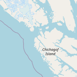
Map view of Glacier Bay National Park and Preserve

Use this park location map to pinpoint Glacier Bay National Park and Preserve in United States of America, understand its exact geographic position, and read its mapped placement within the surrounding landscape more clearly.

Pigeon | © OpenStreetMap contributors

Location context for Glacier Bay National Park and Preserve

AlaskaHoonah-Angoon Census AreaYakutat City and Borough
Park atlas

Explore the distribution of national parks and protected areas within the broader geographic context of Southeast Alaska's glacial and coastal regions.

Discover Other National Parks and Protected Areas Surrounding Glacier Bay National Park and Preserve

Browse other national parks and protected areas near Glacier Bay National Park and Preserve, tracing their geographic distribution across Southeast Alaska's dramatic glacial terrain and coastal environments. This overview enables comparison of diverse conservation landscapes, helps understand interconnected ecosystems, and reveals broader protected-area patterns within this unique wilderness region.
Wildlife reserveAlaska
About 137 km away#1 closest

Southeast

Kootznoowoo Wilderness: Coastal Rainforest and Island Protected Area Map in Alaska

A vast temperate wilderness within the Tongass National Forest

Kootznoowoo Wilderness stands as a landmark protected landscape in Southeast Alaska, spanning the majority of Admiralty Island. Its geography is characterized by towering old-growth conifers, fern-covered understories, and a rugged coastline carved by glacial forces. This wildlife reserve provides a vital refuge for dense brown bear populations and remains one of the most intact examples of a maritime temperate rainforest in North America.

Area
3,962.19 km²
Established
1980
IUCN
Ib
Relief
Mixed relief
Protected landscapeAlaska
About 144 km away#2 closest

Southeast

Tongass National Forest: Geographic Overview of Alaska Coastal Wilderness

Mapped temperate rainforests, fjords, and mountain ranges

Trace the extensive boundaries of Tongass National Forest, a massive protected landscape in Southeast Alaska. This atlas detail covers the unique geography of the Alexander Archipelago, where island wilderness meets the tidewater glaciers and old growth forests of the Coast Mountains. Gain insight into the terrain, ecosystem distribution, and regional context of this globally rare coastal rainforest environment.

Area
68,000 km²
Established
1907
Visitors
1.9M annual
Relief
Mountain
National parkYukon
About 168 km away#3 closest

North

Kluane National Park and Reserve: Yukon National Park Protected Area and Landscape Geography

Explore mapped boundaries and regional context for this Yukon national park.

Kluane National Park and Reserve represents a vital protected national park within Yukon. This detail page focuses on its geographic identity and mapped features, offering insight into its regional landscape context and its role within the broader Canadian protected areas atlas. Discover the park's specific topography and its location within Yukon.

Area
22,013 km²
Established
1972
IUCN
II
Visitors
47.1K annual
National parkAlaska
About 204 km away#4 closest

Northwest

Wrangell, St. Elias National Park and Preserve: Alaska's Expansive National Park Geography

Mapped protected lands and regional landscape context.

Dive into the detailed geography of Wrangell, St. Elias National Park and Preserve, a prominent national park located in Alaska. This resource focuses on its extensive mapped boundaries and its role as a protected landscape, offering insights valuable for understanding regional geography and the distribution of natural areas.

Area
53,320.6 km²
Established
1980
IUCN
II
Visitors
79.5K annual
Wildlife reserveAlaska
About 302 km away#5 closest

Southeast

Kuiu Wilderness: An Alaska Protected Area of Temperate Rainforest and Fjord Geography

A remote wilderness expanse within the Alexander Archipelago

The Kuiu Wilderness serves as a primary example of coastal conservation in Alaska, offering a vast roadless territory that spans from sea level to alpine elevations. Mapped through a series of deep fjords and temperate rainforests, this reserve provides a critical look at the complex landscape transitions that define the ecology of the Alexander Archipelago.

Area
245.16 km²
Established
1990
Relief
Mountain
Climate
Temperate
Wildlife reserveYukon
About 314 km away#6 closest

Northeast

Nisutlin River Delta National Wildlife Area: Yukon Delta and Wetland Geography

Protected boreal river delta and lake ecosystem.

The Nisutlin River Delta National Wildlife Area occupies a strategic position where riverine flow meets the expansive basin of Teslin Lake. The reserve is characterized by its dramatic seasonal transitions, transforming from high-water spring channels to expansive autumn mudflats. This dynamic geography supports essential migratory corridors through the boreal forest terrain of the southern Yukon.

Area
54.83 km²
Established
1995
IUCN
III
State or regional parkBritish Columbia
About 360 km away#7 closest

Southeast

Great Glacier Provincial Park: Glacial Geography and Protected Wilderness in Northern British Columbia

A rugged mountain landscape within the Stikine River corridor.

Great Glacier Provincial Park protects a compact, visually intense glacial environment along the Stikine River. Established to preserve the dramatic Great Glacier as it descends from the Boundary Ranges, this protected area features deep river valleys, steep mountainous slopes, and a unique ecological transition zone near the international border.

Area
93 km²
Established
2001
IUCN
II
Relief
Mountain
State or regional parkBritish Columbia
About 431 km away#8 closest

Southeast

Lava Forks Provincial Park: Geological Mapping and Protected Area Overview

Remote volcanic wilderness in northern British Columbia

This protected area preserves the fresh geological features created by the 1904 eruption of The Volcano. The site offers a detailed look at ash dunes, lava flows, and water-filled potholes within a remote northern British Columbia setting. Use this atlas resource to examine the park boundaries and the unique terrain that characterizes this significant transboundary conservation landscape.

Area
74.63 km²
Established
2001
IUCN
III
Relief
Mountain

Common questions about visiting, size, designation, and location context for Glacier Bay National Park and Preserve

Glacier Bay National Park and Preserve FAQs for park facts, access, geography, and protected area context

Find quick answers about Glacier Bay National Park and Preserve, including protected-area facts, park geography, trail and visitor context, and how the park fits into its surrounding country and regional landscape.
MoriAtlas Explorer

Continue Your Protected Areas Search Across the Global Atlas

Deepen your exploration by continuing the structured search for national parks and protected areas worldwide. Utilize the comprehensive filtering capabilities to compare different conservation landscapes and refine your understanding of global park geography. Discover more about the distribution and characteristics of protected natural areas.

Global natural geography