Mori Atlas logo
National parkWrangell–St. Elias National Park and Preserve

Discover the mapped geography and protected land context of this immense Alaskan natural area.

Wrangell–St. Elias National Park and Preserve: Alaska's Premier National Park Landscape

Wrangell–St. Elias National Park and Preserve stands as a significant protected landscape within Alaska, offering users a detailed view of its vast geographic scope and unique terrain. This page provides an atlas-centric perspective, focusing on the park's mapped boundaries, its place within the broader Alaskan region, and the characteristics that define its protected natural identity.

Volcanic landscapesGlaciers and icefieldsMountain climbingWilderness explorationHistoric mining sitesTransboundary parks

Wrangell–St. Elias National Park and Preserve

National park

Park overview

Structured park overview, official facts, and landscape profile for Wrangell, St. Elias National Park and Preserve

Wrangell, St. Elias National Park and Preserve park facts, protected area profile, and essential visitor context

Review the core facts for Wrangell, St. Elias National Park and Preserve, including designation, size, terrain, visitor scale, habitats, and operating context in one park-focused overview.

About Wrangell, St. Elias National Park and Preserve

Wrangell–St. Elias National Park and Preserve represents one of the planet's most spectacular mountain wilderness areas, where the collision of tectonic plates has created a landscape of extraordinary scale and drama. The park encompasses the entire Wrangell mountain range, the western portion of the Saint Elias Mountains, and the eastern reaches of the Chugach Mountains, protecting an area that dwarfs most other U.S. national parks combined. The mountains here rise dramatically from near sea level to nearly 18,000 feet within just miles of the Pacific coast, creating one of the highest reliefs on Earth. This dramatic elevation change occurs as the Pacific Plate subducts beneath the North American Plate, uplifting vast terranes that have been compressed and folded over millions of years. The result is a landscape of soaring peaks, massive icefields, and broad glacial valleys that remains largely wild and inaccessible, offering visitors true wilderness solitude in one of the most remote corners of North America.

Quick facts and research context for Wrangell, St. Elias National Park and Preserve

The park covers 13,175,799 acres, an area larger than nine U.S. states and comparable in size to Croatia. It contains nine of the 16 highest peaks in the United States and 35 of Alaska's 70 tallest mountains. The Wrangell–St. Elias Wilderness, at 9,078,675 acres, is the largest designated wilderness area in the United States. The park shares its eastern border with Canada's Kluane National Park and Reserve, and together they form part of a UNESCO World Heritage Site. The park is accessible via the Edgerton Highway along the Copper River, with rough gravel roads including the McCarthy Road and Nabesna Road providing access to the interior.

Protection and recognition

Mapping the mixed conservation scope and official establishment records registered since 1980

Wrangell-St. Elias National Park and Preserve Protection Status and Conservation History

Explore the officially documented protection status, mixed management scope, and 1980 designation history of Wrangell-St. Elias National Park and Preserve. Reviewing verified administrative framework records offers essential geographical context for understanding how vast wilderness segments in Alaska are legally protected.

Protection details

Protection scope
Mixed
Designated year
1980
Core area
36,740.09 km²
Park context

Deeper park guide and search-rich context for Wrangell, St. Elias National Park and Preserve

Wrangell, St. Elias National Park and Preserve history, landscape, wildlife, and travel context

Explore Wrangell, St. Elias National Park and Preserve through its history, landscape character, ecosystems, wildlife, conservation priorities, cultural context, and seasonal travel timing in a structured park guide built for atlas discovery and search intent.

Why Wrangell, St. Elias National Park and Preserve stands out

Wrangell, St. Elias is best known for its extraordinary concentration of high mountains, massive glaciers, and active volcanic terrain within a single protected area. The park contains the second-highest peaks in both the United States and Canada, major volcanoes including the active Mount Wrangell, and the three largest glaciers in Alaska. The historic Kennecott copper mines, now a National Historic Landmark district, represent one of the most productive mining operations of the early 20th century. The park's transboundary wilderness landscape, shared with Canada's Kluane National Park, forms one of the world's largest protected mountain ecosystems.

Wrangell, St. Elias National Park and Preserve history and protected-area timeline

The human history of Wrangell–St. Elias stretches back approximately 1,000 years to when the Ahtna people settled along the Copper River, the Eyak people established communities near the river's mouth, and the Tlingit people dispersed along the coast near Yakutat Bay. European explorers arrived in the 18th century, with Russian traders establishing posts along the Copper River in the 1790s. Following the United States' acquisition of Alaska in 1867, American exploration intensified after gold discoveries in the Canadian Klondike in the 1880s. The most transformative chapter began in 1900 when prospectors discovered a rich copper lode at what became Kennecott, leading to the creation of one of the world's most productive copper mines. The Copper River and Northwestern Railway, costing $23.5 million to construct, enabled the extraction of over 4.5 million tons of ore yielding 600,000 tons of copper before operations ceased in 1938. Proposals for protected status emerged as early as 1908, but decades of political maneuvering followed. President Jimmy Carter used the Antiquities Act in 1978 to establish Wrangell–St. Elias National Monument, and the Alaska National Interest Lands Conservation Act formally created the national park and preserve on December 2, 1980.

Wrangell, St. Elias National Park and Preserve landscape and geographic character

The landscape of Wrangell–St. Elias is defined by its extraordinary mountain grandeur and extensive glacial systems. The Wrangell Mountains, a volcanic range containing ten major volcanoes, dominate the western portion of the park, with Mount Blackburn rising to 16,390 feet as the highest peak in the range and Mount Wrangell, the only active volcano in the group, reaching 14,163 feet with an ice-filled summit caldera. The Saint Elias Mountains, forming the eastern boundary with Canada, contain Mount Saint Elias at 18,008 feet and Mount Logan, one of the world's tallest non-volcanic peaks. The park contains the Bagley Icefield, North America's largest subpolar icefield, which feeds numerous glaciers including the Malaspina Glacier, a massive piedmont glacier covering nearly 1,500 square miles. Hubbard Glacier, at 75 miles the longest tidewater glacier in Alaska, calves spectacular icebergs into Yakutat Bay, while Nabesna Glacier extends over 53 miles as the world's longest valley glacier. Broad braided rivers, including the Copper, Chitina, Chisana, and Nabesna rivers, flow through glacial valleys between the ranges, carrying meltwater from the icefields to the sea.

Wrangell, St. Elias National Park and Preserve ecosystems, habitats, and plant life

The ecological diversity of Wrangell–St. Elias reflects its vast size and extreme elevation range, spanning from sea level to nearly 19,000 feet. The park contains five distinct ecological zones: lowlands along the Gulf of Alaska and river valleys, wetlands and muskeg in permafrost areas, boreal upland forests of white and black spruce, subalpine zones above tree line, and alpine tundra. The lowland forests are dominated by black spruce in permafrost regions with understories of alder, Labrador tea, and willow, while the interior boreal forests transition to white spruce and deciduous species including quaking aspen and paper birch. The subalpine and alpine zones feature low-growing shrubs, graminoids, forbs, heaths, and willows adapted to the harsh conditions. The park's plant communities have been shaped by fire frequency, with deciduous species often being the first to colonize after burns, followed by conifers in later succession. The presence of permafrost in many lowland areas creates unique hydrological conditions that influence vegetation patterns across the preserve.

Wrangell, St. Elias National Park and Preserve wildlife and species highlights

Wrangell–St. Elias supports remarkable wildlife populations across its diverse habitats, with large terrestrial mammals including grizzly bears, black bears, timber wolves, and the Mentasta and Chisana caribou herds representing some of the healthiest populations in North America. The park contains one of the densest Dall sheep populations on the continent, with approximately 13,000 individuals occupying the remote montane areas, while mountain goats thrive in the high, rugged terrain. Smaller mammals are diverse and abundant, including wolverines, Canadian lynx, pine martens, river otters, red foxes, and hoary marmots. The coastal waters host migrating whales including orcas, humpback whales, and gray whales, as well as harbor seals, Dall's porpoises, and the endangered Steller sea lion. Twenty-one fish species have been documented in the park's fresh waters, including all five Pacific salmon species, lake trout, cutthroat trout, and Arctic grayling. Approximately 93 bird species inhabit the park, with bald eagles, ptarmigan species, and waterfowl being particularly notable, though only 24 species remain through the harsh winter months.

Wrangell, St. Elias National Park and Preserve conservation status and protection priorities

Wrangell–St. Elias represents one of North America's most significant conservation achievements, protecting a complete transboundary mountain ecosystem that spans the U.S.-Canada border. The park was designated as part of the Kluane/Wrangell-St. Elias/Glacier Bay/Tatshenshini-Alsek UNESCO World Heritage Site in 1979, recognizing its outstanding universal value as a spectacular glacier and icefield landscape with critical habitat for grizzly bears, caribou, and Dall sheep. Nearly 66 percent of the park and preserve, approximately 9 million acres, is designated as wilderness under the National Wilderness Preservation System, making it the largest single wilderness area in the United States. The park is also recognized as an International Biosphere Reserve, highlighting its importance for ecological research and conservation. The dual designation of national park and preserve allows for different land use protections, with the preserve permitting sport hunting while the park prohibits it except for subsistence use by local rural residents. This management approach balances wilderness protection with traditional uses and provides habitat connectivity across one of the continent's most intact mountain ecosystems.

Wrangell, St. Elias National Park and Preserve cultural meaning and human context

The cultural landscape of Wrangell–St. Elias reflects thousands of years of human occupation by the Ahtna people, whose traditional territories centered on the Copper River, the Eyak people near the river's mouth, and the Tlingit people along the coast near Yakutat Bay. Archaeological evidence indicates human presence in the Wrangell Mountains beginning around 1000 AD, with these indigenous peoples developing sophisticated relationships with the land through hunting, fishing, and seasonal resource use. The historic Kennecott mining operation, which employed hundreds of workers at its peak and produced copper worth over $100 million in profit, left a lasting imprint on the landscape with its abandoned mill buildings and support structures, now preserved as a National Historic Landmark district. The communities of McCarthy, Kennicott, Nabesna, Chisana, and Chitina continue to exist within or near the park boundary, maintaining connections to the region's mining heritage and serving as gateway communities for visitors. Subsistence hunting and fishing remain important for local residents, with the park's dual management framework specifically protecting these traditional uses.

Top sights and standout views in Wrangell, St. Elias National Park and Preserve

The highlights of Wrangell–St. Elias National Park and Preserve include the opportunity to witness some of North America's most dramatic glacial landscapes, with the massive Malaspina Glacier and Hubbard Glacier offering spectacular displays of ice in motion. The park provides access to climbing opportunities on 35 of Alaska's 70 highest peaks, including seven of the top ten, making it a premier destination for mountaineers seeking technically demanding ascents in remote terrain. The historic Kennecott mines, with their remarkably preserved mill buildings and equipment, offer a tangible connection to the early 20th-century copper boom that shaped the region. Float trips on the Copper, Nizina, Kennicott, and Chitina rivers provide unique perspectives on the park's vast interior, while air taxi services enable access to remote wilderness areas and sea kayak tours near Icy Bay and Hubbard Glacier. The park's wilderness character is perhaps its greatest highlight, with the largest designated wilderness area in the United States offering opportunities for true solitude and immersion in a landscape that remains largely unchanged from when glaciers first carved these valleys.

Best time to visit Wrangell, St. Elias National Park and Preserve

The best time to visit Wrangell–St. Elias depends on the experience sought, with the primary visitor season running from May through September when facilities are open and access is most practical. Summer months of June and July bring the warmest temperatures, with highs occasionally reaching 80 degrees Fahrenheit, along with wildflower blooms in the valleys but also prolific biting insects. The short Alaska summer transforms the landscape, with long daylight hours providing extended opportunities for exploration. Late summer into early fall, particularly August and September, often brings clearer weather and the first autumn colors, though conditions begin to cool rapidly. Winter visits are possible but extremely challenging, with interior temperatures regularly dropping to 50 degrees below zero Fahrenheit and only the Copper Center visitor center open on weekdays. The coastal areas near Yakutat experience more moderate maritime conditions year-round. For wildlife viewing, late summer and early fall offer the best opportunities to observe bears and other mammals along river corridors, while spring provides opportunities to see Dall sheep at lower elevations as snow recedes.
Monthly climate preview

Monthly average temperatures and long-term precipitation trends in Alaska

Wrangell, St. Elias National Park and Preserve Climate Normals

Long-term data at a representative coordinate indicate a dominant sub-zero climate rhythm, showing brief mid-year warmth peaking above 6 degrees Celsius alongside elevated late-summer precipitation. Accessing the complete weather by month dataset provides precise monthly temperature ranges and average daily precipitation figures across the entire seasonal cycle.
Annual mean-5 °C
-15 °C7 °C
Jan-15°
Feb-13°
Mar-12°
Apr-6°
May
Jun
Jul
Aug
Sep
Oct-6°
Nov-12°
Dec-14°
Warmest month
July

6.6 °C

Coolest month
January

-14.5 °C

Wettest month
September

7.6 mm/day

Driest month
April

2.8 mm/day

Park location guide

Geography guide, regional context, and park location map for Wrangell, St. Elias National Park and Preserve

Wrangell, St. Elias National Park and Preserve park geography, regions, and map view in United States of America

Understand where Wrangell, St. Elias National Park and Preserve sits in United States of America through a broader geographic reading of the surrounding landscape, nearby location context, and its mapped position within the national park landscape.

How Wrangell, St. Elias National Park and Preserve fits into United States of America

The United States of America is a federal presidential republic and one of the world's largest countries by area and population. It consists of 50 states across a vast territory spanning multiple time zones, with its capital in Washington, D.C. and largest city in New York City. The nation has a diverse economy, influential political system, and significant cultural and military presence globally.

Wider geography shaping Wrangell, St. Elias National Park and Preserve in United States of America

The United States occupies a vast territory in North America, bordered by Canada to the north and Mexico to the south. The 48 contiguous states stretch from the Atlantic to the Pacific Ocean, while Alaska occupies the northwestern region and Hawaii is an archipelago in the Pacific. The country encompasses diverse terrain including the Rocky Mountains, Appalachian Mountains, Great Plains, and extensive river systems.

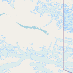
Map view of Wrangell, St. Elias National Park and Preserve

Use this park location map to pinpoint Wrangell, St. Elias National Park and Preserve in United States of America, understand its exact geographic position, and read its mapped placement within the surrounding landscape more clearly.

Pigeon | © OpenStreetMap contributors

Location context for Wrangell, St. Elias National Park and Preserve

AlaskaChugach Census AreaCopper River Census AreaSoutheast Fairbanks Census AreaYakutat City and Borough
Natural feature types

Explore the Geographic Landmarks of Wrangell–St. Elias National Park and Preserve

Deepen your understanding of this vast wilderness by examining the individual mountains, glaciers, and rivers identified in the MoriAtlas database. This structured collection offers a technical view into the complex natural terrain and distinct landforms contained within or near the park boundaries.
Recorded earthquake history

Explore Recorded Seismic Activity Near Wrangell-St. Elias National Park

Browse the documented earthquake history associated with the vast wilderness of Wrangell-St. Elias National Park and Preserve. MoriAtlas provides this catalogue to help users understand recorded seismic events and geographic data trends within this significant Alaskan protected landscape.

Wrangell-St. Elias Earthquake History

Catalogued events

1,644 events

Strongest magnitude

Magnitude 7.1

Most recent event

Jul 16, 2026

This history includes earthquakes recorded inside the park or within 50 km of its borders

Park atlas

Map the surrounding protected landscapes of Alaska and Canada, discovering similar glaciated mountains and expansive wilderness areas.

Discover Related National Parks and Protected Areas Near Wrangell–St. Elias National Park and Preserve

Continue your exploration from Wrangell–St. Elias National Park and Preserve by browsing nearby national parks, state parks, and expansive protected areas within Alaska and neighboring Canadian territories. This atlas view allows for geographic comparison of monumental glaciers, high volcanic peaks, and diverse alpine ecosystems across a broader protected landscape.
National parkYukon
Park boundaries overlap#1 closest

East

Kluane National Park and Reserve: Yukon National Park Protected Area and Landscape Geography

Explore mapped boundaries and regional context for this Yukon national park.

Kluane National Park and Reserve represents a vital protected national park within Yukon. This detail page focuses on its geographic identity and mapped features, offering insight into its regional landscape context and its role within the broader Canadian protected areas atlas. Discover the park's specific topography and its location within Yukon.

Area
22,013 km²
Established
1972
IUCN
II
Visitors
47.1K annual
National parkAlaska
About 204 km away#2 closest

Southeast

Glacier Bay National Park and Preserve: Alaska National Park Geographic Atlas

Mapped protected area context within Alaska's natural landscapes.

Glacier Bay National Park and Preserve serves as a vital protected landscape in Alaska, offering deep insights into regional geography and park boundaries. This detail page provides an atlas-centric view of the park, focusing on its role as a protected natural area and its unique position within the geographic tapestry of Alaska. Engage with structured data that illuminates the park's mapped terrain and its significance as a conservation landscape.

Area
13,045 km²
Established
1980
IUCN
V
Visitors
545.8K annual
National parkAlaska
275 km away#3 closest

West

Kenai Fjords National Park: Alaskan National Park & Protected Area Geographic Context

Mapped protected landscape and regional terrain discovery.

Kenai Fjords National Park serves as a key national park entity for understanding Alaska's protected lands. This destination focuses on the park's specific geographic identity and its role as a mapped protected landscape. Users can explore its protected area boundaries and gain insights into the regional geography it occupies, enriching an atlas-based view of natural terrains across Alaska.

Area
2,711.33 km²
Established
1980
IUCN
II
Visitors
425.4K annual
National parkAlaska
About 288 km away#4 closest

Northwest

Denali National Park and Preserve: Detailed Protected Landscape and Map Exploration in Alaska

Explore its mapped boundaries and Alaskan regional geography.

Understand Denali National Park and Preserve as a distinct protected landscape within Alaska's vast geography. This park detail page offers insights into its mapped boundaries, natural terrain, and its contribution to the regional atlas of protected areas. Discover the geographic context that defines this significant national park, providing a foundation for detailed map-based exploration and understanding of its conservation significance.

Area
24,464 km²
Established
1917
IUCN
V
Visitors
427.6K annual
Wildlife reserveAlaska
324 km away#5 closest

Southeast

Kootznoowoo Wilderness: Coastal Rainforest and Island Protected Area Map in Alaska

A vast temperate wilderness within the Tongass National Forest

Kootznoowoo Wilderness stands as a landmark protected landscape in Southeast Alaska, spanning the majority of Admiralty Island. Its geography is characterized by towering old-growth conifers, fern-covered understories, and a rugged coastline carved by glacial forces. This wildlife reserve provides a vital refuge for dense brown bear populations and remains one of the most intact examples of a maritime temperate rainforest in North America.

Area
3,962.19 km²
Established
1980
IUCN
Ib
Relief
Mixed relief
Protected landscapeAlaska
About 347 km away#6 closest

Southeast

Tongass National Forest: Geographic Overview of Alaska Coastal Wilderness

Mapped temperate rainforests, fjords, and mountain ranges

Trace the extensive boundaries of Tongass National Forest, a massive protected landscape in Southeast Alaska. This atlas detail covers the unique geography of the Alexander Archipelago, where island wilderness meets the tidewater glaciers and old growth forests of the Coast Mountains. Gain insight into the terrain, ecosystem distribution, and regional context of this globally rare coastal rainforest environment.

Area
68,000 km²
Established
1907
Visitors
1.9M annual
Relief
Mountain
Wildlife reserveYukon
357 km away#7 closest

East

Nisutlin River Delta National Wildlife Area: Yukon Delta and Wetland Geography

Protected boreal river delta and lake ecosystem.

The Nisutlin River Delta National Wildlife Area occupies a strategic position where riverine flow meets the expansive basin of Teslin Lake. The reserve is characterized by its dramatic seasonal transitions, transforming from high-water spring channels to expansive autumn mudflats. This dynamic geography supports essential migratory corridors through the boreal forest terrain of the southern Yukon.

Area
54.83 km²
Established
1995
IUCN
III
Nature reserveAlaska
About 394 km away#8 closest

West

Kachemak Bay National Estuarine Research Reserve: Alaska Protected Nature Reserve Atlas

Coastal and marine watershed geography on the Kenai Peninsula.

Kachemak Bay National Estuarine Research Reserve is a federally protected landscape on the western shore of the Kenai Peninsula. It encompasses diverse terrains including eelgrass meadows, tidal mudflats, and spruce forests. As the largest unit in the national estuarine system, it provides a unique window into the geographic connection between Gulf of Alaska marine zones and upland forest catchments.

Area
1,500 km²
Climate
Subpolar
Scope
Mixed
Water
Water-dominated

Common questions about visiting, size, designation, and location context for Wrangell, St. Elias National Park and Preserve

Wrangell, St. Elias National Park and Preserve FAQs for park facts, access, geography, and protected area context

Find quick answers about Wrangell, St. Elias National Park and Preserve, including protected-area facts, park geography, trail and visitor context, and how the park fits into its surrounding country and regional landscape.
MoriAtlas Explorer

Continue Your Protected Areas Search Across the Global Atlas

Deepen your exploration by continuing the structured search for national parks and protected areas worldwide. Utilize the comprehensive filtering capabilities to compare different conservation landscapes and refine your understanding of global park geography. Discover more about the distribution and characteristics of protected natural areas.

Global natural geography