Mori Atlas logo
National parkKenai Fjords National Park

Discover the mapped boundaries and regional natural terrain of this key Alaskan protected area.

Kenai Fjords National Park: Alaskan National Park Protected Landscape & Geographic Atlas

Kenai Fjords National Park represents a significant protected landscape within Alaska, offering a unique focus for geographic exploration and atlas-style discovery. This entry provides detailed context on the park's protected area status and its surrounding natural terrain, essential for understanding its position within the broader regional geography. Explore its mapped boundaries and the distinct landscape context it provides for Alaska's protected lands.

GlaciersIce FieldsFjordsCoastal EcosystemsMarine MammalsAlaska Wilderness

Kenai Fjords National Park

National park

Park overview

Structured park overview, official facts, and landscape profile for Kenai Fjords National Park

Kenai Fjords National Park park facts, protected area profile, and essential visitor context
Review the core facts for Kenai Fjords National Park, including designation, size, terrain, visitor scale, habitats, and operating context in one park-focused overview.

About Kenai Fjords National Park

Kenai Fjords National Park preserves a remarkable convergence of ice, mountain, and ocean ecosystems on Alaska's Kenai Peninsula. The park's namesake reflects its most distinctive landscape feature: the numerous fjords carved by glaciers moving down from the Harding Icefield, creating deep glacial valleys that have been submerged by rising sea levels and land subsidence. The Harding Icefield itself is one of the largest ice fields in the United States, a remnant of continental glaciation that continues to shape the landscape through its outflowing glaciers. The park encompasses a narrow band of coastal land between the mountains and the sea, a transition zone where temperate rainforests meet glacial outwash and tidal waters. This geographic position creates remarkable biodiversity, supporting both terrestrial species adapted to the rugged terrain and marine mammals that inhabit the productive coastal waters. The park's accessibility sets it apart among Alaska's wilderness parks, offering visitors multiple ways to experience the glacial landscape, from the roadside view at Exit Glacier to boat tours into the remote fjords and flights landing on the icefield itself.

Quick facts and research context for Kenai Fjords National Park

Kenai Fjords National Park covers 669,984 acres on the Kenai Peninsula in Alaska, making it the fifth most-visited park in Alaska while ranking 11th in area among the state's 13 national parks. The park is centered around the Harding Icefield, which receives approximately 60 feet of snowfall annually and has existed for about 23,000 years. About 51% of the park is covered by ice, with Bear Glacier being the largest in the park. The park's highest point reaches 6,450 feet at an unnamed peak in the Kenai Mountains. The park is bordered by Kenai National Wildlife Refuge to the west and Kachemak Bay State Park to the south. Exit Glacier is the only portion of the park accessible by road, reaching visitors at the Harding Icefield Trail.

Park context

Deeper park guide and search-rich context for Kenai Fjords National Park

Kenai Fjords National Park history, landscape, wildlife, and travel context
Explore Kenai Fjords National Park through its history, landscape character, ecosystems, wildlife, conservation priorities, cultural context, and seasonal travel timing in a structured park guide built for atlas discovery and search intent.

Why Kenai Fjords National Park stands out

Kenai Fjords is best known for its extraordinary glacial landscape, where the Harding Icefield serves as the dominant feature feeding dozens of glaciers that carve the dramatic fjords extending from the icefield to the sea. The park provides one of the most accessible opportunities to witness tidewater glaciers in Alaska, with Exit Glacier offering road-side viewing. The fjord ecosystem itself is unusual, formed from the mix of glacial freshwater and seawater, creating estuarine conditions that support rich marine life. The contrast between the massive icefield, the rugged Kenai Mountains, and the productive coastal waters makes this park a premier destination for understanding glacial ecology and witnessing the ongoing retreat of glaciers in a protected wilderness setting.

Kenai Fjords National Park history and protected-area timeline

The establishment of Kenai Fjords National Park followed more than a decade of proposals and negotiations during the 1970s. Early studies in the 1930s and 1940s examined potential Park Service units in Alaska, though the Kenai Fjords area was not initially considered a priority. The 1970s brought renewed attention, with various proposals for the area ranging from a National Recreation Area allowing logging and mining to a national monument protecting the icefield and coastline. President Jimmy Carter used the Antiquities Act to designate Kenai Fjords National Monument on December 1, 1978, pending final legislation to resolve Native land claims. The Alaska National Interest Lands Conservation Act, signed on December 2, 1980, converted the monument to a national park. Archaeological evidence has since revealed that the area supported human habitation far longer than initially believed, with village sites documented from approximately 950 AD to 1920. The park's history includes mining activity in Nuka Bay, with eleven mine sites documented and two eligible for the National Register. In 1989, the Exxon Valdez oil spill contaminated approximately 20 miles of the park's coastline, prompting extensive cleanup and restoration efforts that continued into the early 1990s.

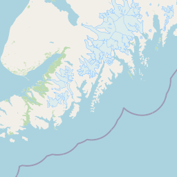
Kenai Fjords National Park landscape and geographic character

The landscape of Kenai Fjords National Park represents a masterpiece of glacial carving along the southeastern Kenai Peninsula. The Kenai Mountains rise from the coast, their peaks sculpted by the movement of the Harding Icefield, which blankets much of the interior. The glaciers emanating from the icefield have carved deep valleys into the mountains, and as these glacial valleys have been submerged by rising sea levels and ongoing land subsidence, they have become the fjords that define the park's coastal character. The floors of these fjords can reach 600 to 1,000 feet below present sea level. The geological foundation reflects the park's position at the boundary of the Pacific and North American plates, with a variety of terranes accreted against the shoreline. The predominant rock types include shale, graywacke, greenstone, tuff, and chert, creating a complex geological tapestry. The Harding Icefield itself covers a significant portion of the park's interior, while Bear Glacier stands as the longest glacier in the park. At the coast, the landscape transitions through a narrow band of forested land before meeting the sea, with the most significant fjords including Aialik Bay, Harris Bay, McCarty Fjord, and Nuka Bay.

Kenai Fjords National Park ecosystems, habitats, and plant life

The ecological character of Kenai Fjords reflects the ongoing interplay between glacial processes and biological succession. As glaciers have retreated through the twentieth century, new lands have been exposed for colonization, creating a dynamic succession sequence that begins with lichens and mosses on stony, soil-deficient substrate. Pioneer plants like dwarf fireweed and yellow dryas establish first, followed by nitrogen-fixing plants such as Sitka alder that enrich the developing soil. The progression continues through willow and cottonwood stages before reaching the mature forest of Sitka spruce and mountain hemlock. The forest understory features devil's club, Alaska blueberry, elderberry, baneberry, watermelon berry, and lady fern. Above the tree line, which sits between 750 and 1,000 feet elevation, alpine ecosystems support dwarf shrubs including bog blueberry, black crowberry, and Aleutian mountainheath. The marine environment features an unusual estuary ecosystem where glacial freshwater mixes with seawater, carrying rock flour that supports phytoplankton and the broader marine food web.

Kenai Fjords National Park wildlife and species highlights

Kenai Fjords supports a remarkable diversity of wildlife across both terrestrial and marine environments. Large terrestrial mammals include timber wolves, porcupines, Canadian lynx, brown bears, black bears, moose, and mountain goats, while smaller mammals such as coyotes, beavers, and river otters also inhabit the park. The marine mammals are particularly notable, with sea otters, harbor seals, and Steller sea lions commonly observed along the coast. The waters host an impressive array of cetaceans including orcas, fin whales, humpback whales, minke whales, Dall's porpoises, and Pacific white-sided dolphins. The bird community is diverse, with bald eagles and Peale's peregrine falcon nesting on the cliffs, while marine birds including tufted puffins, horned puffins, common murres, thick-billed murres, and marbled murrelets nest in the coastal areas. Black-billed magpies and Steller's jays are also present throughout the park.

Kenai Fjords National Park conservation status and protection priorities

Kenai Fjords National Park protects one of the most significant glacial ecosystems in the United States, preserving both the Harding Icefield and the surrounding fjord environment. The park's glaciers have shown retreat during the twentieth century, with a 3% reduction in icefield coverage documented over a 16-year study period, making the protected area valuable for understanding climate change impacts on glacial systems. The coastal waters support productive marine ecosystems that depend on the mixing of glacial fresh water and seawater. The 1989 Exxon Valdez oil spill affected approximately 20 miles of the park's coastline, highlighting both the vulnerability of this environment and the ongoing need for conservation vigilance. Restoration efforts following the spill, funded partially by the settlement with Exxon, have contributed to the park's ecological recovery. The park's protection of the icefield, coastal fringe, and marine waters creates a comprehensive conservation unit that preserves both geological processes and the biological communities they support.

Kenai Fjords National Park cultural meaning and human context

While Kenai Fjords is primarily known for its natural landscape, the park has revealed significant evidence of human occupation that challenges early assumptions about transient use of the area. Archaeological surveys have documented village sites spanning from approximately 950 AD to 1920, with evidence of long-term coastal habitation that provided rich resources for early peoples. A 1993 Park Service survey documented several village sites, and follow-up studies revealed occupation patterns including one site used from 950 AD to 1800. Geological evidence suggests an earthquake around 1170 AD lowered the shoreline by at least 1.8 meters, potentially inundating earlier sites. The park's establishment history includes ongoing relationships with Native village corporations that hold inholdings within the park, with subsistence rights established on approximately 9,000 acres following the 1990s land repurchases. A lodge developed by the Port Graham community on Aialik Bay reflects continued Native community connection to the park landscape.

Top sights and standout views in Kenai Fjords National Park

Kenai Fjords offers exceptional opportunities to experience glacial landscapes in a protected wilderness setting. The Harding Icefield Trail provides hikers access to the edge of the icefield, while boat tours from Seward allow visitors to view tidewater glaciers and marine wildlife including whales, sea otters, and Steller sea lions. Exit Glacier remains the most accessible glacier in the park, reachable by road and offering interpretive trails. The fjord ecosystem, with its mix of glacial and marine environments, supports remarkable biodiversity from mountain goats on the cliffs to humpback whales in the waters. The park's position relative to Anchorage makes it one of the most accessible Alaska national parks while maintaining a remote wilderness character. Kayaking, flightseeing, and wildlife viewing excursions provide diverse ways to experience the park's dramatic scenery and the ongoing glacial processes that continue to shape the landscape.

Best time to visit Kenai Fjords National Park

The best time to visit Kenai Fjords National Park depends on what visitors hope to experience. Summer months (June through August) offer the most accessible conditions, with the longest days, mild temperatures, and full availability of boat tours and trail access. The subarctic climate means cool, crisp conditions even during the warmest months, with average high temperatures in the 50s and 60s Fahrenheit. Late spring brings the melt season, with heavy water flows from the land helping to repel marine contamination such as oil from reaching the fjords. Fall can offer spectacular fall color in the coastal forest and fewer crowds, though conditions become more variable. Winter transforms the landscape, with significant snowfall and reduced access, though the park remains open for cold-season enthusiasts. The park's location along the Gulf of Alaska means year-round precipitation is common, so visitors should be prepared for rain regardless of season.

Park location guide

Geography guide, regional context, and park location map for Kenai Fjords National Park

Kenai Fjords National Park park geography, regions, and map view in United States of America
Understand where Kenai Fjords National Park sits in United States of America through a broader geographic reading of the surrounding landscape, nearby location context, and its mapped position within the national park landscape.

How Kenai Fjords National Park fits into United States of America

The United States of America is a federal presidential republic and one of the world's largest countries by area and population. It consists of 50 states across a vast territory spanning multiple time zones, with its capital in Washington, D.C. and largest city in New York City. The nation has a diverse economy, influential political system, and significant cultural and military presence globally.

Wider geography shaping Kenai Fjords National Park in United States of America

The United States occupies a vast territory in North America, bordered by Canada to the north and Mexico to the south. The 48 contiguous states stretch from the Atlantic to the Pacific Ocean, while Alaska occupies the northwestern region and Hawaii is an archipelago in the Pacific. The country encompasses diverse terrain including the Rocky Mountains, Appalachian Mountains, Great Plains, and extensive river systems.

Map view of Kenai Fjords National Park

Use this park location map to pinpoint Kenai Fjords National Park in United States of America, understand its exact geographic position, and read its mapped placement within the surrounding landscape more clearly.

Pigeon | © OpenStreetMap contributors

Location context for Kenai Fjords National Park

AlaskaKenai Peninsula Borough
Park atlas

Trace the regional spread of protected areas surrounding Kenai Fjords National Park, exploring connected landscapes.

Continue Your Park Exploration: National Parks and Protected Areas Near Kenai Fjords National Park
After exploring Kenai Fjords National Park's glaciated coast and fjords, browse additional national parks and protected areas across Alaska's diverse wilderness, comparing their unique geological features and ecosystems. This geographic view offers valuable context for understanding regional conservation efforts and discovering adjacent landscapes that share similar or contrasting natural characteristics.
National parkAlaska

Lake Clark National Park and Preserve National Park: Alaska's Protected Landscape Discovery

Mapping the geographic context and protected park boundaries.

Lake Clark National Park and Preserve stands as a protected national park in Alaska, offering a distinct geographic identity for atlas exploration. Delve into its role as a protected landscape, examining its mapped presence within the Alaskan region. This resource provides structured insights into the park's protected area status and its contribution to the understanding of natural terrain and regional geography.

Area
16,308.9 km²
Established
1980
IUCN
V
Visitors
19.8K annual
National parkAlaska

Katmai National Park and Preserve: Alaska National Park Atlas and Protected Landscape Exploration

Discover mapped boundaries and regional geographic context within Alaska.

Katmai National Park and Preserve represents a significant protected landscape within the state of Alaska, offering a unique point for atlas-based geographic inquiry. This detail page provides structured information focused on the park's mapped boundaries, its place within regional geography, and the characteristics of its natural terrain. Understand the core identity of Katmai National Park and Preserve as a protected national park entity for comprehensive map exploration.

Area
16,564.1 km²
Established
1980
IUCN
II
Visitors
34.5K annual
National parkAlaska

Denali National Park and Preserve: Detailed Protected Landscape and Map Exploration in Alaska

Explore its mapped boundaries and Alaskan regional geography.

Understand Denali National Park and Preserve as a distinct protected landscape within Alaska's vast geography. This park detail page offers insights into its mapped boundaries, natural terrain, and its contribution to the regional atlas of protected areas. Discover the geographic context that defines this significant national park, providing a foundation for detailed map-based exploration and understanding of its conservation significance.

Area
24,464 km²
Established
1917
IUCN
V
Visitors
427.6K annual
National parkAlaska

Wrangell, St. Elias National Park and Preserve: Alaska's Expansive National Park Geography

Mapped protected lands and regional landscape context.

Dive into the detailed geography of Wrangell, St. Elias National Park and Preserve, a prominent national park located in Alaska. This resource focuses on its extensive mapped boundaries and its role as a protected landscape, offering insights valuable for understanding regional geography and the distribution of natural areas.

Area
53,320.6 km²
Established
1980
IUCN
II
Visitors
79.5K annual
National parkYukon

Kluane National Park and Reserve: Yukon National Park Protected Area and Landscape Geography

Explore mapped boundaries and regional context for this Yukon national park.

Kluane National Park and Reserve represents a vital protected national park within Yukon. This detail page focuses on its geographic identity and mapped features, offering insight into its regional landscape context and its role within the broader Canadian protected areas atlas. Discover the park's specific topography and its location within Yukon.

Area
22,013 km²
Established
1972
IUCN
II
Visitors
47.1K annual
National parkAlaska

Glacier Bay National Park and Preserve: Alaska National Park Geographic Atlas

Mapped protected area context within Alaska's natural landscapes.

Glacier Bay National Park and Preserve serves as a vital protected landscape in Alaska, offering deep insights into regional geography and park boundaries. This detail page provides an atlas-centric view of the park, focusing on its role as a protected natural area and its unique position within the geographic tapestry of Alaska. Engage with structured data that illuminates the park's mapped terrain and its significance as a conservation landscape.

Area
13,045 km²
Established
1980
IUCN
V
Visitors
545.8K annual
National parkAlaska

Gates of the Arctic National Park and Preserve: Alaska's Remote Protected Landscape

Explore mapped park boundaries and regional geographic context.

Delve into the protected landscape of Gates of the Arctic National Park and Preserve, a vast national park situated in Alaska. This entry offers a detailed perspective on its geographic setting, focusing on mapped boundaries and its significance as a protected area. Understand the scale and natural context of this remote wilderness for comprehensive atlas-based exploration.

Area
34,287 km²
Established
1978
IUCN
V
Visitors
11.9K annual
National parkNorthwest Arctic Borough

Kobuk Valley National Park: Protected National Park with Regional Geography Context

Explore mapped boundaries and natural terrain within Northwest Arctic Borough.

Kobuk Valley National Park serves as a primary protected landscape within the Northwest Arctic Borough, Alaska. This entry facilitates detailed atlas exploration of its specific geography, mapped protected boundaries, and the natural terrain that defines its character as a designated national park. Understand its place within the broader regional landscape for comprehensive geographic discovery.

Area
7,084.9 km²
Established
1980
IUCN
II
Visitors
17.6K annual

Common questions about visiting, size, designation, and location context for Kenai Fjords National Park

Kenai Fjords National Park FAQs for park facts, access, geography, and protected area context
Find quick answers about Kenai Fjords National Park, including protected-area facts, park geography, trail and visitor context, and how the park fits into its surrounding country and regional landscape.
MoriAtlas Explorer

Continue Your Protected Areas Search Across the Global Atlas

Deepen your exploration by continuing the structured search for national parks and protected areas worldwide. Utilize the comprehensive filtering capabilities to compare different conservation landscapes and refine your understanding of global park geography. Discover more about the distribution and characteristics of protected natural areas.

Global natural geography