
Mori Atlas logo
Nature reserveKunë-Vain-Talë-Patok-Fushëkuqe-Ishëm Nature Park

A comprehensive look at the Drin delta lagoon system, Mediterranean pine forests, and protected coastal terrain.

Kunë-Vain-Talë-Patok-Fushëkuqe-Ishëm Nature Park: Coastal Wetlands and Adriatic Geography

(Parku Natyror Kunë-Vain-Talë-Patok-Fushëkuqe-Ishëm)

Kunë-Vain-Talë-Patok-Fushëkuqe-Ishëm Nature Park preserves a complex mosaic of brackish lagoons, alluvial forests, and coastal dunes where the Drin River meets the Adriatic Sea in Lezhë County. This protected area functions as a significant avian habitat and represents a unique transition zone of reed beds and pine woodlands. The terrain offers a detailed study of deltaic ecology, shifting water boundaries, and Mediterranean conservation landscapes in northern Albania.

wetlandscoastal lagoonDrin deltaAdriatic coastMediterranean woodlandspine forests
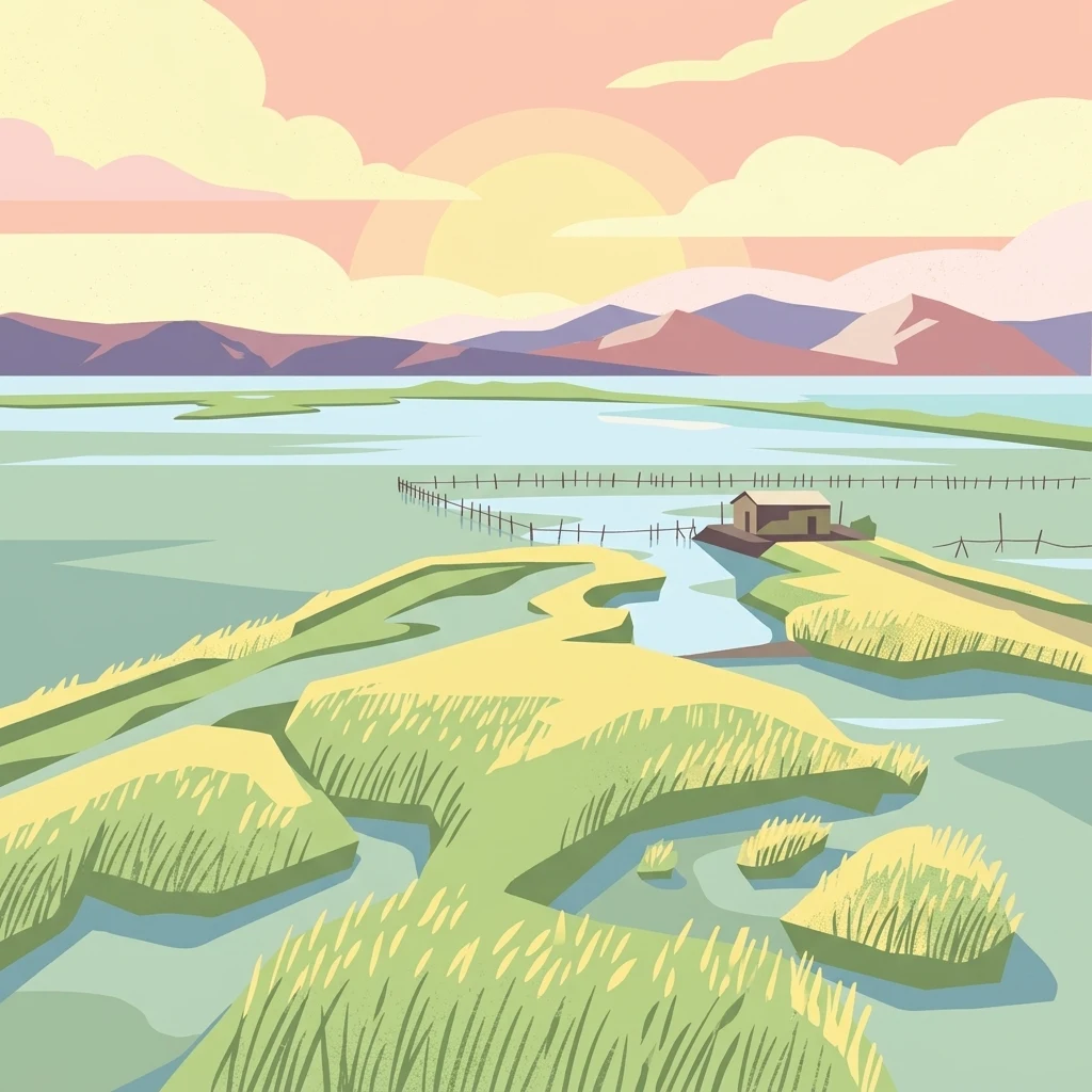
A flat vector-style illustration of a marshy coastal landscape with a small cabin, tall grasses, and mountains in the distance at sunset.

Kunë-Vain-Talë-Patok-Fushëkuqe-Ishëm Nature Park

Nature reserve

Park overview

Structured park overview, official facts, and landscape profile for Kunë-Vain-Talë-Patok-Fushëkuqe-Ishëm Nature Park

Kunë-Vain-Talë-Patok-Fushëkuqe-Ishëm Nature Park park facts, protected area profile, and essential visitor context

Review the core facts for Kunë-Vain-Talë-Patok-Fushëkuqe-Ishëm Nature Park, including designation, size, terrain, visitor scale, habitats, and operating context in one park-focused overview.

About Kunë-Vain-Talë-Patok-Fushëkuqe-Ishëm Nature Park

Kunë-Vain-Talë-Patok-Fushëkuqe-Ishëm Nature Park occupies the northern Albanian stretch of the Drin River delta, where freshwater outflow meets the Adriatic Sea near the city of Lezhë. The protected landscape combines several distinct habitats into a single continuous system: the brackish Kunë-Vain lagoon, the low-lying island of Kunë, surrounding Mediterranean pine and deciduous woodlands, alluvial forests, coastal marshes, reed beds, sand dunes, and sandy beaches along the shoreline.

The park sits within the Illyrian deciduous forests and Mediterranean woodlands terrestrial ecoregion, part of the Palearctic temperate broadleaf and mixed forests biome. Its Mediterranean climate supports dense vegetation, with a recorded flora of roughly 277 plant species. Wildlife inventories for the protected area document 341 fauna species, including 23 mammals, 196 bird species, 10 amphibians, 59 insect species, and 58 fish species, reflecting the diversity generated by the meeting of freshwater, brackish, marine, and terrestrial environments.

Beyond its ecological value, the park functions as an accessible natural area for visitors from Lezhë and the nearby port town of Shëngjin, and it lies within roughly an hour and a half of Tirana. Its proximity to these population centers, combined with its lagoon, woodland, and beach scenery, makes it one of the more visited nature-based destinations in Albania's coastal plain. The site's history as the country's first protected area, dating from 1940, and its formal recognition as an Important Bird Area anchor its importance within Albania's modern system of national parks and nature reserves.

Quick facts and research context for Kunë-Vain-Talë-Patok-Fushëkuqe-Ishëm Nature Park

Kunë-Vain-Talë-Patok-Fushëkuqe-Ishëm is a Nature Park (IUCN Category IV: habitat/species management area) covering roughly 43.93 km² along the Albanian Adriatic coast, at the heart of the Drin River delta. It was first protected as a hunting reserve in July 1940, making it the oldest protected landscape in Albania, and was formally re-established as a nature reserve on 28 April 2010. The park's governing body is Albania's National Agency of Protected Areas, and it is recognized internationally as a BirdLife International Important Bird Area. Its nearest cities are Lezhë and Shëngjin.

Protection and recognition

Documented terrestrial protection details and governance framework

Kunë-Vain-Talë-Patok-Fushëkuqe-Ishëm Nature Park Protection Status and Regional Scope

Terrestrial protection status and documented management boundaries define the conservation framework for Kunë-Vain-Talë-Patok-Fushëkuqe-Ishëm Nature Park. Official records outline the operational scope and designated parameters associated with this protected landscape.

Protection details

Protection scope
Terrestrial
Transboundary protection
No
Park context

Deeper park guide and search-rich context for Kunë-Vain-Talë-Patok-Fushëkuqe-Ishëm Nature Park

Kunë-Vain-Talë-Patok-Fushëkuqe-Ishëm Nature Park history, landscape, wildlife, and travel context

Explore Kunë-Vain-Talë-Patok-Fushëkuqe-Ishëm Nature Park through its history, landscape character, ecosystems, wildlife, conservation priorities, cultural context, and seasonal travel timing in a structured park guide built for atlas discovery and search intent.

Why Kunë-Vain-Talë-Patok-Fushëkuqe-Ishëm Nature Park stands out

The park is best known for the Kunë-Vain lagoon system and its rich birdlife, which has earned recognition as a BirdLife International Important Bird Area. Large flocks of wintering and migratory waterbirds concentrate around the lagoon, while Mediterranean pine forests, coastal dunes, and alluvial woodlands frame the wetland. Kunë Island, the lagoon's dynamic interplay with the Drin delta, and the combination of woodland, marsh, and Adriatic shoreline give the park a distinctive ecological character that is uncommon within Albania's protected-area system.
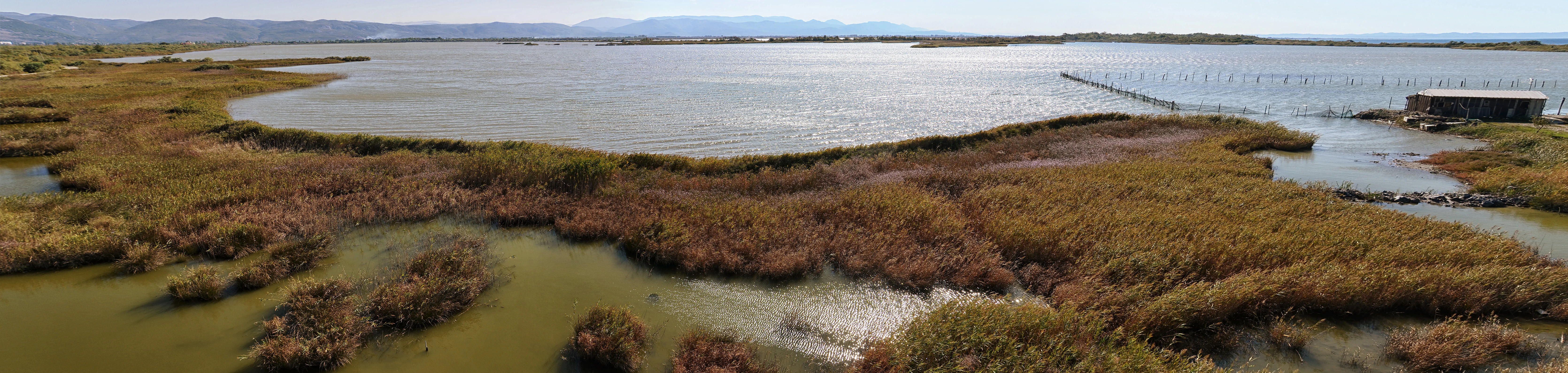
Panoramic view of a coastal lagoon with marshy, reed-filled foreground and open water extending to distant hills under a clear sky.
A wide view of the coastal lagoon ecosystem at Kunë-Vain-Talë-Patok-Fushëkuqe-Ishëm Nature Park, showing marshland vegetation and distant hills.

Kunë-Vain-Talë-Patok-Fushëkuqe-Ishëm Nature Park history and protected-area timeline

The territory enclosed by today's nature park has a longer protection history than any other area in Albania. In July 1940 it was declared a hunting reserve, becoming the first piece of land in the country to receive formal state protection. This early designation happened before Albania's modern environmental framework existed and predates most of the country's protected areas by decades.

After many decades of informal and partial protection, the area was re-established as a nature reserve under contemporary legislation on 28 April 2010. The new designation consolidated the existing Kunë Island, the Kunë-Vain lagoon, the surrounding woodlands, and several additional ecosystems into a single, clearly bounded protected unit. Governance of the park falls under Albania's National Agency of Protected Areas, the national authority responsible for managing the country's network of parks and reserves.

Recognition of the site's international importance came through BirdLife International, which identified it as an Important Bird Area, placing the lagoon and surrounding habitats within a global network of key sites for the conservation of birds, particularly waterbirds and migratory species that depend on the Drin delta.

Kunë-Vain-Talë-Patok-Fushëkuqe-Ishëm Nature Park landscape and geographic character

The landscape of Kunë-Vain-Talë-Patok-Fushëkuqe-Ishëm is shaped by the meeting of the Drin River and the Adriatic Sea. The Drin delta creates a low-relief coastal plain dominated by the brackish Kunë-Vain lagoon, whose outlines shift with the seasonal dynamics of freshwater inflow and marine influence. Kunë Island sits within this transition zone, acting as a hinge between open water, marshland, and the wooded interior.

Inland from the lagoon, Mediterranean pine forests rise on better-drained soils, while alluvial forests and dense reed beds fringe the water bodies. The shoreline includes a sequence of coastal dunes, sandy beaches, and tidal flats, particularly near Shëngjin. The overall terrain is flat to gently undulating, with elevations typical of a deltaic environment, and the visual character of the park is a layered mosaic of still water, marsh vegetation, woodland canopy, and open coast.
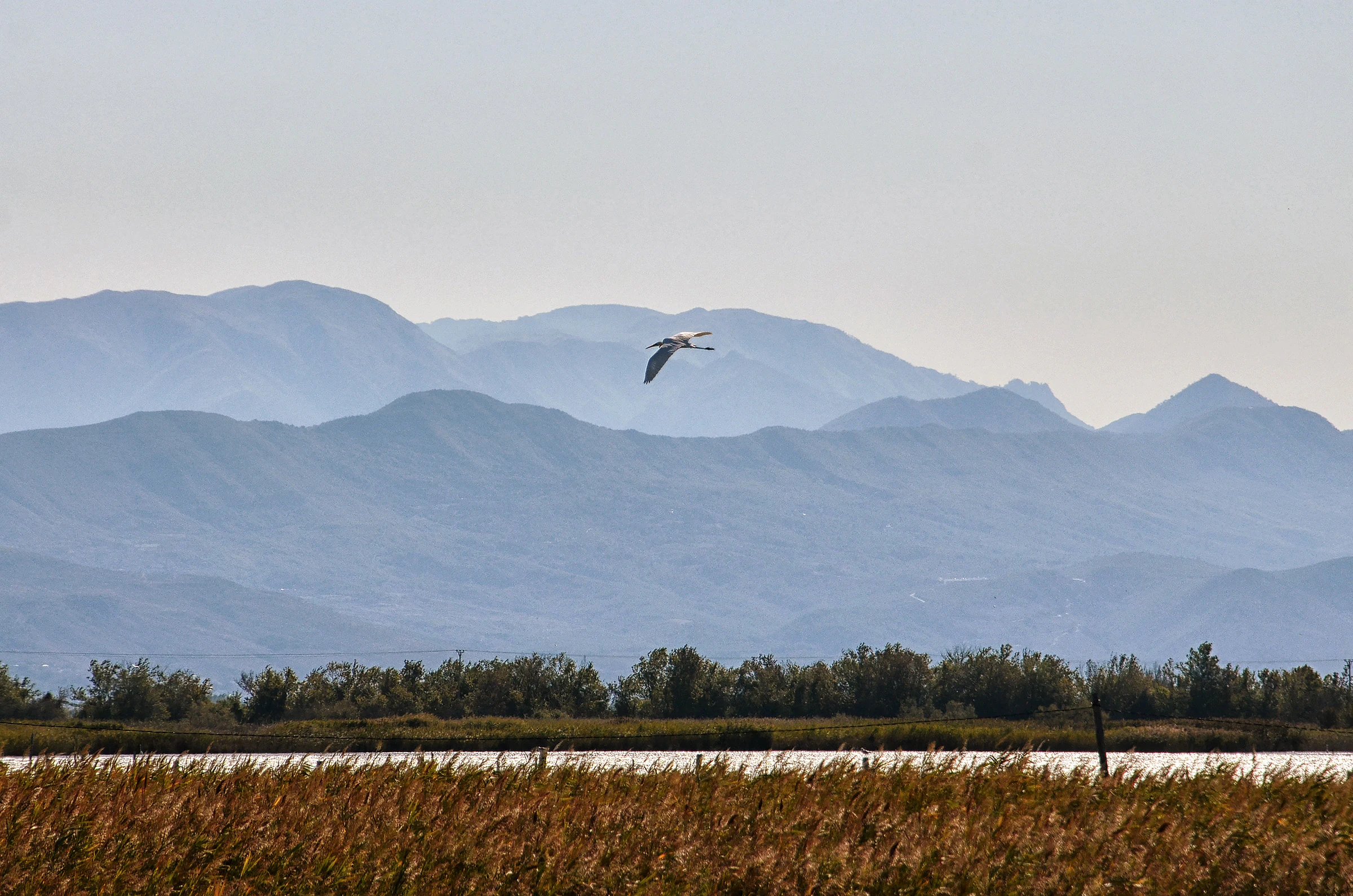
A bird flying over a marshy lagoon with reeds in the foreground and blurred mountain ranges in the distance.
A bird in flight over the wetlands of Kunë-Vain-Talë-Patok-Fushëkuqe-Ishëm Nature Park.

Kunë-Vain-Talë-Patok-Fushëkuqe-Ishëm Nature Park ecosystems, habitats, and plant life

Ecologically, the park is defined by the overlap of four habitat systems within a small geographic footprint. Mediterranean pine woodlands and mixed deciduous forest occupy the dry and mesic ground, while alluvial forests, reed beds (kallamishte), marshes, and lagoonal shallows cover the wetter zones created by the Drin's outflow. Coastal dunes and sandy beaches complete the gradient between land and sea.

The Mediterranean climate, with mild winters and warm, dry summers, supports a relatively rich flora, with inventories documenting around 277 plant species across these varied habitats. The vegetation gradient from dry pine woodland to permanently waterlogged reed bed is unusually compressed for Albania, and it is this compression of habitats that gives the protected area its ecological complexity and biodiversity value.
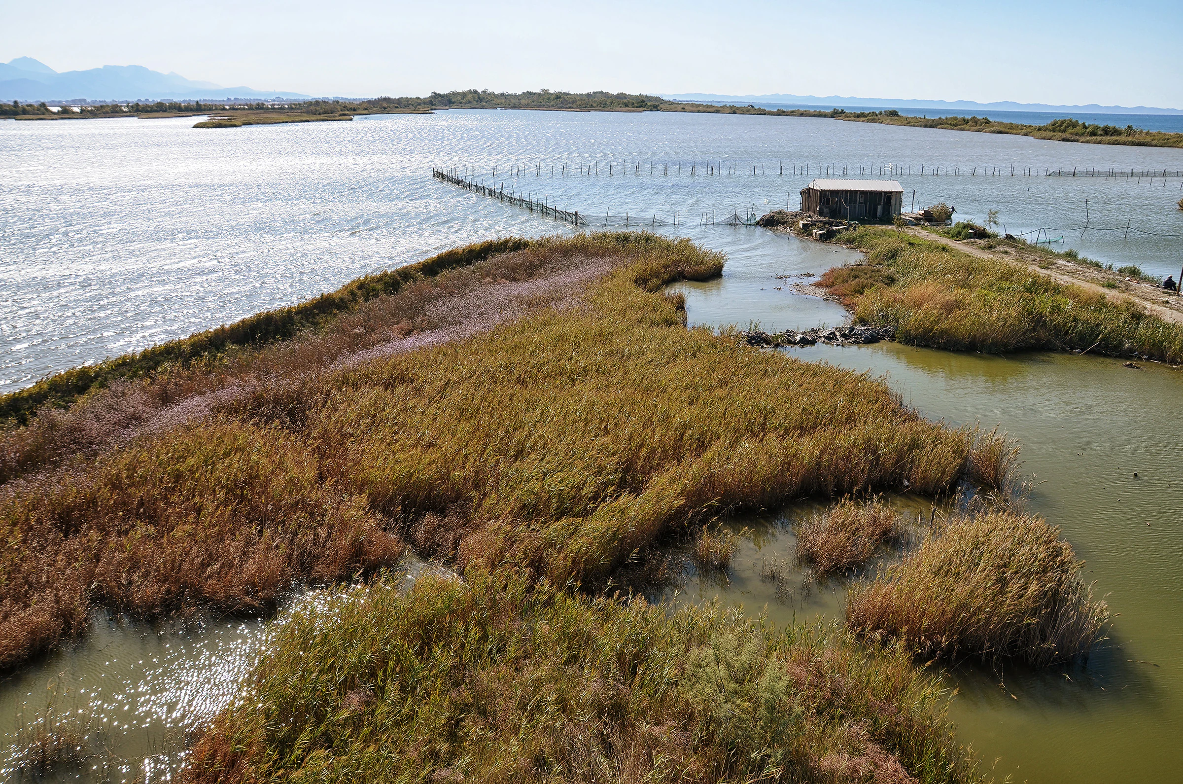
A high-angle view of a coastal wetland in Albania, featuring marshy islands with reeds, a small structure near the water, and calm lagoon waters reflecting the sky.
The wetlands and coastal lagoon area of Kunë-Vain-Talë-Patok-Fushëkuqe-Ishëm Nature Park.

Kunë-Vain-Talë-Patok-Fushëkuqe-Ishëm Nature Park wildlife and species highlights

Wildlife is the single most prominent reason for the park's international recognition. BirdLife International has designated the site as an Important Bird Area, with particular emphasis on the lagoon's role as a wintering and staging site for waterbirds and as breeding habitat for multiple species. Inventories record 196 bird species, among them Dalmatian pelicans, cormorants, egrets and herons (çafka), spoonbills, and a range of ducks and waders that depend on Mediterranean coastal lagoons.

The mammal fauna, although modest in species count at 23, includes woodland and wetland-associated species such as the Eurasian otter. Aquatic biodiversity is also significant: 58 fish species use the lagoon, river channels, and adjacent marine waters, supporting fisheries of local importance. The insect and amphibian components of the fauna, with 59 and 10 recorded species respectively, add further depth to the food webs of the lagoon and surrounding woodland.
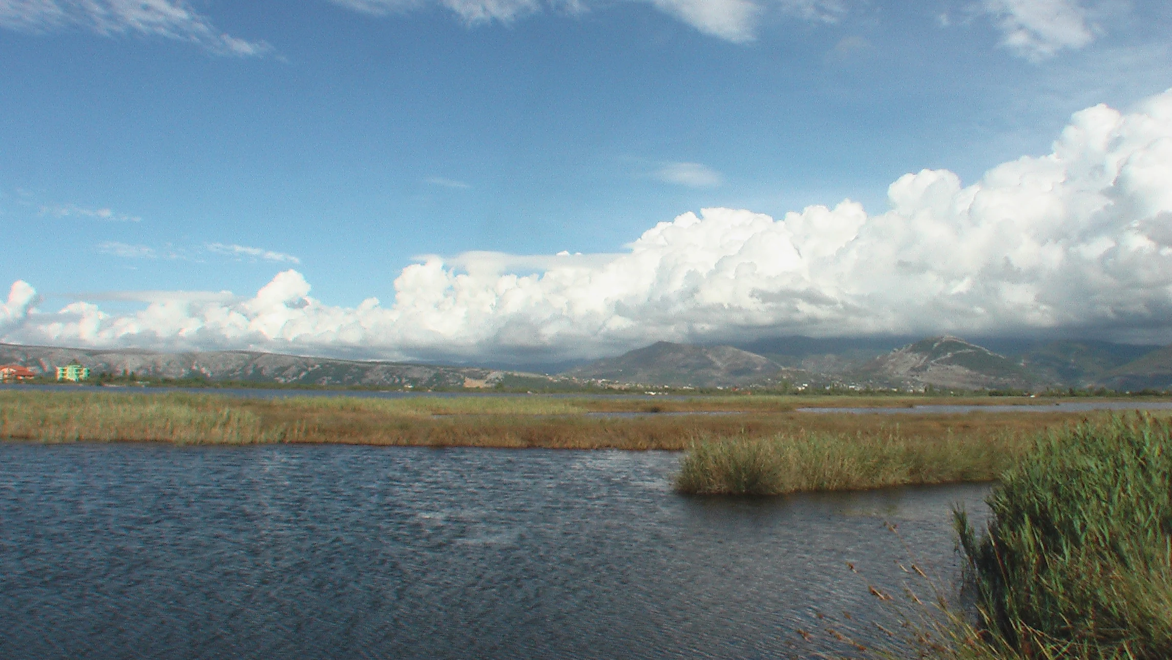
A wide landscape view of a calm lagoon with patches of tall reeds in the water, backed by distant rolling hills under a cloudy blue sky.
A view of the wetlands and lagoon landscape within Kunë-Vain-Talë-Patok-Fushëkuqe-Ishëm Nature Park.

Kunë-Vain-Talë-Patok-Fushëkuqe-Ishëm Nature Park conservation status and protection priorities

From a conservation perspective, the park's importance rests on three pillars: its role within the Drin delta, its overlapping ecoregional and habitat diversity, and its international recognition for birds. The Drin delta is one of the most ecologically significant wetlands on the Albanian coast, and the park covers a substantial portion of the most sensitive transitional zone where river, lagoon, and sea intersect.

The site's status as an Important Bird Area gives it a place within the global network of sites prioritized for avian conservation, while its classification as an IUCN Category IV protected area reflects a management focus on maintaining habitats and specific species rather than wholesale wilderness preservation. Long-term conservation value is reinforced by the area's century-spanning protection history: it has been subject to some form of formal protection since 1940, making it the longest continuously recognized protected landscape in Albania.

Kunë-Vain-Talë-Patok-Fushëkuqe-Ishëm Nature Park cultural meaning and human context

The park is closely tied to the cultural and historical landscape of Lezhë County. The nearby city of Lezhë carries strong historical associations, including sites linked to the national hero Skanderbeg, and the surrounding region has a long tradition of fishing, small-scale agriculture, and interaction with the Drin delta. The coastal town of Shëngjin, adjacent to the park, has long served as a small port and increasingly as a beach destination.

Local communities have historically drawn livelihoods and food from the lagoon and its fish stocks, and traditional fishing practices remain part of the human presence at the park's edge. Although the protected area does not center on a specific cultural monument, its combination of natural and cultural landscapes, proximity to historic Lezhë, and accessibility from Tirana make it a meaningful part of the regional identity of northern Albania.
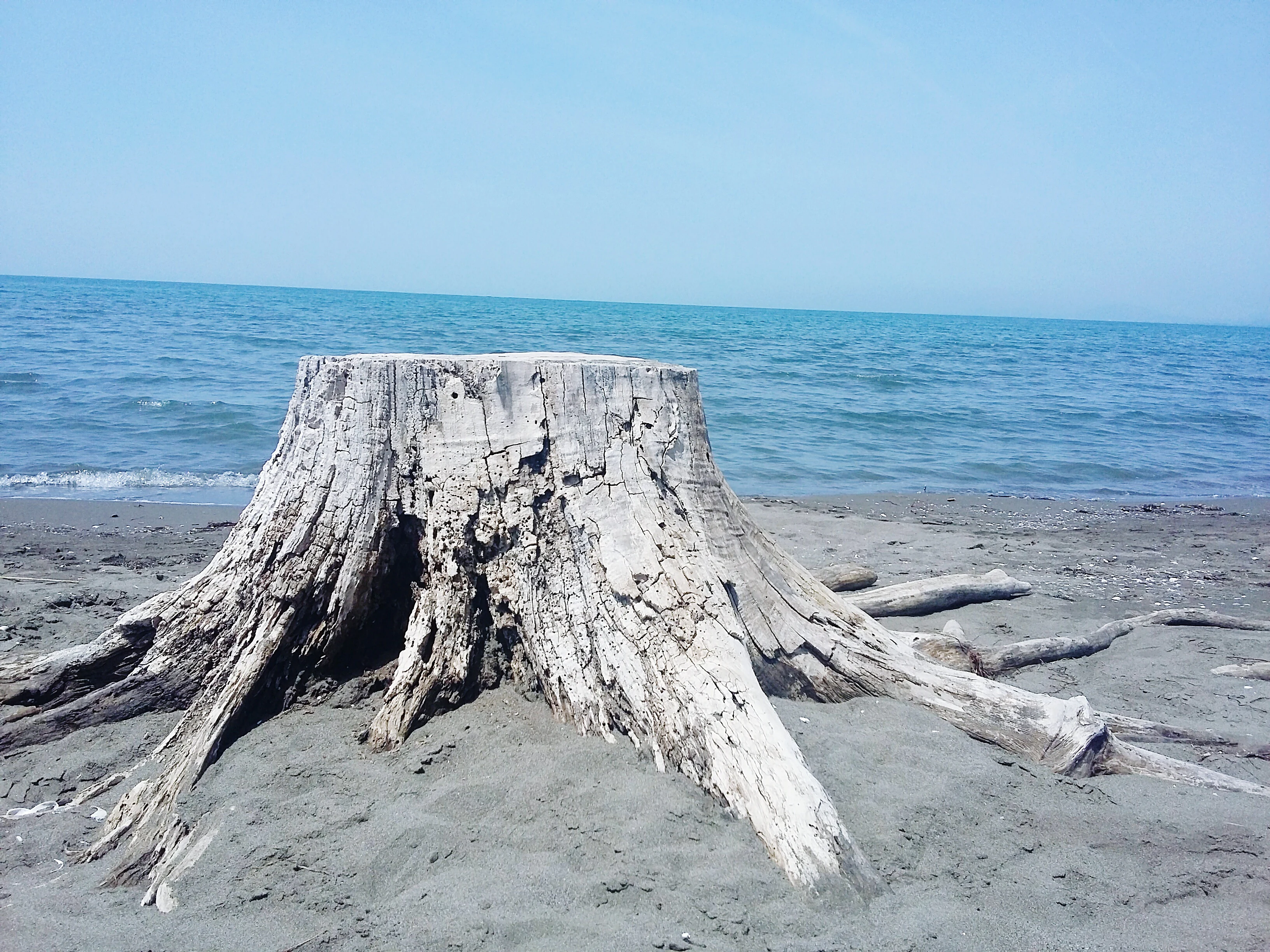
A large, weathered, grey tree stump sits on a sandy beach at the water's edge, with the open sea and blue sky in the background.
A weathered tree stump rests on the sandy coast of the Kunë-Vain-Talë-Patok-Fushëkuqe-Ishëm Nature Park.

Top sights and standout views in Kunë-Vain-Talë-Patok-Fushëkuqe-Ishëm Nature Park

The park's strongest highlights include the Kunë-Vain lagoon as a Mediterranean waterbird hotspot, the unusual wood-to-water habitat gradient of the Drin delta, and the presence of Kunë Island within the protected area. Its long protection history, dating from 1940, and continued international recognition as an Important Bird Area set it apart from many other protected landscapes in Albania. For visitors, the combination of woodland walking, lagoon views, and Adriatic beaches in a single protected unit, close to Lezhë and Shëngjin, makes the park particularly distinctive.
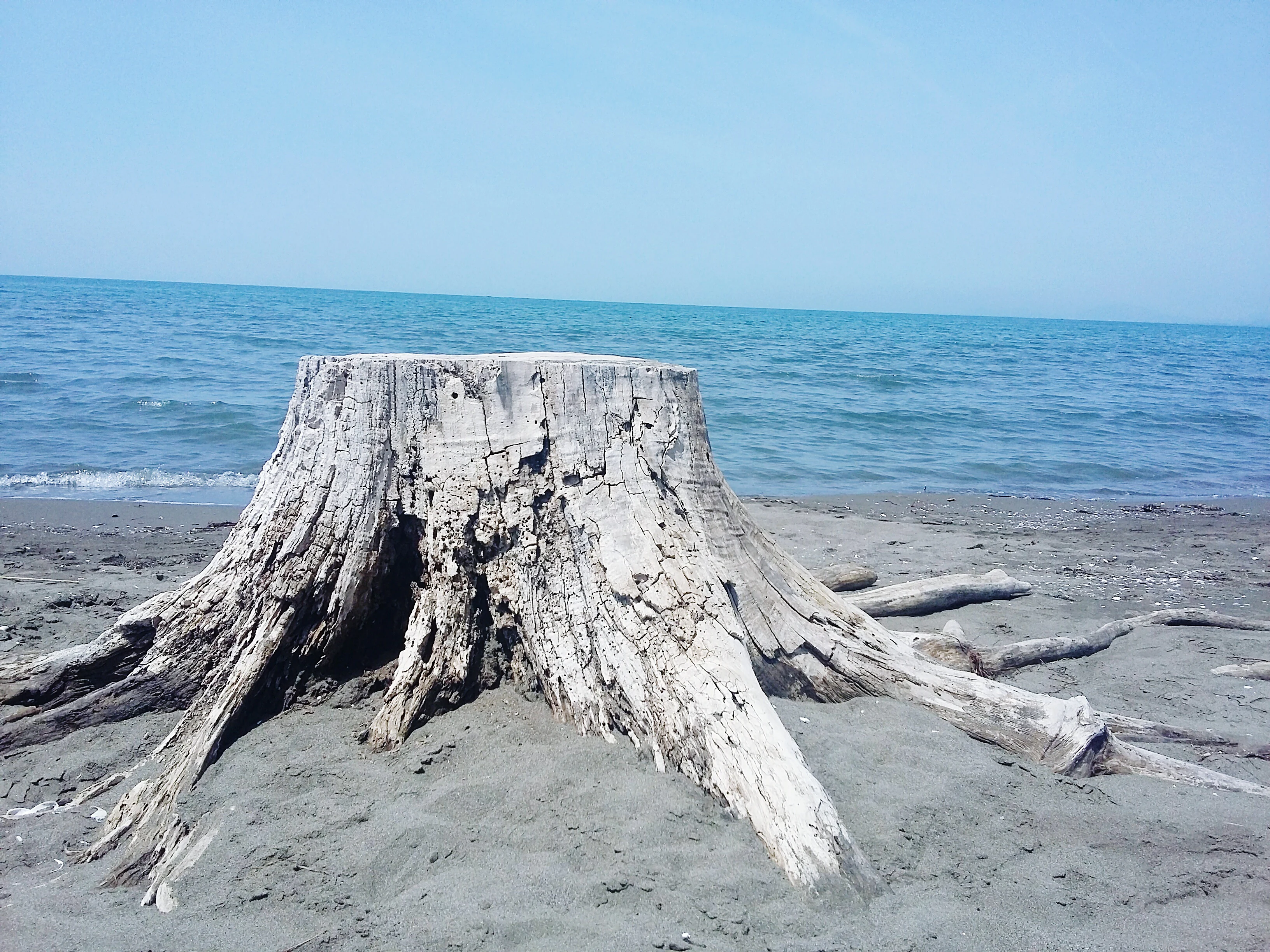
A large, weathered, grey wooden tree stump situated on a sandy beach with the blue water of the Adriatic Sea and a clear sky in the background.
A weathered tree stump sits on the sandy coastline of the Kunë-Vain-Talë-Patok-Fushëkuqe-Ishëm Nature Park.

Best time to visit Kunë-Vain-Talë-Patok-Fushëkuqe-Ishëm Nature Park

Spring and autumn are typically the most rewarding seasons to experience the park's ecological character. Migratory bird passage and breeding activity peak in spring, while autumn brings large concentrations of wintering waterbirds to the lagoon, which are central to the park's identity as an Important Bird Area. Summer remains attractive for visitors interested in woodland and beach settings, though high temperatures and the Mediterranean dry season reduce water levels and shift wildlife behavior. Winter offers quieter conditions and a different, more waterbird-focused character at the lagoon. Because the park is close to Lezhë, Shëngjin, and Tirana, it is reasonably accessible throughout the year, and seasonal visits should generally be planned around wildlife and weather interests rather than logistical constraints.
Monthly climate preview

Long-term temperature and precipitation records measured across representative regional coordinates

Kunë-Vain-Talë-Patok-Fushëkuqe-Ishëm Nature Park Climate Normals and Weather by Month

Representative baseline data captures long-term temperature ranges and monthly precipitation patterns across Kunë-Vain-Talë-Patok-Fushëkuqe-Ishëm Nature Park. Detailed monthly breakdowns provide deeper comparative metrics for evaluating annual meteorological variations.
Annual mean15 °C
6 °C26 °C
Jan
Feb
Mar10°
Apr13°
May18°
Jun23°
Jul26°
Aug26°
Sep21°
Oct17°
Nov12°
Dec
Warmest month
August

26.2 °C

Coolest month
January

5.9 °C

Wettest month
November

5.4 mm/day

Driest month
July

1.1 mm/day

Park location guide

Geography guide, regional context, and park location map for Kunë-Vain-Talë-Patok-Fushëkuqe-Ishëm Nature Park

Kunë-Vain-Talë-Patok-Fushëkuqe-Ishëm Nature Park park geography, regions, and map view in Albania

Understand where Kunë-Vain-Talë-Patok-Fushëkuqe-Ishëm Nature Park sits in Albania through a broader geographic reading of the surrounding landscape, nearby location context, and its mapped position within the national park landscape.

How Kunë-Vain-Talë-Patok-Fushëkuqe-Ishëm Nature Park fits into Albania

Albania is a unitary parliamentary republic in Southeast Europe, situated on the Balkan Peninsula along the Adriatic and Ionian coastal regions. With a population of approximately 2.4 million people, it borders Montenegro, Kosovo, North Macedonia, and Greece. The country features varied landscapes ranging from the Albanian Alps to fertile coastal plains, with Tirana as its capital and largest city.

Wider geography shaping Kunë-Vain-Talë-Patok-Fushëkuqe-Ishëm Nature Park in Albania

Albania occupies the western part of the Balkan Peninsula in Southeast Europe. The country features a varied terrain with rugged mountain ranges including the Albanian Alps (Accursed Mountains), Korab, Skanderbeg Mountains, Pindus, and Ceraunian Mountains. Fertile lowland plains extend along the Adriatic and Ionian coastal regions. The country borders Montenegro to the northwest, Kosovo to the northeast, North Macedonia to the east, and Greece to the south.

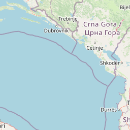
Map view of Kunë-Vain-Talë-Patok-Fushëkuqe-Ishëm Nature Park

Use this park location map to pinpoint Kunë-Vain-Talë-Patok-Fushëkuqe-Ishëm Nature Park in Albania, understand its exact geographic position, and read its mapped placement within the surrounding landscape more clearly.

Pigeon | © OpenStreetMap contributors

Location context for Kunë-Vain-Talë-Patok-Fushëkuqe-Ishëm Nature Park

Lezhë County

Visualizing the coastal lagoons, wetlands, and pine forests of northern Albania

Kunë-Vain-Talë-Patok-Fushëkuqe-Ishëm Nature Park Landscape Photography and Scenery

Visual documentation captures the complex habitats, coastal dunes, and wetland mosaics defining Kunë-Vain-Talë-Patok-Fushëkuqe-Ishëm Nature Park. Photographic archives provide essential reference material for studying the delta terrain, lagoon waters, and protected landscape character along the Adriatic shore.

Panoramic view of a coastal lagoon with marshy, reed-filled foreground and open water extending to distant hills under a clear sky.

Wide landscape view of a calm lagoon with tall grasses along the banks, under a bright blue sky with scattered clouds and distant mountains.

A bird flying over a marshy lagoon with reeds in the foreground and blurred mountain ranges in the distance.

A high-angle view of a coastal wetland in Albania, featuring marshy islands with reeds, a small structure near the water, and calm lagoon waters reflecting the sky.

A wide landscape view of a calm lagoon with patches of tall reeds in the water, backed by distant rolling hills under a cloudy blue sky.

A wide aerial view of a wetland with lagoons, reeds, and a small structure situated on a narrow strip of land extending into the water.

A large, weathered, grey tree stump sits on a sandy beach at the water's edge, with the open sea and blue sky in the background.

A large, weathered, grey wooden tree stump situated on a sandy beach with the blue water of the Adriatic Sea and a clear sky in the background.

A high-angle view of a calm lagoon with a wooden pier and a small covered observation structure extending into the water, bordered by dense vegetation.

Park atlas

Compare adjacent coastal wetlands and regional nature reserves across northern Albania.

Explore Protected Areas and Parks Near Kunë-Vain-Talë-Patok-Fushëkuqe-Ishëm Nature Park

Browse other protected areas and nearby national parks that share similar wetland ecosystems and coastal geography. Continuing through the regional park network reveals broader patterns in Mediterranean conservation landscapes.
A horizontal watercolor painting of a serene river landscape with green trees on both banks and small boats floating on the water at sunset.
Protected landscapeShkodër County
About 24 km away#1 closest

Northwest

Buna River-Velipojë Protected Landscape: Albania Coastal and Wetland Geography

Mapped protected landscape in Shkodër County

The Buna River-Velipojë Protected Landscape encompasses the crucial junction of riverine systems and the Adriatic Sea. This protected area features a mosaic of marshes, lagoons, and alluvial forests that form a significant migratory corridor in northwestern Albania.

Area
230.27 km²
Established
2005
IUCN
V
Relief
Lowland
A minimalist watercolor painting showing a tranquil lake surrounded by gentle hills and trees against a soft, pale sky.
Nature reserveDibër County
About 24 km away#2 closest

East

Lake Ulza Nature Park: Mapped Geography and Protected Area Overview in Dibër County

Analyzing the reservoir and river valley landscapes of central Albania

Lake Ulza Nature Park represents a significant protected mosaic where the Mat River creates a corridor of reservoirs, oak forests, and stony uplands. This overview examines the park geography, offering a structured look at how water bodies and mountainous terrain converge to form a unique inland habitat in Dibër County. Explore the physical relief and environmental boundaries that define this essential Albanian natural landmark.

Area
42.06 km²
Established
2013
IUCN
IV
Relief
Mixed relief
Watercolor painting of a wide wetland area with distant purple mountains, green grassy banks, and water channels.
Protected landscapeUlcinj
About 32 km away#3 closest

Northwest

Saline Ulcinj: Coastal Wetland Geography and Protected Landscape Mapping

A large-scale saline nature park near Ulcinj in southern Montenegro.

Saline Ulcinj represents a significant coastal wetland complex nestled in the Buna delta. This protected landscape is defined by its unusual industrial history and modern transition into a vital nature reserve, characterized by expansive saline pools and shallow mudflats. Its geographic footprint offers a clear look at how coastal water management shapes the surrounding terrain and provides essential stopover habitats for Adriatic migratory birds.

Area
15 km²
Established
2019
Relief
Lowland
Water
Water-dominated
Nature reserveAlbania
About 34 km away#4 closest

Southeast

Shtamë Pass Nature Park: Geographic Overview and Protected Mountain Landscape Map

Highland pine forests and freshwater corridors in Albania

Shtamë Pass Nature Park sits within the central Albanian mountains, providing a critical ecological link between coastal-inland gateway regions. The area protects a complex mosaic of alpine terrain, including clear mountain lakes, cold freshwater springs, and dense black pine forests that shelter brown bears and wolves. This protected zone offers a comprehensive view of regional highland geography and topography through its distinct mountain pass corridor.

Area
68.64 km²
Established
1996
IUCN
IV
A watercolor painting showing a panoramic view of green rolling hills and a body of water under a soft, light sky.
Nature reserveShkodër District
About 37 km away#5 closest

North

Lake Shkodër Nature Reserve: Mapping Protected Wetland and Riverine Geography in Albania

A critical Balkan freshwater protected area.

The Lake Shkodër Nature Reserve serves as a foundational protected landscape in northern Albania, encompassing the extensive shoreline and riverine floodplains of Lake Skadar. This geographic entity showcases a transition from fertile lowlands to mountainous ridges, offering a detailed look at how hydrologic processes and alpine proximity define Balkan wetland habitats.

Area
265.35 km²
Established
2005
IUCN
IV
Relief
Lowland
National parkAlbania
About 51 km away#6 closest

Southeast

Dajti Mountain National Park: Albania's Accessible Protected Mountain Landscape for Geographic Discovery

Explore the mapped terrain and diverse ecosystems of this significant national park.

Dajti Mountain National Park is a prime example of a protected mountain landscape central to Albania's geography. Situated near Tirana, its rugged karst topography, steep limestone ridges, and varied elevation create distinct ecological zones. This atlas-focused entry details the park's terrain, notable geological features like Pellumbas Cave, and its role as a significant protected area offering rich mapped landscape context.

Area
293.84 km²
Established
1966
IUCN
II
Relief
Mountain
Watercolor painting of a lake landscape with green marshes in the foreground, small islands in the middle, and rolling hills in the background.
National parkMontenegro
About 52 km away#7 closest

Northwest

Lake Skadar National Park: An Atlas Overview of Montenegro's Largest Freshwater Wetland

Karst Terrain and Transboundary Protected Landscapes

Lake Skadar stands as a monumental geographic feature in Montenegro, serving as the largest lake in Southern Europe. This national park protects a diverse ecosystem ranging from submerged karst springs to expansive seasonal marshes. Its status as a transboundary system offers insights into Mediterranean hydrology and endemic freshwater biodiversity within the unique Balkan karst basin.

Area
450 km²
Established
1983
Relief
Lowland
Climate
Mediterranean
Watercolor illustration of rolling green hills and distant mountains under a soft sky
National parkDibër County
About 53 km away#8 closest

East

Lurë-Dejë Mountain National Park: Mapped Protected Landscape and Glacial Lake Geography

Dibër County's alpine protected area with unique glacial lakes.

Delve into the detailed geographic context and mapped protected area of Lurë-Dejë Mountain National Park, an essential natural landscape in Albania's Dibër County. This park is renowned for its rare chain of twelve glacial lakes, situated at high elevations amidst dramatic alpine terrain. Its protected status ensures the preservation of significant old-growth forest ecosystems, including the critically endangered Balkan pine, contributing to its recognition as an Important Bird and Plant Area. Explore the park's distinctive terrain, from its soaring mountain peaks to its unique alpine meadows, all within a comprehensive geographic atlas framework.

Area
202.42 km²
Established
1966
IUCN
II
Relief
Mountain

Common questions about visiting, size, designation, and location context for Kunë-Vain-Talë-Patok-Fushëkuqe-Ishëm Nature Park

Kunë-Vain-Talë-Patok-Fushëkuqe-Ishëm Nature Park FAQs for park facts, access, geography, and protected area context

Find quick answers about Kunë-Vain-Talë-Patok-Fushëkuqe-Ishëm Nature Park, including protected-area facts, park geography, trail and visitor context, and how the park fits into its surrounding country and regional landscape.
MoriAtlas Explorer

Continue Your Protected Areas Search Across the Global Atlas

Deepen your exploration by continuing the structured search for national parks and protected areas worldwide. Utilize the comprehensive filtering capabilities to compare different conservation landscapes and refine your understanding of global park geography. Discover more about the distribution and characteristics of protected natural areas.

Global natural geography