
Mori Atlas logo
Protected landscapeLandschaftsschutzgebiet Diedersdorfer Heide und Großbeerener Graben

A comprehensive map view of Brandenburg's peri-urban ecological mosaic, drainage networks, and protected habitat boundaries.

Landschaftsschutzgebiet Diedersdorfer Heide und Großbeerener Graben Protected Landscape and Regional Geography Atlas

(Landschaftsschutzgebiet „Diedersdorfer Heide und Großbeerener Graben")

The Landschaftsschutzgebiet Diedersdorfer Heide und Großbeerener Graben spans a significant rural corridor south of Berlin, characterized by an intricate blend of pine woodlands, wet meadows, and open agricultural plains. This protected area represents a critical peri-urban buffer, managed through a 19th-century hydrological network of drainage ditches that now supports diverse habitat restoration efforts. Users can trace the regional topography from the Osdorfer Feldflur to the Genshagener Busch, gaining a deeper understanding of how this landscape balances agricultural utility with ecological preservation.

landscape protection areaBrandenburgTeltow-Flämingperi-urban countrysideagricultural landscapepine forest
A flat-design, digital illustration of a mountainous valley featuring a winding river, a waterfall cascading down a cliff face, and stylized evergreen trees in the foreground.

Landschaftsschutzgebiet Diedersdorfer Heide und Großbeerener Graben

Protected landscape

Park overview

Structured park overview, official facts, and landscape profile for Landschaftsschutzgebiet Diedersdorfer Heide und Großbeerener Graben

Landschaftsschutzgebiet Diedersdorfer Heide und Großbeerener Graben park facts, protected area profile, and essential visitor context

Review the core facts for Landschaftsschutzgebiet Diedersdorfer Heide und Großbeerener Graben, including designation, size, terrain, visitor scale, habitats, and operating context in one park-focused overview.

About Landschaftsschutzgebiet Diedersdorfer Heide und Großbeerener Graben

The Landschaftsschutzgebiet Diedersdorfer Heide und Großbeerener Graben is one of the larger statutory landscape protection areas anchoring the southern fringe of Brandenburg against the rapid urban expansion of Berlin. Its roughly 55 square kilometers span multiple municipalities, including parts of Blankenfelde-Mahlow, Großbeeren, Diedersdorf, Genshagen, Jühnsdorf, Dahlewitz, and Rangsdorf. Geographically, it lies within the gentle Teltow plateau, where glacial sandy soils historically supported heath and dry grassland, later replaced in many places by forestry and arable farming.

Within this broader matrix, the protected landscape contains a clear internal structure. The northern Osdorfer Feldflur forms an open agricultural transition toward the Berlin districts of Tempelhof-Schöneberg and Steglitz-Zehlendorf. South of this, the Diedersdorfer Heide itself surrounds the Mahlower Seegraben, a key watercourse, before the terrain opens into the Genshagener Busch and the Diedersdorfer Wiesen, separated by the Nuthegraben. The southern edge of the area is defined by the Bundesautobahn 10 (Berliner Ring), while the western edge runs along the Bundesstraße 101 near Großbeeren, and the eastern side meets the Berlin–Dresden railway corridor.

The area's protected status reflects an explicit balancing act. It is designated not as wilderness, but as a working landscape whose continued agricultural and forestry use is itself considered part of its conservation value, alongside its role as a recreational green space for the Berlin conurbation. At the same time, specific ecological interventions have been written into its management framework, including renaturation of watercourses, restoration of natural floodplain soils along streams, maintenance of dry grassland patches, and a long-term program to convert monocultural pine stands into more diverse mixed deciduous forests.

The presence of the Genshagener Busch, a roughly three square kilometer Flora-Fauna-Habitat zone within the broader protection area, connects this regional landscape protection to the European Natura 2000 network and gives the site added cross-border ecological significance. Surrounding protected areas, including the Landschaftsschutzgebiet Notte-Niederung, the Naturschutzgebiet Rangsdorfer See, and the Naturschutzgebiet Zülowgrabenniederung, together with small embedded nature reserves such as the Glasowbachniederung and Torfbusch, frame the landscape within a wider network of conservation sites along the Berlin-Brandenburg transition zone.

Quick facts and research context for Landschaftsschutzgebiet Diedersdorfer Heide und Großbeerener Graben

The Landschaftsschutzgebiet Diedersdorfer Heide und Großbeerener Graben sits in the Teltow landscape of southern Brandenburg, just south of the Berlin city limit. Established by the Brandenburg state government on 27 February 1998, it covers almost 55 square kilometers and is administered by the federal agency responsible for nature conservation. The area is divided into several distinct sub-zones, including the Osdorfer Feldflur, the Diedersdorfer Heide, the Diedersdorfer Wiesen, and the Genshagener Busch, all intersected by the Mahlower Seegraben and the Nuthegraben.

Within the protected area lies a Flora-Fauna-Habitat site of about three square kilometers in the Genshagener Busch, making the broader zone part of the European Natura 2000 network. Land use is dominated by agriculture and forestry, with pine stands earmarked for gradual conversion into mixed deciduous forest, while existing waterways are scheduled for renaturation.

Protection and recognition

Terrestrial protection status, management scope, and documented designation records

Landschaftsschutzgebiet Diedersdorfer Heide und Großbeerener Graben Protection Status

Landschaftsschutzgebiet Diedersdorfer Heide und Großbeerener Graben maintains a documented terrestrial protection status with associated registry records. Official conservation metrics compile structured protection data and international database identifiers for terrestrial conservation analysis.

Protection details

Protection scope
Terrestrial
WDPA ID
320357
Park context

Deeper park guide and search-rich context for Landschaftsschutzgebiet Diedersdorfer Heide und Großbeerener Graben

Landschaftsschutzgebiet Diedersdorfer Heide und Großbeerener Graben history, landscape, wildlife, and travel context

Explore Landschaftsschutzgebiet Diedersdorfer Heide und Großbeerener Graben through its history, landscape character, ecosystems, wildlife, conservation priorities, cultural context, and seasonal travel timing in a structured park guide built for atlas discovery and search intent.

Why Landschaftsschutzgebiet Diedersdorfer Heide und Großbeerener Graben stands out

The protected landscape is most recognized for its role as a large, contiguous buffer of open agricultural land, woodland, and wetland habitat along the southern edge of Berlin. It preserves a mosaic of sandy heath fields, pine forest, wet meadows along the Mahlower Seegraben and Nuthegraben, and the Natura 2000-listed Genshagener Busch, providing both ecological continuity and accessible countryside within a strongly metropolitan region. Equally distinctive is its hydrological framework: an 19th-century system of drainage ditches that channeled excess water from Berlin's former sewage farms into the Nuthe, and which today forms the structural backbone for wetland, meadow, and aquatic habitat restoration. The protected area thus stands out as a landscape where cultural drainage history and modern habitat management actively overlap.
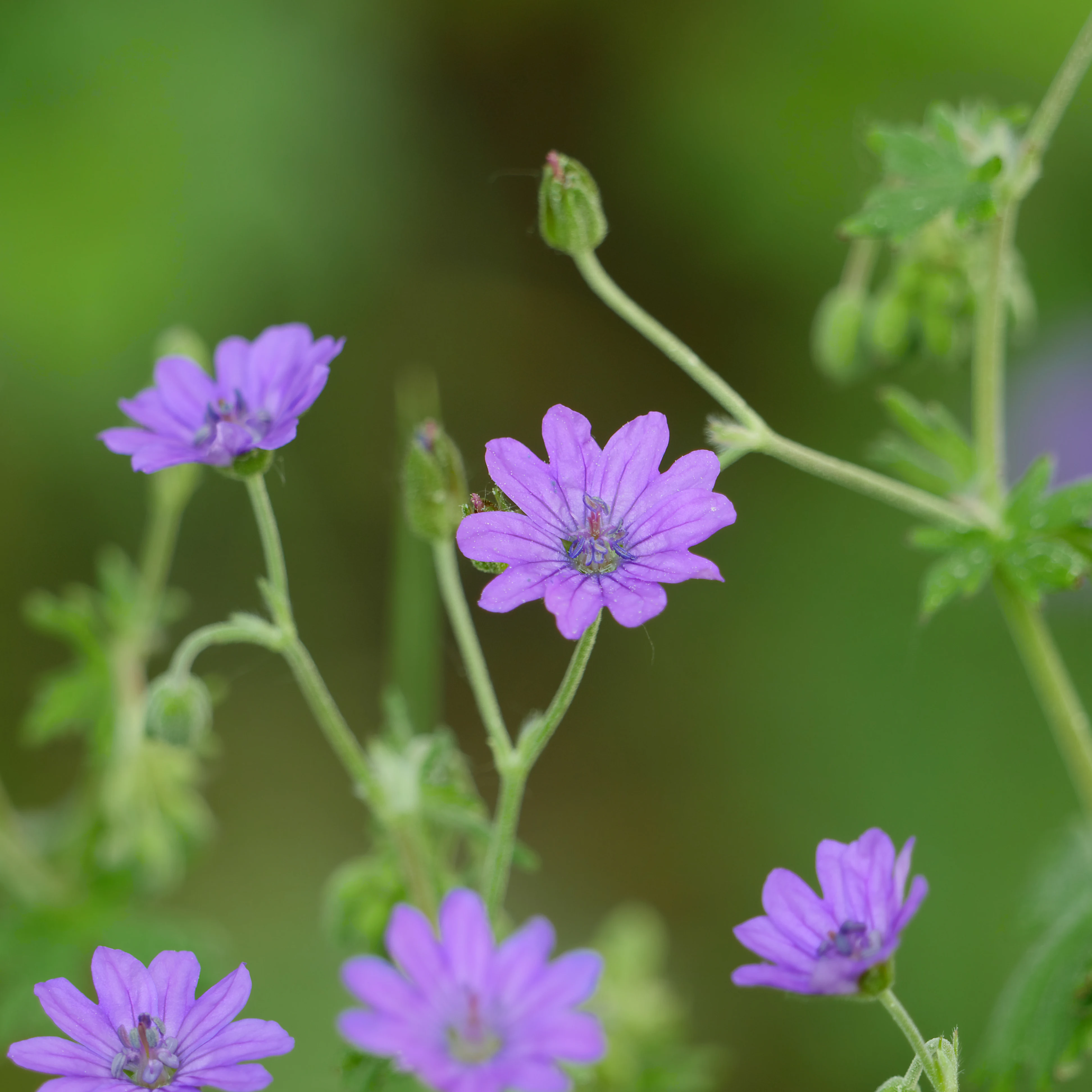
Close up of several delicate purple flowers with five petals, known as Pyrenean cranesbill, against a soft green background.
A cluster of purple Pyrenean cranesbill flowers blooming in the landscape area.

Landschaftsschutzgebiet Diedersdorfer Heide und Großbeerener Graben history and protected-area timeline

The landscape protected today as the Landschaftsschutzgebiet Diedersdorfer Heide und Großbeerener Graben has been shaped by drainage and land-use pressures that long predate its formal designation. Throughout the 19th century, the area's network of ditches served a critical infrastructure function, carrying surplus water from Berlin's Rieselfelder, the historical sewage irrigation fields, into the Nuthe river. By the 1960s, intensified melioration work along the Großbeerener Graben further reorganized the local hydrology in favor of agriculture.

Modern statutory protection began on 27 February 1998, when the Brandenburg state government established the landscape protection area as a unified framework combining ecological preservation with continued productive use. Subsequent amendments followed: on 10 January 2002 and on 23 June 2005, smaller parcels were formally removed from the protected zone to accommodate specific land-use adjustments. A further amendment on 3 February 2014 allowed the protection purposes to be set aside for areas covered by approved building plans, subject to ministerial consent.

A major infrastructural event came with the construction of the four-lane Landesstraße 76, an east-west connecting road opened in 2010, running from Potsdam via Teltow to Mahlow and on to Schönefeld. Because this route cuts fully through the protected landscape, the project was paired with a comprehensive mitigation package. This package included a dedicated wildlife overpass, an amphibian crossing, continuous game-protection fencing along the route, reforestation of roughly 17 hectares with mixed deciduous species, the planting of around 400 deciduous and fruit trees along roads and paths, shrub planting on central reservations and embankments, a bridge over the Mahlower Seegraben functioning as an irrigation transition, a bridge for an agricultural access road, and about two kilometers of new service tracks to support the area's farmers and foresters.

Landschaftsschutzgebiet Diedersdorfer Heide und Großbeerener Graben landscape and geographic character

The landscape of the protected area reflects the typical post-glacial character of the Teltow plateau south of Berlin, with sandy, gently undulating terrain shaped both by natural processes and by long-standing cultivation. The view from the Berlin border sweeps across the open Osdorfer Feldflur, a wide agricultural plain dotted with the small Osdorfer Wäldchen woodland patch, before the relief subtly shifts toward the slightly more sheltered zone of the Diedersdorfer Heide in the center.

Water is one of the strongest organizing elements of the terrain. The Mahlower Seegraben runs through the heart of the area, and the Nuthegraben separates the Genshagener Busch from the Diedersdorfer Wiesen further south. Together with smaller ditches, these waterways have both drained and, in modern management terms, structured the land, defining where wet meadows, floodplain soils, and reed-influenced vegetation persist and where drier, sandy-influenced heath and woodland take over.

Forest cover is dominated by pine stands, many of which are slated for gradual conversion into more diverse mixed deciduous woodland. Open fields and dry grassland pockets break up the otherwise wooded and farmed matrix, while small embanked features, road cuttings, and infrastructure crossings form more recent - but increasingly vegetated - features of the terrain. The ring of transport corridors around the area, including the A10 motorway to the south, the B101 to the west, and the Berlin-Dresden railway to the east, gives the protected landscape a clearly defined perimeter within an otherwise heavily networked region.
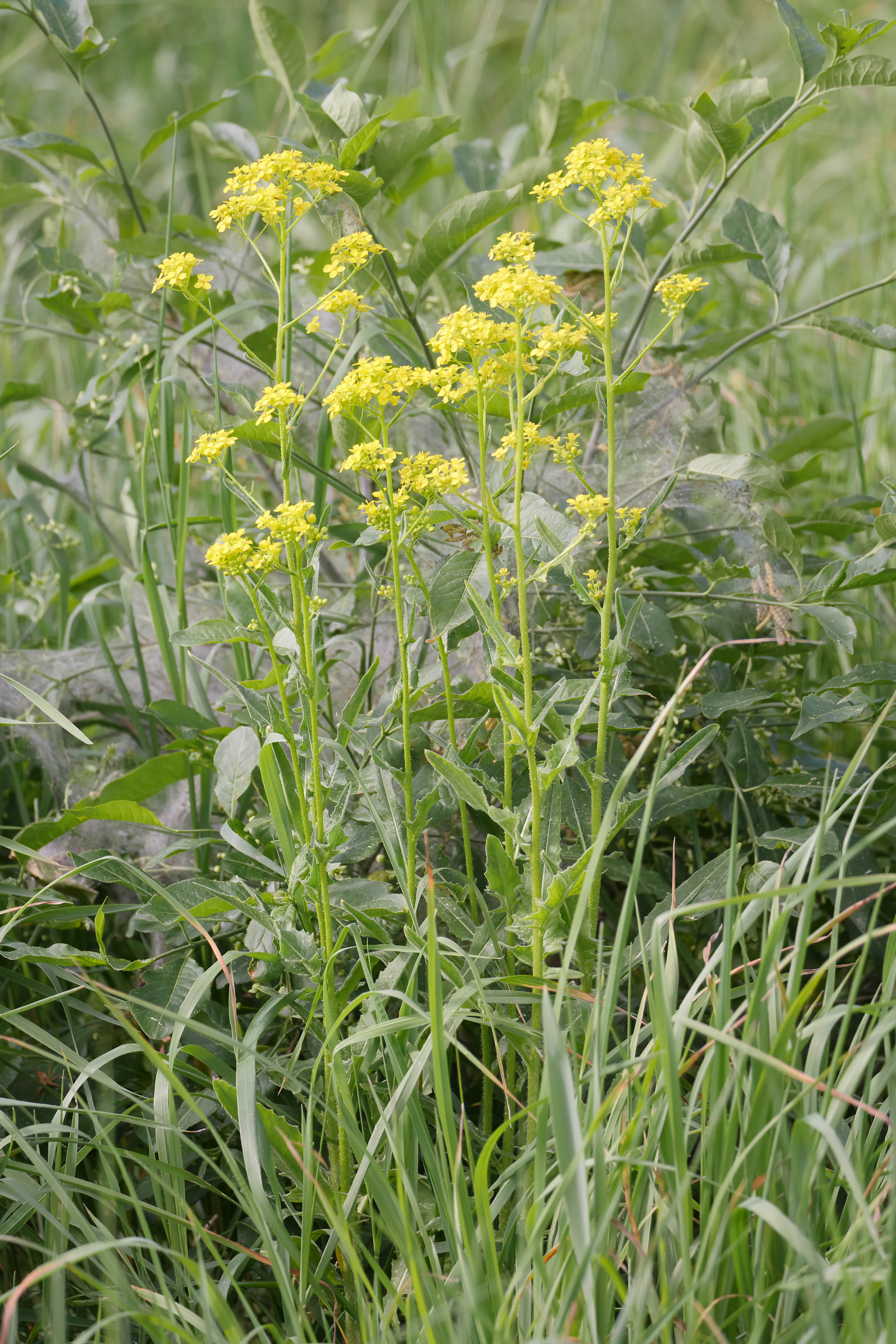
A close-up view of a cluster of yellow wildflowers growing among green grasses and foliage.
Wild blooming flowers within the protected landscape area of Diedersdorfer Heide.

Landschaftsschutzgebiet Diedersdorfer Heide und Großbeerener Graben ecosystems, habitats, and plant life

Ecologically, the protected landscape functions as a large, ecologically varied buffer against the southern expansion of Berlin, combining dry, sandy-influenced habitats with persistent wet zones. Dry grassland fragments have been singled out for active preservation, while pine-dominated forest stands are being progressively converted into mixed deciduous woodland to broaden structural diversity. The water system, centered on the Mahlower Seegraben and Nuthegraben, supports wet meadows and floodplain soils that are being deliberately renaturated after decades of melioration.

The most ecologically concentrated sub-area is the Genshagener Busch, which is recognized as both a Flora-Fauna-Habitat site and a Natura 2000 zone under European Union habitat legislation. Its roughly three square kilometers form the core of the area's biodiversity interest, tying local habitat management into broader transboundary ecological networks. Adjacent and embedded nature reserves such as the Glasowbachniederung, Torfbusch, and the nearby Naturschutzgebiet Zülowgrabenniederung extend the ecological context outward, creating a chain of wetland and woodland habitats along the Brandenburg side of the Berlin-Brandenburg interface.
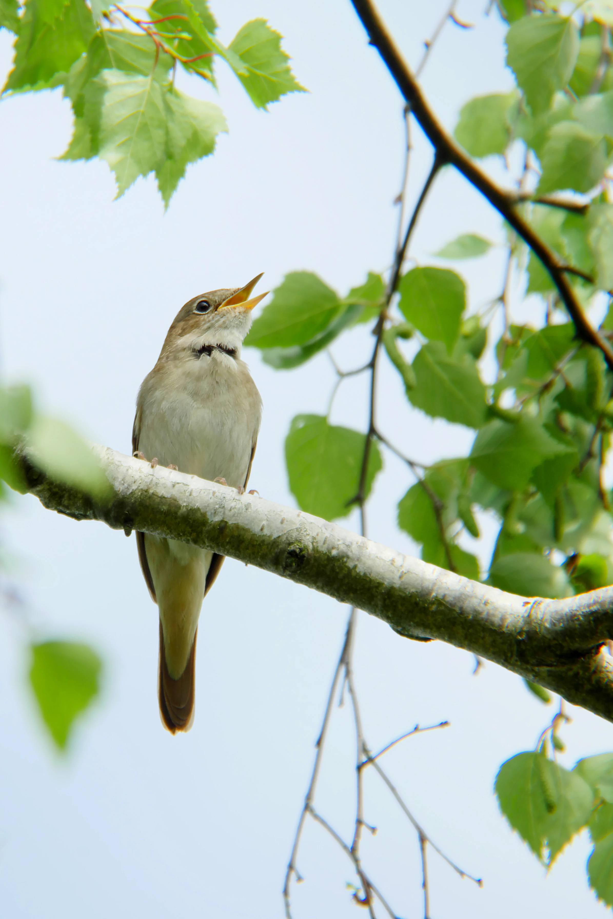
A small brownish bird with its beak open in a singing pose, perched on a thin, light-colored birch branch surrounded by bright green leaves.
A nightingale perched on a branch in the Diedersdorfer Heide and Großbeerener Graben landscape area.

Landschaftsschutzgebiet Diedersdorfer Heide und Großbeerener Graben wildlife and species highlights

Wildlife interest in the protected area concentrates along the network of ditches, wet meadows, scrub edges, and the Genshagener Busch forest patch. Birdlife is notably diverse for a peri-urban protected landscape, with characteristic species including the common crane, nightingale, great tit, willow warbler, yellowhammer, and great spotted woodpecker documented in or near the area. The presence of the crane in particular underscores the wetland value of the Mahlower Seegraben and the surrounding open meadows.

The combination of forest interior, edge habitats, and managed grasslands supports a mix of woodland and farmland bird species, while amphibians benefit from specific crossing infrastructure built into the Landesstraße 76, which cuts through the protection zone. The area is also crossed by the Berliner Mauerweg and the Berliner Nord-Süd-Weg, both of which bring regular human presence into otherwise quiet habitat zones, reinforcing the importance of well-designed wildlife crossings and game fencing for maintaining safe passage for larger mammals.
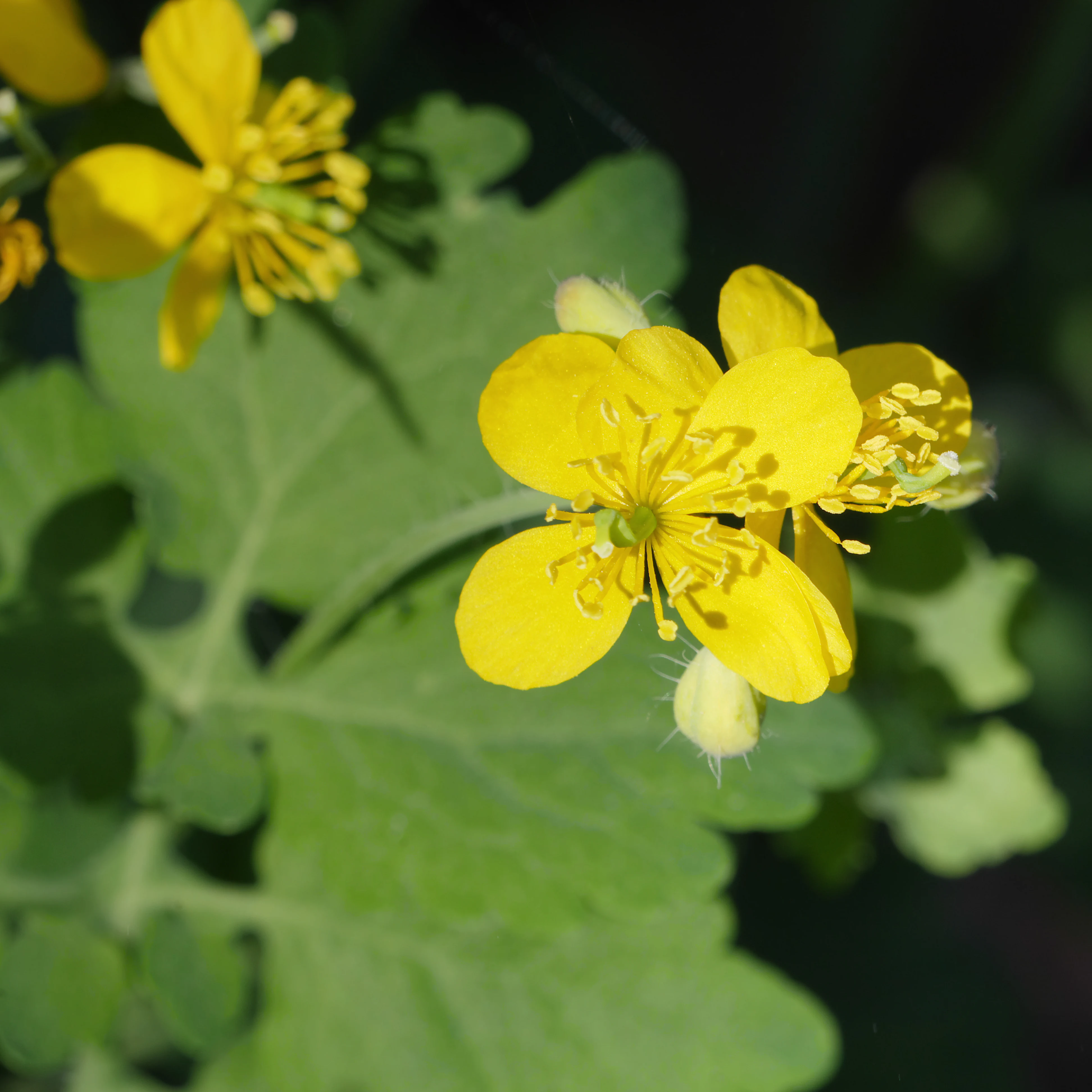
Close up view of bright yellow four-petaled flowers of greater celandine with green leaves and a hairy bud.
Greater celandine flowers blooming in the Diedersdorfer Heide.

Landschaftsschutzgebiet Diedersdorfer Heide und Großbeerener Graben conservation status and protection priorities

From a conservation perspective, the protected area's importance lies in its institutional embedding and its blend of statutory protection with active management. As a designated Landschaftsschutzgebiet under Brandenburg law and as host to a Natura 2000 Flora-Fauna-Habitat site within the Genshagener Busch, it operates within both regional and European conservation frameworks. It is administered by the federal nature conservation authority, which coordinates its management across multiple municipalities.

Its conservation objectives are explicit and wide-ranging: maintaining the functional integrity of the natural balance of the landscape, preserving the diversity, character, and beauty of both natural and culturally shaped features, ensuring the sustainability of its role as a recreational resource for the Berlin conurbation, and steering land use toward nature-compatible and sustainable practices. These objectives translate into concrete actions such as renaturating existing water bodies, developing near-natural floodplain soils along streams, conserving dry grassland remnants, allowing sustainable recreational use under appropriate conditions, and gradually replacing pine monocultures with mixed deciduous forest.

Infrastructure mitigation, above all along the Landesstraße 76 corridor, has become an integral part of conservation practice in the area, with wildlife overpasses, amphibian crossings, protective fencing, new mixed forest, and structural planting along embankments helping to maintain ecological functionality even where the landscape is fragmented by transport routes.

Top sights and standout views in Landschaftsschutzgebiet Diedersdorfer Heide und Großbeerener Graben

The protected area's standout qualities are its sheer scale as a peri-urban cultural landscape, the unusual depth of its hydrological heritage, and the layered network of European and regional protection statuses operating within a single territory. Within a short distance of central Berlin, it preserves tens of square kilometers of working heathland, woodland, and meadow whose management is anchored in 19th- and 20th-century drainage history but actively redirected toward ecological recovery.

The Genshagener Busch adds European Natura 2000 significance, while the mitigation measures around Landesstraße 76 demonstrate how modern infrastructure and nature protection can be reconciled through wildlife crossings, habitat restoration, and forest conversion. The result is a protected landscape that is simultaneously agricultural, ecological, recreational, and infrastructural, reflecting the complex pressures shaping the Berlin-Brandenburg interface.
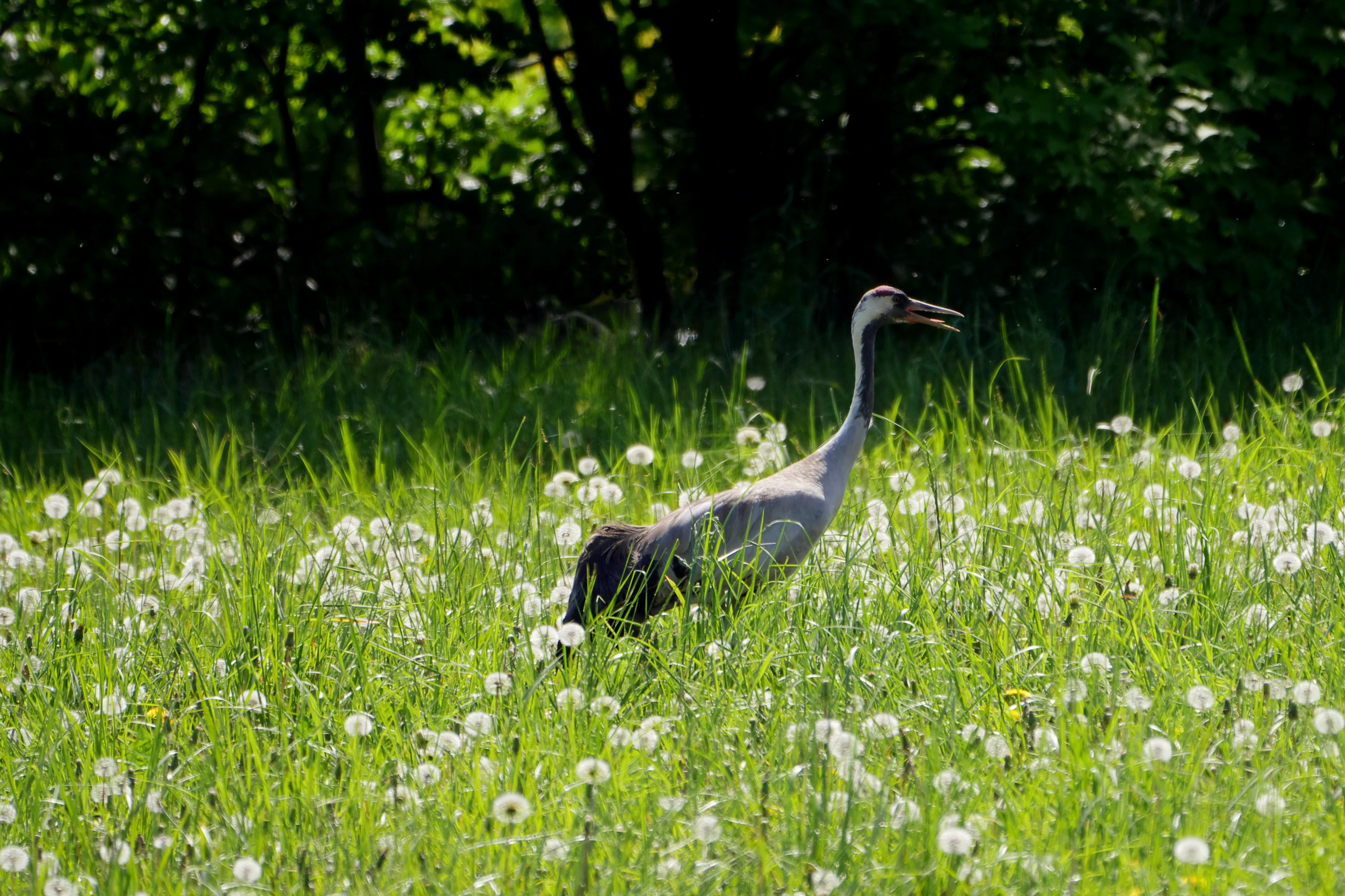
A grey crane standing in a field of tall green grass and white dandelion seed heads with dark trees in the background.
A crane foraging in a meadow within the landscape protection area.

Best time to visit Landschaftsschutzgebiet Diedersdorfer Heide und Großbeerener Graben

The landscape is broadly accessible year-round, but its character shifts notably with the seasons. Spring and early summer bring active birdlife, including visible cranes and nightingales along the wet meadows of the Mahlower Seegraben, alongside fresh growth in woods and along path edges that makes the area especially attractive for walking. Late spring is also when dry grasslands and field margins display their richest floral variety, including characteristic species documented within the protection zone.

Autumn offers quieter conditions, softer light across the open Osdorfer Feldflur, and harvest-season activity in the agricultural parts of the protection area. Winter reveals the broader spatial structure of the landscape, with the mix of open fields and pine-dominated woodland clearly visible, and is a good time for observing larger gatherings of cranes and other seasonal bird movements. Throughout the year, the long-distance trails crossing the area, including the Berliner Mauerweg, the Berliner Nord-Süd-Weg (one of Berlin's 20 green main routes), the Teltower Dörferweg, and the Natura Trail Genshagener Busch, allow visitors to experience the landscape under varying conditions.


Monthly climate preview

Long-term monthly temperature and precipitation rhythm from representative coordinates

Landschaftsschutzgebiet Diedersdorfer Heide und Großbeerener Graben Climate Normals

Representative baseline measurements for Landschaftsschutzgebiet Diedersdorfer Heide und Großbeerener Graben reveal a multi-month range of average temperatures and precipitation rates. Examining the full monthly breakdown provides detailed historical context on annual climate variation across the protected area.
Annual mean9 °C
-1 °C20 °C
Jan-1°
Feb
Mar
Apr
May14°
Jun18°
Jul20°
Aug20°
Sep15°
Oct
Nov
Dec
Warmest month
July

20.3 °C

Coolest month
January

-0.7 °C

Wettest month
July

2.4 mm/day

Driest month
April

1 mm/day

Park location guide

Geography guide, regional context, and park location map for Landschaftsschutzgebiet Diedersdorfer Heide und Großbeerener Graben

Landschaftsschutzgebiet Diedersdorfer Heide und Großbeerener Graben park geography, regions, and map view in Germany

Understand where Landschaftsschutzgebiet Diedersdorfer Heide und Großbeerener Graben sits in Germany through a broader geographic reading of the surrounding landscape, nearby location context, and its mapped position within the national park landscape.

How Landschaftsschutzgebiet Diedersdorfer Heide und Großbeerener Graben fits into Germany

Germany is a federal republic in Western and Central Europe with a population of over 83 million across sixteen constituent states. It is Europe's largest economy by nominal GDP and a major global exporter and importer. The capital is Berlin, and the country borders Denmark, Poland, Czech Republic, Austria, Switzerland, France, Luxembourg, Belgium, and the Netherlands.

Wider geography shaping Landschaftsschutzgebiet Diedersdorfer Heide und Großbeerener Graben in Germany

Germany is located in Western and Central Europe, spanning 357,022 km². It borders Denmark to the north, Poland and the Czech Republic to the east, Austria and Switzerland to the south, and France, Luxembourg, Belgium, and the Netherlands to the west. The country has coastlines on the Baltic Sea and North Sea to the north, with the Alps located in the southern region.

Map view of Landschaftsschutzgebiet Diedersdorfer Heide und Großbeerener Graben

Use this park location map to pinpoint Landschaftsschutzgebiet Diedersdorfer Heide und Großbeerener Graben in Germany, understand its exact geographic position, and read its mapped placement within the surrounding landscape more clearly.

Pigeon | © OpenStreetMap contributors

Location context for Landschaftsschutzgebiet Diedersdorfer Heide und Großbeerener Graben

Brandenburg

Visualizing the terrain, pine woodlands, and wetland habitats of this protected Brandenburg landscape.

Landschaftsschutzgebiet Diedersdorfer Heide und Großbeerener Graben Photos and Landscape Scenery

Browse detailed photography capturing the sandy heath fields, pine forests, and drainage networks that define Landschaftsschutzgebiet Diedersdorfer Heide und Großbeerener Graben. Visual reference imagery reveals the topography and habitat mosaics shaping this protected peri urban ecosystem south of Berlin.

Close up of several delicate purple flowers with five petals, known as Pyrenean cranesbill, against a soft green background.

A male Great Spotted Woodpecker with black, white, and red plumage clings to the rough bark of a thin tree trunk, shown in profile.

A close-up view of a cluster of yellow wildflowers growing among green grasses and foliage.

A small brownish bird with its beak open in a singing pose, perched on a thin, light-colored birch branch surrounded by bright green leaves.

Close up view of bright yellow four-petaled flowers of greater celandine with green leaves and a hairy bud.

A bright yellow yellowhammer bird perched on a branch of an oak tree surrounded by green leaves and catkins.

A grey crane standing in a field of tall green grass and white dandelion seed heads with dark trees in the background.

A wide, panoramic view of a grassy, open field in Germany on a bright, sunny day, with a line of trees on the right and clear blue sky.

A small, light-colored bird perched on the thin, green-leaved branch of a tree against a bright, overexposed white sky.

A great tit bird with a yellow breast and black head perched on a mossy tree branch, with a blurred leafy background.

Park atlas

Compare surrounding regional landscapes and connected protected habitats across the southern Berlin fringe

Explore Protected Areas Near Landschaftsschutzgebiet Diedersdorfer Heide und Großbeerener Graben

Browsing other protected areas near Landschaftsschutzgebiet Diedersdorfer Heide und Großbeerener Graben reveals broader regional terrain patterns across the Teltow plateau. Analyzing adjacent natural reserves helps place peri urban agricultural mosaics and hydrological networks into a wider geographic context.
Protected landscapeBerlin
About 10 km away#1 closest

Northeast

Vogelschutzgebiet am Wildmeisterdamm in Rudow: Berlin Urban Protected Woodland Map

Historical bird sanctuary and broadleaf landscape in Neukölln

Spanning roughly 3.75 hectares in the Gropiusstadt district, this site functions as an important refuge for urban birdlife amidst dense residential development. The woodland features a mix of oak, birch, and elm trees, preserved for their ecological continuity since the site first gained official protection in the early twentieth century.

Area
0.038 km²
Established
1934
IUCN
V
Relief
Lowland
Watercolor painting of a peaceful wetland scene with cattails in the foreground, calm reflective water, a dense tree line on the right, and soft, rolling hills in the background.
Protected landscapeBrandenburg
About 11 km away#2 closest

Southwest

Pechpfuhl Protected Landscape: Glacial Terrain and Wetland Ecosystems in Brandenburg

A study of meltwater channels and post-glacial bog development

Pechpfuhl preserves a compact chain of wetlands created by subglacial erosion twenty thousand years ago. The landscape exhibits a transition from sandy pine-dominated dunes to a water-rich basin of alder swamps and floating bogs. As an established protected landscape, it provides critical insight into the hydrological and geological evolution of the Teltow plateau, serving as a distinct refuge for diverse bog-specific flora and fauna within the Brandenburg district.

Established
1958
Relief
Lowland
Climate
Temperate
Access
Easy access
Nature reserveBerlin
About 13 km away#3 closest

Northeast

Wasserwerk Johannisthal Nature Reserve: Mapping Berlin's Industrial and Hydrological Landscape

A protected urban groundwater zone in Treptow-Köpenick.

Explore the unique geography of Wasserwerk Johannisthal, a nature reserve in Berlin that balances industrial heritage with modern environmental management. This thirty-five-hectare site offers insights into urban protected areas, showing how historic water infrastructure is now secured for groundwater monitoring and remediation, set against the backdrop of the city's complex transport and green-space network.

Area
0.35 km²
Established
2007
IUCN
IV
Relief
Lowland
Nature reserveBerlin
About 14 km away#4 closest

Northwest

Riemeisterfenn Nature Reserve and Protected Peatland Landscape in Berlin

A rare bog ecosystem within the city glacial lake chain

Riemeisterfenn is a distinct nature reserve in Berlin, characterized by its marshy lowlands, reed beds, and alder carr vegetation. This site offers an essential look at a preserved peatland habitat and the Fennkanal hydrology that connects these protected areas to the wider Grunewald forest ecosystem.

Area
0.072 km²
Established
1987
Relief
Lowland
Climate
Temperate
A soft watercolor illustration of a lowland wetland landscape with a small pool of water, grasses, and scattered trees under a light sky.
Nature reserveBrandenburg
About 14 km away#5 closest

East

Flutgrabenaue Waltersdorf Nature Reserve: Protected Wetland Geography and Regional Atlas

A significant floodplain sanctuary in the Brandenburg lowlands.

Flutgrabenaue Waltersdorf represents an ecologically rich lowland floodplain featuring sinuous watercourses, alder swamps, and traditional meadow habitats. Located south of Berlin, this reserve provides a vital geographic contrast to the urbanized infrastructure of the Brandenburg region. Use this overview to study the boundary, terrain characteristics, and regional importance of this protected marshland landscape.

Area
2.88 km²
Established
1998
IUCN
IV
Relief
Lowland
A horizontal watercolor painting showing a wetland landscape with calm water, marshy vegetation, and a background of soft rolling hills and mixed forest trees.
Nature reserveBerlin
About 14 km away#6 closest

Northwest

Langes Luch / Dachsheide: Nature Reserve and Glacial Wetland Geography in Berlin

Protected mosaic of bog, forest, and inland dune habitats

Langes Luch / Dachsheide encompasses a rare urban protected area in Berlin, defined by the interplay between low-lying swampy depressions and elevated sandy heath. The site features complex glacial meltwater channels, open transitional mires, and historical terrain modifications, forming an essential study area for local conservation and regional landscape ecology.

Area
0.324 km²
Established
1960
IUCN
IV
Relief
Lowland
A watercolor painting showing a soft green marshy landscape with low hills in the background and a winding stream in the foreground.
Nature reserveBerlin
About 15 km away#7 closest

Northwest

Hundekehlefenn Nature Reserve: Geography and Protected Wetland Landscapes in Berlin

Glacial meltwater channel and moorland in Grunewald

Hundekehlefenn represents one of the last surviving pieces of original Berlin vegetation, preserved as a nature reserve within the city limits. This compact protected area showcases a glacial meltwater channel geography, featuring marshy depressions, mesotrophic bog remnants, and alder swamp forests. It serves as an essential ecological link within the Grunewaldseenkette lake chain, providing a window into the natural terrain history of the region.

Area
0.1 km²
Established
1987
Relief
Lowland
Climate
Temperate
Watercolor painting of a green wetland area with soft, blurred rolling hills in the background.
Nature reserveBerlin
About 15 km away#8 closest

West

Großes Fenn Nature Reserve: Protected Peatland and Kettle Bog Geography in Berlin

A study of post-glacial landforms and mire environments.

Großes Fenn represents a rare urban kettle bog formed during the last glacial period, now protected within the Berlin region. This reserve showcases the historical peat-forming processes and the fragile ecological balance of small depressions in the Düppeler Forest, offering a compact site for understanding glacial landscape legacies.

Area
0.064 km²
Established
1986
IUCN
IV

Common questions about visiting, size, designation, and location context for Landschaftsschutzgebiet Diedersdorfer Heide und Großbeerener Graben

Landschaftsschutzgebiet Diedersdorfer Heide und Großbeerener Graben FAQs for park facts, access, geography, and protected area context

Find quick answers about Landschaftsschutzgebiet Diedersdorfer Heide und Großbeerener Graben, including protected-area facts, park geography, trail and visitor context, and how the park fits into its surrounding country and regional landscape.
MoriAtlas Explorer

Continue Your Protected Areas Search Across the Global Atlas

Deepen your exploration by continuing the structured search for national parks and protected areas worldwide. Utilize the comprehensive filtering capabilities to compare different conservation landscapes and refine your understanding of global park geography. Discover more about the distribution and characteristics of protected natural areas.

Global natural geography