
Mori Atlas logo
Protected landscapePechpfuhl

Examining the ecological transition from inland dunes to alder swamp woodland within this regional basin

Pechpfuhl Protected Landscape: Mapped Glacial Meltwater Basins and Wetland Habitats of Brandenburg

(Landschaftsschutzgebiet Pechpfuhl)

The Pechpfuhl protected landscape serves as a vital wetland mosaic located on the Teltow plateau in Brandenburg. Formed by subglacial meltwater channels during the Weichselian glaciation, the area contains a sequence of shallow water bodies, floating peat mats, and cotton grass moorland. This geography contrasts sharply with the surrounding sandy pine forests, preserving a rare post-glacial wetland environment that remains a significant natural reference point for the region.

Bog and wetlandAlder swamp woodlandPine forestInland dunesGlacial landscapeLandscape protection area
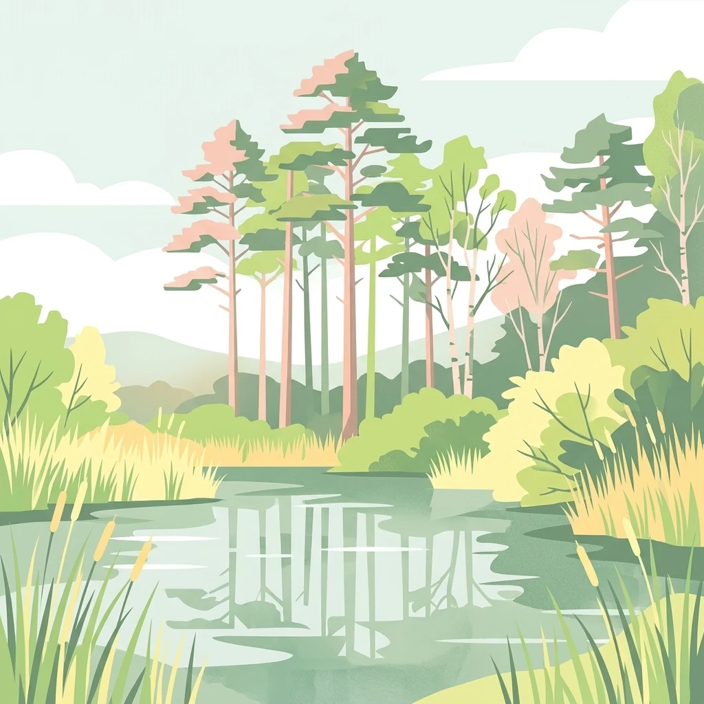
A flat-style digital illustration depicting a calm pond reflecting tall pine trees and surrounded by reeds and wetland vegetation under a soft, light-colored sky.

Pechpfuhl

Protected landscape

Park overview

Structured park overview, official facts, and landscape profile for Pechpfuhl

Pechpfuhl park facts, protected area profile, and essential visitor context

Review the core facts for Pechpfuhl, including designation, size, terrain, visitor scale, habitats, and operating context in one park-focused overview.

About Pechpfuhl

Pechpfuhl is a small but ecologically rich landscape protection area on the northwestern edge of Ludwigsfelde, in the Brandenburg district of Teltow-Fläming. It sits within the Siethener Heide forest complex, on the gently undulating high ground of the Teltow, a regionally important ground moraine plateau formed during the Weichselian glaciation. Although the area borders housing neighbourhoods directly, it preserves a surprisingly intact sequence of wetland, bog, and forest habitats that gives the protected area its distinctive character.

The defining geological feature of Pechpfuhl is a subglacial meltwater channel that was carved beneath the inland ice around twenty thousand years ago. This channel created the elongated basin that today holds the area's open water bodies and wet zones, and it once channeled meltwaters toward a chain of lakes reaching as far as Blankensee. After the ice retreated, the role of the basin shifted, and it became integrated into a broader post-glacial drainage landscape connected to the Nuthe-Nieplitz river system. The result is a landscape that reads almost like a textbook of Brandenburg glacial geomorphology on a very local scale.

Ecologically, the area is shaped by an unusual juxtaposition of dry and wet conditions. The surrounding Teltow soils are largely sandy, with the fertile glacial till layer locally absent, and they support extensive pine forest as well as inland dune fields that were reworked after the ice age. In the low-lying parts of the basin, however, loamy substrates have produced wet depressions and alder swamp woodland, while peat-forming processes have created floating mats of vegetation over parts of the open water. In the northern reaches of the Pechpfuhl, these bog communities take on raised bog character and support cotton grass and sundew, a carnivorous plant that is specially protected in Germany.

Culturally, the site has long been part of local memory. The name Pechpfuhl appears on a map from 1682 and is believed to derive from a nearby pitch-making hut, a reminder of the historical extraction of resin and tar from the surrounding forests. The continuation of this cultural thread into the present is reflected in literature and recreation: a roughly 4.5 kilometre nature trail runs along the basin and the Leopoldsgraben toward the forester's lodge at Siethener See, with information panels explaining the flora and fauna. Further walking route upgrades link Pechpfuhl to nearby destinations such as Ahrensdorf. Modern development has also partially consumed parts of the original wetland: when the main Ludwigsfelde road was built in 1929 to connect the town with Struveshof, a clearing had to be cut through the former swampland, and small sand hills were levelled to fill glacial hollows.

Quick facts and research context for Pechpfuhl

Pechpfuhl is a landscape protection area within the town limits of Ludwigsfelde, Brandenburg, situated on the Teltow ground moraine plateau. The protected landscape contains four open water bodies in its elongated southern section and transitions into raised bog-like terrain with cotton grass moor mats in the north. Surrounding dry, sandy soils support extensive pine forest, while the wet core features alder swamp woodland and floating bog vegetation. The site has been protected by decree of the Potsdam district council since 14 March 1958. Its waters drain through the Leopoldsgraben toward the Siethener See and the broader Nuthe-Nieplitz lowland.

Protection and recognition

Documented management scope and official recognition details for Pechpfuhl

Pechpfuhl Protection Status and Designated Terrestrial Conservation Framework

Pechpfuhl maintains a documented terrestrial protection scope without imported international recognition sources or assigned designation years. Structured conservation records outline the established management framework and official protected area status.

Protection details

Protection scope
Terrestrial
Transboundary protection
No
Park context

Deeper park guide and search-rich context for Pechpfuhl

Pechpfuhl history, landscape, wildlife, and travel context

Explore Pechpfuhl through its history, landscape character, ecosystems, wildlife, conservation priorities, cultural context, and seasonal travel timing in a structured park guide built for atlas discovery and search intent.

Why Pechpfuhl stands out

Pechpfuhl is best known for its compact but well-defined combination of glacial meltwater wetland, swamp woodland, and floating bog communities set against a backdrop of pine-dominated sandy lowland. It is a textbook example of how a small Brandenburg landscape protection area can preserve a full chain of post-glacial habitats within a single elongated basin, from open water through alder carr to cotton grass moor. The site is also notable for its cultural footprint, having served as a recurring scene in the novel Tupolew 134 by Antje Rávic Strubel, set partly in and around Ludwigsfelde.
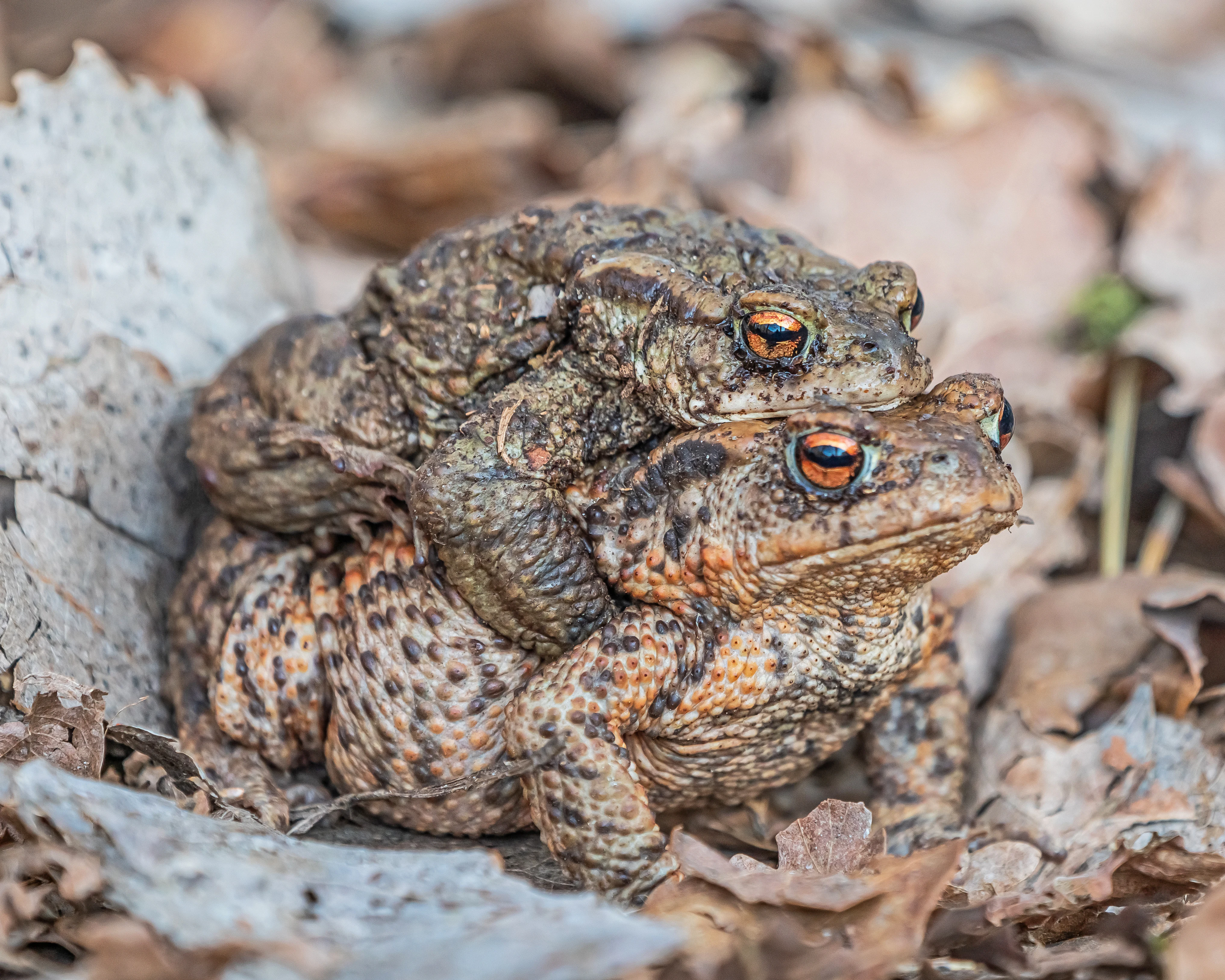
A pair of common toads stacked on top of each other, resting on fallen brown oak leaves.
Two common toads in amplexus at the Pechpfuhl landscape conservation area.

Pechpfuhl history and protected-area timeline

The name Pechpfuhl is documented as early as 1682, when it appears on a historical map, and is thought to refer to a nearby pitch-making hut where resin and tar were produced from the surrounding pine forests. This early reference places the wetland within the long history of small-scale forest-based extractive industries that shaped many Brandenburg landscapes.

In the early twentieth century, the Pechpfuhl basin began to feel the direct pressure of urban growth from nearby Ludwigsfelde. In 1929, construction of the Potsdam road, which later became the main Ludwigsfelde street, required a clearing to be cut through the former swampland. The road was built to connect Ludwigsfelde with the settlement of Struveshof, which at that point was larger and more populous than Ludwigsfelde itself. During the roadworks, small sand hills were levelled and several glacial hollows and former standing water areas were filled.

The site's modern conservation history began on 14 March 1958, when the council of the Bezirk Potsdam resolved to protect Pechpfuhl as a landscape protection area, or Landschaftsschutzgebiet. This early formal designation predates much of the surrounding suburban expansion and has continued to frame the area's management to the present. The protected area has also become part of the wider recreational and educational infrastructure of Ludwigsfelde, with a nature trail established along the basin and ongoing planning for walking route upgrades into neighbouring villages.

Pechpfuhl landscape and geographic character

The Pechpfuhl landscape owes its form to glacial processes that acted on the Teltow plateau during the last ice age. The gently undulating high ground, rising only some ten to twenty metres above the basin, is a classic Weichselian ground moraine surface formed during the Brandenburg glacial stage around twenty thousand years ago. Beneath the ice, meltwater excavated a long, narrow subglacial channel that now defines the axis of the protected area.

Where the surrounding Teltow is typically covered by fertile soils derived from glacial till, the Pechpfuhl basin is dominated by poorer sandy substrates, because the till layer is locally absent and inland dunes were later deposited by wind. At the edges of these dunes, loamy ground has trapped moisture, producing the wet depressions and small lakes that give the area its character. Hydrologically, the basin no longer drains in the direction of the original subglacial flow, which once ran from the Pechpfuhl through the Leopoldsgraben toward the Siethener See and onward to Blankensee. Instead, the present-day Niedplitz flows in part counter to this ancient route, eventually feeding the Nuthe. Four open water surfaces anchor the elongated southern portion of the basin, while the northern part shifts into a more bog-like environment with floating vegetation mats and rising peat.
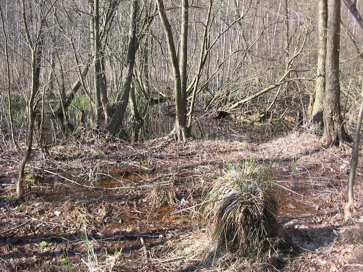
A view into a sparse, deciduous forest in early spring with bare trees, patches of wet ground, and a clump of sedge grass in the foreground.
A view of the Pechpfuhl protected landscape area in Ludwigsfelde, featuring marshy woodland terrain.

Pechpfuhl ecosystems, habitats, and plant life

Pechpfuhl supports a tightly compressed mosaic of habitats that reflect the sharp transition from dry sandy plateau to wet basin. The surrounding pine forests cover most of the dry sandy ground and represent the dominant vegetation type of the wider Siethener Heide. Inland dune relics add further structure to these forests, differentiating the dry ecologies from those of the basin floor.

Within the basin itself, alder swamp woodland, known in German as Erlenbruchwald, dominates in the wetter sections, where the substrate is waterlogged and nutrient rich. Between the open water bodies, the slow accumulation of plant material has produced schwingmoor, or floating bog, communities. On the floating mats of vegetation, plant species of conservation interest occur, including the carnivorous sundew (Drosera), which is specially protected in Germany, alongside cotton grass (Eriophorum) species that mark the transition toward raised bog character in the northern part of the area.

Together, these habitats create ecological gradients that are unusually compact for the region. Dry pine forest, dune, swamp woodland, open water, and active bog communities all occur within the same elongated basin, giving the landscape protection area a level of habitat diversity that exceeds what its modest size would suggest.

Pechpfuhl wildlife and species highlights

The animal life of Pechpfuhl reflects the diversity of its habitats. The mosaic of water, wet woodland, and surrounding dry pine forest supports a rich and varied bird community, including white wagtail (Motacilla alba), Eurasian jay (Garrulus glandarius), and several members of the tit family, among them marsh tit (Poecile palustris). The great spotted woodpecker (Dendrocopos major), Germany's 1997 Bird of the Year, is also present, as is the Eurasian wren (Troglodytes troglodytes), Germany's 2004 Bird of the Year and a specially protected species. From the German Red List's early warning category come the skylark (Alauda arvensis) and the common redstart (Phoenicurus phoenicurus), indicating that even common species here have a conservation foothold.

The open water and wet zones also support a healthy amphibian fauna, with common water frog (Rana kl. esculenta), moor frog (Rana arvalis), common toad (Bufo bufo), and smooth newt (Lissotriton vulgaris) recorded. Among reptiles, the viviparous lizard (Zootoca vivipara) is documented and is specially protected under Germany's federal species protection regulation. The lake waters themselves host common cyprinid fish such as roach (Rutilus rutilus), alongside purely predatory species like pike (Esox lucius) and perch (Perca fluviatilis), completing a wetland food web that ties forests, bogs, and open waters together.

Pechpfuhl conservation status and protection priorities

Pechpfuhl has been formally protected as a landscape protection area, a Landschaftsschutzgebiet, since 14 March 1958, following a decree by the council of the Bezirk Potsdam. This long-standing status has given the site several decades of continuity as a protected habitat, even as the surrounding area has been shaped by suburban growth from Ludwigsfelde.

The site's conservation value rests on the unusually compact layering of habitat types within a single glacial basin. Dry sandy pine woodland, inland dune remnants, alder swamp, open water, floating bog mat, and actively accumulating bog communities with cotton grass and sundew all coexist in close proximity. The presence of protected plant species such as sundew and specially protected fauna including wren and viviparous lizard, as well as species on national Red List watch categories, underscores the area's importance beyond a purely local scale.

Pechpfuhl also forms part of a wider ecological network: its waters drain through the Leopoldsgraben toward the Siethener See and onward into the Nuthe-Nieplitz lowland and the Nuthe-Nieplitz Nature Park. This connectivity means that habitat condition at Pechpfuhl has implications for downstream wetland systems. The maintained nature trail along the basin and the ongoing integration of the site into the town's walking route plan reflect an approach that blends conservation with public education and low-impact recreation.

Pechpfuhl cultural meaning and human context

The cultural footprint of Pechpfuhl is small but distinctive. The name itself, recorded on a map from 1682, reflects a long-standing connection to historical forest-based industries, likely a pitch-making hut in which resin and tar were produced from the surrounding pines. This kind of toponym is a typical trace of pre-industrial resource extraction in Brandenburg's sandy landscapes.

In more recent cultural memory, the site features prominently in Antje Rávic Strubel's novel Tupolew 134, published in 2004. Strubel grew up in Ludwigsfelde, and parts of the novel are set in and around the Pechpfuhl, where her characters walk, joke, court, and reflect. The book weaves the wetland into three narrative timelines centred on a fictional 1978 hijacking of a Tupolev 134 aircraft from East Germany to West Berlin, with the Pechpfuhl functioning as a private counter-space distinct from the better-known settings around the IFA industrial complex in Ludwigsfelde.

The site also plays a role in local recreation and education. A roughly 4.5 kilometre nature trail leads visitors along the basin and the Leopoldsgraben to the forester's lodge at Siethener See and onward through the Märkisches Wanderdorf toward Gröben, with information panels introducing the flora and fauna to walkers. Planned upgrades to the surrounding walking routes, including a path between Pechpfuhl and Ahrensdorf, indicate that the area continues to be integrated into the cultural and recreational life of Ludwigsfelde.

Top sights and standout views in Pechpfuhl

A surviving subglacial meltwater basin on the Teltow plateau, where dry pine forest, inland dunes, alder swamp woodland, open water, and floating bog communities meet within a single elongated protected landscape. A long-protected site of regional conservation interest, designated since 1958 and home to specially protected species such as sundew, wren, and viviparous lizard. A literary landmark through its recurring role in Antje Rávic Strubel's novel Tupolew 134, which preserves the wetland as a counterpoint to the industrial history of Ludwigsfelde. A compact but well-curated nature trail of around 4.5 kilometres, equipped with educational panels on flora and fauna, that connects the basin to the Leopoldsgraben, the Siethener See, and the walking villages of the surrounding area.

Best time to visit Pechpfuhl

The character of Pechpfuhl shifts with the seasons in ways typical of small Brandenburg wetland and forest landscapes. Spring and early summer are particularly rewarding for amphibians, when frogs, toads, and newts are active around the open water and wet margins, and the surrounding pine forests brighten with fresh green. Late spring and early summer are also a good time to observe the bird community, including species of conservation interest such as the wren and woodland birds in the wetter edges. Summer brings long days for walking the nature trail and for seeing the floating bog mats at their most active, though insect presence near the water can be noticeable. Autumn offers quieter conditions, softer light through the pine stands, and cooler, damper conditions that emphasise the bog character of the northern part of the area. Winter visits appeal mainly through the contrast between the bare deciduous elements of the swamp woodland and the surrounding evergreen forest, but conditions underfoot in the wet zones can be challenging.

Monthly climate preview

Long term temperature and precipitation patterns across Brandenburg

Pechpfuhl Climate Normals and Annual Weather by Month

Pechpfuhl exhibits measured monthly temperature variation alongside consistent precipitation records derived from representative coordinate sampling in Brandenburg. Detailed monthly climate profiles provide deeper analytical context for long term temperature averages and seasonal precipitation rhythms across the protected territory.
Annual mean9 °C
-1 °C20 °C
Jan-1°
Feb
Mar
Apr
May14°
Jun18°
Jul20°
Aug20°
Sep15°
Oct
Nov
Dec
Warmest month
July

20.3 °C

Coolest month
January

-0.7 °C

Wettest month
July

2.4 mm/day

Driest month
April

1 mm/day

Park location guide

Geography guide, regional context, and park location map for Pechpfuhl

Pechpfuhl park geography, regions, and map view in Germany

Understand where Pechpfuhl sits in Germany through a broader geographic reading of the surrounding landscape, nearby location context, and its mapped position within the national park landscape.

How Pechpfuhl fits into Germany

Germany is a federal republic in Western and Central Europe with a population of over 83 million across sixteen constituent states. It is Europe's largest economy by nominal GDP and a major global exporter and importer. The capital is Berlin, and the country borders Denmark, Poland, Czech Republic, Austria, Switzerland, France, Luxembourg, Belgium, and the Netherlands.

Wider geography shaping Pechpfuhl in Germany

Germany is located in Western and Central Europe, spanning 357,022 km². It borders Denmark to the north, Poland and the Czech Republic to the east, Austria and Switzerland to the south, and France, Luxembourg, Belgium, and the Netherlands to the west. The country has coastlines on the Baltic Sea and North Sea to the north, with the Alps located in the southern region.

Map view of Pechpfuhl

Use this park location map to pinpoint Pechpfuhl in Germany, understand its exact geographic position, and read its mapped placement within the surrounding landscape more clearly.

Pigeon | © OpenStreetMap contributors

Location context for Pechpfuhl

Brandenburg

Visualizing glacial meltwater wetlands, pine forests, and bog habitats in Brandenburg

Pechpfuhl Landscape Photos and Protected Area Scenery

Visual documentation of Pechpfuhl reveals the distinctive post-glacial terrain, featuring alternating dry pine ridges, alder swamp woodland, and open water basins. Examining protected area imagery provides clear insight into the complex wetland mosaic and rare mire vegetation preserved within the Brandenburg landscape.

A pair of common toads stacked on top of each other, resting on fallen brown oak leaves.

A calm, reflective pond surrounded by dry reeds and a mixed forest of birch and pine trees under a clear blue sky.

A view into a sparse, deciduous forest in early spring with bare trees, patches of wet ground, and a clump of sedge grass in the foreground.

Park atlas

Compare surrounding regional geography and connected glacial wetland habitats

Explore Parks Near Pechpfuhl and Discover Related Protected Landscapes

Visitors exploring Pechpfuhl can browse adjacent protected areas and neighboring nature reserves across the Brandenburg region. Expanding the geographic scope reveals how similar post-glacial terrain and wetland ecosystems connect throughout the surrounding plateau.
A watercolor painting showing a soft, stylized landscape with open fields, a line of green trees, and distant hills under a light sky.
Protected landscapeBrandenburg
About 11 km away#1 closest

Northeast

Landschaftsschutzgebiet Diedersdorfer Heide und Großbeerener Graben Geography and Map Overview

A critical protected area in Brandenburg's peri-urban landscape mosaic.

Analyze the complex topography of Landschaftsschutzgebiet Diedersdorfer Heide und Großbeerener Graben, a large-scale protected zone south of Berlin. This atlas record provides detailed insight into the area's pine-dominated forest structure, wetland meadows, and the historic hydrological systems that define its contemporary habitat patterns and ecological reach.

Area
55 km²
Established
1998
Relief
Lowland
Scope
Terrestrial
Watercolor painting of a green wetland area with soft, blurred rolling hills in the background.
Nature reserveBerlin
About 12 km away#2 closest

Northwest

Großes Fenn Nature Reserve: Protected Peatland and Kettle Bog Geography in Berlin

A study of post-glacial landforms and mire environments.

Großes Fenn represents a rare urban kettle bog formed during the last glacial period, now protected within the Berlin region. This reserve showcases the historical peat-forming processes and the fragile ecological balance of small depressions in the Düppeler Forest, offering a compact site for understanding glacial landscape legacies.

Area
0.064 km²
Established
1986
IUCN
IV
A horizontal watercolor illustration depicting a calm lake surrounded by soft green forest and distant hazy hills.
Protected areaBerlin
About 14 km away#3 closest

Northwest

EU-Vogelschutzgebiet Westlicher Düppeler Forst: Protected Area and Regional Geography

Ecological sanctuary and Havel lakeshore landscape in Berlin

Located in the Steglitz-Zehlendorf district, this protected area spans nearly 10 square kilometres of diverse woodland and aquatic terrain. The site combines historical cultural landmarks with essential breeding grounds for migratory birds, including significant woodpecker populations and varied riparian corridors throughout the southwestern Berlin borderlands.

Area
9.44 km²
Established
2003
Nature reserveBerlin
About 17 km away#4 closest

North

Riemeisterfenn Nature Reserve and Protected Peatland Landscape in Berlin

A rare bog ecosystem within the city glacial lake chain

Riemeisterfenn is a distinct nature reserve in Berlin, characterized by its marshy lowlands, reed beds, and alder carr vegetation. This site offers an essential look at a preserved peatland habitat and the Fennkanal hydrology that connects these protected areas to the wider Grunewald forest ecosystem.

Area
0.072 km²
Established
1987
Relief
Lowland
Climate
Temperate
Nature reserveRhineland-Palatinate
About 17 km away#5 closest

South

Bärluch Nature Reserve: Protected Wetland Terrain and Regional Geography in Brandenburg

Post-glacial fens and swamp forest mosaic

Bärluch represents an essential protected nature reserve in Germany, defined by its bowl-shaped post-glacial depressions and diverse wetland habitats. The area preserves a rare ecological mosaic of oak-dominated forests, wet grasslands, and swampy lowland basins that provide vital breeding grounds for disturbance-sensitive bird populations and specialized regional wildlife.

Area
1.6 km²
Established
2000
Relief
Lowland
Climate
Temperate
A horizontal watercolor painting showing a wetland landscape with calm water, marshy vegetation, and a background of soft rolling hills and mixed forest trees.
Nature reserveBerlin
About 17 km away#6 closest

North

Langes Luch / Dachsheide: Nature Reserve and Glacial Wetland Geography in Berlin

Protected mosaic of bog, forest, and inland dune habitats

Langes Luch / Dachsheide encompasses a rare urban protected area in Berlin, defined by the interplay between low-lying swampy depressions and elevated sandy heath. The site features complex glacial meltwater channels, open transitional mires, and historical terrain modifications, forming an essential study area for local conservation and regional landscape ecology.

Area
0.324 km²
Established
1960
IUCN
IV
Relief
Lowland
A panoramic watercolor illustration showing a meadow with green grasses, pink and purple wildflowers, shrubs, a misty water body, rolling green hills in the background, and a bird flying in a pale yellow sky
Protected landscapeBrandenburg
About 19 km away#7 closest

Southwest

Naturpark Nuthe-Nieplitz: Geographic Overview of a Brandenburg Protected Landscape

Glacial river valleys and rewilded pine forest terrain

Naturpark Nuthe-Nieplitz represents a significant protected area in Brandenburg, Germany, characterized by its interconnected river lowlands and glacial features. The terrain features a rich mix of reed-fringed lakes, alder woodlands, and former military grounds currently undergoing ecological restoration. This overview traces the boundaries and landscape character of the park, providing essential context for its role in regional conservation.

Area
623.23 km²
Established
1999
Relief
Lowland
Climate
Temperate
A soft watercolor illustration of a gentle river winding through green meadows and low hills under a hazy, warm sky.
Nature reserveBrandenburg
About 19 km away#8 closest

Southwest

Europäisches Vogelschutzgebiet Nuthe-Nieplitz-Niederung Protected Area in Brandenburg

Glacial lake and river floodplain landscape context

This significant nature reserve forms a major ecological hub south of Berlin, characterized by its interplay of river floodplains, shallow glacial lakes, and open meadows. It is a critical site for breeding and migratory birds, offering a unique look at the hydrological systems and lowland geography that define the rural character of Brandenburg.

Area
61.44 km²
Established
2007
Relief
Lowland
Climate
Temperate

Common questions about visiting, size, designation, and location context for Pechpfuhl

Pechpfuhl FAQs for park facts, access, geography, and protected area context

Find quick answers about Pechpfuhl, including protected-area facts, park geography, trail and visitor context, and how the park fits into its surrounding country and regional landscape.
MoriAtlas Explorer

Continue Your Protected Areas Search Across the Global Atlas

Deepen your exploration by continuing the structured search for national parks and protected areas worldwide. Utilize the comprehensive filtering capabilities to compare different conservation landscapes and refine your understanding of global park geography. Discover more about the distribution and characteristics of protected natural areas.

Global natural geography