
Mori Atlas logo
Nature reserveLippeaue zwischen Schloss „Oberwerries und Dolberg“

A protected wetland landscape and riverine terrain within the Kreis Warendorf district of Germany

Lippeaue zwischen Schloss Oberwerries und Dolberg Nature Reserve and River Floodplain Geography

(Naturschutzgebiet Lippeaue zwischen Schloss „Oberwerries und Dolberg“)

Lippeaue zwischen Schloss Oberwerries und Dolberg represents a significant floodplain corridor along the Lippe River in western Germany. This protected nature reserve encompasses a complex mosaic of still waters, oxbow remnants, and wet meadows that define the local lowland riverine geography. By preserving these dynamic riparian features, the area functions as a vital ecological sanctuary for diverse wetland-dependent species within the broader Kreis Warendorf landscape context.

floodplainriverine landscapewetland habitatsstill watersreed bedslippe valley
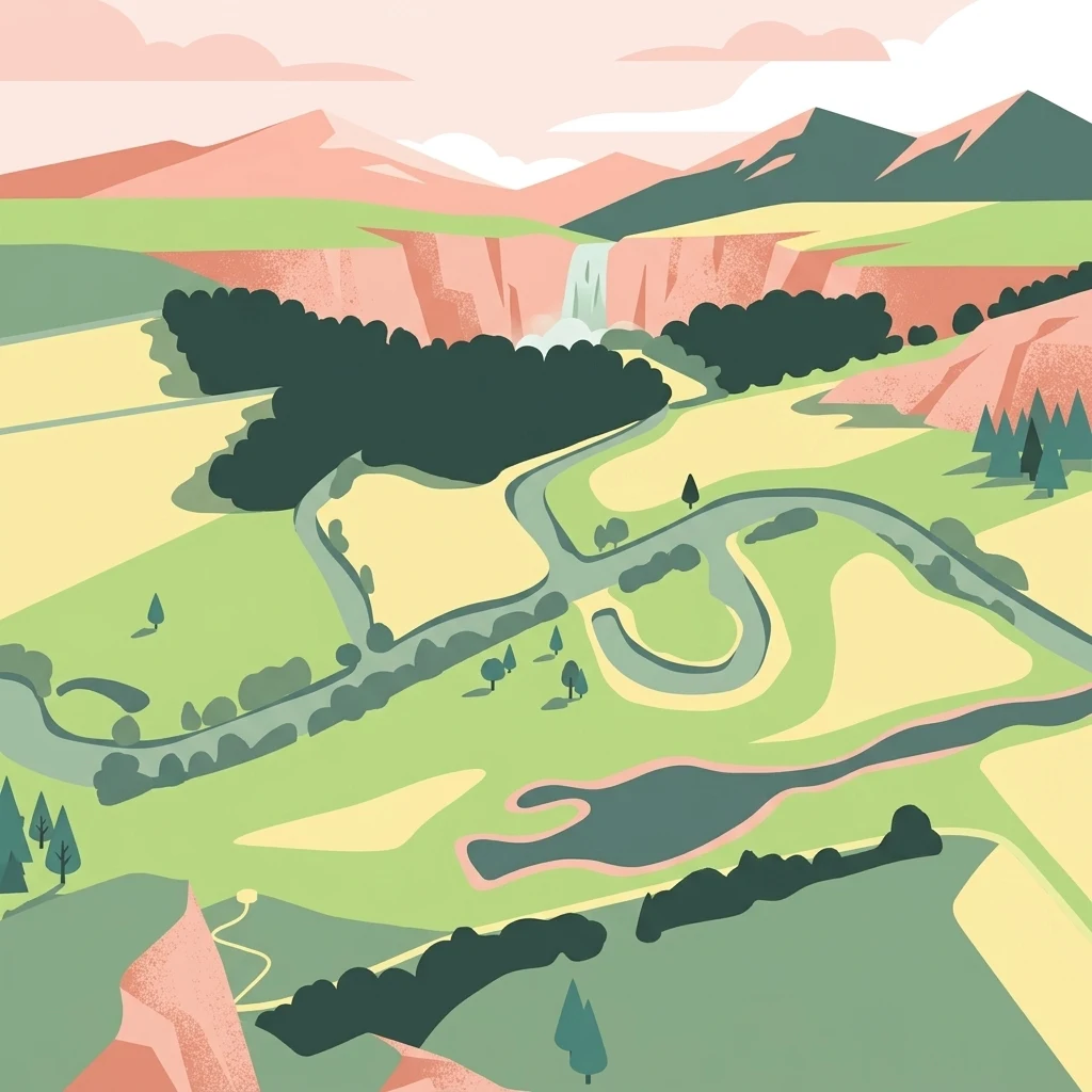
A flat, stylized illustration showing a winding river flowing through a green meadow valley, with a waterfall in the distance against mountains under a soft-colored sky.

Lippeaue zwischen Schloss „Oberwerries und Dolberg“

Nature reserve

Park overview

Structured park overview, official facts, and landscape profile for Lippeaue zwischen Schloss „Oberwerries und Dolberg“

Lippeaue zwischen Schloss „Oberwerries und Dolberg“ park facts, protected area profile, and essential visitor context

Review the core facts for Lippeaue zwischen Schloss „Oberwerries und Dolberg“, including designation, size, terrain, visitor scale, habitats, and operating context in one park-focused overview.

About Lippeaue zwischen Schloss „Oberwerries und Dolberg“

Lippeaue zwischen Schloss „Oberwerries und Dolberg“ is part of the network of nature reserves protecting the varied floodplain landscapes of the Lippe River in North Rhine-Westphalia. Located in the Kreis Warendorf, southwest of Dolberg and immediately south of the flowing Lippe, the reserve represents one of the surviving stretches where the natural character of the floodplain has been maintained and actively managed. Its modest footprint of about 31 hectares belies the ecological density of its habitats.

The landscape combines open water bodies, slowly infilling muddy margins, reed-dominated shores, sedge communities, and water lily stands, interspersed with terrestrial floodplain elements. Such gradients between still and flowing water, between aquatic and terrestrial vegetation, and between open and sheltered habitat create conditions for a notable concentration of species. Amphibians find breeding grounds in the still waters; bats and cavity-nesting birds use mature trees and old wood; dragonflies use the warm, sheltered margins of the ponds; while waders and waterbirds forage across the wet meadows and muddy edges.

The reserve's formal objectives reflect this ecological richness. Protection aims to preserve the landscape-defining floodplain character of the Lippe valley, maintain and develop the still water bodies and their natural succession zones, and promote dynamic fluvial processes, including the meanders and old river arms that shape the site. Equally significant is the recognition of the area's aesthetic and ecological rarity, an acknowledgment that surviving natural floodplain segments have become increasingly unusual in heavily altered German lowland landscapes.

Quick facts and research context for Lippeaue zwischen Schloss „Oberwerries und Dolberg“

Lippeaue zwischen Schloss „Oberwerries und Dolberg“ is a designated nature reserve (Naturschutzgebiet) in the Kreis Warendorf district of North Rhine-Westphalia, Germany. It covers approximately 31 hectares along the southern bank of the Lippe River, southwest of Dolberg, the southernmost part of Ahlen. The site was first placed under formal protection in 1993 and has an additional designation date of 2006.

The reserve lies within the broader Lippe valley landscape and is bordered along part of its northern edge by the L 507 state road. It is classified as IUCN Category IV (Habitat/Species Management Area), reflecting an active management approach focused on conserving and restoring floodplain habitats rather than leaving the area fully untouched. Its protected status is recorded in the World Database on Protected Areas under WDPA ID 164482.

Protection and recognition

Examine the documented terrestrial protection scope and baseline database metrics for this protected landscape

Protection Status and International Recognition for Lippeaue zwischen Schloss Oberwerries und Dolberg

Terrestrial protection data for Lippeaue zwischen Schloss Oberwerries und Dolberg outlines the documented administrative scope within global conservation registries. Review official designation records, management frameworks, and international recognition metrics compiled for this protected area.

Protection details

Protection scope
Terrestrial
Transboundary protection
No
WDPA ID
164482
Park context

Deeper park guide and search-rich context for Lippeaue zwischen Schloss „Oberwerries und Dolberg“

Lippeaue zwischen Schloss „Oberwerries und Dolberg“ history, landscape, wildlife, and travel context

Explore Lippeaue zwischen Schloss „Oberwerries und Dolberg“ through its history, landscape character, ecosystems, wildlife, conservation priorities, cultural context, and seasonal travel timing in a structured park guide built for atlas discovery and search intent.

Why Lippeaue zwischen Schloss „Oberwerries und Dolberg“ stands out

The reserve is best known for its preserved floodplain character along the Lippe River, where still waters, oxbow remnants, reed beds, and water lily communities come together in a small but ecologically rich segment of the valley. It is recognized as an important refuge for wetland-dependent species groups, including amphibians, dragonflies, bats, waterbirds, waders, and cavity-nesting birds. Its identity is closely tied to the dynamic riverine landscape of the Lippe, with meanders and old river arms that retain the natural expression of a lowland floodplain. The site's combination of habitat diversity, river dynamics, and species rarity gives it a distinct ecological value well beyond its modest size.
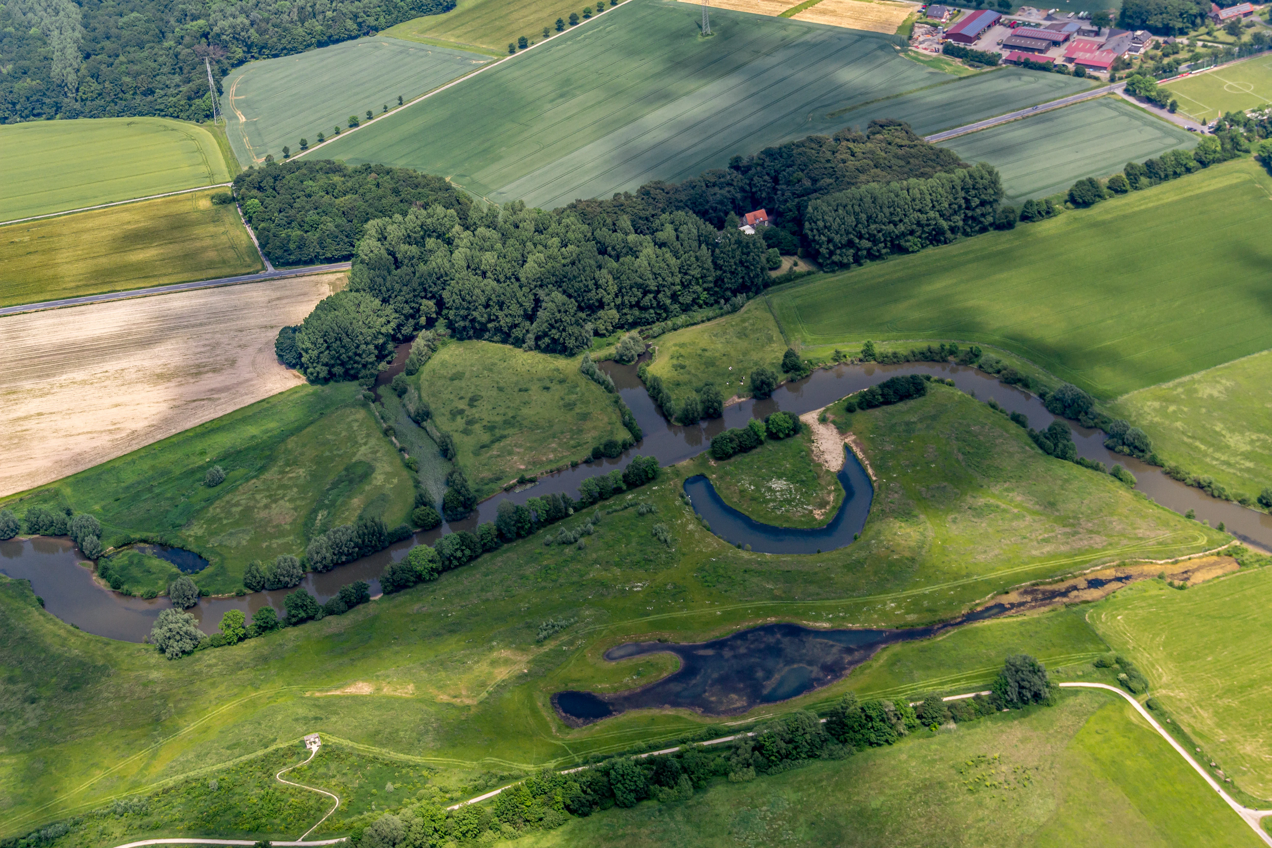
Aerial perspective of a meandering river section flowing through green meadows and patches of forest, with agricultural fields in the background.
Aerial view of the Lippe river floodplains and the Alte Lippe meander.

Lippeaue zwischen Schloss „Oberwerries und Dolberg“ history and protected-area timeline

The area was first placed under formal nature protection in 1993, recognizing the ecological and landscape value of the remaining natural floodplain along the Lippe River between Oberwerries Castle and Dolberg. A further designation event in 2006 reflects subsequent refinement of the protected status, likely tied to adjustments in area boundaries or management categories.

The reserve belongs to a broader regional effort to safeguard characteristic Lippe valley habitats within the Kreis Warendorf. Its history is essentially one of formal recognition and protection of a landscape that had retained enough natural riverine character to warrant conservation, rather than a site shaped by dramatic human interventions or large-scale restoration campaigns. The placement of the reserve within the protected-area framework of North Rhine-Westphalia gives it a stable institutional context and ties it into ongoing habitat management in the region.

Lippeaue zwischen Schloss „Oberwerries und Dolberg“ landscape and geographic character

The reserve occupies a narrow stretch of the Lippe floodplain, with the Lippe River flowing along its southern edge. The terrain is characteristic of lowland river floodplains: gently shaped, water-influenced ground with still water bodies, oxbow-like remnants, and the surviving curves of former or current river channels. Meanders and old river arms remain as visible signatures of the river's past and present dynamics.

The vegetation pattern follows the moisture gradient created by the river. Closer to open water and wetter depressions, aquatic plants and emergent vegetation dominate, including water lily stands and reed beds along the margins. Further back, sedge communities and wet meadows take over, transitioning into the broader matrix of floodplain grassland and shrubby edges. Together these elements form a layered, structurally diverse landscape whose visual character is defined by water, soft topography, and the interplay of open and vegetated zones.

Lippeaue zwischen Schloss „Oberwerries und Dolberg“ ecosystems, habitats, and plant life

Ecologically, the site is best understood as a floodplain mosaic, where the proximity of still and flowing water creates a concentration of wetland habitats within a small area. Still water bodies with actively developing margins are central to the reserve, hosting communities of aquatic and emergent plants such as water lilies and reeds, as well as sedge-dominated vegetation on waterlogged soils.

The floodplain setting also supports a dynamic gradient of moisture, from permanently submerged zones to seasonally wet ground. This gradient sustains a layered vegetation structure and provides habitat conditions for very different ecological groups across short distances. The combination of open water, muddy margins, reed beds, and adjacent woody elements gives the reserve its recognizable ecological identity and explains its capacity to support a varied fauna despite its modest extent.

Lippeaue zwischen Schloss „Oberwerries und Dolberg“ wildlife and species highlights

The reserve's wildlife profile is closely tied to its floodplain habitats and reflects the value of the Lippe valley for wetland-dependent species. Still water bodies and their quiet margins provide breeding and foraging habitat for amphibians, while the warm, sheltered conditions along the reed beds and pond edges are well suited to dragonflies and aquatic beetles.

Mature trees and old wood within the floodplain mosaic support bats and cavity-nesting birds, which depend on natural tree hollows or structural cavities for roosting and nesting. Open water and wet ground attract waterbirds in general, while the muddy edges and shallow margins are used by wading birds feeding along the waterline. In combination, these species groups turn a relatively compact site into a small but ecologically dense refuge within the broader agricultural and settled landscape of the region.

Lippeaue zwischen Schloss „Oberwerries und Dolberg“ conservation status and protection priorities

From a conservation perspective, the reserve is significant because it preserves a remaining segment of natural Lippe floodplain in a region where riverine landscapes have been heavily modified by agriculture, infrastructure, and hydraulic engineering. Its protection aims at both preserving what remains of this natural floodplain character and actively restoring key ecological functions, including the natural dynamics of the river channel and the still water bodies.

The reserve's designation under IUCN Category IV reflects an active management approach. Rather than excluding intervention, management seeks to maintain open water bodies, allow natural succession processes in their margins to continue in a controlled way, and promote the structural diversity of the floodplain. The site's recognition also extends to the aesthetic, scenic, and rarity-based values of the landscape, an acknowledgment that surviving natural floodplain segments have become uncommon enough to warrant conservation in their own right.

Top sights and standout views in Lippeaue zwischen Schloss „Oberwerries und Dolberg“

The reserve concentrates a notable range of floodplain habitats into a small area along the Lippe River, including still waters, reed beds, water lily stands, sedge communities, and surviving meanders and old river arms. This compact mosaic supports amphibians, waterbirds, waders, bats, cavity-nesting birds, dragonflies, and aquatic beetles, giving the site a species richness well beyond its modest hectare count.

Its protected status under IUCN Category IV also means that conservation here is active rather than passive: the goal is not only to preserve what remains of the natural Lippe floodplain but also to maintain the open water bodies and to encourage the dynamic riverine processes that shape this landscape. The result is a small but ecologically distinctive reserve, valuable both locally and as part of the wider Lippe valley conservation network.

Best time to visit Lippeaue zwischen Schloss „Oberwerries und Dolberg“

Late spring through summer typically offers the richest experience of the reserve's habitats, when water lilies come into bloom, reed beds are at full height, and dragonflies and other invertebrate groups are most active along the warm margins of the still waters. This is also when the mix of amphibians, waterbirds, and waders along the wet edges is most visible.

Autumn and winter bring a quieter, more structural character, with the bare outlines of meanders and old river arms becoming more visible in the landscape and waterbird activity continuing on the open water. Because the reserve is a protected area, any visit should focus on quiet observation from accessible paths rather than focused wildlife disturbance, regardless of season.


Monthly climate preview

Long-term representative temperature and precipitation averages across the protected landscape

Annual Climate Normals and Weather by Month for Lippeaue zwischen Schloss „Oberwerries und Dolberg“

Lippeaue zwischen Schloss „Oberwerries und Dolberg“ exhibits a measured annual temperature range from sub-zero winter minimums to warm summer maximums alongside steady daily precipitation normals. Consulting the complete twelve-month climatology profile reveals deeper multi-year weather patterns across the representative park coordinate.
Annual mean9 °C
0 °C18 °C
Jan
Feb
Mar
Apr
May12°
Jun16°
Jul18°
Aug18°
Sep14°
Oct
Nov
Dec
Warmest month
July

18.2 °C

Coolest month
January

0.3 °C

Wettest month
December

2.7 mm/day

Driest month
April

1.7 mm/day

Park location guide

Geography guide, regional context, and park location map for Lippeaue zwischen Schloss „Oberwerries und Dolberg“

Lippeaue zwischen Schloss „Oberwerries und Dolberg“ park geography, regions, and map view in Germany

Understand where Lippeaue zwischen Schloss „Oberwerries und Dolberg“ sits in Germany through a broader geographic reading of the surrounding landscape, nearby location context, and its mapped position within the national park landscape.

How Lippeaue zwischen Schloss „Oberwerries und Dolberg“ fits into Germany

Germany is a federal republic in Western and Central Europe with a population of over 83 million across sixteen constituent states. It is Europe's largest economy by nominal GDP and a major global exporter and importer. The capital is Berlin, and the country borders Denmark, Poland, Czech Republic, Austria, Switzerland, France, Luxembourg, Belgium, and the Netherlands.

Wider geography shaping Lippeaue zwischen Schloss „Oberwerries und Dolberg“ in Germany

Germany is located in Western and Central Europe, spanning 357,022 km². It borders Denmark to the north, Poland and the Czech Republic to the east, Austria and Switzerland to the south, and France, Luxembourg, Belgium, and the Netherlands to the west. The country has coastlines on the Baltic Sea and North Sea to the north, with the Alps located in the southern region.

Map view of Lippeaue zwischen Schloss „Oberwerries und Dolberg“

Use this park location map to pinpoint Lippeaue zwischen Schloss „Oberwerries und Dolberg“ in Germany, understand its exact geographic position, and read its mapped placement within the surrounding landscape more clearly.

Pigeon | © OpenStreetMap contributors

Location context for Lippeaue zwischen Schloss „Oberwerries und Dolberg“

Kreis WarendorfNordrhein-Westfalen

Examine the lowland river terrain, oxbow remnants, and protected floodplain habitats.

Visual Exploration and Photography of Lippeaue zwischen Schloss „Oberwerries und Dolberg“

Visual records capture the low-lying topography, meandering river channels, and diverse wetland vegetation defining the protected floodplain. Photographic documentation illustrates the complex mosaic of still waters, reed beds, and wet meadows sustaining local wildlife populations.

Aerial perspective of a meandering river section flowing through green meadows and patches of forest, with agricultural fields in the background.

Park atlas

Explore nearby protected areas and regional river floodplain landscapes

Parks Near Lippeaue zwischen Schloss „Oberwerries und Dolberg“

Compare Lippeaue zwischen Schloss „Oberwerries und Dolberg“ with other protected areas across the surrounding region to analyze regional wetland habitats. Extended park discovery reveals connected lowland river valleys and conservation zones sharing similar ecological terrain.
A soft watercolor illustration showing a calm, light-toned landscape with a river, a fallen tree reaching into the water, and sparse trees against a backdrop of gentle hills.
Nature reserveNordrhein-Westfalen
About 14 km away#1 closest

East

Lippeaue zwischen Hamm und Lippstadt mit Ahsewiesen Protected Area and Wetland Geography

Mapping the floodplain meadows and river restoration in Nordrhein-Westfalen

Investigate the complex landscape structure of this prominent nature reserve, defined by its extensive floodplain meadows, reed beds, and remnants of alluvial forest. The site offers a clear look at how restored river meanders and managed grassland complexes function within the wider lowland geography of Germany.

Area
72 km²
Established
2004
Relief
Lowland
Climate
Temperate
Nature reserveNordrhein-Westfalen
About 22 km away#2 closest

East

Märzenbecherwald Nature Reserve: Wetland Mosaic and Protected Forest in Nordrhein-Westfalen

A rare calcareous fen and alder swamp forest ecosystem

This protected nature reserve in the Warendorf district serves as a vital ecological anchor, preserving a mosaic of spring-fed seeps, damp woodlands, and calcareous fens. Despite its modest size, the area provides a sharp contrast to the surrounding agricultural fields of the Münsterland region, maintaining a essential water-logged habitat for specialized plant species.

Area
0.016 km²
Established
1995
IUCN
IV
Relief
Lowland
Nature reserveNorth Rhine-Westphalia
About 24 km away#3 closest

Northwest

Wolbecker Tiergarten: Mapped Geography and Protected Forest Landscapes in North Rhine-Westphalia

Ecological continuity and historic hunting park geography.

Wolbecker Tiergarten serves as a prime example of a protected lowland forest ecosystem. Covering nearly 300 hectares, this site offers deep insight into old-growth beech habitats, waterlogged pseudogley soil systems, and diverse insect and amphibian populations. Its well-preserved eighteenth-century hunting park structure provides a unique layer of historical geography to the contemporary nature reserve, making it a critical node in regional biodiversity conservation mapping.

Established
2005
Relief
Lowland
Access
Easy access
Scope
Terrestrial
A soft watercolor illustration depicting rolling green hills, dense forest patches, and a winding stream flowing through a grassy meadow.
Protected landscapeGermany
About 25 km away#4 closest

South

Luerwald und Bieberbach Protected Landscape: Regional Forest Map and Habitat Overview

A major continuous woodland reserve in North Rhine-Westphalia, Germany.

Spanning the landscape between Neheim and Menden, Luerwald und Bieberbach functions as a critical Special Protection Area. The terrain features extensive beech and oak woodlands intersected by the Bieberbach stream, creating an important haven for woodland species and maintaining a large, undisturbed environmental mosaic across the northern Sauerland.

A soft watercolor painting of a river flowing through a lush green landscape with trees lining both banks under a bright, pale sky.
Nature reserveNorth Rhine-Westphalia
About 25 km away#5 closest

South

Naturschutzgebiet Obergraben westlich Wickede: Protected Floodplain and Nature Reserve Atlas

Mapped Ruhr river habitats and protected meadow corridors in North Rhine-Westphalia

Naturschutzgebiet Obergraben westlich Wickede functions as a vital ecological corridor along the Ruhr, featuring a compact mosaic of floodplain woodland, wet meadows, and river island structures. This nature reserve plays a significant role in supporting waterbird populations and maintaining the connectivity of protected riverine landscapes across North Rhine-Westphalia.

Area
0.47 km²
Established
2002
IUCN
IV
Relief
Lowland
A soft watercolor painting of a serene, open natural landscape with trees, rolling hills, and a calm body of water in the background.
Nature reserveKreis Soest
About 28 km away#6 closest

Southeast

Möhnesee Nature Reserve: Mapping the Protected Landscapes of Kreis Soest

A vital aquatic sanctuary in the Westphalian Bight.

The Möhnesee nature reserve anchors a significant corridor of forest and water in central Westphalia. This sanctuary manages an expansive reservoir environment, offering a layered ecological profile that provides essential staging territory for migrating waterbirds while integrating with regional Natura 2000 protected networks.

Area
11.888 km²
Established
1983
IUCN
IV
Relief
Mixed relief
Nature reserveGermany
About 30 km away#7 closest

South

Naturschutzgebiet Quellbäche der Schlibbecke: Protected Headwaters and Brook-Valley Geography

A vital nature reserve within the Northern Sauerland forest landscape.

This nature reserve protects the near-natural headwaters and floodplain forest of the Schlibbecke brook system in Germany. It features a varied topography of steep, narrow valley slopes and moist alder-dominated woodlands, serving as a crucial biotope connection within the broader, largely conifer-influenced regional landscape of the Hochsauerlandkreis.

Area
0.093 km²
Established
1998
Relief
Upland
Scope
Terrestrial
Nature reserveHochsauerlandkreis
About 32 km away#8 closest

South

Naturschutzgebiet Oberlauf des Saliesiepens: Protected Riparian Woodland and Brook Geography

A vital stream-side habitat in the Hochsauerlandkreis uplands

This protected area stands out for its narrow, meandering Saliesiepen brook and the surrounding alder forest patches. It offers a focused view of riparian restoration in a region otherwise dominated by conifer plantations. The reserve represents a specific, linear valley landscape providing essential connectivity for local water-dependent flora and fauna.

Area
0.054 km²
Established
2021
Relief
Lowland
Scope
Terrestrial

Common questions about visiting, size, designation, and location context for Lippeaue zwischen Schloss „Oberwerries und Dolberg“

Lippeaue zwischen Schloss „Oberwerries und Dolberg“ FAQs for park facts, access, geography, and protected area context

Find quick answers about Lippeaue zwischen Schloss „Oberwerries und Dolberg“, including protected-area facts, park geography, trail and visitor context, and how the park fits into its surrounding country and regional landscape.
MoriAtlas Explorer

Continue Your Protected Areas Search Across the Global Atlas

Deepen your exploration by continuing the structured search for national parks and protected areas worldwide. Utilize the comprehensive filtering capabilities to compare different conservation landscapes and refine your understanding of global park geography. Discover more about the distribution and characteristics of protected natural areas.

Global natural geography